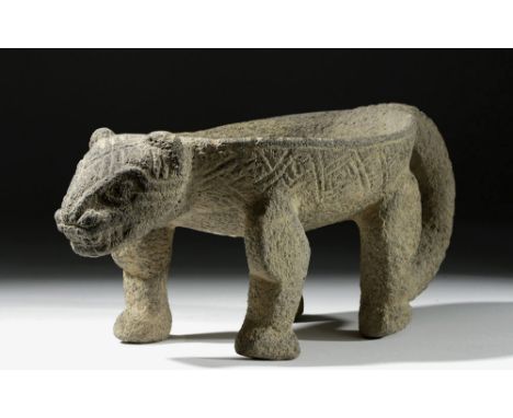

Pre-Columbian, Costa Rica, Atlantic Watershed, ca. 800 to 1200 CE. A jaguar metate, expertly carved from one piece of volcanic stone with refined dimensions and intricately incised details. Note the details on the head - those gnashing teeth, alert ears, and snarling snout - the wonderful stylized weaving pattern on the head, body surrounding the grinding bowl, and the curling tail. A piece like this would have been used to grind hallucinogenic substances, medicines, etc. for ceremonial rituals. Size: 11.875" L x 5.375" W x 5.125" H (30.2 cm x 13.7 cm x 13 cm)Metates were initially created to grind foods such as corn, certainly a utilitarian purpose; however, they evolved into meaningful ritual objects, replete with strong iconography and intriguing sculptural forms have transformed these objects into much more than a tool. Examples of a larger scale but similar degree of decorative carving and iconographic symbolism were sometimes used to seat a departed lord on his journey to the afterlife. Jaguar imagery symbolized power and might throughout the Pre-Columbian world; hence, warriors, rulers, hunters, and shamans alike associated themselves with this king of beasts, the largest and most powerful feline in the New World. Provenance: Ex-private E. Vaught collection, Atlanta, GA Condition: A few small nicks here and there, though difficult to see. Overall excellent. All items legal to buy/sell under U.S. Statute covering cultural patrimony Code 2600, CHAPTER 14, and are guaranteed to be as described or your money back. A Certificate of Authenticity will accompany all winning bids. We ship worldwide and handle all shipping in-house for your convenience. #120728
We found 216134 price guide item(s) matching your search
There are 216134 lots that match your search criteria. Subscribe now to get instant access to the full price guide service.
Click here to subscribe- List
- Grid
-
216134 item(s)/page

CALLINGTON COMMON : " A Map of Callington Common in the Parish of Callington in the County of Cornwall," large hand coloured tithe map, paper mounted on linen, affected by damp,125 x 84 cms, scale - 3 chains to one inch, G.A. Leach, with rolled sheets of vellum containing much detail of tenants, etc, 1862.
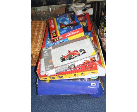
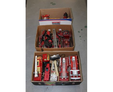
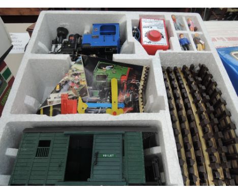
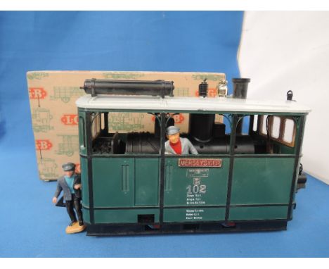
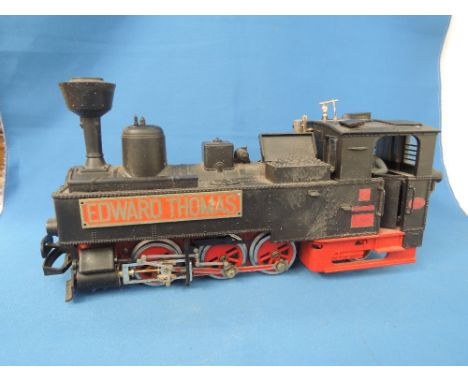
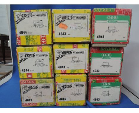
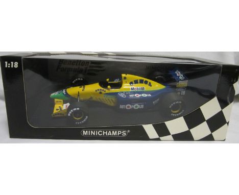
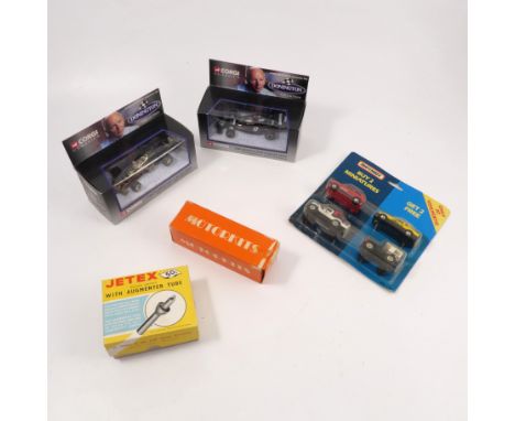
A BOXED SCALEXTIC FORMULA ONE X3 RACING SET, with both cars and track etc, a boxed Tecni Toys SCX McLaren F1 Racing Set, C.2000, with both cars, track and controllers etc, with a boxed SCX Electronic Lap counter and unbuilt Revell 1:24 scale Ferrari F2005 F1 Racing Car (contents not checked), No.07244 (all boxes damaged)
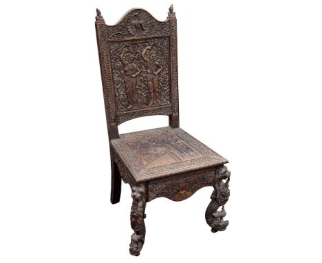
A profusely carved Anglo-Indian hardwood side chair, circa 1860, Bombay region, arched top rail with centralised peacock to front and rear flanked by foliate trails, side uprights bearing scrolling vinery detail and surmounted with figural finials, back splat with male and female costumed dancers to front and foliate carving to reverse, the seat with central panel depicting a rural scene featuring two figures with oxen within a foliate frame with florettes, serpentine form friezes to front and sides bearing conforming carved design, front legs featuring stylised feline heads to upper sections, foliate carved shoulders above scale carved stylistic dolphin feet, 39in. (99cm.) high, 20in. (50.8cm.) wide.
A mid-17th Century English Civil War period Officer's Mortuary hilted broadsword, 84cm blade, indistinctly marked along the medial ridge, characteristic hilt decorated with overlapping scales, plain wooden grip. For swords with similar overlapping scale decoration see page 236 illustration XIII and page 244 illustration IB of British Basket-Hilted Swords by Cyril Mazansky. One side-bar lacking and generally patinated.
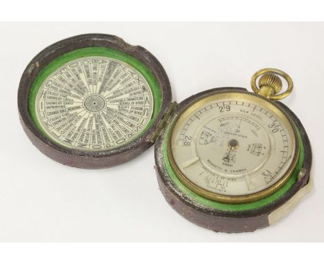
A Negretti & Zambra brass aneroid pocket weather foreteller/weather watch, early 20th century, with silvered dial and adjustable inner ring, with fall, steady and rise apertures, the outer case with actimeter scale, the rear annotated with twenty-six sectors of weather forecasts within original red leather and baize-lined case, inset with an ivorine disc replicating the rear of the foreteller,5.4cm

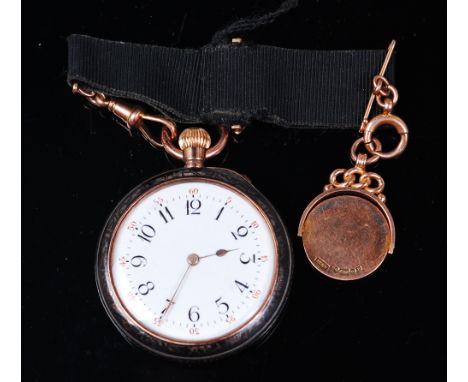
An early 20th century continental silver and niello open faced pocket watch, having white enamel dial, Arabic numerals and outer scale, keyless movement, the inner back cover stamped 'Sir John Bennett Ltd, Makers to the Royal Observatory, Cheapside London, Swiss Made', dia. 3.9cm; together with a 9ct gold and black ribbon lapel hanger with pendant, weighing 9.3g

A collection of four silver pocket watchesThe first, a silver hunter pocket watch, keyless wind, with white enamel dial (a.f.) and black Roman numerals, with subsidiary dial and outer minute scale, signed Horn of Petersen Ltd, Townsville, Swiss made, hallmarked Birmingham, diameter 5.4cm, together with, a silver pocket watch, key wind, white enamel dial, black Roman numerals, subsidiary dial and outer minute scale, signed Improved patent, English lever, hallmarked Chester, diameter 5.3cm, two silver Waltham pocket watches, key wind, white enamel dial and black Roman numerals, subsidiary dial, one inscribed and hallmarked Chester diameter 4.8cm, the other hallmarked Birmingham with silver Albert chain and T-bar diameter 5cm (4)
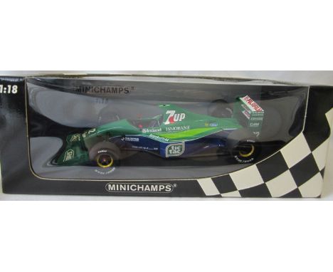
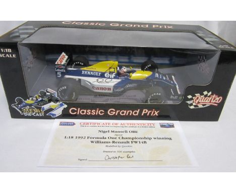
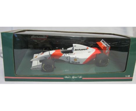
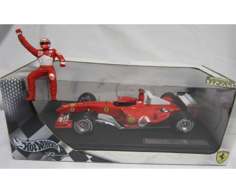
F1 MODEL CARS - MICHAEL SCHUMACHER Issued by Grand Prix Legends, 5 Michael Schumacher 1:18 scale cars. Ferrari F1-2000 - World Champion 2000 Special editon including plinth and perspex cover and box munufacturer, Hot Wheels metal plaques engraved on the plint plus an empty box. The plaque on the right side front base is slightly unstuck and a replacement is included. Ferrari F2001 - World Champion 2001 Special edition including Hot Wheels engraved plinth. No perspex cover. Ferrari F2002 - World Champion 2002 Special edition including Hot Wheels engraved plinth. No perspex cover. Ferrari F2003-GA - World Champion 2003 Special edition including Hot Wheels engraved plinth and perspex cover. Ferrari F2004-GA - World Champion 2004 Special edition including Hot Wheels engraved plinth and perspex cover. Good
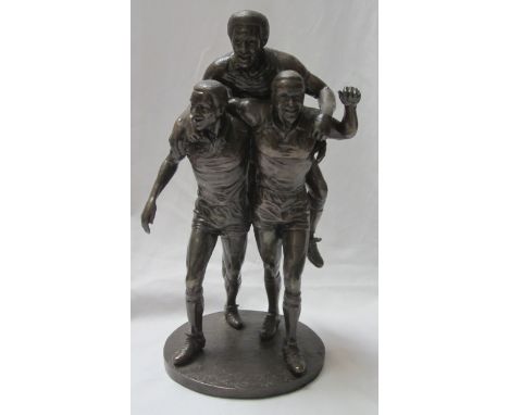
THE THREE DEGREES- WEST BROM A special limited edition scale model of the 10ft high statue that will adorn New Square, West Bromwich. The statue will show Brendon Batson, Laurie Cunningham and Cyrille Regis celebrating a goal. The statue by Graham Ibbeson will be sited at the heart of the regenerated West Bromwich town centre to commemorate the impact and contribution that black players have made to our national game. This scale model of the original , bronze coloured , measures approx 42cm in height and width is approximately 28cm and weighs slightly over 5 kilos. Very good
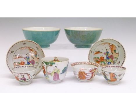
Group of Chinese ceramics comprising: Famille Rose surprise cup, the exterior decorated with figures in a garden, the domed interior containing a standing figure of Shoulao, 6.25cm high, a pair of Famille Rose tea bowls and saucers, each piece with figural reserves, tea bowl decorated with a seascape with European galleons, 8cm diameter and two bowls, one having a purple speckled blue glaze, the other a plain blue glaze, each with red seal marks and measuring 12cm diameter Condition: Single tea bowl with internal rim decoration has two vertical hairlines running almost to the base, one of the pair of small tea bowls has vertical hairline approx 20mm, the novelty cup has stapled repair where a U shaped section approx half the height has been broken out and re-stuck with three staples, there is a further vertical hairline running almost the entire height and much scale and discolouration to the inside, one of the turquoise bowls has two vertical hairlines running from top rim almost to the base with a large internal flake to one of the hairlines approx 15mm x 10mm - **General condition consistent with age
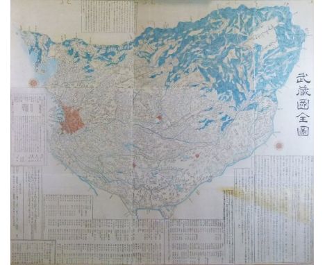
Japanese Edo period large scale wood block map of Musashi Kuni (Tokyo or Edo Province), made from separate sheets, but now laid down as one, 111cm x 127cm Condition: Large area of yellow staining to bottom right corner, old worm damage across top margin, laid down - **General condition consistent with age
-
216134 item(s)/page