A collection of predominantly Lesney 'Matchbox Series' and Matchbox small scale diecast vehicles including Superfast and 75 Series examples with further including Corgi Juniors Whizzwheels and Husky, the majority contained in three Matchbox Superfast collectors' carrying cases, all playworn to varying extents.
We found 216134 price guide item(s) matching your search
There are 216134 lots that match your search criteria. Subscribe now to get instant access to the full price guide service.
Click here to subscribe- List
- Grid
-
216134 item(s)/page
1960s Burns Short Scale Jazz guitar electric guitar, made in England, ser. no. 3738; Finish: cherry burst, faded to the front, minor blemishes and scratches but generally good for the age; Fretboard: rosewood; Frets: good; Electrics: working; Hardware: good; Case: contemporary Burns hard case; Overall condition: good
A Smith & Wesson First Model .44 Russian Six Shot Double Action Revolver, numbered 44945, the 15.2cm round barrel with blade foresight, the top flat marked SMITH & WESSON SPRINGFIELD MASS.U.S.A. PAT'D JAN.17 & 24.65/JULY 11 65.AUG.24.69.JULY 25.71. DEC.2.79. MAY 11 & 25.1880, the left side of the barrel stamped .44 S & W CTG, with fluted cylinder and mother of pearl grip scales, the butt strap numbered 44945, 27.5cm. Double action works. Holds at full cock. Pitting to bore. Black patching and pitting to metalwork. Right grip scale has two small cracks.
A 19th Century Lock Knife, the blade stamped, ''Joseph Rodgers & Sons, Cutlers to their Majesties, No.6 Norfolk Street, Sheffield, England, twin hatched horn scale grips, 26.5 cm overall, open, original leather sheath, and a Victorian Short Swordstick, fullered square section blade, length 33 cm, cane grip and locking scabbard (2). Lock knife - Blade extreme tip broken. Several small nicks to blade edge. Some wear to plated parts. Mechanism in good working order. Sheath loop broken and lacking, otherwise good. Swordstick - Blade with scattered patches of light rust, but mainly quite bright. Scabbard with small split at top. Tip of scabbard appears to be reduced slightly. Grip with small split at base. General signs of wear.
A Smith & Wesson Model No.3 .44 Russian Six Shot Single Action Revolver, No.25082, with blued finish, the 16.5cm round barrel with blade foresight, marked on the top flat SMITH & WESSON SPRINGFIELD MASS.U.S.A. PAT'D JAN.17 & 24.65, JULY 11 65/AUG.24.69.APR.20.75.FEB.20 & DEC.18.1877. REISSUE JULY 25.1871, the top of the backstrap stamped with an anchor, the butt strap numbered 25082, with chequered walnut grip scales, 30cm. Action works, holds at full and half cock. Some pitting to bore, but generally quite crisp. Wear to bluing. Left grip scale has two cracks, chequering on both sides is worn.
A Mid 19th Century Indo Persian Quadara, the 57cm single edge steel blade with three narrow fullers to the back edge and with armourer's mark, the waisted hilt with horn grip scales, lacks scabbard, 72cm. Black patching to blade. One grip scale has a small piece of horn missing above the ricasso.
A Continental Court Sword by Coulaux & Cie, Klingenthal, the 76.5 cm fullered, triangular section steel blade etched with foliage and signed with maker's name, the cast and plated brass hilt and shell guard with fluted mother of pearl grip scales, the leather scabbard with plated mounts, 96cm. Blade good. Hilt and guard plating quite worn and with accumulated polish. One grip scale with broken corner. Scabbard split in two above chape. Some stitching also defective.
*Cheshire. Blaeu (Johannes), Cestria comitatus Palatinus, circa 1645, engraved map with contemporary hand colouring, decorative cartouche and mileage scale, 380 x 505 mm, mounted, framed and glazed, together with Morden (Robert), Hereford [1695 or later], hand coloured engraved map, 365 x 425 mm, framed and glazed (2)
*England & Wales. Saxton (Christopher & Ortelius Abraham), Anglia regnum si quod aliud in toto Oceano ditissimum et florentissimum, published Jan Baptiste Vrints, Antwerp, [1603], map engraved by Pieter van den Keere, with contemporary hand colouring, large decorative cartouche and strapwork mileage scale, additional strapwork cartouche paying tribute to Christopher Saxton and a large maritime vignette commemorating the attack of the Spanish Armada to lower-left, large margins, one worm hole to lower horizontal strapwork margin, 385 x 485 mm, framed and glazed R. W. Shirley, Early Printed Maps of the British Isles 1477 - 1650 no. 258 Marcel Van den Broecke, 'Ortelius Atlas Maps' no.20. (1)
Essex. Chapman (John & Andre Peter), Nineteen sheets only from the large scale 'A map of the county of Essex..., ' numbers 1 - 7, 10 - 12, 14 - 16, 19 & 20, 23 & 24, [1777 or later], nineteen engraved maps with contemporary hand colouring, two duplicate sheets (nos. 5 & 12), some oxidisation to a few sheets causing cracking and flaking with occasional loss, some spotting, toning and staining, each sheet approximately 490 x 610 mm (19)
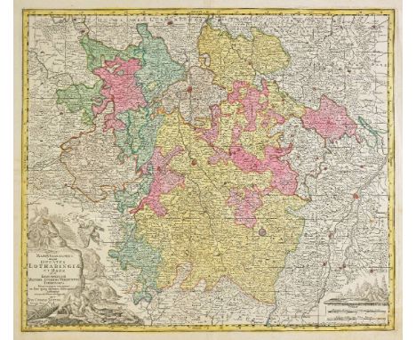
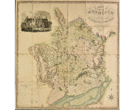
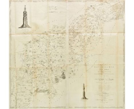
France & Belgium. Lotter (Tobias Conrad), Mappa geographica in qua Ducatus Lotharingiae et Barr..., Augsburg, circa 1740, engraved map with contemporary hand colouring, 500 x 585 mm, together with Nouvelle carte de Cercle de Bourgogne on l'on voit toutes les possessions de la Maison d'Autriche dans les Pays Bas..., Augsburg, circa 1740, engraved map with contemporary hand colouring, 470 x 620 mm, together with Homann (Johann Baptist and heirs of), Comitatus Flandriae in omnes ejusdem subjacentes ditoes cum adjacentibus accuratissime divisus..., Tabula Ducatus Britanniae Gallis le Gouvernemt. general de Bretagne..., Charte von Lothringen und Barr..., [and] Gubernatio generalis Languedociae occitania olim dictae..., circa 1790, together four engraved maps with contemporary hand colouring, two maps with some overall toning, each approximately 485 x 585 mm, together with Cassini de Thury (Cesar Francois), Nouveau Tableau pour servir a l'Assemblage des feuilles de la carte de France par Cassini et de celle des Pays-Bas par Ferraris, au D‚p“t G‚n‚ral de la Guerre, Paris, 1808 [or later], index sheet (with duplicate) and 123 (only?) uncoloured engraved sheets, some marginal fraying and closed tears, occasional sheets torn with loss, occasional spotting, each sheet approximately 620 x 920 mm, (some smaller sheets) The Cassini maps were the first general maps of France using a measuring apparatus were made by the Cassini family during the 18th century on a scale of 1:86,400 (one centimetre on the chart corresponds to approximately 864 meters on the ground). These maps were, for their time, a technical innovation. They were the first maps based on geodetic triangulation, and took more than fifty years to complete. Four generations of the Cassini family were involved in their production. These maps, known as "Cassini Maps" or "Maps of the Academy," are still referenced by geographers, historians and genealogists. In 1808, Napoleon I decided to produce a map intended to be more accurate than that of Cassini. However, Napoleon demanded that the primary goal of the work was to produce battlefield maps. The triangulation for this new map began also from the Paris meridian arc or French meridian line, surveyed this time by Delambre and M‚chain. Work on this map took place between 1817 and 1866. During this period several different scales were tested, with the scale 1:80,000 being chosen. This became known as the "Geological Survey" map. The funding for this work was provided by the Department of War. The first work was done by the D‚p“t de la Guerre (as referenced on the index map) and later by the Geographical Service of the Army, whose first director General Fran‡ois Perrier and his successor General Bassot re-measured the French meridian arc. The variety of paper used on this example is noticeable and indicative of a map produced over a long period of time. (131)
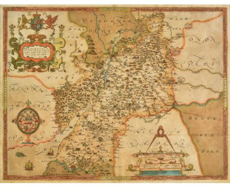
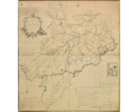
*Gloucestershire. Saxton (Christopher), Glocestriae sive Claudiocestriae Comit (Claudy Caesaris Nomine ad huc Celebrat) Verus Tipus atq Effigies. No. Dni. 1577, [1579], engraved map with contemporary hand colouring, elaborate strapwork cartouche, and mileage scale, 385 x 500 mm, mounted framed and glazed Engraved by Augustine Ryner and decorated with the arms of Queen Elizabeth I, a fine example in very good condition of the first ever published map of Gloucestershire. (1)
India. Stanford (Edward, publisher), Stanford's map of India based on the surveys executed by order of the Honourable The East India Company..., showing the Latest Territorial Acquisitions of the British Empire and the Independent and Protected States, 1857, large scale lithographic map with contemporary outline colouring, sectionalised and laid on linen on two sheets, circular cartouche, inset map of the Malay peninsula, three circular distance and bearings charts, overall size 1500 x 1230 mm, contained in a contemporary cloth slipcase with printed label to upper cover (1)
Lincolnshire. Bee (Stephen), A Survey and Plan of the road from the city of Lincoln. Over the Heath, thro' Dunsby Lane, Sleford, Folkingham, Bourn and Market Deeping to the city of Peterborough and also Bourn thro' Edenham, Grimsthorp Park by Swinstead and Corby to Colsterworth, sold by R. Sayer, circa 1760, large scale engraved map with sparse contemporary outline colouring, with the lettering and draughtsmanship by William Rower, dedication to 'The most noble Peregrine Bertie, Duke of Ancaster & Kesteven, Lord Great Chamberlain of England &c....', old folds, slight creasing and dust soiling, slight overall toning, occasional marginal closed tears, trimmed to neatline along right hand vertical margin, 705 x 640 mm A rare broadsheet map. No auction records found, Copac records only one copy (Oxford University). Worms & Bayton-Williams. British Map Engravers, page 572. (1)
London. Greenwood (C. & J.), Map of London from an actual survey made in the years 1824, 1825 & 1826..., extended and comprising the various improvements to 1830, published Greenwood & Co., 2nd. edition, August 31st 1830, fine large scale map with contemporary hand colouring, engraved by Josiah Neele, sectionalised and laid on linen, calligraphic cartouche, table of explanation and reference to the parishes, inset views of Westminster Abbey and St. Pauls, dedication to King William IV, very slight staining, edged in green silk, marbled endpapers, 1250 x 1890 mm, contained in a contemporary green morocco gilt book box, all edges gilt, some wear to extremities Howgego, Printed Maps of London 1553 - 1850, 309, state 2. The Greenwood brothers Christopher and John spent three years preparing this remarkable new survey of London, prepared on the lavish scale of 8 inches to a mile, illustrating for the first time the planned development of Belgravia by Thomas Cubitt, the completion of the Grand Surrey Canal and Regent's Park one year before it was completed in 1828. This second edition has the additions of the Lea Union Canal and the names of Bayswater and East Greenwich. (1)
Maps. A mixed collection of approximately 350 maps, charts and town plans, 18th - 20th century, engraved and lithographic maps including foreign countries, British town plans and charts, including examples by Letts, Time Atlas, Bowen, Monin, Petermann, Mason & Payne, Philip and Bartholomew, together with a folder of large scale facsimile maps and atlases, various sizes and condition (approx.400)
Monmouthshire. Greenwood (C. & H.), Map of the county of Monmouth, from an actual survey made in the years 1829 & 1830..., published August 23rd. 1830, large scale engraved map with contemporary outline colouring, sectionalised and laid on linen, calligraphic cartouche, table of explanation, compass rose and engraved vignette of Tintern Abbey, edged in green silk, slight spotting, 955 x 910 mm, marbled endpapers, contained in a contemporary calf book box, worn and rubbed (1)
Northamptonshire. Eyre (Thomas & Jefferys Thomas), The county of Northampton as surveyed and planned..., 2nd edition, published William Faden, 1791, uncoloured large scale map, engraved by William Faden on four sheets (conjoined into two), two engraved vignettes of Queen's and Geddington Cross, slight offsetting, slight marginal dust soiling and fraying, overall size 1240 x 1300 mm, contained in a modern purpose made marbled card portfolio (1)
*Oxfordshire. Plot (Robert), The Map of Oxfordshire, [1677], hand coloured engraved map, decorative cartouche, mileage scale, table of explanation and compass rose, old folds, small closed tears with slight loss affecting image, repaired with facsimile, one long closed tear affecting image, 500 x 480 mm, mounted, framed and glazed, together with Plot (Robert), The Natural History of Oxford-shire, being an essay toward the natural history of England, printed at the Theatre in Oxford..., 1677, decorative title, dedication to Charles II, sixteen uncoloured engraved plates, index bound at rear, bookplates of Effingham and Simon Nowell-Smith, later endpapers, 19th century half calf gilt, worn at extremities, 4to Created by the first keeper of the Ashmolean Museum of Oxford, the map is decorated with 172 coats of arms of the county's gentry, Oxford colleges, the city and the four county towns. One of the most decorative maps of Oxfordshire ever produced. (2)
*Scotland. Scobie (Mathew), A map of Roxburgh Shire of Tiviotdale, circa 1770, large scale map with contemporary outline colouring, engraved by John Bayley, on four conjoined sheets, inset map of East Point and Chivot Hill, table of remarks and a list of the principal seats, table of explanation, ornate cartouche and compass rose, slight overall toning and some dust soiling, 1050 x 950 mm, framed and glazed (1)
Shropshire. Greenwood (C. & J.), Map of the county of Salop from an actual survey made in the years 1826 & 1827, published July 2nd. 1827, large scale engraved map with contemporary hand colouring, sectionalised and laid on linen, calligraphic title, compass rose, table of explanation and a vignette of the south west prospect of Shrewsbury, inset map of part of Shropshire, slight staining and offsetting, library stamp below cartouche, edged in green silk, several library stamps to verso, library label to endpaper and inside lid of book box, 1485 x 1230 mm, contained in a contemporary green morocco gilt book box, rubbed and worn at extremities (1)
Yorkshire Jansson (Jan), Provincia Eboracensis Yorke-shire, Ducatus Eboracensis pars Occidentalis. The West Riding of Yorke Shire [and] Ducatus Eboracensis pars Borealis. The North Riding of Yorkeshire, circa 1650, together three engraved maps with contemporary outline colouring, slight spotting and toning, each approximately 390 x 500 mm, German & French text on verso The map of the whole of Yorkshire is from the 1636 'pre-atlas' state without the decorative cartouche and mileage scale. (3)
*Yorkshire. Speed (John), York Shire, published John Sudbury & George Humble, circa 1627, hand coloured engraved map, near contemporary manuscript annotation of the rivers, 385 x 510 mm, framed and glazed, together with Saxton (Christopher & Hole G.), Cestriae comitatus Romanis legionibus et coloniis olim insignis vera et absoluta descriptio, circa 1610, hand coloured engraved map, 'open book' cartouche, compass rose and mileage scale, 260 x 305 mm, framed and glazed, with Morden (Robert), The county Palatine of Chester [and] Buckinghamshire [1695 or later], two hand coloured engraved maps, some spotting to Cheshire, 350 x 415 mm and 420 x 350 mm respectively, both framed and glazed (4)
*Cattle. Garrard (George), Nine prints originally published in 'A Description of the Different Varieties of Oxen Common in the British Isles; Embellished with Engravings; being an Accompaniment to a Set of Models of the Improved Breeds of Cattle Executed by George Garrard upon an Exact Scale from Nature under the Patronage of the Board of Agriculture...,' circa 1805, etchings with contemporary hand colouring, each approximately 260 x 390 mm (9)
LGB and Bachmann G Scale Rolling Stock and Novelty Items, comprising LGB 'Fortuna' fan-powered 'Locomotive', heavy log bogie wagon and 4-wheel cattle wagon with two 'Fanny' cows, together with Bachmann powered pump-trolley and trailer, and a bogie stake wagon (latter with buckeye couplers), and a collection of spare couplers and other parts, mostly G-VG, moderate playwear and some minor damages (9 including cows)
Four Repainted Bachmann G Scale American-Style Clerestorey Coaches, all neatly refinished in 'Fareham Light Railway' brown/cream, as saloon coaches 'Phyllis' and 'Evelyn', and brake coaches 'Irene' and 'Vera', all fitted with 9v battery-operated interior lights, as repaints VG, brake coaches with 'chopper' couplings to one end, others to make a set (4)
A Scratch-built G Scale Push-Pull Coach and Part-built 2-4-2 Diesel/Electric Locomotive and Other Items, the coach on commercial bogies, with 1st, 2nd class and guards compartments and driving cab to one end, in green with gold decals, VG, together with an incomplete plastikard or similar bodied Locomotive based on a Bachmann chassis, (intended for battery operation), in flat crimson livery, F, needs work to complete, and a box of other Bachmann G scale items including plastic track, telegraph poles, kit buildings, loco and caboose bodies only, F-G (qty in 2 boxes)
A Collection of Playmobil G Scale Trains and Accessories, including battery-powered 'PM Train' Bo-Bo Electric Locomotive and 3-car tourist train, both with remote (radio) controllers, with open wagon, side-tip wagon, and a quantity of track with level crossing, buffers and other trackside items, mostly G, Bo-Bo loco missing one coupling rod (qty in 2 boxes)
A Continental G Scale Live Steam Gas-fired 0-4-0 Tank Locomotive, commercially-built with 'Regner' pressure gauge, outside cylinders with Walschaerts valve gear, displacement lubricator, water gauge and regulator valve, finished in black/red livery with DR/DB-style number 99 011, G-VG, moderately used
A Collection of Incomplete Coarse-Scale O Gauge Rolling Stock and Track, including three LMS coach bodies, possibly from CCW or similar kits, 4 vans, 3 open wagons all in wooden with LMC or similar axle fittings, a bogie bolster wagon, three modern Peco plastic finescale wagons, a group of made-up 2-rail brass track sections including a double-track turnout and double-track crossover, together with a box of spare components including wheels, buffers, axleguards, track chairs and many other small parts, mostly F (qty)
LGB G Scale Track Gaugemaster Controller and Other Items, Track including 3 LH points and 2 RH (all 600mm radius), 21 x no 1500 curves, 10 x no 1100 curves, 3 x no 1102 curves, 11 x no 1000 straights, 5 x double straights and 16 'double doubles', + 3 odd lengths, together with a 1992-3 catalogue and seven LGB figures, varying F-VG, most track appears to have seen outdoor use but is all intact (qty in tub + 2 bundles)
An Incomplete Coarse-Scale O Gauge Scratchbuilt GWR 28xx Locomotive Project, apparently started during WWII using a small proportion of commercial parts, the remarkably-detailed superstructure made up from copper, with brass frames and (slightly rusty) cast-iron wheels, fitted with coupling rods, and a substantial roller-bearing motor, the Tender similarly-constructed with sprung axleboxes and other features, overall P-F, both cylinders detached, one connecting rod missing, generally grubby/corroded, various smaller components included (qty)

-
216134 item(s)/page