We found 185385 price guide item(s) matching your search
There are 185385 lots that match your search criteria. Subscribe now to get instant access to the full price guide service.
Click here to subscribe- List
- Grid
-
185385 item(s)/page


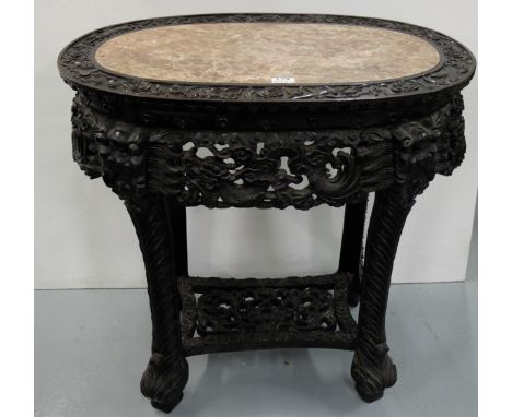
Lot 179
Mid-19thC Intricately Carved Oval Chinese Cherrywood Centre Table, the red and white marble top surrounded by musical and floral carvings, over a frieze of carved dragons with dragon heads over the 4 scale embossed legs, supported by a carved stretcher, on dragon feet, 31”w x 18”d x 32”h (provenance Tulach Nore, Co Laois)
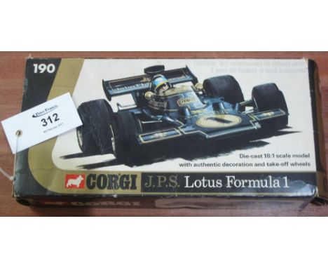
Lot 312
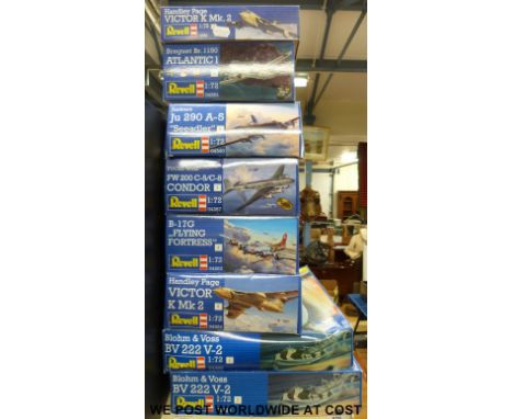
Corgi J.P.S. Lotus Formula One diecast 18:1 scale model with authentic decoration and take-off wheels. No. 190. In original box. CONDITION REPORT: Model itself in good condition overall with minor wear in places, box has some tears, rips and creases to edges and in other places, but appears complete.
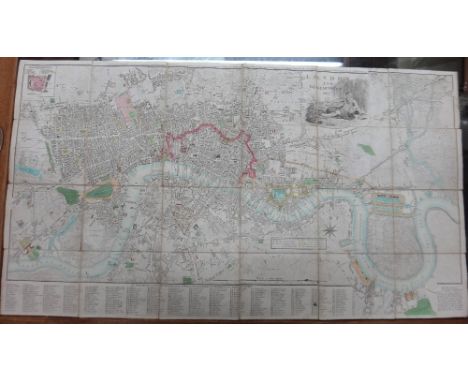
Lot 1482
John FAIRBURN. London and Westminster. 7th edition; exhibiting the various alterations and improvements . . . 45 x 82cms., hand-coloured & folded on linen; engraved pictorial title, list of 300 principal streets, sm. inset plan of the Fleet Prison, etc. 1803. * contained in the original marbled slipcase with coloured pictorial illus.; extent: Pentonville & Bethnal Green / Kennington & Deptford; Paddington & Chelsea / Bow-Creek & Greenwich Park. scale: almost 4 inches to mile. ( ?1806)
Lot 1488
M. PHILIPPE - Carte Nouvelle de la France. 30 x 43cms. (within mount), outline hand-colouring, engraved title, scale & key. 1765; sold with Utriusque BURGANDIAE, tum Ducatus tum Comitatus descriptio. 28 x 36cms. (within mount), hand-coloured, title within decorated surround with armorials. (ca. 1780).
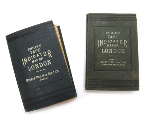
Lot 1475
PHILIP'S Tape Indicator Map of London. 62 x 90cms., colour-printed, folded on linen within printed cloth covers; scale - 3 1/2 ins. to mile. * extent - Kentish Town / Clapham Common; Ravenscourt Park / W. India Docks; with the attached & novel 'tape indicator', & integral 72pp. street index. (ca. 1908); sold with another copy - slightly earlier. * earlier copy with White City unnamed; workhouses still named as such, etc.
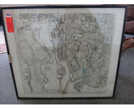
Lot 1478
KYLACHY - Plan of the Lower Grounds of the Estate of Kylachy. The Property Angus Mackintosh Esquire. From a Survey by George C. Mackay 1850. on thick paper (rolled), with some outline colour, 86 x 340cms. (i.e. extends to some 11 feet), scale approx. 7.5ins to 1500 feet. * being part of the Findhorn valley, south of Inverness; old Clan Mackintosh country.

Lot 340
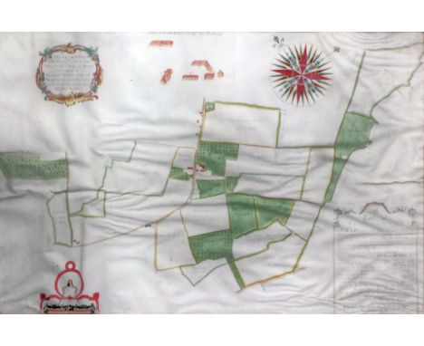
Of Kent interest- 17th Century English School - Ink and watercolour on vellum - Estate Map and description of -"One Capitale Messuage Comonly called the Mote", with title - "A Map & Description of one Capitale messuage Commonly called the Mote with: 28: parcells of Errable and : 7: parcells of wood thereunto belonginge lyinge in the parishes of St Martins St Paules: Fordwich: and Litleboorne Contayninge of Errable, 320-3-24: woodes, 112-2-2-35 beinge parcelle of the possessions of the right honorable Sr John Finch Lord Cheefe Justice of the Comon Pleas", within a cartouche of "Mannerist design" and with elaborately decorated scale with dividers and motto and date 1635 over, and further dated "Anno Domini: 1635", with some contemporary ink descriptions and land values outside the main image, 33.75ins x 15.75ins, (upper left and lower right corners cut and missing), framed and glazed
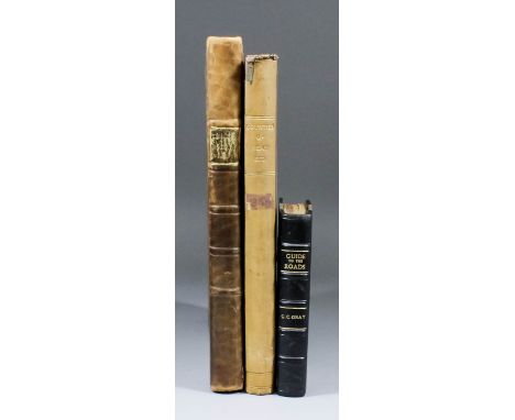
Lot 399
J. Edwards - "A Companion from London to Brighthelmstone, in Sussex; Consisting of a Set of Topographical Maps from Actual Surveys, on a Scale of Two Inches to a Mile", printed by T. Bensley, Bolt Court, Fleet Street, 1801, (one volume with marbled boards), George Carrington Gray - "Gray's New Book of Roads", published by Sherwood, Jones and Co, Paternoster Row, London, 1824, (one rebound volume), and John Wilkinson - "Doomsday: or, An Actual Survey of South - Britain, by the Commissioners of William the Conqueror, Completed in the Year 1086...", published Bye and Law, 1799 (one rebound volume)
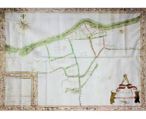
Lot 342
Of Kent interest- 17th Century English School - Ink and watercolour on vellum - Estate Map by James Tull and description of Stile Farm, Chartham, with title "A Map and Description of a certaine Messuag and Land called Stile Farme lying in the Parish of Chartham, & a small parcell partet of with a rid pricked line in the Parish of Chartham and in the County of Kent beinge the Demeasnes of Peter Webster Gent: Surveyed the nine and twenty day of March Anno Dni 1695 by James Tull Surveyor", within a border of running leaf design which also forms a border to this plan, and with elaborately decorated scale with dividers and the date 1695 over, and decorated compass points, 18.75ins x 25.25ins, framed and glazed
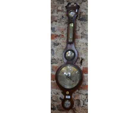
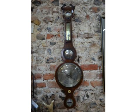
Lot 866
A George III mahogany stick barometer and thermometer by Fasana, No. 35, Milsom Street, Bath, with silvered vernier scale and with mercury thermometer and a hydrometer, figured mahogany case with shaped cresting and turned acorn finial and turned cistern cover, 40.5ins high, (lacking a glazed cover to hydrometer)

Lot 341
Of Kent interest- 18th Century English School - Ink and watercolour on vellum - Estate Map by Thomas Hogben - "Measure and Map of Bobbing Court Lodge Farm in the County of Kent belonginge to Thomas Tyndale Esqr of North Cerney in Gloucestershire now in the Occupation of Mr John Boykett", within a decorative cartouche of rococo design with scrolls and flowers, and with "A Table of REFERENCES", scale with dividers over and a pictorial representation of "A View of the Court Lodge and Buildings", and elaborately decorated compass points, "Survey'd Delineated and Admeasured by Thomas Hogben 1769", 24ins x 37ins Note: Thomas Hogben (1702-1774) may be identified with the land surveyor and schoolmaster of Smarden of that name, son of Thomas Hogben (the Elder) of Ashford, surveyor (1672-1703). The younger Thomas is also known to have produced brass sundials and possibly, occasionally clocks

Lot 339
Of Kent interest- 17th Century English School - Ink and watercolour on vellum - Estate Map and description of the Manor of Ratlinge Court, Kent with title -"A Map & Disscription of the Mannor of Ratlinge Court with: 13: parcells of Errable: &: 4 & percells of woodlande thereunto: belonginge lyinge in the parish of Nonington in East Kent contayninge of Errable..." within a cartouche of "Mannerist" design, and with elaborately decorated scale with dividers and motto over, and decorated compass points, dated "Anno Domini 1637", with some faint later pencil annotations, 21.75ins x 14.75, framed and glazed

Lot 381
John Andrews (1736-1809), Andrew Drury and William Herbert - Coloured engraving - Plate 14 from "A Topographical Map of The County of Kent in 25 Sheets, On a Scale of 2ins to a Mile, From an Actual Survey...", published January 1st 1769, showing Bridge, Petham and Wye Hundreds etc, 18ins x 27ins, framed and glazed
Lot 378
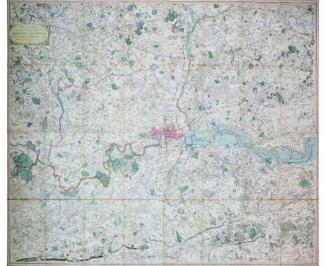
William Faden (1750?-1836) - Coloured print - A Map of "The Country Twenty-Five Miles Round London, Planned from Scale of One Mile to an Inch" (third edition, 1802), 41ins x 50.5ins, published and sold by W. Faden, No. 5 Charing Cross Road, London, "Geographer to His Majesty and to His Royal Highness the Prince of Wales", dissected into thirty two sections and backed on to linen, with original marbled paper cover slip case with printed paper label


-
185385 item(s)/page