We found 216134 price guide item(s) matching your search
There are 216134 lots that match your search criteria. Subscribe now to get instant access to the full price guide service.
Click here to subscribe- List
- Grid
-
216134 item(s)/page


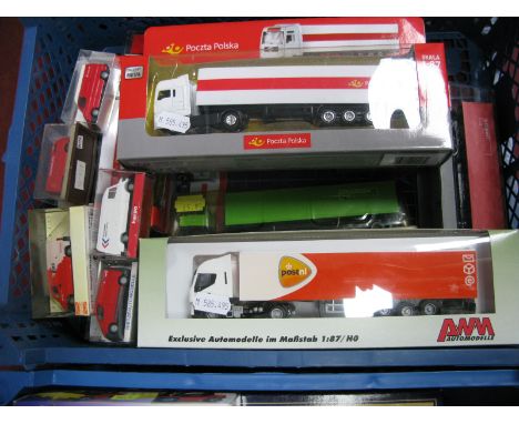
Lot 314
Eight Diecast Model Commercial Vehicles, by Diano, Siku, Macadam, Schuco, City, Eligor, all with a German Postal theme, predominantly 1:43rd scale including Schuco Opel Truck 'Deutsch Bundespost', Eligor #1095 Opel Laubfrosch 1925 Pompiers Secours "Rudesheim", City #CV017 Volkswagen Bulli "Deutsche Bundespost", all cased.
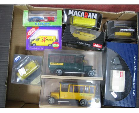
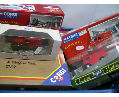
Lot 484
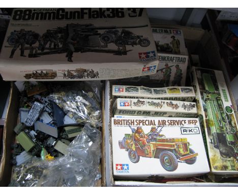
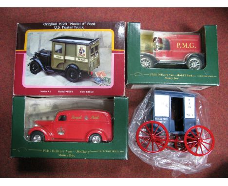
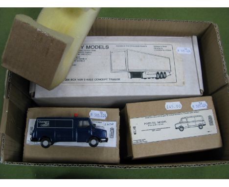
A Quantity of Smaller Scale Diecast and Plastic Model Vehicles, by Corgi, Playart, Wiking, Brekina, Barclay, including Barclay (USA), all Mighty Trucks (three vehicle set), U.S. Mail, Allied Van Lines, Railway Express, Corgi Delivery Service (four vehicle set) 'Royal Mail', Corgi 'Royal Mail-Datapost' Ford Escort, mostly in original packaging but not always sealed.
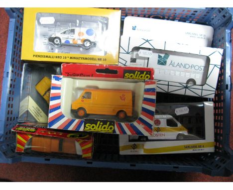
Lot 104
A Quantity of Diecast and Plastic Model Vehicles of Differing Scales, by Siku, Majorette, Dickie, other all with European, Russian postal liveries including Siku #3421 Zoffer-Zug box van Deutsch Post, Siku Mercedes Post van 'PTT Post', Texho Napk 1:72nd scale Lada 110 'Noyta', in original packaging.
Lot 17
A MAHOGANY TABLE OR BRACKET CLOCK the convex silvered Roman dial signed William Chattle, London, the twin train chain fusee movement with anchor escapement, bell strike and engraved back plate decorated with a floral urn, the boxwood strung arch top case with brass fish scale side frets, moulded base and brass ball feet, 42cm high
Lot 12
AN EBONISED BRACKET OR TABLE CLOCK, the square brass dial with silvered Roman chapter ring, Arabic five minutes and stylised sword hilt half hour marks, with slow/fast and chime/silent rings to the upper corners, the Winterhalder & Hofmeier twin barrel movement with anchor escapement and chiming movement, the 18th Century style ebonised case with brass swing handle to the domed top over glazed sides with fish scale frets and ogee bracket feet, 33cm high handle down
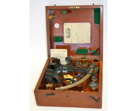
Lot 2101
H G Blair & Co. (Cardiff & Barry) Sextant with black frame, ivory handle and Vernier scale engraved with makers name 7 1/2'', 19cm diameter (some general wear and deterioration form use) with accessories in original mahogany case with retailers label ''Wilson & Gillie, Bruce & Sons (Cardiff)'', Certificate of Examination from the National Physical Laboratory (Surrey) dated July 1905; a Port of New York Alien Seamans Identification Card no.101317 for John James Crosthwaite originally dated for an arrival on SS Siberian Prince 30 Aug 1919 and with subsequent arrivals
Lot 133
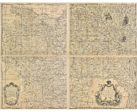
Maps. A mixed collection of 23 maps, mostly 18th & 19th century, including Bowen (Emanuel), An accurate map of Northampton Shire divided into its hundreds..., J. & C. Bowles, circa 1765, engraved map with contemporary outline colouring, 700 x 540 mm, together with An accurate map of Nottingham Shire describing its Wapontakes and divisions..., published C. & J. Bowles, Robt. Sayer & J. Bennett, 1777, engraved map with contemporary outline colouring, 515 x 420 mm, with Cary (John), A new map of Westmorland divided into Wards..., 1801, A new map of Northumberland divided into Wards..., 1807, A new map of Buckinghamshire divided into hundreds..., 1801, A new map of Nottinghamshire divided into hundreds..., 1801, A new map of Leicestershire divided into hundreds..., 1801 [and] A new map of Worcestershire divided into hundreds..., 1801 together 6 engraved maps with contemporary hand colouring, each with an ovoid cartouche, compass rose and mileage scale, each approximately 500 x 555 mm, plus Bowles (Carington, publisher), Bowles's new medium map of Essex divided into hundreds..., 1785, engraved map, originally published in 'The Atlas Anglicanus', with contemporary hand colouring, 235 x 330 mm, and Ogilby (John), The Road from Whitby in com. Ebor. to Durham..., [1676 or later], hand coloured engraved strip road map, some repaired marginal closed tears, 345 x 455 mm, mounted, with another 14 engraved county maps including examples by Greenwood, Zatta, Cary, Lewis and Teesdale, occasional duplicates, various sizes and condition (24)
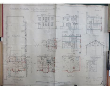
![Jansson (Johannes). Buckingamiae comitatus cum Bedfordiensi vulgo Buckinghamshire and Bedfordshire, [and] Middelsexiae cum He](https://cdn.globalauctionplatform.com/bf4911eb-d0e9-428e-a339-a9d900e12ae8/5f930568-3989-4d09-af9e-a9d9011b6d54/468x382.jpg)
Lot 129
Jansson (Johannes). Buckingamiae comitatus cum Bedfordiensi vulgo Buckinghamshire and Bedfordshire, [and] Middelsexiae cum Hertfordiae comitatu Midlesex & Hertfordshire, published Amsterdam, circa 1650, 2 engraved maps, Buckinghamshire with later hand colouring, Middlesex with contemporary outline colouring, each with an ornate cartouche and mileage scale, Middlesex with central fold repaired on verso, each approximately 410 x 510 mm, both with Latin text on verso (2)
Lot 185
Yorkshire. Warburton (John), [A New & Correct Map of the County of York in all its Divisions. By Actual Survey and Dimensuration: with the Arms and Seats of the Nobility and Gentry, the Distances in Miles and Furlongs between each of the Market Towns. . . By John Warburton Esq.: Somerset Herald of Arms, & Fellow of the Royal Society], circa 1720, large scale uncoloured engraved map on 4 sheets, 2 ornate cartouches containing a table of explanation and dedication, the sea decorated with 2 finely engraved galleons, central folds strengthened on verso, each sheet approximately 500 x 640 mm, overall size (if conjoined) approximately 1000 x 1290 mm, contemporary French manuscript annotations to verso H. Whitaker. A descriptive list of the printed maps of Yorkshire, p. 51. A very scarce map of Yorkshire. Published on seven sheets, four of which are devoted to the map. The other three (lacking) include the title, the alphabetical list of towns and villages and the 693 coats of arms. The scale is 2.5 miles to an inch and was the largest scale at the time. The whole was intended as a wall map with the three text sheets to be cut up and mounted around the map. The French text on the verso suggests that this map may have been originally bound in a French composite atlas. (4)
Lot 183
Yorkshire. Smith (Charles), A new map of Yorkshire divided into Ridings &c., 1804, engraved map with contemporary hand colouring, printed on 4 sheets not conjoined, each sheet approximately 455 x 540 mm, together with Cary (John), A new map of Yorkshire divided into its ridings, and subdivided into hundreds exhibiting its roads, rivers, parks &c., 1808, large engraved map with contemporary hand colouring, ovoid cartouche, compass rose and mileage scale, old folds, printed on 4 sheets not conjoined, each sheet approximately 470 x 555 mm, with Greenwood (C. & J.), Map of the North Riding of York from an actual survey..., [and] Map of the East Riding of the county of York from an actual survey..., 1834, 2 uncoloured engraved maps, each with a calligraphic cartouche, compass rose, table of explanation and an ecclesiastical vignette, occasional marginal closed tears, some offsetting to the North Riding, each approximately 615 x 755 mm (10)
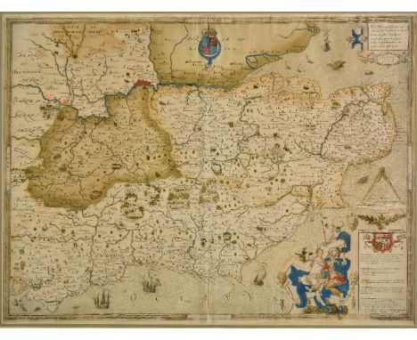
Lot 130
*Saxton (Christopher). Cantii, Southsexiae, Surriae et Middelsexiae comitat una cum suis undique consinibus oppidis, pagis, villis et fluminibus in eisdem vera descriptio, circa 1579, engraved map with contemporary hand colouring, engraved by Remigius Hogenberg, the royal coat of arms of Elizabeth I, strapwork cartouche, and elaborate decorative mileage scale, later manuscript hatching showing possible journeys, slight creasing, 410 x 545 mm, mounted, framed and glazed The First Printed Map of Kent, Sussex, Surrey and Middlesex. The map is dated 1575 but was not published until 1579. This example is state 2 - the atlas state - of the map, and shows the legend 'Pestis Patriae Pigricies' above the Seckford Coat of Arms and 'Christopherus Saxton descripsit' added below the table of explanation to the lower right corner. This is one of the earliest and most important English maps, covering the south-eastern part of England and dissected by the Thames River, with London prominently located near the top centre of the map. It is odd that Saxton chose to combine four of the most important counties of England into a single map. Kent, with Canterbury being the centre of the Church of England, Surrey and Middlesex bordering the capital, and Sussex with its maritime importance would all have warranted standing alone as individual maps. What persuaded Saxton to amalgamate these four counties into one map is something of a cartographic conundrum. (1)
Lot 106
British county maps. A mixed collection of approximately 75 maps, mostly 18th & 19th century, engraved and lithographic maps of British counties, sea charts, railway maps, town plans, parts of large scale maps and maps of the whole country, including examples by Rocque, Moule, Greeenville Collins, Greenwood, Vandermaelen, Bowen, Kitchin, Merian, Weller, Morden, Cary, Pigot and Sayer, various sizes and condition (approx.75)
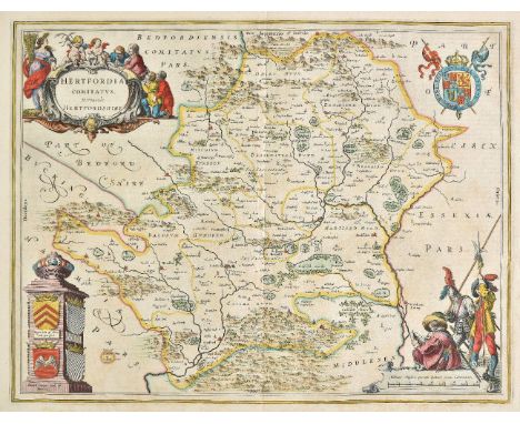
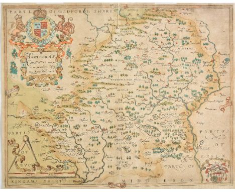
Lot 125
Hertfordshire. Saxton (Christopher), Hartforddiae comitatus nova vera ac particularis descriptio, circa 1579, engraved map by Nicolas Reynolds, with contemporary hand colouring, large ornate cartouche and mileage scale and with the coat of arms of Thomas Seckford in the lower right corner, the map shows signs of having been 'washed', two small repaired worm holes on either side of the central fold, lower margin trimmed with slight loss but skilfully repaired and extended in facsimile, 395 x 500 mm The first engraved map of the county of Hertfordshire with the 'bunch of grapes' watermark. (1)
Lot 151
Sea charts. Chart of the east Coast of America extending from Cape Canso in Nova Scotia to New York, including plans on a large scale of the Principal harbours..., James Imray & Son, 1861, large uncoloured engraved 'blue backed' sea chart, calligraphic title, inset maps of New York and Halifax, slight spotting, retaining old linen ties, 1020 x 1910 mm, together with Blachford & Co's. New chart of the Coast of Brazil from the Equator to Rio Janeiro..., R. Blachford & Co., 1831, large uncoloured engraved 'blue backed' chart, inset horizon profiles and maps of ports and harbours, some dust soiling and creasing, slight spotting, 965 x 1870 mm, with a untitled chart of the Caribbean islands, some creasing and dust soiling, closed tears, 980 x 640 mm, plus East India Archipelago [Eastern passages to China and Japan] Chart no.1, James Imray & Son, 1876, [and], East India Archipelago [Eastern passages to China and Japan] Chart no.4, James Imray & Son, 1866, together two uncoloured engraved 'blue backed' charts, the second chart with long repaired closed tear and some marginal closed tears, some spotting, 1030 x 1260 and 1280 x 1030 mm respectively (5)
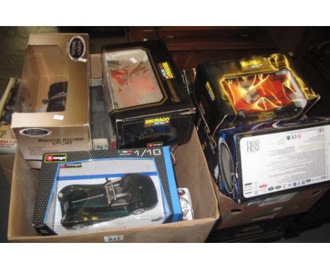
Lot 727
Two boxes of assorted 1:18 scale diecast metal vehicles in original boxes to include: Burago Ferrari F40 1987, Maisto Range Rover sport, Maisto Special Edition Mercedes Benz 300S etc. Together with a 1:13 scale Burago Morgan Aero 8 etc. (2)(B.P. 24% incl. VAT) CONDITION REPORT: Not in great condition boxes poor. We cannot guarantee all cars are complete, sorry.
-
216134 item(s)/page