Robertson James. Map of the Counties of Aberdeen Banff and Kincardine; with parts of those of Forfar Perth Inverness and Moray large engraved map on six double-page sheets contemporary green half morocco with paper label on upper cover large folio 1822. Note: A good copy of this detailed large scale map with a scale of one inch to a mile.
We found 216134 price guide item(s) matching your search
There are 216134 lots that match your search criteria. Subscribe now to get instant access to the full price guide service.
Click here to subscribe- List
- Grid
-
216134 item(s)/page
Thomson John & Co. The atlas of Scotland containing maps of each country and places of importance laid down from actual survey. Large folio (54.5 x 41.5 cms.) index map as frontispiece (hand coloured in outline) 2 folding. hand coloured panoramas the one of the heights of the principal mountains the other the length of the rivers 29 maps hand coloured in outline and with engraved topographical vignettes town plans etc. on 58 sheets of which several are joined together contemporary half calf paper boards partial split of the lower joint occasional light offsetting lower margin of the map of Linlithgowshire slightly dusty and frayed some light stain marks in the outer margins of the map of Buteshire occasional slight cropping of the plate marks in a couple of instances touching the imprint otherwise a fine copy. Note: Chubb p. 388 no xxxii; Moir I p. 129 & II p. 154 no 11; Tooley p. 91. The publication of this atlas described by Tooley as "the finest county atlas of Scotland in the nineteenth century" was spread over the years 1820 to 1830 with the maps being sold in loose sheets when completed. Its cost lead to the publisher's bankruptcy. The scale of the maps of almost one and a half miles to an inch resulted in the most detailed map of Scotland prior to Ordnance Survey. An interesting feature is the provision on the maps of the names of the various surveyors and others involved in their compilation attesting to their accuracy. A corrected edition was brought out in 1869 by Lizars in 4to.
Bartholomew (John). The Imperial Map of England & Wales According to the Ordnance Survey, with the Latest Additions, shewing clearly every feature of the country, Railways and their Stations, Roads, Canals, Rivers, Gentlemen's Seats, &c. &c., on the Scale of 4 Miles to an Inch, Fullarton & Co., c.1870, title and seventeen folding maps, all sectionalized on linen, maps hand-col. in outline, approx. 540 x 740 mm., contained in pubs. orig. gilt dec. morocco map box, scuffed and worn, lid (with flap) detached (1)
Scale (Bernard). Tables for the Easy Evaluing of Estates, from One Shilling to Five Pounds Per Acre, also the Parts of an Acre, from Three Roods to One Perch, 1st Dublin ed., 1771, eng. title and dedication leaf (excised but present), ink lib. stamps to front pastedown, contemp. calf, rubbed and a little wear to extrems., 8vo (1)
France. Ortelius (Abraham), Poictov: Pictonum Vicinarum que Regionum Fidiss Descriptio, 1579 [or later], hand coloured engraved map of the Poitou region after Pierre Rogier, ornamental title and scale cartouches, plate dimensions approx. 360 x 505 mm, blank to verso, together with Venvxini Comitatus Nova Descr./Gallia Narbonens/Sabavdiae Ducat., late 16th century, three hand coloured engraved maps on one plate, plate dimensions approx. 350 x 460 mm, blank verso (2)
* London. A New and Accurate Plan of the Cities of London and Westminster, including the New Roads & New Buildings, n.d., late 18th c., uncol. eng. map in sixteen sections, mounted on coarse linen (scale of 880 yards or half a mile), some sl. wear and chipping to edges of sections, with occn. minor loss, overall approx. 42 x 68 cm (1)
Saxton (Christopher). Original manuscript estate plan of an area to the west of Wakefield, Yorkshire, dated 1601, drawn in ink on paper, the title contained within an ornate cartouche and reading 'A Plat of Mr Pilkinton his Landes, belonging to the old Haule, & new Haule, in the parish of Wakefield, Made by Christopher Saxton. Ano 1601', with separate compass rose, scale of distance surmounted by dividers and a circular crest depicting the Pilkington seal of a mower with scythe, each field marked with tennants name, some faded original yellow colour marking the boundaries, creased where previously folded and with some areas of loss confined to the borders, lightly spotted and laid onto linen, the sheet measuring 803 x 767 mm An extremely scarce example of an original manuscript estate plan by Christopher Saxton (c.1543-c.1610) who is less well known as a local estate surveyor although it was the profession that dominated his later years. The title cartouche incorporates the initials of Christopher's son Robert who was then aged about sixteen and was probably given the task of drawing up the map although the writing is in Christopher's hand. The scale is sixteen perches to one inch which equates to about 92 meters to an inch. The area mapped is bounded on the north by 'The Waie from Halifax to Wakefield' and from north-east to south by an unnamed watercourse with a road traversing the southern third on the route of the present Horbury Road.
SPEED, JOHN. The Countie of Radnor Described and the Shyretownes Sittuatione Anno 1610 (but later, date altered). Described by Christiopher Saxton, Augmented and published by John Speeds...solde by Tho. Bassett and Ric. Chiswell. Hand coloured engraved map, with cartouche, coat of arms, scale and plan of Radnor (a few repairs, and spotting). Framed and glazed. 407 x 535 mm. (to edge of frame). CHUBB XXVII.
A set of six Royal Worcester porcelain dessert plates, circa 1903, each painted with flower filled vignettes within gilt overlaid scroll borders on a pink scale ground, within a shaped white beaded rim, puce factory mark including 'A.T. Wiley & Co Ltd, Montreal' retailers and painted 'W6855' to base, diameter approx 22.5cm.
France. Jaillot (Alexis Hubert), Le Gouvernement General de Provence divisé en ses Vigueries et Terres Adjacentes, 1696, uncoloured engraved map, separate ornamental title and scale-of-distance cartouches, browned with some brittling of paper and subsequent marginal flaking with one or two closed tears encroaching into printed area, approx. 570 x 660 mm (1)
Wales. Jansson (Jan), Principatus Walliae pars Borealis vulgo North Wales, [1646 or later], uncoloured engraved map, separate title and scale cartouches, very light browning to central fold, a few repaired short closed tears, plate dimensions approx. 410 x 515 mm, Latin text to verso A good impression. (1)
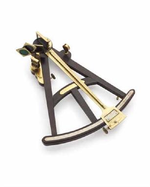
A FINE PAIR OF FRENCH SILVER-MOUNTED FLINTLOCK PISTOLS OF PRESENTATION QUALITY BY BOUTET DIRECTEUR ARTISTE A VERSAILLES NO. 51, ROUEN SILVER MARKS FOR 1798-1808, MAKERS MARK, IN A DIAMOND THE INITIALS IM BENEATH A FIVE-POINTED STAR with sighted barrels formed in two stages and cut with micro-groove rifled bores, struck with the mark of Jean Nicolas Leclerc (Neue Stockel 3741) and a further mark beneath the breeches, and with the maker's name 'Boutet' within a rectangle on each side of the sighting flat above, decorated at the muzzles with a band of gold foliage carrying fouled anchors, and over the breeches with a large panel filled with martial trophies, the sterns of two ships, a globe, cresents, a trident, garlands and palmette, all in gold against a finely matted ground (the barrels rebrowned, the gold with losses), engraved case-hardened breech tangs decorated with neo-classical foliage and incorporating the back-sight, bevelled locks signed 'Boutet Directeur Artiste' and 'Manufre ... Versailles' respectively (the cocks expertly replaced), gold-lined pans, set triggers, figured walnut half-stocks, finely chequered butts carved with a band of scale ornament and a demi-flower at the base on each side (small bruises), full silver mounts cast and chased in high relief, comprising trigger-guards decorated with the stern of a ship on the bow, the finial formed as a neoclassical urn with an anchor at the base and filled with a bouquet of sea-shells, butt-caps decorated with a fouled anchor issuant from a laurel wreath fore and aft, decorated with a pair of addorsed marine monsters on each side, all against a finely punched 'fish-roe' ground, two-piece scalloped side-plates, retaining much gilt wash throughout, and with no provision for a ramrod44.7cm; 17Kin (2) The use of Naval and Maritime subjects on the barrel and mounts and the high quality of these pistols would suggest that these were made for presentation to a Senior Naval Officer. A pair of pistols by the same maker, with similarly decorated barrels and with very similar silver mounts struck with Paris silver marks and the same maker's mark as the present pistols were presented by Napoleon to Captain Coronado in 1802. A further pair of pistols by Boutet also with similar barrels and very similar silver mounts struck with Rouen mark for the same period were sold Bonhams, Knightsbridge, 1st April, 2004 lot 258 (£28,680).
A PAIR OF CONTINENTAL PERCUSSION RIFLED TARGET PISTOLS, SIGNED J.G. PARISIS IN AACHEN, LIEGE PROOF, CIRCA 1850 with etched twist octagonal barrels rifled with eight narrow grooves, blued fore-sights, engraved breeches and breech tangs, scroll-engraved back-action locks signed in gold capitals, set triggers, highly figured walnut half-stocks carved with a lion mask in the round at the fore-ends, the grips each carved with scale pattern, spurred steel trigger-guards engraved with differing game birds, and ebony pommels fitted with white metal butt-caps with copper traps embossed with a Bacchus mask (each dented): in original lined and fitted case complete with their full compliment of accessories including copper powder-flask embossed with a trellis pattern framing flowerheads and signed B ... P (the case with repairs, lining with areas of wear and small tears) 42cm; 16Iin
AN INDIAN PATA, 17TH CENTURY with broad fullered European blade, iron 'gauntlet' hilt of characteristic form engraved with scale ornament, finely roped edges, iron grip bar with some early fabric binding, original arm bar of rectangular links, and retaining its original padded leather lining 96.5cm; 38in blade Provenance: Robin Wigington, The Arms & Armour Gallery, Poet's Arbour.
AN ENGLISH TOY GUN, LATE 16TH/EARLY 17TH CENTURY with tapering octagonal barrel incised with scale ornament, lever trigger, shaped serpentine incorporating a clamp for match, and lemon-shaped butt (ramrod missing) 12cm; 4NinA number of similar guns have been excavated in England, many of which are preserved in the London Museum and the Royal Armouries, Leeds. For a discussion of Elizabethan Toy Guns see H.L.Blackmore 1989, pp.10-14.
A collection of three vases, Chinese 19th century and later, to include a wucai jar and cover, enriched with blossom on a diaper and scale ground, a baluster vase with celadon ground decorated with birds among flowering boughs, a famille-verte shouldered vase with stylised floral decoration. Tallest 51cm.
A good collection of boxed Hornby Dublo including D1 signal cabin, D1 footbridge, D1 through station, a "true scale" station, assorted box track including points, signals, double arm D2, single arm D1, loading gauge - rolling stock to include coal wagon, D1, low sided wagon D1, goods van D1, fish van D1 and mineral wagon D2 (all boxed)

-
216134 item(s)/page