We found 216136 price guide item(s) matching your search
There are 216136 lots that match your search criteria. Subscribe now to get instant access to the full price guide service.
Click here to subscribe- List
- Grid
-
216136 item(s)/page


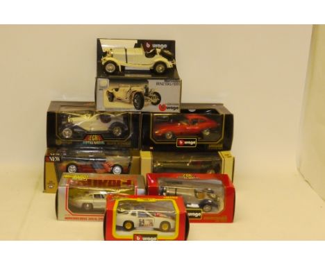
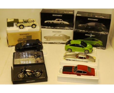
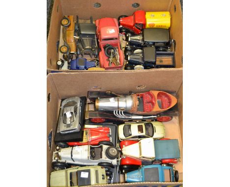
Lot 119
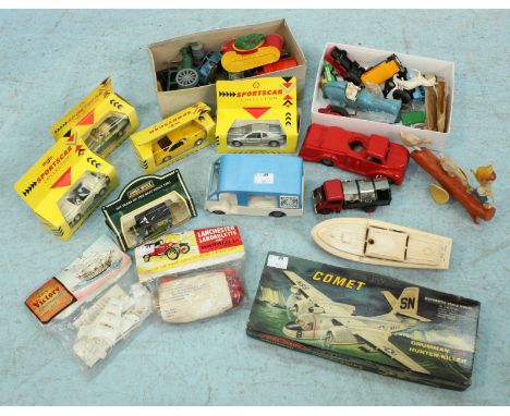
Burago, all boxed including 1:18 scale 1997 corvette airbrushed with Mt Rushmore livery limited edition 32/66, (3356), Jaguar (3006), Alfa Romeo, (3008), Jaguar (3018) and Mercedes Benz desk tidy/ model (3002) together with 1:24 scale Mercedes Benz (0522) and (1509) and Porsche 924 (9105) E, boxes P-G, (8)
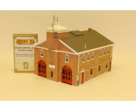
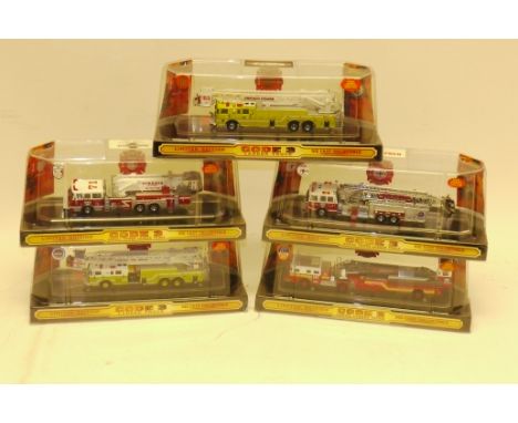
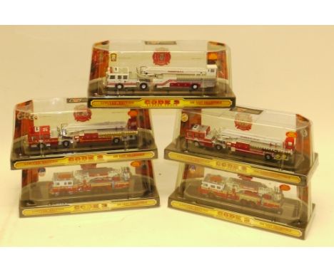
Lot 303
Code 3 Collectibles Fire Service Vehicles, boxed 1:64 scale American fire service limited edition vehicles including, Pierce 100ft Platform trucks Chicago and Massport (12909, 12911 ) American La France Tower ladder truck Yonkers NY (12745), Sutphen tower ladder truck Orlando (12930) and Seagrave aerial ladder truck NY (12658) E, boxes G-E, (5)
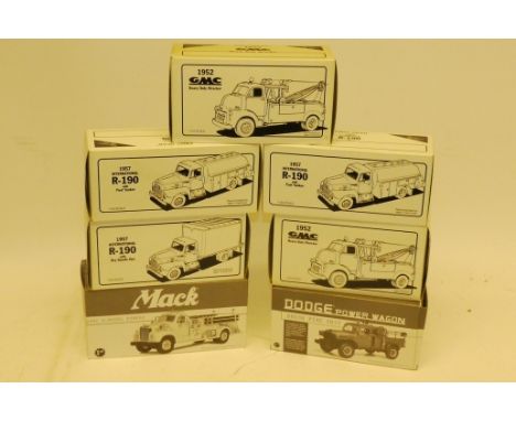
Lot 177
First Gear, boxed collection of 1:30 scale North American fire service vehicles comprising, Dodge power wagon Ma. Division, 1957 international R-190 tanker Chicago and FDNY, 1960 Mack model B pumper Chicago,1957 international R-190 dry goods van FDNY, 1952 GMC wrecker Columbia and FDNY, G-E, boxes G-E (7)
Lot 432
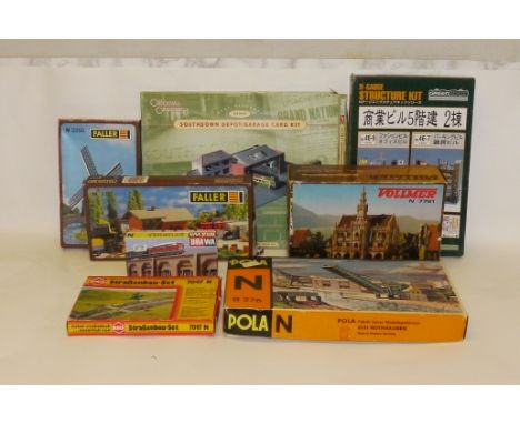
An Assortment of N Gauge and Other Kits and Track, including an 'Artitec' Train Ferry kit with one made-up and one unmade boat 'Fehmann', 2 Pola Lifting bridge kits, Vollmer town hall, other N gauge scenic kits by Kibri, Faller, Brawa and Japanese makers, together with two Revell 1:144 helicopter kits, a OO scale Corgi bus depot, and a bundle of Fleischmann 'Piccolo' N gauge track (qty)

Lot 100
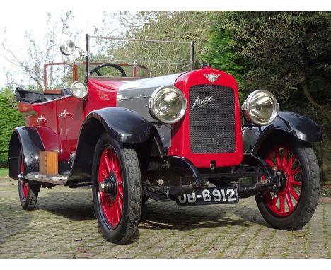
1918 Austin Twenty EXP1 Prototype Tourer- The very car that Edgar Wren drove nationwide to drum up orders for Austin's upcoming 20hp model- Rescued from a hedgerow as a rolling chassis and treated to an extensive restoration during the 2000s- Featured in numerous publications: The Autocar (1918), The Austin Advocate (1919) and The Automobile (2009)Herbert Austin was nothing if not ambitious. By the outbreak of the First World War the company that bore his name was Britain's fifth largest motorcar manufacturer. However, the firm with which he had begun his motoring endeavours, Wolseley, was the biggest. Accepting government contracts for aircraft, shells, heavy artillery and 3-ton lorries saw the Austin Motor Company prosper during WW1 and its workforce expand from 2,500 to 22,000. Sensing an opportunity to leapfrog his rivals and taking a leaf from Henry Ford's book, Herbert Austin decided to offer just a single model when peace returned. Hugely impressed by the Hudson Super Six he ran during the hostilities - an example of which had successfully completed the first two-way transcontinental trip from New York to San Francisco and back in 1916 - he challenged his designers to create a similarly well-engineered machine. The first prototype Austin Twenty began to take shape in the chassis erecting shop at Longbridge during 1917 and an abridged specification was published in that September's issue of The Austin Advocate magazine. Like the Hudson Super Six, the newcomer featured a substantial ladder frame chassis equipped with all-round semi-elliptic leaf-sprung suspension, rear wheel brakes, an engine of monobloc construction with in-unit, centre-change gearbox and a sheet metal radiator cowl. Displacing 3610cc, its unstressed sidevalve four-cylinder engine developed 40bhp @ 2,000rpm (an output sufficient for Austin to later warrant that the chassis could reach 70mph). Eminently tuneable, privateer Felix Scriven's `Sergeant Murphy' and the Works' `Black Maria' both proved that an Austin Twenty could beat a Bentley 3 Litre or Vauxhall 30/98 in competition (Scriven's mount reaching 104mph at Brooklands).Labelled P1's (with `P' signifying Post War), two prototype Austin Twenties were readied for 1918, a Landaulette and a Tourer. Road registered as `OB 6912', the latter sported a commodious four-door, five-seater body with a prominent hood well and internal storage for two spare wheels. With dreams of producing 25,000 cars a year (a gargantuan increase on the 3,000 that Wolseley had managed in 1914), Herbert Austin despatched Works test driver Edgar Wren on a nationwide trip aboard `OB 6912' to drum-up interest. With a projected price of just £495 for the Tourer, and thanks also to the efforts of sales organiser Alfred Dupuis who travelled the Commonwealth and was reliant merely on photos and specification sheets, Austin had attracted some £6,000,000 worth of orders by July 1919. Unfortunately, the company could not fulfil them. The government tax on excess war profits meant that Herbert Austin could not afford to fully equip his expanded factories and the awful carnage of World War One had resulted in a severe shortage of skilled labour. Without the hoped-for economies of scale, Austin found itself losing money on every Twenty sold and thus had to introduce a `temporary surcharge' of £100 per car in October 1919. Things went from bad to worse with the global economic slump of 1920-1921 and by December that year Austin was in receivership. The company famously bounced back with the Twelve and Seven models and the Twenty remained in production until December 1929 by which time some 15,287 had been made. Famously long-lived, it was not unheard of for a Twenty to cover in excess of 1,000,000 miles. Indeed, the motoring historian and long-term Twenty owner Mike Worthington-Williams has suggested that the model is `the hardest wearing machine of all time'. Presumed lost for many years, `OB 6912' was re-registered with the DVLA on August 2nd 1983. A rolling chassis when found, it was treated to an extensive `ground up' restoration during the 2000s with replacement parts being sourced or made as necessary. Using period photos as a guide the car's Tourer coachwork was painstakingly recreated and fitted with such niceties as an Auster screen, fold-out occasional seats and deep-button Black leather upholstery. There can be comparatively few cars that have been featured in magazine articles ninety-one years apart but as well as gracing the pages of The Autocar in November 1918 and The Austin Advocate in July 1919, `OB 6912' was the subject of a four-page article in The Automobile for August 2009. Described by the vendor as being in `excellent overall' condition with regard to its engine, gearbox, electrical equipment, interior trim, bodywork and paintwork, he succinctly sums-up `OB 6912' as `a true piece of British motoring history'.PLEASE NOTE: All estimates are subject to a buyer's premium of 16.2% incl. VAT
Lot 125
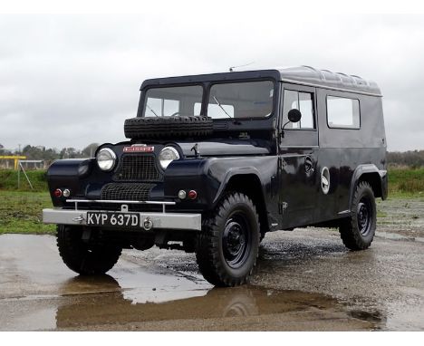
1966 Austin Gipsy Series IV Station Wagon- Purchased new by the police force in Whitchurch, Hants but designated as a reserve vehicle and scarcely used - Remarkably original having had just three private keepers since being sold off by the police in 1996 - Believed to have covered just 4,952 miles from new! Introduced in 1958, the Austin Gipsy featured an all-steel body and fully independent suspension utilising Flexitor rubber units developed by Alex Moulton. Powered by a 2199cc OHV four-cylinder engine that drove all four wheels via an all-synchromesh, four-speed gearbox coupled to a high/low ratio transfer box, the newcomer would climb a 45-degree slope and haul a maximum payload of 0.5 tons. The Series II Gipsy of 1960 was available in short- (90in) or long-wheelbase (111in) guises and had its mountaineering credentials proven when a team of London University students used one to scale Ben Nevis (Britain's highest peak at 4,406ft). There was no Series III Gipsy, but at the end of 1962 the leaf-spring equipped Series IV appeared. Gipsy production ceased in 1969 after some 21,208 examples had been sold. A rare Series IV Station Wagon, this particular example was reportedly purchased new by the police force in Whitchurch, Hants. However, the allocation of a fleet of Ford Transits saw the Austin quickly consigned to the role of reserve vehicle and stored in a local garage. Its services were never called upon and the garage proprietor purchased it from the police during 1996. He in turn sold the Gipsy to its previous keeper some seven years later. Entering the current ownership via our October 2010 auction, the Austin had not long been treated to a new clutch master cylinder and brake overhaul (at a cost of £911.91). Described at the time as being 'immaculate and original', it remains highly presentable today. Believed but not warranted to have covered just 4,952 miles from new, the Series IV Station Wagon has formed part of a private Irish collection for the past seven years. Starting readily during our photography session (October 2017), it is accompanied by assorted spares, workshop manuals and old Whitchurch-issued tax discs etc.PLEASE NOTE: This lot is currently registered in Eire and as such does not carry the UK number plate 'KYP 637D' which was surrendered when it was exported. It should be possible to reunite the Austin with its original number plate should a new owner so wish. Although, this will be at the discretion of the DVLA.PLEASE NOTE: All estimates are subject to a buyer's premium of 16.2% incl. VAT
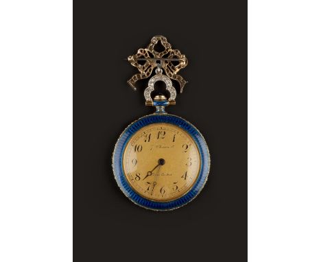
Lot 170
A DIAMOND AND ENAMEL FOB WATCH BY CHAUMET, the circular gilt dial with Arabic numerals and outer minute scale, signed J. Chaumet, Paris Londres, to keyless wind movement, the blue and white guilloche enamel case edged with millegrain set rose-cut diamonds, with cabochon blue stone winder, lozenge-shaped maker's mark 'JP' and French eagle's head control mark for gold, numbered 53301, suspended from a loosely tied ribbon bow brooch fitting, millegrain set with graduated old, rose and lasque-cut diamonds, case diameter 2.95cm, length 5.3cm
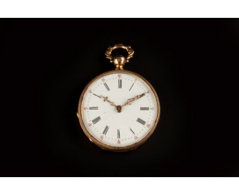
Lot 207
AN OPEN FACE FOB WATCH, the white enamel dial with Roman numerals, outer red 0-60 scale and pierced foliate scroll hands, to a key wind movement, the case back with black enamel decoration, monogrammed, the case sides with bead borders, together with a gilt metal locket pendant, decorated with foliate scrolls, watch case diameter 3.2cm (2)
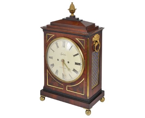
Lot 284
A Bracket Clock by Igglesden of Chatham:Large Mahogany architectural case, with gilt Pineapple finial, Cornucopia ring handles and Ball feet.The Eight inch dial with Roman Numerals and "Igglesden Chatham" to the centre.Four gilt edged spandrels surrounding the dial, the gilt scale design side panels backed with blue cloth.The back glazed door revealing ornate engraved movement and pendulum with twin train movement striking on a bell.Height 50 cm Width 29 cmDepth 18 cm. CONDITION REPORT: In good working condition,very Minor losses to side of right flank around the vent.and minor losses to the top frieze above dial.refurbished professionally, and in near original condition. bearing label to the inside for Wehrle Bros. 1883, movement sits well and firmly placed no bends to the brackets.

Lot 420
Five boxed Vanguards 1.43 scale model vehicles, Rover 100, Rover P5 MkII, P4, Austin A35 and Eddie Stobart Morris Minor van, together with five modern boxed Dinky models, sixteen Days Gone commercial vehicles, Lledo Trackside Eddie Stobart Depot and Trailer set and other die-cast scale model (in two boxes)
Lot 475
A Bentley's Patent Earth Driven Clock, number 169, in later authentic reproduction copy of the original mahogany case, arched case with deeply moulded cornice over a bevelled glazed door on a panel base, the 12 inch circular silvered Arabic dial with cut-out subsidiary seconds and bold blued steel hands, the movement with typical heavy steel rod pendulum terminating in a brass cylinder mounted on an arc and with subsidiary bob below, reading against a beat scale, 191cm high, together with a printed copy of 'Antiquarian Horology, December 1972 'The Earth Driven Clock' by Dr F.G.A. Shenton. (Mahogany case unstained and unpolished)


-
216136 item(s)/page