We found 216136 price guide item(s) matching your search
There are 216136 lots that match your search criteria. Subscribe now to get instant access to the full price guide service.
Click here to subscribe- List
- Grid
-
216136 item(s)/page

Lot 114
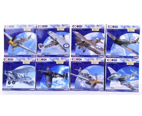
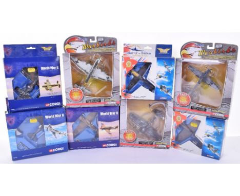
Eight Corgi The Aviation Archive Models:AA27102A Messerscmitt Bf109-G2, AA27103 Messerscmitt Bf109-G6, AA27401 Gloster Meteor F3, AA36905 Hawker Demon G-BTVE,AA39207 Supermarine Spitfire Mk.I, AA39304 Boulton Paul Defiant Mk.I, AA39603 Hawker Audax and AA39604 Hawker Hart, all 1:72 Scale, all in near mint to mint boxed condition with certificate’s (8 items)

Lot 128
Six Corgi The Aviation Archive Models,1:144 scale, Berlin Airlift 47111 Douglas Dakota, 47205 Avro York ,Frontier Airliners, 47202 Avro York BOAC, 47401 Avro Lancaster MK XPP, Classic Jetliners 48506 De Havilland Comet 4B and 48502 D.H.Comet 4 Dan-Air London, all in very good to excellent boxed condition, parts unchecked (6 items)

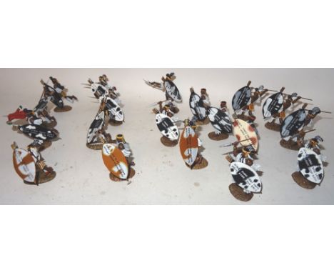
Lot 76
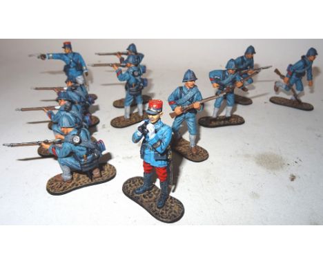
Britains First World War 'Opening Moves' 1914 54mm scale, matt finish, Black Watch sets 17898 and 17951, Royal Fusiliers set 17643, German mounted Death's Head Hussars sets 17673 (two) and 17674, 84th Infantry sets 17656, 17871 (two), 17872 and 17915 in original boxes ((E, boxes VG) (22 in eleven boxed sets)

Lot 150
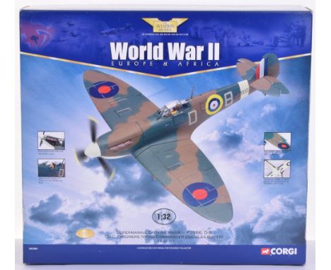
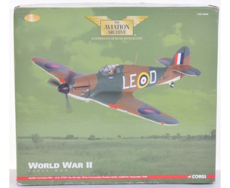
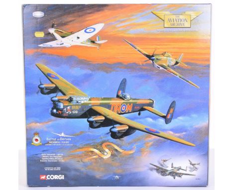
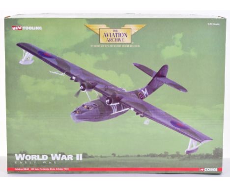
Corgi The Aviation Archive AA35505 World War II Early War Hawker Hurricane MkI-LE-D, V7467, No.242 Sqn, Wing Commander Douglas Bader, Coltishall, September 1940, in excellent condition,model is dusty where it has been on display, aerial needs re-glueing, lid of box has very slight age wear, with certificate-1:32 Scale.
Lot 204
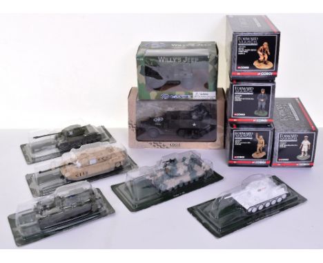
Various Military Models including, Atlas Edition Multiple Gun Motor Carriage M16, Gate Willys Jeep, 5 x diecast military Tanks, in blister packs and 4 x Corgi Forward March 1:32 scale metal figures, CC59172 Chales Upham, CC59162 T.E. Lawrence, CC59194 Mountbatten and CC59184 Richthofen , all in near mint to mint boxed condition (11 items)
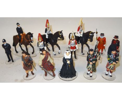
Lot 60
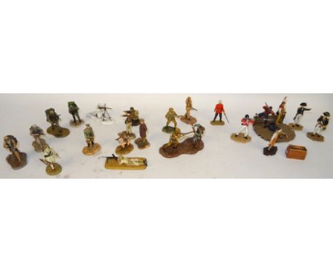
Corgi Icon London and Scotland Models 75mm scale matt finish, London: mounted and dismounted Life Guard, Royal Horse Guard and Police, Yeoman and Warder, Scotland: William Wallace, Mary Queen of Scots, Rob Roy and Pipers of the Black Watch and Highlanders in original individual boxes (E boxes G) (22)
Lot 124
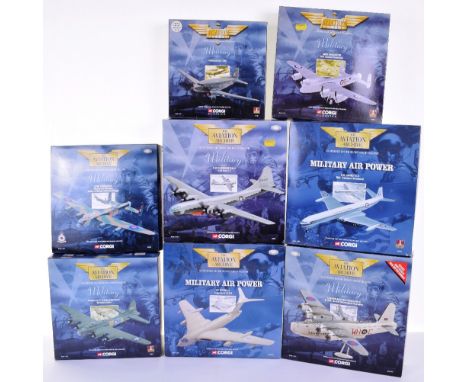
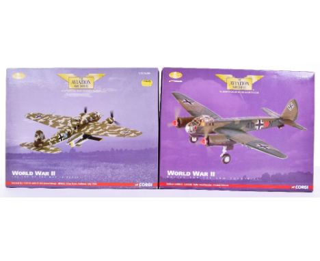
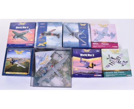
Eight Corgi The Aviation Archive Military Models, 1:144 scale,AA31602 HP Victor K2 ‘Lusty Linda’ AA31701 Sunderland Mk V Norwegian Sqn,47106 Douglas DC3-RAF,47302 Avro Lancaster Coastal Command, 47306 Avro Lancaster,48204 Boeing B-17 Memphis Belle, 48503 D.H. Comet RAF Transport Command and 48903 B-29 Superfortress with Bell X-1,some models have been on display, all in excellent boxed condition (8 items)
Lot 122
Eight Corgi The Aviation Archive Models,1:144 scale,AA30201 Avro Lancaster Just Jane’ 1:72 scale AA30701 Hawker Hurricane,AA32103 Messechmitt Bf 109E-3, 49004 Supermarine Spitfire Brian Carbury, 49201 Messechmitt 109E, Warbirds series 2 WB99618 Messechmitt 109E-3, WB99628 Hawker Typhoon Mk.IB and WB99621 JU.87B-2 all in near mint to mint boxed condition (8 items)
Lot 120
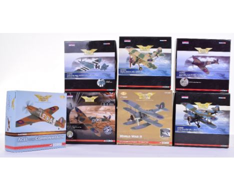
Seven Corgi The Aviation Archive Models,AA36205 Gloster Gladiator Mk.1,with certificate,AA3603 Fairey Swordfish Mk.I floatplane, with certificate, AA39201Spifire Mk Ia Eric Stanley Lock, AA39203 Spitfire MkII P7350,with certificate, AA36306 Fairey Swordfish Mk.I Fleet Air Arm, with certificate, AA38702 Spitfire PR.XIX, with certificate and AA32008 Hawker Hurricane MkI, not issued with certificate, all 1:72 Scale, all in near mint to mint boxed condition (7 items)
Lot 183
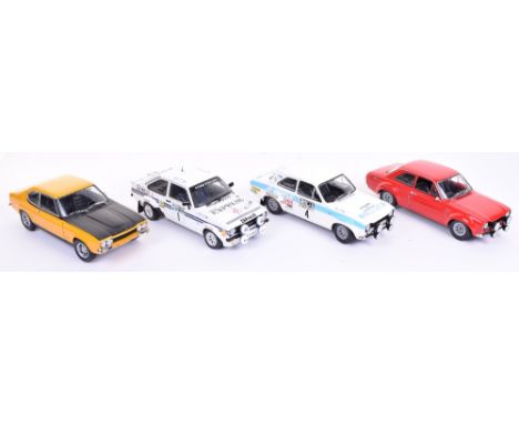
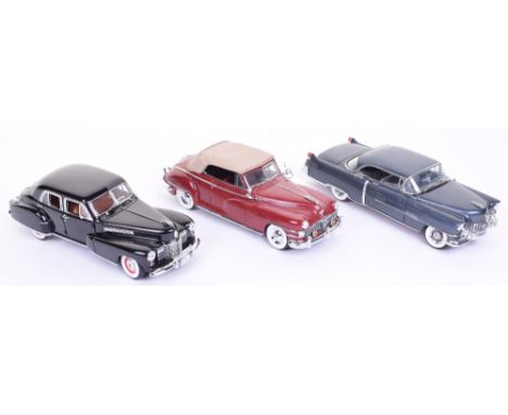
Three 1:18 scale Minichamps Ford Model Cars, Ford Capri RS2600, Roger Clark’s Ford Escort Mark 1 (1972 International RAC Rally) Ford Escort Mark 1 RS 1600, models are in mint condition, with polystyrene boxes only, missing card illustrated outer’s and unboxed 1:18 scale Sun Star Ford Escort Mark II RS 1800 RAC Lombard Rally, (4 items)
Lot 176
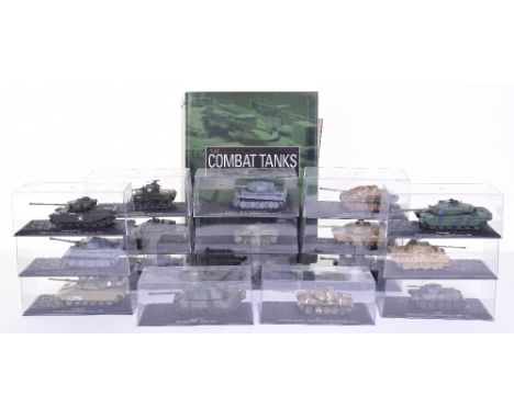
Seventeen De Agostini Combat Military Tank Models,1:72 scale, including: Centurion Mk3, T-54, Pz.Kpfw.VI Tiger Tank, M48A3 Patton 2, Chieftain Mk.5, Pz.Kpfw.V Panther, T-34/76, Jagdpanther, Challenger 1, plus others all in near mint to mint condition, with Perspex boxes with booklets in folder, (17 items)
Lot 174
Three Danbury Mint USA Cars, including 1941 Cadillac Fleetwood Series 60 Special, black body, 1948 Chrysler New Yorker convertible, dark red body, tan cloth soft top and 1954 Cadillac Coupe Deville, dark silver grey body, 1:24 scale models are in near mint to mint unboxed condition, (3 items)
Lot 61
Corgi Forward March Models 54mm scale matt finish, Trafalgar with Nelson and Hardy, WWI with Laurence of Arabia, WWII with Rommel, Montgomery and Churchill, and Special Forces series in original boxes, with two models of Tournament Knights by Allaya and a Napoleonic British Pioneer by Oryon, all but the last in original individual boxes (E boxes G) (28)
Lot 123
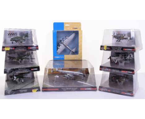
Six Corgi The Aviation Archive WWII Legends Models, in blister packs, 1:72 scale,AA31916 Spitfire LF IX Jonnie Johnson, AA31105 Boeing B-17F,AA33809 P47D Thunderbolt Fred Christensen, AA35701 Me 262A Adolf Galland,AA36206 Gloster Gladiator Mk.II Ron Walter, AA36305 Firey Swordfish Mk.II, plus 1:144 scale AA35101 Lockheed L-1049H Super Constellation and WB99636 B-17 Bomber (wheels are broken) all others are in near mint to mint boxed condition (8 items)
Lot 201
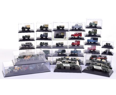
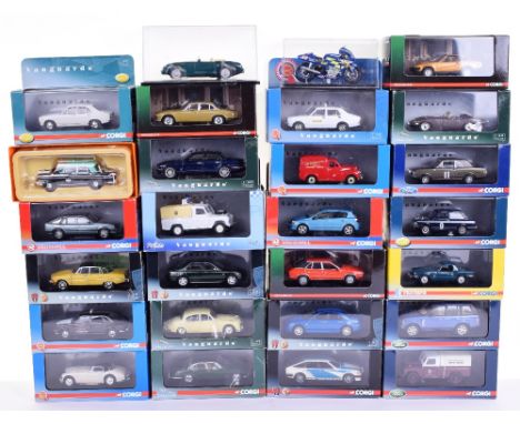
Twenty Five Vanguards Diecast Models, 1:43 scale including: VA 04408 Austin Cambridge Taxi (missing lid of box) VA 04907 Jaguar E Type, VA 05105 Austin Healey 100-six,VA 06307 Morris Marina 1800 Taxi, VA 06512 Rover P6 3500,VA 06711 triumph spitfire MKIII, VA 07604 Land Rover Met police, VA08402 Jaguar MKII, VA 08612 Jaguar XJ6 4.2, VA 08908 Austin 1800 Taxi,VA10205 Princess 2200 HL, VA10500 Triumph TR7,plus other all in mint condition, with near mint to mint boxes, plus Corgi MGA open top and Suzuki GSV-R motorcycle (27 items)
Lot 121
Eight Corgi The Aviation Archive Models,1:72 scale AA32204 P-51D Mustang, AA33002 Vought F4U-1A Corsair ‘White 29’ (missing prop) with certificate, AA33006 Corsair IV KD345 No 1850 Sqn, Royal Navy with certificate,AA33008 F4U-1 Corsair white 576 “Marines Dream” never issued with certificate, AA33102 Mitsubishi A6M3-22 Zero 251st Kokutai , with certificate,AA33803 P-47D Thunderbolt ‘Miss Mary Lou’ (rear jockey wheel broken) with certificate AA33806 P-47D Thunderbolt (one prop blade broken) never issued with certificate, plus 1:444 Scale Confederate Airforce Set, B29 ‘Fifi’ Mustang & Thunderbolt in Perspex display case, all in good to near mint boxed condition, some models dusty wear they have been on display (8 items)
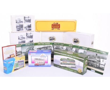
Lot 164
Eight Atlas Editions Trams of The World,1:76 scale, 2 x Feltham tram’s, Halle TW 4 electric tram,Hong Kong tramcar, Basel BEB CE 2/3 tram, Blackpool Brush Railcoach, Blackpool Balloon tram, all in mint boxed condition, with leaflets, plus Atlas Edition The Greatest Show On earth ‘Carters’ Foden generator tractor & low loader, 2 x Corgi Classics Trams, 36603 West Hartlepool and 97273 Blackpool tram (11 items)
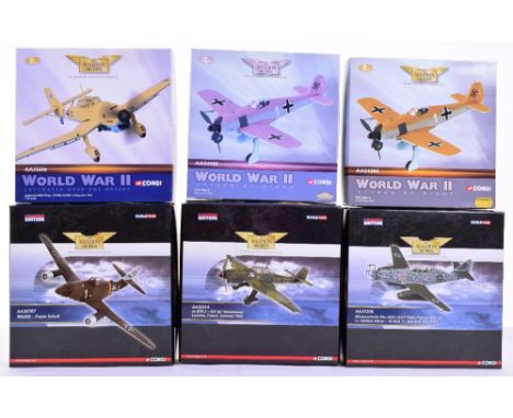
Lot 116
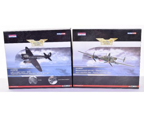
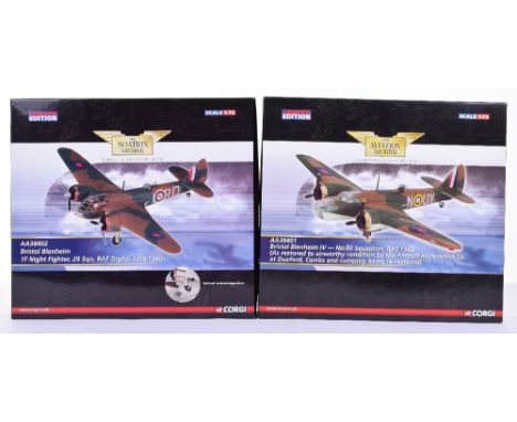
Seven Corgi The Aviation Archive Models,32003 Hawker Hurricane MkIID BP188/JV-Z with certificate,AA32501 Junkers Ju-87 Stuka B-2 ‘T6-HL’ no certificate, AA32504 Junkers Ju 87B-2 Tropical Stuka-III, with certificate, AA32505 Junkers Ju 87B-2 Stuka S2+AP,with certificate, AA34302 Focke Wulf FW 190A-4, with certificate, AA34304 Focke Wulf 190A-4, never issued with certificate and 49505 Battle of Britain Set Supermarine Spitfire MKI and Messerschmitt Bf 109E, with certificate, missing didplay stands, all 1:72 Scale, all in near mint to mint boxed condition (7 items)
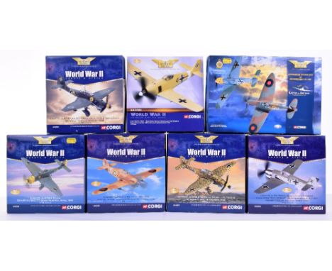
Lot 118
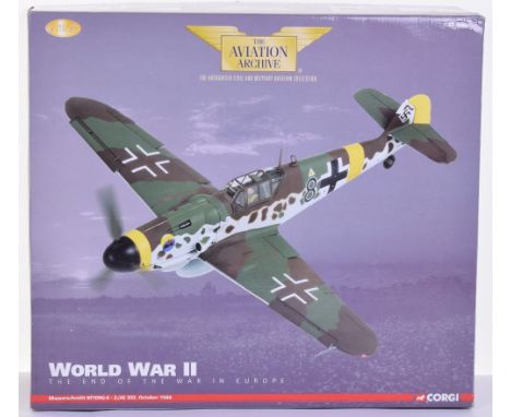
Six Corgi The Aviation Archive Models AA32506 World War II Luftwaffe over the desert Junkers Ju 87B-2 trop, AA32514 Ju-87B-2-5ST-G2 ‘Immelmann’ with certificate,2 x AA34305 World War II attack at night, FW-190A-4 SG2, Tunisia, not issued with certificate (one box lid faded) AA35707 Me262 franz Schall, with certificate and AA37206 Messerschmitt Me 262B Lt.Herbert Altner, with certificate, all 1:72 Scale, all in near mint to mint boxed condition (6 items)
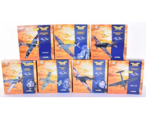
Lot 127
Seven Corgi The Aviation Archive Flying Aces Models,1:72 scale, 49002 Supermarine Spitfire (Bader)-missing stand, 49003 Supermarine Spitfire, 49102 Hawker Hurricane MKI-missing stand, 49103 Hawker Hurricane MKI, 49202 Messerschmitt 109E JG 26, 49203 Messerschmitt 109E7.JG51 and 49302 P51D Mustang , all in near mint to mint boxed condition (7 items)
-
216136 item(s)/page