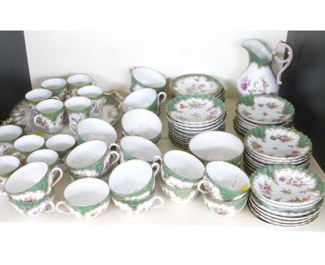
*** Please note, the description of this lot has changed ***British Isles.- Bacon (George W., publisher) New Large Scale Ordnance Atlas of the British Isles..., 104 hand-coloured double-page lithographed maps, mounted on stubs, occasional spotting and minor browning, re-backed, modern half morocco, g.e., losses to inside marbled papers, minor rubbing, 4to, [c. 1883].*** Including regional and geological maps of Britain and Ireland, plans of towns and ports, a railway map of London and its suburbs, and a map of the Lakes of Killarney.
We found 216134 price guide item(s) matching your search
There are 216134 lots that match your search criteria. Subscribe now to get instant access to the full price guide service.
Click here to subscribe- List
- Grid
-
216134 item(s)/page
England.- Bradshaw (George) Bradshaw's Map of Canals, Navigable Rivers, Rail Road &c. in the Midland Counties of England from Actual Survey, said to be the second edition, enlarged to accommodate the development of the Grand Junction Canal from Stoke Hammond to Tring, large-scale map centred on Birmingham, with decorative border and calligraphic title, engraving with hand-colouring, 1380 x 1280 mm (54 1/4 x 50 3/8 in), dissected and mounted on linen, a clean bright impression with some offsetting, edged with green linen, some coming loose, folding without slipcase, 8vo, 1830
***Please note, the description of this lot has changedLondon.- Bacon (George W.) New Large-Scale Ordnance Atlas of London & Suburbs with Supplementary Maps..., title, contents, two index maps, one for nine-inch scale and the other four-inch scale maps, with 34 double-page maps at nine-inch scale, 25 double-page maps at four-inch scale, four double-page maps of the environs of London, and 10 further supplementary maps, lithographs with some hand-colouring, each approx. 350 x 525 mm. (13 3/4 x 20 3/4 in), occasional finger-soiling, surface dirt and minor browning, a few maps with splitting to folds, numerous tears and loss to text leaves, rebound in blue cloth, boards now completely detached, worn, folio, 1886.
London.- Bacon (George W., publisher) Bacon's New Large Scale Atlas of London and Suburbs with Supplementary Maps, Letterpress Descriptions and Alphabetical Index, complete with title, contents, three sets of index, index map, and 46 double-page maps, lithographs with some hand-colouring, each approx. 350 x 525 mm. (13 3/4 x 20 3/4 in), some tabs with tears into text leaves, a few repaired, otherwise occasional minor surface dirt but good clean maps, original cloth, gilt, slight rubbing with label to spine, folio, 1906.
NO RESERVE South America.- De Laet (Johannes) Venezuela ende het Westelyckste Gedeelte van Nueva Andalusia, map of Venezuela, with ornamental title cartouche and separate scale of distance, engraving on laid paper with armorial watermark, platemark 282 x 360 mm. (11 1/8 x 14 1/4 in), sheet 306 x 377 mm. (12 x 14 7/8 in), central vertical fold as issued, handling creases and minor nicks to edges, unframed, [?Amsterdam, circa 1630].
* Manuscript Genealogy. The Family Chart of British Kings from the Norman Conquest to 1905, by F.A. Fairall, Aldershot, 1905, large cream glazed cotton chart, with calligraphic title at head and royal pedigree carefully delineated in pen & ink, accompanied by numerous portrait busts, heraldic motifs, medals and ensignias, crowns and coronets, ensigns, and country emblems, all in pen, ink, and watercolour, lower right corner inscribed 'Designed and Drawn by F.A. Fairall. 119 Grosvenor Road, Aldershot, 1905', toned and some fox spots, stained to left hand margin and with a 2" closed tear (not quite touching one of the portraits), edges frayed and creased, and with tack holes where previously mounted, 101.5 x 94cm (40 x 37ins)Qty: (1)NOTESA most unusual large-scale production, painstakingly delineated by someone who clearly had some time to spare; perhaps intended for instruction in the classroom or nursery.
* Chinese Export. An impressive 18th century Chinese armorial part tea service c.1782, comprising, teapot, 12 coffee cups, milk jug and cover, 3 tea bowls, 5 saucers, slop bowl, tea canister, shaped dish and a footed bowl, all decorated with an armorial and famille-rose pallette, several pieces with damage, the teapot 23cm high, with an original manuscript letter of provenance dated 2 October 1852The accompanying manuscript letter dated 2 Octr 1852 reads:'History of the China got from Bowley. The East India ship Gustavus was wrecked on the Goodwin Sands and Captn Bowbyes of the Revenue cutter got this sett of china presented to him for his valuable services in saving the officers & crew in 1782 and remained in the family until the death of the widow in 1851. Discription of the arms [:] A Dove Volant resting on a Bees Cape, That is industry promoted by peace, on the Dexter - is a Lady Supporter. In her right hand, the cape of Liberty on a rod. Sinester, Supporter, Scale of Justice in her left hand, and in her right hand - The Sword of Justice. The Shield contains a group of flowers. The arms of Industry, Peace, Liberty, Justice & Commerce - Suitable for any merchant.'Qty: (27)
* Glasgow. The Fairfield Shipbuilding & Engineering Co. Limited, Govan, circa 1900, unattributed colour lithograph, 385 x 655 mm, mountedQty: (1)NOTESTHE DAVID SMITH PRINT COLLECTION PART I CIVIL ENGINEERING, TRANSPORT & TOPOGRAPHICAL PANORAMAS The Fairfield Shipbuilding and Engineering Company, Limited was a Scottish shipbuilding company in the Govan area on the Clyde in Glasgow. Fairfields, as it is often known, was a major warship builder, turning out many vessels for the Royal Navy and other navies through the First World War and the Second World War. It also built many transatlantic liners, including record-breaking ships for the Cunard Line and Canadian Pacific, such as the Blue Riband-winning sisters RMS Campania and RMS Lucania . At the other end of the scale, Fairfields built fast cross-channel mail steamers and ferries for locations around the world. These included ships for the Bosporus crossing in Istanbul and some of the early ships used by Thomas Cook for developing tourism on the River Nile. The company was found in 1834 as an engine and machinery firm and in 1852 it became Randolph, Elder and Company when John Elder joined the business. In 1858 the company acquired the Govan Old Shipyard and diversified into shipbuilding. It became The Fairfield Shipbuilding & Engineering Company in 1886. It became part of the Northumberland Shipping Company in 1919 and in 1935 Fairfield was taken over by Lithgows of Port Glasgow. It changed hand several times during the 20th century, declined and was nationalised and eventually emerged as part of BAE Marine Systems in 1999.
Hertfordshire. Saxton (Christopher), Hartfordiae Comitatus nova, vera ac particularis descriptio, 1579, engraved map with contemporary outline colouring, large decorative strapwork cartouche and mileage scale respectively surmounted by the coat of arms of Elizabeth I and a pair of dividers, additional coat of arms of Thomas Seckford, trimmed to neatline along upper margin, some browning and staining, occasional marginal closed tears, paper 'brittle', central fold strengthened on verso, 400 x 500 mmQty: (1)NOTESThe first printed map of Hertfordshire.
* Gillray (James). The Cabinetical-Balance. NB. The representation of, the astonishing strength & Influence of the Rays from the Rising-Sun, is taken from Sir Isaac Newtons Theory of Light, H. Humphrey, Feby. 16th. 1806, etched caricature with contemporary hand colouring, thread margins, slight toning, tipped on to later paper, 350 x 250 mm, mounted, framed and glazed, together with Rowlandson (Thomas). Dr Syntax Taking Possession of his Living, 1812, aquatint with contemporary hand colouring, slight staining, 120 x 190 mm, mounted, framed and glazed, with The Dance on Dun-Can, originally published in 'the Picturesque Beauties of Boswell', circa 1786 but later 19th-century impression, hand-coloured etching with explanatory text below image, 240 x 265 mm, mounted, framed and glazedQty: (3)NOTESThe first described caricature shows a pair of scales. Poised on the cross beam are Sidmouth and Ellenborough The former is depressing the balance with his foot whilst Ellenborough rides piggy-back on his shoulders. This lower scale contains the 'Broad-Bottomites' or New Opposition and the upper scale holds the 'No-Bottomites', the Foxites, or Old Opposition. Fox is the most prominent and is squeezed between Erskine and Grey with Moira, in a cocked hat and regimentals, stands stiffly behind. Fox and Grey have the revolutionary 'bonnets rouges' but do not wear them. The other bowl contains Grenville, one hand on his fat nephew Lord Temple and Windham waves his hat triumphantly. The scales are suspended above the curve of the globe on which Great Britain and Europe are mapped. On the distant horizon is a setting sun containing a royal crown through which the ghost of Pitt flies weeping. The setting sun's feeble rays are outshone by the heavy beams of the rising sun which are surmounted by the Prince of Wales's three feathers.
* Monmouthshire. Blaeu (Johannes), Monumethensis comitatus. Vernacule Monmouth Shire, Amsterdam, circa 1645, engraved map with contemporary hand colouring, ornate and decorative cartouche and mileage scale, 380 x 500 mm, framed and glazed, together with Saxton (Christopher & Hole G.). Monumethensis comitatus quem olim Incoluerunt Silures, [1637], hand-coloured engraved map, large strapwork cartouche, mileage scale and compass rose, 280 x 345 mm, framed and glazedQty: (2)
* Poland. Jaillot (Alexis-Hubert), Le Duché de Pomeranie divisé en ses Principales Parties, Paris, 1692, large engraved map with contemporary outline colouring, printed on two sheets, large decorative cartouche and mileage scale, additional title in French above map, 545 x 875 mm, mounted, framed and glazedQty: (1)
A Spode Copeland dessert service early 20th century with scale green borders, printed and painted with panels of flowers and birds, the service comprising six plates, 22.5cm diameter; pair of oval dishes, 29cm wide; a square dish, 21.5cm square and a pedestal comport dish, 13cm high, printed factory marks, painted numerals R3686/7 (10)
An early 19th century stick barometer signed twice J.S Marratt, 63 King William Street, London Bridge, the bow-fronted moulded case with ivory twin scale marked for 10am yesterday and 10am today from 27-31" with vernier scales, the shaft with ivory mercury thermometer, the base with half urn cistern cover, 142.5cm high.
Carpenter and Co, Cainscross, Stroud stoneware flagon, William Legge, Berkeley flagon, various bottles by Niblett Stroud, Wadley and Holloway, Highworth, Morrell's, Oxford, J.G.Workman, Chalford, early Bown and Co, Stroud x2 and a 'Fresh Unpressed Astrachan Caviare, Tonge and Sons, 20 Scale Lane, Hull' in Doulton Lambeth pot, tallest 34cm
An early Continental Apostle spoon with peardrop bowl and dragon scale decorated handle, unusual marks, bears ownership initials "LP", 18.5 cm, 1.2 oz CONDITION REPORTS Stem seems a little off centre. Possible repair to the centre of the stem although only see solder like lump on the front and not on the back. In need of a good clean. Wear and tear conducive with age and use. Surface scratches. Bowl slightly mis-shapen. See images for more details.

-
216134 item(s)/page