We found 216134 price guide item(s) matching your search
There are 216134 lots that match your search criteria. Subscribe now to get instant access to the full price guide service.
Click here to subscribe- List
- Grid
-
216134 item(s)/page

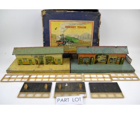
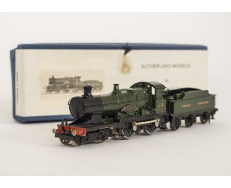
Lot 83
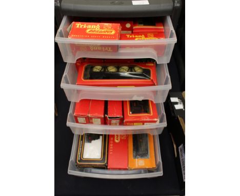
A Hornby Train tinplate clockwork locomotive outfit and a Marklin HO scale AC set, both boxed, together with a quantity of tinplate and plastic railway platforms and buildings. (qty)Provenance: Single owner stock collection of Robert Dartnell and Mrs Joyce Buttigieg owners of Engine and Tender, a toy shop in London to be sold Without reserve over 115 lots .
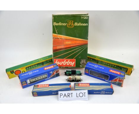
Lot 90
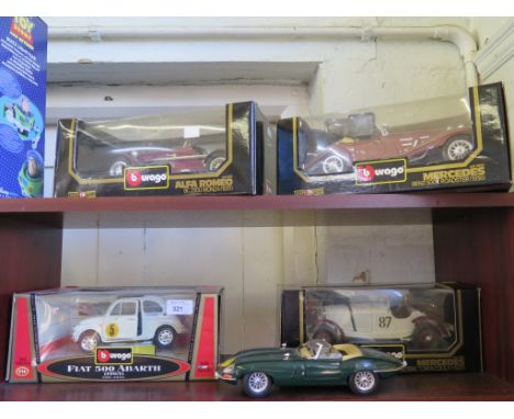
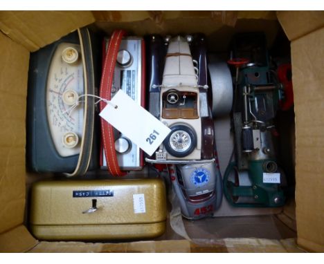
Four 1:43 scale Minichamps models, a red Tri-ang pressed metal crane, a Micromachines camper van and other models. (qty)Provenance: Single owner stock collection of Robert Dartnell and Mrs Joyce Buttigieg owners of Engine and Tender, a toy shop in London to be sold Without reserve over 115 lots .
Lot 109
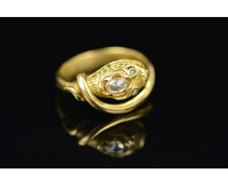
A GOLD DIAMOND SNAKE RING, the ring designed as a snake, the head with engraved scale detail and set with an oval rose cut diamond and circular rose cut eyes, ring size O, approximate gross weight 5.1 gramsassessed as between 15ct-18ct, overall condition good, this ring may have been previously enamelled ?
Lot 302
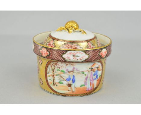
AN EARLY 19TH CENTURY CHINESE EXPORT BOWL AND COVER, the domed cover with gilt berry and leaf finial above a deep border of iron red painted vignettes between gilt scrolls and fish scale ground, the circular bowl similarly decorated and with two oval scenes of figures in landscapes, diameter 12.5cm x height 10cm (condition: two vertical cracks in bowl at the rim, approximately 4cm and 3cm in length)
Lot 72
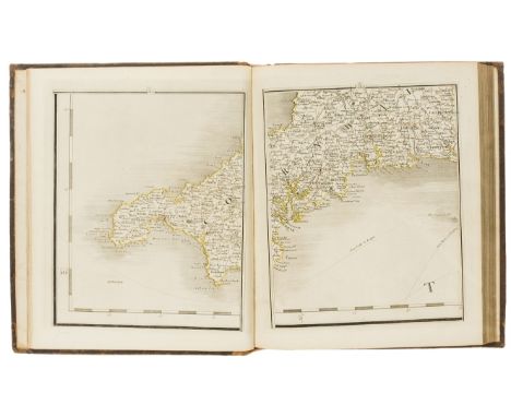
Nelson & Bronté (William Nelson, first Earl Nelson, second Duke of Bronté, Anglican clergyman and older brother of Horatio Nelson, first Viscount Nelson, 1757-1835).- Britain.- Cary (John, publisher) Cary's New Map of England and Wales with Part of Scotland, William Nelson's copy signed Nelson & Bronté on front pastedown, engraved title, dedication, hand-coloured general map and 79 sheets (numbered 1-81), mostly engraved maps hand-coloured in outline but including dedication, key & scale as part of sheets, no sheets numbered 62 or 80 as issued (presumably unnumbered title and general map), 85-page "List of Places", lacks list of subscribers, slightly browned, contemporary speckled calf, slightly rubbed, rebacked with the original gilt spine laid down, 4to, John Cary, 1794.
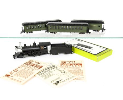
Lot 125
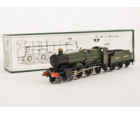
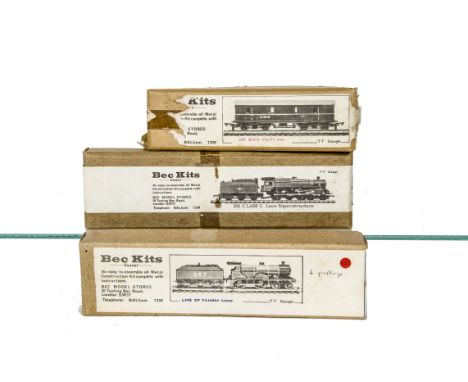
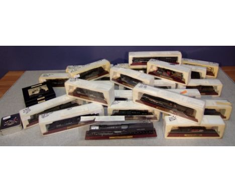
H0 n3 Gauge Locomotives rolling stock and Accessories, black 2-8-0 Steam Locomotive and Tender, two green coaches with verandas and Baggage/US Mail van, Grandit Line and Durango Press unmade Gondola plastic kits, Precision scale Stock Car kit, MRGS Caboose kit, all four in original boxes, six Shinohara Points (Turnouts), in original packaging, 12 lengths of Rail Craft Flexi Track, various Kadee coupling packs and other HO accessories, VG-E, boxes G-VG (qty)
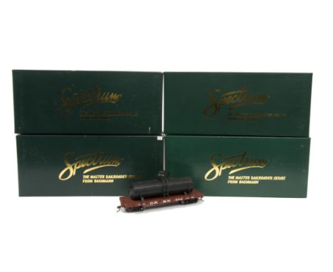
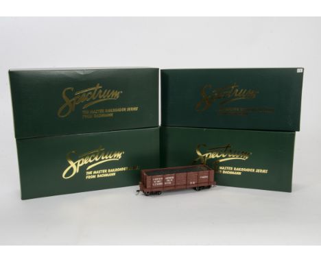
Lot 142
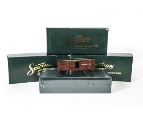
On30 Scale Spectrum Freight and Passenger Cars, a boxed group of six, all Denver & Rio Grande Western, comprising No 27618 Ventilated Box Car (2), No 27018 Box Car, No 27418 Reefer Refrigerated, No 26118 Combine Car (factory sealed) and No 26318 Passenger Car (with lit interior) G-E, boxes G, (6)
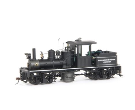
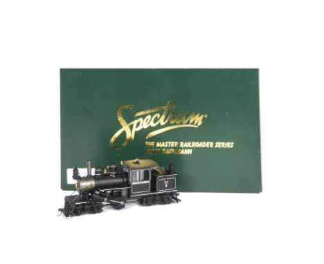
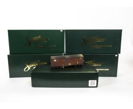
Lot 137
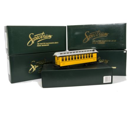
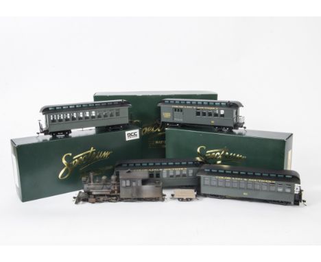
On30 Scale Spectrum Locomotive and Coaches, An unboxed Spectrum by Bachmann No 25499 Forney 2-4-4, Locomotive with DCC and sound, in weathered livery, together with three Colorado & Southern carriages, comprising two passenger cars and an RPO coach, another unmarked passenger coach and a four wheel flat car, G, (6)
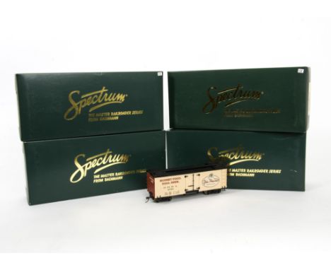
Lot 144
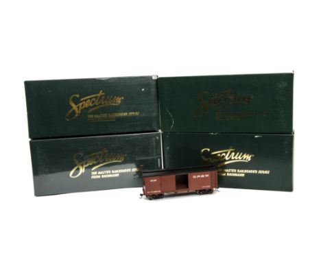
On30 Scale Spectrum Freight Cars, a boxed group of five, comprising Rampo Valley Brewery No 27470, Billboard Reefer Cars, (2) John Howard's Brewhouse No 27467 Billboard Reefer Car and Bricktown Brewery, No 27466 Billboard Reefer Car, together with a Breakwater and Delaware Bay No 27656 Ventilated Box Car, G-E, boxes G, (5)
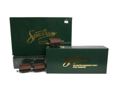
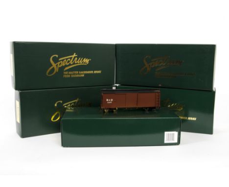
Lot 146
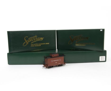
On30 Scale Spectrum Freight Cars, a boxed group of five, comprising, Chesapeake & Delaware No 27635 Ventilated Box Cars (2), No 27857 Greenbrier Big Run Lumber Co Highside Gondola and No 26863 Little River Logging Co Pulpwood Car together with No 26878 Carolina Pulpwood & Paper Co Pulpwood Car, G-E, boxes G, (5)
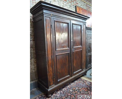
Lot 763
A substantial 18th century Palazzo scale Florentine fruitwood armoire, the dentil moulded canopy top over twin panelled doors, raised on a plinth base to squat bun feet, 205 cm w x 65 cm x 235 cm h (dismantles for transit)Provenance - by repute, previously owned by the 'Franchetti' family - a noble Italian houseOld splits to all front panels, some old worm damage to edge immediately above left-hand door, old worm holes overall - all commensurate with age, later mirror to inside
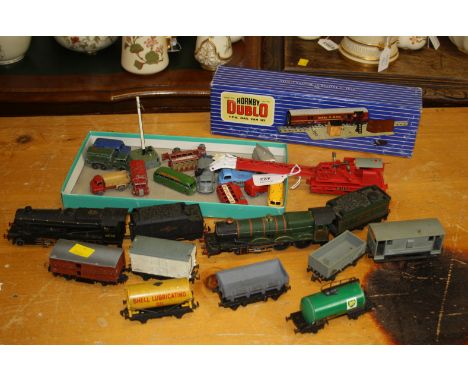
Lot 422
A Hornby Dublo Mallard Locomotive and Tender, No 3211, for three rail 12 volt electric railways (boxed), together with a Bristol Castle locomotive and tender, a British Rail 48158 locomotive and tender, Bristolian and other passenger coaches, a good quantity of track, points, level crossing, uncoupling points, etc., also included a No 133 crane and a small quantity of rolling stock, scale die cast commercial vehicles, kit constructed buildings, boxed platforms, bridges and signal hut, landscaping, a Bristol Castle locomotive body, transformers and power control units, related booklets, manuals, etc
Lot 773
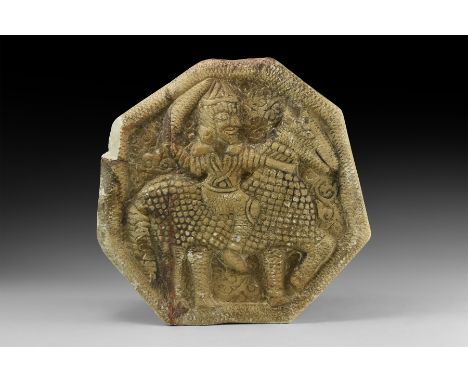
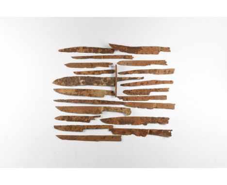
An undated archaistic carved stone irregular octagonal wall tile with raised hatched rim, high-relief horseman with sword drawn, horse with scale armour, scrolled tendrils in the field. 4.2 kg, 16cm (10 1/4"). Property of a London gentleman; acquired before 2000. [No Reserve] Fine condition.
Lot 870
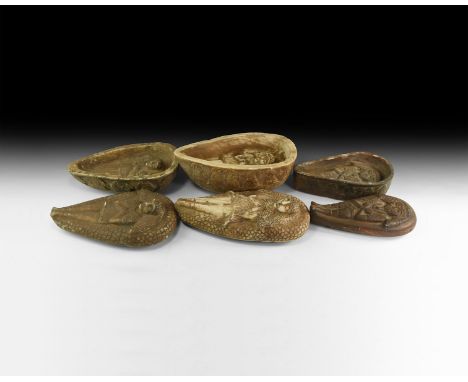
A mixed group of undated archaistic carved stone coffins each with frieze of profile busts to the sidewall, body laid out on the lid with crescent pillow and scale field, similar image within modelled in high relief. 8.2 kg total, 20-25cm (8 - 9 3/4"). Property of a London gentleman; acquired before 2000. [3, No Reserve] Fine condition.
Lot 391
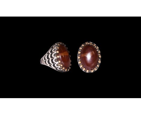
19th-20th century AD. A silver ring comprising a flat-section hoop, tapering shoulders with low-relief scale patterning, ellipsoid bezel with claw setting, inset amber(?) cabochon. 19 grams, 29mm overall, 19.72mm internal diameter (approximate size British T 1/2, USA 9 3/4, Europe 21.89, Japan 21) (1 1/4"). Property of a Surrey, UK, collector; acquired on the London art market 1990s. [No Reserve] Very fine condition. A large wearable size.
Lot 675
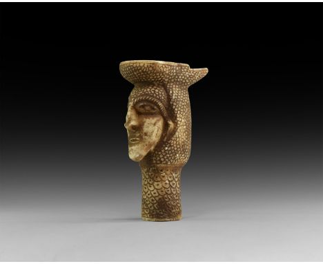
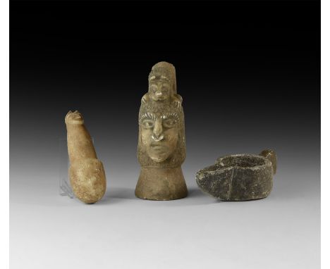
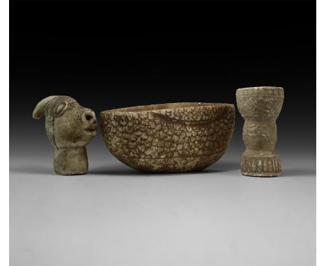
An undated archaistic group of carved stone items comprising: a pestle with beast-head finial; a mortar with bird-head lug handle, a female bust with scale headdress and lion crest. 1.4 kg total, 12-16cm (4 3/4 - 6 1/4"). Property of a London gentleman; acquired before 2000. [3, No Reserve] Fine condition.

-
216134 item(s)/page