A Fine border of Brussels needle lace with complex Rococo design of large scale leaves and flowers shells and fruit and a number of detailed infills 18 th Century, length 272, with 86 cm returnsFrom a gentleman's private collection of lace which was amassed over many years . one tan coloured stain, a few small rust marks 2 x 1.5 cm, a few small holes otherwise good
We found 216136 price guide item(s) matching your search
There are 216136 lots that match your search criteria. Subscribe now to get instant access to the full price guide service.
Click here to subscribe- List
- Grid
-
216136 item(s)/page
A 1930s with possible later adaption's raspberry red silk velvet dress with large scale design sewn with glass beads . Good overall condition but some faults4cm tear under one arm pit, small 1cm tear to one shoulder seam , colour of fabric goodMost of bead work present but there are some looses and loose beads, perhaps 10% loss overall
* Miles Master. An exceptionally fine flying scale model of this wartime aircraft which was produced as an advanced trainer for pilots who would go on to fly Spitfires and Hurricanes. Its Rolls Royce Kestrel engine gave it a speed of over 475 mph - almost as fast as the front line fighters . The model is a much researched 'one off,' constructed from wood and having an extremely authentic finish in RAF camouflage scheme - but yellow below, to indicate a trainer - and markings of the period, with aircraft number N7775. It has folding undercarriage, a petrol engine and outstanding detail in both cockpits. 183cm wingspan x 156cm nose to tail (Qty: 1)
* Tokens. A collection of National Aircraft Factory, Croydon canteen tokens circa 1917, comprising 15 circular ivorene discs each stamped N.A.F. 1D 2 Croydon, 19mm diameter (Qty: 15)NOTESIn 1917 the Ministry of Munitions, commissioned the construction of 4 National Aircraft Factories to significantly boost the rate and scale of production of aircraft. No.1. Factory based at Waddon in Croydon produced De Havilland DH9 for the Royal Flying Corps.
* Frog Hawker Hart Flying Scale Model. In original box, circa 1935, a very scarce example of this limited production flying-model aeroplane, of very lightweight pressed-aluminium, wood and doped paper construction, with detachable wire-braced wings, contained in its original box, complete with inbuilt winder mechanism & handle, instruction manual(s) and oil lubrication bottle etc, very good original condition for age. (Qty: 1)
A collection of six late 19th / early 20th century miniature porcelain vases, to include a pair of Coalport vases painted with panels of exotic birds, butterflies and insects on a blue scale ground, 9cm, a Crown Derby vase with floral and gilt decoration, 12cm, and a Doulton Lambeth example, 9cm, (some a/f)
Natural history interest, a wooden box containing a large quantity of specimens, to include three large pieces of coral, conch shells, cowry shells, a rostellaria shell, a box of pond fossils, a tin filled with various small shells, a box of sea snail shells, a box of sea urchins, a fish scale fossil, an ostrich egg painted with a scene of boats sailing and one other unpainted, a carved gourd from the West Indies, a tin filled with Mexican Wild Vine Seed, a box of Icelandic Spar, caoutchouc, a tin filled with agates and pearly tops, multiple quartz crystals, Penang rubber, silkworm silk etc
titled in kanji , reads 'Dai-Nihon kaikiru zenzu', translated as 'the complete nautical and land maps of the Great Japan', published in the 4th Bunky year (1864) by the publisher Ebisuya Shoshichi in Toto City, the original woodblock engraved by Takeguchi Takizabur , oriented with north to the upper right, with the scale of 1:1,944,000, despite the mainland of Japan, also covers the Japanese archipelago, which are Yakushima, Tanegashima, Okinoerabujima, Kikaijima, Hachij -jima, Kunashir etc., with wooden frame (Dimensions: 81cm x 108cm) (Qty: 1)(81cm x 108cm)
Kenner and Hasbro large-scale Star Wars Figures, boxed: Kenner Skywalker/Leila/Solo 11" figure pack, Kenner 11" Barquin D'Arc, Hasbro Amidale 11" figures in black and red gowns, Ep.1 Watto 8" figure, Ep.1 Anakin 7" figures (x7), Podracer and Commtalk Reader, all in original packaging together with unboxed 11" Bobba Fett (14)
Poland. Jaillot (Alexis-Hubert & Sanson (Guillaume), Estats de Pologne subdivisés suivant l'estendue des Palatinats, Jean Covens & Corneille Mortier, Amsterdam, circa 1720, engraved map with contemporary hand colouring, title repeated in French above engraved image, large allegorical cartouche and mileage scale, old folds, 575 x 875 mm (Qty: 1)
Poland. Gilly (David), Special Karte von Suedpruessen mit Alleroechster Erlaubniss aus der Koniglichen..., Simon Schropp & Co., Berlin circa. 1803, large scale engraved map on thirteen (complete) sheets, not conjoined, contemporary outline colouring, one sheet with small repaired closed tear, each sheet approximately 540 x 720 mm (Qty: 13)
* South East England. Saxton (Christopher) . Cantii, Southsexiae, Surriae et Middelsexiae comitat una cum suis undique consinibus oppidis, pagis, villis et fluminibus in eisdem vera descriptio, circa 1579, engraved map with contemporary hand colouring, engraved by Remigius Hogenberg, the royal coat of arms of Elizabeth I, strapwork cartouche, and elaborate decorative mileage scale, slight creasing, lower right corner torn with loss and skilfully replaced in facsimile, 410 x 545 mm, mounted, framed and glazed (Qty: 1)NOTESThe first printed map of Kent, Sussex, Surrey and Middlesex. The map is dated 1575 but was not published until 1579. This example is state 3 - the atlas state - of the map, and shows the legend 'Pestis Patriae Pigricies' above the Seckford Coat of Arms and 'Christopherus Saxton descripsit' added below the table of explanation to the lower right corner. This is one of the earliest and most important English maps, covering the south-eastern part of England and dissected by the Thames River, with London prominently located near the top centre of the map. It is odd that Saxton chose to combine four of the most important counties of England into a single map. Kent, with Canterbury being the centre of the Church of England, Surrey and Middlesex bordering the capital, and Sussex with its maritime importance would all have warranted standing alone as individual maps. What persuaded Saxton to amalgamate these four counties into one map is something of a cartographic conundrum.
Staffordshire. Phillips (J. & Hutchings W.F.), A Map of the County of Stafford, Divided into Hundreds & Parishes from an accurate Survey, made in the years 1831 and 1832, Henry Teesdale, 1832, large scale engraved map with contemporary hand colouring, sectionalised and laid on linen, table of explanation, compass rose and an uncoloured vignette of Lichfield cathedral, slight dust and finger soiling, 1320 x 975 mm, marbled endpapers, contained in a contemporary blind stamped mottled tree calf book box, later morocco gilt label to spine, a little worn at extremities (Qty: 1)
* Bedfordshire. Bedford Shire and the situation of Bedford described with the armes of thos honorable familyes that have borne ye titles of Dukes and Earls thereof, 1st edition, published George Humble, [1611], uncoloured engraved map, inset town plan of Bedford, large strapwork cartouche and mileage scale, 385 x 510 mm, facsimile of text on verso of map fixed to rear of frame, mounted, framed and glazed (Qty: 1)
Yorkshire. Teesdale (Henry & Stocking C.), To the Nobility, Gentry & Clergy of Yorkshire, this map of the county constructed from a survey commenced in the year 1817 & corrected in the years 1827 & 1828 is respectfully dedicated by the proprietors, April 21st, 1818, Teesdale & Co. and C.Stocking, April 21, 1828, large scale engraved map with contemporary hand colouring, sectionalised and laid on linen on three sheets, calligraphic title, compass rose, table of explanation and a table of the altitudes of the principal mountains and an uncoloured engraved vignette of the North West View of York Cathedral, some offsetting from title, slight staining, marbled endpapers, edged in green silk, overall size 1840 x 2230 mm, contained in a contemporary gilt morocco book box, slight wear to extremities (Qty: 1)
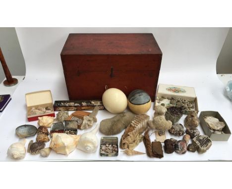
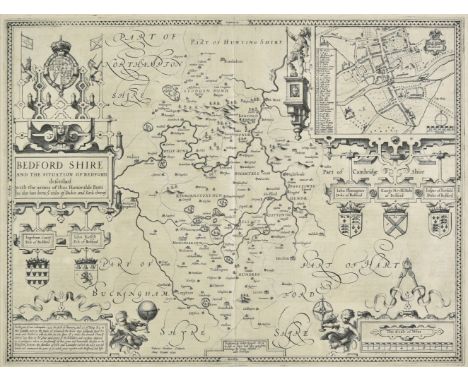
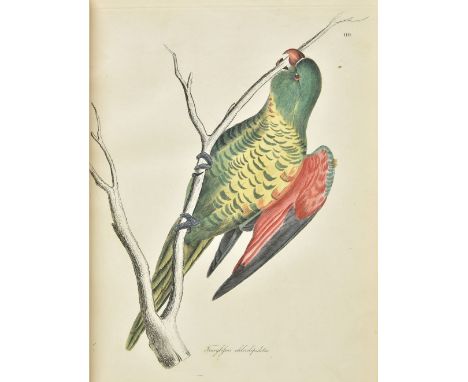
Jardine (William, & Prideaux John Selby). Illustrations of Ornithology, 4 volumes, 1st edition, Edinburgh: W. H. Lizars, [1826-43], engraved title-pages, 207 hand-coloured etched plates numbered 1-110, 106-136, 139-151, I-LIII (plate 93 misnumbered 94, 135-6 misnumbered 138-7), of which 1-151 (i.e.154) each with uncoloured duplicate as issued, marginal paper restoration and repair to plate 31 and duplicate (with loss to image in the latter), repaired closed tear to 138 duplicate, mild toning, variable offsetting, occasional light spotting, finger-soiling and other marks, contemporary ownership inscriptions ('M. R. Lea') to title-pages, top edges gilt, others untrimmed, modern green crushed morocco gilt, 4to (31.5 x 21.5 cm) (Qty: 4)NOTESAnker 222; Fine Bird Books p. 108; Nissen IVB 472; Wood p. 405; Zimmer pp. 322-4. 'This celebrated work was issued in 19 parts, constituting chiefly of a series of beautiful hand-colored plates with explanatory text of birds of many regions by well-known artists, among them Lear, Gould, and the principal text contributors' (Wood). Illustrations of Ornithology was published to complement Selby's Illustrations of British Ornithology (1821-33) and in response to the paucity of works on non-European avifauna. Apart from John Latham's General History of Birds (1821-8), which Jardine and Selby deemed insufficient, there were in 1826 ‘fewer than a dozen titles published in Europe covering birds of Africa, Asia, North and South America, and one for Australia’ (Jackson & Davis, Sir William Jardine: A Life in Natural History , p. 37). To obtain specimens Jardine organised a collecting drive of unprecedented scale, applying to agents in the Cape of Good Hope, Jamaica, Barbados, Madeira, South Carolina, Trinidad, the Gambia and Sierra Leone, Buenos Aires and North America, and soliciting examples from relatives and associates travelling to Australia, India and Africa. The work is rarely encountered complete with the fourth volume of 53 plates, which was published between 1836 and 1843, and is described in the 'Note' to the rear of the third volume as a 'New Series'.
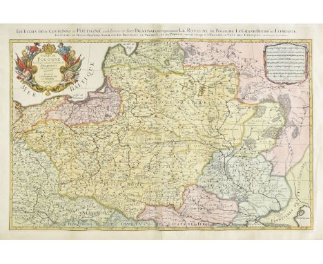
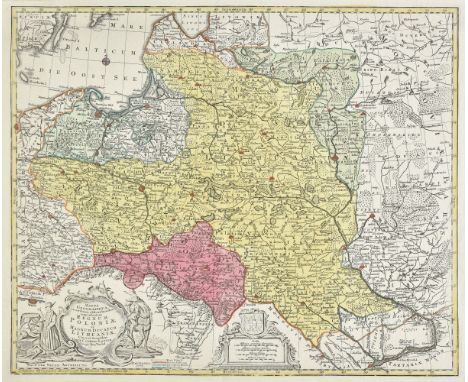
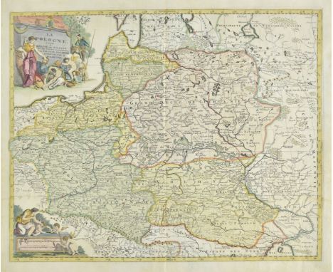
Durham. Hobson (William Colling), This Map of the County Palatine of Durham is most respectfully dedicated to the Nobility, Clergy, Gentry &c. &c. by their most Obliged and very Humble servant, the Proprietor, 1840, large scale map, engraved by J & C Walker, sectionalised and laid on linen, sparse near contemporary outline colouring identifying the railways, calligraphic title and table of explanation, occasional pencil annotations, slight dust soiling and staining, 790 x 980 mm (Qty: 1)
East Indies. Hondius (Jodocus), Insulae Indiae Orientalis Praecipuae in quibus Moluccae Celeberrimae sunt, Amsterdam, circa 1607, engraved map with contemporary hand colouring, two ornate cartouches and mileage scale, toned overall, central fold professionally reapired on verso, repaired marginal closed tears, 345 x 475 mm, Latin text on verso (Qty: 1)
Estate Plan. A Plan of Wood-House Estate belonging to Christopr. Thompson Maling Esq..., 1767, ink and watercolour estate plan with key plate, ornate cartouche and mileage scale, laid on linen with a highly ornate semi-heraldic design to verso, frayed with some loss to image, 365 x 310 mm (Qty: 1)
* Nottinghamshire. Speed (John), The Countie of Nottingham described, The Shire Townes situation and the Earls there of observed, 1st edition, published John Sudbury & George Humble, [1611], uncoloured engraved map, large strapwork cartouche and mileage scale, inset town plan of Nottingham, slight browning to central fold, 385 x 515 mm, English text on verso, mounted, framed and glazed (Qty: 1)
* Poland & Pomerania. Lubben (Eilhard), Nova Illustrissimi Principatus Pomeraniae Descriptio, Amsterdam, 1618 [but 1757], large engraved wall map on twelve conjoined sheets, engraved by Van Gellkerchen, contemporary outline colouring, the margins decorated with forty-six views of cities and towns, each sheet approximately 420 x 540 mm, overall size 1245 x 2160 mm, framed and glazed (Qty: 1)NOTESArguably the rarest and most important map of Pomerania. Created by Professor Eilhard Lubben under the instruction and patronage of Philip II, Duke of Pomerania, this monumental wall map illustrates and maps the country in extraordinary detail. Lubben surveyed the country in 1611 and 1612 and the map was eventually published in 1618. It is decorated with noble arms, a genealogical tree, portraits (including a prominent engraving of Philip II), and 46 town views. A few examples were presented to the Pomeranian court, but the shortage of paper and the thirty years war prevented the printing of additional examples and no extant copies of the 1618 printing are known. Geelkerken's copperplates were rediscovered in the eighteenth century in Stralsund (a town featured in a vignette on the map), and in 1757 the map was reissued, but Scharfe notes that "again only a small number of copies were printed and so this edition is a very rare object today". Lubben's map remained the only piece of significant cartography on Poland until the Prussian surveys of the 18th century and it remains as one of the finest examples of large scale surveying and mapping. Only a handful of copies are known and this particular example is in particularly fine condition.
Poland. Elwe (Jan Barend), La Pologne Divisee en Royaume de Pologne et les Etats y Apartenans la Pologne Prussienne Autrichienne & Russienne, Amsterdam, [1792], engraved map with contemporary hand colouring and some later enhancement, large ornate cartouche and mileage scale, 485 x 605 mm (Qty: 1)NOTESUnlike many of Elwe's maps, this is an original work and not a re-issue of an earlier cartographer's efforts.
Four Corgi The Aviation Archive diecast model aeroplanes Flying Aces limited edition 1:72 scale Messerschmitt 109E 7.IG51 49203, 1:72 scale P-51D Mustang 'Petie 2nd' AA32204, World War II Europe & Africa 1:144 scale Avro Lancaster NX611 B MkVII 'Just Jane' AA30201 and Battle of Britain 1:72 scale Spitfire MKI 74 Sqd RAF 49001, all in original boxes.

-
216136 item(s)/page