We found 216134 price guide item(s) matching your search
There are 216134 lots that match your search criteria. Subscribe now to get instant access to the full price guide service.
Click here to subscribe- List
- Grid
-
216134 item(s)/page


Lot 464
Chinese Belt Closure with Gold and Silver InlayHan Dynasty, 206 BC-220 AD. A bronze belt hanger fashioned as a dragon, its serpentine body forming a sweeping loop, decorated with inlaid gold and silver rectangles and stylised scale patterning; the hook formed as a zoomorphic head with recurved neck and bands of gold and silver inlay; a human hand motif where it joins the dragon`s body; a circular knop to the underside. 385 grams, 18.5 grams (7"). Ex Chang collection. Very fine condition, some green patination.Starting Price: £600


Lot 205
British Isles. Blaeu (Johannes), Magnae Britanniae et Hiberniae Tabula, [1631 or later], hand coloured engraved map, inset map of the Orkney islands, strapwork cartouche and mileage scale, torn with slight loss to strapwork border along lower margin, professionally restored, 390 x 505mm, Latin text on verso, together with Bowen (Emanuel), A New and Accurate Map of Great Britain & Ireland together with their respective Islands, n.d., c.1740, hand coloured engraved map, decorative cartouche, 350 x 430mm. The first described item. R.W.Shirley, Early Printed Maps of the British Isles, no.423. (2)

Lot 207
British Isles. Jansson (Jan), Magnae Britanniae et Hiberniae Nova Descriptio, Amsterdam, c.1650, hand coloured engraved map, strapwork cartouche and mileage scale, inset map of the Orkneys, slight mount staining, two marginal closed tears just affecting image repaired on verso, short splits to central fold repaired on verso, slight dust soiling, 430 x 550mm, French text on verso (1)
Lot 225
Hertfordshire. Kitchin (Thomas), A New Improved Map of Hartfordshire from the Best Surveys & Intelligence Divided into Hundreds...., pub. Robt. Sayer, Robt. Wilkinson & Carington Bowles, c.1785, engraved map with contemp. outline colouring and some later enhancement, decorative cartouche, toned overall, 535 x 660mm, together with Jansson (Jan), Herefordia Comitatus vernacule Hereford Shire, n.d., c.1650, engraved map with contemp. hand colouring, decorative cartouche and mileage scale. light overall toning, 385 x 505mm, Latin text on verso, with Blaeu (Johannes), Huntingdonensis Comitatus Huntington Shire, n.d. c.1650, uncoloured engraved map, decorative cartouche and mileage scale, 395 x 500mm, plus Bowen (Emanuel), An Accurate Map of Nottingham Shire Describing its Wapontakes and Divisions...., pub. T & J Bowles, John Tinney & Robt. Sayer, c.1760, engraved map with contemp. outline colouring, decorative b & w cartouche, 705 x 540mm (4)


Lot 263
West Africa. Van Keulen (Johannes), Paskaart van de Kuste van Gualate en Arguyn....., Amsterdam, c.1700, engraved sea chart with contemp. hand colouring, orientated to the east, large and decorative cartouche and mileage scale, compass roses and numerous rhumb lines, slight oxidisation to early water colour, slight browning, 515 x 590mm (1)

Lot 266
Westmorland. Speed (John), The Countie Westmorland and Kendale the Cheif Towne Described with the Armes of such Nobles as have bene Earles of either of them, pub. Thomas Bassett & Richard Chiswell, c.1676, hand coloured engraved map, inset town plan of Kendal, elaborate strapwork cartouche and mileage scale, 385 x 515, English text on verso (1)
Lot 268
Worcestershire & Warwickshire. Blaeu (Johannes), Wigorniensis Comitatus et Comitatus Warwicensis nec non Coventrae Libertas, Worcester, Warwik Shire and the Liberty of Coventre, c.1648, hand coloured engraved map, decorative cartouche, slight spotting, 415 x 505mm, Latin text on verso, together with Schenk (Pieter & Valk Gerard), Wigorniensis Comitatus cum Warwicensi nec non Coventriae Libertas, n.d., c.1710, engraved reticulated map with contemp. hand colouring, elaborate b & w cartouche and mileage scale, some oxidisation to old watercolour causing slight cracking, 425 x 515mm (2)

Lot 276
Yorkshire. Speed (John), The West Ridinge of Yorkshyre with the most famous and Fayre Citie Yorke Described, pub. John Sudbury & George Humble, c.1627, uncoloured engraved map, inset town plan of York, decorative strapwork cartouche and mileage scale, central fold stained and strengthened on verso, trimmed to neat line, very slight loss in one corner, 385 x 510mm, English text on verso, mounted (1)
Lot 599
Lewis (Samuel). A Map of England & Wales, Divided into Counties, Parliamentary Divisions & Dioceses, shewing the Principal Roads, Railways, Rivers & Canals, the Seats of the Nobility and Gentry, with the Distance of Each Town from the General Post Office, London, Reduced from the Survey made under the Direction of the Honourable the Board of Ordnance to a Scale of Five Miles to an Inch and Corrected to the Presented Time, 1839, four large map sheets (NE Division, SW Division, NW Division & SE Division), hand-col. in outline, sectionalised on linen, some minor scattered spotting, each division contained in contemp. gilt-dec. plum straight-grained morocco, rubbed on spines, 8vo, and other topography, including Lewis’s Topographical Dictionary of England, Wales, Scotland and Ireland (3 shelves)

Lot 194
Bedfordshire. Speed (John), Bedford Shire and the Situation of Bedford described with the Armes of thos Honorable Familyes that have borne ye titles of Dukes and Earls therof, pub. Henry Overton [1707 or later], hand coloured engraved map, inset town plan of Bedford, elaborate strapwork cartouche and mileage scale, 385 x 505mm, no text on verso (1)

Lot 1093
A Boxed Set of Britains Lead `The Rifle Brigade (Prince Consorts Own)` No.9, pre-war set with oval bases, containing eight figures including officer, in `British Soldiers` box; A Boxed Set of Britains Lead `Duke of Cambridge`s Own 17th Lancers` No.13b, pre-war set, containing four small scale mounted figures (2)


Lot 114
Joseph Sloan (b.1940)CONDUCTORbronze on black marble base; (no. 1 from an edition of 3)8 by 6.5in., 20.32 by 16.51cm.Art Foundry, Dublin; Where purchased by the present owner`Joseph Sloan and Simon O`Donnell, Two Man Show`, The Art Foundry, Ringsend, Dublin, c.1985 -1986The Conductor Series emerged in Joseph Sloan’s oeuvre in the 1980s and is an exploration which continues to inspire the artist today. A large-scale interpretation of this theme, The Conductor, is appropriately housed in the collection of the National Concert Hall, Dublin.


Lot 33
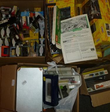
12 x Airfix 1/72 scale plastic military figure sets: #1703-5; #1743; #1703-5; #1737-8; #1716-1; #1746; #1735; #1737; 1716-1; 3 others in damaged boxes. Together with Airfix Bengal Lancer and Black Prince model kits, and a sealed Zvezda 1/35 scale military figure set. All boxed, not checked for completeness. (15)


-
216134 item(s)/page