We found 216134 price guide item(s) matching your search
There are 216134 lots that match your search criteria. Subscribe now to get instant access to the full price guide service.
Click here to subscribe- List
- Grid
-
216134 item(s)/page


Lot 142
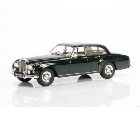
1:43 Scale Models, Spark S3023 Vodafone McLaren Mercedes MP4-26, S3044 Vodafone McLaren Mercedes MP4-27, Minichamps 530 114314 Vodafone McLaren Mercedes MP4-26, VW Amarok, Neo 44175 Rolls-Royce Silver Shadow, Lansdowne Models LDM.64 1950 Bentley Mk VI 4-Door Saloon, U.S Model Mint U.S 38 1952 Studebaker R5 Pick-Up, in original boxes, E, boxes VG-E (7)
Lot 191
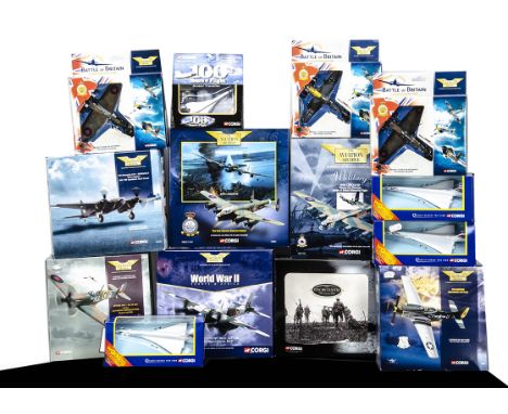
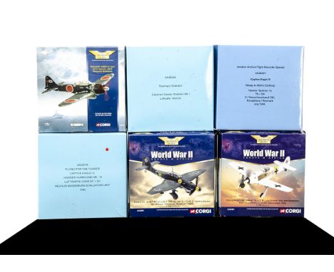
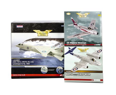
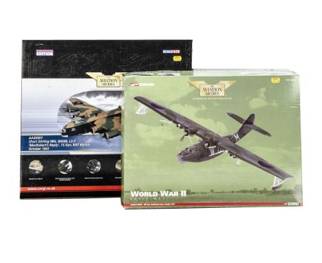
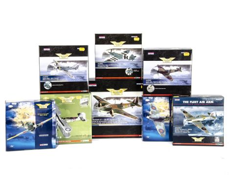
Corgi Aircraft, a group of WWII and Modern Aircraft comprising Aviation Archive 1:72 scale 49303 P51D Mustang, AA32801 Mosquito Grim Reaper, AA32803 Mosquito 49005 Spitfire MK1, 47306 Lancaster Mickey The Moocher, 47304 Dam Busters Lancaster and Battle of Britain 49101, 49201, 49001, together with For King and Country CS90026 Somme Set and Concorde models 100 Years of Flight and 59902 (3), G-E, Boxes F-E, (14)
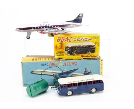
Lot 193
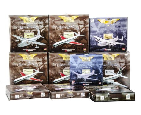
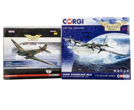
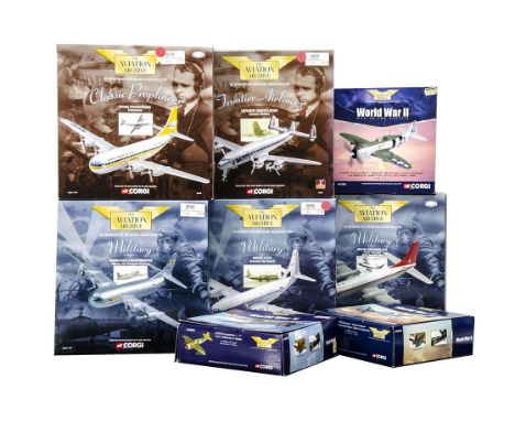
Corgi Aviation Archive, a boxed collection of 1:144 scale models comprising, Berlin Airlift 47111 RAF Dakota, 47201Skyways Avro York, Classics Jetliners DH Comet 48 48501 BEA (3) together with Classic Propliners 48605 Britannia, 48802 Short Sunderland and Vickers Viscount 47603, 47601, G-E, Boxes G-E, (10)
Lot 194
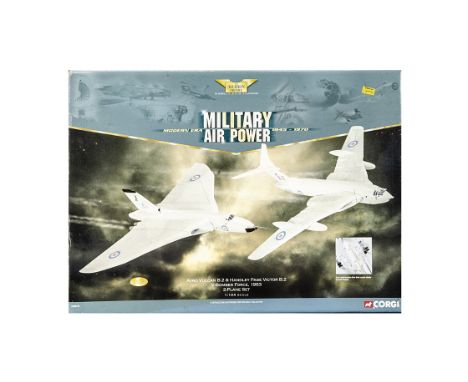
Corgi Aviation Archive Military, a boxed group of 1:144 scale models comprising Operation Chastise Avro Lancaster 47304 (2), 48304 Avro Vulcan B2, 47506 USAF Constellation, 47302 RAF Lancaster and AA30402 USAF Constellation, Columbine, together with 31806/31805 card kits (F) F-E, Boxes G-E (8)
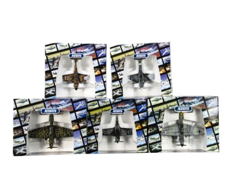
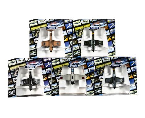
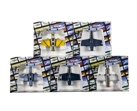
Lot 196
Corgi Aviation Archive WWII Aircraft, a boxed group of six Axis aircraft 1:72 scale comprising, AA36507 Captive Eagle III 1944, AA32018 Captive Eagle IV, both with discoloured cockpit canopies, AA36208 Goering's Gladiator, AA33102 Mitsubishi Zero, AA32501 Stuka France 1940 and AA34301 Focke Wulf White 8 1942, F-E, Boxes F-G, (6)
Lot 198
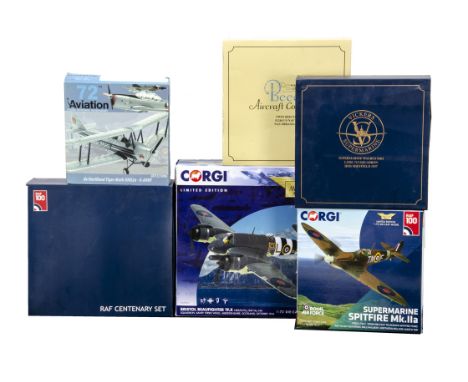
WWII and Later Diecast Aircraft, a boxed collection of 1:72 scale models, Corgi Aviation Archive AA28601 Bristol Beaufighter 144 Squadron 1944 and AA39213 Spitfire Mk IIA 504 Squadron 1941, Oxford Aviation 72SW005 Supermarine Walrus HMS Sheffield 1937, 76SET58 RAF Cetenary Set Spitfire and four vehicles and 72BE003 Twin Beech US Navy NAS Miramar, together with Aviation 72 AV7221006 De Havilland Tiger Moth, G-E, Boxes F-E, (6)
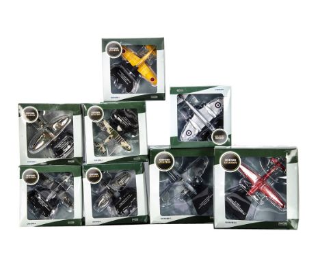
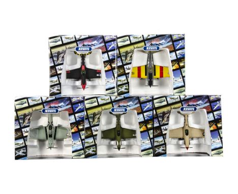
Lot 200
Oxford Aviation Front Line Fighters 1:72 Scale Aircraft, a boxed group of eight WWII and later aircraft AC090 Focke Wulf, AC092 Mitsubishi Zero (yellow training aircraft), AC083 Henschel, AC091 Macchi Veltro, AC096 German TA 152H-0 (red livery), AC052 Spitfire MK1, AC093 Ilyushin Beast and AC095 Gloster Meteor RAF, G-E, Boxes G-E, (8)
Lot 201
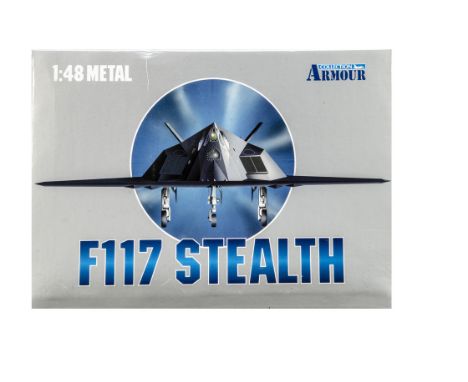
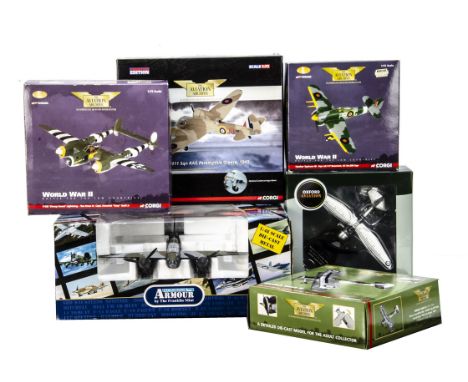
WWII Aircraft, A boxed group of six 1:48 scale Franklin Mint Armour Collection B11B640 DH98 Mosquito , 1:72 scale Oxford Aviation AC072 Westland Lysander and Corgi Aviation Archive AA38404 Bristol Blenheim, AA36502 Hawker Typhoon, AA36302 Fairey Swordfish and AA36602 P38J Droop Snoot Lightning, some models have been displayed, F-E, Boxes F-E, (6)
Lot 202
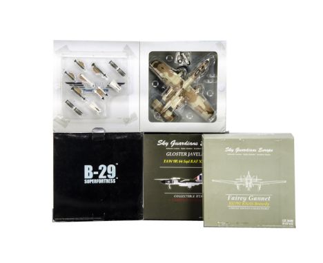
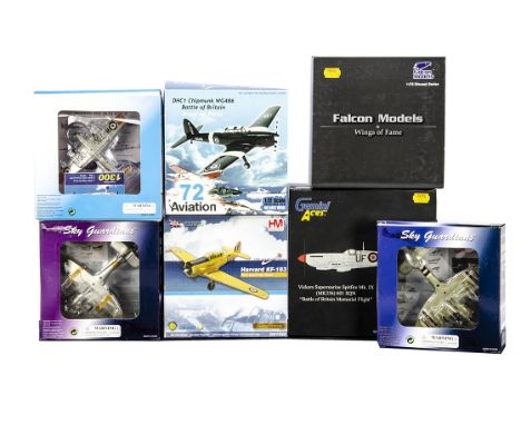
WWII and Later Diecast Aircraft, a boxed group of four 1:72 scale Hobby Master HA313 A-10A Peanut, Sky Guardians 002-001 Fairey Gannet (loose nose cone and components), 004-001 Gloster Javelin RAF and Dragon Wings 51001 B29 Superfortress Enola Gay, some models have been displayed, F-E, Boxes P-G, (4)
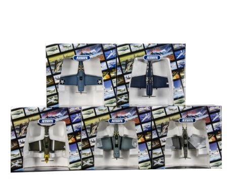
Lot 205
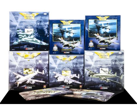
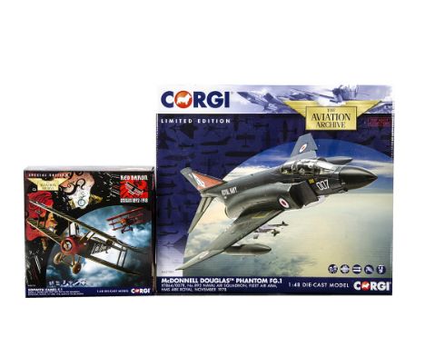
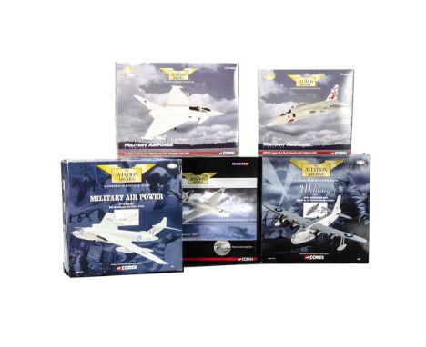
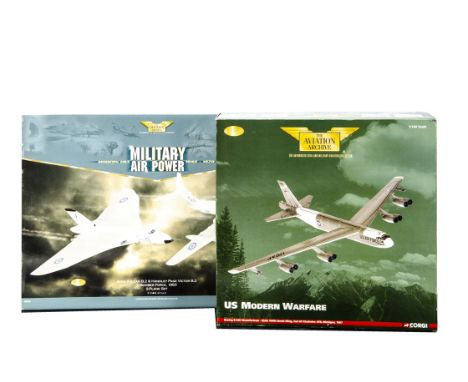
Corgi Aviation Archive, five boxed examples, 1:72 scale AA35408 Sepecat Jaguar RAF Coltishall 2005 and AA36401 Euro Fighter Typhoon RAF Coningsby 2006, together with 1:144 scale 48702 HP Victor MK2, 48805 Short Sunderland MKIII and AA39401 RAF Vickers Valiant Christmas Island 1957, some models have been displayed, F-E, Boxes F-E, (5)
Lot 209
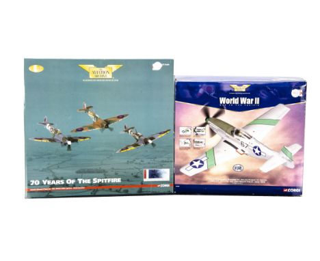
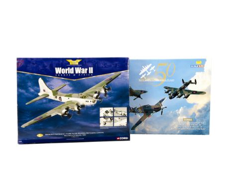
Corgi Aviation Archive WWII Aircraft, two boxed examples 1:72 scale AA33303 Europe & Africa Boeing B-17 Fortress 1942 and AA39911 Battle of Britain 50 Memorial Flight 2007 three plane set Hawker Hurricane, Spitfire and Lancaster, (minus one small stand) both models have been displayed, dusty, F-E, (2)
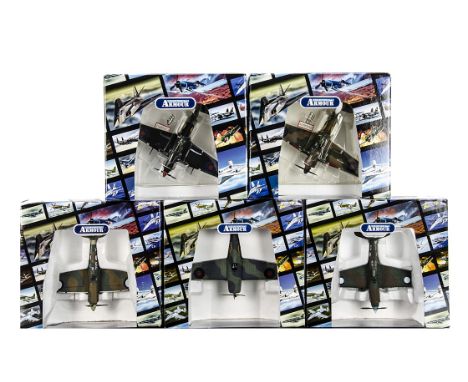
Lot 212
Corgi Aviation Archive WWII Aircraft, eight boxed examples 1:72 scale, AA39203 Spitfire, AA38704 Spitfire, AA32017 Hurricane, AA31901 Spitfire, AA32001 Hurricane, AA38702 Spitfire, AA38401 Bristol Blenheim and AA36302 Fairey Swordfish, (nicotine stained), all have been displayed with dust and some dirt/nicotine, F-G, Boxes G-E, (8)
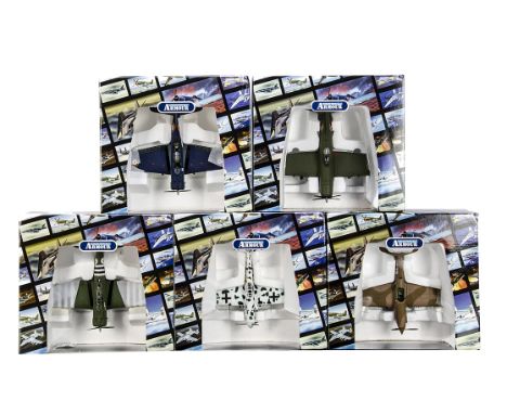
Lot 214
Diecast WWII and Later Aircraft, a boxed group of seven 1:72 scale Sky Guardians 025-00A Hawker Seafury, 015-022 Hawker Seafury, Gemini Aces GARAF 1009 Spitfire Battle of Britain memorial flight, Falcon Models FA724004 Fi 156c 83rd Group Air Officer Commanding 2nd Tactical Airforce France 1944, Hobby Master HA1522 Harvard KF-183 and Aviation 72 26-001 De Havilland Chipmunk, 26-003 DHC1 Chipmunk Battle of Britain, -E, Boxes G-E,(7)
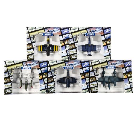
Lot 215
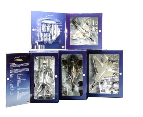
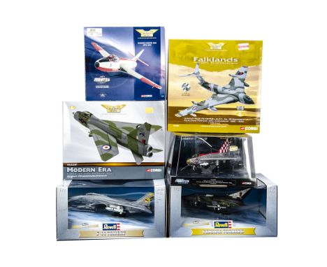
Diecast Modern Military Aircraft, a boxed/bubble packed group, Corgi 1:144 scale AA31603 Falklands Handley Page Victor 1982 and 1:72 scale 49803 Hawker Hunter MK 6 1973, AA32307 BAC Lightning RAF Binbrook 1977 and bubble packed AA32308 Modern Fighter Legends English Electric Lightning F3 1965, together with Revell 08205 F-14 D Tomcat and 08206 Mk 1 Tornado RAF, G-E, Boxes G-E, (6)
Lot 216
Corgi Aviation Archive WWII and Later Aircraft, a boxed group 1:72 scale P-47D Thunderbolts AA33805/AA33804 and P-51D Mustang AA32205 Cripes A Mighty, together with 1:144 scale Classic Propliners 48106 Stratocruiser, Frontier Airliners 47507 Constellation and Military 48104 C-97A Startofreighter, AA31502 Bristol Britannia and 48103 Boeing C-97G Delaware Air Guard, G-E, Boxes F-E, (8)
Lot 224
Franklin Mint Armour Collection WWII German and French Airforce Aircraft, five boxed 1:48 scale models French Airforce B11B626 P40 Warhawk, B11E096 P47 Thunderbolt, and DB 1 Dauntless B11B936/B11E081, together with Luftwaffe B11C995 Messerschmitt, cockpit canopies present where detachable, E, Boxes with outer boxes G-E, (5)

Lot 227
Corgi and Ultimate Soldier Plastic WWII Aircraft Models, a boxed group all with snap on wings and other components, Corgi 1:18 scale 10163 P-40B Warhawk and 10127 F4U Corsair, each with action figures, together with 1:32 scale examples by Ultimate Soldier 20350/20309 (some parts loose in box)/13293 Messerschmitt and 13310 Zero Type 22, G-E, Boxes G-E, (6) in three boxes
Lot 435
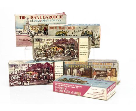
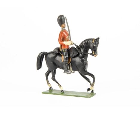
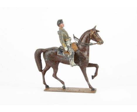
Paramount (England) 1:30 Scale Model Kits, No.2 Lord Mayor's Coach, No.2a Lord Mayor's Coachman Horses, Harness & Postillion (2), No.3 Royal Mail Coach, No.1a Horse-Harness & Postillions for Her Majesty's State Coach, No.V2 The Royal Barouche with Coachman & Greys, in original boxes, all appear complete but are unchecked, boxes G-VG (two still partly sealed) (6)
Lot 442
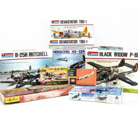
Aircraft Kits, Monogram 1:48 Black Widow P-61, Devastator TBD-1 (2), B-25H Mitchell, Esci Henschel HS-123, Henschel HS-129, Heller 1:100 Atlantic, LS Japanese 1:75 Mitsubishi Zero, ZP Ruch small scale TS-11 Iskra, in original boxes, all appear complete but are unchecked, boxes F-E, one sealed (9)
Lot 456
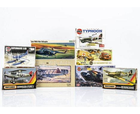
Airfix, FROG & Matchbox Kits, Airfix 1:144 H.P 42 "Heracles", OO Scale Emergency Set, 1:72 Hawker Typhoon, WW1 Tank Mk1, Supermarine S.6B, FROG Lynx Multi-Role Helicopter, Matchbox Hawker Fury 1 PK-1, Hawker Hurricane PK-11, in original boxes, all appear complete but are unchecked, boxes F-VG (8)
Lot 466
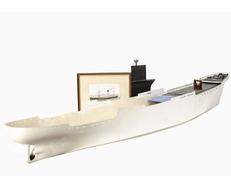
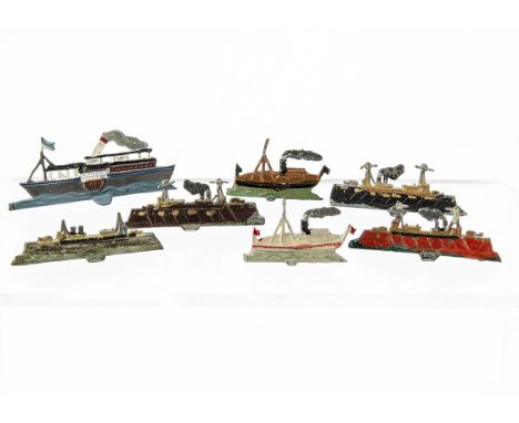
A Large 'Blue Funnel Line' Steam Ship Kit, with large fibreglass hull, approx 60" in length, (scale 1/8"=1'), with box of deck accessories, keel, upper deck moulding and other parts, with original framed watercolour of Cargo Liner 'Neleus' by John Nice, components generally G, part of upper deck moulding cracked, unchecked for completeness (qty)
-
216134 item(s)/page