We found 216136 price guide item(s) matching your search
There are 216136 lots that match your search criteria. Subscribe now to get instant access to the full price guide service.
Click here to subscribe- List
- Grid
-
216136 item(s)/page

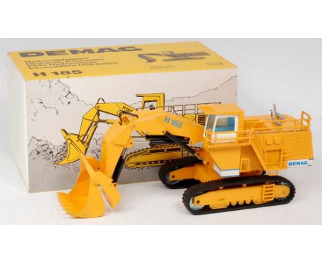
Lot 1516
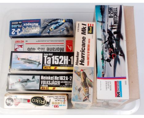
3 boxes of mixed scale plastic aircraft kits, by Revell, Monogram, Pro Modeller, Airfix and others, 3 kits missing boxes, some example sealed, and others with parts away from sprues, to include Monogram 1/48 B-17G Fortress, Monogram 1/48th B-24J Liberator, Revell JU-88 Night Fighter and others, 20+ in total
Lot 1211
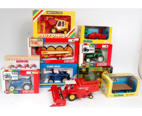
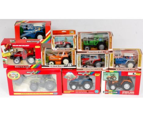
Britains and ERTL 1/32nd and 1/16th scale Tractor and Farming Implement Group, 1 loose all others boxed, to include No.9534 Krone Round Bale Wagon, ERTL Ford 8630 Tractor and Front Loader, loose Britains 760 Massey Ferguson Combine, Britains 5610 Ford Tractor, No.9496 Deutz Fahr Tractor, and others
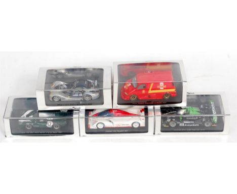
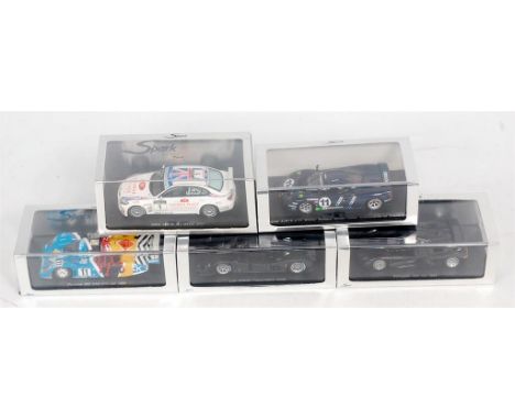
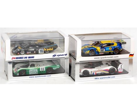
Lot 2703
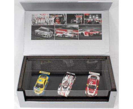
Spark Models 1/43rd scale Resin Le Mans, Supervan and Concept Car Group, 5 cased examples, to include S1270 Peugeot 908 Concept Car, S0290 Ford Transit Royal Mail Supervan, S1431 Lola T70 MK2 Aston Martin No.12 LM 1967, S0360 Radical SR9 Judd No.22 LM 2006, and S0367 Morgan Aero 8 GT LM 2004 (All NM-BVGNM)
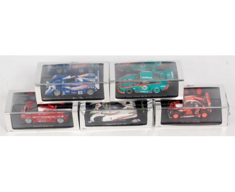
Lot 2707
Spark Models 1/43rd scale Resin Racing Car Group, 5 cased examples, to include KBS051 Kremer Porsche 935 K2 1977 No.51, S0247 Lola B05/40 Zytek Team Binnie LM 2007 Winner LMP2 Class, S0830 Fun Cup No.194 2007, S0666 Gumpert Apollo 2005, and S1274 Peugeot 905 EVO2 1992, rear spoiler A/F, all others NM-BVG
Lot 1401
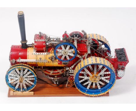
A very well made 1/8th scale model of a Fowler BB1 Class Ploughing Engine, built from measurements and photographs of the two ploughing engines at Bressingham Steam Museum, Diss, mainly constructed from Meccano components but fitted with a non-Meccano 12V motor to the underside, measurements: Length 30 inches, and Max Height 19 inches approximately
Lot 2571
Franklin Mint 1/24th scale Classic Car Group, 4 boxed examples, to include 1911 Rolls Royce finished in white, staining to roof (GVG-BG), 1928 Stutz Black Hawk Boat Tail Roadster, finished in red and black (NM-BVG), 1929 Bentley finished in green (NM-BVG), and a 1903 Ford Model A, finished in red (VG-BVG)
Lot 1203
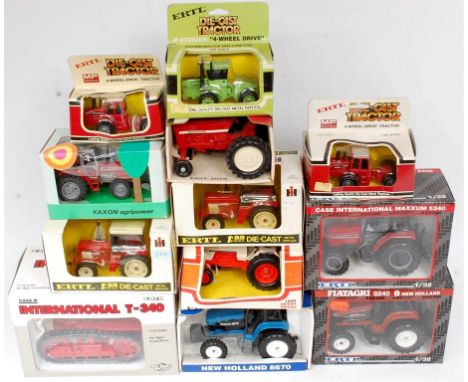
ERTL and Yaxon of Italy mixed scale Tractor and Farm Implement Group, 12 boxed examples, scales to include 1/16th, 1/32nd, 1/64th and 1/43rd, examples to include ERTL International Mini Tractor, ERTL No.4734 International T-340 Crawler, Yaxon MF 1134 Tractor, ERTL Steiger 4 Wheel Drive Tractor, and others
Lot 2629
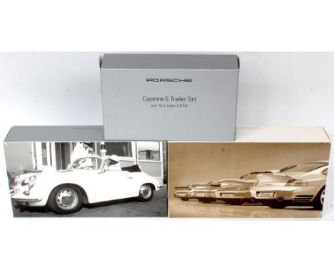
Minichamps 1/43rd scale Porsche Boxed Set Group, 3 boxed examples, to include Porsche Cayenne S Trailer Set Including 911 Turbo 1976, Limited Edition of 1500 pieces (NMM-BNM), Minichamps Set 04 Porsche 911 Turbo 4 Piece Set, 1 Model Requires Wing Mirror Restoration otherwise (NM-BVG), and Minichamps Set 08 Porsche History Collection of Police Cars (NMM-BNM)
Lot 2614
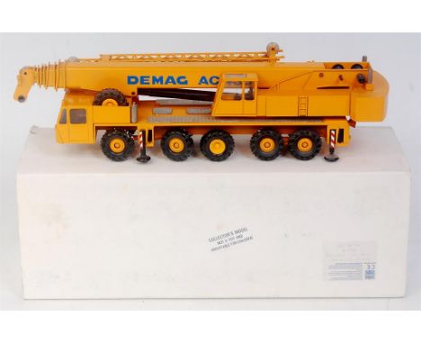
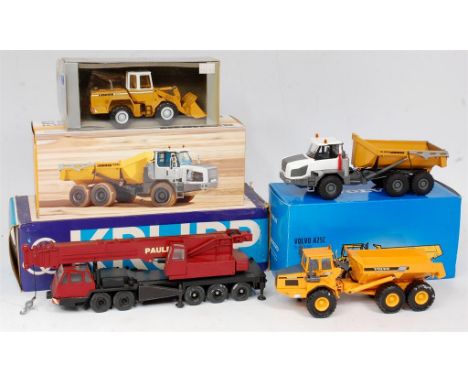
Conrad and Motorart 1/50th scale construction vehicle group, 4 boxed examples to include Conrad No.3070 Krupp 80 GMT "Paule" Mobile Crane (VG-BG), Conrad No.2728 Liebherr TA230 Articulated Dumper (NM-BVG), Motorart Volvo A25C Articulated Dump Truck (NMM-BVG), and a Conrad No.2887 Liebherr 531 Wheeled Excavator (VG-BVG)
Lot 2610
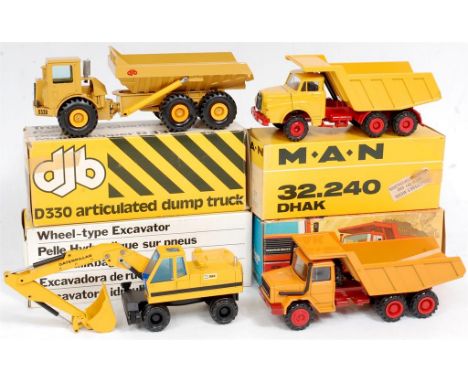
NZG, Conrad and Cursor Moddell 1/50th scale construction vehicle group, 4 boxed examples to include Cursor Moddell No.280 Magirus Deutz 256M Dump Truck (VG-BGVG), Conrad No.3035 DHAK 32-240 MAN Tipper Truck (NM-BVG), NZG No.259 CAT 224 Wheel Type Excavator (VGNM-BVG), and a NZG No.166 DJB D330 Articulated Dump Truck (NM-BVG)
Lot 2611
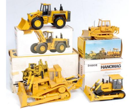
Conrad and Gescha 1/50th scale Construction Vehicle Group, 4 boxed examples to include Conrad No.2425 Hanomag Radlader 70E Wheel Loader (NM-BVG), Conrad No.2853 Hanomag D680E Crawler Dozer (VGNM-BVG), Gescha Liebherr PR731 Crawler Dozer (VG-BG), and a Conrad No.285 CAT D10 Track Type Tractor (GVG-BG)
-
216136 item(s)/page