We found 216134 price guide item(s) matching your search
There are 216134 lots that match your search criteria. Subscribe now to get instant access to the full price guide service.
Click here to subscribe- List
- Grid
-
216134 item(s)/page

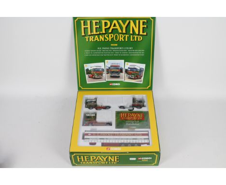
Lot 127
Corgi - A limited edition boxed H.E. Payne Transport set # CC99147 containing a Scania, a DAF and a Volvo truck with a curtainside trailer in 1:50 scale. This set comes with a certificate to show it is number 2249 of only 3100 produced. The models appear in Mint condition with unfitted mirrors still in the box. The outer box is Good with some storage wear. (This does not constitute a guarantee)
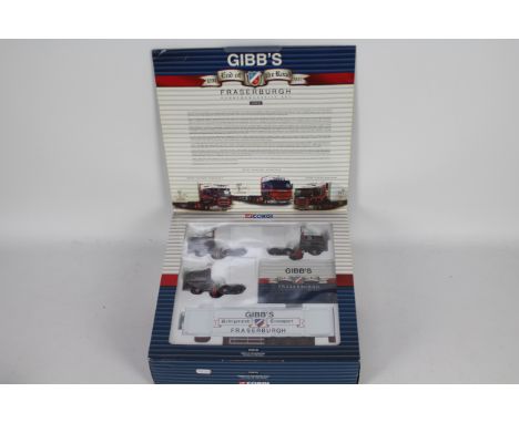
Lot 128
Corgi - A limited edition boxed Gibbs Of Fraserburgh Commemorative set # CC99125 containing 2 x Scania tractor units and a Volvo truck with a box trailer in 1:50 scale. This set comes with a certificate to show it is number 1182 of only 2200 produced. The models appear in Mint condition with unfitted mirrors still in the box. The outer box is Good with some storage wear. (This does not constitute a guarantee)
Lot 130
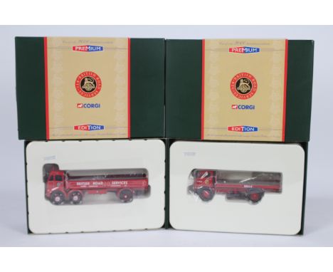
Corgi - 2 x boxed limited edition trucks in 1:50 scale, Austin 4 wheel platform lorry in BRS livery number 336 of only 2000 produced # CC13302 and an ERF 6 wheel dropside in BRS livery number 1955 of 2000. Both appear Mint with unfitted mirrors in Very Good boxes with light storage marks. (This does not constitute a guarantee) (2)

Lot 131
Corgi - Eddie Stobart 4 x boxed limited edition truck models in 1:50 scale, Bedford S box van # 19306, Bedford S with flat trailer # 19801, Thames trader dropside lorry # 30202 and Thames Trader with Morris 1000 pickup # 31704. They all appear Mint in Very Good boxes with light storage marks. (This does not constitute a guarantee) (4)
Lot 134
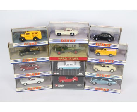
Corgi - Dinky - Matchbox - 12 x boxed cars in 1:43 scale including Ford Zodiac MkII # 01601, Ford Mustang # DY-16B, Bentley Continental R Type # DY-13 and other similar models. All the vehicles appear Mint in Good to Very Good boxes, the screw that should hold the Zodiac in its box is missing. (This does not constitute a guarantee) (12)
Lot 135
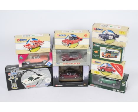
Corgi - Solido - 10 x boxed models in 1:43 scale including James Bond Anniversary Lotus Esprit & Jaws figure # 65001, Inspector Morse The Remorseful Day Jaguar MkII # 01806, Pensacola Chevrolet Fire Chief car # 97397 and other similar models. All the models appear Mint in Good to Very Good boxes with accessories and certificates where required. (This does not constitute a guarantee) (10)
Lot 138
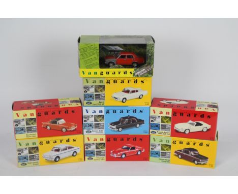
Corgi Vanguards - 8 x boxed cars in 1:43 scale including Hidden Treasures Morris Marina # VA06304, Singer Chamois Coupe # VA40003, Ford Consul Capri GT # VA03405 and other similar models. The cars all appear Mint with mirrors and certificates where required. (This does not constitute a guarantee) (8)
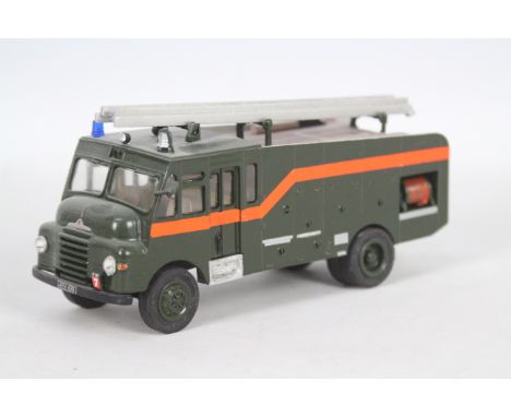
Lot 146
Fire Brigade Models - A kit built resin and white metal Bedford Green Goddess in 1:48 scale # FBM77. The model is dusty from display and would benefit from cleaning, the driver side mirror has broken off and is missing, the condition is otherwise Very Good. It is 15 cm long. (This does not constitute a guarantee)
Lot 168
Fire Brigade Models - A white metal Scania Metz 100 Foot Turntable Ladder in Lothian And Borders Fire Brigade livery in 1:48 scale. The model has been out on display so requres some cleaning and minor repairs, one support leg has come unstuck but is undamaged, the mirrors and one windscreen wiper are missing. It appears in Fair to Good condition. (This does not constitute a guarantee)
Lot 170
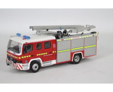
Fire Brigade Models - A white metal and resin Mercedes Fire Engine in South Yorkshire Fire And Rescue livery in 1:50 scale. The model has been out on display so would benefit from cleaning and some minor repairs, one mirror is loose and one windscreen wiper is missing. It appears in Good overall condition. (This does not constitute a guarantee)
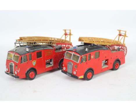
Lot 171
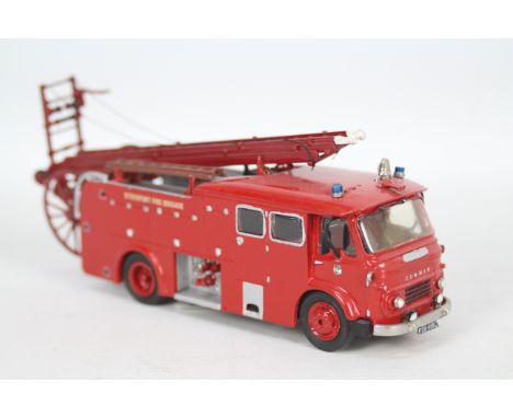
Fire Brigade Models - A resin and white metal Commer Pump Escape in Stockport Fire Brigade livery in 1:48 scale. #FBM76E. The model has been on display so requires cleaning and some repairs, a bell is missing from the roof and the ladders are loose. It appears otherwise in Good condition. (This does not constitute a guarantee)
Lot 181
Matchbox - Vanguards - Atlas - Vitesse - EFE - 18 x boxed models mostly in 1:43 scale including limited edition Ford Cortina Mk3 in Sapphire Blue number 3986 of 5010 produced # VA10300, Hanomag SdKfz 251/1 halftrack # 6690007, Leyland PS1 in Birch Brothers livery # 97838 and others. The boxes range from Poor with tape repairs to Mint. They have accessories and certificates where appropriate. (This does not constitute a guarantee)
Lot 188
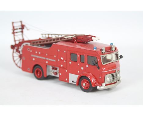
Fire Brigade Models - A resin and white metal Commer Pump Escape in 1:48 scale in Buckinghamshire Fire Brigade livery. # FBM79. The model has been on display so would benefit from cleaning and some minor repairs, the ladders are loose. It appears in Good overall condition. (This does not constitute a guarantee)
Lot 189
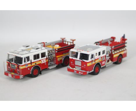
Code 3 Collectibles - 2 x unboxed Seagrave 1000 gpm Pumper models in FDNY livery in 1:76 scale, Engine number 305 is one of only 1500 produced # 12837. Engine number 58 is a Collectors Club model which is one of only 2004 # 12836. Engine 58 has lost a windscreen wiper, they appear otherwise Mint but have no original packaging or paperwork. (This does not constitute a guarantee) (2)
Lot 192
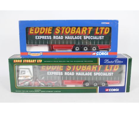
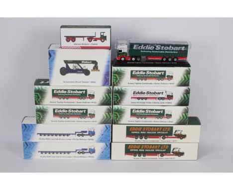
Corgi - Two boxed 1:50 scale diecast models from Corgi in 'Eddie Stobart Ltd.' liveries. Lot comprises of CC12901 Limited Edition Scania Topline Curtainside (with mirrors and Certificate); together with CC19904 'Hauliers of Renown' Curtainside Trailer. Both items appear Mint, housed in Good - Very Good window boxes with some general wear. (2) (This does not constitute a guarantee)
Lot 196
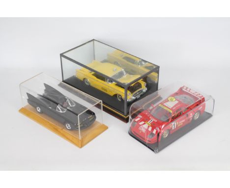
Johnny Lightning, Mira, Bburago - Three unboxed 1:18 scale diecast models. Lot consists of Johnny Lightning 'Batmobile'; Bburago Ferrari F40; and Mira Buick Century Yellow Cab. Models appear to be in Very Good condition overall, housed in perspex and glass display cases which appear Fair Plus - Good overall with a crack in Yellow Cab case, plus general surface display related wear. Models unchecked for completeness. (3) (This does not constitute a guarantee)
Lot 197
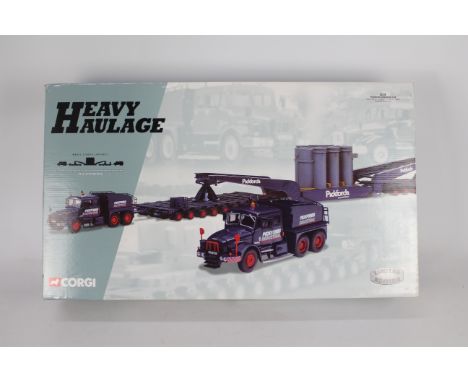
Corgi Heavy Haulage - A boxed Corgi Heavy Haulage Limited Edition 1:50 scale #18005 'Pickfords International Ltd.' Scammell Contractor x2, Nicolas Trailer, Bogies & Generator. The set appears to be in Near Mint slightly dusty condition with a small piece missing on the generator, and comes with certificate which numbers the set 1371 of 400. The set in housed within Mint inner polystyrene inner and is presented within a Good slightly dusty lift off lid box with storage related wear. (This does not constitute a guarantee)
Lot 198
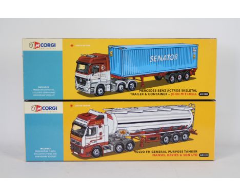
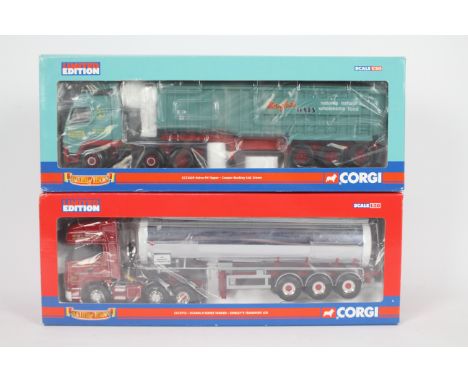
Corgi - Two boxed 1:50 scale '50th Anniversary' Corgi diecast trucks. Lot consists of Corgi AN14001 Volvo FH General Purpose Tanker 'Mansel Davies & Son Ltd.'; with AN13805 Mercedes Benz Actros Skeletal Trailer & Container 'John Mitchell'. Both models appear to be in Mint condition both with mirrors plus certificate and plinths in Good - Very Good boxes with some storage related scuffs and general wear. (2) (This does not constitute a guarantee)
Lot 199
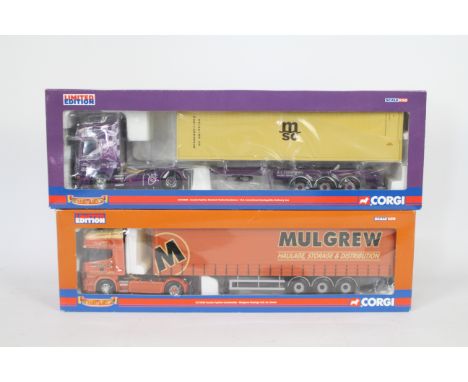
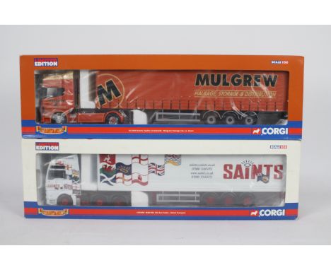
Corgi - A pair of boxed 1:50 scale Limited Edition diecast trucks from the Corgi 'Hauliers of Renown' range. Lot consists of Corgi CC12930 Scania Topline Skeletal Trailer / Container 'RS Carmichael Haulage / No Ordinary Joe (joey Dunlop); with CC12926 Scania Topline Curtainside 'Mulgrew Haulage Ltd.' Both models appear to be in Mint condition both with mirrors plus certificate / collectors card in Good Plus - Excellent boxes with some storage related scuffs and general wear. (2) (This does not constitute a guarantee)
Lot 200
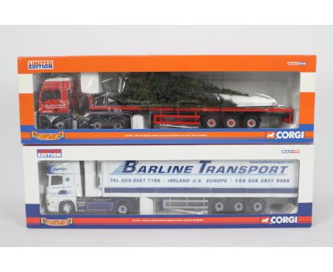
Corgi - Two boxed 1:50 scale Limited Edition diecast trucks from the Corgi 'Hauliers of Renown' range. Lot consists of Corgi CC13422 ERF ECT Olympic Flatbed Trailer & Christmas Tree Load 'Beck & Politzer'; together with CC13720 Scania R Series Topline Fridge Trailer 'Barline Transport'. Both models appear to be in Mint condition both with mirrors plus certificate / collectors card in Good - Excellent boxes with some storage related scuffing and general wear. (2) (This does not constitute a guarantee)
Lot 201
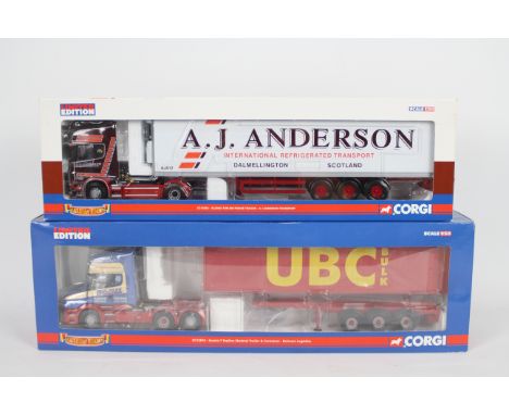
Corgi - A pair of boxed 1:50 scale Limited Edition diecast trucks from the Corgi 'Hauliers of Renown' range. Lot consists of CC12934 Scania Topline Fridge Trailer 'AJ Anderson Transport' plus CC12816 Scania T Topline Skeletal Trailer & Container 'Bulmers Logistics'. Both models appear to be in Mint condition both with mirrors plus certificate / collectors card in Good - Very Good boxes with some storage related imperfections. (2) (This does not constitute a guarantee)
Lot 202
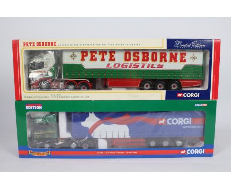
Corgi - Two boxed 1:50 scale Limited Edition diecast trucks from Corgi. Lot consists of CC13709 'Hauliers of Renown' Scania R Series Curtainside 'CS Ellis / Corgi'; together with CC12209 Scania Curtainside 'Pete Osborne logistics Ltd.' Both models appear to be in Mint condition both with mirrors plus certificate / collectors card in Good - Very Good boxes with some storage related wear. (2) (This does not constitute a guarantee)
Lot 203
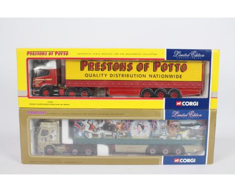
Corgi - A pair of boxed 1:50 scale Limited Edition diecast trucks from Corgi. Lot consists of #76404 Scania Curtainside 'Prestons of Potto; with CC12104 Renault Premium Curtainside 'Strongserve Ltd.' Both models appear to be in Mint condition both with mirrors plus certificate / collectors card in Good Plus - Excellent boxes with some storage related scuffs and general wear. (2) (This does not constitute a guarantee)
Lot 204
Corgi - Two boxed 1:50 scale Limited Edition diecast trucks from the Corgi 'Hauliers of Renown' range. Lot consists of Corgi CC12926 Scania Topline Curtainside 'Mulgrew Haulage Ltd.'; plus CC13406 MANTGA XXL Box Trailer 'Saints Transport'. Both models appear to be in Mint condition both with mirrors plus certificate / collectors card in Good - Very Good boxes with some storage related wear. (2) (This does not constitute a guarantee)
Lot 205
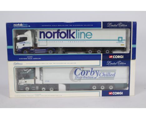
Corgi - Two boxed 1:50 scale Limited Edition diecast trucks from Corgi. Lot consists of Corgi CC12216 Scania Fridge Trailer 'Corby Chilled Distribution Ltd.'; together with CC12204 Scania Fridge Trailer 'Norfolkline';. Both models appear to be in Mint condition both with mirrors plus certificate / collectors card in Good - Very Good boxes with some storage related wear. (2) (This does not constitute a guarantee)
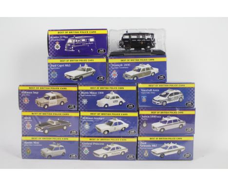
Lot 206
Atlas Editions - 12 boxed diecast 1:43 scale Police vehicles from Atlas Editions 'Best of British Police Cars' series. Lot includes Ford Granda MkI 'Avon & Somerset'; Vauxhall Astra 'Thames Valley police'; Ford Capri Mk3 'Sussex Police' and similar. Models are presumed to be in Mint condition, being housed in Excellent - Mint factory sealed boxes. (This does not constitute a guarantee)
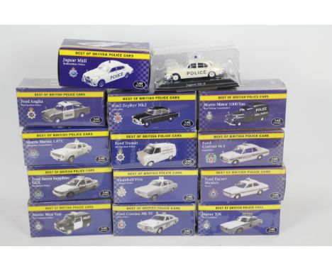
Lot 207
Atlas Editions - 13 boxed diecast 1:43 scale Police vehicles from Atlas Editions 'Best of British Police Cars' series. Lot includes Ford Transit 'Metropolitan Police'; Jaguar XJ6 'West Yorkshire'; Ford Cortina Mk.II 'Hampshire' and similar. Models are presumed to be in Mint condition, being housed in Excellent - Mint factory sealed boxes. (This does not constitute a guarantee)
Lot 209
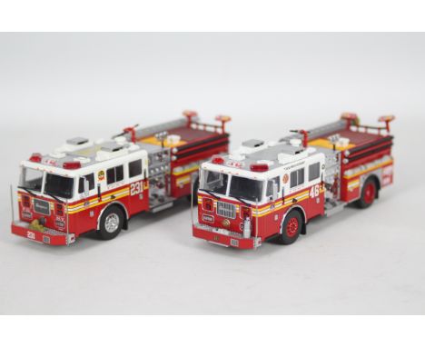
Code 3 Collectibles - 2 x unboxed limited edition Seagrave Fire Pumpers in FDNY livery in 1:76 scale, Engine number 46 is one of only 3000 produced # 12833 and Engine number 231 is one of only 3000 produced. # 12835. They both appear in Mint condition, they do not have their original packaging or paperwork. (This does not constitute a guarantee) (2)
Lot 211
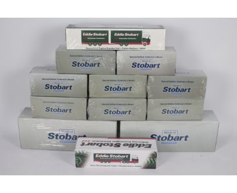
Atlas Editions - 12 boxed diecast 1:76 scale model vehicles predominately from Atlas Editions 'World of Eddie Stobart' series. Lot includes Atlas Edition #4664107 Class 66/69 Locomotive 'Eddie the Engine'; #4664124 14.7 ton Volvo EC14DL Excavator; #4649133 Volvo FH Curtainside and similar. Models are presumed to be in Mint condition, being housed in Excellent - Mint factory sealed boxes. (This does not constitute a guarantee)
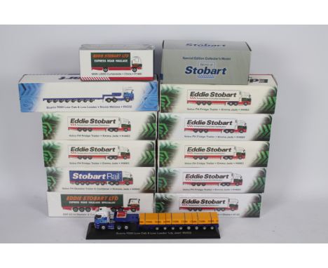
Lot 212
Atlas Editions - A fleet of 14 predominately boxed diecast 1:76 scale model vehicles from various Atlas Editions 'Eddie Stobart' themed series. Lot includes Atlas Editions #4649131 ERF EC14 Olympic & Curtainside Trailer 'Ann Eileen'; #4649134 Scania Topline Refrigerated Trailer 'Shona'; #4649138 Volvo FH Skeletal Trailer & Container 'Victoria Jade' and similar. Five of the models are presumed to be in Mint condition, being housed in Excellent - Mint factory sealed boxes. Opened boxed models appear Mint with mirrors in Good - Very Good boxes with general storage imperfections. (This does not constitute a guarantee)
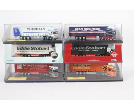
Lot 216
Oxford Diecast - Six boxed 1:76 scale Limited Edition diecast model trucks. Lot includes Oxford Diecast SCA02CS Scania Curtainside 'Pollock (Scotrans) Ltd.'; #SCA06FR Scania Fridge Trailer 'Eddie Stobart'; #SCA05CS Scania Curtainside 'Mulgrew' and similar. Models appear Mint with certificates housed in a couple Fair perspex case with cracks to sides / tops - Good - Very Good perspex cases with some surface marks contained with Good - Very Good outer sleeves with some storage related wear. (6) (This does not constitute a guarantee)
Lot 219
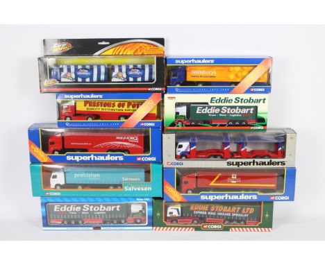
Corgi -Ten boxed 1:64 and 1;76 scale diecast model trucks from Corgi. Lot includes Corgi 'Superhaulers' #TY86617 Scania Curtainside 'Prestons of Potto';TY86616 Scania 'Sainsbury's Truck; Corgi CP18110 Scania R Curtainside 'Eddie Stobart Ltd' and similar. Models appear to be in Mint condition, presented within Good - Excellent window boxes with some minor storage related wear. (This does not constitute a guarantee)
Lot 222
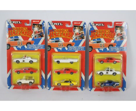
Ertl - Three carded 1:64 scale '#7068 'The Dukes of Hazzard - Hazzard County Hot Pursuit Sets'. The three car sets appear to be in Mint condition sitting in Mint clear blister packs, on Excellent - Near Mint backing cards with some very minor storage related wear. (This does not constitute a guarantee)
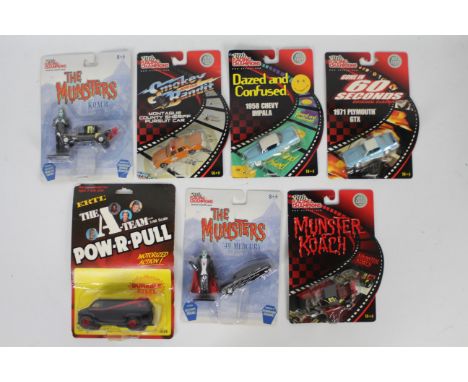
Lot 228
Ertl / Racing Champions - Seven carded diecast TV / Film related models from Ertl / Racing Champions. Lot includes Ertl 1:48 scale 'The A-Team' 'Pow-R-Pull' motorised van; Racing Champions 'The Munsters' '49 Mercury; Racing Champions 'Gone in 60 Seconds' 1971 Plymouth GTX and similar. Models appear Mint in Mint clear bubble packs on Good - Very Good backing cards with some general storage related wear. (This does not constitute a guarantee)
Lot 23
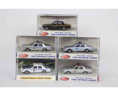
White Rose - 5 x boxed limited edition Chevrolet Caprice American State Trooper Police cars in 1:43 scale in the liveries of Ohio, Maine, South Carolina, New York and Pennsylvania States. The cars all appear Near Mint but there are a couple of aerials missing. The boxes are mostly Good, one has some creasing. (This does not constitute a guarantee) (5)
Lot 231
Atlas Editions - A fleet of 12 boxed diecast 1:76 scale model vehicles from various Atlas Editions 'Eddie Stobart' themed series. Lot includes Atlas Editions #4649101 Volvo FH Fridge Trailer 'Emma Jade'; #4649120 Konecranes Reach Stacker RS02; #4649110 Scania T Curtainside 'Kerry Jane' and similar. Models appear Mint with mirrors in Good - Very Good boxes with general storage imperfections. One model presumed Mint in Factory Sealed packaging. (This does not constitute a guarantee)
Lot 235
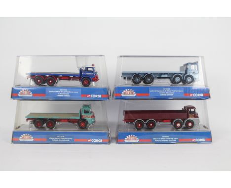
Corgi - Four boxed diecast 1:50 scale trucks from Corgi's 'Marquess of Distinction' series. Lot consists of CC10506 ERF KV 8 Wheel Dropside 'Rileys Transport, Sheffield'; CC11415 Limited Edition Bedford KM 6 Wheel Platform 'J.Beasley Ltd'; CC10308 Limited Edition Leyland Ergomatic 8 Wheel 'Charles Alexander'; and CC11610 Albion Reiver 'Pollock, Musselburgh'. Models appear Mint in Very Good - Excellent bubble packs with some general surface wear. (4) (This does not constitute a guarantee)
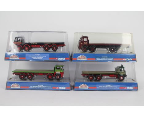
Lot 236
Corgi - Four boxed diecast 1:50 scale trucks from Corgi's 'Marquess of Distinction' series. Lot consists of CC10604 Limited Edition Leyland Octopus 'Gibbs of Fraserburgh'; CC10806 Foden S21 6 Wheel 'Richard, Johnson & Nephew Ltd, Ambergate Derbys'; CC11704 Guy Invincible 'Frederick Ray Ltd, Leighton Buzzard'; and CC10603 Leyland Octopus 'Edward Derbyshire, Liverpool'. Models appear Mint in Very Good - Excellent bubble packs with some general surface wear. (4) (This does not constitute a guarantee)
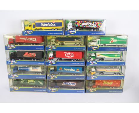
Lot 237
Corgi - An armada of 14 boxed 1:64 scale diecast model trucks from Corgi. Lot includes Corgi #913141 Volvo Tanker 'BP'; #91320 Scammell Container 'Weetabix'; #91310 Volvo Container 'Hula Hoops' and similar. Models appear to be in mostly Mint condition - a couple show dusty signs of display, presented within Fair Plus window boxes with cracks in cellophane to some plus general storage related wear. (This does not constitute a guarantee)
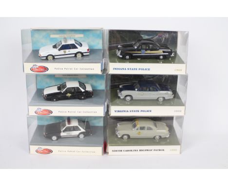
Lot 24
White Rose - 6 x boxed limited edition American Police cars in 1:43 scale, three Ford Mustangs and three 1949 Ford Tudor sedans in Texas, Oklahoma, Colorado, Virginia, Indiana and South Carolina liveries. They appear in Near Mint condition, there are a couple of aerials missing. The boxes are in Good overall condition. (This does not constitute a guarantee) (6)
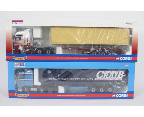
Lot 243
Corgi - A pair of boxed 1:50 scale Limited Edition diecast trucks from the Corgi 'Hauliers of Renown' range. Lot consists of CC13416 MAN TGA XXL Skeletal Trailer & Container 'Hanbury Davies Ltd.'; together with CC13228 DAF XF Space Cab Curtainside 'ARR Craib Transport Ltd.' Both models appear to be in Mint condition both with mirrors plus certificate / collectors card in Good Plus - Excellent boxes with some storage related scuffs and general wear. (2) (This does not constitute a guarantee)
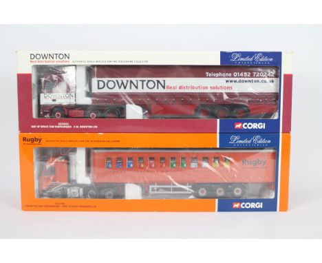
Lot 244
Corgi - Two boxed 1:50 scale Limited Edition diecast trucks from Corgi. Lot consists of CC13211 DAF XF Space Cab Curtainside 'CM Downton Ltd.'; plus CC 13503 Volvo FM Low Curtainside 'RMC Packed Products Ltd.' Both models appear to be in Mint condition both with mirrors plus certificate / collectors card in Good - Very Good boxes with some storage related wear. (2) (This does not constitute a guarantee)
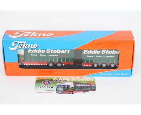
Lot 245
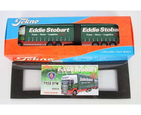
Tekno - A boxed Limited Edition 1:50 scale Tekno #9932 Scania R-series Topline Combi Curtainsider in 'Eddie Stobart' livery. The model appears to be in Mint condition and is number 37 of 500 produced, and comes with mirrors plus certificate and is housed in a Near Mint box with some slight storage wear. (This does not constitute a guarantee)
Lot 246
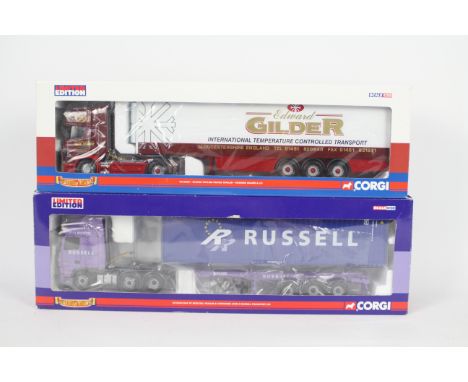
Corgi - Two boxed 1:50 scale Limited Edition diecast trucks from the Corgi 'Hauliers of Renown' range. Lot consists of CC 13234 DAF XF Skeletal Trailer & Container 'John G Russell Transport Ltd'; together with CC 12933 Scania Topline Fridge Trailer 'Edward Gilder & Co'. Both models appear to be in Mint condition both with mirrors plus certificate / collectors card in generally Good - Good Plus boxes with some storage related scuffs and general wear. (2) (This does not constitute a guarantee)
Lot 247
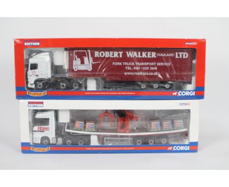
Corgi - A pair of boxed 1:50 scale Limited Edition diecast trucks from the Corgi 'Hauliers of Renown' range. Lot consists of CC13226 DAF XF Space Cab Step Frame Curtainside 'Robert Walker (Haulage) Ltd.'; plus CC13804 Mercedes Benz Actros Crane Trailer & Brick Load 'A.Howe & Sons Ltd.' Both models appear to be in Mint condition - however there is severe warping to the Mercedes Benz trailer attributed to a manufacturing fault. Both models have mirrors plus certificate / collectors card in generally Good - Good Plus boxes with some storage related scuffs and general wear. (2) (This does not constitute a guarantee)
Lot 248
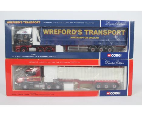
Corgi - Two boxed 1:50 scale Limited Edition diecast trucks from Corgi. Lot consists of CC13216 DAF XF Space Cab Curtainside 'SW Wreford & Sons Ltd.' together with CC12808 Scania T Bulk Tipper 'John Toulson (Teesdale) Ltd.' Both models appear to be in Mint condition both with mirrors plus certificate / collectors card in generally Good overall boxes with some storage related scuffs and general wear with some yellowing on inner packaging to one. (2) (This does not constitute a guarantee)
Lot 249
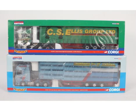
Corgi - Two boxed 1:50 scale Limited Edition diecast trucks from the Corgi 'Hauliers of Renown' range. Lot consists of CC13224 DAF XF Super Space Cab Livestock Transporter 'Longthornes of Hebden'; plus CC13703 Scania R Series High Roof Curtainside 'CS Ellis (Group) Ltd. Both models appear to be in Mint condition both with mirrors plus certificate / collectors card in generally Fair Plus - Good boxes with some storage related scuffs and general wear. (2) (This does not constitute a guarantee)
Lot 25
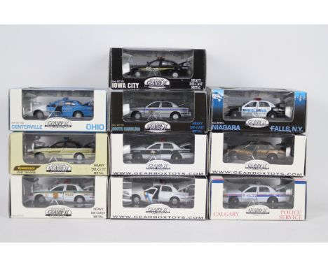
Gearbox - 10 x boxed limited edition American Ford Crown Victoria Police cars in 1:43 scale including Tennesse State Trooper # 27108, Centreville Ohio # 27199, Niagra Falls # 27215 and others. One cars has a spot light missing, they appear otherwise Mint in Good boxes with light storage wear. (This does not constitute a guarantee) (10)
Lot 250
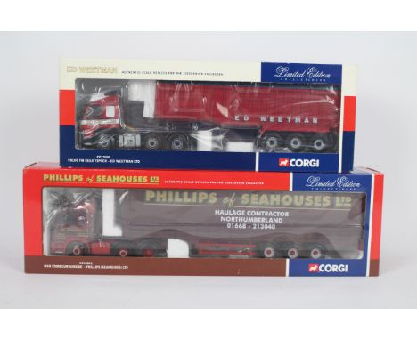
Corgi - Two boxed 1:50 scale Limited Edition diecast trucks from Corgi. Lot consists of CC13505 Volvo FM Bulk Tipper 'Ed Weetman Ltd.'; together with CC12012 MAN F2000 Curtainside 'Phillips (Seahouses) Ltd. Both models appear to be in Mint condition both with mirrors plus certificate / collectors card in generally Good Plus boxes with some storage related wear. (2) (This does not constitute a guarantee)
Lot 251
Tekno - A boxed Limited Edition 1:50 scale Tekno #9932 Scania R-series Topline Combi Curtainsider in 'Eddie Stobart' livery. The model appears to be in Mint condition and is number 40 of 500 produced, and comes with mirrors plus certificate and is housed in a Near Mint box with some slight storage wear. (This does not constitute a guarantee)
Lot 252
Corgi - Two boxed 1:50 scale Limited Edition diecast trucks from the Corgi 'Hauliers of Renown' range. Lot consists of CC13712 Scania R Series Tanker 'Shelley's Transport Ltd.'; together with CC12429 Volvo FH Tipper 'Cooper Buckley Ltd. Crewe'. Both models appear to be in Mint condition both with mirrors plus certificate / collectors card in generally Fair Plus - Good boxes with some storage related scuffs and general wear. (2) (This does not constitute a guarantee)
Lot 253
Atlas Editions - 14 boxed diecast 1:76 scale model vehicles from various Atlas Editions 'Eddie Stobart' series. Lot includes #4649126 Scania R420 'Kimberly Kate'; #4649121 Scania R560 Low Cab & Low Loader 'Nicola Melissa'; #4649122 Scania R440 Highline Skeletal 'Olave St.Clair' and similar. Models are presumed to be in Mint condition, being housed in Very Good - Mint factory sealed boxes. (This does not constitute a guarantee)
Lot 254
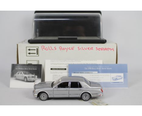
Franklin Mint - A boxed 1:24 scale Rolls Royce Silver Seraph by Franklin Mint. The model appears to be in Mint condition with swing tag attached and comes with Franklin Mint certificate and ephemera. The model sits within Mint polystyrene inner box, contained within Fair Plus outer shipping box with pen annotations and tape marks. The lot also contains an associated Franklin Mint perspex display case, which appears to be in Excellent condition requiring cleaning. (2) (This does not constitute a guarantee)
Lot 255
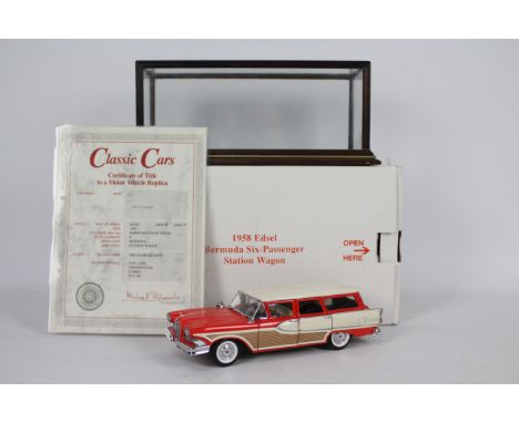
Danbury Mint - A boxed 1:24 scale 1958 Edsel Bermuda six-Passenger Station Wagon by Danbury Mint. The model appears to be in Mint condition and comes with Danbury Mint certificate which has been laminated. The model sits within Mint polystyrene inner box, contained within an Excellent outer shipping box with some small amounts of tape attached. The lot also contains an unassociated glass and wood display case, which appears to be in Excellent condition requiring cleaning. (2) (This does not constitute a guarantee)
Lot 256
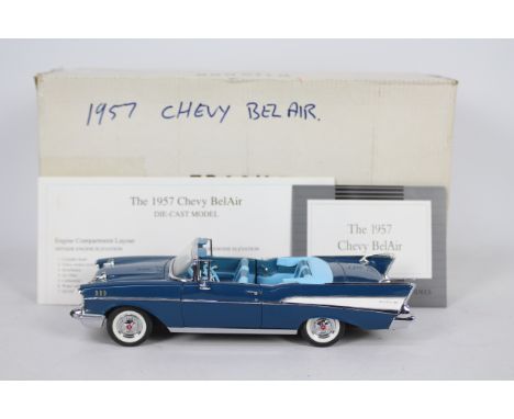
Franklin Mint - A boxed 1:24 scale 1957 Chevy Bel-Air by Franklin Mint. The model appears to be in Excellent condition overall (two rear aerials are bent over probably by packaging - but look as though they could be lifted for display purposes) and comes with Franklin Mint certificate plus ephemera. The model sits within Mint polystyrene inner box, contained within Fair Plus - Good overall outer shipping box with pen annotations, tape marks and storage imperfections. (This does not constitute a guarantee)
Lot 257
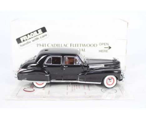
Danbury Mint - A boxed 1:24 scale 1941 Cadillac Fleetwood Series 60 Special by Danbury Mint. The model appears to be in Mint condition and comes with Danbury Mint certificate which has been laminated and folded. The model sits within Mint polystyrene inner box, contained within an Excellent outer shipping box with some small amounts of tape attached plus some general storage wear. (This does not constitute a guarantee)
-
216134 item(s)/page