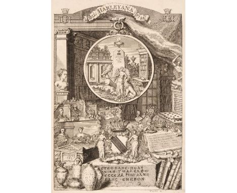

Harley (Edward, 2nd Earl of Oxford). A Catalogue of the Collection of the Right Honourable Edward Earl of Oxford deceas'd: consisting of several capital pictures by the most eminent Italian, French, and Flemish Masters, great variety of Greek and Roman antiquities in urns, edicts, inscriptions, &c. as also of busto's and bronzes; together with several very scarce books of prints and drawings; particularly of the most famous altars, vestments, chalices, &c. by J. Paulo Panini and others; collected by the late Mr. Talman; the King of France's Cabinet complete; the Heads of the most eminent men in Europe in 30 volumes; with divers other valuable curiosities out of the Arundel Collection: which will be sold by auction, by Mr. Cock, at his House in the Great Piazza, Covent-Garden, on Monday the 8th of March, 1741-2, and the five following Days, [London, 1742]. engraved frontispiece by George Vertue, 18pp., annotated in contemporary brown ink with names of the buyers to outer margins, bound with A Catalogue of Greek, Roman and English Coins, Medallions and Medals, of the Right Honourable Edward Earl of Oxford, deceas'd, which will be sold by auction, by Mr. Cock, at his House in the Great Piazza, Covent Garden, on Thursday March the 18th, 1741-2, and the five following days, [London, 1742], 50pp., annotated in contemporary brown ink with names of the buyers to outer margins throughout, 20th century wood engraved bookplate (designed by Reynolds Stone) of the architectural historian John Harris to front pastedown, 18th century half calf over marbled boards, lightly rubbed to extremities, 4toQTY: (1)NOTE:ESTC T30228 and T30132. The second item is considered the most important English numismatic catalogue of the 18th century.Edward Harley (1689?1741), son of Robert, 1st Earl of Oxford and Mortimer, married the only daughter and heir of the 1st Duke of Newcastle upon Tyne, who brought a fortune of half a million pounds. Not surprisingly, he collected on a grand scale so that at his death he was estimated to own 7,639 manuscript volumes, 14,236 original rolls, charters and deeds, 330,000 printed pamphlets, 41,000 prints, over 17,000 books (the finest private library in England at the time), as well as antiquities, coins, medals and pictures. The Harley Manuscripts were sold to the nation in 1753 for £10,000 (a fraction of their contemporary value) under the Act of Parliament that also established the British Museum.
We found 216136 price guide item(s) matching your search
There are 216136 lots that match your search criteria. Subscribe now to get instant access to the full price guide service.
Click here to subscribe- List
- Grid
-
216136 item(s)/page
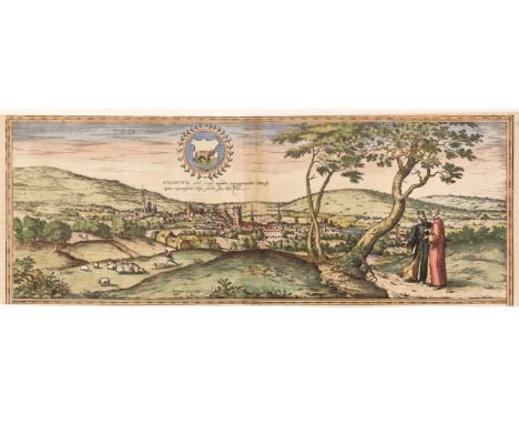
Braun (Georg & Hogenberg Franz). Oxonium nobile Anglie oppidum Septenrionalem..., circa 1575, an engraved panorama of Oxford with contemporary hand-colouring, thread margins along the horizontal borders, slight toning to the central fold, 180 x 485 mm, together with Saxton (Christopher & Hole G.). Buckingham comitatus in quo olim Insederunt Cattieuchlani [1610], uncoloured engraved map, large strapwork cartouche and mileage scale, 275 x 290 mm, with Kitchin (Thomas). Hampshire Drawn from the best Surveys & Maps..., circa 1786, hand-coloured engraved map, 175 x 220 mm, supplied with a page of descriptive text, plus Royce (John). A Plan of the Canals now making from the several Coal Mines in the neighbourhood of Stourbridge and Dudley to the Great Canal from the Trent to the Severn near Stourton in the County of Stafford, Survey'd in 1775 by Robert Whitworth, circa 1776, uncoloured engraved canal map, old folds, repaired tear to the right - hand vertical margin, but not affecting the printed image, 175 x 370 mmQTY: (4)
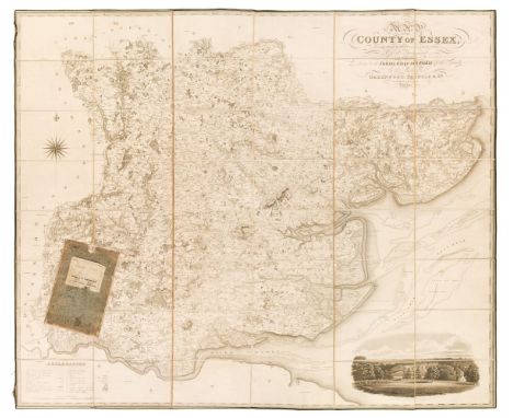
Essex. Greenwood (C & J), Map of the County of Essex, from an actual survey made in the year 1824..., Greenwood, Pringle & Co. July 1st 1825, large scale uncoloured engraved map, sectionalised and laid on linen, calligraphic cartouche, table of explanation, compass rose and a vignette view of Audley End House, edged in green silk with some fraying, some offsetting and spotting, 1330 x 1570 mm, contained in a later slipcase (rubbed) QTY: (1)
![* Derbyshire. Speed (John), Anno Darbieshire described, Thomas Bassett & Richard Chiswell [1676], hand-coloured engraved](https://cdn.globalauctionplatform.com/2c61f7bf-ae43-41de-bb88-b132012566a4/c72980e8-14fd-48dc-b7cb-b13e010b9d3b/468x382.jpg)
* Derbyshire. Speed (John), Anno Darbieshire described, Thomas Bassett & Richard Chiswell [1676], hand-coloured engraved map, inset town plan of Derby and a vignette of St. Anne's Well at Buxton, large strapwork cartouche and compass rose, large margins, 385 x 510 mm, mounted, framed and double-glazed, English text on verso, together with Blaeu (Johannes). Darbiensis Comitatus Vernacule Darbie Shire, Amsterdam circa 1646, engraved map with contemporary outline colouring, large allegorical cartouche and mileage scale, 385 x 505 mm, German text on versoQTY: (2)
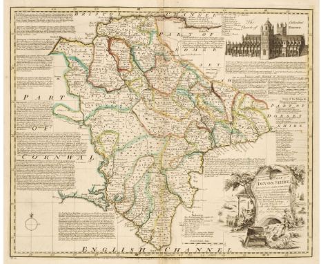
Devon. Bowen (Emanuel). An Accurate Map of Devonshire Divided into its Hundreds..., John Bowles & Son, Messrs. Bakewell & Parker, T. Bowles, H. Overton, T. Kitchin and J. Ryall, circa 1762, engraved map with contemporary outline colouring, originally published in 'The Royal English Atlas', slight creasing to the central fold, slight water staining to the lower margin, 415 x 495 mm, together with Cary (John). A New Map of Devonshire Divided into Hundreds..., 1807, engraved map with contemporary wash colouring, ovoid cartouche, compass rose and mileage scale, very slight staining, 500 x 560 mm, with Greenwood (C. & J.). Map of Devon from an actual Survey made in the years 1825 & 1826..., published Greenwood & Co. 1829, engraved map with bright contemporary wash colouring, inset map of the Isle of Lundy, calligraphic title, uncoloured vignette of Exeter Cathedral, compass rose and table of explanation, 645 x 715 mm, plus Teesdale (Henry). Devonshire, circa 1829, engraved map with bright contemporary wash colouring, table of reference to the hundreds, 355 x 430 mm, and Stockdale (John, publisher). A Map of Devonshire from the Best Authorities, 1805, map engraved by John Cary with contemporary outline colouring, 435 x 480 mm, with Harrison (J.). A Map of Devonshire Engraved from an Actual Survey, 2nd July 1789, uncoloured engraved map, large margins, old folds, some creasing, 340 x 470 mm, QTY: (6)
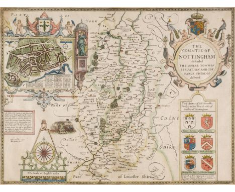
* Nottinghamshire. Speed (John), The Countie of Nottingham described, The Shire Townes Situation and the Earls there of Observed, Thomas Bassett & Richard Chiswell [1676], hand-coloured engraved map, inset town plan of Nottingham, large strapwork cartouche and mileage scale, central fold partially strengthened on verso with very slight toning to the recto, 385 x 510 mm, English text on verso, mounted, framed and double-glazed, together with Huntington both Shire and Shire Towne with the Ancient Citie Ely Described, George Humble [1627], hand-coloured engraved map, inset town plans of Ely and Huntington, central fold a little frayed and creased, strengthened and repaired on verso some creasing, 380 x 505 mm, English text on verso, mounted, framed and double-glazedQTY: (2)
![Devon. Blaeu (Johannes), Devonia vulgo Devon-Shire, [1645 or later], engraved map with contemporary outline colouring, decora](https://cdn.globalauctionplatform.com/2c61f7bf-ae43-41de-bb88-b132012566a4/caa1c414-a253-4313-aee8-b13e010b9db4/468x382.jpg)

Birmingham. Beilby, Knott & Beilby (publishers), To the Right Honourable William Earl of Dartmouth, Viscount Lewisham &c. &c. the Zealous Promoter of the interests of the Town and Liberal Patron of its Public Institutions, This Map of Birmingham engraved from a minute Trigonometrical survey, made in the years 1824 & 1825, is with permission dedicated..., J. Pigott Smith, Surveyor and Engineer, Birmingham, March 25th 1828, uncoloured large engraved map, sectionalised and laid on linen, inset plan of the town of Birmingham in the year 1731, large calligraphic cartouche, compass rose and mileage scale, slight staining and offsetting, edged in green silk which is frayed with some loss, short splits along old folds, 1380 x 1290 mm, marbled endpapers, contained in a contemporary marbled card slipcase, case worn and frayedQTY: (1)NOTE:An uncommon large scale map of Birmingham.


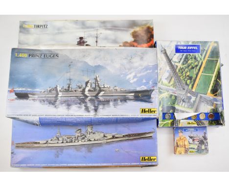


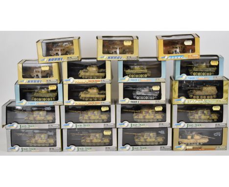
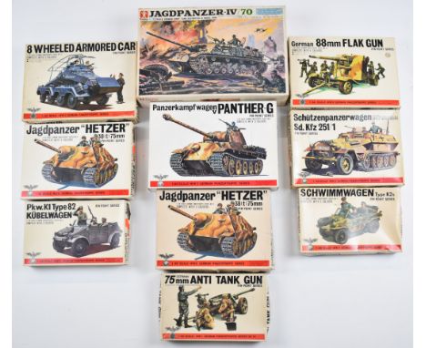
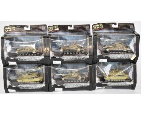
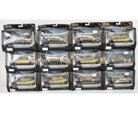
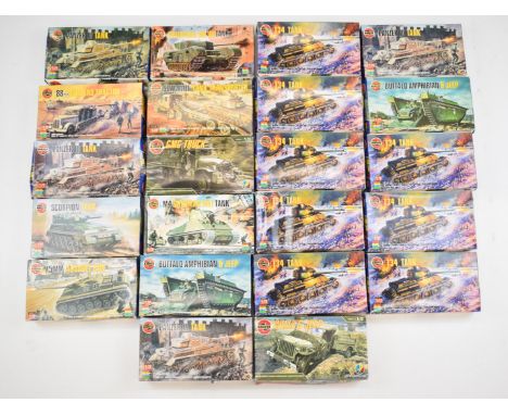
Four Airfix 1:72 and 1:48 scale plastic model aircraft kits comprising The Dam Busters 617 Squadron 60th Anniversary Gift Set 10998, Battle of Britain Memorial Flight 10999, Lockheed Hercules AC 130 H Gunship 09004 and Sepecat Jaguar GR3/ES 10010, in original boxes with contents in sealed bags.


-
216136 item(s)/page