We found 216136 price guide item(s) matching your search
There are 216136 lots that match your search criteria. Subscribe now to get instant access to the full price guide service.
Click here to subscribe- List
- Grid
-
216136 item(s)/page


Lot 114
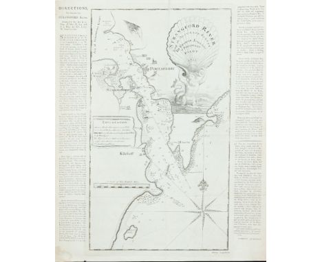
George JohnstonChart of the Entrance to Strangford Lough This is an isolated chart, surveyed and presumably published by George Johnston in 1755. The first state gives no engraver's name, but the second state gives it as John Ridge of Dublin.It shows the entrance to Strangford Lough, with the mainland from Gunn's Island to Castle Ward, and the Ards coast from Millin Bay round Ballyquintin Point to Ballywhite Bay. It gives soundings and anchorages but little inland detail. The title in the top right corner reads Strangford River from an Accurate Survey by George Johnston of Portaferry Pilot 1755, and is depicted on a shell supported by a sea-god. The cartouche is very similar to that of Greenvile Collins' title page for his Great Britains' Coasting Pilot, except that the figure is facing left instead of rig ht. There are three ships alongside this figure, and some houses, castles and churches are illustrated. In the middle left is an Explanation or key to the symbols and depth markings. In the lower left corner is A Scale of Two English Miles 2[= 119 mm.]. There is one compass rose showing north to the top, but no scale of latitude or longitude. The frame consists of two parallel lines. 295 x 525 mm.
Lot 115
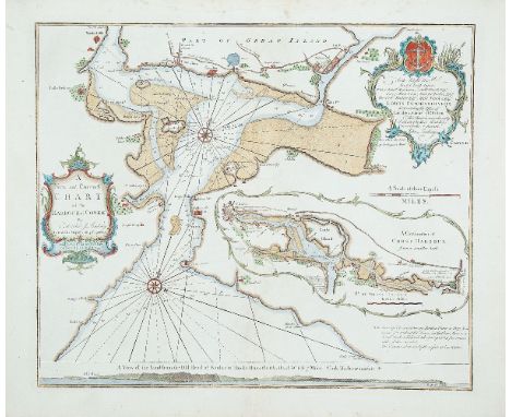
The Rev J LindsayA New and Correct Chart of Cork Harbour A New and Correct Chart of the Harbour of Corke by the Revd. J. Lindsay, Late of His Majesty's Ship Fougueux. Sold by W. & I. Mount, T. & T. Page on Tower Hill, London. 1759. There is an inset (120 x 305mm.) in an irregular scalloped frame showing A Continuation of Corke Harbour from a smaller Scale. The scale of this reads English Miles 3 [= 66mm.].Below the chart is a coastal profile entitled A View of the Land from the Old Head of Kinsale to Hawks Rock, the Old Head W b S 7 Miles. Cork Harbour marked * . 512 x 433mm.
Lot 118
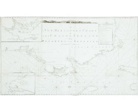
Murdoch Mackenzie XXXII. Chart of the North East Coast of IrelandThis chart was printed in a left and right half, which are separate in the B.L. version but can be mounted together. It has “Pl. 2” printed above the top right and left corners. It is one of the six charts published after Murdoch Mackenzie`s death but based on his surveys (only acknowledged in the second state).The title in the top centre, unframed, reads “A New Mercator`s Chart of the Coast of Ireland from Drogheda to the Skerries. The imprint below the frame reads “London, Published as the Act Directs, Jany. 1st 1800, by D. & E. Steel at the Navigation Warehouse, Little Tower Hill.” North is to the right and there are scales of latitude and longitude west from London along the four borders, There is a key to “References” or symbols framed to the left of the title and one coastal profile in the top centre. There are two insets:- 1. “A Chart of Strangford Loch”., with a “Scale of four English Miles 4” and showing north to the bottom right.2. “A Chart of Carlingford Loch and Dundalk Bay.”, with a “Scale of four English Miles 4”. North is unmarked but at the bottom. 1,310 x 765mm.
Lot 119
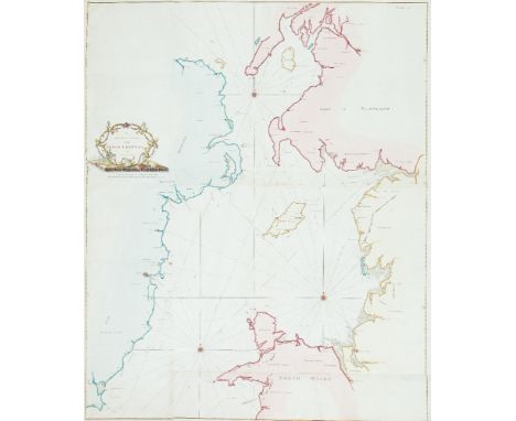
Murdoch Mackenzie Chart of East Ireland and the Irish Sea This is the 6th chart in Vol. II of A Maritime Survey of Ireland, published in London in 1776. It is printed on five sheets joined together and has Chart VI in the top right corner.It shows the east coast of Ireland from Greenore, county Wexford, to Coleraine, county Londonderry, and the west coast of Great Britain from mid-Wales to the Mull of Kintyre. The title is in a rococo frame in the left centre, with ships at the quayside, a globe and books, and the symbols of England, Scotland, Ireland and the Isle of Man (rose, thistle, harp and three legs). It reads A General Chart of the Irish Channel by M. Mackenzie senr.. Below the title cartouche is (unframed) A Scale of 10 Leagues, 20 to a Degree of the Meridian 10 [= 161 mm.]. Between the two is Engrav'd by G Terry, 62, Paternoster Row. and below the chart frame is Published as the Act directs Novr. 26th 1775. There are three compass roses showing north to the top, with magnetic variation dated 1760, and scales of latitude on each side. 955 x 1,165 mm.
Lot 122
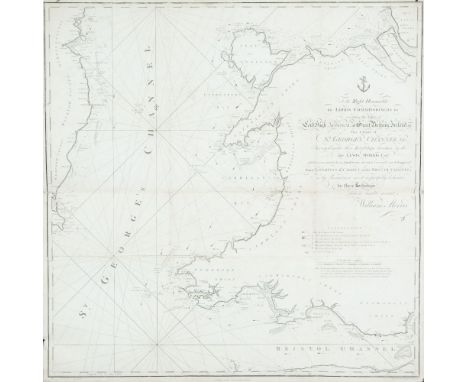
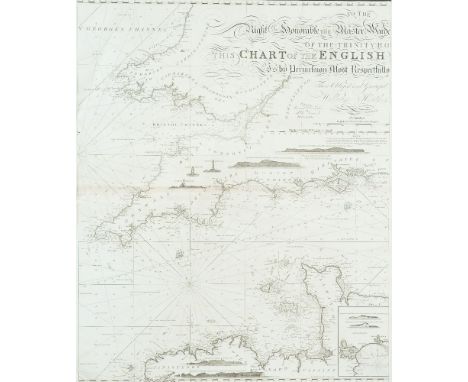
William MorrisChart of St. George's Channel This is a loose chart, considerably modified from Lewis Morris's chart of 1748 covering the same area, which was published in 1800.It shows the Irish coast from Carnsore Point, county Wexford, to Lambay Island, county Dublin, as well as the British coast from north Somerset and Cardiff to Formby, Lancashire. The title in the centre right, unframed, reads To the Right Honourable the Lords Commissioners for executing the Office of Lord High Admiral of Great Britain, Ireland, &c. This Chart of St. George's Channel &c. Surveyed under their Lordships' direction by the late Lewis Morris Esqr. which is now extended by an Actual Survey (the whole Corrected & much Improved) from Liverpool to Cardiff in the Bristol Channel; is by Permission most respectfully dedicated by their Lordships' obedient humble servant William Morris. Below the lower margin is Published 25th Novr. 1800 by Willm. Morris. Engraved by Wm. Simpkins, Clements Inn. Below this is an explanation of symbols and below it, unframed, is A Scale of Leagues 10 [= 147 mm.]. There is one compass rose showing north to the top and there are scales of latitude and longitude (W. from London) along all four borders. 780 x 885mm.
Lot 123
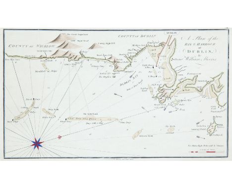
William MorrisChart of Dublin BayThis is the last chart in William Morris's Plans of the Principal Harbours, Bays & Roads in St. George's and the Bristol Channels, which was first published in 1748 by his father, though this chart only appeared in this edition of 1801.It shows the Irish coast from Five Mile Point, county Wicklow, to Lambay Island. The title is unframed in the top right corner and reads A Plan of the Bay and Harbour of Dublin by William Morris and an imprint below the lower border reads Publish'd by W. Morris 25th Novr. 1800. Simpkins fe.. In the lower right corner is A Scale of Miles 4 [= 50 mm.]. There are soundings along the whole coast and round the sandbanks, as well as signs for the currents and lighthouses. One compass rose shows north to the top right. 320 x 187 mm.
Lot 126
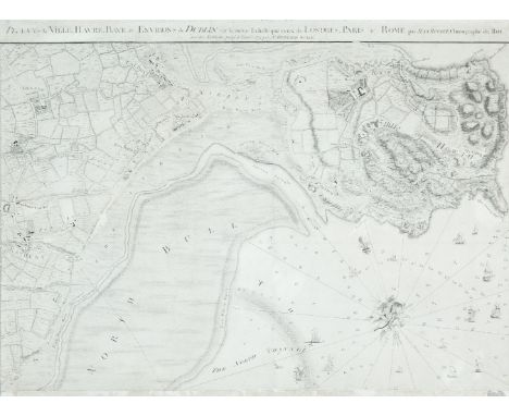
John Rocque (1705-1762)Chart of Dublin Bay and Plan of Dublin and Environs This is on four sheets, the bottom left sheet of which can be regarded as a town-plan of Dublin and the remainder as a map of the surroundings and a chart of Dublin Bay. The town-plan is a later state of No. 2 described in the Introduction, with the addition of river depths and the outer administrative boundary of the city.It shows the coast from Scotchman's Bay, Dalkey, northwards to include all of Howth Head, and inland to the centre of Phoenix Park and Finglas. The title is printed above the top of the two northern sheets and reads A Survey of the City Harbour Bay and Environs of Dublin on the same scale as those of London Paris & Rome By John Rocque Chorographer to his Royal Highness the Prince of Wales. Plan de la Ville, Havre, Baye & Environs de Dublin sur la meme Echelle que ceux de Londres, Paris & Rome par Jean Rocque chorographer du Roi avec des additions jusq a l'année 1773 par Mr Bernard Scalé. In the top left, in an irregular frame with the royal arms, is the dedication To His Royal Highness Prince Edward This Plan is most humbly inscribed by His Most Obedient Humble Servt. John Rocque. Below the left half of the frame are four scales: A Scale of an Irish Mile 320 Perches [= 168 mm.] A Scale of Yards 1000 [= 83 mm.] Echelle de Toises 500 [= 93 mm.] A Scale of an English Mile 320 Perches [= 132 mm.]. Alongside the scales is Published according to Act of Parliament and J.J. Perret Sculpt. Below the right half of the frame is an Explanation of the many symbols of boundaries and types of land use on the map. The bay has an indication of sand-banks and coastline with many soundings and 75 ships extending up the river Liffey. There is a decorative compass indicator of fish, nets and cornucopia showing true and magnetic north to the top left.There are three insets in the top left corner:1. Kildare House (120 x 210 mm.) showing the house and frontage on to Kildare Street, with various types of carriages arriving.2. The Barracks (120 x 208 mm.) with ladies and gentlemen strolling in front.3. The Royal Hospital (105 x 133 mm.) at Kilmainham, viewed from across the river.There is also an inset in the bay (195 x 197 mm.), depicted as if on a sheet, showing Dublin Anno 1610 Dublin comme il etait en 1610. The plan is flanked by two notes The Figures of the surroundings are Dotted thus . to distinguish them from those of the References. this Plan is Copyed from that Taken in 1610 and the Spelling the Same as at that Time. There are 69 numbers and a key for streets and buildings. Four sheets when joined. 1,395 x 1,010 mm. (4) For a full description see Abl Printed maps of Dublin R2. 1-4
Lot 129
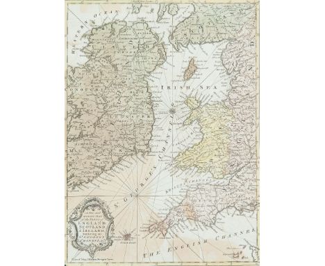
Ralph William Seale 1732-1775 II The Irish Sea This occurs in The Universal Magazine of 1757 (Vol. 21, opposite p. 49.)It shows a similar area to the previous chart except that it omits the west coast of Ireland. There are fewer markings round the coast, but there are again the rhumb lines, without soundings. The title in the lower left corner in an ornate scalloped frame, reads A New and Accurate Map of the Parts of England, Scotland & Ireland, Bordering on St. George`s Channel, &c. Below the frame is Univers. Mag. J. Hinton, Newgate Street and below the right corner of the frame is R.W. Seale del. et sculp. There is no scale of length, but latitude and longitude west from London are marked along all four sides, and there is one compass rose. 265 x 365 mm.
Lot 130
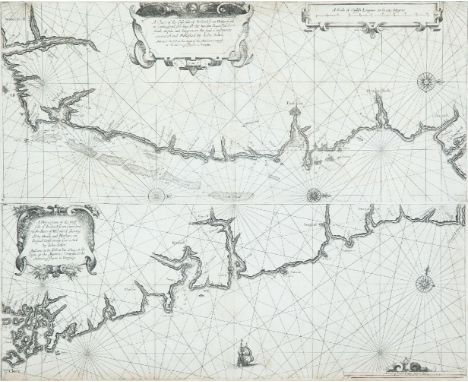
John Seller 1634-1697(i) Chart of the South-East Coast of Ireland (ii) Chart of the South Coast of Ireland These two charts were printed from separate plates (a above b) on one page of The English Pilot, Southern Navigation (1672) and the Atlas Maritimus. The top half can be found on a separate sheet, but when printed together, the lower edge of the upper plate is omitted, reducing the total height by about 15 mm. from the above figures.(i) This shows the coast from south of Waterford to Kilkeel. It is entitled in a cartouche of strap-work in the top-centre A Chart of the East side of Ireland, from Waterford to Carlingford, shewing all the havens, Bayes, harbours, sands, depths and dangers, on the said Coast newly corrected and Published by Iohn Seller. And are to be sold at the Signe of the Mariners Compass at the Hermitage Stayres in Wapping. There are three compass roses showing north to the right, and one ship, but no scale of latitude or longitude. The scale in the top right corner reads A Scale of English leagues 20 in one degree 10 [= 132 mm.]. 545 x 245 mm.(ii) This covers the south coast of Ireland from Cape Clear to Waterford. It is entitled in a cartouche of strap-work and fruit, in the top left corner A Discription of the West side of Ireland from Cape Clere to the River of Waterford, shewing all the Roads and Harbors on the said Coast, newly Corrected by Iohn Seller. And are to be sold at his Shop, at the Signe of the Mariners Compass at the Hermitage stayrs in Wapping. Note that the title mentions the west coast for what is really the south coast. There is one compass rose showing north to the top, and one ship, but no scale of latitude or longitude. The scale in the lower right corner reads A Scale of English Leagues 20 in one degree [10 = 132 mm.]. 545 x 215 mm.
Lot 131
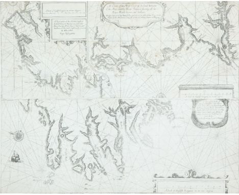
John Seller (1634-1697)(i) Chart of the North-West Coast of Ireland(ii) Chart of the West Coast of Ireland(iii) Chart of the South-West Coast of Ireland The two upper charts are side by side with an irregular border, on one plate. The third chart, on one plate, forms the lower half of the page in The English Pilot, Southern Navigation (1672) and the Atlas Maritimus. As with chart I, part of both plates is omitted to allow them to be printed on the same page.(i) This shows the coast from the Bann mouth to Killala Bay. In the top right corner is A Scale of English Leagues, 20 in one Degree 11 [= 92 mm.]. Below this is the title A Description of the North Coast of Ireland between Banhaven and Cabo Moye, shewing all the Bayes, havens and harbors, on the said Coast newly corrected by Iohn Seller. Both are in double-lined rectangular frames. There are two half compass roses showing north to the left, but no scale of latitude or longitude. 545 x 245 mm.(ii) This chart is separated from the above by a straight and curved border and shows the west coast of Ireland from Killala Bay to the mouth of the Shannon and Limerick. The title is in the top centre of the page in an oval frame and reads A Chart of the West Coast of Ireland, between Cabo Moye and the River Shannon, shewing all the Bayes, Roads, havens and harbors. Newly corrected by Iohn Seller, and are to be sold at his Shop at the Signe of the Mariners Compass at the Hermitage stayres in Wapping. In the lower right corner there is A Scale of English Leagues, 20 in one Degree 13 [= 110 mm.]. There is one half compass rose showing north to the right, but no scale of latitude or longitude. 545 x 245 mm.(iii) This shows the coasts of Kerry and West Cork and is entitled in the top right corner A Chart of the Southwest side of Ireland, from Cape Cleare to the River Shannon, Describeing all the Bayes, havens, Roads and Harbors one [sic] the said Coast laid downe acording to their true Courses and distances, newly corrected and Published by Iohn Seller at the Hermitage stayres in Wapping. In the lower right corner there is A Scale of English Leagues 20 in one Degree 10 [= 132 mm.]. There is one compass rose showing north to the right, and one ship, but no scale of latitude or longitude. 540 x 235 mm.
Lot 134
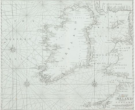
John Seller (1634-1697)Chart of Ireland and the Irish Sea This chart does not appear in the 1690 edition of The English Pilot, Southern Navigation, and is first seen in the 1701 edition. Three different plates were made, each occurring in two distinct states. The chart was replaced in an edition of c. 1769. It also occurs on its own in the Atlas Maritimus Novus or New Sea-Atlas by Mount and Page and in later editions of The English Pilot, Third Book.It shows all Ireland and the Irish Sea, with the British coast from Cornwall to the Mull of Galloway. The Ards peninsula and Island Magee are shown as separated from the mainland. The title (unframed) in the lower right corner reads A Chart of the Coasts of Ireland and Part of England. Below this is a scale of English and French Leagues 20 [= 80 mm.]. There is one compass rose showing north to the top and there are scales of latitude at each side. This edition from 1743. 555 x 445 mm.
Lot 134A
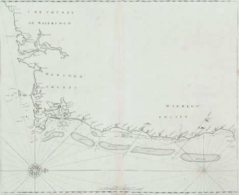
John Seller (1634-1697)Chart of the South-East Coast of Ireland This chart appears first in Seller's The English Pilot, Southern Navigation of 1690, and it was unchanged in editions up to 1715. Later editions used new plates.It shows the coast from Waterford to Dalkey and has no title. The scale in the lower centre reads A Scale of English and French Leagues 20 in a Degre 5 [= 102 mm.]. There is one compass rose, with 16 points, showing north to the right, and there are a scales of latitude at top and bottom. This edition from the first English plate without title or insert. 535 x 440 mm.
Lot 151
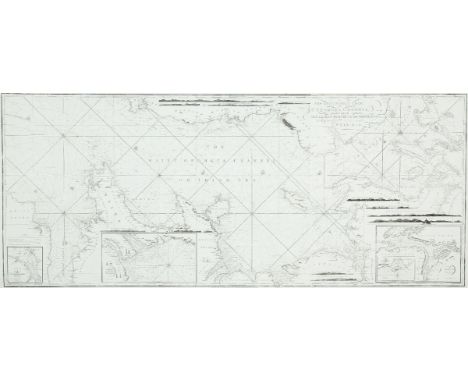
William HeatherChart of the St. George's and English Channels The dedication is unframed in the top centre and reads To the Right Honorable the Master, Wardens and Elder Brethren of the Trinity House this Chart of the English Channel Is most humbly dedicated by their obedient Servant William Heather. This was first produced as a separate chart in 1794 on three sheets which may be joined together. A new edition was printed in 1805.It shows the Irish coast from county Clare to Wexford, the British coast from Barmouth to Yarmouth and Europe from Britany to Haarlem in the Netherlands. There are detailed soundings round the coast and in the open sea, as well as tide and current marks and notes on the sea bottom. Below the frame is the imprint Published as the Act directs, July 12th 1794 by W. Heather, at the Navigation Warehouse, No. 157 Leadenhall Street, London. The navigational route through the English Channel is marked by a hand and two ships on the left sheet and two further ships on the middle sheet. There are scales of latitude and longitude east and west from London on all four sides, as well as three coastal profiles in the top centre. Magnetic variation on the left sheet is dated 1794 and there are four compass arrows showing north to the top as well as four ships. (1,890 x 775 mm.).There are six insets in the right sheet, each with one compass arrow showing north to the top:1. (142 x 345 mm.) entitled Portsmouth, with a Scale of Miles 5 [= 30 mm.].2. (100 x 120 mm.) entitled Sketch of the Situation of The Owner's Light by order of the Trinity House, 1794.3. (235 x 125 mm.) entitled Dartmouth, with a Scale of half a Mile 1/2 [= 45 mm.].4. (175 x 175 mm.) entitled Falmouth, with a scale of One Mile [= 30 mm.].5. (175 x 165 mm.) entitled Plymouth, with a scale of One Mile [= 30 mm.].6. (315 x 192 mm.) entitled Downs and Margate, with a Scale of Miles 3 [= 41 mm].1,890 x 775mm
Lot 152
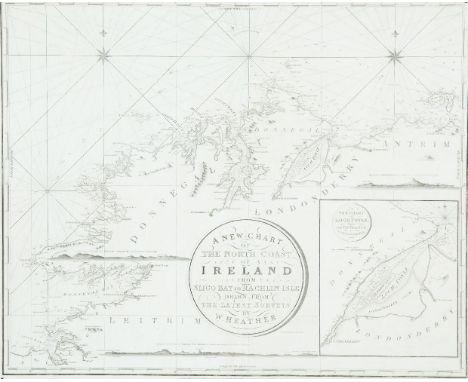
William HeatherChart of the North Coast of Ireland The title is in a circular frame in the centre and reads A New Chart Of The North Coast of Ireland From Sligo Bay to Rachlin Isle Drawn From The Latest Surveys for W. Heather. 1807. Below the title is J. Stephenson Engraver. Below the frame is the imprint London. Published as the Act directs, January 1st 1807, by William Heather, at the Navigation Warehouse, No. 157 Leadenhall Street. This is part of a series of three charts covering the north, west and south coast of Ireland, first produced in 1807. It overlaps chart V to include Sligo town.It shows the coast from Ballycastle and Rathlin Island, county Antrim, to Achris Head, county Sligo. There are scattered coastal profiles, notes on the sea bottom, numerous soundings and tide and current marks. There are also two compass roses showing north to the top and scales of latitude and longitude west from Greenwich, on all four sides. Magnetic variation is dated 1807.In the lower right corner is an inset (265 x 230 mm.) entitled A New Chart of Loch Foyle, being the Entrance to Londonderry with a Scale of Miles 6 [= 70 mm.] and one compass rose showing north to the top. 780 x 645mm.
Lot 157
William Heather IChart of the St. George's and English Channels (1,890 x 775 mm.)This was first produced as a separate chart in 1794 on three sheets which may be joined together. A new edition was printed in 1805.It shows the Irish coast from county Clare to Wexford, the British coast from Barmouth to Yarmouth and Europe from Britany to Haarlem in the Netherlands. The dedication is unframed in the top centre and reads To the Right Honorable the Master, Wardens and Elder Brethren of the Trinity House this Chart of the English Channel Is most humbly dedicated by their obedient Servant William Heather. There are detailed soundings round the coast and in the open sea, as well as tide and current marks and notes on the sea bottom. Below the bottom border is the imprint Published as the Act directs, July 12th 1794 by W. Heather, at the Navigation Warehouse, No. 157 Leadenhall Street, London. The navigational route through the English Channel is marked by a hand and two ships on the left sheet and two further ships on the middle sheet. There are scales of latitude and longitude east and west from London on all four sides, as well as three coastal profiles in the top centre. Magnetic variation on the left sheet is dated 1794 and there are four compass arrows showing north to the top as well as four ships.There are six insets in the right sheet, each with one compass arrow showing north to the top:1. (142 x 345 mm.) entitled Portsmouth, with a Scale of Miles 5 [= 30 mm.].2. (100 x 120 mm.) entitled Sketch of the Situation of The Owner's Light by order of the Trinity House, 1794.3. (235 x 125 mm.) entitled Dartmouth, with a Scale of half a Mile 1/2 [= 45 mm.].4. (175 x 175 mm.) entitled Falmouth, with a scale of One Mile [= 30 mm.].5. (175 x 165 mm.) entitled Plymouth, with a scale of One Mile [= 30 mm.].6. (315 x 192 mm.) entitled Downs and Margate, with a Scale of Miles 3 [= 41 mm]. (3 sheets joined)1,890 x 775mm.
Lot 158
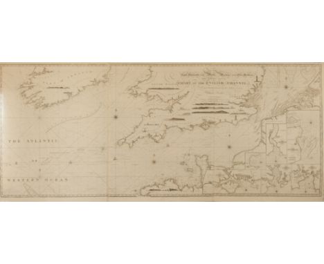
William Heather VIIIChart of the St. George`s and English Channels (1,910 x 790 mm.)There an unframed dedication to the top centre which reads To the Right Honorable the Master, Wardens and Elder Brethren of the Trinity House this Chart of the English Channel Is by Permission Most Respectfully Dedicated by Their Most Obliged and Grateful Servant William Heather. A New Edition 1815. Stephenson sculpsit. Church Street, Bethnal Green. This is another new version of the 1794 chart on three sheets, published in 1815.It shows the Irish coast from the river Shannon to Glasscarrick (that is, slightly less than before), and the Welsh coast from Barmouth as before, but rather more of the coast north of Yarmouth. Again the European coast is shown from Brittany to Haarlem. To the left is Drawn, Revised & Corrected by J.W. Norie, Hydrographer. Below the frame is the imprint London. Published as the Act directs, January 1st 1815 by Norie & Co. at the Navigation Warehouse, No. 157 Leadenhall Street. The navigational route through the English Channel is marked as before and there are scales of latitude and longitude on all sides. There are scattered coastal profiles, but lighthouses are confined to Devon. There are five compass roses with arrows showing north to the top. There are three scales as follows English and French Miles 60 to a Degree 60 miles [= 182 mm.], Duytche en Danish Mylen 15 in een Graadt 15 [= 78 mm.]2 and Swedish Miles 10 to a Degree 10 [= 80 mm.].There are 7 insets, each with a compass rose showing north to the top, as follows:1. (130 x 180 mm.), over Ireland, entitled A New Plan of Cork Harbour, Surveyed by M. Mackenzie, with a Scale of Nautical Miles 5[= 56 mm.].2. (145 x 380), grouped with the other insets in the lower right, entitled A New Chart of Portsmouth by Capt. Mackenzie, with a Scale of Miles 10 [= 70 mm.].3. (135 x 153 mm.), entitled A New Chart of Torbay by Lieut J. Wilson, with an scale of One Mile [= 25 mm.].3 sheets
Lot 160
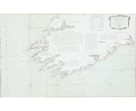
HuddartChart of the South-West Coast of IrelandThis chart was first published in 1780 by Sayer and Bennett on three sheets, and was included in their East India Pilot of 1781. The title is in a classical rectangular frame in the top right corner and reads A Chart of the West and South-West Coast of Ireland from the Mouth of the River Shannon to Waterford Haven on the same Scale as the Chart of St. George's C hannel. By Capt. Jos. Huddart. London. Printed for R. Sayer and I. Bennett, Fleet Street, As the Act directs, August 1st 1780. Below this is an unframed Scale of Nautic Leagues 20 to a Degree 8 [= 156 mm.].1.270 x 785 mm.
Lot 161
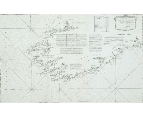
HuddartChart of the South-West Coast of Ireland The title is in a classical rectangular frame in the top right corner and reads A Chart of the West and South-West Coast of Ireland from the Mouth of the River Shannon to Waterford Haven on the same Scale as the Chart of St. George's C hannel. By Capt. Jos. Huddart. London. Printed for R. Sayer and I. Bennett, Fleet Street, As the Act directs, August 1st 1780.1,270 x 785 mm.

Lot 162
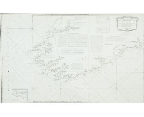
HuddartChart of the South-West Coast of Ireland The title is in a classical rectangular frame in the top right corner and reads A Chart of the West and South-West Coast of Ireland from the Mouth of the River Shannon to Waterford Haven on the same Scale as the Chart of St. George's C hannel. By Capt. Jos. Huddart. London. Printed for R. Sayer and I. Bennett, Fleet Street, As the Act directs, August 1st 1780.1,270 x 785 mm.
Lot 163
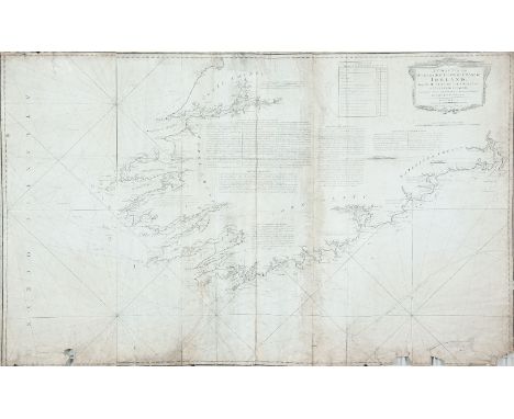
HuddartChart of the South-West Coast of Ireland The title is in a classical rectangular frame in the top right corner and reads A Chart of the West and South-West Coast of Ireland from the Mouth of the River Shannon to Waterford Haven on the same Scale as the Chart of St. George's C hannel. By Capt. Jos. Huddart. London. Printed for R. Sayer and I. Bennett, Fleet Street, As the Act directs, August 1st 1780. 1,270 x 785 mm.
Lot 164
HuddartChart of the South-West Coast of Ireland The title is in a classical rectangular frame in the top right corner and reads A Chart of the West and South-West Coast of Ireland from the Mouth of the River Shannon to Waterford Haven on the same Scale as the Chart of St. George's C hannel. By Capt. Jos. Huddart. London. Printed for R. Sayer and I. Bennett, Fleet Street, As the Act directs, August 1st 1780.1,270 x 785 mm.
Lot 165
HuddartChart of the Shannon EstuaryThe title is in an oval frame in the lower right corner and reads A New and Exact Hydrographical Survey of the River Shannon; from Limerick to the Sea, with all the Banks, Shoals, Rocks, Channels, Soun dings, Anchoring Places, &c. Within the frame also is a Scale of Two Leagues or Six Miles 6 [= 142 mm.] and the imprint London. Printed for Robt. Sayer and John Bennett, Fleet Street, as the Act directs 14 April 1781.Sayer and J. Bennett, No. 53 Fleet Street, as the Act directs 14 April 1781. 1,560 x 725 mm.
Lot 166
HuddartChart of the Shannon Estuary The title is in an oval frame in the lower right corner and reads A New and Exact Hydrographical Survey of the River Shannon; from Limerick to the Sea, with all the Banks, Shoals, Rocks, Channels, Soun dings, Anchoring Places, &c. Within the frame also is a Scale of Two Leagues or Six Miles 6 [= 142 mm.] and the imprint London. Printed for Robt. Sayer and John Bennett, Fleet Street, as the Act directs 14 April 1781.This chart was prepared by Joseph Huddart in 1781 for Sayer and Bennett (Robinson, 1962; B.L. Catalogue), though it is not signed by him. It is printed on three sheets joined side by side. 1,560 x 725 mm.
Lot 170
HuddartChart of the East Coast of Ireland and the Irish SeaThe title is in a scalloped frame with a cannon, flags, nets and an anchor, and reads A New and Original Hydrographical Survey of the North and St. George's Channel Extending from Arran to Caldy Island on the British Coast and from Skerries Port Rush to Bannow on the Irish Coast By Capt. Joseph Huddart London Published 12th May 1794 by Laurie & Whittle No. 53 Fleet Street.This is a reduced version of Huddart's chart of the area which was first published in 1779 by Sayer and Bennett. This version was published in 1794 by Laurie and Whittle on two sheets and was included in their Irish Coasting Pilot (1795). It was enlarged southwards by a small third sheet, to measure 1200 x 665 mm., and this form is the first chart in The North-about Navigator, published by Laurie and Whittle in 1818.It shows the whole Irish coast from Baginbun Head, county Wexford, to Portrush, county Antrim, and the British coast from Caldy Island in Pembrokeshire, to the Mull of Kintyre in Scotland, with detailed soundings round the coast and across the Irish Sea. In the lower right there is a Scale of Nautic Leagues 20 to a Degree 10 [= 120 mm.]. There are also, as in the larger-scale version of the chart, A Table of the Stream of Tide for every 1/2 Hour in the bottom centre, A Table of Time to be added to the end of the Stream in the bottom right corner, an Explanation of symbols in the centre, and a long passage of Remarks on the Chart of St. George's Channel .... Royal Admiral, Mother Bank, 31 March 1778, Joseph Huddart. There are scales of latitude along each side and of longitude, east and west from Dublin, along the upper and lower borders. There are two compass roses showing north to the top, and many coastal profiles on all sides.In the top right corner is an inset (120 x 110 mm.) entitled The Harbour of Lamblash in the Isle of Arran, with a scale of One Mile 3 [= 26 mm.]. (665 x 980 mm.).
Lot 463A
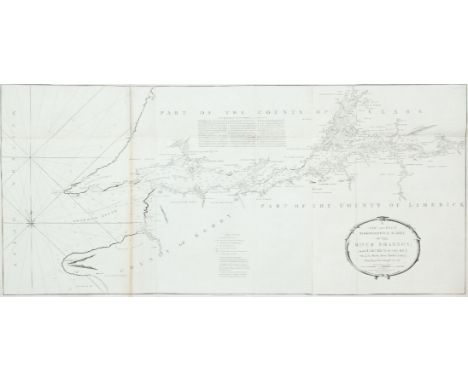
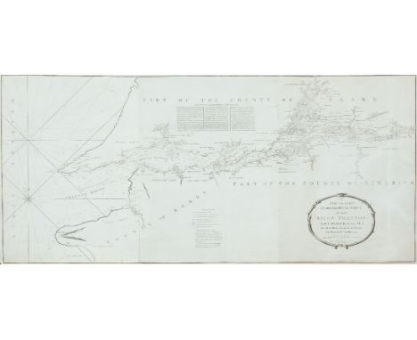
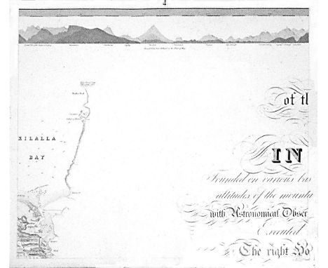
William BaldMayo, Map of the maritime County Mayo in Ireland.Founded on various bases and trigonometrical operations, exhibiting barometrical altitudes of the mountains, the levels and depths of the bogs and lakes; with Astronomical Observations, Physical Sections and Profiles of the Country; Executed by order of the Grand Jury. The Right Honourable Denis Brown M.P. and Member of the Dublin Society, and Royal Irish Academy, foreman; Commenced in 1809, and terminated in 1817, by William Bald F.R.S.E. Member of the Royal Geographical Society Paris, Member of the Geological Society London, Member of the Royal Irish Academy, Honorary Member of the Wernerian Natural History Society Edinburgh. Engraved by Pierre Tardieu, 1830. overall dimensions when joined. 3.11m x 2.57m average sheet size 620 x 510By William Bald, a massively detailed map of Mayo in 25 sections, each varying slightly in size; a little detail here and there of adjacent counties. Large title cartouche. Extensive table of mountain heights. Lake levels; bog levels and depths. Coastal soundings. Plan of trigonometrical base lines. Scale 1 inches to 1 mile. Published by the Mayo Grand Jury. Some edges frayed and some light foxing otherwise in very good condition. William Bald was born in Burntisland in 1789. He was employed as an apprentice under the celebrated Scottish surveyor, engraver and mapmaker, John Ainslie. Bald made a survey of Harris in 1805 when he was only 16, and was later responsible for surveys of ~Benbecula, south Ulst, Eriskey and Argyll, possibly because the tugged nature of the terrain would have been difficult for Ainslie, then in his 60s. These and other of his surveys were later incorporated into Aaron Arrowsmith's map of Scotland. By the time Bald arrived in Mayo in 1809 as county surveyor, he had been described by his teacher and mentor John Ainslie as a very big man... In the words of John Andrews, no ordinary tribute for a twenty-year-old. Bald's first commitment in Mayo was a Grand Jury map of the county. At the same time, he managed to work for the Bogs Commission on their brief for a survey of the bogs of Ireland. Both surveys were to degree of sophistication and meticulousness which far outstripped anything known in Ireland up to that time. His map of Mayo was unique in its scale and scholarship. The base measurement and triangulation were impeccable. Bald spent 18 years on the Mayo survey and engaged Pierre Tardieu in Paris, the foremost engraver of his day, to bring the map to fruition. This was done very slowly and at great expense, finally reaching the light of day in 1830. Bald was a familiar figure in Castlebar, much admired by some, yet disliked by others who through envy of his great expertise, carped at his efforts; or who, unused to the sheer cost of mapping on such a scale, complained at his lavish use of public money. Bald went on to plan surveys of Clare and Down. He even envisaged a general triangulation of Ireland and a new geological map. He still found time to attend to roads and bridges in his adopted county. The coming of the Ordnance Survey spelled the end of the era of the great land surveyors, Bald among them. In later life, he concentrated on roads, bridges, canals and harbours, and eventually railways. He was a principal adviser in the early deliberations of the Ordnance Survey. William Bald loved Mayo, as can be seen from his Map. The profusion of place names, particularly coastal place names, attests to his love of the Mayo landscape, so like his native Scotland. He was one of the ablest, most hard-working and most creative map-makers ever to practise in Ireland. He died in 1857; he is buried in Highgate Cemetery, London. His wife, Anne, pre-deceased him; she is buried in Straide, Co. Mayo.

Lot 77A
Depot de la Marine VII. Chart of the West Coast of Ireland (530 x 765mm)This chart is in the volume of Le Neptune Francois of 1803, covering the British Isles, based on an earlier chart of Captain Joseph Huddart (chart V).It shows the west coast of Ireland from Mullaghmore, county Sligo, to Kerry Head, county Kerry. The title is in an oval frame in the centre right and reads Carte Particuliere de la Cote Ouest d'Irlande depuis Sligo jusqu'a L'Embouchure du Shannon Tiree des Cartes du Cape. Joseph Huddart et Publiee Par Ordre du Contre-Amiral Decres Ministre de la Marine et des Colonies au Depot General de la Marine en l'An XII. Below this is a note on the soundings. In the lower right corner is a scale of Lieues Marines 10 Lieues [= 171 mm.] and beside this is the circular mark of the Depot Gal. de la Marine R.F. and below both, outside the frame, is Prix Deux Francs. There is one compass indicator with an arrow showing north to the top, and scales of latitude on each side.


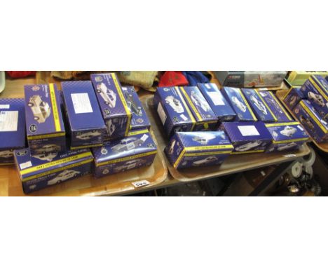
Lot 110
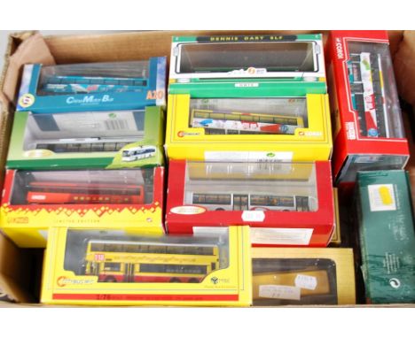
TWO CORGI 1:50 LARGE SCALE LIMITED EDITION MINT AND BOXED MODELS OF SINGLE DECK BUSSES, viz New York - GM Fishbowl Bus and ditto Canadian Coach Lines, ANOTHER OF A GREYHOUND SCENIC CRUISER, pictorial boxes good, two 1:76 scale CORGI CLASSICS MINT AND BOXED LIMITED EDITION OF AMERICAN SINGLE DECK BUSSES, viz P.C.S.T. Seaworld and Greyhound - New York World Fair, pictorial boxes good (5)

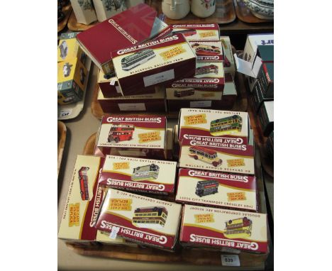
Lot 121
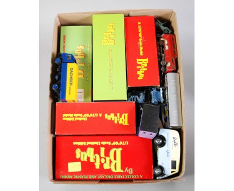
FIVE 'BRITBUS' MINT AND BOXED LIMITED EDITION 1:76 SCALE MODELS OF DOUBLE AND SINGLE DECKER BUSSES, each in hard plastic box with outer card sleeve and limited edition plastic card certificate TOGETHER WITH APPROX 49 MODERN UNBOXED DIE CAST MODELS OF BUSSES AND OTHER VEHICLES, various but including a repainted Dinky Supertoys Pressure Refueller model No. 642, 54 pieces in total (54)


Lot 128
CORGI AVIATION ARCHIVE BOXED 1:72 SCALE MODEL OF AN AVRO LANCASTER R5868/PO-S BOMBER, 467 Squadron (a.f.), a BOXED DIORAMA OF THREE AMERICAN W/WII AIRCRAFT, ACADEMY 1:72 SCALE PLASTIC KIT OF A BOEING B-17F FLYNG FORTRESS, two cast brass models of WWII British aircraft and a SELECTION OF MODERN DIE CAST MODELS OF MILITARY AIRCRAFT, various conditions, approx 24 items (24)

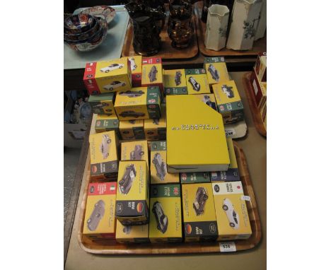
Lot 135
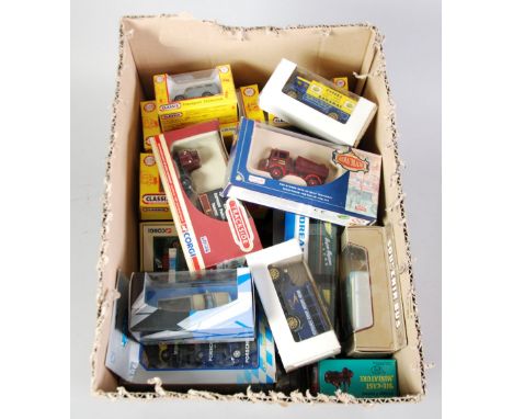
SMALL COLLECTION OF MINT AND BOXED SMALLER SCALE AND OTHER VINTAGE VEHICLES includes; Classix and Trackside 'OO' or 1:76 and similar scale items approx 26 items window boxes, good and approx 15 UNBOXED DIE CAST VEHICLES VARIOUS includes Dinky Routmaster Bus No. 289, approx 31 items in total (31)


-
216136 item(s)/page