We found 186097 price guide item(s) matching your search
There are 186097 lots that match your search criteria. Subscribe now to get instant access to the full price guide service.
Click here to subscribe- List
- Grid
-
186097 item(s)/page

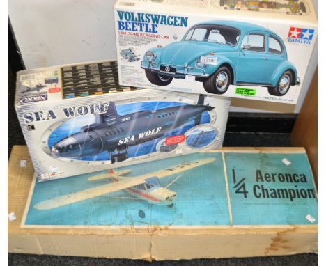
Lot 2131
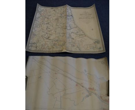
Bell (John Thomas William) Plan of the Hartlepool Coal District in the County of Durham including part of the Wear District in the Same County, being the First of a Series of Plans of the Great Northern Coal Field..., 1843, Castle Eden, large hand coloured map, linen-backed, (wear to lower edge); with four Ordnance Survey maps of Hartlepool, 1/2500 scale c.1859, coloured, rolled sheets (5)
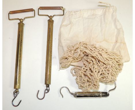
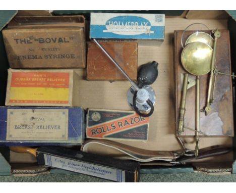
Lot 373
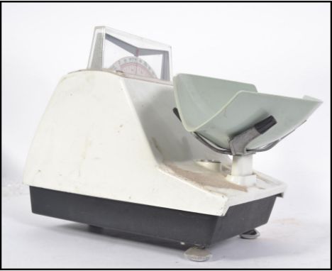
A late 19th/early 20th Century travelling apothecarys scale in mahogany veneered box with brass fittings; a later boxed set of apothecarys weights; two boxed breast relievers; a boxed Holmspray Atomiser; a boxed Rolls Razor; a razor strop; a Boval enema syringe box containing assorted eye droppers, glass tubes etc and other items (a lot)
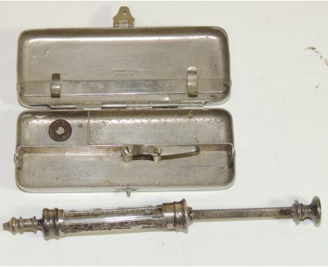
Lot 508
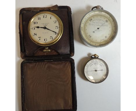
A late 19th Century pocket barometer the silvered metal dial marked "F L West Maker 31 Cockspur St London" in brass case (lacks outer case) 5cms diam; an Airey's Altitude Scale, compensated, with silvered dial and in white metal casing, 7.25cms diam and a Waltham travelling timepiece in leather case (3)

Lot 175
Birmingham. Sherriff (James), A Map of Upwards of 25 Miles round the Town of Birmingham..., published Jas. Sherriff & Wm. Faden, 1798, large engraved map with contemporary outline colouring, sectionalised and laid on linen, decorative uncoloured cartouche and mileage scale, table of explanation and compass rose, slight spotting, 845 x 705 mm Uncommon. (1)
![*Greece. Speed (John), Greece, published Thomas Bassett & Richard Chiswell, [1676], hand coloured engraved map, ornate strapw](https://cdn.globalauctionplatform.com/a21f5fd7-def9-4b2a-95ed-a5f700d54520/812e83aa-3eb7-4a89-dc47-0a836abe8897/468x382.jpg)
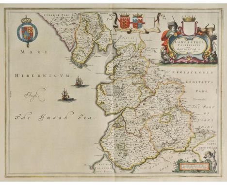
Lot 196
Lancashire. Blaeu (Johannes), Lancastria Palatinatus Anglis Lancaster et Lancas Shire, published Amsterdam, circa 1645, engraved map with contemporary hand colouring, ornate cartouche and mileage scale, 400 x 515 mm, Latin text on verso, together with, Jansson (Jan), Lancastria Palatinatus Anglis Lancaster & Lancasshire, published Amsterdam, circa 1655, engraved map with sparse hand colouring, central fold strengthened on verso, slight mount staining, 380 x 505 mm, French text on verso (2)
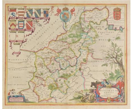
Lot 208
Northamptonshire. Blaeu (Johannes), Comitatus Northantonensis vernacule Northamton Shire, published Amsterdam, circa 1648, hand coloured engraved map, large ornate cartouche and mileage scale, slight spotting, largely confined to margins, 420 x 505 mm, French text on verso, together with, Saxton (Christopher & Kip William), Northamtoniae Comitatus Descriptio in quo Coritani olim Insederunt, [1637], uncoloured engraved map, slight spotting, central fold partially strengthened on verso, 290 x 360 mm, together with another fifty-eight engraved maps of Northamtonshire, including examples by Lewis, Archer, Morden, Kitchin, J & C Walker, Cary, Pigot, Harrison, Duncan, Teesdale, Seller/Grose, Fullarton, Collins, Greenwood and Moule, some duplicates, various sizes and condition (60)
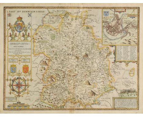
Lot 217
Shropshire. Speed (John), Shropshyre described, The Sittuation of Shrowesbury Shewed with the Armes of thos Earles and other Memorable things observed, published George Humble, circa 1627, hand coloured engraved map, large strapwork cartouche and mileage scale, inset town plan of Shrewsbury, central fold partially strengthened on verso, slight overall toning, 390 x 510 mm, English text on verso (1)
Lot 218
Staffordshire. Blaeu (Johannes), Staffordiensis Comitatus vulgo Stafford Shire, published Amsterdam, circa 1645, engraved map with contemporary hand colouring, ornate cartouche and mileage scale, 415 x 505 mm, Latin text on verso, together with another seven maps of Staffordshire, including examples by Walpoole, Archer, Morden and Saxton/Kip, some duplicates, various sizes and condition (8)
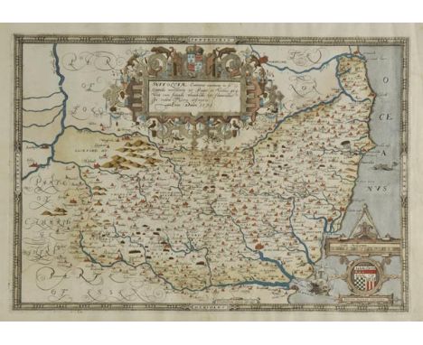
Lot 219
Suffolk. Saxton (Christopher), Suffolciae Comitatus continens in se Oppida Mercatoria 25 Pagos et Villas 464 una cum Singulis Hundredis & Fluminibus in eodem Vera Descriptio, circa 1579, engraved map with early hand colouring, ornate strapwork cartouche and mileage scale, central fold partially strengthened at base, slight creasing in mrgins, 340 x 480 mm With the bunch of grapes watermark. (1)
Lot 224
Warwickshire. Saxton (Christopher & Kip William), Warwici comitatus a Cornauiis olim inhabitus, [1637], uncoloured engraved map, strapwork cartouche and mileage scale, 295 x 350 mm, bound with eleven pages of descriptive text, 20th century cloth boards, slim 4to, together with, Kitchin (Thomas), A New and Accurate Map of Warwickshire drawn from the best Surveys and Intelligence..., published R.Sayer, T. & J. Bowles, circa 1760, engraved map with contemporary outline colouring, sectionalised and laid on linen, slight staining, 670 x 530 mm, contained in contemporary card slipcase with printed label to upper cover, with, Richmond (George, publisher), New Map round Birminham from the Ordnance Survey, circa 1870, large engraved map with contemporary outline colouring, sectionalised and laid on linen, 1040 x 1270 mm, publisher's cloth boards, upper board detached, with another seven maps and part volumes similar, various sizes and condition (10)
-
186097 item(s)/page