We found 186094 price guide item(s) matching your search
There are 186094 lots that match your search criteria. Subscribe now to get instant access to the full price guide service.
Click here to subscribe- List
- Grid
-
186094 item(s)/page


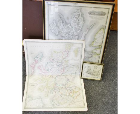
Lot 143
Cartography - 19th century folded map of Scotland with it's islands drawn from the topographical surveys by James Wyld showing the Shetland Islands with the continuation of the Orkney Islands on a reduced scale published by James Wyld geograpger to her majesty Charing Cross East, London; SKYE ISLAND from actual survey viz lord Macdonald's portion by Blackadder Landsur by William Johnson, land surveyor published by John Thomson & Co. Edinburgh 1824, framed; T.Kitchin a map of the Isle of SKY drawn from beft authorities, framed c.1760 (3)


-
186094 item(s)/page