We found 118894 price guide item(s) matching your search
There are 118894 lots that match your search criteria. Subscribe now to get instant access to the full price guide service.
Click here to subscribe- List
- Grid
-
118894 item(s)/page

Lot 2774
Milne, A.A. Now We Are Six, first edition, illustrations by Ernest Shepherd, original cloth gilt, some slight water marks, top edge gilt, 8vo, London: Methuen and Co., 1927; The House at Pooh Corner, first edition, illustrations by Ernest Shepherd, original cloth gilt, some slight water marks, top edge gilt, 8vo, London: Methuen and Co., 1928; and 3 others by the same author, 8vo (5)
Lot 2902
Woolnoth, William. A Graphical Illustration of the Metropolitan Cathedral Church of Canterbury, first edition, LARGE PAPER COPY, additional engraved title, 18 full-page engraved plates, engraved tail-piece, some spotting and off-setting, contemporary calf gilt, boards partially detached, all edges gilt, folio, London: T. Cadell and W. Davies, 1816
Lot 2791
Doves Press. Tidcombe, Marianne. The Doves Press, first edition, plates, original cloth, dust-jacket, 4to, London: The British Library, 2002; Nash, John R. Mr Cobden-Sanderson's Two-handed Engine, one of 350 copies, signed, wrappers, 8vo, London: Nine Elms Press, 1994; Adams, Frederick B. Bookbindings by T.J. Cobden-Sanderson, plates, wrappers, New York: Pierpont Morgan Library, 1969; another copy, 1969 (4)
Lot 3004
Ravenstein, Ernst Georg. The Russians on the Amur, first edition, half-title, 4 tinted lithographed plates, 3 maps, library blindstamps, original cloth, bookplate of Bath Library, 8vo, London: Trubner & Co., 1861; Latham, R.G. Russian and Turk, first edition, original cloth, bookplate of Bath Library, 8vo, London: William H. Allen, 1878; Rambaud, Alfred. The History of Russia, 2 volumes, first edition, original cloth, bookplate of Bath Library, 8vo, London: Sampson Low, 1879; and 18 others, Russia, v.s. (22)
Lot 3014
Stanley, Henry M. In Darkest Africa; or the Quest, Rescue, and Retreat of Emin, Governor of Equatoria, 2 volumes, first edition, engraved frontispieces, 36 plates, 4 coloured maps, 3 folding, some spotting, contemporary half morocco, somewhat worn, 8vo, London: Sampson, Low, Marston, Searle and Rivington, 1890; and 2 others, similar (4)
Lot 2970
Holton, Isaac F. New Granada: Twenty Months in the Andes, first edition, illustrations, lacks general map, library blindstamps, modern cloth, bookplate of Bath Library, 8vo, New York: Harper and Brothers, 1857; Page, Thomas J. La Plata, the American Confederation and Paraguay, first edition, large folding map, hand-coloured, library blindstamps, modern cloth, bookplate of Bath Library, 8vo, New York: Harper and Brothers, 1859; and 12 others, South America, 8vo (14)
Lot 2805
Morris, William. An Address Delivered by William Morris at the Distribution of Prizes to Students of the Birmingham Municipal School of Art on Feb. 21, 1894, first edition, original cloth-backed boards, 8vo, London: Chiswick Press, 1898; Mackail, J.W. The Parting of the Ways, An Address, first edition, original vellum-backed boards, 8vo, London: Chiswick Press, 1903; Morris, William. Love is Enough, first edition, original cloth gilt, 8vo, London: Ellis and White, 1873; and 8 others by Morris, mostly political, 8vo (11)
Lot 2859
Horsfield, Thomas Walker. The History, Antiquities and Topography of the County of Sussex, 2 volumes, first edition, 2 engraved portrait frontispieces, 2 folding engraved maps, 54 engraved plates, tissue guards, a few early leaves to volume one waterstained, somewhat browned and spotted, 4to, Lewes: Sussex Press, 1835
Lot 2888
Shaw, Rev. Stebbing. The History and Antiquities of Staffordshire, volume 1 and volume 2, part 1 (all published), first edition, 82 engraved plates, folding map, folding plan, some repairs, rather spotted, contemporary half calf, worn, boards detached, folio, London: J. Nichols and Son, 1801
Lot 2989
Martin, R. Montgomery. The British Colonies. Their History, Extent, Condition and Resources, volumes 2-12 only, plus supplement, first edition, 36 engraved plates and portraits, 35 double-page engraved maps, hand-coloured in outline, some spotting, library blindstamps, original publisher's cloth gilt, spines chipped, bookplate of Bath Library, 4to, London: London Printing and Publishing Company, [n.d.]
Lot 2965
Hargrove, George. An Account of the Islands of Walcheren and South Beveland, against which the British Expedition proceeded in 1809, first edition, engraved frontispiece, list of subscribers, some browning, title with library blindstamp, contemporary half calf, extremities worn, 4to, Dublin: Gilbert and Hodges, 1812
Lot 2871
Mathews, E.R. Norris. Bristol Bibliography, first edition, original cloth, bookplate of John E. Pritchard, 4to, Bristol: Libraries Committee, 1916; The Dancey Gift. Catalogue of Manuscripts, Books, Pamphlets and Prints relating to the City and County of Gloucester, original calf gilt, 4to, Gloucester: John Jennings, 1911; and 4 others, bibliography, v.s. (6)
Lot 3020
Umarah ibn 'Ali, al-Kahami. Yaman. It's Early Medieval History... with Translation and Notes by Henry Cassels Kay, first edition, library blindstamps, folding map in pocket at end, lacking folding genealogical table, original cloth, soiled, bookplate of Bath Library, 8vo, London: Edward Arnold, 1892
Lot 2816
Vervliet, H.D.L. Sixteenth-Century Printing Types, first edition, cloth, dust-jacket, 4to, Amsterdam: Menno Herztberger, 1968; Simpson, Percy. Proof-Reading in the Sixteenth, Seventeenth and Eighteenth Centuries, cloth, dust-jacket, 4to, Oxford: University Press, 1970; Catalogue of Books Printed in the XVth Century now in the British Museum, Part V Venice, reprint, annotated by R. Briggs, cloth-backed boards, folio, London: BritishMuseum, 1970, and one other (4)
Lot 3080
Vosburgh, Walter S. Cherished Portraits of Thoroughbred Horses from the Collection of William Woodward, first edition, [one of 200 copies only], inscribed 'To H.R. Millar with appreciation of his appreciation of the interest in sporting paintings William Woodward', half-title, 68 photogravured plates, tissue guards, 3 charts, contemporary full morocco by Sangorski and Sutcliffe, top edge gilt, folio, [New York]; Privately Printed [Derrydale Press], 1929
Lot 2860
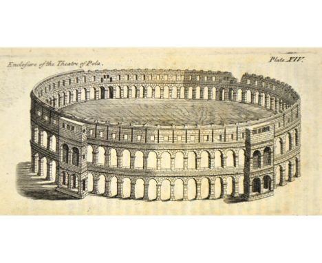
Horsley, John. Britannia Romana: or the Roman Antiquities of Britain, first edition, 21 engraved maps, including 5 double-page, 85 engraved plates, engraved vignette, Ddd and Fff torn without loss, some spotting, contemporary mottled calf, worn, bookplate of Hugo Meynell, folio, London: John Osborn, 1732
Lot 2951
Davis, Nathan. Ruined Cities within Numidian and Carthaginian Territories, first edition, folding engraved map, plates, contemporary calf gilt, 8vo, London: John Murray, 1862; Wordsworth, Christopher. Greece: Pictorial, Descriptive and Historical, new edition, illustrations, contemporary calf, tooled elaborately gilt, 8vo, London: John Murray, 1859; and 4 others, similar (6)
Lot 2834
Brayley, Edward W. and John Britton. A Topographical History of Surrey, 5 volumes, first edition, colour-printed titles, 129 engraved plates and plans, one folding and hand-coloured in outline, wood-engraved illustrations in text, rather spotted, a few leaves shaken, contemporary half calf, spines gilt, 8vo, London and Dorking: Robert Best Ede and Tilt and Bogue, 1841-[1848]
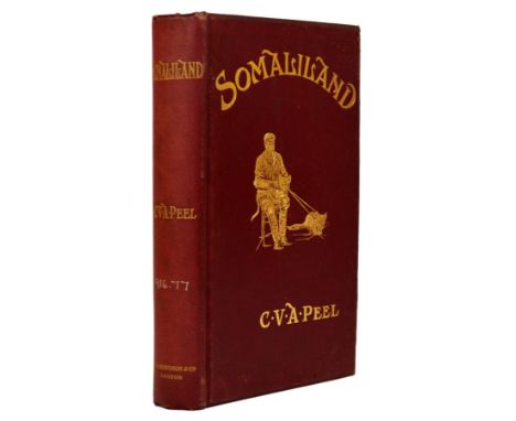
Lot 3002
Peel, Charles Victor Alexander. Somaliland, being An Account of Two Expeditions into the Far Interior, first edition, frontispiece, folding map, illustrations, a few library blindstamps, some spotting, original cloth gilt, top edge gilt, bookplate of Bath Library, 8vo, London: F.E. Robinson & Co., 1900
Lot 3030
Wilkinson, Sir J. Gardner. Dalmatia and Montenegro: with a Journey to Mostar in Herzrgovina, 2 volumes, first edition, 7 tinted lithographed plates, 2 folding, wood-engraved plates, 2 folding tables, folding map, library stamped, modern cloth, bookplate of Bath Library, 8vo, London: John Murray, 1848
Lot 2808
Peterson, William S. The Kelmscott Press, first edition, plates, original cloth, dust-jacket, 4to, Oxford: Clarendon Press, 1991; Sparling, H. Halliday. The Kelmscott Press and William Morris, Master Craftsman, original holland-backed boards, 8vo, London: Macmillan and Co., 1924; William Morris and the Art of the Book, plates, original wrappers, 4to, New York: Pierpont Morgan Library, 1976; Robinson, Duncan. William Morris, Edward Burne-Jones and the Kelmscott Chaucer, plates, original boards, glassine wrapper, London: Gordon Fraser, 1982 (4)
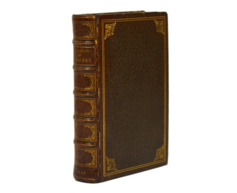
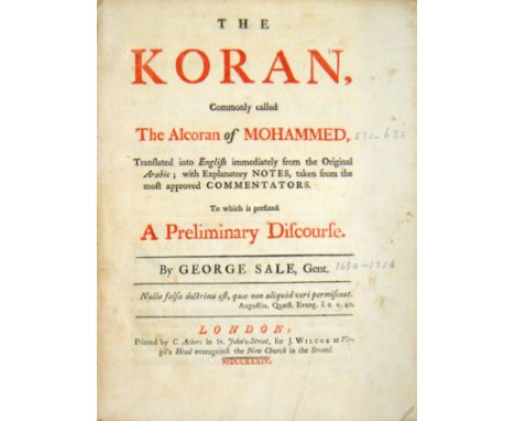
Lot 2979
Koran. The Alcoran of Mahomet, Translated out of the Arabique into French; by the Sieur du Ryer, Lord of Malezair... and Newly Englished, first octavo edition in English, upper margin cropped, occasionally affecting running title, some browning and soiling, modern full brown morocco gilt, top edge gilt, 8vo, London, 1649
Lot 2789
Bohn, Henry G. The Origin and Progress of Printing, first edition, original morocco-backed boards, 8vo, [London: Privately Printed by the Philobiblon Society], 1857; Jacobi, Charles. Some Notes on Books and Printing, fourth edition, original cloth, 8vo, London: Chiswick Press, 1912; Hodson, J.S. An Historical and Practical Guide to Art Illustration, signed by the author, original cloth, 8vo, London: Sampson Low, 1884; and 48 others, books, printers and book design, v.s. (51)
Lot 2799
Moran, James. Printing Presses, first edition, illustrations, original cloth, dust-jacket, 4to, London: Faber and Faber, 1973; Cave, Roderick. The Private Press, first edition, original cloth, dust-jacket, 4to, London: Faber and Faber, 1971; Jackson, Holbrook. The Printing of Books, second edition, cloth, dust-jacket, London: Cassell and Company, 1947; and 27 others, similar, v.s. (29)
Lot 3010
Sanson d'Abbeville, Nicholas. The Present State of Persia: with a Faithful Account of the Manners, Religion, and Government of that People, first edition in English, engraved frontispiece (misbound), 5 engraved plates, one folding, one loose, some spotting and browning, marginal notes on p.142 and p.154 slightly shaved, contemporary calf, rubbed, joints slightly cracked, 12mo, London: M. Gilliflower, 1695
Lot 2974
Japan. Cram, Ralph Adams. Impressions of Japanese Architecture, first edition, plates, original cloth, 8vo, New York: Japan Society, 1930; Eliot, Charles. Japanese Buddhism, first edition, plates, original cloth, 8vo, London: Edward Arnold, 1935; Hearn, Lafcadio. Glimpses of Unfamiliar Japan, 2 volumes, original cloth gilt, 8vo, London: Kegan Paul, 1903; Japan, An Interpretation, original cloth gilt, 8vo, New York, 1904; Out of the East, original cloth, 8vo, London: Kegan Paul, [n.d.]; and 28 others on Japan, v.s. (34)
Lot 2771
Grahame, Kenneth. Pagan Papers, first edition, half-title, title border by Aubrey Beardsley, original cloth, untrimmed, 8vo, London: Elkin Mathews and John Lane, 1894; The Wind in the Willows, second edition, half-title, some soiling and spotting, original cloth gilt, 8vo, London: Methuen & Co., 1908; and 4 others by the same author, 8vo (6)
Lot 2821
Allen, Thomas. History of the Counties of Surrey and Sussex, 2 volumes, first edition, 2 engraved titles, 52 steel-engraved plates, mostly on India-paper, somewhat spotted throughout, contemporary green half morocco, top edge gilt, bookplate of the Duke of Bedford, Woburn Abbey, 1873, 8vo, London: I.T. Hinton, 1829 [1830]
Lot 2840
Collinson, John. The History of Somersetshire, 3 volumes, first edition, half-titles, 40 engraved plates, large folding map backed on linen, EXTRA-ILLUSTRATED with a few additional engraved plates, mounted, some browning, late nineteenth-century calf gilt, two boards detached, all edges gilt, 4to, Bath: R. Cruttwell, 1791
Lot 2858
Hoare, Sir Richard Colt. The Ancient History of North [and South] Wiltshire, 3 parts bound in 2 volumes, first edition, 3 engraved additional titles, 127 engraved plates and maps, a few double-page, engraved vignettes in text, some light spotting, contemporary half calf, rebacked preserving original spines, folio, London: William Millar, 1812-1821
Lot 2994
Monson, William John. Extracts from a Journal, first edition, list of subscribers, 2 engraved plates, title margin repaired, library stamp to reverse of title, modern cloth, bookplate of Bath Library, 8vo, London: Rodwell and Martin, 1820 William John Monson, 6th Baron (1796-1862) records here his tour of Sicily, Malta and Calabria, 1817-1819.
Lot 2986
Madden, Richard Robert. Egypt and Mohammed Ali, Illustrative of the Condition of His Slaves and Subjects, second edition, engraved frontispiece, library blindstamps, original cloth, bookplate of Bath Library, 8vo, London: Hamilton, Adams & Co., 1841; Lamartine, Alphonse de. Travels in the East, including a Journey in the Holy Land, 2 volumes, first edition, half-titles, original cloth gilt, bookplate of Bath Library, 8vo, Edinburgh: William Chambers, 1850; and 5 others on Egypt, 8vo (8)
Lot 2842
Dallaway, James. Antiquities of Bristow in the Middle Centuries; including the Topography by William Wyrcestre, first edition, one of only six copies printed on large paper, half-title, frontispiece and 2 engraved plates, one hand-coloured, extra-illustrated with a further 3 engraved plates, coats of arms coloured by hand, contemporary half morocco, rubbed, bookplate of John E. Pritchard, 4to, Bristol: Mirror Offices, 1834; bound with, William Wyrcestre Redividus, engravings in text, 4to, Bristol: J.M. Gutch, [n.d.]
Lot 2981
La Mottraye, Aubrey de. Travels through Europe, Asia, and into Part of Africa, volumes 1-2 [of 3] only, first edition, 9 engraved plates and maps only, some double-page, library blindstamps, contemporary calf, worn, boards detached, bookplate of Bath Library, folio, London: For the Author, 1723
-
118894 item(s)/page