Simler (Georg) Observationes de arte grammatica. De literis grecis ac diphthongis & quemadmodum ad nos ueniant..., collation: A-G4, H8, K-L4, M8, N-P4, Q8, R-T4, V8, X-Y4, Z8, &4, cum4, rum8; A-Ξ4, AA-BB4, ΓΓ8, ΕΕ6, text in Latin and Greek, initial spaces with guide-letters, errata leaf at end, to verso a woodcut printer's device and colophon framed by an early watercolour, lacking final blank, Tübingen, Thomas Anshelm, March, 1512 bound with Cicero (Marcus Tullius) Epistole Familiares, cum Ascensianis introductiunculis recognitis & auctis, & argumentis illustratis..., edited by Sebastian Munro and with an introduction by Badius Ascencius, collation: A-T4.8, Aa-Tt4.8, initial spaces with guide-letters, lacking Nn1-4, Strasbourg, Matthias Schürer, 1512, together 2 works in 1 vol., ink marginalia in both works in at least three sixteenth- and seventeenth- century hands, stained, some spotting, marginal repairs, a few short tears, lightly browned, new endpapers, contemporary blind-stamped pigskin over wooden boards, metals clasps (with new leather thongs), rebacked, preserving majority of original backstrip in compartments, rather worn, but holding firm, thick 8vo ⁂ Two rare works. The Simler is the first edition of the first grammar of Greek printed in Germany. Simler had been director of the renowned school at Pforzheim, where he introduced the young Phillipp Melanchthon to the study of Greek. The present work is supplemented with two other grammatical writings, again presented to a German audience for the first time: Manutius' De Litteris Graecis ac diphthongis, and the popular Erotemata by the Byzantine philologist Chrysoloras. The Cicero is the first Strasbourg edition, with an introduction by the great scholar-printer Badius Ascencius. Provenance: 'Ego Georgius Sp[?] sum possessor hujus 1621' (ownership inscription to the verso of original front free endpaper); the Scolopian convent at Strážnice (South Moravian Region, Czech Republic; ownership inscription to title of the Simler 'Domus Strasneciensis Pauperum Matris Dei'). Literature: Neither in Adams; I. VD16 S-6497, VD16 M-683, VD16 M-766, VD16 S-6496; K. Steiff, Der erste Buchdruck in Tübingen, 1498-1534, Tübingen 1881, pp. 84-85; II. VD16 C-3030; Ritter no. 488; Chrisman no. A1.6.3; Muller, p. 182, no. 70.

![Aesop. The Fables..., first edition, Imperial Paper issue [one of 500 copies], Variant B with cut of 'Philosopher' and "cando](https://cdn.globalauctionplatform.com/8766109f-1deb-4a16-a9ea-a7e0012ad58f/11c5bb7a-ead9-41cc-fddd-9f1581a1c6c6/468x382.jpg)
![[Apperley (Charles James)], "Nimrod". The Life of a Sportsman, first edition, first issue with 4 mounted plates, hand-coloure](https://cdn.globalauctionplatform.com/8766109f-1deb-4a16-a9ea-a7e0012ad58f/c66e50af-1bf6-4e40-8f3f-6347025410b2/468x382.jpg)
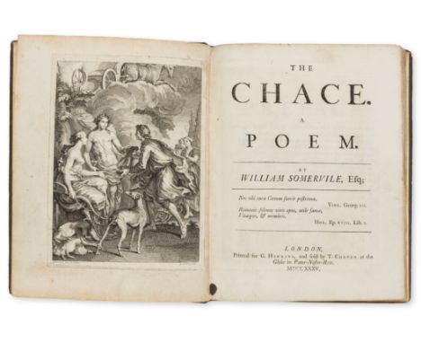
![[Goury de Champgrand (Charles Jean)] Traité de Vénerie et de Chasses, 2 parts in 1 vol., first edition, half-title to each pa](https://cdn.globalauctionplatform.com/8766109f-1deb-4a16-a9ea-a7e0012ad58f/b0373ee1-2d09-4963-958b-b5f0c1052698/468x382.jpg)
![[Apperley (Charles James)], "Nimrod". Hunting Reminiscences, first edition, engraved frontispiece, additional vignette title,](https://cdn.globalauctionplatform.com/8766109f-1deb-4a16-a9ea-a7e0012ad58f/90e9d21d-6206-4267-a0f0-9e39323e3db3/468x382.jpg)
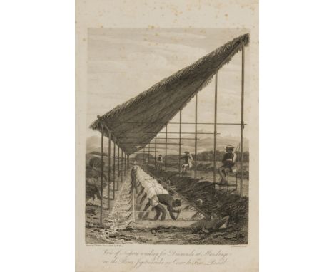
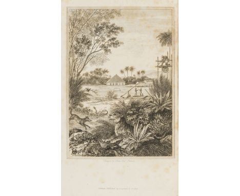
![[Percy (Thomas, editor)] Miscellaneous Pieces Relating to the Chinese, 2 vol., first edition, engraved frontispiece, slightly](https://cdn.globalauctionplatform.com/8766109f-1deb-4a16-a9ea-a7e0012ad58f/602483bb-885a-468a-cac6-d26aeb5d1c34/468x382.jpg)
![[Richardson (John)] Seanmora ar na Priom Phoncibh, na Chreideamh... Sermons upon the Principal Points of Religion, Translated](https://cdn.globalauctionplatform.com/8766109f-1deb-4a16-a9ea-a7e0012ad58f/0b4f51a5-1993-424e-bf52-5d7f174db2df/468x382.jpg)
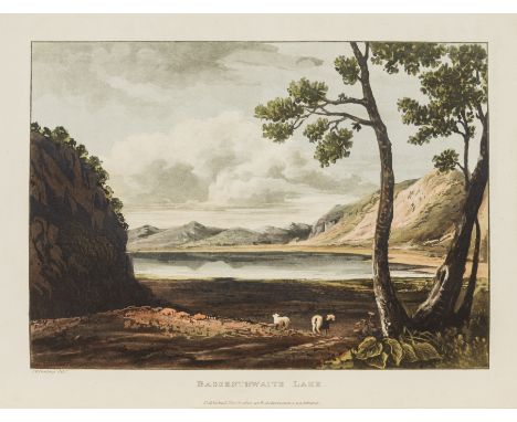
![[Combe (William)] Journal of Sentimental Travels in the Southern Provinces of France, first edition, 18 hand-coloured aquatin](https://cdn.globalauctionplatform.com/8766109f-1deb-4a16-a9ea-a7e0012ad58f/c9dc819c-dabd-4537-8e06-f6000b996aeb/468x382.jpg)
![Tyndale's Bible.- Bible, English. [The newe Testament of our Sauiour Jesu Christe], The Leicester Harmsworth copy, [Tyndale's](https://cdn.globalauctionplatform.com/8766109f-1deb-4a16-a9ea-a7e0012ad58f/a7554f83-cbfa-4e4d-b81b-f5e5ee6dd7b6/468x382.jpg)