We found 118894 price guide item(s) matching your search
There are 118894 lots that match your search criteria. Subscribe now to get instant access to the full price guide service.
Click here to subscribe- List
- Grid
-
118894 item(s)/page

![[PALMER] An Account of the Trial of Thomas Fyshe Palmer, Unitarian Minister, Dundee, before the Circuit Court of Justiciary,](https://cdn.globalauctionplatform.com/6f184679-f563-4cc3-a152-a7d800ed118b/ce6d274e-e276-4faf-9ec7-620303c19bc9/468x382.jpg)
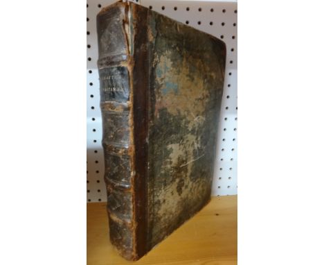
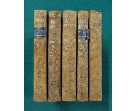
Lot 1407
[PALMER] An Account of the Trial of Thomas Fyshe Palmer, Unitarian Minister, Dundee, before the Circuit Court of Justiciary, at Perth . . . for Sedition. First Edition. portrait frontis., old marbled wrappers. Perth: printed . . . for R. Morrison and Son, (1793?); sold together with a few leatherbound volumes.
Lot 1397
HANDOVICI (Leopold) Lapidarium Zeylanicum. Being a collection of monumental inscriptions of the Dutch churches and churchyards of Ceylon. First Edition. engraved title & 97 leaves of engraved illus. (6 coloured); old leather-backed cloth, gilt-panelled spine, roy. 4to. Colombo: J. Maitland & Co., 1877. * an obscure & scarce monograph.
Lot 1337
CAMPBELL (A.) A Journey from Edinburgh through Parts of North Britain: containing remarks on Scottish landscape; and observations on rural economy, natural history, manufactures, trade, and commerce. First Edition, 2 vols. 44 mezzotint plates from sketches by the author); later 19th cent. half vellum & marbled boards, gilt-decorated spines & red labels, 4to. 1802. * with purchase labels from the library of the Surveyor's Institution.
Lot 1414
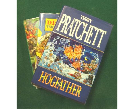
PRATCHETT (T.) The Last Hero: a Discworld fable. First Edition. coloured illus. (by Paul Kidby); d/wrapper, 4to. 2001. * signed by the author on front free e/p.; together with 3 other Pratchett first editions, & The Colour of Magic & the Light Fantastic (25th anniversary edition); also 10 novels by others.
Lot 1354
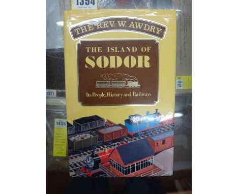
AUDRY (Rev. W.) & AUDRY (G.) The Island of Sodor: its people, history and railways. First Edition. text photos., maps & other illus.; d/wrapper, cr. 8vo. Kaye & Ward, 1987. * the fascinating background to the ever popular 'Railway series'; signed (on a pictorial 'Thomas' bookplate) by both authors.
Lot 1344
MANNING (Rev. O) & BRAY (Wm.) The History and Antiquities of the County of Surrey . . . First Edition, 3 vols. complete with the many engraved plates, facsimiles, tables & maps (some folded), subscribers list: contemp. gilt & blind-decorated polished calf (including a panelled spine), marbled e/ps. & edges, folio. 1804-14. * large paper copy of the standard antiquarian history; armorial bookplates of Francis Freeling.
Lot 1424
BIBLE - The Text of the New Testament of Jesus Christ. Translated out of the vulgar Latine by the Papists of the Traiterous Seminarie at Rhemes . . . whereunto is added the translation out of the original Greeke, commonly used in the Church of England . . . the whole worke, perused and enlarged in diuers places by the authors owne hand before his death . . . by W. Fulke. (2nd edition). title within 'architectural' pictorial borders, engraved head / tailpieces, historiated / decorated initial letters; (42), 914 & (10)pp. 19th cent. half calf & marbled boards, panelled spine, roy. 4to. imprinted at London by Robert Barker, 1601. * the Rheims & Bishops' texts in parallel columns, with the many notes as whole page printing; first published in 1589, being 'indirectly responsible for the marked influence which Rheims exerted on the Bible of 1611' - Darlow & Moule.
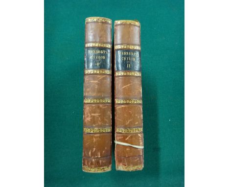
Lot 1392
TENNENT (Sir J.E.) Ceylon: an Account of the Island Physical, Historical, and Topographical. With notices of its natural history, antiquities and productions. First Edition, 2 vols. 4 maps (2 folded), 2 plates & num. engraved text illus. (some full-page); contemp. half calf & marbled boards, gilt-panelled spines, cr. 8vo. 1859. * crested bookplates of Wm. Wright.
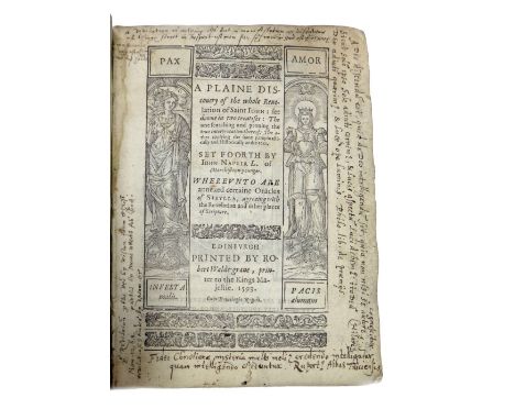
Lot 1435
NAPIER (John) A Plaine Discouery of the Whole Revelation of Saint John: set downe in two treatises . . . whereunto are annexed certaine Oracles of Sibylla . . . First Edition. title within pictorial & decorated borders, royal arms of Scotland on verso, some engraved headpieces, (12), 269 & (11)pp.; contemp. limp vellum, 8vo. Edinburgh: printed by Robert Walde-graue, 1593; bound with JAMES VI (of Scotland) Ane Fruitfull Meditatioun contening a Plane and Facill Expositoun of ye 7.8.9 and 10 Versis of the 20. Chap. of the Reuelatioun in forme of ane sermon . . . First Edition. title within decorated woodcut border, large engraved tailpiece, (15)pp. imprentit at Edinburgh be Henrie Chateris, 1588. * ownership names (beginning of first work) - ' Richard Lodge . . . 1633 (?) in Hambrough' & (?) Rad. Thoresby'; the first work with 14pp. of closely written latin notes prior to title, in title margins, in some text margins, & concluding on 11pp. following text. * The Book of Revelation was used by protestant propogandists to give currency to the Reformation (the Pope being the Anti-Christ), & James had taken verses from this (& other biblical texts) to emphasise his religious position & monarchial status, culminating in none less than the Authorised (King James) Version of the Bible. John Napier (1550-1615) better known as a mathematician (& inventor of logarithms) apart from the Book's relevance to mathematics, reinforces this approach - his dedicatory preface (to the King) warns of the catholic shadow, & ' the apparent danger of papistry arriving in these islands'. Fortunately these related & rare titles have come together to form one book; see also internet condition report. Illustrated
Lot 1395
WRIGHT (A.), editor. Twentieth Century Impressions of Ceylon: its history, people, commerce, industries, and resources. First Edition. decorated title, a map, very many photo. & other illus. (some full-page), erratum note (p. 305); publisher's gilt red morocco (defective), impl. 8vo. 1907. * an exhaustive account, more than 900pp. printed in triple column.
![[DODGSON, C.L.] Alice's Adventures in Wonderland. By Lewis Carroll. Second (First Published) Edition. frontis & 41 text illu](https://cdn.globalauctionplatform.com/6f184679-f563-4cc3-a152-a7d800ed118b/7e57cc1d-0b1d-4a67-9a95-f96215e6d517/468x382.jpg)
Lot 1434A
[DODGSON, C.L.] Alice's Adventures in Wonderland. By Lewis Carroll. Second (First Published) Edition. frontis & 41 text illus. (by John Tenniel), half title; publisher's red cloth, gilt-ruled covers (with central medallions), gilt-lettered spine, g.e., lilac e/ps., cr. 8vo. Macmillan and Co., 1866. * it is well-known that, owing to Tenniel's dissatisfaction with the printing of the illustrations, the original (1865) edition was recalled before sale; it is uncertain whether two or four thousand copies of this edition were issued; the actual publication date is known to have been Nov, 1865.
Lot 1342
SHAKESPEAR (Col. L.W.) & STEVENS (Lt. Col. G.R.) History of the 2nd King Edward's Own Goorkha Rifles (the Sirmoor Rifles). First Edition, 3 vols. 111 plates (3 coloured), 39 maps & plans (mostly folded & coloured); original gilt- pictorial cloth (with leather corners, vol. 1) & gilt-pictorial cloth (others). Aldershot, 1912-52. * of limited circulation, especially vols. 1 & 2 (1924).
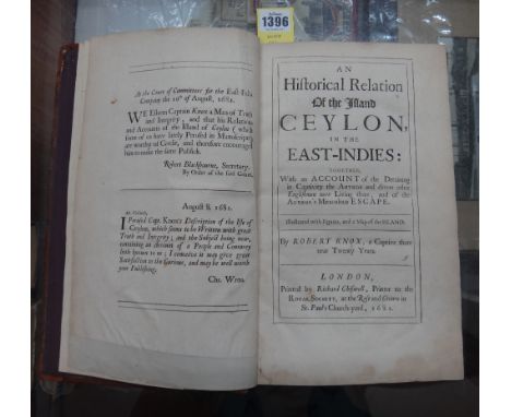
Lot 1396
KNOX (Robert) An Historical Relation of the Island Ceylon, in the East-Indies: together, with an account of detaining in captivity the author and divers other Englishmen . . . and of author's miraculous escape. First Edition. folded map & 8 copper-engraved plates (only, of 15), advert leaf; old calf, 4to. 1681.
Lot 1377
ANGELUCCI (Teodoro) Ars Medica ex Hippocratis Galeni'que Thesauris Potissimum Deprompta . . . woodcut title device, some historiated/decorated initial letters; early limp vellum, sm. 4to. Venice: apud Paulum Meiettum, 1588. * an early edition of this well-known text, first published (by this press) 1561.
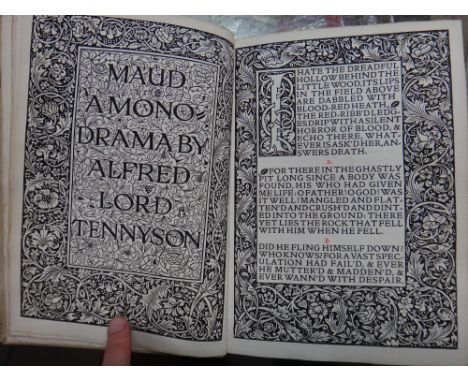
Lot 1379
TENNYSON (Alfred, Lord) Maud: a mono-drama. Limited Edition. wood-engraved decorated title & opening text page, decorated initial letters, some border decoration & a decorated colophon, stanza nos. printed in red; limp vellum (with ties), gilt-lettered on spine, cr. 8vo. printed by William Morris at the Kelmscott Press . . . published by Macmillan & Co., 1893. * commissioned by the publisher, who apparently took all the 500 copies (printed in Golden type on Bachelor handmade paper); this copy in the first state - with uncorrected errors on 4 pages.
Lot 290
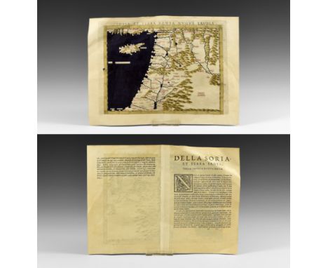
Published 1561 AD. Taken from La Geografia di Claudio Tolomeo Alessandrino, Venice, translated by Girolamo Ruscelli and Vincenzo Valgrisi as 'Nuouamente tradotta di Greco in Italiano'; comprises an original double-page with Latin text relating to the map to reverses with hand-coloured folding map titled SORIA ET TERRA SANTA NVOVA TAVOLA, also showing Cyprus and part of the eastern Mediterranean region, the border, water and hills coloured with red lining to most place names. See British Museum, General Catalogue of Printed Books to 1955 pp.334-344 for information on the issues of this work. 5.93 grams, 30x22cm (12 x 8 3/4"). Ex Swiss collection; acquired 1980s. Claudius Ptolemaeus (circa 100-170AD) was born in Alexandria and became one of the foremost scholars of his day as a geographer (he is sometimes known as the 'Father of Geography) and mathematician with his works being important for centuries after his death; in the Medieval period, his atlas was first published in Bologna in 1477; an incomplete copy of the 1561 edition containing fifty (of sixty-four) maps was sold by Christies, 10 October 2013 lot 68 and achieved a hammer price of 10000. Very fine condition. Rare.
Lot 61
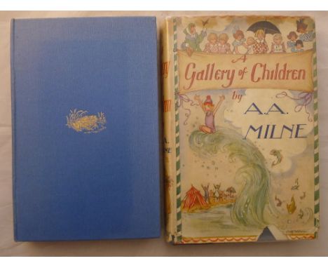
Milne, A.A. Toad of Toad Hall, A Play from Kenneth Grahame's Book "The Wind in the Willows".Methuen & Co. Ltd., 1929, first edition, hardcover with blue cloth covers with gilt decoration and lettering; together with A Gallery of Children, George G Harrap & Co. Ltd., 1939, first edition, hardcover with blue cloth covers with orange decorations and lettering and with dust jacket. CONDITION REPORTS: Toad of Toad Hall - generally good, pencil inscription inside cover and further biro inscription on title page, some staining to pages and edges. A Gallery of Children - with slight bruising to covers, some staining inside covers, pencil inscription inside cover, dust jacket with tear and loss and further tear and losses to spine and a little stained.
Lot 62
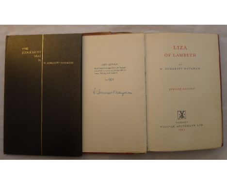
Maugham, W. Somerset; Hyde, Ulrica. The Judgement Seat. The Centaur Press, 1934, limited first edition, number 116 of 150, hardcover with black cloth cover and gilt lettering, limitation leaf signed and frontispiece signed; together with Maugham, W. Somerset. Liza of Lambeth, William Heinemann Ltd, 1947, limited Jubilee edition, number 901 of 1000, hardcover with pink cloth cover and vellum spine, signed limitation leaf. CONDITION REPORTS: Judgement Seat - generally good, some minor bruising to corners and slight dints to covers, pencil inscription inside cover, slight staining to title page. Liza of Lambeth - minor bruising to covers, slight staining inside covers, pencil inscription inside cover, slight area of damage to impression leaf.
Lot 59
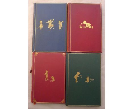
Milne, A.A.; Shepard, E.H. When We Were Very Young.Methuen & Co. Ltd., London 1924, first edition, hardback blue cloth covers with gilt decorations and lettering; Winnie-the-Pooh, Methuen & Co. Ltd., 1926, first edition, hardback green cloth covers with gilt decorations and lettering; Now We Are Six, Methuen & Co. Ltd., 1927, first edition, hardcover red cloth covers with gilt decorations and lettering; and The House at Pooh Corner, Methuen & Co. Ltd., 1928, first edition, hardcover red cloth covers with gilt decorations and lettering. (4) CONDITION REPORTS: When We Were Very Young - with bruises and dints to corners and spine, covers rubbed, pencil inscription and ink dedication inscription dated Xmas 1924 inside cover, binding a little loose and slightly split in parts, some staining inside covers, some pencil marks to interior pages. Winnie-the-Pooh - generally good, slight bruising to corners and spine, some minor staining inside cover, pencil inscription and ink dedication inscription dated 1926. Now We Are Six - generally good, some slight bruising to covers, some staining inside covers, pencil inscription inside cover dated 1927 and scratched through in biro, further pencil inscription on title page. The House at Pooh Corner - loss to spine, some slight bruising to corners of cover, minor scuffing to covers, some staining inside covers, pencil inscription.
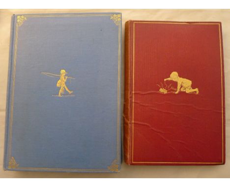
Lot 60
Milne, A.A.; Shepard, E.H. Now We Are Six.Methuen & Co., Ltd., 1927, first edition, hardcover with red cloth covers and gilt decorations and lettering; together with The Christopher Robin Verses, Methuen & Co., Ltd., 1932, combined volume first edition, hardcover with blue cloth covers with gilt decorations and lettering. CONDITION REPORTS: Now We Are Six - with split spine, creasing to cover, some bruising, staining inside covers and pencil inscription, binding a little loose in parts with visible splits. The Christopher Robin Verses - with dints and bruises to covers, staining to inside cover, pencil inscription and further ink inscription inside cover, some foxing to edges, some slight scuffs and stains to covers.
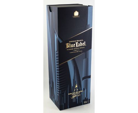
Lot 338
1 Litre Bottle Limited Edition of 1500 Johnnie Walker Blue Label "Dubai Duty Free Edition" Art by Jeff Nishinaka "Following the success of its 2013 Skyline Collection range, Diageo Global Travel Middle East, in partnership with internationally renowned artist, Jeff Nishinaka, released a new series of limited edition design travel exclusives for 2015 featuring handcrafted designs of some of the world's most famous cityscapes - the Johnnie Walker Blue Label Cities Collection. Each edition is engraved with a Jeff Nishinaka handcrafted design, bringing to life the cityscapes of some of the world's most iconic travel destinations. The first edition in the collection celebrates the unique character and culture of Dubai. Dubai is a city of firsts, a global icon and a luxury travel destination - and the perfect skyline to form the first of the J Cities Collection".
Lot 14
A book - The Theory of the Earth containing an account of the original of the earth and of all the general changes which it hath already undergone or is to undergo till the consummation of all things. The two first books concerning the deluge and concerning paradise. The third edition reviewed by the author, printed in London by R N for Walter Kettilby, 1697, leather bound.
Lot 128
Thomas Hardy (1840-1928) two 1st edition 'The Famous Tragedy of the Queen of Cornwall', both with original pictorial green cloth cover, publisher Macmillan & Co 1923; Thomas Hardy 1st edition 'Life's Little Ironies' with original pictorial green cover publisher Osgood McIvaine & Co 1894; Thomas Hardy 1st edition 'Winter Words' publisher Macmillan & Co 1928; Thomas Hardy 1st edition 'A Group of Noble Dames' (in first issue binding) original brown flecked cream cloth, publisher Osgood, McIlvane & Co dated 1891. (5)
![Poetry - Blunden [Edmund Charles], Pastorals: A Book of Verses, first edition, later signed by the author in 1966, Erskine Ma](https://cdn.globalauctionplatform.com/01ba2e64-7f3f-4569-93b6-a7c8007b75f2/fd510748-3f29-45fd-d6a4-d6b18c4d35af/468x382.jpg)
Lot 3752
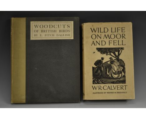
Natural History - Daglish (E. Fitch), Woodcuts of British Birds, With Descriptions by the Artist, Ernest Benn, Ltd., London 1925, limited edition of 500 copies, 165pp, illustrated with 20 ornithological woodcuts, oatmeal buckram spine, 'morocco' paper boards, paper title label, 4to; Calvert (W.R.), Wild Life On Moor and Fell, Illustrated by Winifred M. Thridgould, first edition, Hodder & Stoughton Limited, London 1937, 230pp, h/b, pictorial d/j, 8vo [2]
Lot 3764
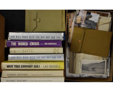
Walter and Lao Russell, New Age Cosmologists - an important family archive collection, sent to Peter Summersfield of Chellaston, Derby, Lao's (née Daisy Stebbing) nephew, including works by each of the philosophical couple, including Russell (Dr Walter and Lao), Atomic Suicide?, signed and dedicated first edition, University of Science and Philosophy [...], Swannanoa 1957, h/b, d/j, 8vo; another signed and dedicated copy; another, The World Crisis: Its Explanation and Solution, signed and dedicated first edition, University of Science and Philosophy, Swannanoa 1958, h/b, d/j, 8vo; Russell (Lao), The Continuity of Life: Why You Cannot Die!, Reincarnation Explained, signed and dedicated first edition, Limited Edition DeLuxe [...], h/b, d/j, 8vo; others, God Will Work With You But Not For You: A Living Philosophy, sixth edition, h/b, d/j. 8vo and Love: A Scientific and Living Philosophy of Love and Sex, fifth edition, h/b, 12mo; further books, monographs and pamphlets by the pair, including those published by The Walter Russell Foundation; album of monochrome photographic negatives; early 20th century and later family leisurely photographs, b/w and colour; other original ephemera; topographical watercolours of the Pyrenees; The Derby School of Art Magazine, Vol. 5, No. 1, Spring 1933, with woodcuts and advertising notices; the whole contained in a University of Science and Philosophy, Formerly The Walter Russell Foundation, cardboard box; qty
![Dorset Topography - Woodward (Ida), In and Around The Isle of Purbeck, With Thirty-Six [Chromolithographic] Plates in Colour](https://cdn.globalauctionplatform.com/01ba2e64-7f3f-4569-93b6-a7c8007b75f2/6a9f2fab-4201-464c-b772-e94437369b13/468x382.jpg)
Lot 3736
Dorset Topography - Woodward (Ida), In and Around The Isle of Purbeck, With Thirty-Six [Chromolithographic] Plates in Colour by John W.G. Bond, first edition, John Lane, The Bodley Head, London 1908, xiv, 237pp, adverts [ii], green buckram as issued, armorial bookplate of I.D. Margary to front pastedown, 4to
Lot 3761
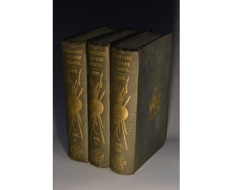
The Thousand and One Nights, Commonly Called, In England, The Arabian Nights' Entertainments, A New Translation From the Arabic, With Copious Notes by Edward William Lane, Illustrated by Many Hundred Engravings on Wood, From Original Designs by William Harvey, first edition of Lane's translation, three-volume set, Charles Knight and Co., London 1839-1841, line-engraved title and sub-title pages, with further vignettes throughout, gilt embossed green buckram, as issued, yellow endpapers, 4to
![Bensusan [Samuel Levy], Morocco, Edition de Luxe no. 112/250, Adam and Charles Black, London 1904, xv, 231pp, illustrated wit](https://cdn.globalauctionplatform.com/01ba2e64-7f3f-4569-93b6-a7c8007b75f2/26bdcdaf-2296-4faf-e6d7-01be2672c2d3/468x382.jpg)
Lot 3730
Bensusan [Samuel Levy], Morocco, Edition de Luxe no. 112/250, Adam and Charles Black, London 1904, xv, 231pp, illustrated with off-set plates after paintings by A.S. Forrest, pictorial buckram binding in the Moorish taste, 4to; Lawrence (T.E., of Arabia), Seven Pillars of Wisdom: A Triumph, first edition for general circulation, Jonathan Cape, London 1935, brown buckram as issued, 4to [2]
Lot 241
A QUANTITY OF COLLECTABLE BOOKS TO INCLUDE, Geoffrey Trease - So Wild the Heart 1959 first edition with dustjacket, together with Mumfie the Admiral by Katherine Tozer 1937 first edition, etc Condition Report:Please note: every page of every book is not checked, if you are unable to view yourself please ask for detailed information
Lot 271
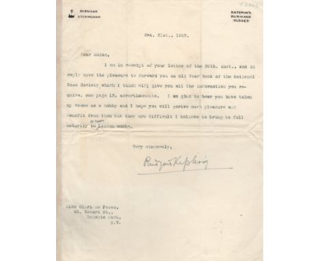
KIPLING RUDYARD: (1865-1936) English Author, Nobel Prize winner for Literature, 1907. T.L.S., Rudyard Kipling, one page, 4to, Bateman's, Burwash, Sussex, 31st October 1903, to Miss. Clarisse Pasco. Kipling forwards his correspondent an old copy of the Year Book of the National Rose Society, which he feels will give her all of the information she requires, and adds 'I am glad to hear you have taken up roses as a hobby and I hope you will derive much pleasure and benefit from them but they are difficult I believe to bring to full maturity in or near London smoke'. Some light creasing, not affecting the signature, and some very minor traces of former mounting to the verso, about VG Kipling's love poem Blue Roses was first published in 1887 and was later included in Hutchinson's Book of Beauty (second edition, published in London, 1902).
-
118894 item(s)/page