36562 Preisdatenbank Los(e) gefunden, die Ihrer Suche entsprechen
36562 Lose gefunden, die zu Ihrer Suche passen. Abonnieren Sie die Preisdatenbank, um sofortigen Zugriff auf alle Dienstleistungen der Preisdatenbank zu haben.
Preisdatenbank abonnieren- Liste
- Galerie
-
36562 Los(e)/Seite


Los 64
commemorative, commemoratives, commemorate, military, naval 1797 Sir Horatio Nelson: a very rare creamware jug the bellied body printed in black with a named portrait oval and on the reverse a compass, 131mm, spout restored and hairline crack Illustrated * Following the Battle of Cape St Vincent in 1797 Nelson was made a Knight of the Bath, later the same year he lost his arm at the Battle of Santa Cruz de Tenerife This print is quite possibly the first event for which Nelson was commemorated.


Los 51
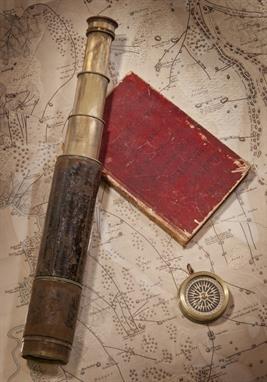
A SMALL BRITISH AND FOREIGN SAILORS` SOCIETY COPPER BUST OF NELSON, of typical form, with inscribed socle mounted on turned fruitwood base -- 8in. (20cm.) high; together with a presentation aneroid barometer from H.M.S. Worcester, dated July 1907, and with officer of the watch-type telescope by H. Hughes & Son Ltd with leather-covered tube and dust cap; and a small oxidised-brass sighting compass by Troughton & Simms , (4)
Los 53
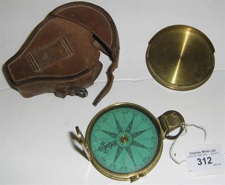
A COLLECTION OF ARTEFACTS PERTAINING TO WILLIAM COLLINGWOOD`S INDIAN SURVEYING EXPEDITION, 1846, comprising a passage journal kept aboard the Oriental from London to Bombay between 6th January and 30th May 1846, written over sixty-nine pages in a neat and clear hand with occasional coloured ink sketches, varied content including weather observations, poetry, and day-to-day commentary - March 31st 1846 Tuesday: A large shoal of porpoises playing about the bows the mate went out on the dolphin striker to harpoon one but was unsuccessful.. bound in red morocco with inscribed cover -- 7¼ x 4¾in. (18.5 x 12cm.); together with a presentation leather-cased 1½in. three-draw leather-covered surveying telescope and compass compendium signed and inscribed A. Ross, London / From Comr. Selby, Surveyor in Mesopotamia to Lieut. W. Collingwood, Asst. Surveyor, in kind remembrance of Services together in Babylonia & Irak Arabia, contained in leather carry case with lid enclosing a lacquered-brass compass, closed length -- 11½in. (29cm.); three 7 x 9in. (18 x 23cm.) watercolour and ink ship profiles by Collingwood of the Tigris; Coromandel and Georgiana each inscribed, signed and dated between 1856-8 and attached to ?album leaves; a printed service record for Collingwood (`H.M. late I.N.); and a map printed by J & C Walker, London of a Trigonmetrical Survey of a part of Mesopotamia by Selby and Collingwood , (7), Please see back cover image, Provenance: The family and thence by decent, Commander W.B. Selby, late Royal Indian Navy, began his distinguished surveying career in 1837 when, as a midshipman, he embarked on the expedition first to lay navigation buoys in the mouths of the Indus River and thence to chart some coastal areas in the `Horn of Africa`. By 1846 he was back working off the mouths of the Indus, having made his reputation in Mesopotamia (in 1840-41), and thereafter achieved considerable acclaim for his numerous other surveys, including those during the military expedition to Persia in 1856, before returning home (to England) at the end of 1862. He was succeeded as Surveyor of Mesopotamia by his protege, Lieutenant William Collingwood (a distant cousin of the Admiral), who had already done much valuable work in the region, including the large-scale, though surreptitious, mapping of Baghdad in 1855 and described by him as follows:-, "The survey of the city of Baghdad was completed entirely by myself and under very unpleasant restrictions....... The Turkish Government were not to know anything about it....... and I was left to survey the town as best I could, and under such difficulties that at times I had to note bearings and paces all over my white shirt, where best I could get the pencil at the time.....", During this same expedition, Collingwood also surveyed the Shatt-ul-Arab, the city of Bussorah (also by stealth) and much of the country between the Tigris and Euphrates Rivers, and was undoubtedly one of the most gifted and productive R.I.N. surveyors of his day.

Los 56
AN ATTRACTIVELY PRESENTED MODEL NAVY GUN, with ¾in. bore, four-stage brass 13½in. barrel with stylised dolphin handles, touch hole and cascabel, secured to stepped, naval-type carriage with turn-screw elevation and metal wheels, mounted on ornate oak carved display base with marine theme including dolphins, shells, compass rose etc. stamped on the underside MADE OF OAK FROM H.M.S. VICTORY -- overall measurements 8½ x 18 x 12in. (21.5 x 46 x 30.5cm.)

Los 229
A MAGAZINE OF DRAWING INSTRUMENTS, the top tray with apparently complete complement of compass, divider etc. the lower section with rules, watercolours and other accessories, contained in a mahogany box with retail label for J. & W.E. Archbutt, Lambeth and inset name plate for Halliday; together with a large two-tier case of yacht curves, rules, stencils, accessories, catalogues etc. -- 31in. (79cm.) diameter, (2, a lot)

Los 252
WAKELY, ANDREW (FL. 1631-65): `THE MARINER`S COMPASS RECTIFIED … ENLARGED WITH MANY USEFUL ADDITIONS BY J. ATKINSON..` , London: Printed for J. Mount and T. Page, 1774. 8vo (168 x 110mm). Half title with publisher`s advertisement on verso, woodcut illustrations, tables (occasional light staining and spotting). Contemporary calf (rubbed, upper joints split). Provenance: James Patience (early signature on front pastedown).


Los 261
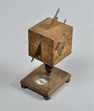
A LATE 18TH-CENTURY WOOD AND PAPER SHEPHERD DIAL BY W. BUREICH.. NUREMBERG, apparently unsigned, the top with pull-out folding gnomon, the base threaded, containing a hand painted dry card compass and original set of folding instructions printed on laid paper contained within -- 5½in. (14cm.) high


Los 279
A LATE 19TH-CENTURY POCKET ALT-AZIMUTH BY L. CASSELLA LONDON, the 2¾in. steel dial divided 90-0-90°, signed as per title and numbered 86, the reverse containing a compass contained within oxidised-brass case with twin telescopic sights and mounting arbor, contained within original fitted morocco case -- 3½in. (9cm.) diameter

Los 310
A RARE 19TH-CENTURY LIFEBOAT COMPASS BY DENT, with 2in. card set within liquid-filled bowl with finely-engraved rim inscribed DENT`S patent liquid compass No. 1790 61 Strand, London, with threaded top-up cap, gimbal-mounted with front securing catch, within white-painted copper case with instructions pasted to the back on retail label for Dollond & Co. hinged candle chamber with white-painted candle sconce, perforated chimney over bevelled glass viewing port, reverse securing hook and top carry handle -- overall measurements 9 x 6½ x 6½in. (23 x 16.5 x 16.5cm.)

Los 311
A LATE 19TH-CENTURY AMERICAN LIQUID-FILLED COMPASS BY RITCHIE, BOSTON, with 7½in. card signed Ritchie Boston USA, contained in liquid-filled bowl with rim stamped SS RITCHIE BOSTON and patent dates for 1862, 1866 and 1870, mounted in a substantial brass gimbal ring within oak travel box -- 7¼ x 13½ x 13½in. (18.5 x 34.3 x 34.3cm.)


Los 206
A universal equinotcal dial, Augsburg, the reverse signed Ioh. G. Vogler beneath a list of cities and latitudes, the octagonal brass plate engraved with hunting scenes, hinged hour ring and gnomon and adjustable latitude arc, inset silvered compass, 3in (7.5cm) wide, in leather ad card travelling case.


Los 108
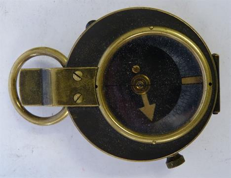
A WWII Medal Group, including 1939/45 Star, the Africa Star (with 8th Army clasp), the Italy Star, the France & Germany Star and the Victory medal, with a selection of ephemera including army prayer books, army phrase books, occupational currency, a Royal Army Service Corp badge, photographs, Alamein Desert Rats patch and military issue compass, etc.
Los 113
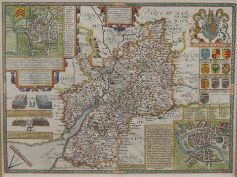
AFTER JOHN SPEEDE "Gloucestershire", a hand-coloured map bearing town plan of Glocester and Bristow, with coat of arms and compass and rule, sold by Roger Rea of Elder and Younger at The Golden Cross, Cornhill Exchange, image size 40 cm x 51 cm CONDITION REPORTS Overall with general wear and dirt, fold to centre is obscuring some letters/words, printing generally is not particularly sharp/crisp, with quite a lot of the letters and place names quite patchily printed, appears to be printed on fairly thick paper, map is sealed within frame so unable to check whether bears script/printing verso. Framed and glazed


-
36562 Los(e)/Seite