36562 Preisdatenbank Los(e) gefunden, die Ihrer Suche entsprechen
36562 Lose gefunden, die zu Ihrer Suche passen. Abonnieren Sie die Preisdatenbank, um sofortigen Zugriff auf alle Dienstleistungen der Preisdatenbank zu haben.
Preisdatenbank abonnieren- Liste
- Galerie
-
36562 Los(e)/Seite


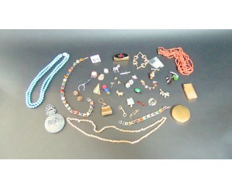
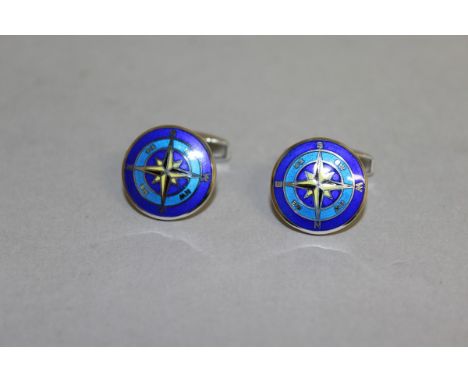
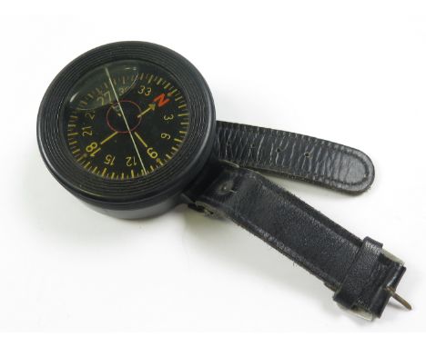
Los 36
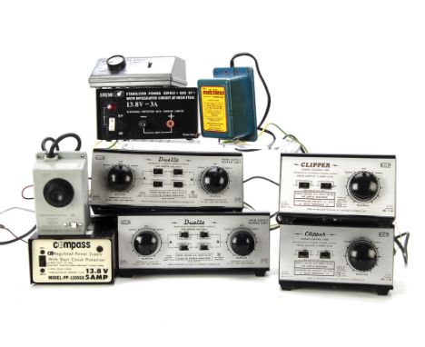
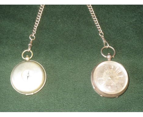
Miscellaneous Bronze Medallions, Gloucester Education Regular Attendance, dated 1908 and 1912 together with vintage coins including coppers, small quantity of English silver coins including florins, three penny bits and six pence. A solid silver compass fob chain approx 73 gms and two silver cased pocket watches, a Meerschaum pipe and an antique enamel pill box with wording 'Long may you live and be happy'.
![Ireland. Speed (John), The Countie of Leinster with the Citie Dublin Described, published Roger Rea, [1662], uncoloured engra](https://cdn.globalauctionplatform.com/c12840a3-3b4d-4fdb-b160-a59100af72af/3417d0cc-6db4-4bb0-a5f3-f265af9615be/468x382.jpg)
Los 244
Ireland. Speed (John), The Countie of Leinster with the Citie Dublin Described, published Roger Rea, [1662], uncoloured engraved map, inset town plan of Dublin, large compass rose, strapwork cartouche and mileage scale, small library blindstamp to margin, 385 x 510 mm, English text on verso (1)
Los 235
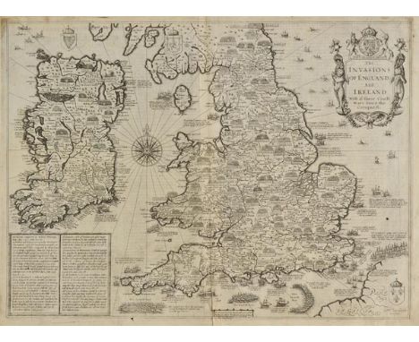
England, Wales & Ireland. Speed (John), The Invasions of England and Ireland with al their Civill Wars since the Conquest, published Roger Rea, [1662], uncoloured engraved map, engraved by Cornelius Danckerts, decorative cartouche, compass rose and numerous rhumb lines, slight fraying and dust soiling to margins, short split at base of central fold, strengthened on verso, one small hole to image, small library blind stamp in margin, 385 x 520 mm, English text on verso Shirley. Early Printed Maps of the British Isles, 1477 - 1650, no.397. (1)
Los 266
Radnorshire. Speed (John), The Countie of Radnor Described and the Shyretownes sittuatione, published Roger Rea, [1662], uncoloured engraved map, strapwork cartouche, mileage scale and compass rose, inset town plan of Radnor, slight creasing, small library blindstamp to margin, 385 x 510 mm, English text on verso (1)
Los 234
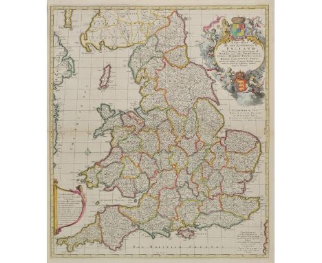
England & Wales. Visscher (Nicolas), A New Mapp of the Kingdome of England, Representing the Princedome of Wales and other Provinces, Cities, Market Towns, with the Roads from Town to Town and the Number of Reputed Miles between them, are given by Inspection without Scale or Compass, published John Overton, circa 1694, engraved map with contemporary outline colouring, large decorative cartouche, 575 x 500 mm, together with, Angliae Regnum Tam in Septem Antiqua Anglo-Saxonum Regna quam in omnes Hodiernas Regiones accuratissime distinctum..., circa 1690, engraved map with contemporary hand colouring, large decorative cartouche, slight worming to central fold, skillfully repaired on verso, 565 x 495 mm, with, Schenk (Peiter), Novissima prae caeteris aliis accuratissima Regnorum Angliae Scotiae Hiberniae..., published Amsterdam, circa 1706, engraved map with contemporary hand colouring, inset map of the Shetland, Orkney and Faroe islands. decorative cartouche with later hand colouring, one small hole to image, 575 x 490 mm R.W.Shirley. Printed Maps of the British Isles 1650 - 1750. Visscher 2 state 4. Visscher 3. unrecorded state with a dedication to George III and Schenk 1. state 2. (3)
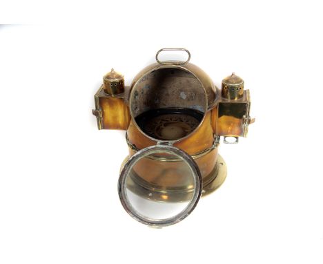
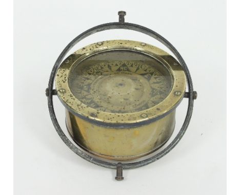
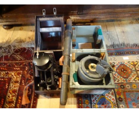
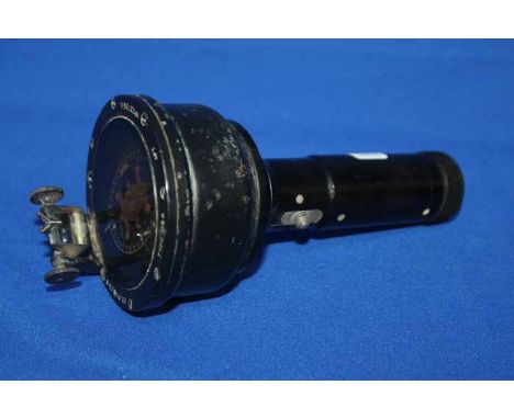
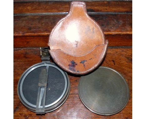
Los 944
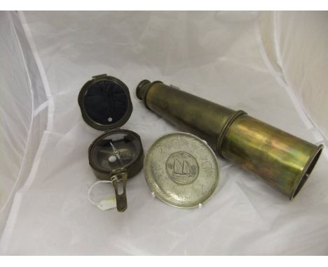
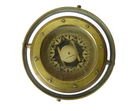
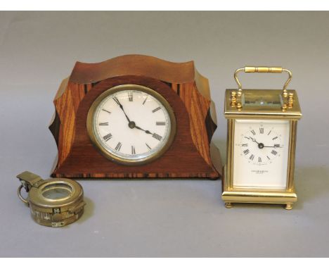
Ship's Binnacle: good early 20thC Marine Compass by Christie & Wilson of Glasgow, circa 1900, polished brass casing with detachable cover, dual oil side-light illumination, complete with reservoirs, gimbal-mounted compass-housing inscribed with maker's name, flange-mounting base-plate, 30cm dia.
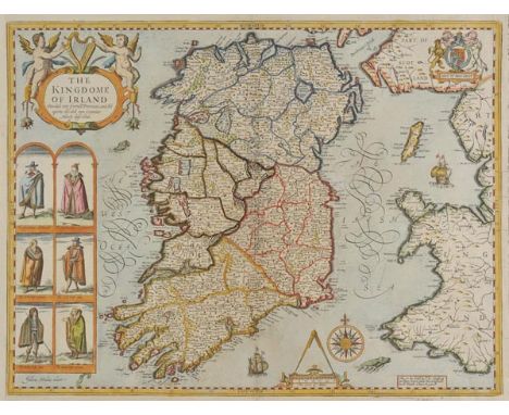
Los 247
Ireland. Speed (John), The Kingdome of Irland Devided into severall Provinces and then againe devided into Counties Newly described, published Thomas Bassett & Richard Chiswell, [1676], hand coloured engraved map, six engraved costumed figures, ornate cartouche, mileage scale and compass rose, occasional marginal repaired closed tears, central fold partially strengthened on verso, one margin trimmed to neat line and extended, 390 x 510 mm, English text on verso (1)
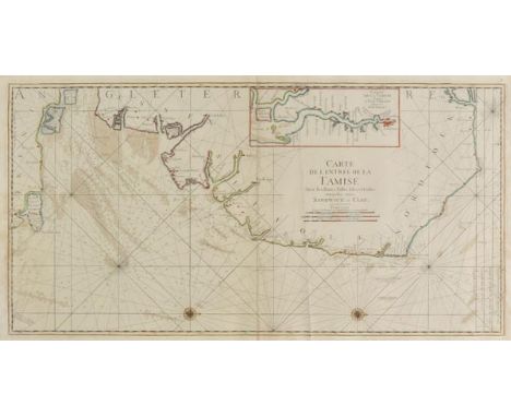
Los 271
Sea charts. Jaillot (A.H. & Bellin J.N.), Carte de l'Entr‚e de la Tamise avec les Bancs, Passes, Isles et Costes comprises entre Sandwich et Clay, published Patis, circa 1750, hand coloured engraved sea chart orientated to the right, inset map of the Thames estuary, compass roses and numerous rhumb lines, slight creasing, 460 x 890 mm, together with another uncoloured copy (2)
![Anglesey. Speed (John), Anglesey Antiently called Mona, Described, published Roger Rea, [1662], uncoloured engraved map, inse](https://cdn.globalauctionplatform.com/c12840a3-3b4d-4fdb-b160-a59100af72af/6134275f-ee4e-41d2-b4d7-4b37de59762e/468x382.jpg)
Los 217
Anglesey. Speed (John), Anglesey Antiently called Mona, Described, published Roger Rea, [1662], uncoloured engraved map, inset town plan of Beaumaris, large strapwork cartouche and mileage scale, compass rose and numerous rhumb lines, small library blindstamp to margin, slight fraying to margins, central fold partially strengthened on verso, 390 x 510 mm, English text on verso (1)
Los 229
Caernarvonshire. Speed (John), Caernarvon both Shyre and Shire-towne with the ancient Citie Bangor described, published Roger Rea, [1662], uncoloured engraved map, inset town plans of Caernarvon and Bangor, small library blindstamp to margin, slight creasing, one margin trimmed to neatline, 385 x 510 mm, English text on verso, together with, Caermarden both Shyre and Towne described, published Roger Rea, [1662], uncoloured engraved map, inset town plan of Carmarthan, large strapwork cartouche, mileage scale and compass rose, slight creasing, small library blindstamp to margin, repaired closed tear affecting image, small hole affecting image, crudely repaired on verso, 385 x 510 mm, English text on verso (2)
Los 242
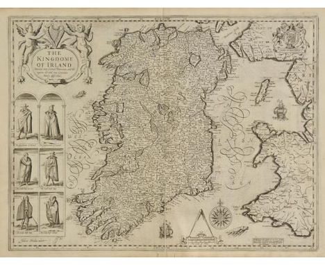
Ireland. Speed (John), The Kingdome of Irland Devided into Severall Provinces and then againe devided into Counties Newly described, published Roger Rea, [1662], uncoloured engraved map, six engraved costumed figures, ornate cartouche, mileage scale and compass rose, small library blinstamp to margin, central fold partially split, strengthened on verso, 390 x 510 mm, English text on verso (1)
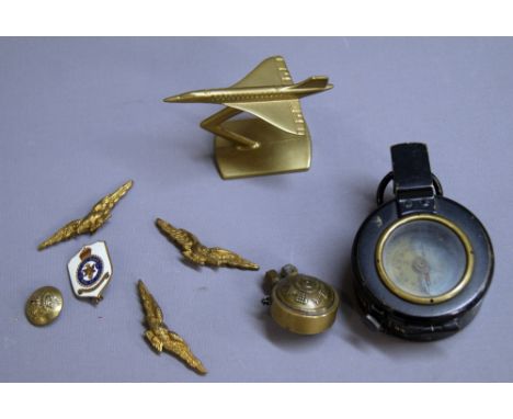
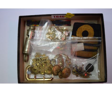
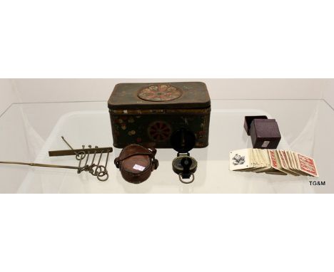
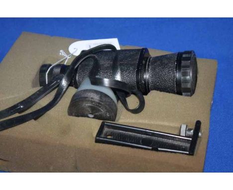
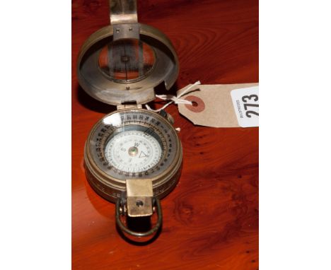
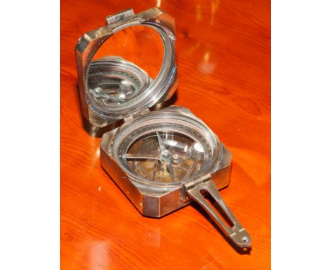
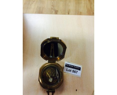
Los 96
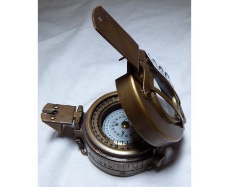
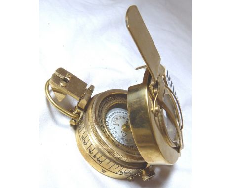
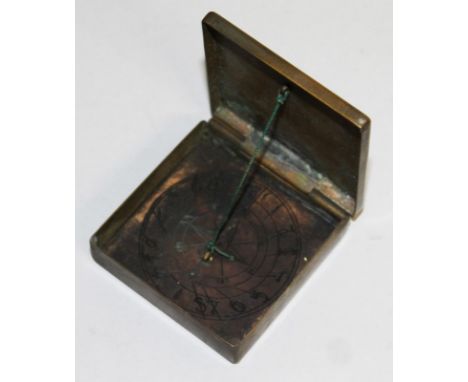
A selection of military collectibles, to include a Black Watch pocket-lighter, a field-compass, badges and buttons CONDITION REPORT; Available on request. Catalogue descriptions and condition reports are offered as a guide only and we highly recommend inspecting any lot to satisfy yourself as to its condition. Kruger Gibbons Auctioneers offers no guarantee on authenticity or physical condition


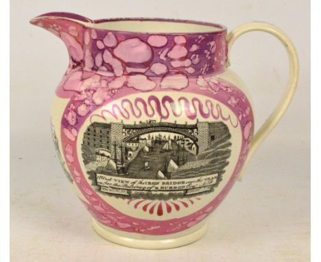
Los 425
A large early 19th century Sunderland lustre jug decorated to the front with a west view of the iron bridge over the Wear under the patronage of R. Burdon Esq, with mariners' compass point to the front and a poem to the reverse, overall set within a mottled pink frame, height 23.5cm. CONDITION REPORT: Generally good condition. Couple of minor defects to the transfer picture. Minor wear to base commensurate with age and a firing crack. Crazing to glaze. Wear to spout.
-
36562 Los(e)/Seite