36562 Preisdatenbank Los(e) gefunden, die Ihrer Suche entsprechen
36562 Lose gefunden, die zu Ihrer Suche passen. Abonnieren Sie die Preisdatenbank, um sofortigen Zugriff auf alle Dienstleistungen der Preisdatenbank zu haben.
Preisdatenbank abonnieren- Liste
- Galerie
-
36562 Los(e)/Seite

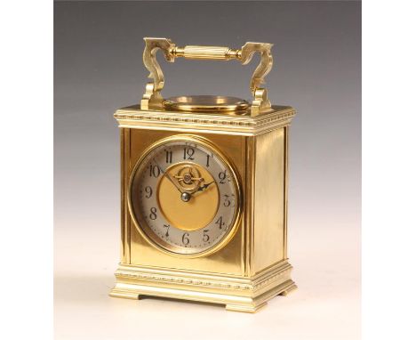
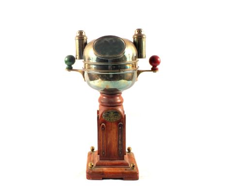
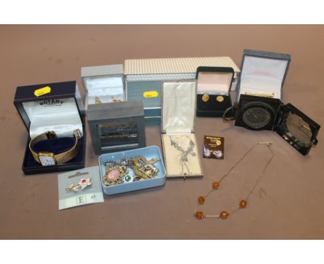
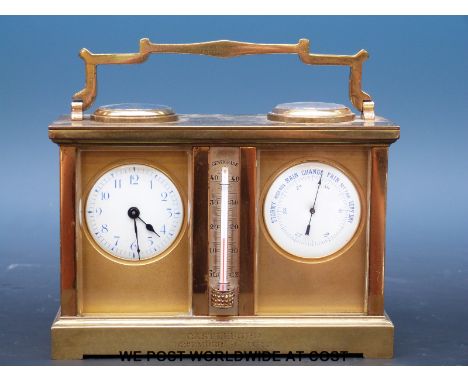
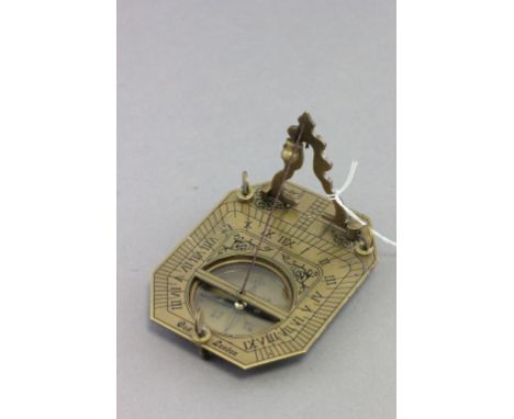
Los 102
A good late 19th Century Brass carriage type DESK CLOCK with ornate folding handle and inset circular silvered thermometer and compass dial beneath. The front dial with silvered Arabic chapter ring and visual balance wheel escapement to the gilded centre fronting an eight day spring driven timepiece movement 20.5cms high with handle up

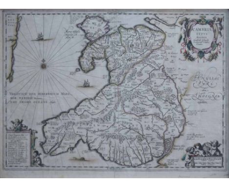
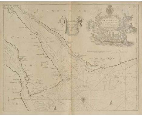
Los 40
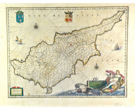
Wales. Mercator (Gerard, Jansson Jan & Lhuyd Humphrey), Cambriae Typus Auctore, Humfredo Lhuydo Denbigiense Cambrobritanno, c.1630, hand coloured engraved map, decorative cartouche and mileage scale, compass rose and numerous rhumb lines, French text on verso, 37 x 50.5cm.; 14.5 x 19.75in. Reference: John Booth. Antique Maps of Wales, No.3.
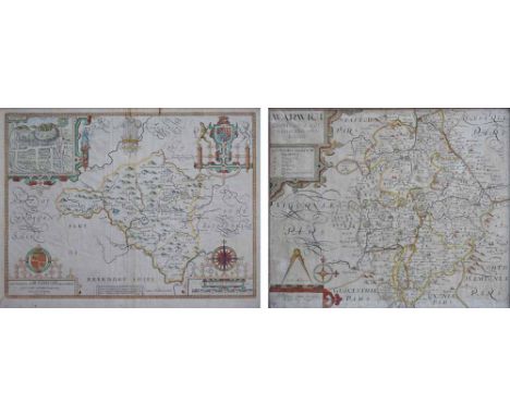
Los 41
Radnorshire. Speed (John), The Countie of Radnor Described and the Shyretownes sittuatione, described by Christopher Saxton, augmented and published by John Speed, sold by Thomas Bassett in Fleet Street and Richard Chiswell in St. Paul's Churchyard, 1618, hand coloured engraved map, strapwork cartouche, mileage scale and compass rose, inset town plan of Radnor, English text on verso, 42 x 53.5cm.; 16.5 x 21in, together with Christopher Saxton and William Kip, Warwici comitatus a cornauiis olim inhabitatus [Warwickshire], engraved county map, hand-coloured in outline, 29 x 35cm.; 11.5 x 13.75in (2).
Los 3481
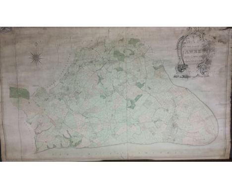
An early 19th century working estate chart, Map of the Parish of Awre in the County of Gloucester, Made partly from Old Surveys and partly from Actual Survey by Charles Baker, Land Surveyor, Civil Engineer, Architect & c., Painswick 1828, printed and laid onto canvas, the parish with plots of land numbered and annotated in ink ms., a red titled line cuts through the parish and is inscribed Forest of Dean Central Railway, including elaborate Chippendale style cartouche drawn and titled in pen and ink, printed compass to margin, the lower portion flanking the River Severn, Forest of Dean to the West, etc., 103cm x 160cm, mahogany turned baton

Los 87
Collins (Captain Greenvile). A New and Exact Survey of the River Dee, The Isle of Man, The North Sea, St. Georges Channel, Yarmouth, Milford Haven [and] The Menai Straits, circa 1730, together seven uncoloured engraved sea charts, each with a decorative cartouche, compass rose and numerous rhumb lines, slight overall toning and dust soiling, each approximately 450 x 560 mm Originally published in 'Great Britain's Coasting Pilot'. (7)
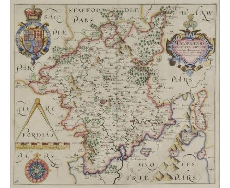
Los 167
*Worcestershire. Saxton (Christopher & Hole William), Wigorniensis comitatus Sabrinae Fluminis Amenitate insignis qui oilm ad Cornauios spectant description, circa. 1637, hand coloured engraved map, strapwork cartouche, compass rose and mileage scale, 285 x 315 mm, mounted, framed and glazed, together with Walker (J & C),Gloucestershire, published Longman, Rees, Orme & Co., 1835, engraved map with bright contemporary hand colouring, 400 x 335 mm, mounted, framed and glazed (2)
Los 92
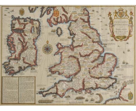
*England & Ireland. Speed (John), The Invasions of England and Ireland with al their civill wars since the conquest, published Thomas Bassett & Richard Chiswell, [1676], hand coloured engraved map, decorative cartouche, compass rose and numerous rhumb lines, 385 x 520 mm, mounted, framed and double glazed, English text on verso (1)
![Scotland. Collins (Captain Greenville), Edinburgh Firth, The Firth of Murry, Part of the Maine Island of Shetland [and] The E](https://cdn.globalauctionplatform.com/97730585-3d9d-4238-afe7-a67500ac3e34/bdc33d6d-c33b-4c18-f020-656056c24e93/468x382.jpg)
Los 154
Scotland. Collins (Captain Greenville), Edinburgh Firth, The Firth of Murry, Part of the Maine Island of Shetland [and] The East Coast of Scotland with the Isles of Orkney and Shetland, circa 1730, four uncoloured engraved sea charts, each with a large ornate cartouche, compass rose and numerous rhumb lines, slight overall toning, each approximately 460 x 570 mm Originally published in 'Great Britain's Coasting Pilot'. (4)
Los 155
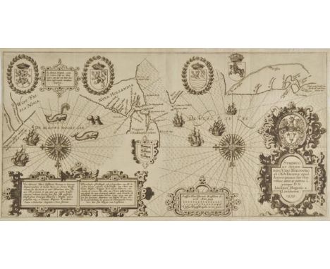
Sea chart. Linschoten (Jan Huyghen), Vera delineatio Maris Insularum Portuum et littorum Septentrionalium ab Insula Toxar per fretum Nassoviacum, published Amsterdam, [1601], uncoloured engraved chart, large ornate strapwork cartouche, compass rose and numerous rhumb lines, old folds, 257 x 540 mm An important early map of the search for the Northeast Passage. The map was drawn by Jan Huyghen van Linschoten to illustrate his account of Willem Barentsz's first two voyages, on which Linschoten was a crew member. It is one of the earliest maps of the area to be made by someone with direct experience of the terrain; Linschotens presence even makes itself felt in the toponymy, with a headland on Nova Hollandia named Linschotens hoeck, which would have been named for him when he was the first to spot it. It is orientated to the south and centred on Vaygach Island, with the Barents Sea on the right and the Kara Sea on the left. A pair of spouting whales and playful seals appear in the water. (1)
![Ireland. Collins (Captain Greenville), The Harbour of Corke, Dublin Bay [and] The Chart of Kingsale Harbour, circa 1730, thre](https://cdn.globalauctionplatform.com/97730585-3d9d-4238-afe7-a67500ac3e34/2544d5b9-f31b-4f88-c25b-0145be516dcd/468x382.jpg)
Los 110
Ireland. Collins (Captain Greenville), The Harbour of Corke, Dublin Bay [and] The Chart of Kingsale Harbour, circa 1730, three uncoloured engraved sea charts (Dublin Bay with sparse colouring in the sea), each with a decorative cartouche, compass rose and numerous rhumb lines, slight overall toning and occasional spotting, each approximately 435 x 530 mm Originally published in 'Great Britain's Coasting Pilot'. (3)
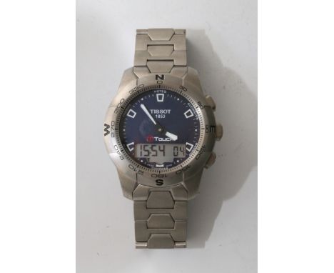
Los 2256
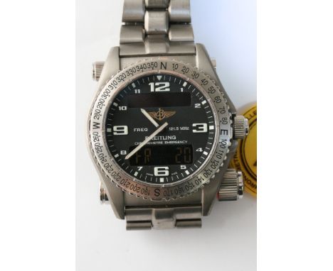
A gents Breitling Emergency watch, the bezel acting as a compass, the watch has a built in antenna to be activated in emergencies, producing as an antenna to provide signal for emergency services, the dial features arabic numerals, with quarterly numerals being enlarged, on a deep blue face, which also hosts a digital display, the back of the watch provides an FCC ID of OPFE 56X21-Y, all mounted in stainless steel, set on a stainless steel strap
Los 109
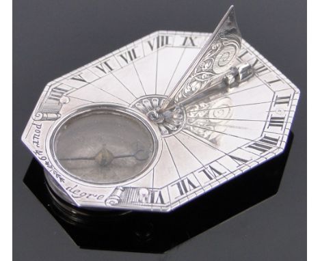
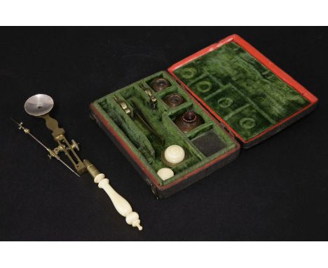
A rare compass microscope, c.1745, probably by George Adams, brass and steel, with turned ivory handle, in original shagreen case with green velvet lining,case 13cm wide9cm deep2.5cm highAn accompanying letter from John Bunyan, dated 19th March 1962, states that it is illustrated and described in Adams' 'Micrographia Illustrata', edn. 1747, p.16, pl.5 and in the Royal Microscopical Society catalogue, p.197, pl.15. (John Bunyan, LDS, RCS was president of the Society from 1958-1960).
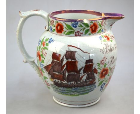
Los 324
A Sunderland lustre jug with loop handle; inscribed: 'John and Mary Bambe/Born 1751/Aged 77 years'; the exterior also portraying a three masted sailing vessel and a design and description of the Ship's Compass, 20cm high, 19th Century Condition Report Areas of deterioration including fritting, loss, chipping and repair - the handle has been broken off into two and re-glued at the rim and two other points, large fresher rim chip, smaller old rim chip, the circumference of the main body showing internal hairline extending approx half the diameter (partly visible on the exterior beneath the lettering 'Born 1751 ....... to handle), numerous older frits/chips to the footrim

-
36562 Los(e)/Seite