36562 Preisdatenbank Los(e) gefunden, die Ihrer Suche entsprechen
36562 Lose gefunden, die zu Ihrer Suche passen. Abonnieren Sie die Preisdatenbank, um sofortigen Zugriff auf alle Dienstleistungen der Preisdatenbank zu haben.
Preisdatenbank abonnieren- Liste
- Galerie
-
36562 Los(e)/Seite

Los 333
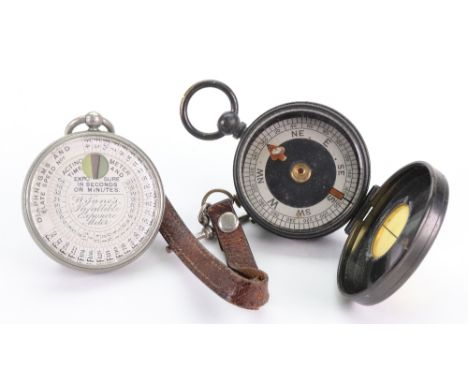
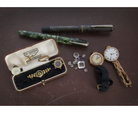
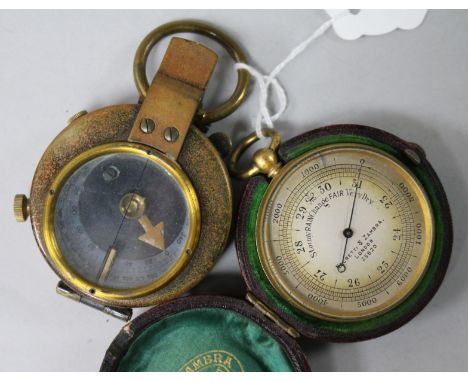
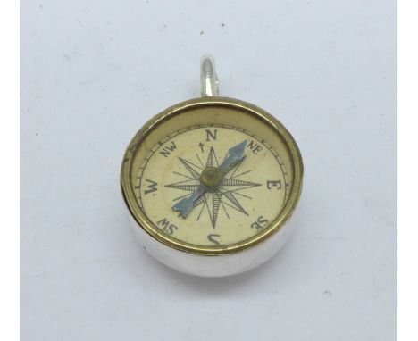
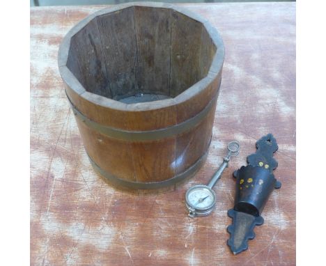
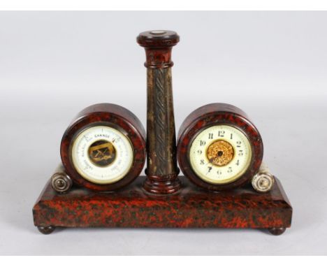
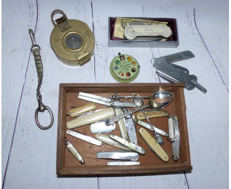
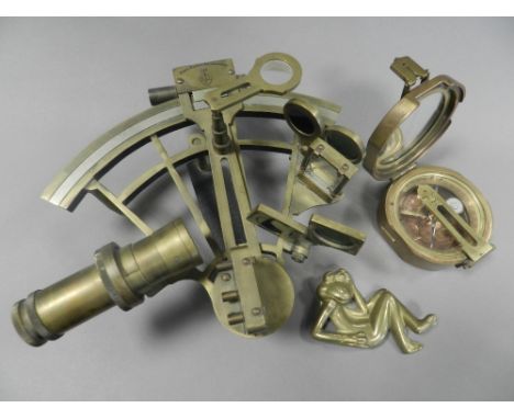
Two Edwardian and later 9ct gold cased ladies wristwatches and other items, one on a 9ct marked expanding strap, together with a 15ct gold peridot and seed pearl brooch in a case, a Conway Stewart in box, another fountain pen with 14k marked nib, a compass fob, two dress studs, a damaged gold plated ring and some loose cut paste stones (parcel)

Los 712
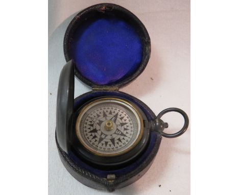
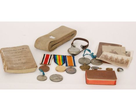
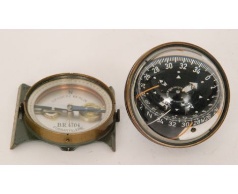
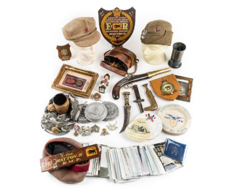
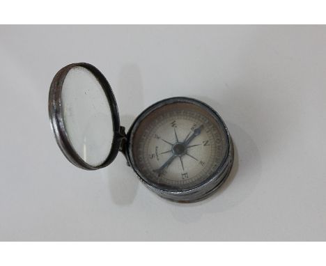
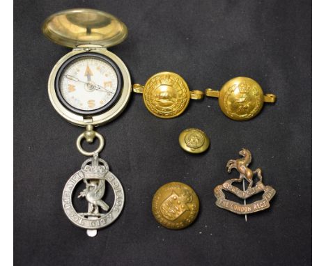
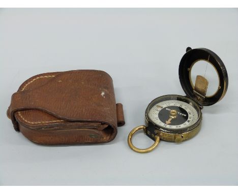
A World War I medal pair to 48226 Pte J.T. Bevan Worc R. together with a Special Constabulary medal, conforming ribbon bar, four other non-related ribbon bars, an F. Darton & Co pocket compass dated 1916, a 'Knowledge for War, Every Officer's Handbook For the Front', a copy of the 'Active Service Testament 1914' and soldiers prayer, two trench art signet rings, a rootwood swagger stick with plated Yorkshire Light Infantry terminal, oak framed photograph of Private Bevan, postcards, Jubillee medals etc. (qty)
Los 826
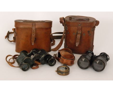
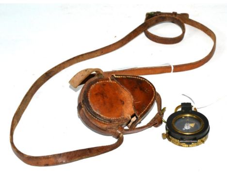
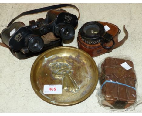
*WWII Binoculars. A pair of WWII Air Ministry binoculars by Bausch & Lomb, with A.M. markings and 6E/29 in original brown leather case with aperture for a compass, together with a Polish Army green sidecap applied with white metal badge, a 1950s Malayan Communist Party hat, khaki with embroidered red star, WWII 11th Hussars beret, various cap badges including Royal Naval Air Service and other items (a carton)
Los 973
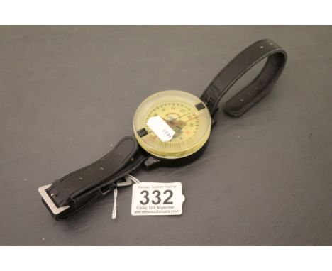
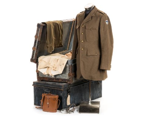
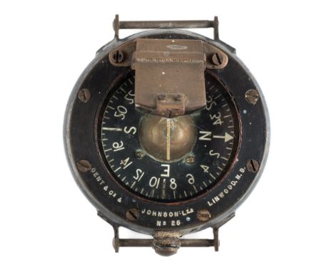
*Uniform. Uniforms belonging to Lieutenant-Colonel Thomas Wentworth Nickalls, 17/21 Lancers, comprising a large lead covered trunk bound with wooden struts, the lid inscribed CAPT. T.W. NICKALLS 17/21 LANCERS, enclosing regimental tunic with brass "Death or Glory" buttons, tailors label inscribed 'Lt. Col TW Nickalls 18.10.48', with cloth badges to each arm possibly Belgium Formation Badge of 2nd Army, trousers, two pairs of breaches, pair of Officer's spurs, two bone handle boot pull, military marching compass Mk III by T.G. Co Ltd, No 19616 dated 1940 in webbing case, a modern non-military pair of binoculars by Carton plus civilian clothes, together with another tin trunk the lid relating to his son Captain O.T. Nickalls, 17/21 Lancers, the lid inscribed LT. O.T. NICKALLS, 12 SIDNEY STREET, LONDON S.W.3. ENGLAND, enclosing pocket prayer book and civilian clothes, see lot 926 Lieutenant-Colonel Tom Wentworth Nickalls was born in 1903, served with 17/21 Lancers, commissioned 2nd Lieutenant 1923, Lieutenant 1925, Captain 1932, Major August 1940, advanced to Lieutenant-Colonel May 1944 and retired from service February 1945. (2 trunks)
Los 749
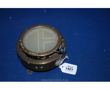
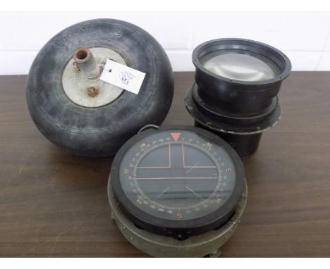
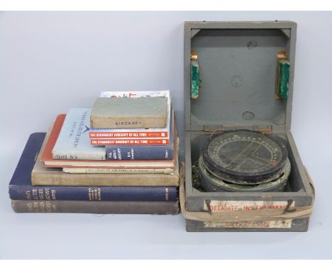
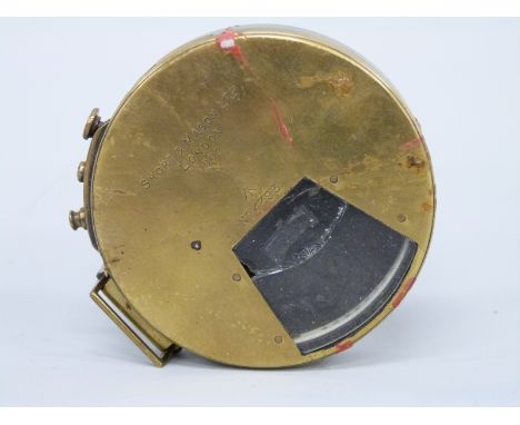
*Aircraft Compass. Military Type P10 aircraft compass, the black rim stamped TYPE P.10 No 16487 B, the grey casing stamped with war department arrow and 6A/1671, 19cm diameter together with a large lens from an aircraft reconnaissance camera, stamped f/6.3 and REF.14A/4264, 13.5cm diameter lens plus WWII period fighter aircraft tail wheel, 25cm diameter (3)
Los 750
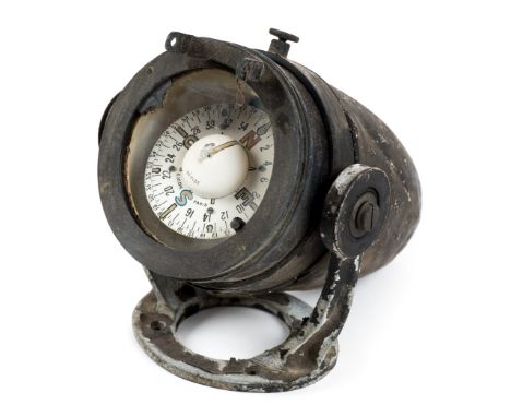
*Aircraft Compass. A rare WWI period French aircraft compass by E. Vion, Paris, the white circular dial in tapered aluminium case, hinged gimbal stand for securing to the aircraft, 11.5cm diameter x 22cm long Established in 1832, the company Vion were famous for optical instruments. In 1922 Eugene Vion took over the company and flourished with aircraft compasses, mostly being manufactured in the 1930s/40s. (1)
Los 176
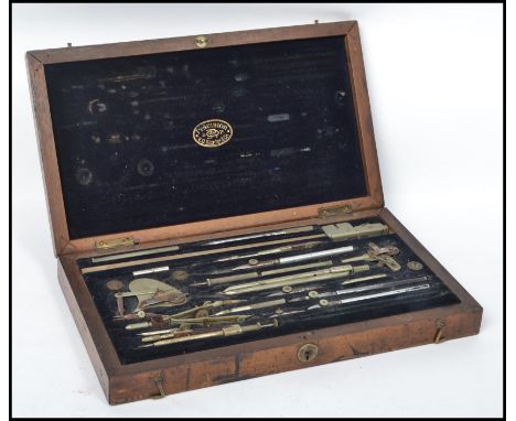
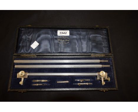
Drawing Instruments A fine set of draughtsman's nickel plated brass drawing instruments, by E. O. Richter & Co, most individually signed or with makers trademark, included in this set is a roller parallel rule, various proportional and other dividers, beam compass with fittings, marker pens and other associated accessories, all contained in a plush lined and fitted mahogany case, with lock, and two closing hooks. Measures 33 cm wide.
Los 159
Bristol. Meisner (Daniel), Brightstowe in Engellandt, circa 1630, uncoloured engraved town plan, printers fold, 95 x 145 mm, together with Greenwood (C. & J.), Map of the County of Northampton from an actual survey..., 1830 [and] Map of the County of Worcester from an actual survey..., 1830, two engraved maps with contemporary hand colouring, calligraphic title, table of explanation, compass rose, uncoloured engraved vignette of Peterborough cathedral and Worcester cathedral respectively, each approximately 600 x 700 mm, with Blome (Richard), A Mapp of Warwickshire with its hundreds, circa 1681, hand coloured engraved map, 320 x 265 mm, plus Bowen (Emanuel), Staffordshire drawn from the best authorities, published in 'The Universal Magazine', 1755, uncoloured engraved map, old folds, 200 x 175 mm, with another three maps similar (8)
Los 163
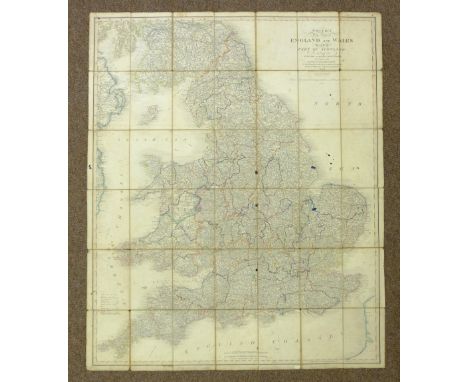
British Isles. A collection of eight folding maps, 18th & 19th century, including Faden (William), The Roads of Great Britain, 1781, engraved map with contemporary hand colouring, sectionalised and laid on linen, inset map of Scotland, some staining, 740 x 595 mm, later ink ownership signatures to verso, contained in contemporary marbled card slipcase with booksellers label with near contemporary manuscript title to upper board, worn and frayed, with another copy but with the linen worn and split along old folds, together with Paterson (Daniel), Bowles's New Pocket map of England & Wales with the addition of new roads and improvements, published Carington Bowles, circa 1790, engraved map with contemporary outline colouring, sectionalised and laid on linen, inset map of the Isles of Scilly, toned overall, splits along linen folds, 600 x 530 mm, contained in a contemporary marbled card slipcase with publisher's printed labels to upper and rear boards, worn, with Mogg (Edward), Mogg's map of Steam Navigation. Map of the United Kingdom or Water itinerary of Great Britain & Ireland with the adjacent parts of the continent from Amsterdam to Paris and Brest..., Jany. 1st. 1841, engraved map with bright contemporary hand colouring, sectionalised and laid on linen, inset map of the Shetland Islands, compass rose and table of British counties, 775 x 610 mm, printed instructions on endpapers, contained in a contemporary card slipcase with printed label to upper board, frayed at extremities, plus Smith (Charles), A New Map of England and Wales comprehending the whole of the Turnpike roads with the great rivers and navigable canals, 2nd edition, 1808, engraved map with contemporary hand colouring, sectionalised and laid on linen, 570 x 460 mm, publisher's card slipcase with printed label to upper board, some wear to extremities, and Cary (John), A New Map of England from the latest authorities, 1818, engraved map with contemporary hand colouring, sectionalised and laid on linen, slight wear to linen folds, 565 x 485 mm, marbled endpapers, together with, Kerr (Thomas & Co., publishers), England, circa 1860, engraved map with contemporary hand colouring, sectionalised and laid on linen, dust and finger soiled, 570 x 470 mm, contemporary cloth boards with publisher's label to upper cover, spine frayed with slight loss, boards stained, and Smith (Charles), Smith's New Map of England and Wales with part of Scotland, including the Turnpike and principal Cross roads..., 1841, engraved map with contemporary outline colouring, sectionalised and laid on linen, toned overall, several ink stains affecting image, some spotting, 1150 x 945 mm (8)
Los 165
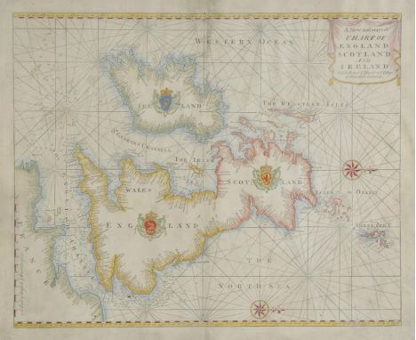
British Isles. Mount (W. & J. & Page T., publishers), A new and correct Chart of England, Scotland and Ireland, circa 1748, hand coloured sea chart orientated to the west, compass rose and numerous rhumb lines, some soiling but largely confined to margins, small repair to central fold, occasional repaired worm holes, 450 x 560 mm (1)
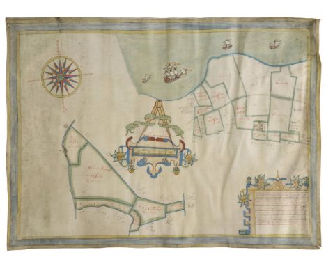
Los 196
Isle of Thanet. Boycot (Gulielmus) Untitled estate plan, circa 1650, pencil and watercolour on vellum, large mileage scale topped by dividers, large compass rose, some dust soiling and slight creasing, 440 x 595 mm The surveyor's note in the lower right corner reads :- The description of one meassuage called Streete farme with 14 pcells of Arable thereunto belonginge lyinge in the parishes of S. Johns & minister in the Ile of Thannett conte. 107 - 0 - 26 more 6 pcells of fresh marsh lyinge in the parishes of Chisslett & S Nicholas conty 91 - 1 - 27. (1)
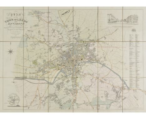
Los 198
Leeds. Fowler (Charles), Plan of the Town of Leeds and the environs; including Woodhouse Carr, Knostrop, Hunslet, Holbeck and New Wortley..., 1831, engraved map with contemporary outline colouring, sectionalised and laid on oil cloth, vignette view of the western entrance to Leeds and a vignette of Jefferies' Plan of Leeds, compass rose and a table of explanation, 575 x 815 mm, contained in a contemporary green blind stamped morocco slipcase with printed label to upper board (1)
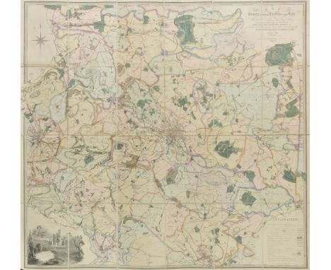
Los 199
Leeds. Martin (S. D.), Map of the Country extending ten miles round Leeds, including Wakefield, Bradford, Dewsbury, Otley, Harewood, Aberford & Castleford, shewing all the Parish and Township Boundaries &c., ..... re-surveyed & Corrected to January 1st. 1849 by Martin & Fox, Surveyors, Leeds, large folding engraved map with contemporary hand colouring, sectionalised and laid on linen, uncoloured vignette of Kirkstall Abbey, table of explanation and compass rose, 115 x 1230 mm, contemporary green morocco gilt boards, retaining original metal clasp, worn and frayed, spine partially lacking, upper board detached (1)
Los 209
Middlesex & Surrey. Greenwood (C. & J.), Map of the County of Middlesex from an actual survey..., 1829 [and] Map of the County of Surrey from an actual survey..., 1829, two engraved maps with contemporary hand colouring, both with calligraphic titles, tables of explanation, compass rose and uncoloured engraved ecclesiastical vignettes, each approximately 600 x 700 mm, together with the western sheet of Joseph Smith's two sheet plan of London, an uncoloured engraved plan, 590 x 490 mm, with another approximately twenty-five plans of the River Thames, 19th and early 20th century, various sizes and condition (28)
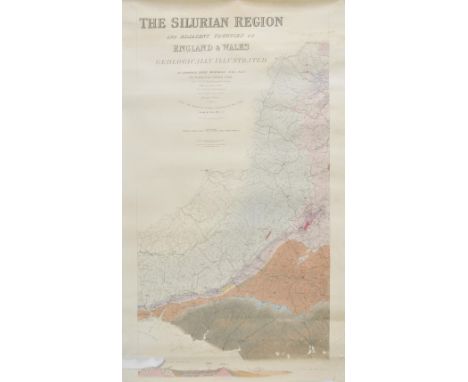
Los 213
Murchison (Roderick Impey). The Silurian Region and Adjacent Counties of England and Wales. Geographically Illustrated By Roderick Impey Murchison F.R.S. F.L.S. Vice President of the Geological Society. Late V.P. of the Royal Geographical Society. Memb. Geol. Society France. Hon. Memb. Royal Irish Acad. and of other Scientific Societies in France, Germany and America. From the Ordnance Survey Coloured in the Field during the Years 1831-8. Drawn and Engraved by J. Gardner, Regent Street, London, [1839], engraved map on three sheets (as published), mostly of Wales, with contemporary hand colouring, geological cross section at base of map, table of explanation, compass rose inset geological map of England & Wales, slight staining, central sheet with small area of rodent damage causing slight loss, each sheet approximately 960 x 510 mm An important and scarce geological map. (3)
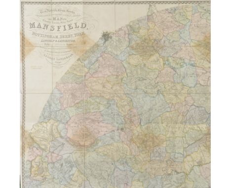
Los 218
Nottinghamshire. Sanderson (George) To the Nobility, Clergy, Gentry, Professional Gentlemen and Public in General, this Map of the Country Twenty Miles Round Mansfield, Comprehending Parts of the Counties of Nottingham, Derby, York, Lincoln and Leicester, showing the fields and characteristic features of the district..., published Mansfield, July 10th 1835, monumental circular wall map, engraved by J. & C. Walker, on four sheets, sectionalised and laid on linen, with contemporary hand colouring, calligraphic title, compass rose, table of explanation and an engraved vignette of Newstead Abbey, some staining causing slight fraying to paper, each sheet 1135 x 1140 mm, contained in later blue cloth slipcase (1)
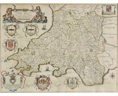
Los 230
*South Wales. Blome (Richard), A Generall Mapp of South Wales..., circa 1673, hand coloured engraved map, old folds, 350 x 465 mm, mounted, framed and glazed, together with, Saxton (Christopher & Hole William), Monumethensis comitatus quem olim incoluerunt silures, circa 1610, hand coloured engraved map, large strapwork cartouche, mileage scale and compass rose, 275 x 345 mm, mounted, framed and glazed (2)
Los 189
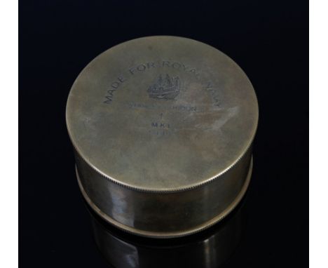
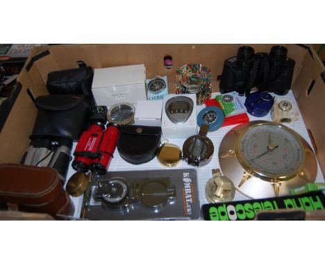
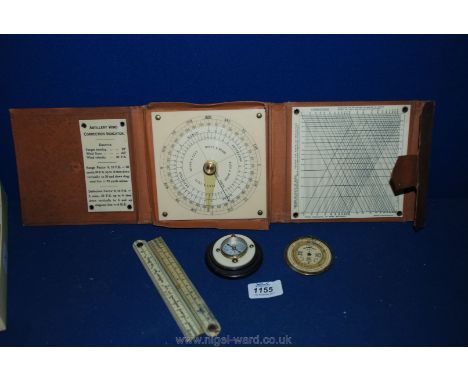
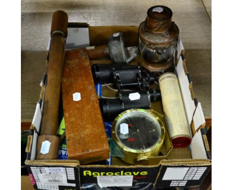
A DEALERS/TRADERS LARGE BOX CONTAINING A NUMBER OF MILITARY STYLE ITEMS, three cannisters for possibly German WWII gas masks, eleven pairs of binoculars, two hand held looking glasses, a metal drinking vessel, three leather ammunition belts webbing and a Scottish hat, also present is a boxed Planimeter, boxed British gas mask, also a box of military buttons and a boxed naval compass
-
36562 Los(e)/Seite