36562 Preisdatenbank Los(e) gefunden, die Ihrer Suche entsprechen

Verfeinern Sie Ihre Suche

Jahr

Sortieren nach Preisklasse
  • Liste
  • Galerie
  • 36562 Los(e)
    /Seite

Los 193

Various collectables in a vintage military themed Geo. Bassett & Co biscuit tin to include a boxed Ronson lighter inscribed with the initials 'AM', a 1920s Ansonia Sunwatch compass, three pocket compass, a pack of De la Rue's shilling card games, a pair of cufflinks, a vintage corkscrew with bottle popper (af), plated magnifying glass, a small whistle, various collar studs and a pocket Coronet Scoper (13).

Los 215

Various mixed collectables to include daguerreotypes, compact in the form of a piano, magnifying glass, coins brass plaques, compass, silver handled button hook etc.

Los 227

A hardstone globe on a brass-effect stand, united by a cross-stretcher mounted with a compass, height 46cm.

Los 244

Various collectibles to include a pair of military binoculars, a compass in wooden box, a wall-hanging cross, a copper horn, hip flask, a miniature Petie camera, Salter spring scales, a hand bell and a brass crimping tool (10).

Los 250

A pair of Kingsley floral enamel napkin rings in presentation box, a reproduction maritime brass compass in wooden box and an unusual Walter Bosse style nest of six pewter hedgehog ashtrays (3).

Los 549

A vintage Henry Browne Sestrel compass, possibly military, in black painted case, a Plastimo brass-cased weather barometer and a Dolland four-drawer telescope (3).

Los 786

A hallmarked 9ct gold Masonic pendant with set square, compass and 'G' under royal arch, a hallmarked 9ct gold Masonic pin, a yellow metal Masonic pin, the square and compass inset with tiny diamonds, also a 9ct gold St Christopher and a 9ct gold airplane pin, approx combined 9.5g.

Los 866

A 19th century hallmarked 18ct gold ring, central vacant mount flanked by two small rubies approx 2.2g, a small compass pendant in gold coloured case suspended on a gold plated necklace and a pair of amber drop earrings with silver screw backs (3).

Los 13

§ NEIL MACPHERSON R.S.A. (SCOTTISH CONTEMPORARY) STUDY FOR 'THE APOSTLE OF THE NORTH', 1992 Signed lower right, oil on board(25cm x 20cm (9.75in x 8in))Footnote: Exhibited: 'Christmas Exhibition', Compass Gallery, Glasgow, 1992 Provenance: The Late Dr Helen E C Cargill Thompson

Los 63

§ MARK I'ANSON (SCOTTISH B.1968) AFF THE MERRY GO ROUND III Ink and wash(16cm x 10.5cm (6.25in x 4in), and a further work by the same artist, 'Christopher' (2))Footnote: Exhibited: Compass Gallery, Glasgow

Los 296

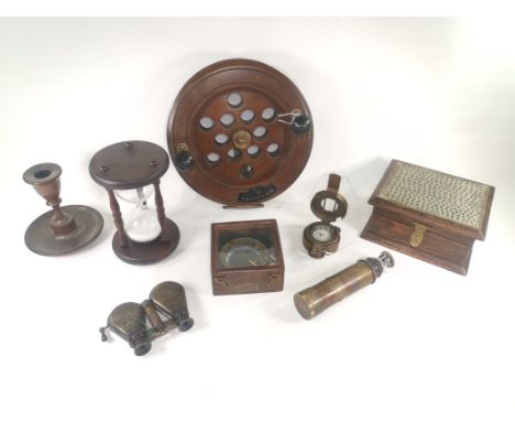
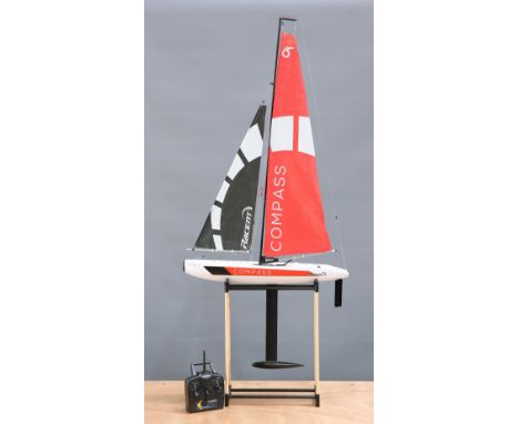
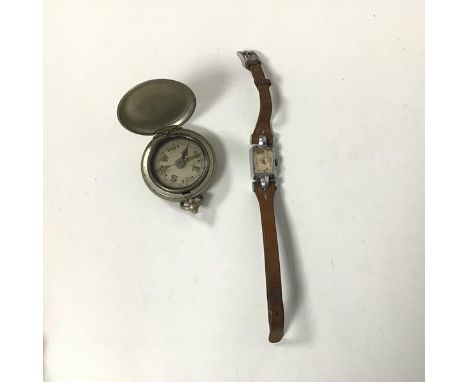
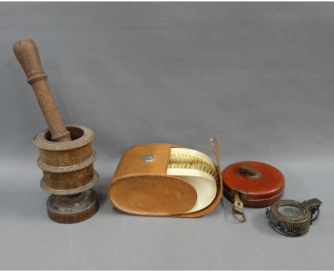
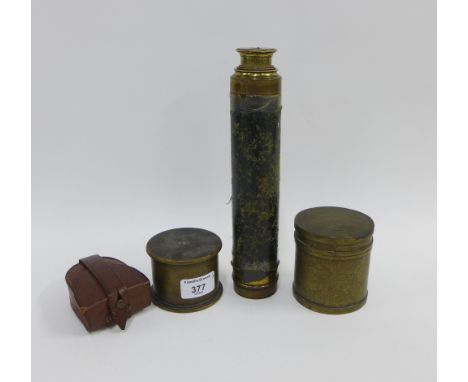
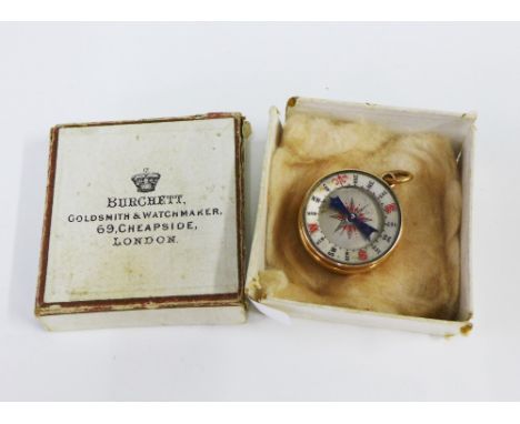
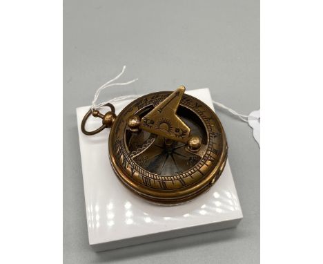
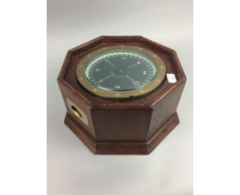
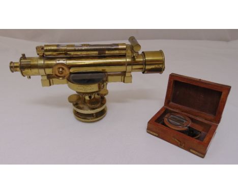
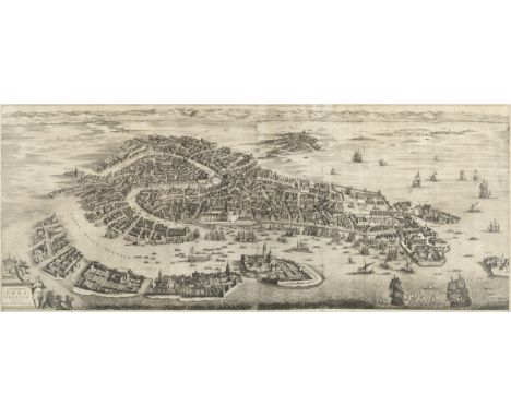
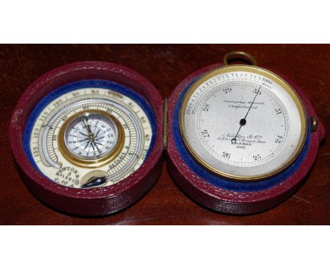
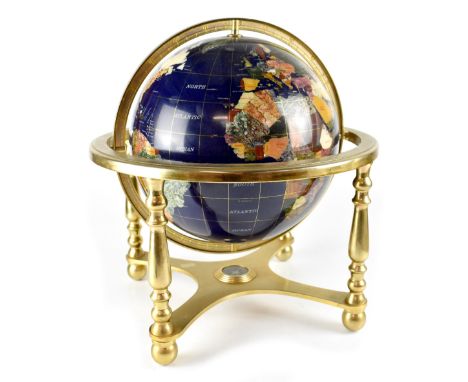
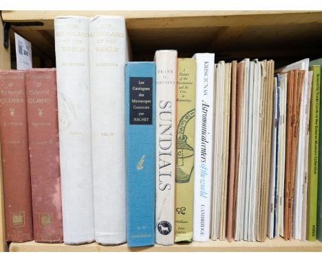
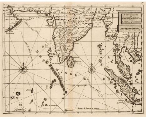
Gunther (Robert T.). The Astrolabes of the World, based upon the series of instruments in the Lewis Evans Collection in the Old Ashmolean Museum at Oxford, with notes on astrolabes in the collection of the British Museum, Science Museum, Sir J. Findlay, Mr S.V. Hoffman, The Mensing Collection, and in other public and private collections, 2 volumes, Oxford University Press, 1932, numerous monochrome illustrations, original white cloth gilt, rubbed and some light soiling, 4to, together with: Wheatland (David P.). The Apparatus of Science at Harvard 1765-1800, Harvard University Press, 1968, colour and monochrome plates and illustrations, original red cloth gilt, some marks, 4to, plus: Takacs (Kornelia). Compass Chronicles, Schiffer Publishing Ltd., 2010, numerous colour illustrations, original pictorial boards in matching dust wrapper, 4to, and others on antique scientific instruments, microscopes, clocks, globes, etc., including Edward Luther Stevenson, Terrestrial and Celestial Globes, Their History and Construction, 2 volumes, Newhaven, Yale University Press, 1921, Silvio A. Bedini, Early American Scientific Instruments and Their Makers, Washington, Smithsonian Institution, 1964, L.A. Mayer, Islamic Astrolabists and Their Works, Geneva, Albert Kundig, 1956, Frank W. Cousins, Sundials, 1969, etc., including many related exhibition and auction catalogues, original cloth and printed wrappers, mainly 4to/8vo (approximately 150 volumes)Qty: (3 shelves)

Los 331

British Isles. Blaeu (Johannes), Anglia Regnum, Amsterdam, circa 1662, engraved map with contemporary outline colouring, slight spotting and dust soiling, upper margin strengthened on recto, 385 x 500 mm, Spanish text on verso, together with Blome (Richard). A Mapp of Staffordshire with its Hundreds, circa 1673, engraved map, hand-coloured in outline, 330 x 245 mm, with Morden (Robert). Cheshire, circa 1705, uncoloured engraved map, 165 x 200 mm, plus Williams (G. Commander, surveyor). Isle of Man, Admiralty chart, 1846, last update 1977, colour photolithographic map, inset maps of Port Erin, Peel, Calf Sound, Castletown Bay, Ramsey Bay & Port St. Mary, the title of each inset map scored through in biro, old folds, slight browning, 1020 x 665 mm and Mount (William & Page Thomas). A New and Correct Draught of the Channell between England & France, shewing ye Sands, Shoales, depth of Water & Anchorage on ye said Coasts with the Setting of the Tydes and the time of High water as observed by Capt. Edm. Halley, circa 1748, an uncoloured engraved chart on two conjoined sheets, inset map of the Scilly Isles, horizon profiles to upper margin, compass rose and numerous rhumb lines, old folds, heavily dust-soiled, some spotting and staining, near-contemporary manuscript annotations to verso, 450 x 815 mm, together with Faden (William). A Map of the Mediterranean Sea with the Adjacent Regions and Seas in Europe, Asia and Africa, 1785, engraved map with bright contemporary hand colouring, large uncoloured allegorical cartouche, 605 x 850 mmQty: (6)NOTESThe Mount and Page chart of the English Channel was an immediate reaction to Edmond Halley's 'Fundamental Thematic Map of the English Channel'. The importance of understanding longitude was well known, but the tidal flow of the seas and their unpredictability was a major navigational hazard resulting in heavy losses of vessels, especially on the approach to harbours and ports. Halley's voyage aboard the "Paramore" in 1701, enabled him to produce a map of the English Channel which for the first time, enabled a prediction of the tides. Its genius was that it made something that was extremely complicated, understandable by 18th-century mariners. Mount & Page published a derivative map in 1702 and this example was published in the 'English Pilot' of 1749.

Los 336

Carmarthenshire. Speed (John), Caermarden Both Shyre and Towne described, John Sudbury & George Humble, [1627], hand-coloured engraved map, inset map of Carmarthen, large strapwork cartouche and compass rose, very slight dust soiling to central fold, slight marginal staining, 385 x 510 mm, English text on verso, together with Jansson (Jan). Penbrochia Comitatus et Comitatus Caermardinum, Amsterdam, circa 1650, engraved map with contemporary hand-colouring, some browning, 385 x 520 mm, German text on versoQty: (2)

Los 343

England & Wales. Dower (J.). A New Map of England & Wales Divided into Counties, Parliamentary Divisions & Dioceses shewing the Principal Roads, Railways, Rivers & Canals and the Seats of the Nobility and Gentry..., Edward Stanford, 1862, large engraved map with bright contemporary hand colouring, sectionalised and laid on linen on two sheets, large calligraphic title, compass rose, table of explanation, a list of proposed ports and table of the Dioceses of Canterbury, very slight browning, edged in green silk, each sheet approximately 1050 x 1700 mm, embossed endpapers, contained in a contemporary morocco gilt slipcase, worn at extremitiesQty: (1)

Los 346

Essex. Greenwood (C & J), Map of the County of Essex, from an actual survey made in the year 1824..., Greenwood, Pringle & Co. July 1st 1825, large scale uncoloured engraved map, sectionalised and laid on modern linen on three sheets, calligraphic cartouche, table of explanation, compass rose and a vignette view of Audley End House, later marbled endpapers, modern paper chemise, contained in a modern morocco book-box with contrasting morocco gilt labels to spine, each sheet approximately 1320 x 535 mmQty: (1)

Los 356

Indian Ocean. De Bruyn (Cornelius) Route Exacte de Gamron à Batavia et de Batavia à Gamron, originally published in "Travels into Muscovy, Persia, and part of the East-Indies…", 1737, an uncoloured engraved map showing De Bruyn's route from Gamron (Bandar Abas) to Batavia (Jakarta), compass rise and numerous rhumb lines, large margins, 235 x 305 mmQty: (1)

Los 362

Lancashire. Hennet (G.), A Map of the County Palatine of Lancaster Divided into Hundreds and Parishes from an accurate survey made in the years 1828 and 1829, Henry Teesdale and Co. May 1st. 1830, large scale engraved map with contemporary outline colouring, sectionalised and laid on linen, calligraphic cartouche, compass rose, table of explanation, uncoloured vignette of the New Custom House Liverpool, some offsetting and staining, marbled endpapers, edged in green silk, 1615 x 1130 mm, marbled endpapers, contained in a contemporary calf book-box with contrasting modern morocco gilt label to spine, box worn and rubbedQty: (1)

Los 367

* Manchester. Dean (R. & W. publishers), A Plan of Manchester and Salford, 1809, hand-coloured engraved map, compass rose and decorative cartouche, 455 x 655 mm, mounted, framed and glazed, together with Baines (Edward). Manchester and its Environs engraved from an actual survey..., by William Swire, Leeds, 1824, hand-coloured engraved map, inset plan of Manchester in 1650, decorated with topographical vignettes and coats of arms, old folds, some spotting, 415 x 520 mm, mounted, framed and glazed, with Hall (Sidney). Bolton, 1824, uncoloured engraved city plan, slight staining, 175 x 250 mm, mounted, framed and glazed plus Morton (W.). A Plan of Manchester and Salford taken in about 1650, circa 1840, hand-coloured engraved plan, toned overall, unobtrusive blind stamp to the upper right corner, 130 x 180 mm, mounted, framed and glazedQty: (4)

Los 384

* Poland. Blauvitz (Christoph), N - Ro I. Diese Carte zeiget uns dass Hoch Freiherrl. Fidei Comiss guth Praub mit dem herschafftlichen Schlob und forweds gebäuden auch Kirch und Pfarr haub sambt allen ... Und zu gehörigen Feldern..., A Manuscript plan of Prusy (Prauss) in Strzelin (Strehlen) County near Breslau, circa 1740, a pen and watercolour plan of the village of Prauss, a large decorative cartouche, compass rose and mileage scale showing a surveyor using a pair of dividers, old folds, some creasing, occasional repaired closed tears, 425 x 860 mm, mounted, framed and glazedQty: (1)NOTESPrauss (now Prusy) is a village in South-west Poland. This plan was made during the First Silesian War (1740 - 42) between Prussia and Austria and the Prussian victory and the subsequent 'Peace of Breslau and the Treaty of Berlin resulted in the bulk of Silesia and the Bohemian County of Kladsko being ceded to the Prussians. This area was later consolidated as the Province of Silesia.

Los 395

River Thames. Jaillot (Alexis Hubert), Carte de Entrée de la Tamise avec les Bancs, Passes, Isles et Costes Comprise entre Sandwich et Clay, Depot de la Marine, Paris [1693 or later], hand-coloured engraved map orientated to the east, inset map of the River Thames, compass rose and numerous rhumb lines, slight marginal creasing, and one repaired marginal closed tear, one small hole in the margin but not affecting image, central fold strengthened on verso, 460 x 900 mm, together with Wells (J. B. publisher). A New Map from the Mouth River Thames to the Severn, shewing a great space of Country on each side of the River Thames with the Mail and other Stage Roads from London..., 1798, uncoloured engraved map decorative cartouche, some spotting and staining, old folds strengthened on verso, 340 x 925 mmQty: (2)NOTESThe first described chart is a later 18th-century impression because the north 'point' on the compass rose has had the fleur-de-lys replaced with a revolutionary bonnet.

Los 401

Sea Charts. Sayer (R. & Bennett J.), A Chart of the Entrance into the Channel containing the West Coast of Cornwall and Scilly Isles with all the Soundings, 1779, hand-coloured sea chart, compass rose and numerous rhumb lines, seven inset horizon profiles, some near-contemporary marginalia, 520 x 710 mm, Greenville Collins (Captain). Untitled chart of south-west Cornwall, and the Scilly Isles, circa 1720, uncoloured engraved chart, compass rose and numerous rhumb lines, 450 x 575 mm, with Laurie (Robert & Whittle James). Plans of the Bays of Polkerris and Mevagizey in Cornwall, 1794, hand-coloured engraved sea chart, two inset horizon profiles, 650 x 470 mm, plus Halley (Edmund). Isle of Wight and Portsmouth, circa 1710, uncoloured engraved chart, on a sheets with five other charts comprising of, Portland, Dartmouth, Falmouth Harbour, Plymouth Sound [and] the course of the River Thames, margins frayed and torn, repaired on verso, slight overall browning, 505 x 575 mmQty: (4)

Los 409

Waghenaer (Lucas Janzoon). Angliae Orae Maritimae Inter Plemoutham Et Portlandiam..., [1585 or later], hand-coloured decorative engraved sea chart with a large compass rose and ornate strapwork cartouche, Dutch text to horizontal margins and on verso, central fold strengthened and repaired on verso, 355 x 510 mmQty: (1)

Los 5

Maritime 'Captain Cabin' map reader compass with magnifying glass, together with a selection of maritime collectables including a 1940 MKIII TG. Co brass military compass, a 'Seareel' reel, R & J Beck folding pair of binoculars, etc. (small quantity) .

Los 379

Quantity of Various Webbing consisting American, khaki green canvas Waterproof Suitcase, complete with straps ... 1944 pattern, webbing compass case ... 4 x 1937 pattern waterbottle cradles ... 2 x 1937 pattern, webbing belts ... Webbing bayonet frog ... 16 x 1937 pattern pack L straps. Quantity.

Los 322

MARINE INTEREST, CLOCKS ETC to include a brass cased binnacle type clock, modern Quartz example, boxed handheld pilot's compass, pocket compass and a vintage type travel clock

Los 142

Weather vane, with rotating pig above the four compass points, 66cm wide, 96cm high

Los 116

BOX CONTAINING A COMPASS AND A COMPACT WITH TERRIER PICTURE TO FRONT

Los 5046

A VOLANTEX COMPASS 2.4GHZ RTR YACHT, V791-1, the 650mm fibreglass sailing model with transmitter, on display stand. Yacht height approx. 137cm (excluding stand)

Los 6

A Roamer 1930s/40s lady's wristwatch, the rectangular dial with hoop and bar fastening for leather strap, engraved A.I.C.W., no.87069 (18cm), also a pocket compass in the form of a pocket watch (2)

Los 179

Mixed lot to include a turned wooden mortar and pestle, vintage Chesterman tape measure, MKIII compass, leather case with brushes, (a lot)

Los 377

Negretti and Zambra compass in a brown leather case, two trench art shell cases and a four drawer brass and leather telescope, (4)

Los 52

18ct gold mounted barometer and compass pendant, stamped 18ct, 3cm diameter, with a Burchett Goldsmiths & Watchmakers, Cheaspside, London box.

Los 236

A brass 19th Century surveyor’s level by Thomas Street of London on a revolving circular base, 18 x 32.5cm and a cased brass compass

Los 174

4 BRASS HANDLED WALKING STICKS INCLUDING DOG, DUCK AND COMPASS

Los 37

VINTAGE C J H ROSTFREI #724 MILITARY KNIFE WITH FITTED COMPASS TO HANDLE

Los 78

German Third Reich Reichsbahn belt buckle, stamped R.Z.M. M34/2 to the reverse, a Condor Legion silver wound badge and a brass version, together with a military compass. (4)

Los 650

A mahogany framed glazed 'shadow box', on a maritime theme, containing various memorabilia, cleats, shackle, pulleys, compass, wheel etc, overall dimension 76x110cm

Los 91

VENICEAA (PIETER VAN DER) Celeberrima urbs Venetiae, engraved panoramic bird's-eye-view on 2 sheets (joined), of Venice and its surrounding islands, architectural title cartouche in lower left incorporating the lion of St. Mark's, and a female personification of the city holding a cornucopia, compass rose and ships in the sea area, light creases visible from old fold, small losses at one vertical crease touching a couple of buildings, 410 x 1022mm., Leiden, [c.1729]This lot is subject to the following lot symbols: •• Zero rated for VAT, no VAT will be added to the Hammer Price or the Buyer's Premium.For further information on this lot please visit Bonhams.com

Los 48

A TALL NAUTICAL CLOCK INCORPORATING FIVE INTERNAL SHELVES AND A COMPASS H: 80CM

Los 171

AN ASSORTMENT OF ITEMS TO INCLUDE A BRASS COMPASS, A FOR 50 YRS CALENDAR 1992-2041, A SUBMARINE TIE PIN AND A QUARTZ TRAVEL CLOCK

Los 20

A WOODEN WALKING STICK INCORPORATING A COMPASS IN THE HANDLE

Los 3

A LAPIZ LAZULI AGATE GEMSTONE HANDCRAFTED LARGE GLOBE INCORPORATING A COMPASS H:46CM

Los 9037

A rummage tray of vintage and antique collectables, comprising of travelling inkwells; pipe shaped smokers knife; picnic knife and fork set; compasses; travelling cup container fashioned as compass / pocket watch; wax jack; Japanese Meiji period gold lacquer miniature chest of drawers; brass snuff box fashioned as a book; two silver and enamel trinket boxes (a/f); miniature books, purses and aide memoire; engraved brass letter clip with three graduated miniature paintings; collection of miniature seals of varying forms; Victorian brass pillar postal scales, polished steel lorgnettes, folding glasses etc. (quantity)

Los 1042

A 1940 T. G. Co. Ltd MKIII army issue marching compass, with broad arrow, No. B 75944, with leather pouch and belt; together with a group of vintage tobacco and other tins and a pipe. (qty)

Los 1055

A Second World War Air Ministry Astro Compass MkII, numbered 6A/1174 4P, in original blue painted pine box.

Los 166

Boxed brass sundial compass marked Cox London. P&P Group 1 (£14+VAT for the first lot and £1+VAT for subsequent lots)

Los 203

Box of vintage instruments to include compass set, plastic and wooden rulers, transparent bevelled edge French curves, pencils etc. (B.P. 21% + VAT)Fountain pen is marked Conway Stewart, no model number, has a 14ct gold nib.

Los 41

J.D. Lang & Co Glasgow brass ships binnacle compass. (B.P. 21% + VAT) Generally worn with use as expected.Scratch to serial number Impressed marks 8819Some dinks and dents.

Los 161

A 19th century lacquered brass meteorological pocket case suite, by Newton & Co., Fleet Street, London, comprising an aneroid barometer and combination thermometer enclosing a compass, 4.6cm diam, fitted roan case**Please note all lots must be collected from Sudbury, Derbyshire on the 30/31/3 OR 1/4, a surcharge of £10 will be charged if the item is not collected and removed to the saleroom**

Los 12

9ct gold gent"s Masonic ring, the oval centre chased and engraved with a compass and ruler motif to a plain polished shank, size V, 6.4gms

Los 247

Mixed Lot: hallmarked silver cased pen knife, a silver framed cigar cutter, vintage brass cigarette roller, metal compass on chain together with a reproduction coin pendant

Los 459

Glory bag collection includes Metal Nutcracker, Digital watch with compass, Vintage Map Taunton and Lyme Regis, The Remington Historical of American Guns book and Antique Guns by Hank Bowman softback book. Good condition We combine postage on multiple winning lots and can ship worldwide. UK postage from £4.99, EU from £6.99, Rest of World from £8.99

Los 405

A cast-iron weathervane,19th century, with scrolling wrought detail and an arrow-shaped wind indicator,97cm wide228cm highCondition report: Rust, weathering and general wear, compass points misshapen.

Los 3062

British WWII or later military marching compass MKI. P&P Group 1 (£14+VAT for the first lot and £1+VAT for subsequent lots)

Loading...Loading...
  • 36562 Los(e)
    /Seite

Kürzlich aufgerufene Lose