36562 Preisdatenbank Los(e) gefunden, die Ihrer Suche entsprechen
36562 Lose gefunden, die zu Ihrer Suche passen. Abonnieren Sie die Preisdatenbank, um sofortigen Zugriff auf alle Dienstleistungen der Preisdatenbank zu haben.
Preisdatenbank abonnieren- Liste
- Galerie
-
36562 Los(e)/Seite

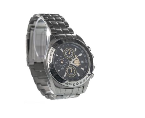
Los 721
GENTLEMAN'S ROYAL MARINES COMMANDO STAINLESS STEEL QUARTZ WRIST WATCH, the round black dial with applied wedge hour markers, date aperture at 3, subsidiary dials at 6, 9 and 12, inner tachymeter scale in white, with compass style bezel, 41mm case, on a stainless style bracelet, lacking box and papers
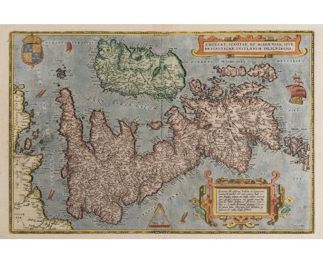
Los 127
British Isles.- Ortelius (Abraham) Angliae, Scotiae, et Hiberniae, sive Britannicar Insularum Descriptio, Ortelius' earliest map of Britain, oriented with north to the right, and embellished with two ornate strapwork cartouches, a royal coat of arms, a compass and scale, and five sailing ships, engraving with hand-colouring on laid paper with watermark of crossed arrows, platemark 345 x 500 mm (13 1/2 x 19 3/4 in), sheet 405 x 560 mm (16 3/4 x 22 in), Latin text verso, central vertical fold with repaired splitting and small area of loss to border restored in facsimile, handling creases and cockling to sheet, surface dirt, small nicks to edges, unframed, [circa 1570 or slightly later]Literature:VdB 16
Los 128
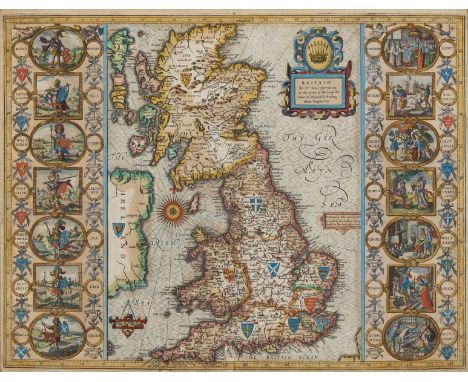
British Isles.- Speed (John) Britain as it was devided in the tyme of the Englishe Saxons especially during their Heptarchy, decorative map of the British Isles with compass rose and numerous rhumb lines, fourteen engraved vignettes of historical scenes and Saxon kings to the vertical margins, engraving with hand-colouring, on laid paper with armorial watermark, 390 x 510 mm. (15 1/4 x 20 in), under glass, English text verso, central vertical fold with careful repairs to splits and two areas of loss restored to foot, small hole in the upper section, small margins with left and right edges re-margined, framed, Sudbury and Humble [circa 1611 but slightly later].
Los 129
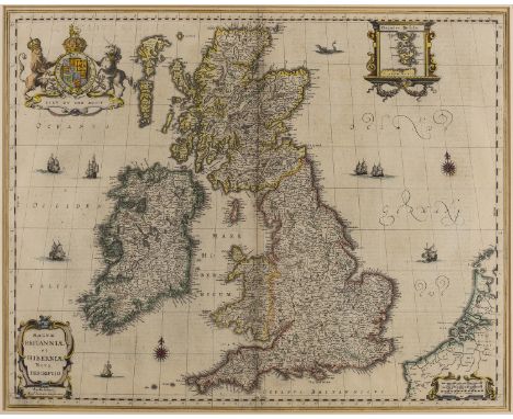
British Isles.- Jansson (Jan) Magnae Britanniae et Hiberniae nova descriptio, inset map of the Orkney Islands in the upper right corner, numerous sailing ships, two compass roses, and a sea monster just north off the coast of Aberdeen, engraving with outline hand-colouring, platemark 430 x 545 mm (16 7/8 x 21 1/2 in), sheet 470 x 550 mm (18 1/2 x 21 3/4 in), German text verso, central vertical fold reinforced with careful repair to splitting in the lower section, even toning and some minor spotting and surface dirt, taped at edges into mount, unframed, Amsterdam, [circa 1646]
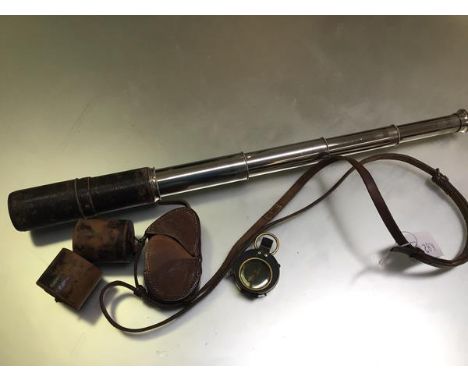
Los 462
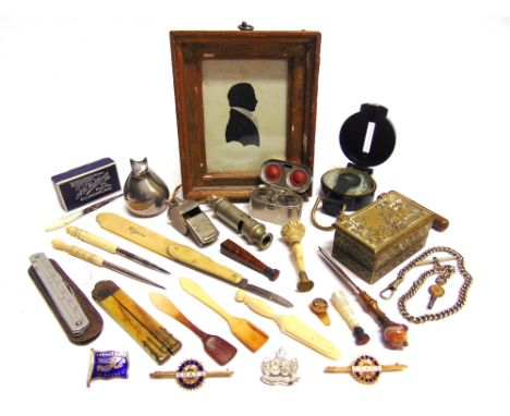
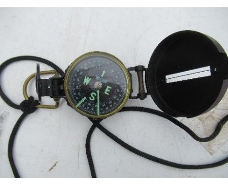
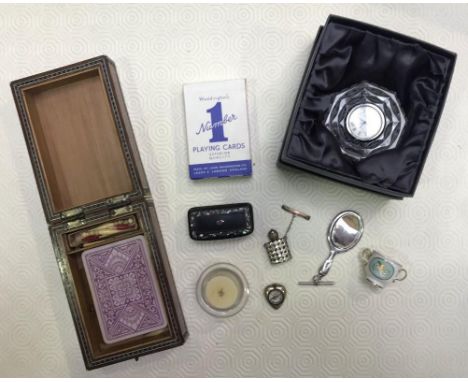
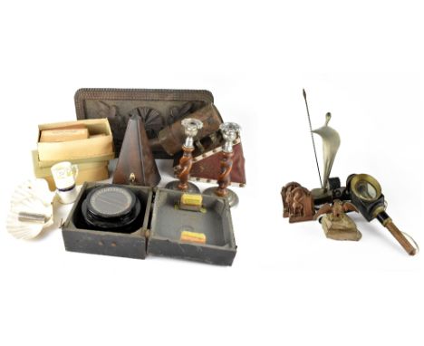
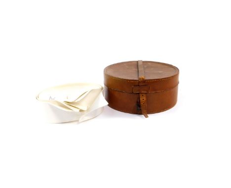
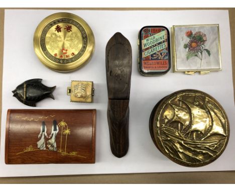
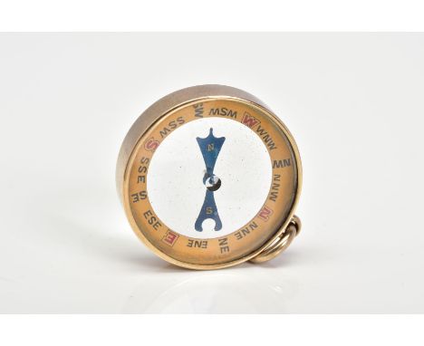
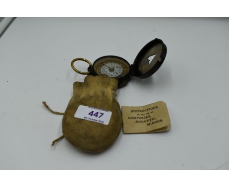
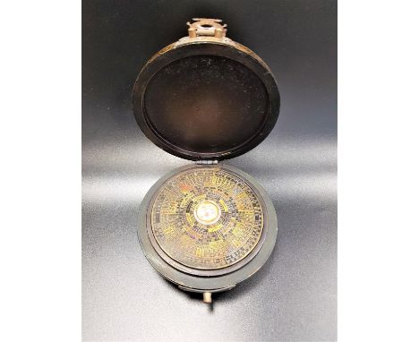
ASSORTED COLLECTABLES comprising a brass vesta box, the lid depicting St. George and the dragon, 7.5cm wide; a travelling double inkwell; a whistle by J. Hudson & Co., Birmingham, dated 1915; a miniature silhouette portrait of a gentleman, 10cm x 7.5cm; a bakelite pocket compass; and other items.
Los 10
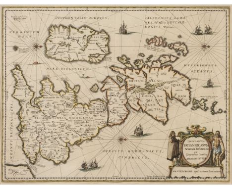
* British Isles. Jansson (Jan & Ortelius Abraham), Insularum Britannicarum Acurata Delineatio ex Geographicis Conatibus Abrahami Ortelii, Amsterdam, 1646 [or later], an historical map engraved by Pieter van den Keere with contemporary outline colouring, large decorative cartouche, compass rose and numerous rhumb lines, orientated to the west, 395 x 510 mm, mounted, framed and glazedQty: (1)NOTESR. W. Shirley. Early Printed Maps of the British isles, 1477 - 1650, 575. A good dark impression.

Los 276
* Gillray (James). Judge Thumb-or-Patent Sticks for Family Correction; Warranted Lawful!, W. Humphrey, Nov. 27th. 1782, uncoloured etching on laid, some spotting. slight staining and dust soiling, 350 x 250 mm, together with "Oh! that this too too solid flesh would melt, [1791] but a later impression by John Miller, London and William Blackwood, Edinburgh, [1824 - 27], etched caricature with contemporary hand colouring, slight mount staining, 210 x 240 mm, with Cruikshank (G. C.). The Wimbledon Hoax! or Waterloo Review!!! !!! June 18th 1816, etching with contemporary hand colouring, thread margins, old folds, 200 x 470 mm, plus Williams (Charles). Making a Compass at Sea - or the use of a Scotch Louse..., Thomas Tegg, circa 1815, etched caricature with bright contemporary hand colouring, one short closed tear affecting image, slight mount staining, 235 x 330 mm, with another four caricatures after Henry Alken and four others similar, various sizes and conditionQty: (12)NOTESThe first described item is an early Gillray caricature of Sir Francis Buller. Buller's conduct on the bench was often the subject of severe criticism, and he was accused of being very severe and prejudiced. He was the subject of controversy due to an alleged statement he made that "a husband could thrash his wife with impunity provided that he used a stick no bigger than his thumb" . This claim was widely circulated and led to Buller being caricatured as "Judge Thumb" and depicted carrying a bunch of 'rods'.
Los 29
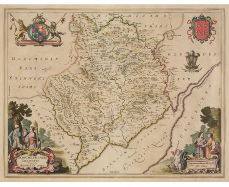
* Monmouthshire. Blaeu (Johannes), Monumethensis comitatus. Vernacule Monmouth Shire, Amsterdam, circa 1645, engraved map with contemporary hand colouring, ornate and decorative cartouche and mileage scale, 380 x 500 mm, framed and glazed, together with Saxton (Christopher & Hole G.). Monumethensis comitatus quem olim Incoluerunt Silures, [1637], hand-coloured engraved map, large strapwork cartouche, mileage scale and compass rose, 280 x 345 mm, framed and glazedQty: (2)
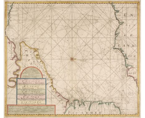
Los 53
Van Keulen (Gerald). Nieuwe Zeekaart van t' Eerste Gedeelte van t' Canaal Tuischen Engeland en Vrankryk, Amsterdam, circa 1680, hand-coloured engraved sea chart of the Dover Straits and the Eastern English Channel, title repeated in French, English, Spanish and Italian, each corner torn with slight loss but skilfully replaced in facsimile, 515 x 600 mm, together with Nieuwe Paskaert vande oost cust van Engeland en Schotland; Beginnende van t' Flamburger Hoost totaan de Rivier van Eedenborg..., Amsterdam, circa 1680, hand coloured engraved sea chart orientated to the west, decorative cartouche, inset map of Newcastle and the River Tyne, upper margin extended, lower margin strengthened on verso, 515 x 585 mm, with A New Gradually Encreasing Compass Map of part of the Sea Coasts of England in which is contained the Coasts of Sussex extending from Eastwood of Hastings to Arundel..., Amsterdam, circa 1760, uncoloured engraved sea chart, title repeated in Dutch, 515 x 590 mmQty: (3)

Los 472
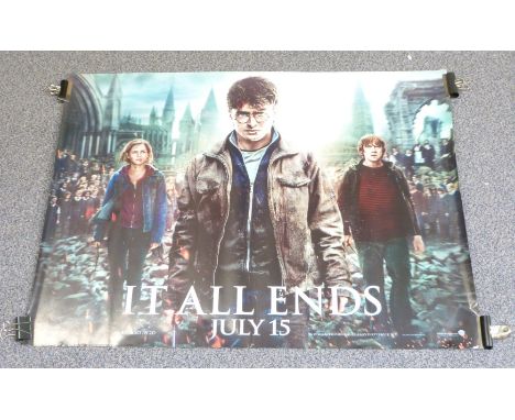
Approximately 40 cinema film posters to include X Files, Riteous Kill, Miss Congeniality, Walt Disney Enchanted, Smurfs, Emperors New Groove, Maybe Baby, State of Play, Sex and the City, The Golden Compass, Toy Story, Harry Potter, Gone Baby Gone, Notting Hill, James Bond Quantam of Solace etc, each approximately 76 x 102cm
Los 24
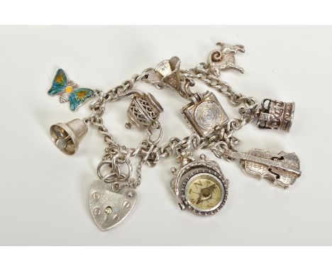
A SILVER CHARM BRACELET, with eight attached charms such as a small fob compass, violin, bell, crown, enamelled butterfly, openwork teapot, goat, music box most with marks to indicate silver, fitted to a heart clasp, hallmarked silver London, with additional safety chain, length 189mm, approximate gross weight 33.1 grams
Los 76
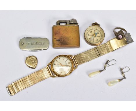
A SELECTION OF ITEMS, to include a gentlemen's gold plated Ernest Borel pillar wristwatch, cream dial, Arabic and baton markers, engine turn design bracelet, a pair of mother of pearl drop earrings, a small compass, a lighter, small 'Guiness' fruit knife, a 9ct gold back and front heart locket, together with a white metal pink cubic zirconia set ring, stamped 925
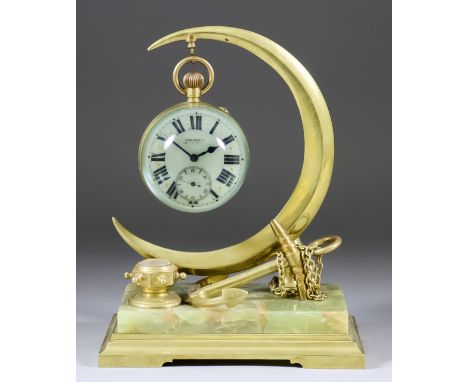
Los 890
A Late 19th/Early 20th Century French Gilt Brass Framed and Glass Spherical Desk Timepiece, the 3ins diameter enamel dial with Roman numerals and signed "Godchaux", to the single train keyless movement with balanced escapement No. M258745, the whole supported on brass and onyx base in the form of a crescent and anchor with small hexagonal binnacle inset with compass, on rectangular green veined marble and gilt brass rectangular base, 9.25ins high
-
36562 Los(e)/Seite