36562 Preisdatenbank Los(e) gefunden, die Ihrer Suche entsprechen
36562 Lose gefunden, die zu Ihrer Suche passen. Abonnieren Sie die Preisdatenbank, um sofortigen Zugriff auf alle Dienstleistungen der Preisdatenbank zu haben.
Preisdatenbank abonnieren- Liste
- Galerie
-
36562 Los(e)/Seite
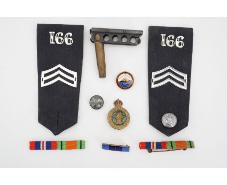

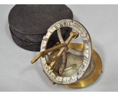
Los 325
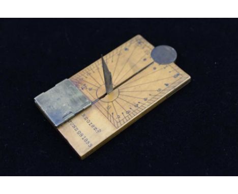
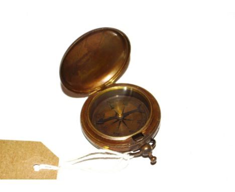
A 19TH CENTURY BOXWOOD COMBINATION RULER, SUNDIAL & COMPASS, the two arms are united by a circular brass hinge, when the rule is folded it may be used as a sundial, hour lines radiate from the retractable brass gnomon, the bottom left corner contains a compass under a hinged brass cover, it is stamped with a registration mark, "Registered June 28 1853" , 4.5cm x 7.5cm (folded) (A similar boxwood example is in the "Whipple Museum of Science", Cambridge University, and an ivory example is in the "National Maritime Museum", Greenwich)
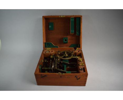
Los 48
A late 19c theodolite by Troughton and Simms of London having a lacquered brass sighting scope fixed parallel to a similar sized spirit level upon which is mounted a compass with silvered dial under a glazed bezel marked out with 360 individual degrees. The underside bears a threaded mount for a tripod. It is contained in a felt lined mahogany box 10in w overall.
Los 3332
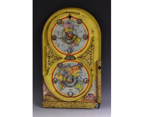
An American Art Deco period 'tinplate' bagatelle, Lindstrom's Atlas, Patent No. 1, 995, 263, the board printed in polychrome with the Northern and Southern Hemispheres, their native animals and indigenous peoples, lower margins with a train and car, the whole surmounted by a compass, three-coloured balls en suite, 61cm long, copyright dated 1934
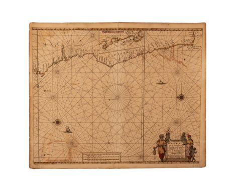
Los 162
Hendrick Doncker TWO HENDRIK DONCKER CHARTS, 17TH CENTURY PASCAART VAN DE ZEE-CUSTEN VAN ANGOLA EN CIMBEBAS VAN RIVIER DE GALION TOT C. DE BONA ESPERANCAAmsterdam, 1659Copperplate, hand coloured, offsetting, pencil notes in bottom margin, 1cm tear in left margin, two small tears in bottom margin, top and bottom of centerfold opening in margin, some foxing; verso: 5cm tear repaired with tape, brown paint show through, 53,5 by 43cm; and PAS-CAERT VAN’T WESTELYCKSTE DEEL VAN OOST INDIEN EN DE EYLANDEN DAER ONDER BEGREPEN, VAN C. DE BONA ESPERANCA TOT C. COMORIN Amsterdam, c.1670Copperplate, hand coloured, one 5mm hole and two 2mm hole on left edge of map, penciled number in bottom margin, tanning on outer edge, some foxing, offsetting; verso: tanned, paint show through, white lines along top and bottom margins from previous framing, pencil note at top, 52 by 42cmExamples of maritime cartography from the Dutch Golden Age are rare. This was the age when the Dutch Republic was a major European trading power and dominated the oceans through the VOC (Vereenigde Oost-Indische Compagnie) and the WIC (West-Indische Compagnie). Not only trade flourished, but also art, science and a combination of the two, cartography. Of the cartographers and sea atlas publishers working in Amsterdam in the second half of the seventeenth century, Hendrik Doncker’s atlases were regarded as of particularly high quality. He was known to carefully and constantly revise his work and did not rely on previously published maps.The first Doncker chart shows the West Coast of Africa, from the Equator to the Cape of Good Hope and Cape Agulhas. It also includes an inset of the coast from St. Martin’s Bay (Velddrif/ Paternoster area) to the Cape of Good Hope. The map of the East Coast of Africa, in smaller scale, overlaps the other and the coastline starts at Monte dos Bramides, rounds southern Africa and continues up the coast to the Horn of Africa. It also includes Arabia, the Malabar Coast of India and Madagascar.Both maps use the Mercator projection with vertical meridians. The bar scales include Dutch, Spanish and French and English miles. The charts are crisscrossed with rhumb lines meeting at central points, with some adorned with compass roses. On the compass roses a fleur-de-lis points North and there is a Christian cross pointing East, denoting the position of Jerusalem in relation to Europe.The title of cartouche on the western chart is surrounded by depictions of the inhabitants of the area holding a sounding lead, a cross staff and a chart, all navigation tools of the period. Another decorative element on this chart is the depiction of Dutch East Indiamen sailing in the Atlantic. The eastern chart’s cartouche is decorated with a tortoise, lizards, snakes, and surmounted by an open winged bat. - L.R.Howse, Derek, The Sea Chart: An Historical Survey Based on the Collections in the National Maritime Museum, New York: McGraw-Hill, 1973
Los 164
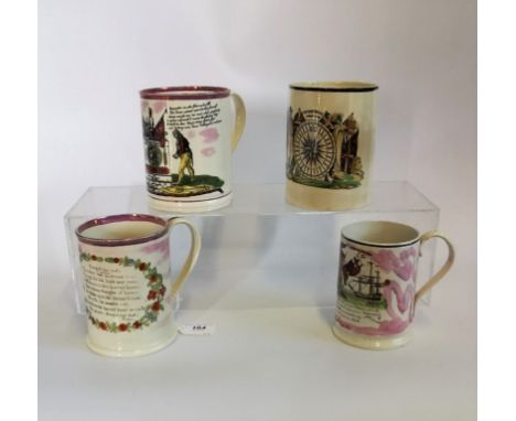
A collection of early 19th century creamware and lustre commemorative mugs, to include: Trafalgar frog mug, Forget Me Not, Mariners Compass and one other (AF) (4). Condition Report: All in (AF) as found condition, with chips, cracks and wear consistent with age. Cracks to interior and underside of some mugs (see images). Top left mug, Mariner Compass, pottery not named.
Los 197
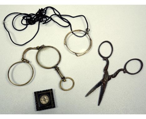
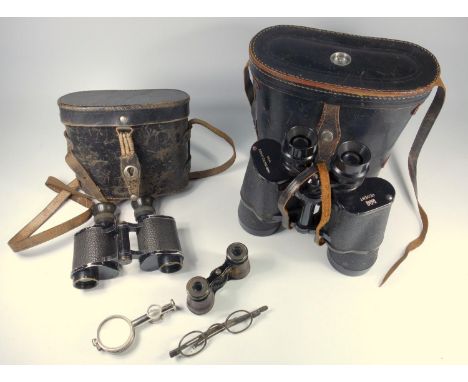
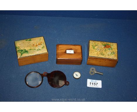
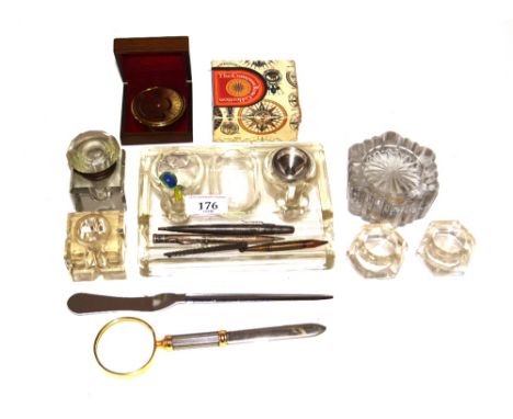
AN UNUSUAL METAL COMPASS WITH MIRROR, TWO FOLDING LENSES AND TWO ADJUSTABLE FOLDING LENSES, PAIR OF 19TH CENTURY SILVER PLATED ADJUSTABLE SPECTACLES, PAIR OF FRENCH JUMELLE DUCHESSE, PAIR OF CARL ZEISS, JENA, 6 X 50 BINOCULARS, CASED, AND A PAIR OF REGENT 7 X 50 BINOCULARS IN A CASE, THE HINGED COVER INSET WITH A COMPASS (7)

Los 3261
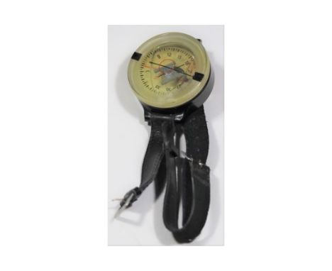
Michelin tyre interest - binder containing large quantity of early 1960s French paperwork relating to fuel consumption tests carried out to promote the benefit of the new radial tyres over crossply; Silva Sweden Michelin Muslims Compass, boxed with paperwork and 1987 Diamond Jubilee Commemorative medallion, boxed (3) Condition Report Click here for further images, condition, auction times & delivery costs
Los 55
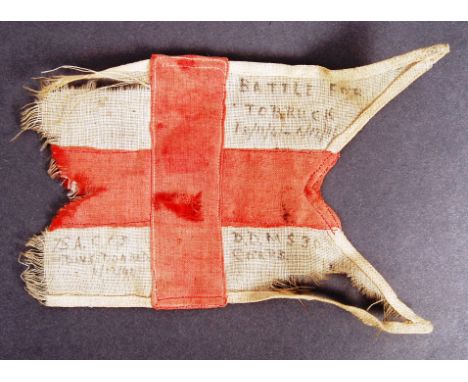
A rare and unique piece of military history - a DDMS 30 Corps (XXX Corps) staff car pendent flag, possibly that of General Field Marshall Montgomery, which was destroyed by Dive Bomber during the North Africa campaign in 1942. The flag, being a red cross on white ground, features handwritten notation to three corners ' Battle For Tobruck (sic) 18/11/41-5/12/41', ' DDMS30 Corps ' and ' 75A CCS - Dive Bombed 6/12/42'. Flag shows signs of wind and age damage. An interesting piece of WWII history. XXX Corps (30 Corps) was a corps of the British Army during the Second World War. The Corps provided extensive service in the North African Campaign at the Second Battle of El Alamein in late 1942, and in the Tunisia Campaign and the Allied invasion of Sicily in 1943, after which it returned briefly to the United Kingdom; the Corps served in the reclamation of France from June 1944 in the Allied Invasion of Normandy, and then served in Operation Market Garden, in the Netherlands, and finally in Operation Veritable in Germany until May 1945. The Siege of Tobruk lasted for 241 days in 1941, after Axis forces advanced through Cyrenaica from El Agheila in Operation Sonnenblume against Allied forces in Libya, during the Western Desert Campaign (1940–1943) of the Second World War. In late 1940, the Allies had defeated the Italian 10th Army during Operation Compass (9 December 1940 – 9 February 1941) and trapped the remnants at Beda Fomm. During early 1941, much of the Western Desert Force (WDF) was sent to the Greek and Syrian campaigns. As German troops and Italian reinforcements reached Libya, only a skeleton Allied force remained, short of equipment and supplies.
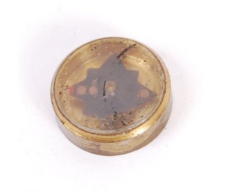
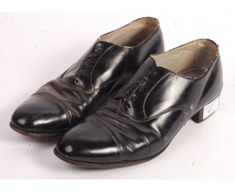
Los 65
An incredibly rare original WWII Second World War SOE ( Special Operations Executive ) pair of secret agent shoes. The shoes being a pair of size 5's, the left shoe containing a secreted miniature compass within its heel. The compass being of brass construction. Rare pair of secret agent / spy shoes.
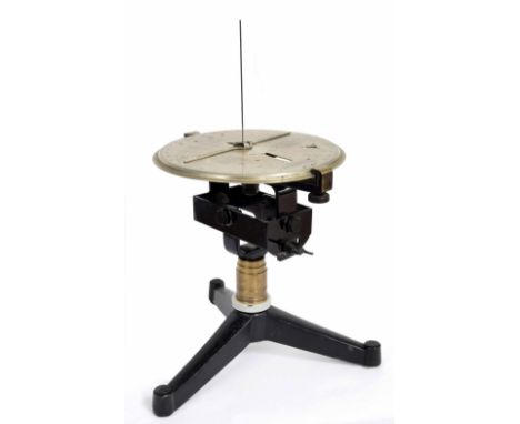
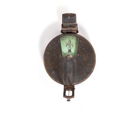
Los 1341
Interesting and rare scientific instrument, the 8" silvered dial inscribed Sun Compass Cole Pattern MK II, engraved with operating instructions to find local meantime by day or night, by moving gnomons to the required settings, upon a swivel and tilting cast iron cage over a turned gun barrel column and tripod base, 11" high (without vertical gnomon)

-
36562 Los(e)/Seite