36562 Preisdatenbank Los(e) gefunden, die Ihrer Suche entsprechen
36562 Lose gefunden, die zu Ihrer Suche passen. Abonnieren Sie die Preisdatenbank, um sofortigen Zugriff auf alle Dienstleistungen der Preisdatenbank zu haben.
Preisdatenbank abonnieren- Liste
- Galerie
-
36562 Los(e)/Seite


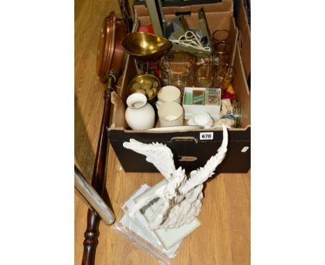
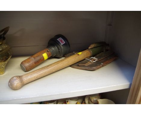
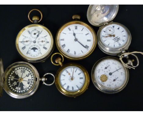
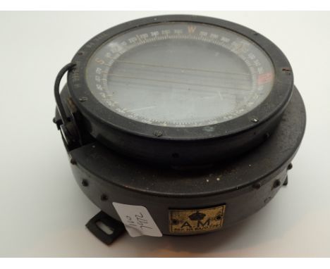
Los 670
A BOX AND LOOSE OF ASSORTED ITEMS, to include a Holland Studio Craft sculpture of a unicorn with certificate of authenticity, approximate height 24cm, Clarke and Sons scales with weights, a brass warming pan, eight packets of Wills cigarette cards, glass water set, plastic compass, collectors plates etc

Los 237
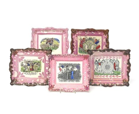
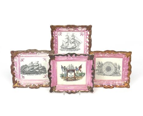
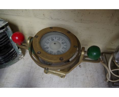
Five rectangular Sunderland lustre plaques 19th century, variously decorated with maritime and trade subjects, one of a sailor holding a Union Jack, two of depictions of France and England in Union, one with the Mariner's Compass, another with The Sailor's Farewell, within moulded pink and copper lustre borders, one broken and riveted, 23cm max. (5)
Los 239
Four Sunderland lustre plaques 19th century, of rectangular form, one printed with a scene of 'The Mariner's Compass', two with ships at sea, one of which titled 'The Gauntlet Clipper Ship', the last printed and coloured with 'The Mariners Arms', all within moulded pink and copper lustre borders, three with impressed marks for Dixon & Co, 22.3cm. (4)

Los 223
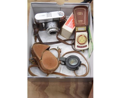
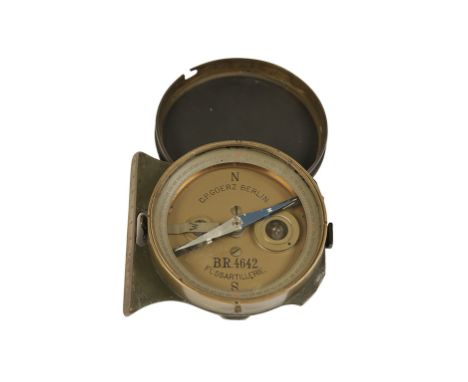
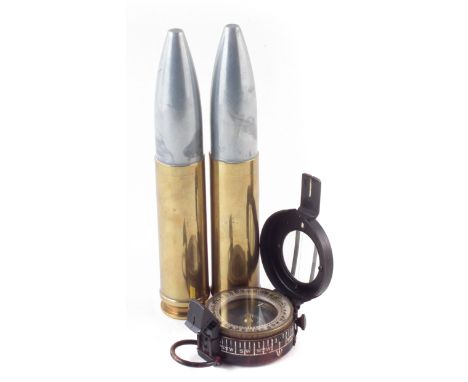
A mixed collection of various camera and related equipmentTo include a Voighander Vito C, with 2.8/50 lens and tan leather case together with a Zeiss Ikophot light metre together with a T.G.Co Ltd Mk III compass, dated 1940 numbered 66120 in tan leather case, a national PE-170 electric flash unit.
Los 105
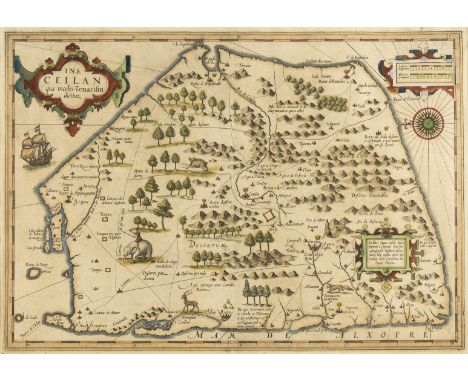
Sri Lanka.- Mercator (Gerard) and Jodicus Hondius. Ceilan Quae Incolis Tenarisin Dicitur, early map of Sri Lanka shown as a five-sided shape, with north orientated to the west, strapwork title cartouche in the upper left, with a sailing ship, elephant, and decorative compass rose, engraving with hand-colouring on laid paper with indistinct watermark, platemark 350 x 502 mm. (13 3/4 x 19 3/4 in), sheet 440 x 550 mm. (17 1/4 x 21 3/4 in), Latin text verso, under glass, some minor surface dirt and light browning, small repair visible verso to upper left corner, well outside the map, framed, [circa 1606 and later].
![Portugal.- Algarve.- Waghenaer (Lucas Jansz) and Anthony Ashley. [The Kingdom of Algarve], decorative sea chart of the Algarv](https://cdn.globalauctionplatform.com/b079d8b6-c9f1-44ba-a4d1-a96600ab5dd9/572f58aa-7d28-4cf9-fd07-dd53d21bff50/468x382.jpg)
Los 132
Portugal.- Algarve.- Waghenaer (Lucas Jansz) and Anthony Ashley. [The Kingdom of Algarve], decorative sea chart of the Algarve in Portugal with a coastal profile at the top, two elaborate strapwork cartouches, with two sea monsters and ships and a compass rose, engraving on laid paper with watermark of a portcullis topped by St Edward's Crown, platemark 327 x 510 mm. (12 7/8 x 20 in), sheet 385 x 540 mm. (15 1/8 x 21 1/4 in), English text verso, central vertical fold, small repairs to extremities, unframed, [circa 1588].⁂ Sea chart from Anthony Ashley's English edition of 'The Mariners Mirrour', translated from Waghenaer's 'De Spieghel der Zeevaerdt' at the request of Charles Howard, 1st Earl of Nottingham, 2nd Baron Howard of Effingham (1536-1624), commander of the English forces during the battles against the Spanish Armada.
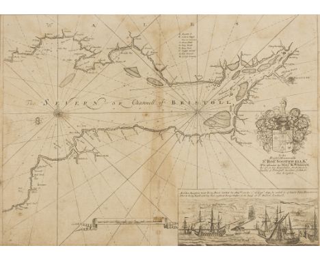
Los 161
NO RESERVE Bristol and Bath.- Collins (Capt. Greenville) Printed chart of the Bristol Channel from Chepstow and Bristol to Broad Haven and Boscastle, with vignette lower right showing the arrival of William III to 'King Road', compass rose and rhumb lines, and decorative coat of arms centre right, engraving, 430 x 560 mm. (17 x 22 in), central vertical folds, handling creases, laid onto antique paper support with early graphite drawing verso, unframed, c. 1693; together with a group of seven other maps and plans of Bristol and Bath, including a [?]19th century manuscript pen and brown ink map of Bristol and its surrounds, presumably intended as a book illustration, and with Mathew's 'New & Correct Plan of City and Suburbs of Bristol', 1815, Gibbs' 'A New and Correct Plan of the City of Bath', Barratt & Son's 'A New and Correct Plan of the City of Bath', 1817, and with Waterlow and Sons' 'Map of the Country & of the Railways Existing and Proposed in the Districts situated between Bristol, Exeter & Dorchester', engravings, lithographs, various sizes, largest 560 x 725 mm. (22 x 28 1/2 in), occasional handling creases, tears and surface dirt, all unframed, [mainly 18th and 19th century], (8).
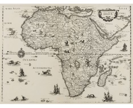
Los 6
Africa.- Merian the Elder (Matthaeus) Nova descriptio Africae, decorative map of the African continent based on the cartography of Blaeu, embellished with numerous ships, sea monsters, a compass rose and exotic animals, engraving, a good clean impression on laid paper with watermark of a Bishop's Crosier within crowned shield, platemark 270 x 360 mm. (10 5/ 8 x 14 1/4 in), sheet 310 x 327 mm. (12 1/4 x 12 7/8 in), central vertical fold, with discrete well-executed repairs to minor splitting, unframed, [1637].Literature:Norwich 33
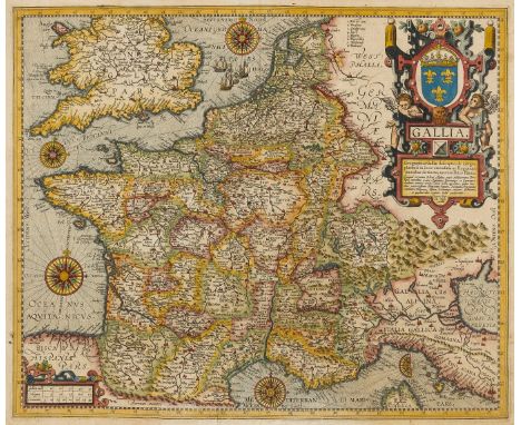
Los 72
France.- Ortelius (Abraham) Gallia, detailed map of France, with part of southern England, northern Italy, and includes Belgium and the Netherlands, a large title cartouche with two putto decorating the upper right quadrant, with 4 1/2 compass roses, and three sailing ships off the Norfolk coast, engraved map with extensive hand-colouring on laid paper with watermark of a postal horn, platemark 402 x 487 mm. (15 7/8 x 19 1/4 in), sheet 430 x 545 mm. (17 x 21 1/2 in), Latin text verso, central vertical fold with minor repairs to lower section, other minor repaired nicks to lower margin, some surface dirt and handling creases, unframed, with Joan Baptista Vrient's imprint at the end of the title cartouche, [1612].Literature:VdB 36
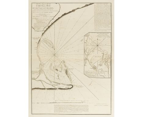
Los 93
India.- Leslie (Capt. Charles) An Eye Sketch of Coringa Bay on the Coast of Golconda, with the soundings laid down as taken on every point of the compass, by a boat from the center, being the place of the ship (the Orford man of war), detailed chart of Coringa Bay, showing a ship standing in the middle of the bay with compass lines in all directions, sandbanks, and mudbanks, and inset plan of Coringa Bay made in 1789 by Michael Topping, from 'The East-India Pilot', engraving on cream wove paper, platemark 720 x 510 mm. (28 1/4 x 20 1/8 in), sheet 940 x 640 mm. (37 x 25 1/4 in), central horizontal fold, minor offsetting and surface dirt, unframed, Laurie & Whittle, 1798.
-
36562 Los(e)/Seite