36562 Preisdatenbank Los(e) gefunden, die Ihrer Suche entsprechen
36562 Lose gefunden, die zu Ihrer Suche passen. Abonnieren Sie die Preisdatenbank, um sofortigen Zugriff auf alle Dienstleistungen der Preisdatenbank zu haben.
Preisdatenbank abonnieren- Liste
- Galerie
-
36562 Los(e)/Seite


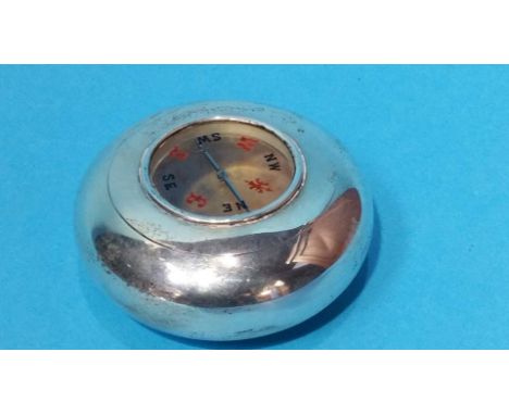
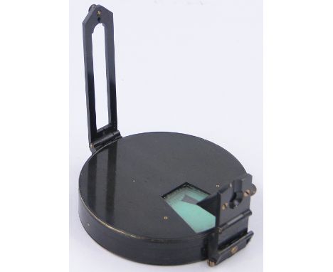
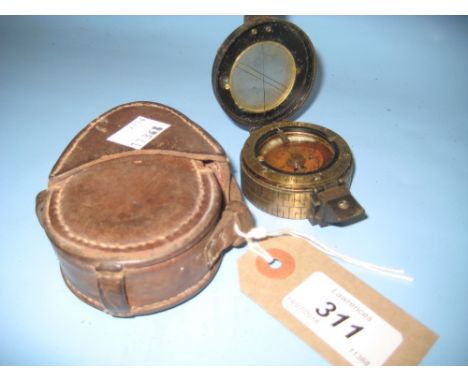
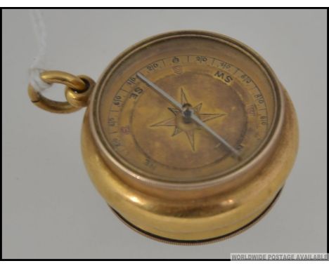
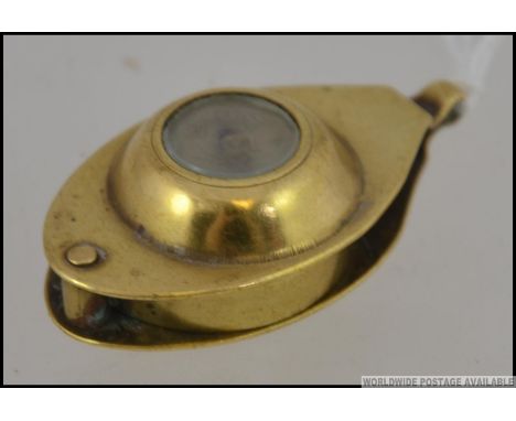
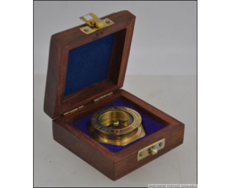
Los 1095
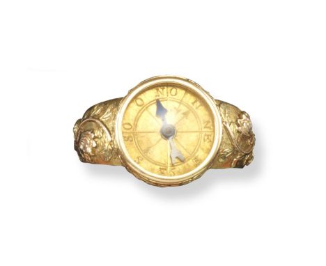
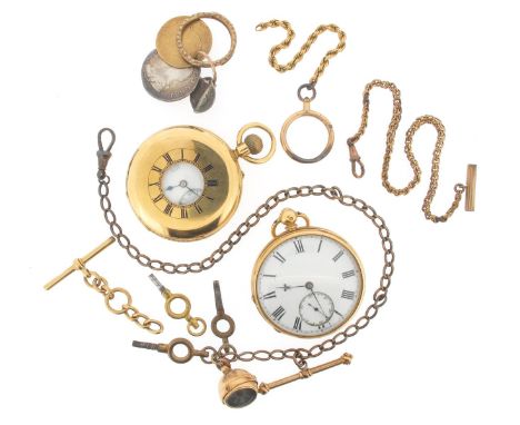
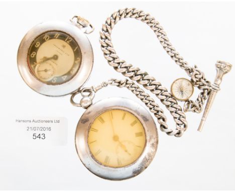
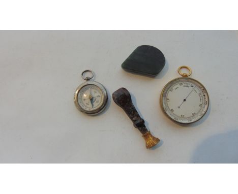
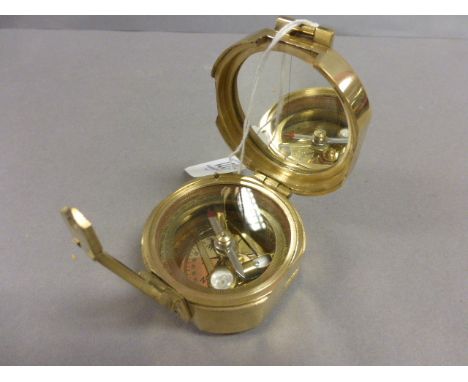
An 18ct yellow gold stem-wind half hunting cased pocket watch, blue enamel outer chapter ring with Roman numerals. The white enamel dial signed 'Dent, 61 Strand' and '4 Royal Exchange', and numbered 56243. With subsidiary seconds dial, signed 3/4 plate movement. And an 18ct yellow gold key-wind open faced pocket watch. White enamel dial with subsidiary seconds dial. 3/4 movement, signed 'Moreland, Chester'. Loose glass. With an 18ct yellow gold T-bar and chain, a gold fob pendant with retracting compass, three chains and a pendant formed with three coins.
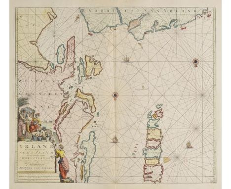
Los 116
Sea charts. Van Keulen (Johannes), Pascaart van de Noortcust van Yrland als meede de Westcust van Schotlamd en een gedeelte van de Lewys Eylanden..., Pascaert van de Westkust van Schotlandt als mede een gedeelte van de Lewys Eylanden van St. Patricius tot Nary..., [and] A New Gradually Encreasing Compass Map of a part of the Sea coasts of England in which is contained the Coasts of Sussex Extending Eastward of Hastings to Arundel haven..., published Amsterdam circa 1680, together three engraved sea charts with contemporary outline colouring, each approximately 510 x 580 mm (3)
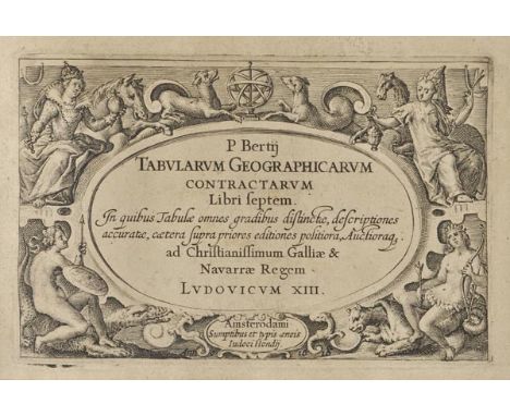
Los 4
Bertius (Petrus). Tabularum Geographicarum Contractarum Libri septem..., 7 parts in one volume, published J.Hondius, Amsterdam, 1616, decorative engraved title with additional half titles for each part, 220 uncoloured engraved maps and an engraved plate of a compass rose, maps engraved by Pieter Van den Keere, Salomon Rogier, Joducus Hondius Jnr and others, good margins, later endpapers (possibly 18th century), contemporary vellum with yapp fore-edges, manuscript title and old label to spine, vellum a little stained, oblong 8vo, binding size 135 x 210 mm (5.25 x 8.25 inches) P. Van der Kroght (Atlantes) 342.01. R.Shirley. Atlases in the British Library. T.Bert 2a. (1)
Los 476
*Saussine (Leon, publisher). The Learned Swallow, Paris, circa 1880, colour lithographed geographical game in a box, with circular glass window revealing a magnetic swallow which moves around the points of a compass pointing to various answers and country names, with a circular card spinner with questions, possibly incomplete/repaired and without rules, lid with hand-coloured lithograph label with printed signature of T. Scherer, box dusty and worn, with one side of lid missing, 22.5 x 27.5 x 6cm (9 x 10.75 x 2.25ins) Rare. The English version of the French game 'L'Hirondelle Savante'. (1)
Los 69
British county maps. Blaeu (Johannes), Comitatus Dorcestria sive Dorsettia vulgo Anglice Dorset Shire, circa 1650, uncoloured engraved map, 385 x 500 mm, no text on verso, together with, Speed (John), The Countie Westmorland and Kendale the chief Towne described with the Armes of such Nobles as have bene Earles of either of them, published George Humble, circa 1627, uncoloured engraved map, inset town plan of Kendal, large strapwork cartouche, compass rose and mileage scale, heavily wormed with two margins and central fold strengthened on verso, 385 x 510 mm, English text on verso, with, Morden (Robert), The County Palatine of Lancaster, The County Palatine of Chester, Westmorland, Cumberland, The Bishoprick of Durham [and] Northumberland, circa 1722, together six uncoloured engraved maps, 'Cumberland' with some spotting, old folds, each approximately 370 x 430 mm, plus, Saxton (Christopher & Hole William), Eboracensis comitatus pars Septentrionalis vulgo North Riding [and] Eboracensis comitatus..., pars Orientalis vulgo East Riding, circa 1610, two hand coloured engraved maps, 195 x 345 mm and 200 x 250 mm respectively (10)
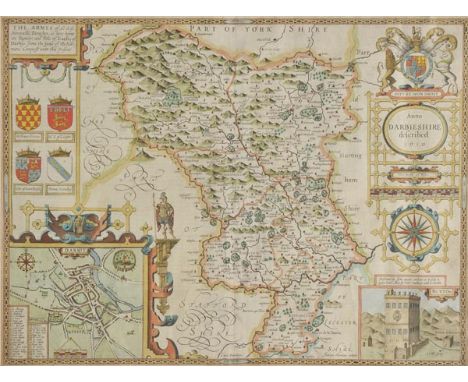
Los 85
*Derbyshire. Speed (John), Anno Darbieshire described, published John Sudbury & George Humble, circa 1627, hand coloured engraved map, inset town plan of Derby and Buxton well, large strapwork cartouche and compass rose, central fold strengthened on verso, some creasing, 390 x 510 mm, mounted, framed and double glazed, English text on verso (1)
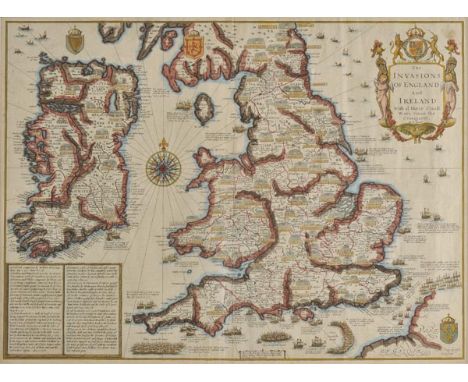
Los 87
*England & Ireland. Speed (John), The Invasions of England and Ireland with al their civill wars since the conquest, published Thomas Bassett & Richard Chiswell, [1676], hand coloured engraved map, decorative cartouche, compass rose and numerous rhumb lines, 385 x 520 mm, mounted, framed and double glazed, English text on verso (1)
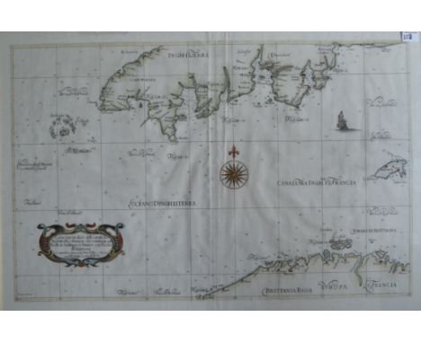
Los 103
A C17th hand coloured copper engraved map of The English Channel from South coast of Devonshire and Cornwall including the south coast to Lyme Regis with Gurnsey and Northern France showing with central Rose compass by Sir Robert Dudley 1646-47 engraved by Anton Francesco Lucini'Carta particolare dell canale Fra Inghilterra e Francia che comincia con L’Isole di Sorlinges e Finisce con L’Isola di Garnsey, pub. Florence,' H 53cm W80cm
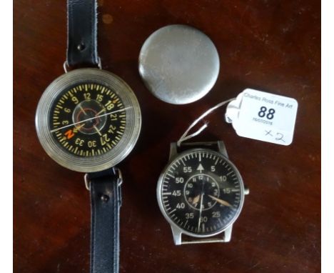
Los 88
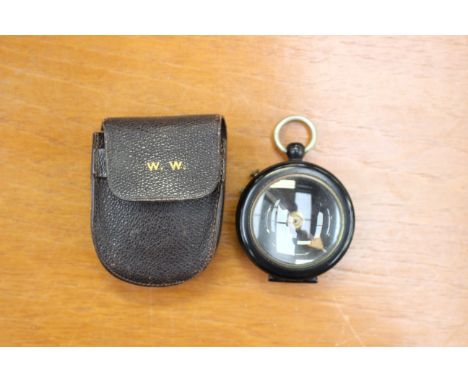
A WWII German Luftwaffe over-sized aviators/navigators wristwatch by Bouart Lange & Sohne, early 1940's, the black dial with five minute markers and an inner hour dial with luminous hands in an anti-magnetic nickel silver plated case numbered FL23883, the movement numbered 214696, together with a Baumuster AK39 wrist compass.

-
36562 Los(e)/Seite