36562 Preisdatenbank Los(e) gefunden, die Ihrer Suche entsprechen
36562 Lose gefunden, die zu Ihrer Suche passen. Abonnieren Sie die Preisdatenbank, um sofortigen Zugriff auf alle Dienstleistungen der Preisdatenbank zu haben.
Preisdatenbank abonnieren- Liste
- Galerie
-
36562 Los(e)/Seite

Los 82
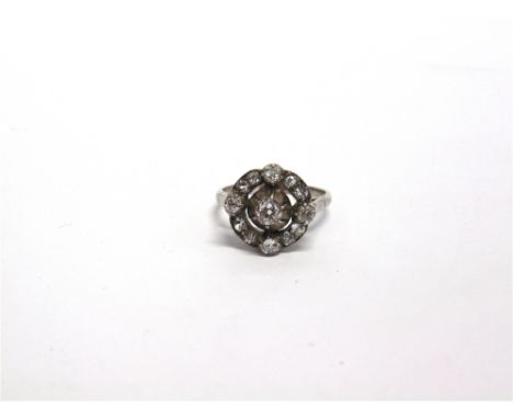
A LATE VICTORIAN DIAMOND CLUSTER RING in an unmarked white metal, the central silver collet set old brilliant cut of approximately 0.35 carats, with four stones to the compass points and a pair of diamonds between, finger size U, 5g gross, diamonds total approximately 1.2 carats including the centre stone


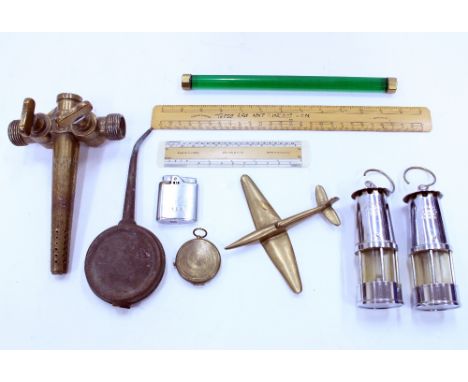
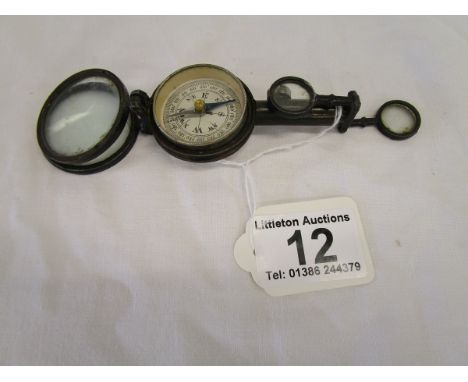
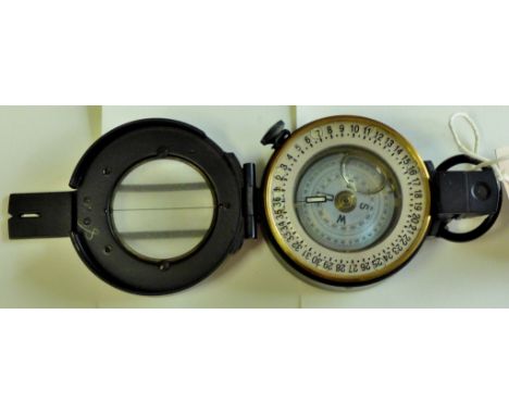
Los 408
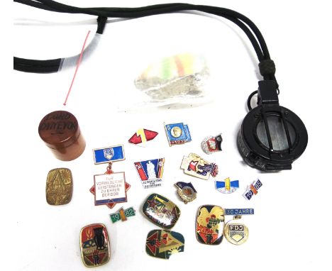
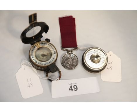
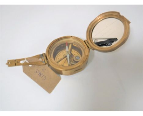
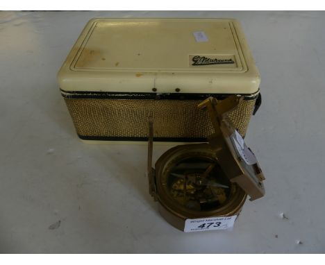
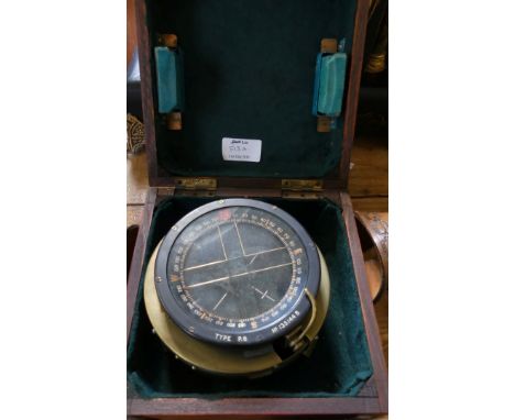
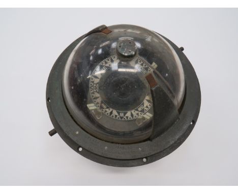
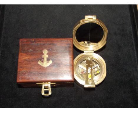
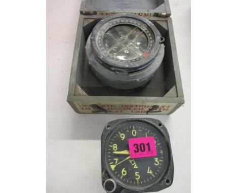
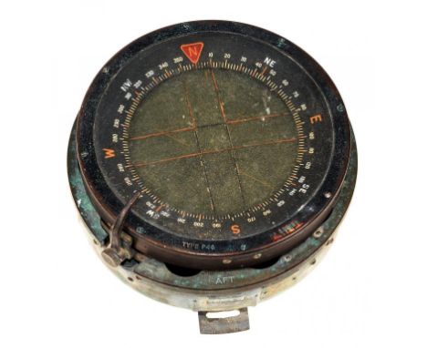
A GROUP OF MISCELLANEOUS COLLECTABLE ITEMS to include two promotional small size miners lamps by The Proctor Lamp Co. Ltd, Eccles, 12.5cm high together with a small cast brass aeroplane, a compass, a Ronson cigarette lighter, a Joseph Lucan Ltd oil can, a double ended barrel tap and various rules
Los 344
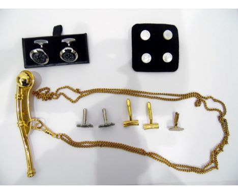
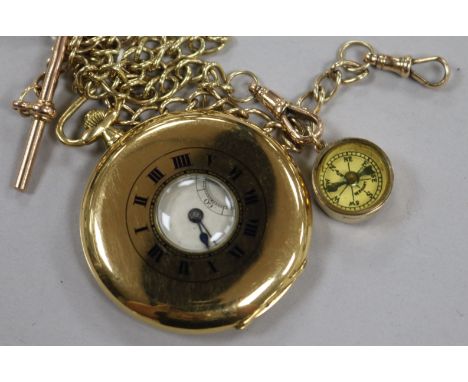
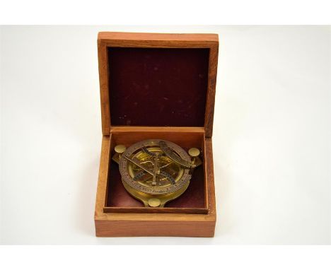
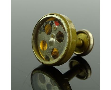
A quantity of costume jewellery items to include a 19th Century millefiori oval panel brooch in pinch beck mount, possibly French, A/F, a 9ct rose gold wristwatch, cut steel items, sundry paste set jewellery, cufflinks, a compass, a brooch modelled as a native American stamped Sterling Silver etc..all A/F (qty)
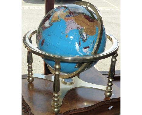
Los 178
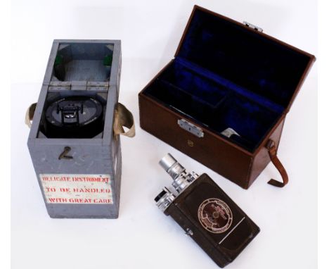
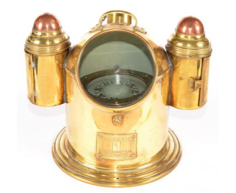
A gemstone globe on a gilt metal stand, these handcrafted globes use 40 different minerals and semi-precious stones to depict the countries of the world against rich ocean backgrounds of turquoise, detailed with a meridian of gilded wire, silk screened legend, the stand has a compass in the base, diameter of globe 28cm
Los 1007
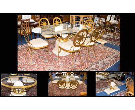
Contemporary Glass And Gilded Metal Dining Suite And Accompanying Console Table Each with Compass Star design, the table with stylised globe base and oval glass top, the chairs of gilded metal with exaggerated star design to back rests. Complete with accompanying statement console table. Excellent condition, dining table, 76 x 43 inches.

Los 38
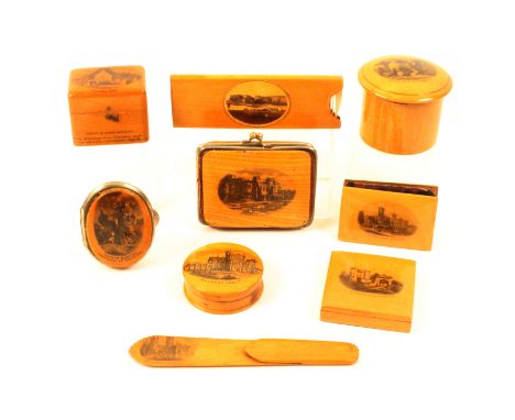
Mauchline ware - nine pieces comprising a rectangular purse (Hawarden Castle - Made From Tree Felled By The Right Hon W.E. Gladstone), worn, 7cm, an oval purse (Sainte Marthe-Patronne De Tarascon), 5.2cm, a puzzle box (Carisbrooke Castle) complete, 5cm, a circular compass box (Melrose Abbey), 4.5cm, a small powder cylinder (Water Mill At Trefriw), 5.5cm, a ring box (Alloway Kirk - Bought In Burns' Monument), 4.5cm, a pen wiper (Osborne House), 5.6cm, a horn comb in case (The Grand Parade Weston Super Mare), 10.3cm, and a book mark (Canterbury Cathedral), 11.7cm (9)
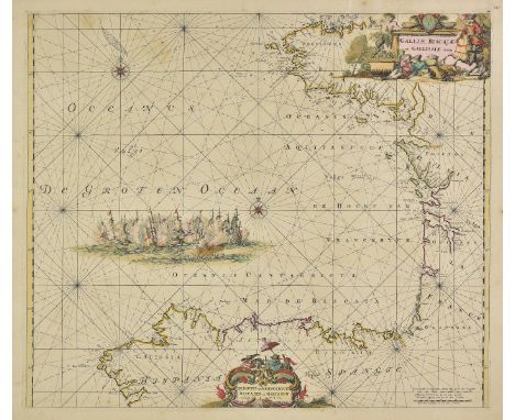
Los 112
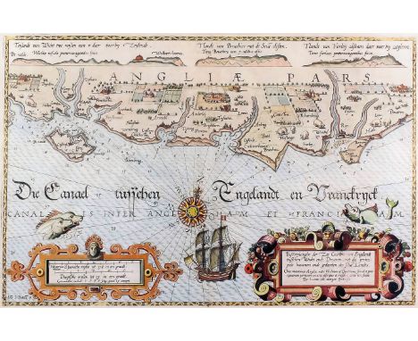
Bay of Biscay. De Wit (Frederick), Galliae Biscajae et Gallissiae sinus, circa 1680, engraved map with contemporary outline colouring, large vignette of a sea battle, compass rose and numerous rhumb lines, slight oxidisation causing cracking, strengthened and repaired on verso, 485 x 570 mm (1)
Los 145
England & Wales. Andrews (John), A New Physical, Historical & Political Map of England and Wales from actual survey & Astronomical Observations of the Royal Society, exhibiting the natural state of its surface by describing the great range of mountains, hills and high lands which seperate the heads of the rivers & point out their course from its spring to the ocean..., published John Andrews, 1786, large hand coloured engraved map on three separate sheets, table of the vales and valleys, table of explanation, compass rose and dedication, inset map of the Scilly Isles, old folds, each sheet approximately 535 x 1315 mm, together with Thomson (John & Co. publishers), British Isles, 1815, engraved map with contemporary hand colouring, 615 x 515 mm, with Pigot (James), Pigot & Co.s. Map of England & Wales with part of Scotland..., 1830, engraved map with contemporary outline colouring, old folds, some toning, some marginal closed tears, some dust soiling, some repaired tears affecting image, 690 x 535 mm, with another copy similar, plus Goubaud (J.), Carte G‚ographique des Œsles Britanniques..., circa 1825, engraved map with contemporary hand colouring, French text below and to the sides of the map, overall size 520 x 665 mm (7)
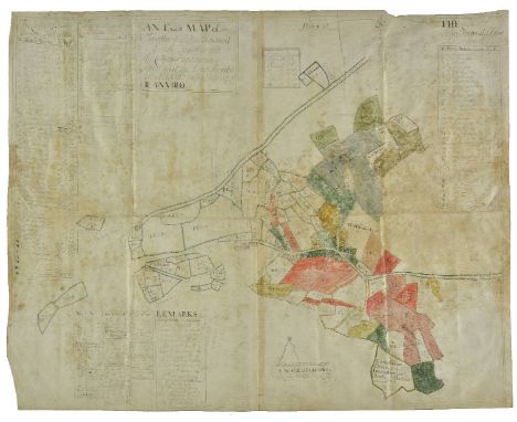
Los 148
Estate Plan. An exact map of Trevithe & John Prichard's land: Together with the cottages upon nain-y-givis and the land Incroch'd on. Allt-Rillo in the Parish of Ilanvillo, circa 1700, ink and watercolour plan, title cartouche and a scale of chains, compass rose, inset tables of remarks and field names and sizes, old folds, some staining, slight creasing, 560 x 695 mm Appears to be a plan of a village near Tregarth in central Wales. (1)
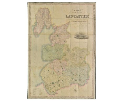
Los 166
Lancashire. Hennet (G.), A map of the County Palatine of Lancaster divided into hundreds and parishes from an accurate survey made in the years 1828 and 1829, published Henry Teesdale, 1830, large scale map, engraved by James Bingley, sectionalised and laid on linen, contemporary hand colouring, large calligraphic cartouche, table of explanation, compass rose and engraved vignette of the custom house Liverpool, slight staining and offsetting, edged in green silk, 1615 x 1115 mm, contained in a contemporary calf bookbox, worn and rubbed (1)
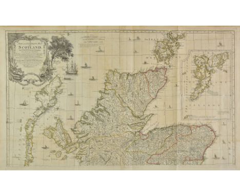
Los 187
Scotland. Kitchin (Thomas), A New and Complete Map of Scotland and Islands thereto belonging; from actual survey, the shires properly divided and subdivided, the forts lately erected & roads of communication or military ways; carried on by His Majesty's command..., [published Robert Sayer, 1773 or later], large engraved wall map of Scotland with contemporary outline colouring, four sheets conjoined in pairs, inset map of the Shetland islands, large uncoloured decorative cartouche, table of 'remarkable places in Scotland', compass rose, old folds, one short split along old fold on lower sheet, each sheet approximately 600 x 1010 mm The Early Maps of Scotland to 1850. Published The Royal Scottish Geographical Society. Volume 1 pp. 195. Published in 'A General Atlas describing the whole Universe...,'. This edition without imprint. Uncommon. (2)
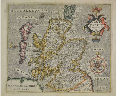
Los 189
Scotland. Hole (William), Scotia Regnum, circa 1610. hand coloured engraved map, large strapwork cartouche and compass rose, 265 x 310 mm, together with Zatta (Antonio), Il Regno do Scozia, di nuova projezione, published Venice, circa 1778, engraved map with contemporary outline colouring, inset map of the Shetland Islands, 305 mx 405 mm, with De Fer (Nicolas), Table des latitudes et longitudes des principaux lieux du Royaume d'Ecosse, published Paris, circa 1710, engraved map with contemporary outline colouring, inset maps of the Shetland and the Faroe Islands, 375 x 515 mm, plus Mariette (Pierre), L'Ecosse Royaume en ses deux principales parties..., published Paris, 1665, engraved map with contemporary outline colouring, 410 x 510 mm, with another twelve city plans, sea charts, regional and country maps, including examples by Robinson, Dower, Dorret, Greenville Collins and Bartholomew, various sizes and condition (16)
Los 190
Sea chart. Van Keulen (Johannes), Pascaart van de Noortcust van Yrland als meede de Westcust van Schotland..., published Amsterdam, [1695 or later], uncoloured engraved chart of Scotland and Ireland, large allegorical cartouche, compass rose and numerous rhumb lines, 510 x 580 mm, together with A new gradually encreasing compass map of a part of the sea coasts of England in which is contained the coasts of Sussex. Extending eastward of Hastings to Arundel haven with their shallownesses and depths, published Amsterdam 1698 [or later], hand coloured engraved chart, compass rose and numerous rhumb lines, title repeated in Dutch, trimmed with very slight loss to lower margin, repaired, 515 x 595 mm, with Collins (Captain Greenville), Untitled sea chart of the east coast of England and Wales, circa 1690, hand coloured engraved chart, orientated to the east, compass rose and numerous rhumb lines, some staining and dust soiling, 450 x 570 mm (3)
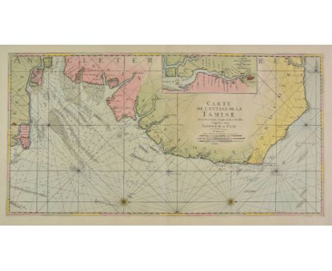
Los 193
Sea chart. Jaillot (Alexis Hubert), Carte de l'entree de la Tamise avec les bancs, passes, isles et costes comprises entre Sandwich et Clay, published Paris, circa 1705, large engraved chart with bright contemporary hand colouring, orientated to the east, inset map of the course of the River Thames from London to Isle of Grain, compass rose and numerous rhumb lines, slight oxidisation, 455 x 890 mm (1)
-
36562 Los(e)/Seite