36562 Preisdatenbank Los(e) gefunden, die Ihrer Suche entsprechen
36562 Lose gefunden, die zu Ihrer Suche passen. Abonnieren Sie die Preisdatenbank, um sofortigen Zugriff auf alle Dienstleistungen der Preisdatenbank zu haben.
Preisdatenbank abonnieren- Liste
- Galerie
-
36562 Los(e)/Seite
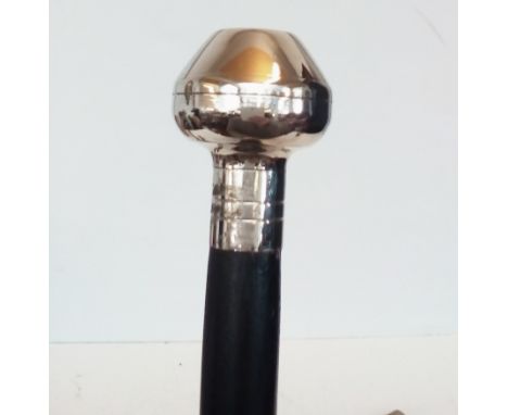

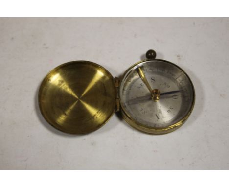
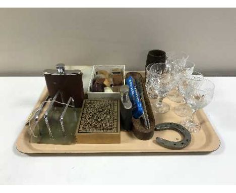
![WHITE METAL SOVEREIGN CASE COMPASS TOP EST [ £15- £25]](https://cdn.globalauctionplatform.com/33f14584-19fc-4110-b31e-a83200bb3f1f/60404ece-6d22-43ef-b97f-0eb996bea67f/468x382.jpg)
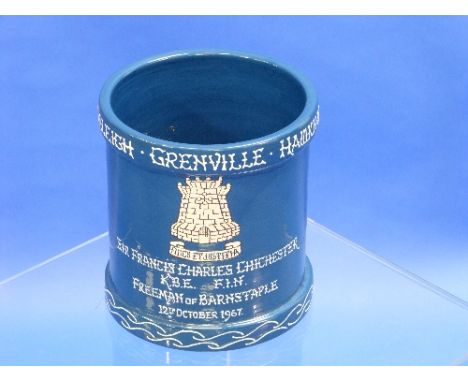
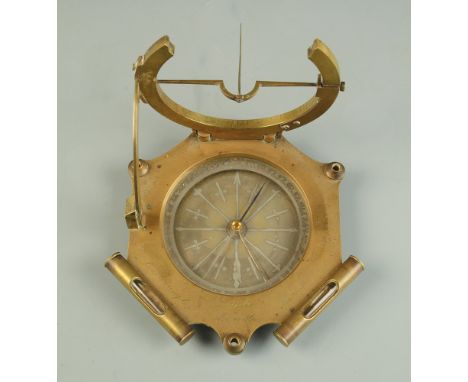
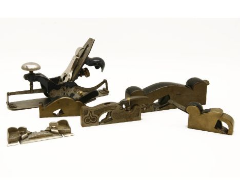
Los 623
Sir Francis Chichester (1901-1972), a Brannam Pottery blue-ground vase, tube-lined and decorated in white, the rim inscribed 'Raleigh. Grenville. Hawkins. Drake. Hood. Chichester', the body with crest and monogram, inscribed 'Sir Francis Charles Chichester K.B.E., F.I.N., Freeman of Barnstaple 12th October 1967 - Born at Shirwell near Barnstaple Devon. September 17th 1901', the interior with compass, 10½in (26.5cm) high, with original straw-lined Brannam box.
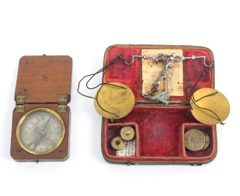
Los 833
An 18th Century shagreen cased steel balance and a mahogany cased compass, the scale with elaborate steel beam, brass pans, four weights, old hand-written label to inner lid with various dates circa 1770, black shagreen case with two hook catches, 10 x 5.5cm, and a paper dial compass in crude hinged lid mahogany case inscribed in ink to lid, the base carved ‘JCM-1823’, 5cm sq (2)
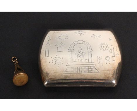
Los 871
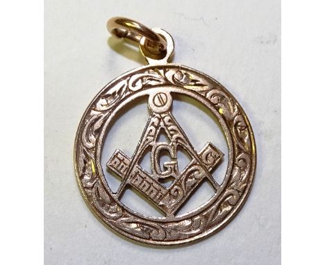
Of Masonic Interest – a silver cigarette case and a gold seal, the cigarette case hinged with a sprung closure engraved to both sides with Masonic symbols and around a triangle ‘KSHTWSST’ and ‘JHP No. 1923’, Birmingham, 9 x 7cm, the seal with compass, mallet, set square and trowel mounted on a dome, the seal conforming to the case, 3.8cm (2)

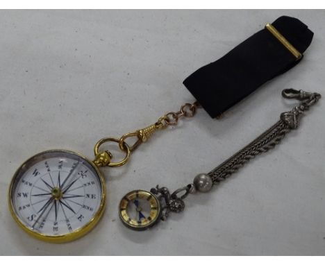
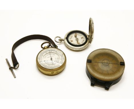
Los 564
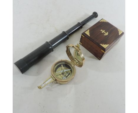
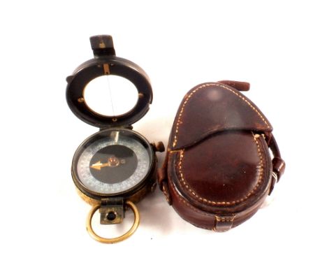
A George III pocket compass, by Robert Bancks, the plated body with enamelled dial inscribed "Bancks No. 440 Strand, London" (Robert Bancks is noted as working from this address between 1796 and 1804). housed within in a red Morocco leather case with green velvet interior. Diameter 4 cm. CONDITION REPORT: The metal body is tarnished but with no significant faults. The dial on first appearance looks to be in good order however under a jeweller's loop there is very very fine hairline crack above the word strand running from just past the D to just over the outer perimeter line. The dial is a little dirty at the south east. The glass is rather scratched but again the extremity of the scratches is only viewable under a jeweller's loop. The item does work. The case has scratches and marks around the edge and underside however the hinge and locking clasp are good. The interior is faded commensurate with age.
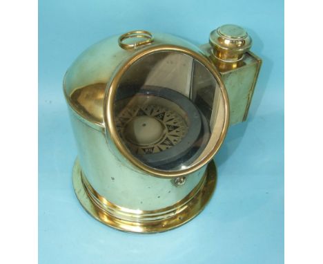
Los 637
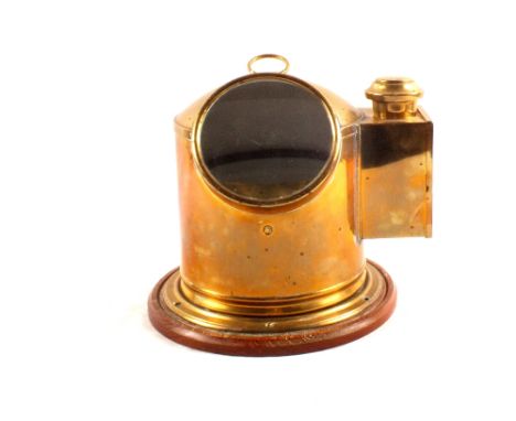
A lacquered brass surveyors compass, late 19th century, with silvered dial signed for "Adie & Son, Edinburgh", in a fitted mahogany case and with applied trade label to lid. Dial diameter 17 cm (see illustration). CONDITION REPORT: The needle does in fact point North when released. Generally the silvered dial and outer dial are in good condition although there are small spots of staining which may be visible on our web image. The glass is in good order. The lacquered brass is worn and tarnished although this is to be expected I would believe from something of this age. There are no issues regarding cracks, knocks or dents. The case is in good order however the lid is loose from its hinged frame but this is easily rectified and not detrimental.
![Blaeu. Mappa Aestivarum Insularum, alias Barmudas. [Amsterdam, Ex officina Guiljelmi Blaeu, 1630 ca.]Mappa incisa su rame (mm](https://cdn.globalauctionplatform.com/2ee320e6-3eca-45f5-953d-a82d00d7d57b/c69224ff-38ad-46dd-ec3a-1d69cf9ed018/468x382.jpg)
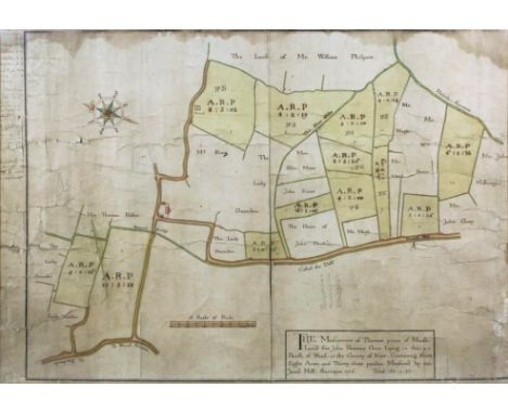
Los 282
Blaeu. Mappa Aestivarum Insularum, alias Barmudas. [Amsterdam, Ex officina Guiljelmi Blaeu, 1630 ca.]Mappa incisa su rame (mm 405x533), parzialmente acquerellate a mano. Testo latino al verso. Buon esemplare di questa carta delle Bermuda basata sulle misurazione del capitano John Smith.Engraved map, partially hand-colored, (mm 405x533). Latin text on verso.Fine old color example of Blaeu's map of Bermuda. Blaeu based his work on John Speed's remarkably accurate map of 1626-1627. It shows the island divided into tribes and lots, and the The table at the bottom includes a list of the proprietors, divided by Tribe and the number of shares purchased by each Proprietor, along with a number key, identifying the land owned by each of the shareholders. A splendid cartouche shows Neptune astride the Royal Arms holding a ship and a trident. Further adorned with scale cartouches, coats of arms and compass rose with a fleur-de-lys.
Los 62
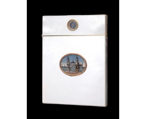
Ω A scarce rectangular mother of pearl and gem inset souvenir card case, circa 1895, inset with a printed and painted oval vignette titled Amsterdam D'Exposition 1895 , the cover inset with a compass into single sheets of fine mother of pearl, 10.4cm (4 1/8in) long Cites Regulations Please note that this lot (lots marked with the symbol Ω in the printed catalogue) may be subject to CITES regulations when exported from the EU. The CITES regulations may be found at www.defra.gov.uk/ahvla-en/imports-exports/cites
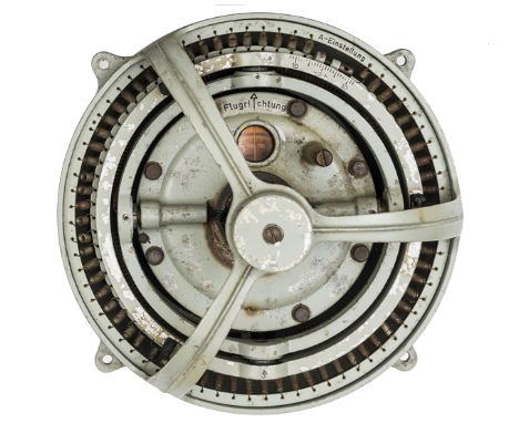
Los 450
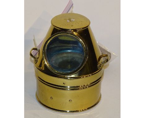
A Luftwaffe aircraft master compass, of grey painted aluminium alloy construction, the liquid filled centre mounted in gimbals beneath a three armed cage, the whole suspended on springs within a bowl to which is attached a multi pin electric socket. GC (some wear to paintwork and minor damage). Plate 2From the collection of the late Steven Hall of Brighton, a well known authority on WWII German aircraft crash sites and aircrew who were killed or captured.
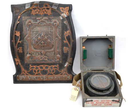
Los 454
A WWII Compass Type PS, spring mounted in its khaki painted wooden case marked “Delicate Instrument to be handled with care”, with carrying strap (glass bubbled, most spirit evaporated); and a dark wooden panel bearing embossed rectangular plate with coat of arms and “AD 1906”, in stencilled sheet copper frame, (parts loose) with “By Virtue and Faith” below, 17” x 13½”. Basically GC (2)
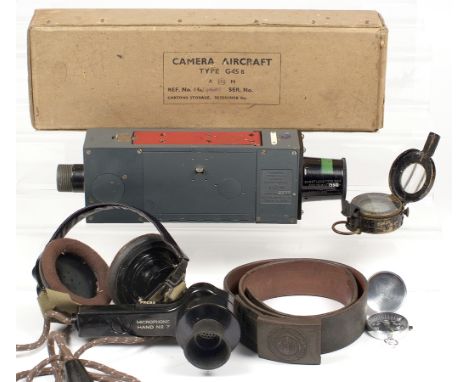
Los 677
Williamson G45 Aircraft Gun Camera. Probably from a Spitfire or similar, fitted with a 'Short Lens', both parts showing the Air Ministry mark. Original film cassette present and packed in makers box with inner packing; A WWII German army belt. The buckle (worn) shows a German eagle atop a swastika and with laurel leaves below. The words "GOTT MIT UNS" (God is with us) are around the top; a British army compass, dated 1940 and with the W.D. arrow mark; A WWII microphone No.7 with earphones, etc
Los 464
Jared Hill (early 18th Century English school) - Ink and watercolour on laid paper - Estate map for land in the parish of Word (Worth, near Sandwich ) Kent, with title - "The Meafurment of Thirteen pieces of Marfh - Land for John Paramor Gent, Lying in the Parifh of Word in the County of Kent. Containing Sixty Eight Acres, and Thirty three perches Meafured by me Jared Hill. Surveyor, 1716, Total 68:0:33", with decorated compass points and "A Scale of Rods", with later light pencil annotations to main map and ink annotations to left margin, the last being for Lady Day 1750, 17ins x 25ins (laid down on linen - some damage), framed and glazed Note: An example of Hill's work as Surveyor was sold by The Canterbury Auction Galleries -18/03/2008 - Lot No. 242. The National Archives have an interesting example if his work - "Old Bolingbroke Estate Map, Lincolnshire", dated 1719, under image library reference MPC 1/118
-
36562 Los(e)/Seite