36562 Preisdatenbank Los(e) gefunden, die Ihrer Suche entsprechen

Verfeinern Sie Ihre Suche

Jahr

Sortieren nach Preisklasse
  • Liste
  • Galerie
  • 36562 Los(e)
    /Seite

Los 427

Cheshire. Swire (W. & Hutchings W.F.), A Map of the County Palatine of Chester, Divided into Hundreds & Parishes from an accurate survey, made in the years 1828 & 1829, published Henry Teesdale, 1830, large scale map engraved by J. Dower with contemporary outline colouring, calligraphic title, compass rose, table of reference and an uncoloured vignette of the south-west view of Chester cathedral, slight offsetting, edged in green silk, dust-soiled, finger marked and with some staining and spotting, edged in green silk, 960 x 1320 mm, marbled endpapersQty: (1)

Los 433

Derbyshire. Blaeu (Johannes), Darbiensis Comitatus vernacule Darbie Shire, Amsterdam, circa 1660, engraved map with contemporary hand-colouring, large decorative cartouche and mileage scale, 385 x 500 mm, Latin text on verso, together with Bowen (Emanuel). An Accurate Map of the County of Derby Divided into its Hundreds...., R. Sayer, Carington Bowles & R. Wilkinson, circa 1787, engraved map with contemporary outline colouring, originally published in 'The Large English Atlas', 700 x 540 mm, with Saxton (Christopher & Hole G.). Universi Derbiensis Comitatis qui olim Coritanorum suit descriptio [1637], hand-coloured engraved map, large strapwork cartouche, compass rose and mileage scale, very slight water staining to the lower margin, 285 x 315 mm, plus Bowles (C. & Carver W. publishers). Bowles's New Medium Map of Derby Shire Divided into Hundreds..., circa 1785, engraved map with contemporary outline colouring, slight mount staining, 320 x 225 mmQty: (4)

Los 434

Derbyshire. Speed (John), Anno Darbieshire described, Thomas Bassett & Richard Chiswell [1676], hand-coloured engraved map, an inset town plan of Derby and a view of Buxton, large strapwork cartouche and compass rose, occasional repaired marginal closed tears, central fold appears strengthened, 385 x 510 mm, mounted, framed and glazedQty: (1)

Los 446

Gloucestershire. Speed (John), Glocestershire contrived into thirty thre severall hundreds & those againe into foure principall devisions. The citie of Glocester & Bristowe discribed with the armes of such noble men as have bene dignified with ye titlles of Earles & Dukes therof, John Sudbury & George Humble [1627], uncoloured engraved map, inset town plans of Gloucester and Bristol, some staining and toning, margins chipped and frayed with slight loss to the printed surface, central fold strengthened and repaired on verso, 380 x 510 mm, together with Greenwood (C. & J.). Map of the County of Gloucester from an Actual Survey made in the year 1823, Jany. 26th 1831, uncoloured engraved map, calligraphic cartouche, compass rose, table of explanation and inset vignette of Gloucester Cathedral, slight creasing and staining, right-hand margin damp stained and frayed with some loss to the printed surface, 610 x 690 mm, with Atkyns (Robert). Glostershire [1712 or later], hand-coloured engraved map, 350 x 410 mm, mounted, plus Collins (H. G. publisher). The British Gazetteer, Glocestershire, [1852 or later], hand-coloured engraved map, old folds, occasional repaired marginal closed tears, slight mount staining, 425 x 350 mm, mountedQty: (4)

Los 450

Hertfordshire. Seller (John), Hertfordshire Actually Surveyed and Delineated, Sold by G. Willdey at the Great Toy Spectacle, China Ware and Print Shop..., circa 1732, hand-coloured engraved map, large decorative title cartouche, compass rose and ornate table of explanation, torn with slight loss to the upper strapwork margin, replace in facsimile, slight marginal staining, toned overall, 420 x 500 mmQty: (1)Footnote: Uncommon.

Los 456

Ireland. Hole (G.), Hiberniae, Ireland Anglis Yverdon Britannis Erin..., 1610, uncoloured engraved map orientated to the west, strapwork cartouche and ornate compass rose, printer's fold, slight toning, 270 x 340 mm, together with Morden (Robert). The Kingdom of Ireland [1695 or later], hand-coloured engraved map, slight spotting and slight marginal tape staining, 410 x 350 mm, with another uncoloured example similar, plus Gall & Inglis (publishers). Gall & Inglis' Map of Ireland with the Railways, Edinburgh, circa 1850, coloured lithographic map, slight mount staining, 540 x 440 mm, and Seale (R. W.). A New and Accurate map of parts of England, Scotland & Ireland bordering on St. George's Channel, J. Hinton, circa 1780, hand-coloured engraved map, old folds, backed with archival tissue, 365 x 270 mmQty: (5)

Los 466

Lincoln. Padley (James Sandby), To Sir Edward French Bromhead Bart. This Map of the City of Lincoln is most respectfully Dedicated...,1842, new edition corrected to 1868, large engraved map with contemporary outline colouring, sectionalised and laid on linen, calligraphic title, table of reference, list of parishes, compass rose and an uncoloured vignette of the 'South View of the City of Lincoln', edged in green silk, marbled endpapers, contained in a contemporary morocco slipcase with gilt lettering to spine, corners bumped and frayed, 1200 x 1030 mmQty: (1)

Los 494

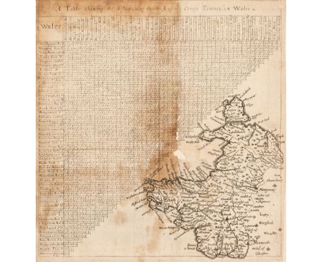
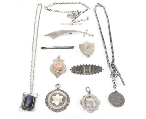
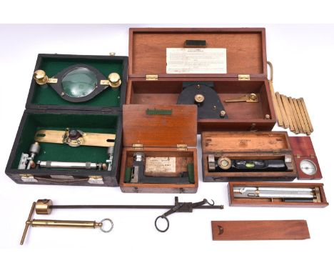
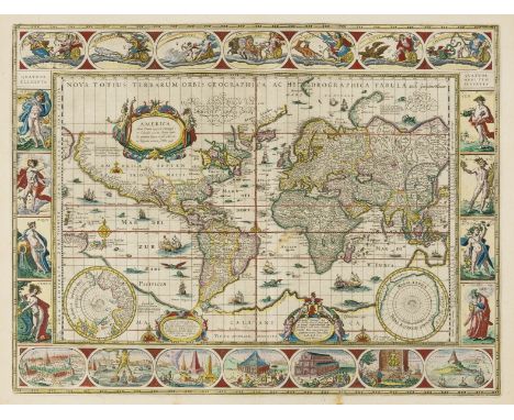
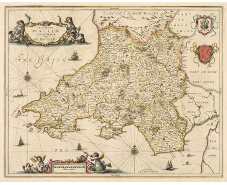
South Wales. Jansson (Jan), Principatus Walliae pars Australis vulgo South-Wales, 1646, engraved map with contemporary outline colouring, decorative cartouche and mileage scale, compass rose and numerous rhumb lines, slight offsetting, 415 x 520 mm French text on verso, together with Blome (Richard). A Generall Map of South Wales wherein are the Countyes of Glamorgan, Carmarden, Pembrock, Cardigan, Brecknock, Radnor [1673], hand-coloured engraved map, old folds, slight fraying to the margins, one repaired closed tear affecting the printed surface, 345 x 460 mm, with Schenk (P. & Valk G.). Principatus Walliae pars Australis vulgo South-Wales, Amsterdam, circa 1715, engraved map with contemporary outline colouring, occasional wormholes, slight spotting to the margins, 410 x 510 mm, plus Bowen (Emanuel). A New and Accurate Map of South Wales, containing the Counties of Pembroke, Carmarthen, Cardigan, Glamorgan, Brecknock & Radnor..., Carington Bowles, [1729 or later], two engraved sheets (only of six showing parts of Pembroke and Cardiganshire), both with contemporary outline colouring, some professional marginal restoration, each approximately 595 x 480 mm, and Walker (J. & A.). Map of South Wales drawn from Trionometrical Surveys, 1833, large engraved map with contemporary outline colouring, sectionalised and laid on linen, 630 x 785 mm, marbled endpapers with publisher's printed title label to one cover, with Morden (Robert). South Wales [1695 or later], uncoloured engraved map, 360 x 430 mmQty: (7)
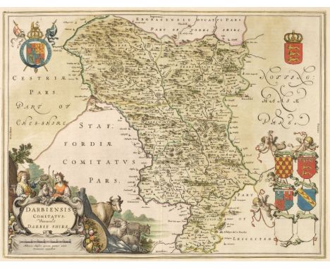
Los 501

The Potteries. Hargreaves (Thomas), To the Most Noble George Granville, Marquess of Stafford K. G. &c. &c. The Zealous Promoter of the Interests of the Several Towns and Liberal Patron of their Public Institutions, This Map of the Staffordshire Potteries & Newcastle, Including their Vicinities, Shewing the Limits of the Boroughs, Parishes, Townships, etc., Engraved from a Minute Trigonometrical Survey, is with permission dedicated..., Burslem, 1st May 1832, large engraved map with contemporary outline colouring, sectionalised and laid on linen, calligraphic title cartouche, table of explanation and compass rose, slight staining, marbled endpapers, 1580 x 1220 mmQty: (1)

Los 504

Waghenaer (Lucas Janzoon). Angliae Orae Maritimae Inter Plemoutham Et Portlandiam..., [1585 or later], uncoloured decorative engraved sea chart with a large compass rose and ornate strapwork cartouche, Dutch and Latin text to the margins, printer's fold, slight water staining, , 355 x 510 mm, Latin text on versoQty: (1)Footnote: The chart shows the south coast of England from Plymouth in the west to Dorchester in the east.

Los 507

Wales. Jenner (Thomas - Van Langeren Jacob), A Table shewing the distances of the most of the Chiefe Townes in Wales, 1643, uncoloured engraved map below a mileage triangle, old folds, heavily stained, frayed along old folds with slight loss, laid on later paper, 225 x 220 mm, together with Saxton (Christopher & Hole G.). Glamorgan Comitatus qui olim pars Silurnum [1637], hand-coloured engraved map, large strapwork cartouche, mileage scale and compass rose, slight staining, 270 x 335 mm, with Ogilby (John). The Continuation of the Road from London to St. Davids co. Pembroke Commencing at Burton-Ferry & Extending to St Davids, circa 1676, hand-coloured engraved strip road map, 335 x 440 mm, plus Morden (Robert). South Wales [1695], uncoloured engraved map, heavily spotted, 360 x 435 mm, and Dawson (R. K.). Swansea, circa 1835, town plan and map of the mouth of the River Tawe (as published) both with contemporary hand-colouring, supplied with a sheet of contemporary explanatory text, 330 x 195 mm, plus an uncoloured strip road map of Wales by J. Owen and E. Bowen, printed on both sides, 185 x 120 mmQty: (6)

Los 510

World. Bellin (Jacques Nicolas), Carte Reduite des Parties Connues du Globe Terrestre...., Paris, 1755, large engraved map of the world on a Mercator projection with contemporary outline colouring and some later enhancement, decorative cartouche and advertisement, compass rose and numerous rhumb lines, some creasing and dust soiling, 555 x 825 mmQty: (1)Footnote: An early state without the Depot de la Marine blind stamp or price.

Los 20

§ NEIL MACPHERSON R.S.A., R.S.W, R.G.I. (SCOTTISH 1954-) THE THANKSGIVING Signed lower right, oil on canvas board(24cm x 29cm (9.5in x 11.5in))Footnote: Exhibited: Compass Gallery, Glasgow, 2005

Los 32

§ PETER THOMSON R.G.I. (SCOTTISH b.1962-) THE FLAUTIST Signed with initials lower left, acrylic(11.5cm x 19cm (4.5in x 7.5in))Footnote: Exhibited: Compass Gallery, Glasgow, 2005

Los 53

§ PHILIP REEVES R.S.A., R.S.W., A.R.C.A., R.G.I. (SCOTTISH 1931-2017) UNTITLED (ABSTRACT) Signed lower left, collage(25cm x 24cm (9.75in x 9.5in))Footnote: Exhibited: Compass Gallery, Glasgow

Los 81

§ JAMES MORRISON R.S.A., R.S.W., L.L.D. (SCOTTISH 1932-2020) BELHAVEN TERRACE, 1977 Signed and dated lower right, sealed gesso on board(37.5cm x 30cm (14.75in x 11.75in))Footnote: Exhibited: The Compass Gallery, Glasgow, 1977

Los 1072

A vintage ship's compass Type P4A, with maker's initials 'AM', in wooden carry case.

Los 1074

An early/mid-20th century brass binnacle compass by H Hughes & Son, London, the compass in a gimbal mount, fitted in a brass domed cover with glazed circular panel to the top and side, on a fluted wooden column stand to square base, excluding base approx 148cm.

Los 1076

J BRUCE & SONS LTD, LIVERPOOL; a brass cased gimbal mounted ship's compass, the dial stamped with maker's details and 'No.BB1485', this number is further replicated to the upper edge of the brass case, mounted on a later mahogany plinth, height excluding base approx 22cm. CONDITION REPORT The dial appears to be in overall good order, although the black painted metal gimbal mount has some pitting and corrosion to the painted finish. The outer brass case is highly polished.

Los 1410

A quantity of mixed vintage and modern costume jewellery to include a gentlemen's Rotary gold plated wristwatch, the white square dial set with raised gold baton numerals and calendar window at 3 o'clock, a silver heart double locket on sterling silver chain, small silver charm bracelet with four charms including cottage, birdcage, gramophone and '21' key, united with a heart-shaped padlock clasp, a reproduction Dalvey pocket compass in presentation box with booklet, brooches and various mixed collectible and pre-decimal coins.

Los 200

A group of collectors' items including a George V vintage fire extinguisher, a large Nottingham star back fishing reel with plaque, a further star back reel, a small brass fishing reel, a Sestrel compass and an instrument (6).

Los 202

LIVERPOOL PORCELAIN; two c1800 creamware jugs, both with black printed design, the larger example depicting a woman leaning against an anchor watching sailing ship departing, and inscribed verso 'Come box the compass', with an image of a compass, sailors and 'Invented by Murphy a Dutchman, AD1229, first exhibited at Venice, 1206, improved by Giora of Naples 1309. Its declination discovered by Hartman 1538', height 14cm and a Masonic related jug with the All-Seeing Eye and various Masonic implements and inscribed 'Hail! Masonry divine! Glory of ages shine, Long may'st thou reign where'er the lodges stand may they have great command and always grace the land. Thou art divine' and image verso of a Masonic figure seated, with coat of arms, beehive, compass and other Masonic related items, height 11cm (2). CONDITION REPORT Larger jug: some expected age-related wear in the form of surface scratches, crazing to glaze in some areas. One or two small rim frits, no cracks or other chips, so sign of restoration.Smaller jug: some expected age-related wear, crazing to glaze throughout. Hairline crack to base, no signs of restoration.

Los 181

A selection of silver and white metal jewellery to include Victorian silver bar brooch. Hallmarked Birmingham 1889. Makers Mark Leonard Hall. A/F pin missing. Three silver fob medals, one marked Sterling silver, the others hallmarked Birmingham 1949, Markers Mark Herbert Bushell and sons and  Birmingham 1947, Makers Mark W.W & S. The lot also to include a silver bar brooch marked Sterling. A white metal fob chain and T Bar. Measures 27cm length. A white metal Samui sword brooch, Measures 8cm length. A brooch in the form of a shield inscribed with 'Blanche'. Measures 3.8cm length. Plus, a white metal necklace and pendant set with a rectangle abalone pearl. Measures 48cm length. A white metal fob chain with T Bar and coin dated 1923. Measures 38cm length. A rolled pocket watch chain with compass. Measures 31cm length. 

Los 416

A late 19th Century Victorian silver hallmarked vesta case. The vesta of plain form with a compass set to the front and a match striker to the base. Hallmarked Birmingham 1900. Weight 27.7g. Measures 6cm. 

Los 269

VINTAGE MOUNTAINEER'S ICE AXE, 66cms L and a hand-held gimbal compass with magnifier by Sestrel

Los 209

VINTAGE POCKET COMPASS & A LEATHER & BRASS SHOT FLASK - the compass inscribed to the back 'Charles Owen Optician' and indistinct further detail, the leather carry case embossed 'HMS', the shot flask has volume markings only

Los 528

An Edwardian combination carriage clock, barometer, thermometer and compass, in gilt brass case with carrying handle, 18cm wide, 17cm high.

Los 56

A Vintage Marine Gimballed Compass Set in Brass Binnacle, 24cm High

Los 67

Scouting memorabilia to include sterling silver badge 6g, map reading compass, medal, lapel badge, The Hackney Scout song book and Sheffield District Scout membership cards.

Los 89

World War I marching compass, S.Mordan & Co, dated 1918, with leather pouch; Carl Zeiss Jena '1670' brass gauge, cased; and a 19th century lacquered brass extending magnifying device, with bench clamp, cased.

Los 153

A selection of assorted metalware, to include a travelling compass, elephant figures, Middle Eastern teapot, and more

Los 490

A selection of shipping instruments, including: the 'Unit' trim indicator, by John Lilley & Gillie Ltd, in stained wood case; brass sextant; and a brass cased ships marine gimbal compass, by C. Plath Hamburg, with brass hood. (3)

Los 7

9x early 20th Century Scientific measuring instruments. Including; a Cased Clinometer. 3x cased spirit levels with vernier adjustments, etc. A cased Edney 'Swing Hygrometer. A small compass. A Stanley brass measuring stick. 2x scales for weighing. GC-VGC for age. £50-70

Los 93

A quantity of motoring related ephemera. Including 2x 1930s oil cans; Pratts oil in black and Esso in green. Both with original brass lids. Together with a well constructed brass oil can with pump action and transfer reading; 'The Master Pneumatic Hand Sprayer No.5P/T', stamped Made in England. A Romac pressure gauge and compass set. Plus a number of other small items including early Dunlop cycle repair tin, Press-button punches and dyes, a pocket aneroid thermometer, pocket sundial, etc. GC. £60-80

Los 27

A YELLOW METAL COMPASS PENDANT AND LOCKET, a round locket, approximate width 21mm, detailed with scrolling foliage and a vacant ivy leaf cartouche, together with a compass pendant mounted in yellow metal, unmarked, approximate gross weight 8.2 grams, (condition report: general moderate wear, would benefit from a gentle clean)

Los 166

A WWII H. HUGHES & SON (HUSUN), DEAD-BEAT GIMBALED COMPASS, No. 8130, dial signed Sestel. 19cm diameter

Los 197

A late 19thc/early 20thc brass cased liquid filled ship's compass, with a gimble mounting (d.16cm)

Los 193

Novelty brass paperweight in the form of a ship's wheel with integral compass

Los 262

A clock mounted in a propeller boss, various clocks and a cased compass

Los 1169

A cased military type Compass having bevelled glass, the loop stamped 1942, marked to the underside ''National Sozialistiche -D.A.P.'' surrounding a swastika, 62 mm diameter, 14 mm thick, the case with inset brass plaque ''Gott Mit Uns''

Los 1456

A black leather bound case containing high quality Nickel fittings for a wooden beam setting-out compass and with lead holder and ink nib, the case marked to the lid ''W.H. Harling, Mathematic instrument manufacturer, 47 Finsbury Pavement, London". Case size 4 9/16'' x 2 5/16'' x 1 1/16'' high.

Los 116

A small collection of items including Merit Pocket Compass, RAF buttons, small antique bottles etc.

Los 635

Cleo Laine signed 10x8 colour magazine cover page. Dame Cleo Laine, Lady Dankworth DBE (born Clementine Dinah Bullock; 28 October 1927) is an English jazz and pop singer and an actress, known for her scat singing and for her vocal range. Though her natural range is that of a contralto, she is able to produce a G above high C, giving her an overall compass of well over three octaves. Laine is the only female performer to have received Grammy nominations in the jazz, popular and classical music categories. She is the widow of jazz composer and musician Sir John Dankworth. Good condition. All autographs come with a Certificate of Authenticity. We combine postage on multiple winning lots and can ship worldwide. UK postage from £4.99, EU from £6.99, Rest of World from £8.99

Los 1576

A boxed set of Silea ceramic tea/egg spoons, soapstone figure of an Egyptian cat, desktop compass paperweight, New Zealand memory book etc.

Los 1158

Artists Easel, compass, early XX Century photograph frames, etc:- One Box.

Los 1412

Postcards, photographic Cookham Dean, etc. compass, spinning top, Harry Hall tailors measure, etc:- One Tray.

Los 6016

19th century Sunderland pink lustre jug with four coloured Masonic panels H20cm and a Sunderland bowl with the Mariners compass and Arms, the interior with verse, Ancient Order of Foresters etc D23cm and a volume '19th century Lustreware' by Michael Gibson

Los 220

A quartz clock of cubic form with compass, hydrometer and thermometer on raised circular base, 11cm (h)

Los 176

World.- Blaeu (Willem Janszoon) Nova totius terrarum orbis geographica ac hydrographica tabula, world map on Mercator's projection, with largely identical geographical information as found on Blaeu's wall map of 1605, elaborately decorated with ships, sea monsters, compass roses, and ornate border panels, the upper panel features allegorical representations of the sun, moon and the five known planets, the lower panel showing the seven wonders of the ancient world, with the elements and seasons featured in the left and right panels accordingly, engraving with early hand-colouring, heightened with white, an excellent impression of Shirley's fourth state (of five), on laid paper without watermark, platemark 410 x 545 mm (16 1/8 x 21 1/2 in), sheet 510 x 610 mm (20 1/8 x 24 in), Latin text verso, expert almost invisible marginal repair to lower right corner, some surface dirt and minor spotting, unframed, Amsterdam, [circa 1630]Literature:Shirley 255 iv/v⁂ A masterpiece in world mapping from the Golden Age of Dutch Cartography.

Los 57

Friderici (Johann Christian) Prospect van met eyland, en de rheede van St. Lago.../Verbeelding van de Inwoonders op St Lago, panoramic view of the island of Santiago, Cape Verde, with a fleet of sailing vessels with British and Dutch ensigns, large title cartouche with Dutch text and artist's name in the upper left, with further cartouche in the upper right surrounded with people of Cape Verde, watercolour, point of the brush, on laid paper with indistinct watermark, probably Pro Patria With Maid Of Dort, ruled black ink border, total sheet 295 x 1205 mm (11 3/4 x 47 1/2 in), under glass, mounted onto support, numerous old folds with some splitting and small repairs, minor damp-stains and surface dirt, framed, 1783⁂ Large and early panoramic view of Santiago, Cape Verde. The compass rose in the lower right corner suggests that the view looks towards southern part of the island, showing Praia Harbour.

Los 436

Bellin (Jacques Nicolas), Carte Des Isles de Java, Sumatra, Borneo &a. Les Détroits de la Sonde Malaca et Banca, Golphie de Siam &a., pub. c.1758, engraved map with hand colouring, decorative title cartouche and compass rose, 10 x 11¼in. (25.4 x 28.6cm.); together with 'Les Iles Philippines.......', Rigobert Bonne, c.1780, hand coloured engraved map with inset of Isles Marianes, 8¼ x 12 5/8in. (21 x 32.1cm.). (2) * - Bellin: Two vertical folds to paper. Some cockling. Faint mount burn and a few tiny fox marks. - Bonne: Central vertical fold. Paper very lightly toned, colours strong.

Los 1136

Gold (tested to 14kt) and enamel Masonic Jewel for Mosaic-530 Lodge, awarded to Jos. Simpson, 1943 with square and compass and round cut diamond to centre, L8cm, 18.7g gross

Los 240

A Customs Officers Folding Yard Measure, English, date stamped 1913, engraved along the length 'LANCASHIRE COUNTY COUNCIL HIGHER BLACKBURN DEVISION' and 'W & T Avery Ltd London Standard Yard, the scale with standard stamps and engraved in inches, with compass type joint to the centre, in mahogany case

Los 244

English, date stamped 1908, engraved along the length 'LANCASHIRE COUNTY COUNCIL MANCHESTER DIVN' and 'DE GRAVE & CO LTD, MAKERS LONDON', the scale with standard stamps and engraved in inches, with compass type joint to the centre, in mahogany case, with engraved plaque to the lid which reads' 'LANCASHIRE COUNTY COUNCIL MANCHESTER DIVN' and 'DE GRAVE & CO LTD, MAKERS LONDON', the case 53cm wide

Los 266

Three Telescopic Turn-about Compasses, one in brass,19th century, two in nickel silver, 19th/20th, with an unusually large early example (incomplete0, and a folding pen compass (5)

Loading...Loading...
  • 36562 Los(e)
    /Seite

Kürzlich aufgerufene Lose