36562 Preisdatenbank Los(e) gefunden, die Ihrer Suche entsprechen
36562 Lose gefunden, die zu Ihrer Suche passen. Abonnieren Sie die Preisdatenbank, um sofortigen Zugriff auf alle Dienstleistungen der Preisdatenbank zu haben.
Preisdatenbank abonnieren- Liste
- Galerie
-
36562 Los(e)/Seite

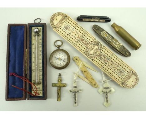
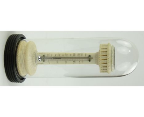
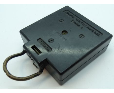
Los 1089
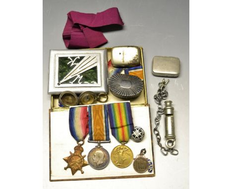
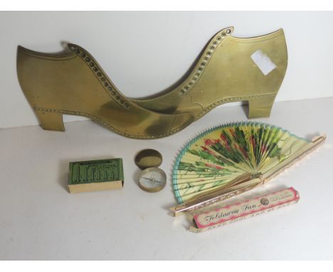
A Napoleonic period prisoner of war bone cribbage board engraved with coloured decoration, an Edwardian ivory thermometer by C.Baker, 244 HIgh Street, Holbeach, London, in a leather covered case, a 19th century bone carved pen knife, a jet brooch, three mother of pearl pendant crucifix, a Spanish enamelled pen knife, and a brass compass. (10)
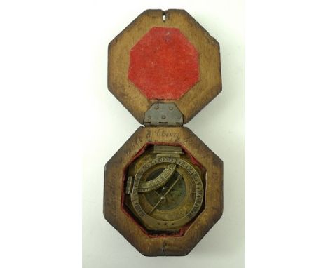
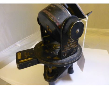
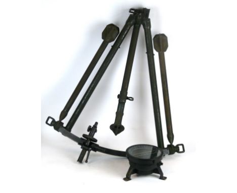
Los 1079
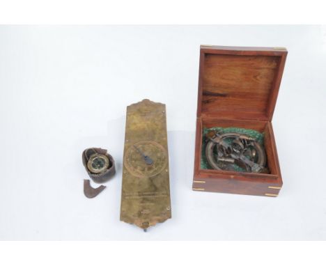
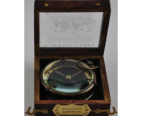
An Augsburg Universal equinoctial sundial, late 18th century, in a portable oak case initialled verso L.T.M. (possibly Ludovicus Theodatus Muller, Germany), the octagonal brass plate engraved with scrollwork and containing a magnetic compass with engraved base plate, the equinoctial hour ring is hinged to the North side and the adjustable latitude arc to the West side of the plate, the gnomon centred at a pivoted bar, with the original carved oak hexagonal box bearing indistinct inscription to the inner rim.
Los 363
*Canals. A Plan for a Navigation Chiefly by Canal from Longbridge near Burslem in the County of Stafford to Newcastle, Lichfield and Tamworth, and to Wilden in the County of Derby, by James Brindley, Revis'd and Approv'd by John Smeaton, 1760, manuscript plan drawn by Hugh Henshall, ink on paper with map showing canal, river, occasional churches and dwellings plus Lichfield Cathedral, title cartouche, compass rose and columns of copperplate writing giving details of landowners, ink-ruled border, vertical central crease, somewhat dust soiled and numerous marginal splits and nicks but without loss of text, a few crude paper repairs to verso, two old ink notes to verso noting 'The original plan of the Grand Trunk drawn by H. Henshall from which the plate was engraved', 54.5 x 75cm Hugh Henshall (1734-1816) was an English civil engineer, noted for his work on canals. Henshall worked with Brindley and John Smeaton in 1758 to survey the proposed Trent and Mersey (Grand Trunk) Canal. (1)
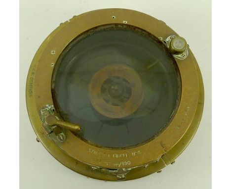
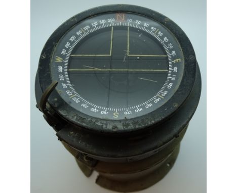
Los 1864
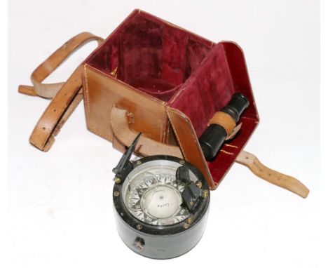
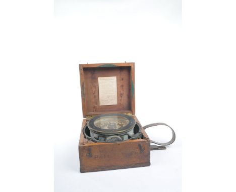
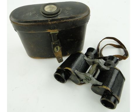
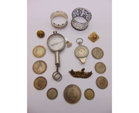
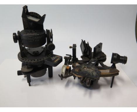
A late 19th early 20th Century circular brass and silver coloured metal sextant Unsigned with silvered scale and vernier with telescope and mirrors raised upon four feet contained within a brass banded hardwood box, a brass cased pocket compass signed Ross London with a damaged leather outer case and a No. 60 T Salters Trade Spring Balance to weigh twenty pounds 38cm (3).
Los 91
Estate plans. A Plan of an Estate lying and being within the Township of Caton and County of Lancaster, the Property of W.Anderson of Lancaster. Drawn by Ricd. Hall, A.D. 1791, pencil, pen & ink estate plan, oval cartouche, compass rose and table of explanation, old folds, slight dust soiling, strengthened and repaired on verso, 445 x 570 mm, together with, Plan of an Estate situate at Mile End called Buckeridge Lands, The Property of the Corporation of the Sons of the Clergy, 1806, pen & ink estate plan, old folds, some dust soiling, margins extended, strengthened and repaired on verso, 500 x 695 mm, with another thirty regional, county maps and town plans, including examples by Weller, Radclyffe, Ordnance Survey, Langley, Thomson, Pinkerton/Neele and Greenwood, various sizes and condition (approx.30)
Los 108
Somerset. Greenwood (C. & J.), Map of the County of Somerset from Actual Survey made in the Years 1820 & 1821, published George Pringle, 1822, large engraved map sectionalised and laid on linen, on six sheets, contemporary hand colouring, calligraphic title, compass rose, table of explanation and uncoloured vignette of Wells Cathedral, slight staining and offsetting, marbled endpapers, 1340 x 1900 mm, contained in later marbled calf gilt book box Brian Kentish. A Catalogue of County Atlases of England and Wales..., and large scale maps, 2012, Item 82. (1)
Los 574
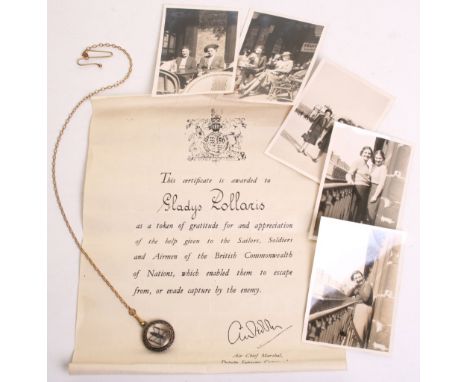
Historically Interesting and Poignant WW2 Grouping of Gladys Pollaris, being an official certificate awarded to Gladys by the British Government for helping Sailors, Soldiers and Airmen escape or evade capture in occupied Europe. Accompanying the document is a 1930’s period small compass on chain which was said to have been given by Gladys to a RAF pilot who she helped escape and who returned the item to her after the war.
Los 209
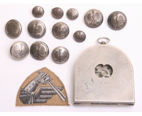
Pre War Polish Officers Compass, complete with the original white metal outer field cover stamped W P with Polish eagle to the centre and Z JEZNACKI WARSZAWA WZ K.M. 32 No 7874. Some wear to the casing. Accompanied by an Italian weave 2nd Armoured division cloth formation sign and 12 silvered Polish Eagle tunic buttons. (14 items)
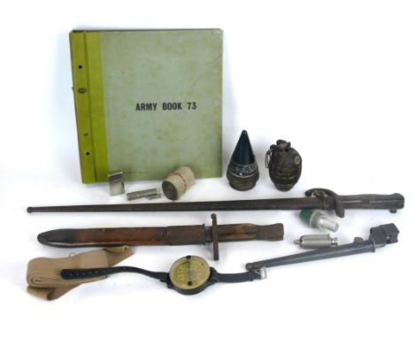
Los 543
A French Gras bayonet, dated 1875 The 52cm single edged blade with steel cross guard, brass pommel, complete with metal scabbard, a Canadian Ross mark Mk II bayonet, 26cm single edged blade, wooden grips, complete with leather and metal mounted scabbard, British no 4 Mk I spike bayonet, an Acme siren whistle (sometimes known as a bicyclists whistle) a deactivated Mills grenade, shell timer cone, compass, lighter etc.
Los 292
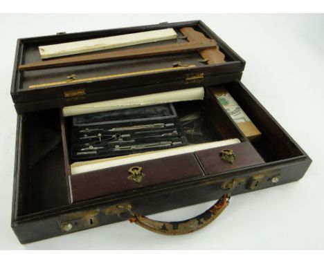
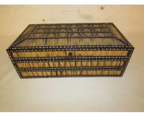
Porcupine quill writing box framed in dark hardwood and inlaid with roundels of ivory, the outer sides with three bands of quills, the lid interior inlaid with a compass of specimen woods, central elephant motif, and floral painted roundels; the hinged slope with green baize and compartmented twice, three small drawers set behind a removable plinth, cylindrical rule, two inkwells, pen trays, all inlaid with ivory roundels, probably Indian, late 19th / early 20th century (height 14cm width 39.5cm depth 14cm)

Los 14
A COLLECTION OF MAINLY BRITISH COINS, to include a selection of silver three pences Victoria to George VI, modern commemorative crowns, a WWI USA military compass, and a quantity of loose minor stamps and trade cardsBuyers - for shipping pricing on this lot, visit www.cuttlestones.co.uk/shipping
-
36562 Los(e)/Seite