36562 Preisdatenbank Los(e) gefunden, die Ihrer Suche entsprechen
36562 Lose gefunden, die zu Ihrer Suche passen. Abonnieren Sie die Preisdatenbank, um sofortigen Zugriff auf alle Dienstleistungen der Preisdatenbank zu haben.
Preisdatenbank abonnieren- Liste
- Galerie
-
36562 Los(e)/Seite
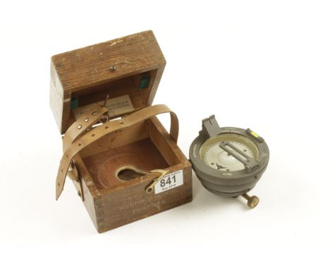

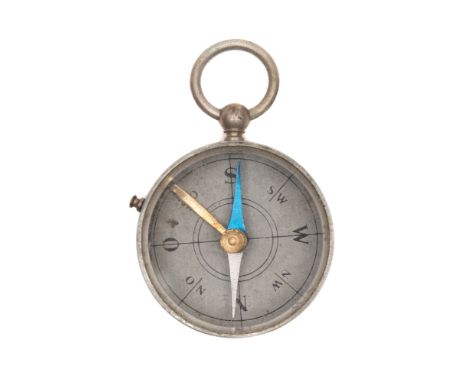
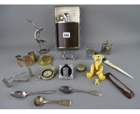
Los 633
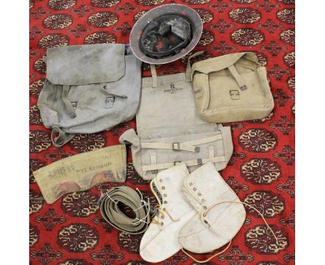
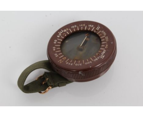
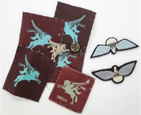
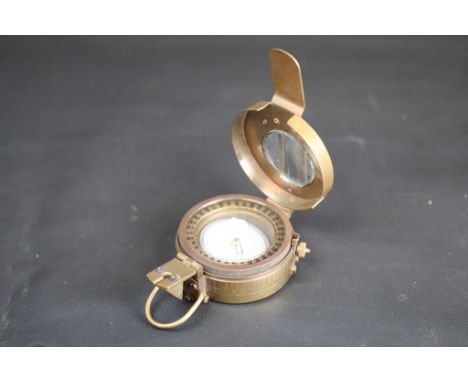
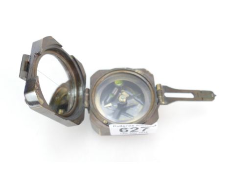
WW11 PERIOD PARACHUTE WINGS-BADGES etc. Two different pattern Parachutist Wings, never having been sewn to a uniform. A single India Pegasus cloth sleeve badge, two unmounted Pegasus sew-on sleeve badges, as issued and unworn. A silver Pegasus sweethearts brooch of good quality. A Commando/Parachutist escape compass, 15mm in diameter.
Los 170
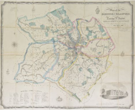
Bradford. Dixon (Thomas), Map of the Borough of Bradford comprising the townships of Bradford, Bowling, Horton & Manningham, from actual surveys made in the years 1844, 1845 & 1846, published Bradford, June 1846. large engraved map, sectionalised and laid on linen, bright original outline colouring, calligraphic title, compass rose, table of reference and engraved vignette of Bradford Infirmary, very slight offsetting, 1140 x 1420 mm, contained in an orginal gilt cloth slipcase with blind embossed arabesque on both boards, gilt title to spine, slipcase a little worn at extremities (1)
Los 172
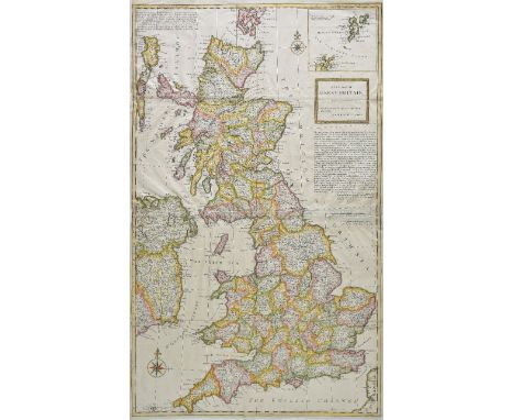
British Isles. Moll (Herman), A new map of Great Britain according to the newest and most exact observations, 1st edition, published 1717, large hand coloured engraved map on two sheets conjoined, inset map of the Shetland Islands, picture frame cartouche and compass rose, old folds strengthened on verso, slight fraying to left hand vertical margin, repaired, slight staining, 1025 x 625 mm R.W.Shirley, Printed Maps of the British Isles, 1650 - 1750, Moll 7. state 1. (1)
Los 181
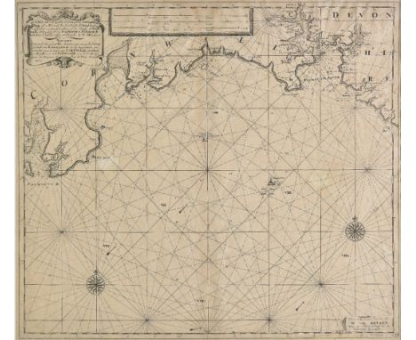
Cornwall. Mackenzie (Lieut. Murdoch), A survey of the South coast of England from Plymouth to the Lizard, 1773 , published by the Hydrographical Office, 1809, large uncoloured engraved sea chart, inset map of Fowey Harbour, one horizon profile, slight offsetting and spotting, 630 x 960 mm, together with Sayer (Robert, publisher), Plan of the Bays of Polkeris and Mevagizey in Cornwall, 1786, uncoloured engraved sea chart, two horizon profiles, 655 x 475 mm, with Laurie (Robert & Whittle James), A chart of the Chops of the Channel to the South of Scilly Isles; containing the west coast of Cornwall and Scilly Isles..., 1795, uncoloured engraved sea chart seven inset horizon profiles, compass rose and numerous rhumb lines, slight offsetting, 515 x 690 mm, plus Collins (Captain G.), Untitled sea chart of the west of Cornwall and the Scilly Isles, uncoloured engraved sea chart, compass rose and numerous rhumb lines, 460 x 580 mm (4)
Los 183
Devon & Cornwall. Van Keulen (Gerard), A new grad nally encreasing compass map of a part of the sea coasts of England, in which y contanied a part of the coasts of Cornwall extending to Big Berry to Falmouth..., published Amsterdam [1728 or later], uncoloured engraved sea chart, compass rose and numerous rhumb lines, title repeated in Dutch, slight overall toning, 525 x 595 mm, mounted, together with Collins (Captain G.), Untitled sea chart of south west Cornwall and the Scilly Isles, circa 1700, hand coloured engraved chart, compass rose and numerous rhumb lines, some dust soiling, 455 x 575 mm, mounted (2)
Los 187
England & Wales. Lewis (Samuel), A map of England & Wales, divided into counties, parliamentary divisions and dioceses, shewing the principal roads, railways, rivers & canals..., published S. Lewis and Co., 1841, engraved map with contemporary outline colouring, sectionalised and laid on linen on four sheets, large calligraphic title, compass rose, table of explanation, uncoloured vignette of the General Post Office London, table of the distances from port to port and a table of dioceses, each sheet approximately 1040 x 870 mm, each section bound in contemporary morocco gilt boards, spines a little frayed and worn, one board detached, together with A map of Scotland divided into counties, shewing the principal roads, railways, rivers, canals, lochs, mountains, islands &c., published S. Lewis & Co., 1840, engraved map with contemporary outline colouring, sectionalised and laid on linen on three sheets, calligraphic title, table of explanation, compass rose and an uncoloured vignette of Melrose Abbey, 630 x 1290 mm, bound in contemporary morocco gilt boards, frayed and worn, lacking two spines (7)
Los 215
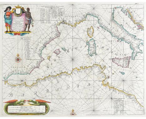
Mediterranean. Jansson (Jan), Pascaarte van 't Westelyckste deel vande Middelandsche Zee..., published Amsterdam, circa 1657, hand coloured engraved sea chart of the Western Mediterranean, decorative cartouche and mileage scale, compass rose and numerous rhumb lines, slight staining, two small professionally repaired closed tears to margins, 420 x 540 mm, Latin text on verso, mounted Originally published in Jansson's sea-atlas "De Water-Weereld." (1)
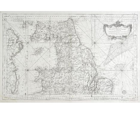
Los 222
Northern England. Bellin (Jacques Nicolas), Carte reduite des Isles Britanniques, Seconde Feuille, partie septentrionale de L'Angleterre..., published Paris, circa 1750, uncoloured sea chart stamp of the 'Depot de la Marine' to lower right, compass rose and numerous rhumb lines, slight dust soiling, 565 x 875 mm, together with Mercator (Gerard & Hondius Henricus), Eboracum, Lincolnia, Derbia, Staffordia, Notinghamia, Lecestria, Rutlandia etr Norfolcia, [1628], hand coloured engraved map, large strapwork cartouche, slight spotting, slight text showthrough, slight creasing, 360 x 425 mm, French text on verso, with Coronelli (Vincenzo Maria), Partie septentrionale del regno D'Inghilterra..., circa 1690, uncoloured engraved map of the northern half of England & Wales, inset map of the British Isles set in a 'curtain' border, large strapwork cartouche, 465 x 625 mm, plus Von Reilly (Franz Johann Joseph), Postkarte von Nord England, circa 1790, engraved map of northern England with contemporary hand colouring, 345 x 510 mm, and Marmocchi (Francesco), Parte settentrionale dell' Inghilterra, published Florence, 1839, engraved map with contemporary hand colouring, decorated with a vignette of a 'blue ensign', 230 x 315 mm (5)
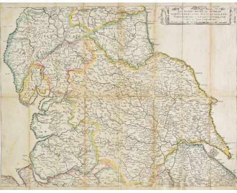
Los 230
Quartermaster's map. Hollar (Wenceslaus), The Bishop=Ricke of Durham and Cumberland, Westmoreland, York=Shire, Lancast=Shire, and Parte of Linconshire, circa 1644, engraved map with contemporary outline colouring, old folds, strengthened and repaired on verso, slight dust soiling, 395 x 510 mm Hollar was employed by Thomas Jenner to etch a six sheet map of England and Wales, based on Christopher Saxton's wall map. The map was designed to be 'Useful for all Comanders for Quarteringe of Souldiers & all sorts of Persons that would be informed, where the Armies be; never so commodiously drawne before this, The set of maps was designed for utilitarian use, and therefore are often found in a 'used' condition.The maps were re-printed three times between 1644 and 1688, This early edition does not show any roads but has a naive compass indicator at the mouth of the River Humber. John Rocque published two late editions in 1752 and 1799. R. W. Shirley, Early Printed Maps of the British Isles. 1477 - 1650, no. 537. (1)
Los 260
Yorkshire. Tuke (John), Map of the County of York, 1787, engraved map with contemporary hand colouring on four sheets conjoined to form two sheets, inset town plan of Kingston upon Hull, inset map of the county showing the Roman roads, large decorative uncoloured cartouche, compass rose and table of explanation, slight dust soiling and toning, trimmed to neatline with thread margins, old folds with slight creasing, overall size 1180 x 1420 mm (2)
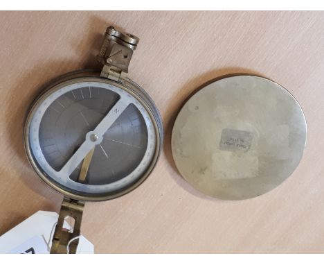
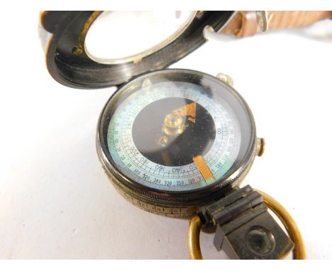
Los 231
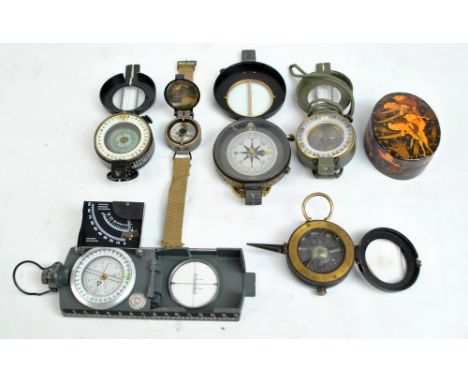
Sale Item: BRASS COMPASS T COOKE LONDON No2007 Vat Status: No Vat Buyers Premium: This lot is subject to a Buyers Premium of 15% + Vat @ 20% Additional Info : Lots purchased online with the-saleroom.com will attract an additional charge for this service in the sum of 3% of the hammer price plus VAT @ 20%
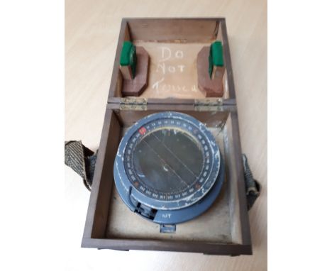
Los 656
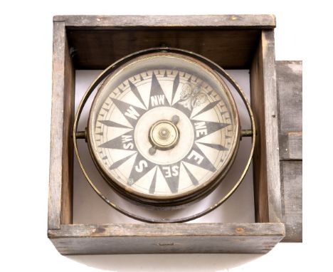
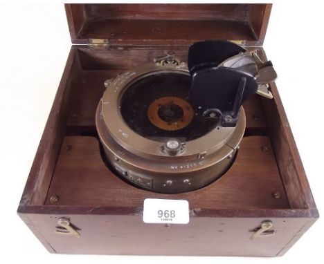
Sale Item: CASED SHIPS COMPASS (AF) Vat Status: No Vat Buyers Premium: This lot is subject to a Buyers Premium of 15% + Vat @ 20% Additional Info : Lots purchased online with the-saleroom.com will attract an additional charge for this service in the sum of 3% of the hammer price plus VAT @ 20%


Los 49
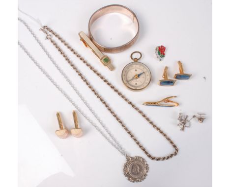
A collection of objects of vertu, to include: a leather and silver mounted card case, sponsor's mark L.K, import mark for Birmingham 1900, pressed leather covers opening to a tan leather interior, stamped Parkins & Gotto Oxford St. W., 10cm (4in) long; a silver pencil holder, engraved M. D. Pope. 1929. Shooting Prize. Fonthill, 7cm (2 3/4in) long; a silver cross country medal; an oval shooting game counter, 6cm (2 1/4in) long; and a compass (see illustration on our website)
Los 611
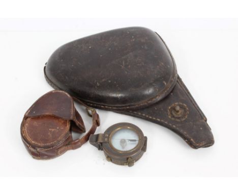
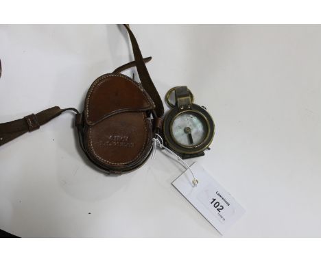
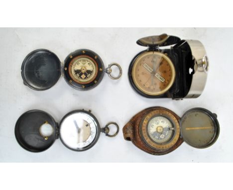
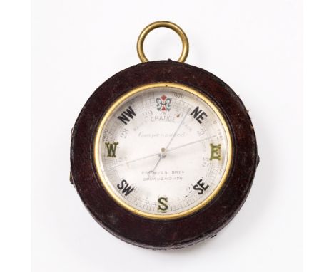
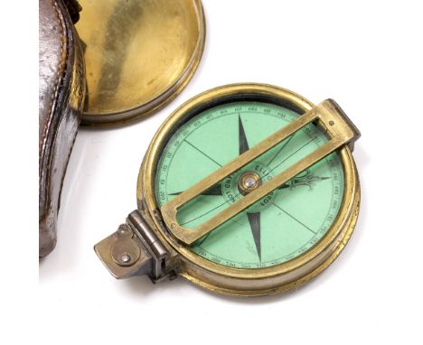
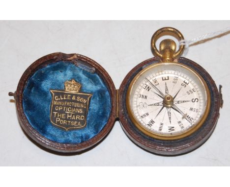
A late Victorian gilt metal cased pocket compass, having silvered dial, in fitted leather case bearing label for 'G Lee & Son, Manufacturing Opticians, The Hard, Portsee' Condition Report / Extra Information In working order.Gilt worn to suspension ring.Some wear to the gilt casing.Leather outer case has wear consistent with age/use.
-
36562 Los(e)/Seite