36562 Preisdatenbank Los(e) gefunden, die Ihrer Suche entsprechen
36562 Lose gefunden, die zu Ihrer Suche passen. Abonnieren Sie die Preisdatenbank, um sofortigen Zugriff auf alle Dienstleistungen der Preisdatenbank zu haben.
Preisdatenbank abonnieren- Liste
- Galerie
-
36562 Los(e)/Seite


Los 546
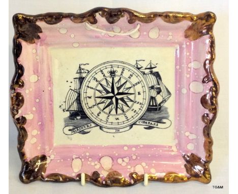
A LATE VICTORIAN BRASS VESTA set with the portrait of a cat with red eyes, a nickel plated French example set with an applied miniature Eiffel tower, stamped "ALLIARD AINB A BESANCON", a plated Art Nouveau example with flowers in relief, a tin plate example with a hunter jumping a fence by The Bell & Black Match Co.Ltd., and four other plated vestas (one set with a compass) (8)
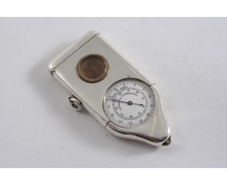
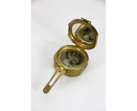
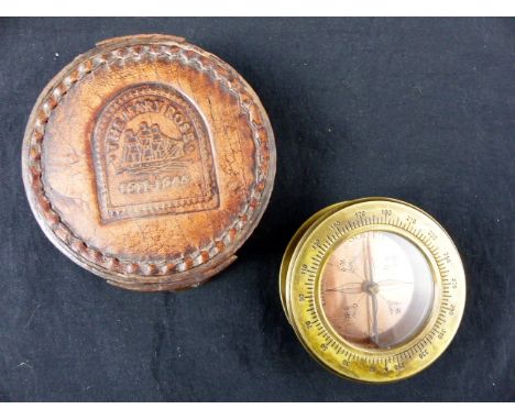
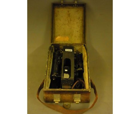
Los 557
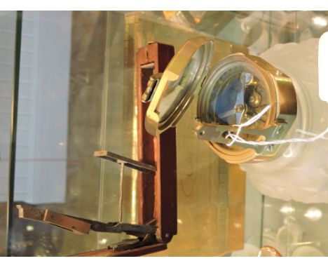
AN EDWARDIAN COMBINED VESTA CASE & MAP MEASURING INSTRUMENT inset with a small compass, the reverse inscribed "he hath smote for us a pathway to the ends of all the earth" & "LW", suspensory ring, Registered Design No. "514307", by Percy Edwards Ltd., London 1907; 3.25" (8.1 cms) long; 2.3 oz gross
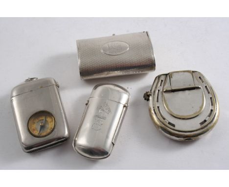
Los 648
A VICTORIAN OVAL TUBULAR VESTA CASE with engine-turning & a suspensory ring, crested, by William Summers, London 1874, another rounded oblong vesta with button-operated cover, initialled & crested, by the same maker. London 1872 and two plated vestas (a Victorian horseshoe with slow match holder, crested & monogrammed & another with an inset compass); 2.1 oz weighable silver (4)
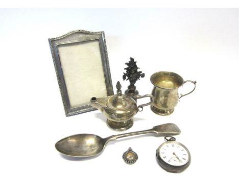
Los 94
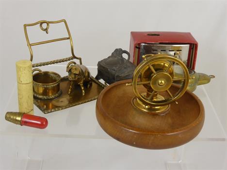
A SILVER PICTURE FRAME Birmingham 1927, rectangular arched top form with engine turned decoration, 15.5cm tall, image area 12cm by 6.5cm, wooden backed; with a Mappin and Webb silver table lighter, of lamp form, 1906; a silver small baluster shaped Christening mug; a compass watch fob; a late Victorian silver open faced pocket watch; a plated candelabra; and a plated tablespoon; 128g (4.11 troy ozs) gross weighable
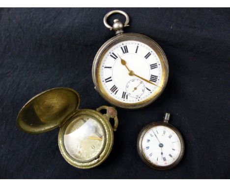
Los 1028
Mixed lot comprising a last quarter of 19th Century continental white metal cased small pocket watch One (of two) blued steel hands to a white enamelled dial (hairline crack), black Roman numerals, subsidiary seconds dial, 1.5” diameter dial, key wind, unmarked together with an early 20th Century novelty watch case shaped compass cum travelling beaker combination stamped “C T & S Number 5407” to the back. (2)
Los 1032
Mixed lot including a Second World War Nickel cased pocket watch, the black enamelled dial (with damage) inscribed “30 hour, non-hyper luminous, Mark V” and further numbered B.E.10612 A/F Mounted on a long graduated hallmarked Silver watch chain which also suspends a metal watch case design compass Vesta and Goldstone mounted fobs plus a Victorian oval white metal locket


Los 108
Folding maps. Lynam (George), Map of the Parish of Stoke upon Trent in the County of Stafford from an Actual Survey, 1848, litho. map sectionalised and laid on linen, sparse contemp. hand colouring, some staining, some worming to image, 645 x 930mm, cloth endpapers, contained in contemp. slip case, worn and stained, with, Greenwood (C. & J.),Map of the County of Hereford from an Actual Survey, 1834,engraved map sectionalised and laid on linen, contemp. hand colouring, calligraphic cartouche, compass rose and table of explanation, b & w vignette of Hereford cathedral, slight offsetting, marbled endpapers, 590 x 700mm, with another ten folding maps, including examples by Ordnance Survey, Pratt and Bartholomew, plus an early 20th century jigsaw puzzle of central London, various sizes and condition (12)

Los 124
Lancashire. Hennet (George), A Map of the County Palatine of Lancashire, Divided into Hundreds and Parishes from an accurate Survey made in the Years 1828 and 1829, pub. Henry Teesdale & Co., 1830, engraved map by James Bingley, contemp. hand colouring, sectionalised and laid on linen, calligraphic title, table of explanation, compass rose and engraved vignette of the New Custom House Liverpol, slight dust soiling, the whole edged in green silk, 1600 x 1110mm, marbled endpapers, contained in contemp. calf book box, rubbed and worn at extrems. Brian Kentish. A Catalogue of County Atlases of England and Wales...., and large scale maps, 2012. No.68. (1)

Los 142
North America. Speed (John), A Map of New England and New York, pub. Thomas Bassett and Richard Chiswell, c.1676, hand coloured engraved map, strapwork cartouche and mileage scale, compass rose and numerous rhumb lines, laid on later stiff paper, 385 x 505mm. P.Burden. The Mapping of North America, no.455. (1)
Los 150
Sea chart. Mortier (Pierre), Carte Generale des Costes de L`Europe sur L`Ocean Comprises depuis Dronthem en Norvege jusques au Detroit de Gibralter, pub. Paris, c.1693, large uncoloured engraved chart of north western Europe, orientated to the east, compass rose and numerous rhumb lines, slight dust soiling, 605 x 870mm. From Mortier`s counterfeit edition of Jaillot`s `Neptune Francois`. (1)
![Sea chart. Van Keulen (Gerard), Afteekening van de Rivier van London of River Thames [on sheet with] Afteekening van de Iarm](http://lot-images.atgmedia.com/SR/10729/2920268/151-2014128122417_468x382.jpg)
Los 151
Sea chart. Van Keulen (Gerard), Afteekening van de Rivier van London of River Thames [on sheet with] Afteekening van de Iarmouthse Banken geleegen voor Iarmouth Aan de Oost Kust van Engeland in de Noord Zee, pub. Amsterdam, c.1734, two uncoloured engraved charts on one sheet (as published), orientated to the east, compass rose and numerous rhumb lines, 515 x 595mm (1)

Los 153
South America. Moll (Herman), A New & Exact Map of the Coast Countries and Islands within ye Limits of ye South Sea Company from ye River Aranoca to Terra del Fuego and from thence through ye South Seas to ye North Part of California &c...., c.1726, engraved map with contemp. outline colouring, three large inset maps of Baldivia, Guiaquil and Chilo harbour and nine further small inset maps, insular California, old folds strengthened on verso, one closed tear repaired on verso, 665 x 495mm, together with, Sayer R. & Bennett J., pubs.),A Chart of the Straits of Magellan. Inlarged from the Chart published at Madrid in 1769 by Don Juan de la Cruz Cano y Olmedilla, 1775,engraved map with contemp. outline colouring, inset map of the Falkland Islands, compass rose and numerous rhumb lines, central fold partially strengthened on verso, slight staining, 520 x 700mm, with another chart similar (3)

Los 159
Wiltshire. Greenwood (Christopher), Map of the County of Wilts from Actual Survey made in the Years 1819 & 1820, pub. 1820, engraved map with contemp. outline colouring, sectionalised and laid on linen, on four sheets, calligraphic title, compass rose, dedication and table of explanation, some staining and spotting, overall size 1450 x 1110mm, together with, Martin, Hood & Larkin (pubs.),The Meux Estates. Plan of the Second Portion being the Marlborough Downs Section in the Parishes of West Overton, Fyfield, Preshute, Ogbourne St. Andrew, Berwick Bassett & Broad Hinton, for sale by Auction by Messrs, Giddy & Giddy, 1906,col. litho. estate map, old folds, 800 x 590mm (2)
Los 87
British Islands. Blaeu (Johannes), Sarnia Insula, Vulgo Garnsey et Insula Caesarea Vernacule Jarsey, c.1648, engraved map with contemp. hand colouring, ornate cartouche and mileage scale, slight creasing, 395 x 475mm, French text on verso, together with, Insula Sacra Vulgo Holy Island et Farne, c.1648, engraved map with contemp. hand colouring, 390 x 475mm, French text on verso, with, Jaillot (Alexis Hubert),Carte de la Manche...., pub. Paris, 1692, hand coloured engraved chart of the English Channel, southern England & Wales and northern France, compass rose and numerous rhumb lines, 590 x 805mm, plus, Fricx (Eugene Henri),Partie de L`Angleterre, c.1710, hand coloured engraved map of the eastern part of Kent, 445 x 575mm (4)
Los 97
Crete. Jansson (Jan), Creta Iovis Magni Medio jacet Insula ponto...., c.1650, engraved map with contemp. hand colouring compass rose and numerous rhumb lines, slight overall toning, 380 x 485mm, together with, Visscher (Nicolas),Cretae seu Candiae Insula et Regnum cum Diversis aliis Archipelagi Insulis....., pub. Amsterdam, c.1695, engraved map with contemp. hand colouring, slight staining, 495 x 580mm (2)

Los 98
Derbyshire. Speed (John), Darbieshire described, pub. John Sudbury & George Humble, c.1627, hand coloured engraved map, inset town plan of Derby and a vignette of St. Anne`s well at Buxton, large strapwork cartouche, compass rose and mileage scale, central fold with closed tear, repaired and strengthened on verso, 390 x 515mm, English text on verso, together with, Blaeu (Johannes),Leicestrensis Comitatus, Leicester Shire, c,1648, uncoloured engraved map, some browning to central fold, 390 x 500mm, Dutch text on verso (2)


-
36562 Los(e)/Seite