We found 45695 price guide item(s) matching your search
There are 45695 lots that match your search criteria. Subscribe now to get instant access to the full price guide service.
Click here to subscribe- List
- Grid
-
45695 item(s)/page

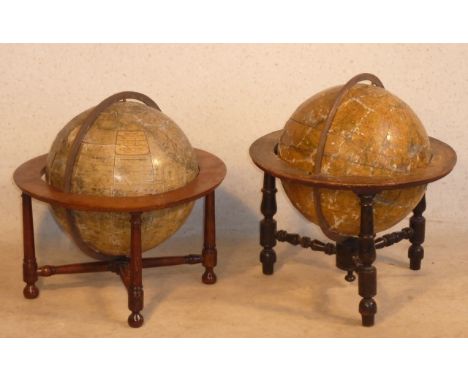
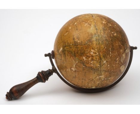
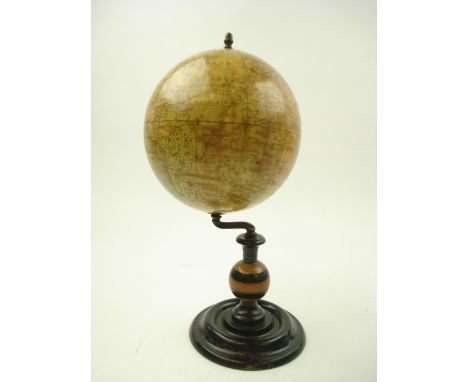
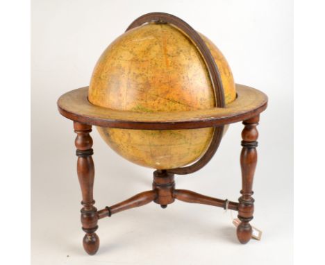
Lot 301
A matched pair of late 18th/early 19th Century Terrestrial and Celestial Table Globes, the Terrestrial Globe (approx. 30cm diameter, not including stand, approx. 39cm high including stand) with makers label of Malby's (Charring Cross, London) and on a four legged oak stand, the Celestial Globe on an ebonised tripod stand (later stands), the equatorial arc graduated in degrees, (condition commensurate with age)
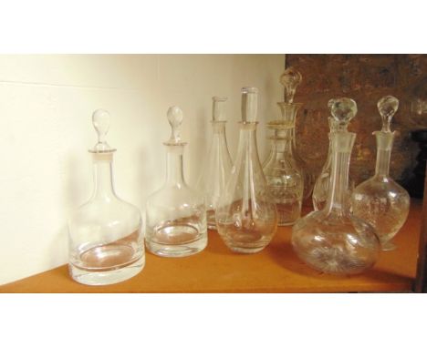
Lot 162
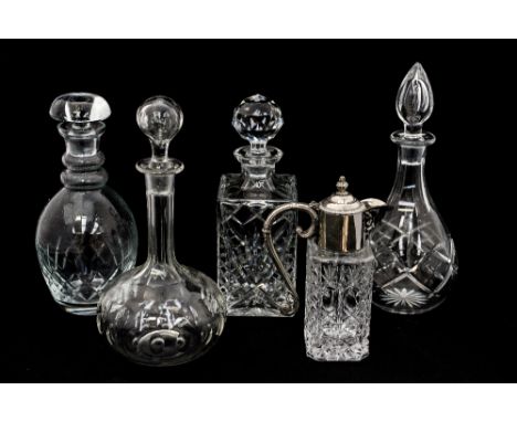
A good quality pair of tall cased decanters with diamond and fan cut detail set beneath cut shoulders and faceted globular stoppers, the bases with star cut decoration together with a pair of good quality clear glass shaft and globe shaped decanters with pointed stoppers, a further decanter of squared form with extensive cut detail (5)
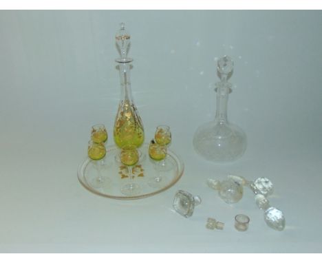
Lot 168
A liquor set comprising slender footed decanter and five matching glasses, all with green tinted bowls with gilded ivy and other decoration, all upon an associated clear glass tray of circular form together with single Shaft & Globe shaped decanter, a selection of clear glass decanters, stoppers


Lot 376
An 18th Century German Bronze Six Branch Chandelier. The fillet knopped stem above a globe pendant enriched with punchwork, and having two discoid platforms; one cut with dovetails for slot-on reflectors above the other pierced with mortise holes numbered by a series of dots coinciding to the tenons of the scrolling candle arms. The piece surmounted by a bird finial with suspension ring, 18½ ins (47 cms) high, 24 ins (61 cms) wide.
![BACON (F), THE HISTORIE OR THE RAIGNE OF KING HENRY THE SEVENTH, engraved portrait frontis by John Payne, engraved title [2],](https://cdn.globalauctionplatform.com/87a0ae42-cb3c-47d1-b26f-a61d007e160a/f8121293-f2c9-4d0b-9b1b-ac2b25130485/468x382.jpg)
Lot 217
BACON (F), THE HISTORIE OR THE RAIGNE OF KING HENRY THE SEVENTH, engraved portrait frontis by John Payne, engraved title [2], 248pp, repaired full tan calf, London, W. Stansby 1622; BACON (F), SYLVA SYLVARUM OR A NATURAL HISTORY, IN THE TEN CENTURIES, seventh edition, engraved portrait frontis, engraved pre-title with globe and two columns, lacking pp41-44, title to New Atlantis torn, Natural history title dated 1658, full tan calf, London, William Lee, 1658 (2)

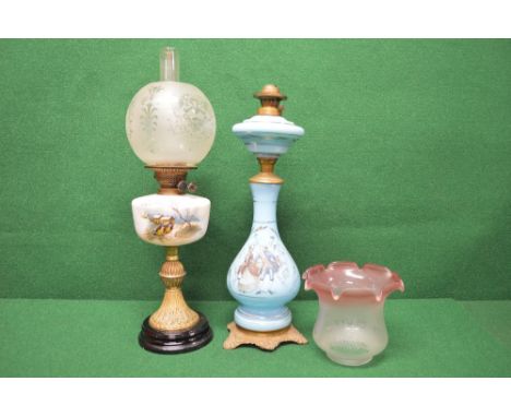
Lot 188
Blue glass oil lamp having transfer decoration of figures, standing on a metal base - 23.75" tall (no chimney or shade) together with one other oil lamp having globe shade on a white glass reservoir with decoration of birds on a tree with buildings beyond, standing on a brass base - 25.5" tall
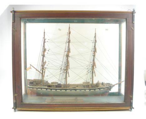
Lot 809
A scratch built model of the Clyde built iron hulled sailing ship Harbinger by William Prettejohn:, standing and running rigged over decks with lifeboats and cabin houses, white gunwales, the hull painted grey to waterline and red beneath, on a wooden cradle with label 'To Peter Ryder Globe in Dec 6 1967 from H W Pratt Frogmore', in a glazed pine case, the case 63cm x 79cm x 29cm, also together with a newspaper cutting relating to Mr Prettejohn dated 1949. (one glass section damaged)
-
45695 item(s)/page