

"ORBIS VETERIBUS NOTUS", map belonging to the "Atlas Universel, dressé sur les meilleures cartes modernes", second half of the 18th century.Illuminated engraving (color demarcations).Edition M. Remondini, Venice, 1784.Hand-numbered on the reverse (no. 54), corresponding to the numbering stipulated in the index.The lot is accompanied by a copy of the title page of the Atlas.Measurements: 49 x 66 cm (print); 53 x 76 cm (paper).Large map of the Ancient World published by the famous cartographer J.B.B. D'Anville. The map shows an outline of the regions of Europe known at the time of Ptolemy, using ancient place names and omitting regions not yet known to Europeans.The origin of the "Atlas Universel, dressé sur les meilleures cartes modernes" (Universal Atlas made from the best modern maps) dates back to 1757, when Gilles Robert de Vaugondy (1668-1766) and his son Didier Robert de Vaugondy (1723-1786), geographers to the King of France, formed one of the most renowned map and globe making workshops in France. The excellent position of the Vaugondys in the field of topography, added to the family ties that united them with Nicolas Sanson, one of the most important cartographers of the 17th century, led the Vaugondys to inherit much of the cartographic material that the latter had accumulated over the years, leading to the birth of the ambitious and unique Universal Atlas of which our map is a part. The copy became a commercial and cartographic success with enormous influence in all Europe, reason why the brothers Paolo and Francesco Santini, Venetian engravers, did not let escape the opportunity to acquire the original plates to the Vaugondy. Thus, in 1776, the Santini brothers commissioned the production of new copper plates, while substantially maintaining the original design, keeping the toponyms and the inscriptions in French as defined in the 1757 copy. Due to their knowledge of the Italian territory, the Santini's changes mainly affected the maps of the Italian regions. The following year, Paolo Santini ceded all his publication rights to M. Remondini, who in 1777 and 1784 republished the same Atlas, but with his name.The copy of which our map is part, published in 1784, maintains the exceptionality of the original work of the Vaugondy: the meticulous treatment of the information (based on the revision of the oldest maps available, buying them with the most updated material at the time); the incorporation of the latest academic research in force at the time; the integration of their own astronomical observations (correcting if necessary even latitude and longitude) or the great decorativism of each of their maps. As in the great majority of cartographic documents produced in France during the 18th century, the map in question is characterized by its enormous pictorial value and great attention to detail.Antique maps are one of the most complete documentary typologies. Their double nature, cartographic and historical, attracts the attention of the most demanding collectors, who see in cartography the faithful reflection of the past, betting on its purchase and its diffusion in the art market. The rarity of some of the editions, added to the longevity of many of the specimens, make the possession and enjoyment of antique cartography an increasingly fashionable pleasure among art lovers. Understood as authentic reminiscences of the past, antique maps become a conscientious reflection of how the territory was divided long ago, or how geographical features define our world. Their decorative character, added to the meticulous and ambitious work of cartographers, turn these pieces into authentic works of art.
We found 41226 price guide item(s) matching your search
There are 41226 lots that match your search criteria. Subscribe now to get instant access to the full price guide service.
Click here to subscribe- List
- Grid
-
41226 item(s)/page

"AUSTRIAN POLAND", map belonging to the "Atlas Universel, dressé sur les meilleures cartes modernes", second half of the 18th century.Illuminated engraving (color demarcations).Edition M. Remondini, Venice, 1784.Hand-numbered on the reverse (no. 47), corresponding to the numbering stipulated in the index.The lot is accompanied by a copy of the title page of the Atlas.Measurements: 46 x 60 cm (print); 53 x 76 cm (paper).This map of Austrian Poland also contains part of Red Russia and the southern part of the Kraków Palatinate.The origin of the "Atlas Universel, dressé sur les meilleures cartes modernes" (Universal Atlas made from the best modern maps) dates back to 1757, when Gilles Robert de Vaugondy (1668-1766) and his son Didier Robert de Vaugondy (1723-1786), geographers to the King of France, formed one of the most renowned map and globe making workshops in France. The excellent position of the Vaugondys in the field of topography, added to the family ties that united them with Nicolas Sanson, one of the most important cartographers of the 17th century, led the Vaugondys to inherit much of the cartographic material that the latter had accumulated over the years, leading to the birth of the ambitious and unique Universal Atlas of which our map is a part. The copy became a commercial and cartographic success with enormous influence in all Europe, reason why the brothers Paolo and Francesco Santini, Venetian engravers, did not let escape the opportunity to acquire the original plates to the Vaugondy. Thus, in 1776, the Santini brothers commissioned the production of new copper plates, while substantially maintaining the original design, keeping the toponyms and the inscriptions in French as defined in the 1757 copy. Due to their knowledge of the Italian territory, the Santini's changes mainly affected the maps of the Italian regions. The following year, Paolo Santini ceded all his publication rights to M. Remondini, who in 1777 and 1784 republished the same Atlas, but with his name.The copy of which our map is part, edited in 1784 by M. Remondini, maintains the exceptionality of the original work of the Vaugondy: the meticulous treatment of the information (based on the revision of the oldest maps available, buying them with the most updated material at the time); the incorporation of the latest academic research in force at the time; the integration of their own astronomical observations (correcting if necessary even the latitude and longitude) or the great decorativism of each of their maps. As in the great majority of cartographic documents produced in France during the 18th century, the map in question is characterized by its enormous pictorial value and great attention to detail.Antique maps are one of the most complete documentary typologies. Their double nature, cartographic and historical, attracts the attention of the most demanding collectors, who see in cartography the faithful reflection of the past, betting on its purchase and its diffusion in the art market. The rarity of some of the editions, added to the longevity of many of the specimens, make the possession and enjoyment of antique cartography an increasingly fashionable pleasure among art lovers. Understood as authentic reminiscences of the past, antique maps become a conscientious reflection of how the territory was divided long ago, or how geographical features define our world. Their decorative character, added to the meticulous and ambitious work of cartographers, turn these pieces into authentic works of art.

"CIRCLE OF BAVARIA", map belonging to the "Atlas Universel, dressé sur les meilleures cartes modernes", second half of the 18th century.Illuminated engraving (color demarcations).Edition M. Remondini, Venice, 1784.Hand-numbered on the reverse (no. 33), corresponding to the numbering stipulated in the index.The lot is accompanied by a copy of the title page of the Atlas.Measurements: 49.5 x 54.5 cm (print); 53 x 76 cm (paper).Map of the circle of Bavaria including the Upper Palatinate, the duchies of Upper and Lower Bavaria and Neuburg, the archbishopric of Salzburg, the archbishoprics of Regensburg, Freisingen and Passau and the provostship of Berchtolsgaden. The Bavarian Circle was an Imperial Circle of the Holy Roman Empire.The origin of the "Atlas Universel, dressé sur les meilleures cartes modernes" (Universal Atlas made from the best modern maps) dates back to 1757, when Gilles Robert de Vaugondy (1668-1766) and his son Didier Robert de Vaugondy (1723-1786), geographers to the King of France, formed one of the most renowned map and globe making and manufacturing workshops in France. The excellent position of the Vaugondys in the field of topography, added to the family ties that united them with Nicolas Sanson, one of the most important cartographers of the 17th century, led the Vaugondys to inherit much of the cartographic material that the latter had accumulated over the years, leading to the birth of the ambitious and unique Universal Atlas of which our map is a part. The copy became a commercial and cartographic success with enormous influence in all Europe, reason why the brothers Paolo and Francesco Santini, Venetian engravers, did not let escape the opportunity to acquire the original plates to the Vaugondy. Thus, in 1776, the Santini brothers commissioned the production of new copper plates, while substantially maintaining the original design, keeping the toponyms and the inscriptions in French as defined in the 1757 copy. Due to their knowledge of the Italian territory, the Santini's changes mainly affected the maps of the Italian regions. The following year, Paolo Santini ceded all his publication rights to M. Remondini, who in 1777 and 1784 republished the same Atlas, but with his name.The copy of which our map is part, edited in 1784 by M. Remondini, maintains the exceptionality of the original work of the Vaugondy: the meticulous treatment of the information (based on the revision of the oldest maps available, buying them with the most updated material at the time); the incorporation of the latest academic research in force at the time; the integration of their own astronomical observations (correcting if necessary even the latitude and longitude) or the great decorativism of each of their maps. As in the great majority of cartographic documents produced in France during the 18th century, the map in question is characterized by its enormous pictorial value and great attention to detail.Antique maps are one of the most complete documentary typologies. Their double nature, cartographic and historical, attracts the attention of the most demanding collectors, who see in cartography the faithful reflection of the past, betting on its purchase and its diffusion in the art market. The rarity of some of the editions, added to the longevity of many of the specimens, make the possession and enjoyment of antique cartography an increasingly fashionable pleasure among art lovers. Understood as authentic reminiscences of the past, antique maps become a conscientious reflection of how the territory was divided long ago, or how geographical features define our world. Their decorative character, added to the meticulous and ambitious work of cartographers, turn these pieces into authentic works of art.


A FLINTLOCK ‘DUCK'S FOOT’ PISTOL the late 18th century wire-inlaid square walnut grip signed Bunney London with inset silvered plate inscribed Capt. Edw. Rotherham, flintlock action to breech punched with proof marks and four numbered turn-off cannon barrels -- 13in. (33cm.) long overall, contained within an associated brass-bound wooden case of c1790 with fitted plush-lined interior containing bullet mould, bullets, late 19thC paper-covered globe inkwell, and an unidentified optical device (a lot)Condition report: As viewed.

A PARKES & HADLEY PATENT BRASS TABLE ORRERY, LONDON, CIRCA 1880 the 10in. cast iron calendar plate with geared push mechanism to 3in. George Phillip & Son globe and moon orbit, the plate inscribed Parkes & Hadley Patent Orrery, on a brass foot (lacking candle sconce and reflector) – 9½in. (24cm.) high overall

A 9IN. CELESTIAL GLOBE PUBLISHED BY MALBY AND ISSUED BY J. WYLD, 1860 coloured gores with maker's label inscribed MALBY’S CELESTIAL GLOBE collated from the works of Piazzi, Bradley, Hevelius, Meyer, La Caille & Johnson Reduced to the Year 1860 / J WYLD LEICESTER SQ., LONDON, mounted in calibrated brass meridian with swivel indicator, on original turned wooden base – 14in. (35.5cm.) highCondition report: Overall old patination commensurate with age

A FINE STAR GLOBE BY KELVIN & HUGHES LTD FOR EPOCH, 1975 the 7in. globe with metal core, white gores printed with star systems, signed in cartouche Kelvin & Hughes Ltd, signed as per title and inscribed printed by George Phillip & Son Ltd, mounted within lacquered brass horizon ring with serial numbers and removable meridians, contained within fitted box of issue with instructions pasted inside lid, indicators and pencil, securing hooks and carry handle, approximately -- 10½in. (26.5cm.) square


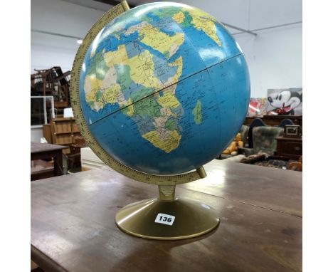
TWO BOXES AND LOOSE, PICTURES, DVD'S IN STAND, LIGHTS, BOXED HP DESKJET, ETC, to include a Scan-Globe A/S table top globe (not tested), metal music stand, novelty lamp (music related shade), a metal wall hanging shaped as a music note, various modern pictures, mirror, a tub of cotton reels, desk lamps, etc


Actor Kelsey Grammer signed DVD jacket Allen Kelsey Grammer is an American actor, producer, director and writer, best known for his two-decade-long portrayal of psychiatrist Dr Frasier Crane on the NBC sitcom Cheers and its spin-off Frasier, for which he won four Primetime Emmy Awards and two Golden Globe Awards. Good condition. All autographs come with a Certificate of Authenticity. We combine postage on multiple winning lots and can ship worldwide. UK postage from £4.99, EU from £6.99, Rest of World from £8.99

Game Of Thrones, Peter Dinklage signed 10x8 colour photograph pictured as he plays Tyrion Lannister on the HBO television series Game of Thrones (2011-2019), for which he won the Primetime Emmy Award for Outstanding Supporting Actor in a Drama Series a record four times [3] He also received a Golden Globe Award in 2011 and a Screen Actors Guild Award in 2020 for the role. Good condition. All autographs come with a Certificate of Authenticity. We combine postage on multiple winning lots and can ship worldwide. UK postage from £4.99, EU from £6.99, Rest of World from £8.99

Game Of Thrones, Richard Madden signed 10x8 colour photograph in the HBO epic fantasy television series Game of Thrones (2011-2019) earned him international recognition and several accolades, including a Golden Globe Award nomination for Best Actor - Television Series Drama in 2019 and two Primetime Emmy Award nominations for Outstanding Supporting Actor in a Drama Series in 2016 and Outstanding Lead Actor in a Drama Series in 2019. Good condition. All autographs come with a Certificate of Authenticity. We combine postage on multiple winning lots and can ship worldwide. UK postage from £4.99, EU from £6.99, Rest of World from £8.99

Ali Macgraw signed 10x8 black and white photo American actress and activist She gained attention with her role in the film Goodbye, Columbus (1969), for which she won the Golden Globe Award for Most Promising Newcomer. Good condition. All autographs come with a Certificate of Authenticity. We combine postage on multiple winning lots and can ship worldwide. UK postage from £4.99, EU from £6.99, Rest of World from £8.99

Tom Cruise signed 12x8 colour photo from Mission Impossible American actor and producer He has received various accolades for his work, including three Golden Globe Awards and three nominations for Academy Awards He is one of the highest-paid actors in the world His films have grossed over $4 billion in North America and over $10 1 billion worldwide making him one of the highest-grossing box office stars of all time. Good condition. All autographs come with a Certificate of Authenticity. We combine postage on multiple winning lots and can ship worldwide. UK postage from £4.99, EU from £6.99, Rest of World from £8.99

Penelope Cruz signed 12x8 colour photo Spanish actress She is the recipient of various accolades, including an Academy Award and a British Academy Film Award, in addition to nominations for a Primetime Emmy Award, four Golden Globe Awards, and five Screen Actors Guild Awards. Good condition. All autographs come with a Certificate of Authenticity. We combine postage on multiple winning lots and can ship worldwide. UK postage from £4.99, EU from £6.99, Rest of World from £8.99

Patrick Stewart signed 10x8 colour photo from Star Trek English actor who is best known for his work in various stage, television, film and video games in a career spanning six decades He has been nominated for Olivier, Tony, Golden Globe, Emmy, Screen Actors Guild, and Saturn Awards. Good condition. All autographs come with a Certificate of Authenticity. We combine postage on multiple winning lots and can ship worldwide. UK postage from £4.99, EU from £6.99, Rest of World from £8.99

Matthew Broderick signed 7x5 black and white photo Dedicated American actor and singer His roles include the Golden Globe-nominated portrayal of the title character in Ferris Bueller's Day Off (1986), the voice of adult Simba in Disney's The Lion King (1994), and Leo Bloom in both the Broadway musical The Producers and its 2005 film adaptation. Good condition. All autographs come with a Certificate of Authenticity. We combine postage on multiple winning lots and can ship worldwide. UK postage from £4.99, EU from £6.99, Rest of World from £8.99


-
41226 item(s)/page