We found 12130 price guide item(s) matching your search
There are 12130 lots that match your search criteria. Subscribe now to get instant access to the full price guide service.
Click here to subscribe- List
- Grid
-
12130 item(s)/page


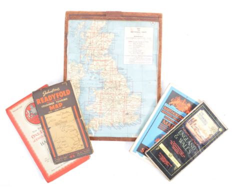

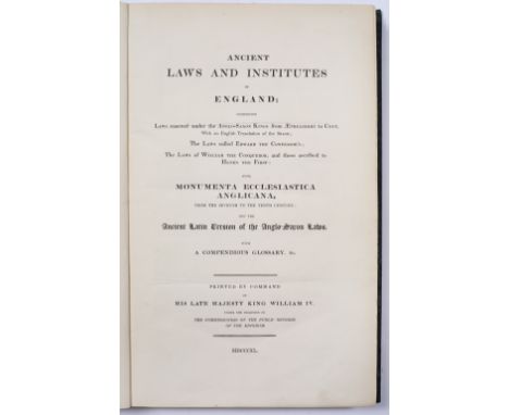
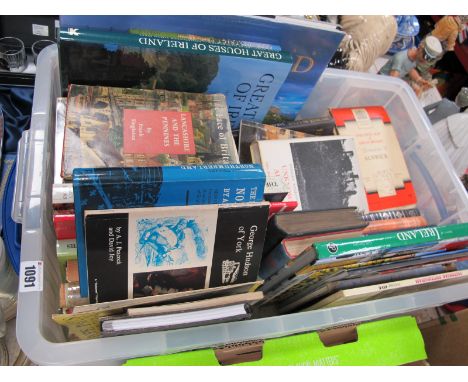
Lot 656
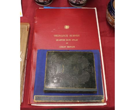
ANCIENT LAWS AND INSTITUTES OF ENGLAND……and The Ancient Latin Version of Anglo-Saxon Laws Commissioners of Public Records of the United Kingdom, 1840. Fo. Tog.with Appendix to Reports from the Commissioners….with engraved facsimiles printed by Order of the House of Commons, 1819. Fo. Boards, much worn. Plus Gloucester Fragments 1. Facsimile of some leaves in Saxon Handwriting on Saint Swidhun copied by Photozincography at the Ordnance Survey Office, Southampton, Tog.with Essay by John EARLE, Longman Green, Longman and Roberts, London, 1861. Titled bds. 335x268mm. EGS. b/ps. 3
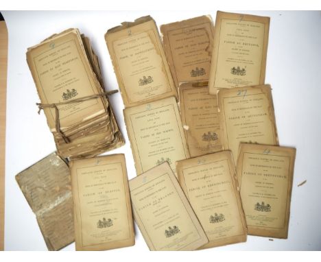
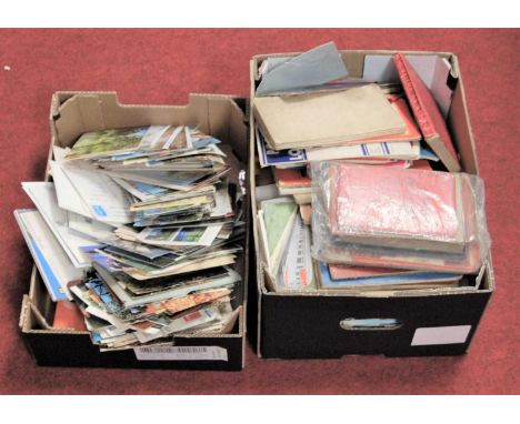
Lot 6068
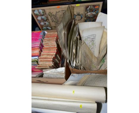
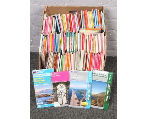
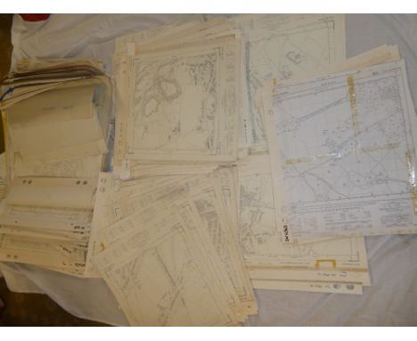
A good quantity of approx 50 Ordnance Survey Books of Reference to Plans of South Norfolk Parishes circa 1880's, including Ashwellthorpe, Blo Norton, Banham, Burston, Diss, Forncetts, Kenninghall, Old Buckenham etc etc, original printed wraps chipped and worn, some covers detached but present etc
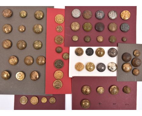
Lot 177
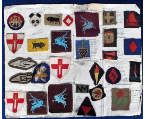
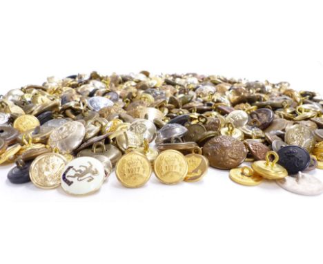
36 Corps large buttons, Tank Corps, R.T.C. and R.T.R., RAC, Wm IV and Vic. Medical Staff, Ed VII Army Med. Staff, KC RAMC, Vic and KC Army Pay Dept., Vic Commissariat & Transport, Vic Ordnance, RAOC, Ed VIII and Geo VI RASC, Education, Signals, Catering, Dental etc; 13 small similar; 10 large and 5 small General Service, Vic and KC. GC to VGC £40-50
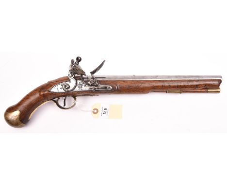
Lot 316
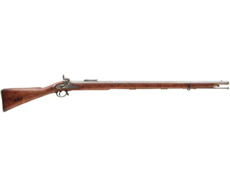
A .56” Tower long Sea Service flintlock belt pistol, 19½” overall, barrel 12” with Tower proofs, the lock with line engraved border and marked with crowned “GR”, “Tower”, and ordnance inspectors mark; walnut fullstock with regulation brass mounts, steel belt hook, and brass tipped ramrod, the butt with traces of ordnance storekeeper”s mark. WO & Clean condition, hammer will not hold on first lock and there is a small flaw to stock behind barrel tang.
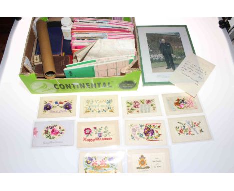
Lot 130
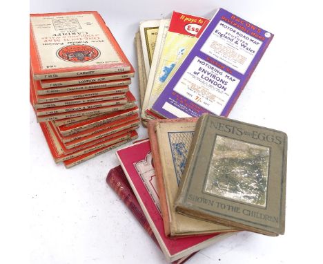
Collection of embroidered silk military postcards (including Queen's Westminster, Remembrance, Forget Me Not), HM Queen Elizabeth 1953 Lullingstone silk tassel in presentation card, AA 1935-36 handbook supplement in case with service booklet, Winston Churchill facsimile letter and print, ordnance survey maps /railway and motoring maps, assorted cigarette cards stuck into album, etc.
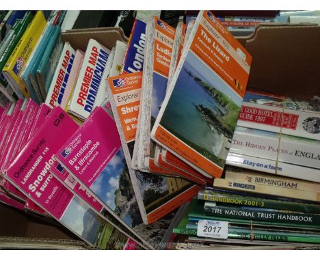
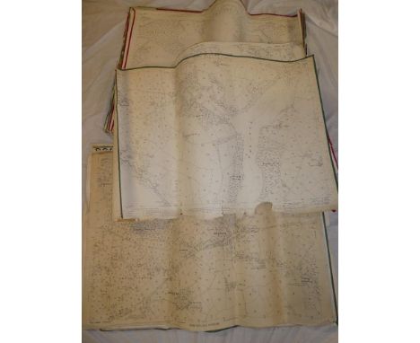
Lot 631
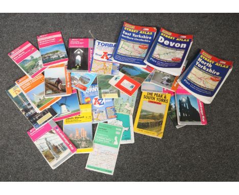
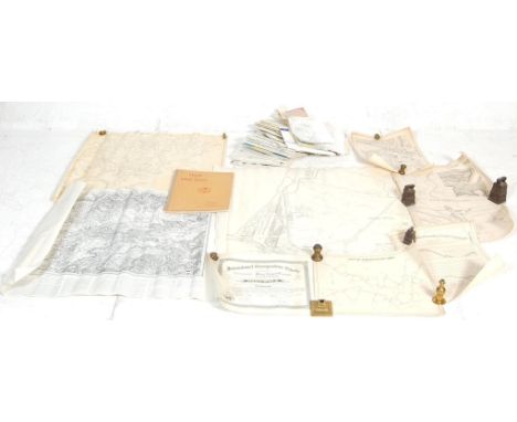
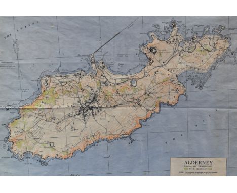
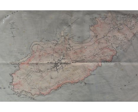
A QUANTITY OF ORDNANCE SURVEY AND OTHER MAPS, from various series and dates, condition ranges from good to poor, with a quantity of assorted loose Ordnance Survey and larger scale extracts from Ordnance Survey maps, many relating to Walsall and other local areas, condition ranges from good to poor, with a framed hand coloured copy of 'Britannia prout divisa fruit temporibus Ango Saxonum', 48cm x 56.5cm (two boxes loose and framed maps)
Lot 177
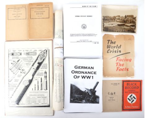
Large Box of Military Paperwork, including rolled map of Falaise (France) 1943; black and white photograph of French artillery shells being unloaded; 1943 Technical Manual Enemy Land Mines and Booby Traps; War Department Military Dictionary English – Russian and Russian – English 1941; Box file of reprint information on German ordnance, etc.
Lot 87
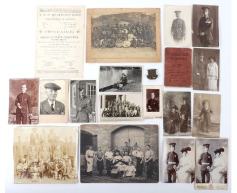
Small Photograph Grouping for an Other Ranks later Officer in the Army Ordnance Corps, grouping consists of images taken of one man and comrades in uniform from the Boer War period through to WW1 and post WW1. Many images of him wearing campaign medals etc. Army Ordnance Department workshop band programme for 1916 and linen covered booklet “All You Want in France” with his cap badge attached.

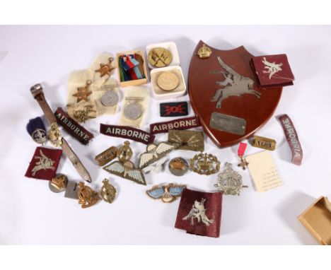
Lot 480
WWII medal group comprising war medal, Defence medal, 1939-45 star and France and Germany star in issue box addressed to Mr J S Morrison of 10 Granby Road Edinburgh, miniature OBE medal, a shield plaque "1st Airborne Division Workshops REME To AQMS Morrison JS From Members of the SGTS Mess in Token of Comradeship 1943", cap badges including REME, KOSB, Royal Army Ordnance Corps etc, KOSB shoulder titles, Boy scouts badge with plume, cloth badges including Pegasus, Airborne titles etc. and a Royal Burgess Golfing Society of Edinburgh medal to J S Morrison Elected Honorary Life Member 1998, (this lot is being sold in aid of a charity)
Lot 540
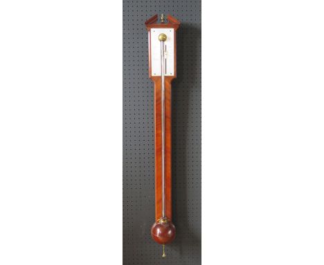
A Rare Stick Barometer by George Adams _ The silvered brass scale calibrated from 27" to 31" with weather indications and a sliding vernier incorporating a brass pointer and a small brass knob for adjustment. The engraved inscription to the arch reads; Made by G. Adams, No 60 Fleet Street, London. Instrument Maker to his Majesty. The fine mahogany case (c. 103cm) with exposed mercury tube, surrounded with herringbone mahogany veneer, well turned mahogany cistern cover and architectural top with central brass finial, c.1765. Note: George Adams was an outstanding barometer maker, optician and instrument maker. He was apprenticed to James Parker in 1724 and Thomas Heath in 1726 who was also a maker of some note. He was instrument maker to His Majesty's Office of Ordnance between 1746 and 1748. He became instrument Maker to the Prince of Wales in the 1750s and then Instrument Maker to his Majesty King George III in 1760. George Adams died in 1773 leaving two sons by the names of George and Dudley to carry on the business into the 19th century.Collect in person or specialist courier

![Francis Lamb (fl. 1667 - 1701), after Captain Greenville Collins (1643-1694), two-page map, Dartmouth [Devon], [Dedicated] To](https://cdn.globalauctionplatform.com/b5d0520c-3f9d-4619-b761-abe600c55abf/1d4b6d19-d026-4baf-973d-ac0500cb33cc/468x382.jpg)
Lot 4012
Francis Lamb (fl. 1667 - 1701), after Captain Greenville Collins (1643-1694), two-page map, Dartmouth [Devon], [Dedicated] To the Right Honourable George Lord Dartmouth, Mr Generall (sic) of his Majesty's Ordnance &c [...], allegorical and armorial dedication cartouche, numbered 15 within the plate, [London: early-mid 18th century], copperplate engraving with contemporary hand-colouring, 46cm x 57cm
Lot 4022
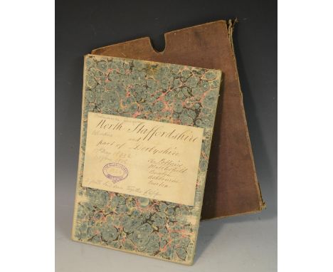
Local Interest - Ordnance Survey, two parts laid on linen as one, North Staffordshire and part of Derbyshire, including The Potteries, Macclesfield, Buxton, Ashbourne and Burton, Published at the Tower of London [...], 1833 & 1836, 24 folds, monochrome engravings, marbled covers, the upper-cover with a titled ink MS and paper label with a purple ink collection stamp within a heraldic knot: The Allan Library, 97.5cm x 112.5cm, cloth-covered sleeve case, [1]
Lot 4023
Local Interest, Transport - Ordnance Survey, three parts laid on linen as one, incorporating Staffordshire, Derbyshire and Nottinghamshire, with Birmingham in the lower-left fields, c. 1850 restrikes of maps from 1834-1835, incorporating railway and canal lines which have subsequently been picked-out and delineated by hand and highlighted their cross-sections, including the then Grand Junction Railway from Liverpool to Birmingham, Birmingham Railway, Tame Valley Railway, Birmingham and Derby Railway, Midland Counties Railway and North Mildland Railway, Scale one inch to a Statute Mile, 16 folds in total, engraving, 122cm x 146.5cm overall, mauve cloth wrappers, upper-cover with steel engraved paper label for Simms Dinham of Manchester, [1]

Lot 4024
Railwayana: folio of 16 25in to 1 mile OS maps, in covers 39.5 x 27.5 in (100 x 70.2cm) marked in gilt lettering Midland Railway Sawley and Weston Ordnance plans/Land agent's office/Derby: Derbys. LV.14, /lviii.2, LVIII.3/Leics. IX.3 (& another, coloured), LV.15 (and another, coloured), LV.16/Leics. IV.16 (and another, coloured), LVIII.4/Leics. IX.4, Leics. V.13; Derbys. XLV.14/Leics. V.14 coloured, LV.10/XLV.10/Leics. V.10 coloured, LVI.6/Leics. V.6 and another, coloured, LVI.7/XLV.7 & LV.1`2/Leics. IV.12; Also, a rare printed notice of abandonment, Worcester & Aberystwyth Railway, No. 131 dated Hay-on-Wye 9th December 1876, printed folded foolscap Sherwood, Grubbe, Pritt & Cameron, 7, Great George Street, Westminter, MS endorsed Arthur Cheese to Thomas Powell Humphreys, Rhayader Also two pre-grouping luggage labels: GWR/Ballingham (Herefs.) 2.5 ins square (6.3cm) & Taff Vale Railway/Treherbert to Hereford 3ins square (7.6cm) also Rivarossi model railway catalogue 1970s. (qty) Condition Report: Damp stained and binding broken on cover, first seven maps have limited damp damage on lower edge
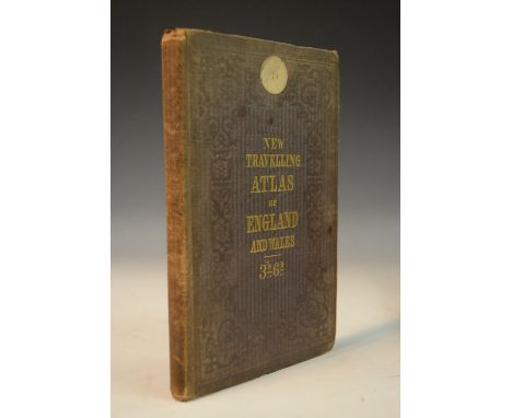
Lot 4191
Cartography - Reynolds's Travelling Atlas of England: with All the Railways and Stations, Accurately Laid Down, Constructed from the Surveys of the Board of Ordnance, Railway Companies, and other Authorities, London: Simpkin, Marshall & Co., [n.d. 1852], pp: [iv], 32 two-page engraved maps, contemporary cloth, gilt-lettered upper-cover, yellow endpapers, 8vo, [1]
Lot 4194
Cartography, Topography and Bibliography - Margary (Ivan D): Roman Ways in the Weald, first edition, London: Phoenix House Ltd, 1948, ochre cloth, 8vo, (1), &, Roman Roads in Britain, first edition, two-volume set, London: Phoenix House Ltd, 1955-1957, blue cloth, d/j (worn), 4to, (2); Ogilby (John), Britannia, Volume the First: or, an Illustration of the Kingdom of England and Dominion of Wales, facsimile, London: 1939, cloth as issued, oblong 4to, (1); Cox (Edward Godfrey), A Reference Guide to the Literature of Travel [...], Volume Three: Great Britain, Seattle: University of Washington Press, 1949, brown cloth, 4to, (1); Fordham (Sir George), The Road-Books & Itineraries of Great Britain 1570 to 1850, A Catalogue with an Introduction and a Bibliography, numbered limited edition 25/550, Cambridge: University Press, 1924, gilt-lettered green cloth, Syndics of the Cambridge University Press copy, later Manchester Geographical Society, 4to, (1); Crook (Captain Henry T.), The Maps of the Ordnance Survey: As they are as they ought to be, Manchester: J.E. Cornish, 1892, 42pp, pink wrappers as issued, 8vo; later Ordnance Survey descriptions and guides, various; mid-20th and later Francis Edwards catalogues, various; other booksellers' catalogues, including Bernard Quaritch; etc


Lot 410
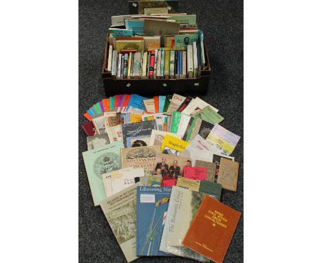
Books - Topography and Local Interest - The Aristocratic Estate: The Hastings in Leicestershire and South Derbyshire, 1982, original wrappers, 8vo; further Derbyshire and Leicestershire interest; Nottingham through 500 Years: A Short History of Town Government, 1949, pictorial dustjacket over green cloth board; further Nottingham and Nottinghamshire history; other county and municipal works; Automobilia, The Roadfaring Guides, No. 3: Road Touring in Central England, Illustrated by Original Sketch Maps, London: [n.d., c. 1920]; cartography, further early 20th century and later maps, including Ordnance Survey; pamphlets, many of regional interest; some signed and dedicated association copies, [2 boxes]
Lot 432
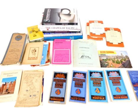
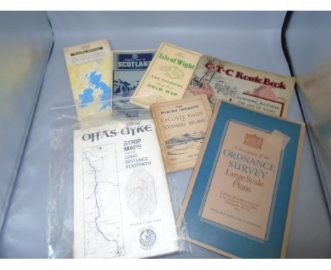
Various books, Smith (Keith), Silversmithing A Manual of Design and Techniques, Wine According to Ralph Stead, various other books, Salerooom Catalogue, Photographs, Bloomsbury, Dreweatts Wednesday 19th May 2010, Thirsty Work, Heineken Advertising and various Ordnance Survey maps, etc. (a quantity)

Lot 16
A .790 CALIBRE PERCUSSION CHINESE CONTRACT PATTERN 1842/51 RIFLE MUSKET, 39inch sighted rifled barrel fitted with ramp and ladder rear sights, Ordnance and proof markings to left side of the breech, Chinese characters and the serial no. 2810 to the right side, border engraved lock stamped 1855 over TOWER and with a crown over VR at the tail, full stocked, the butt stamped with BO marks and Chinese characters, regulation brass mounts, steel ramrod, complete with socket bayonet by SALTER & CO. The bayonet catch would suggest a P51 but the bore and lock plate a P42.
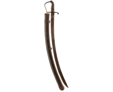
Lot 273
A 1796 PATTERN CAVALRY TROOPER'S SWORD, 82.5cm heavily sharpened curved blade struck with an Ordnance mark at the forte and with a balance mark and maker's name GILL on the back edge, regulation steel stirrup hilt, ribbed wooden grip, worn and split, contained in its steel scabbard, patinated.
-
12130 item(s)/page