We found 12129 price guide item(s) matching your search
There are 12129 lots that match your search criteria. Subscribe now to get instant access to the full price guide service.
Click here to subscribe- List
- Grid
-
12129 item(s)/page


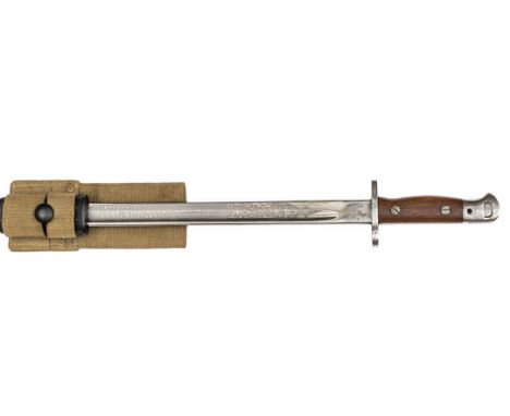
Lot 93
An interesting Wilkinson P1907 presentation bayonet, of standard pattern, with maker’s and ordnance inspector’s stamps at forte, the blade etched on one side “Presented to J. Clayton by the Wilkinson Sword Co Ltd on the completion of 2,000,000 bayonets, 1915-1918” within scrolled fenestrated panels, in its leather scabbard with khaki webbing frog. Very Good Condition Plate 64.
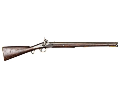
Lot 140
A rare .73” first model Victoria cavalry carbine, 42” overall, twist barrel 26” with Tower proofs and ordnance inspector’s marks, standing rearsight, break off breech and swivel ramrod; back action lock engraved with crown over “VR/Tower 1838” (the first and possibly only year of production), and with traces of officially removed safety bolt; the heavily varnished walnut fullstock stamped on the left side of the butt with broad arrow over “WD” (post 1855), on the right side “I.C.R” (1st class reserve), and on the underside “J & W Field” (stockmakers), and with saddle bar and ring, the rear end of which screws directly into the stock; brass mounts include combined fore end plate and ramrod pipe, and trigger guard with scroll; every individual part, even the screw heads and the saddle ring, bearing the serial number “17”. Good Working Order and Condition. Plate 73
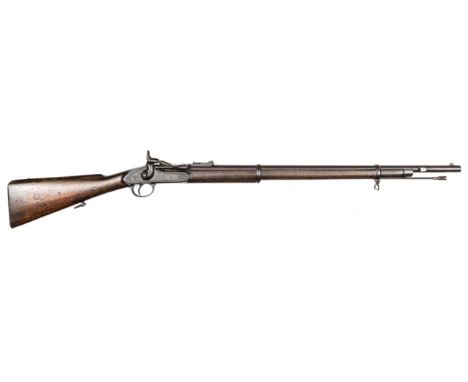
Lot 149
A .577” Snider Mark II** 2 band short rifle, 48½” overall, barrel 30½” with 5 groove rifling and bayonet lug at the muzzle, breech with ordnance proofs and stamped “II” over 2 stars; unlined lock marked with crown over VR and “BSA Co 1865”; dark walnut fullstock stamped with RM Enfield storekeeper’s mark, 3 over 1867, (the date of official approval of the pattern), and government sale mark; with regulation steel mounts and sling swivels. Good Working Order and Condition, with dark patina overall (the cleaning rod a replacement) Plate 76
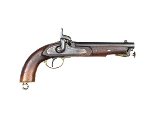
Lot 157
A very good .65” East India Government percussion holster pistol, 14” overall, smooth bore barrel 8” with ordnance proof and Birmingham inspector’s marks; lock stamped with crown over broad arrow and “EIG” and “Birmingham 1871”; dark walnut fullstock stamped on the left side “W Tranter” (stockmaker) and with EIG Birmingham storekeeper’s mark; with regulation brass mounts, lanyard ring, and swivel ramrod. In Very Good Working Order and Unissued Condition, the bore bright, barrel with original blued finish, lock with colour hardened finish. Plate 78
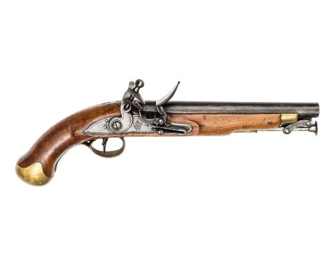
Lot 161
A very good William IV .56” Sea Service flintlock belt pistol, 15½” overall, barrel 9” with ordnance proofs; line engraved lock bearing crowned “WR” and lock viewer’s mark; pale walnut fullstock stamped with broad arrow over BO and various stock viewers’ marks; with regulation brass mounts, swivel ramrod, and 5½” steel belt hook on the left side. In Very Good Working Order and Unissued Condition, the barrel retaining original draw filed and grey/blue finish. Plate 79

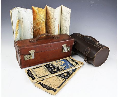
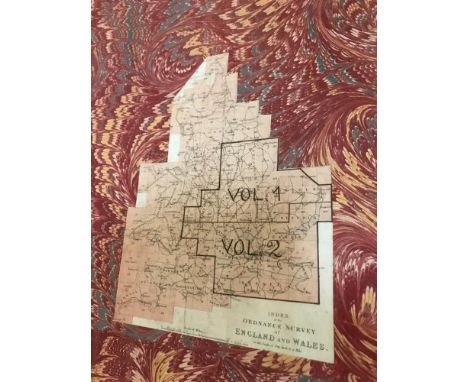
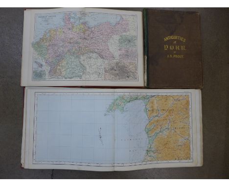
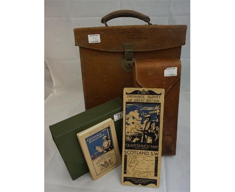
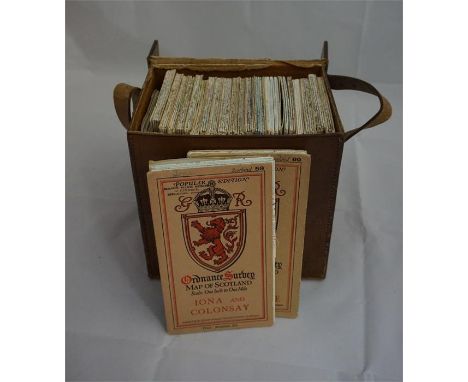
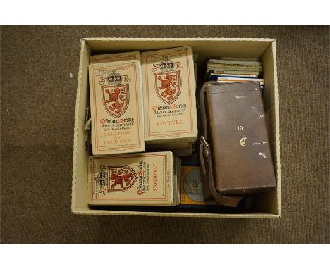
Lot 165
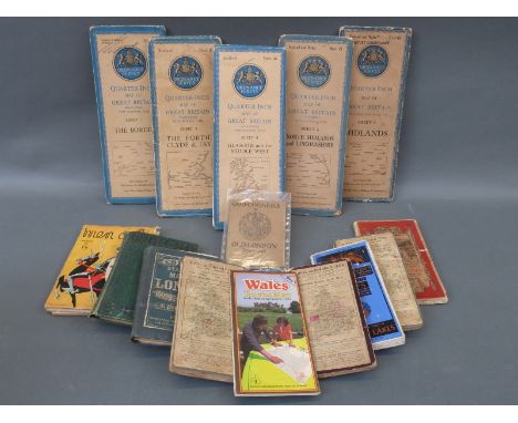
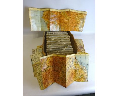
BARTHOLOMEW's Reduced Ordnance Maps of England and Wales, Ireland and Scotland, a series of folding Tourist, Motorist or Cycling maps in uniform coloured covers, scale 2 miles to an inch, Scotland with 21 (of 28) maps, Ireland complete with 7 maps, England complete with 37 maps, contained in two pine cases
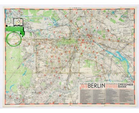
Lot 663C
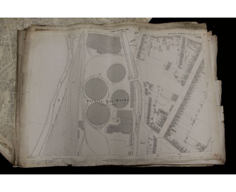
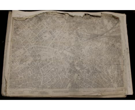
MAPS AND PLANS. PLAN VON BERLIN scale 1:25,000m, lithograph in colour, 60 x 82cm, c1936, creased where folded, the British Grand Fleet in the Great War Complete Chart of North Sea Movements 1914-18, Ordnance Survey map London-Paris, second edition, published by the War Office, 1944 and an Admiralty chart of the River Tyne Jarrow Slake to Elswick, 1902 (4)


Lot 260
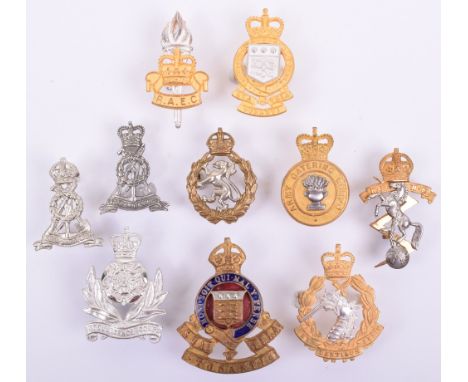
9x Bronze OSD Cap Badges, including KSLI, Dorsetshire regiment, East Yorkshire regiment, East Surrey regiment, Cheshire regiment, Royal Army Medical Corps (lug fittings), Royal Corps of Signals, Army Educational Corps and Royal Army Ordnance Corps. All with fittings to the reverse. (9 items)
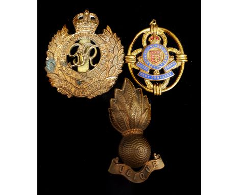
Lot 231
10x Officers Cap Badges, all being silver gilt or silver gilt and enamel. Various Corps including Royal Army Ordnance Corps with TONANTI scroll, EIIR Intelligence Corps, EIIR Royal Army Dental Corps, George VI WRAC, EIIR Army Catering Corps, George VI REME, plus others. All remain in very good condition with lug fittings to the reverse. (10 items)
Lot 384
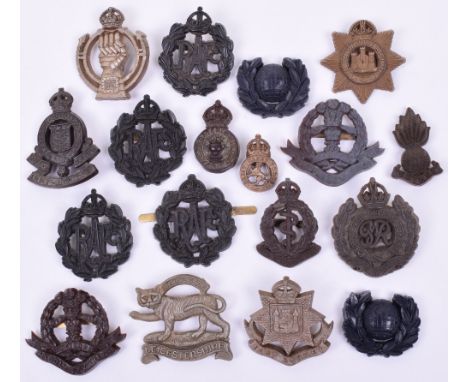
18x WW2 War Economy Plastic Cap & Collar Badges, consisting of Leicestershire regiment, Middlesex regiment, Devonshire regiment (damage to top of crown), East Surrey regiment, Royal Engineers, 4x Royal Air Force, Royal Army Ordnance Corps, Middlesex regiment, RAMC, Royal Armoured Corps, Army Catering Corps (missing one blade), pair of Royal Marines collar badges, Royal Artillery forage cap / collar badge and Army Cadet Corps. Various conditions. (18 items)
Lot 555
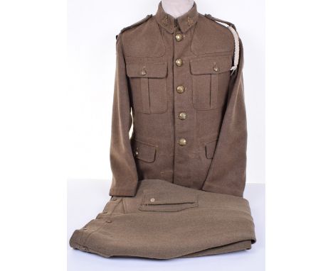
Royal Army Ordnance Corps Service Dress Tunic, being an other ranks example with brass collar badges, shoulder titles and tunic buttons. To the arms are formation signs for the 47th Infantry division and black felt Arm of Service strip. White twist cord lanyard to the shoulder. WD stamping to the interior. Accompanied by a 1942 dated pair of Service Dress Pantaloons for Motor Cyclists. Both show service wear but generally good condition, one formation sign is partially un-stitched. (2 items)


Lot 3132
Stevenson (Robert Louis). The Black Arrow, published by Castle & Co 1912, a book prize from King Edward VI School in Louth, The Stately Homes of England, illustrated, 2 vols, and various other general books, to include Millers Guides, Ladybird Publications, copies of The Illustrated London News, Ordnance Survey Maps, etc, (5 shelves).
Lot 80
Britain.- Hall (Sidney) A Travelling County Atlas: with all the Railroads Accurately laid down, and the Boundaries Coloured, complete with 46 maps, 42 double-page, and 4 folding, including Ireland, Scotland, Wales, and Yorkshire, with title and list of maps, engravings, with outline hand-colouring, on wove paper, the double-pages each approx. 205 x 275 mm. (8 1/8 x 10 3/4 in), the folding maps each approx. 390 x 260 mm. (15 3/8 x 10 1/4 in), occasional offsetting, minor surface dirt and browning, some loose, in original limp green morocco wallet-style binding, rubbed, 8vo, [1848] § Cheffins (Charles F.) Cheffins's Map of the English & Scotch Railways, fourth edition, lithographed map with hand-colouring, 710 x 700 mm. (28 x 27 1/2 in), dissected and mounted on linen, folding with printed advertisement to endpanel into original cloth boards with printer's label, 8vo, [1844] § Cary (John) Cary's Six Sheet Map of England and Wales with Part of Scotland, engraved map, outline hand-colouring, dissected and not joined, each segment mounted on linen, each approx. 225 x 130 mm. (8 7/8 x 5 1/8 in), if joined total approx. 1140 x 930 mm. (44 7/8 x 36 5/8 in), spotting, surface dirt and staining, presented in slip-case, 1818 § Jackson (Frederick) Jackson's Plan of Nottingham, from Surveys made between the Years 1851 & 1861, lithographed map, with hand-colouring, 665 x 530 mm. (26 1/8 x 20 7/8 in), dissected and mounted on linen, folding with yellow endpanel into contemporary green boards, gilt title to upper cover, 8vo, rubbed, 1861; together with two Ordnance Survey maps, one of Cheshire showing Warrington, the other of North Shropshire covering the environs of Market Drayton, lithographed maps, each approx. 640 x 830 mm. (25 1/4 x 32 3/4 in), dissected and mounted on linen, surface dirt and browning, folding with green morocco endpanels, presented in original green morocco slip-case wallet, 8vo, 1833, (4).
Lot 94
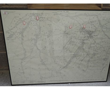
London.- Mudge (Lt. Col. William) Four Ordnance Survey maps covering the environs of London, numbered I, VI, VII, and VIII, showing from Great Marlow to the mouth of the River Medway, and East Grinsted to St. Albans, engravings, four sheets, each approx. 655 x 970 mm. (25 3/4 x 38 1/4 in), dissected and mounted onto linen, with silk edges, minor off-setting and browning, each folding into contemporary calf wallet-style slip-case, blind tooled, with black morocco label to spine, gilt, rubbed and worn, [1805-1822].
Lot 65
Yorkshire and County Durham, a very large collection including Hutton, W. The history of the Roman Wall. 1802. 8vo, folding map and 7 plates, 19th century calf, neatly rebacked; Watkins, William The fall of Carthage... first presented at The Theatre, Whitby. Whitby: T. Webster, 1802. First edition, 8vo, half-title, 4pp. list of subscribers, contemporary half calf; [Hegge, Robert] Saint Cuthbert, or the histories of his churches at Lindisfarne, Cunecastre and Dunholme. Sunderland: G. Garbutt, [1816], printed and woodcut title, contemporary boards, rebacked; Parson, William and William White History, directory and gazetteer of the counties of Durham and Northumberland. Printed for W. White & Co., 1827-28. 2 volumes, 12mo., original boards, uncut, without the maps (issued separately), boards covered in transparent adhesive material; Young, Rev. George A picture of Whitby and its environs. Whitby, 1840. 12mo. second edition, folding map, plates, some folding, contemporary cloth; Wellbeloved, D. Eburcum, or York under the Romans. York, 1842. 8vo, plates, maps, list of subscribers, original cloth, worn; Ornsby, George Sketches of Durham. Durham, 1846. 12mo, original cloth, worn; Gibson, W.S. Descriptive and historical notices of some remarkable Northumbrian castles, Churches and Antiquities. 1848. First Series only, frontispiece, original boards, some spotting, rebacked; [Abbatt, Richard] A history of the Picts or Romano-British Wall. 1849. 8vo, plates, original cloth; Richardson, George The annals of the Cleveland Richardsons and their descendants. Newcastle-upon-Tyne, 1850 "Not Published", presentation copy, original cloth, spine faded; [Rewcastle, James] A record of the Great Fire in Newcastle and Gateshead. 1855. 12mo, frontispiece, presentation copy from the writer, original cloth, repaired, new endpapers; Ordnance Survey Map of Hartlepool. 1861, hand-coloured folding map, backed on linen, morocco slipcase, worn; Heavisides, Henry The annals of Stockton-on-Tees. Stockton-on-Tees, 1865. First edition, frontispiece, original cloth, spine rubbed at head and base; Heavisides, Henry Courtship and matrimony. Stockton, 1864. 12mo, frontispiece, original cloth; [Mawr, Eta] Tributes to the Tees. Darlington, 1864, inscribed from the compiler, frontispiece, original boards; [Dresser, William, printer] The Tees in the olden time. Darlington, 1866, original green boards, worn; Baring-Gould, S. Notes on the folk lore of the Northern Counties of England. 1866, 8vo, coloured frontispiece, original cloth; Pickford, John A week in the Yorkshire Dales. Manchester, 1869, presentation copy from the author, original green cloth, title discoloured; Gordon, Samuel The watering places of Cleveland. Redcar, 1869. 8vo, original cloth, worn; Hamlyn, N.T. The Border ballad of Hedgley Moor. Durham, 1894. 4to., original cloth-backed boards; Palgreave, F.M.T. A List of the words and phrases in every-day use by the Natives of Hetton-le-Hole in the County of Durham. 1896, original cloth, title slightly discoloured; [Dixon, S.F.] History of the Saxon Royal Town of Corbridge-on-Tyne. Newcastle, 1912. folding map, plates, original cloth; and c.230 books and pamphlets (approximately half being books), on Yorkshire, County Durham and Northumberland, mostly later
Lot 182
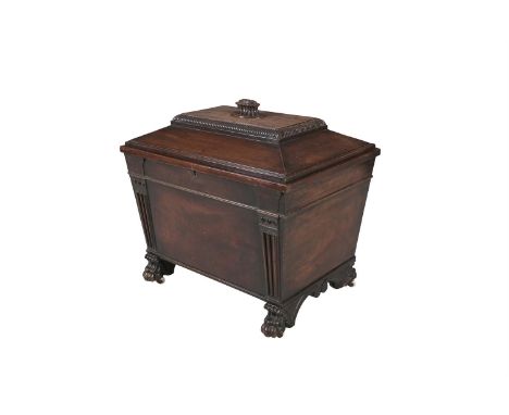
A GEORGE IV IRISH MAHOGANY CELLARETTE, BY MORGAN OF DUBLIN, the sarcophagus shape with flat domed hinged lid above fluted pilasters and raised on carved paw feet with castors. 67cm wide, 68cm tallIn an advertisement published in 1832 Anthony Morgan & Co. claimed that the business of the house continues to be conducted with the diligent attention which for upwards of half a century, has received the liberal support of the Nobility and Gentry of this Kingdom. Their father, Robert Morgan is listed in the directories in the years 1782 to 89 as an upholder and cabinetmaker at 16 Henry Street and from 1790-1807 at 21 Henry Street. He was made a Freeman of the City of Dublin as a joiner by service, in 1779 and claimed he manufactured a variety of furniture which on inspection will be found equal to any in Europe. From the 1820s, after Robert Morgans death, the business was managed by his two sons Anthony and Louis and became one of the most important firms in the trade. They promoted the firm as Morgans, Cabinetmaker and Upholder to the Right Honble & Honble the Commissioners of his Majestys Revenue, General Office, Board of Ordnance. The firm supplied furniture to Borris House, Co. Carlow, Mount Bellew, Co. Galway and Florence Court, Co. Fermanagh. They received a very important commission to supply dining room furniture for the Provosts House, Trinity College Dublin, for the visit of Kind George IV in 1821. The firm supplied 24 very best Mahogany Parlour Chairs of an extra size with deep carved top rails and having hollowed seats upholstered and covered with satin hair-cloth finished with silk tufts and brass mouldings; £54. 12. 0. The firm also supplied the set of Trafalgar Dining Tables consisting of seven mahogany tops and strong frames on turned and roped legs and patent castors, the entire when opened to form a set, 10 feet 4 inches long and 5 feet 6 inches wide, finished in the best manner with brass fastenings as per agreement - £34. 2. 6. A case was also supplied to store the leaves, made of deal painted as oak lined with Cloth and slipped etc. The term Trafalgar came into use after Nelsons victories. Finally to complete the suite Morgans supplied a mahogany wine cooler and a Mahy Tea Store to match - each with turned pillars, carved claws and castors. The distinctive pattern used on this wine cooler and tea store appears on this wine cooler illustrated here.
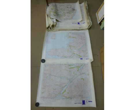
Lot 683
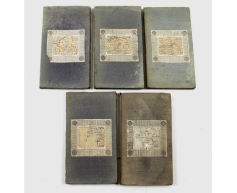
A group of five folding maps, circa 1880, engraved and printed onto linen backing in 21 sections with card and cloth cover, and marbled end sheet, 'Cruchley's Reduced Ordnance Map of England and Wales', published by G. F. Cruchley, Map Seller & Globe Maker, 81 Fleet Street, comprising sheet number 20, London, with trimmed lower edge, sheet number 37, Stafford and surrounds, sheet number 43, Manchester and surrounds, sheet number 47, Bay of Morecambe, Lancaster and coastlands, and sheet number 52, Lake District and surrounds, each hand coloured and with later additions showing railway lines in red, each 53.5 by 69cm, and 18.5 by 10.5cm, when folded. (5)


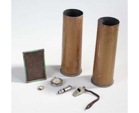
Lot 515
A mixed lot of Military related items to include 2 x 18 pdr shell casings of first world war vintage, Army type 58 whistle with leather strap for attaching to tunic pocket button, stamped de courstaff Birmingham 1916, trench style whistle stamped England, German souvenir ring in yellow metal, iron cross emblem flanked by date 1914, green painted metal photo frame, 9.5 cm x 14.5 cm, open faced watch, white dial with Arabic numerals and subsidiary dial, stamped on the back with Board of Ordnance broad arrow, G.S.T.P. and serial number KC9956, contained within a protective cover, (7)
-
12129 item(s)/page