We found 12130 price guide item(s) matching your search
There are 12130 lots that match your search criteria. Subscribe now to get instant access to the full price guide service.
Click here to subscribe- List
- Grid
-
12130 item(s)/page


Lot 1
Brabner (J.H.F., ed.). The Comprehensive Gazetteer of England and Wales, 6 vols., n.d., c. 1895, numerous maps and town plans, uncol. plts., a.e.g., orig. cloth gilt, large 8vo, together with together withGroome (Francis H., ed.) Ordnance Gazeteer of Scotland: A Survey of Scottish Topography..., 6 vols., Edinburgh, 1884, col. maps & plans, eng. plts., orig. cloth gilt, large 8vo, with Wilson (John Marius), The Imperial Gazetteer of England and Wales..., 6 vols. plus index vol., pub. Fullarton & Co., c.1860s, hand-col. maps, eng. plts., orig. cloth gilt, large 8vo (19)
Lot 1
Hamilton (N.E.S.A., ed.,). Tha National Gazetteer of Great Britain and Ireland; or, Topographical Dictionary of the British Islands, 12 orig. divs., [1875], double-page col. maps, orig. blindstamped cloth gilt, spines faded, and frayed at ends, 4to, together with The Gazetteer of the World, Prominence Being Given to Great Britain and Colonies, the Indian Empire, and United States of America, 9 vols., 1885-86, numerous col. maps, orig. gilt dec. cloth, 4to, plus Groome (Francis H.), Ordnance Gazetteer of Scotland: A Survey of Scottish Topography, new ed., 6 vols., [1894-95], double-page and folding col. maps, b & w plts., orig. gilt dec. cloth, 4to (27)

Lot 1
A good .56" William IV flintlock short Sea Service belt pistol, 15" overall, barrel 9" with Tower proofs, flat lock stamped with crowned "WR" and ordnance inspector's mark, pale walnut fullstock impressed with broad arrow and "BO" and inspector's mark, regulation brass mounts, belt hook on left side, swivel ramrod. GWO & clean condition, the stock quite crisp, the barrel retaining much original protective black finish. Plate 15

Lot 1
An interesting P1879 saw backed bayonet, blade 25?" with ordnance stamps, in its brass mounted brown leather scabbard, stamped 1917, the pommel and top of locket marked en suite P.3.S.M 80; the late date and style of scabbard indicate use by Sappers and Miners in India. GC (some surface rust marking) Plate 11

Lot 1
A 5 shot 38 bore Adams Model 1851 self cocking percussion revolver, 13?" overall, barrel 7?", the top strap engraved "Hollis & Sheath, Makers to HMH Board of Ordnance, London", the frame engraved "Adams's Patent No 4884 (X)", London proved, chequered walnut butt with hinged trap in the plain butt cap. GWO & generally GC (light to moderate pitting overall, frame engraving faint, butt bruised on one side). See "Adams Revolvers" by Chamberlain & Taylerson, p 55, for reference to Hollis & Sheath made revolvers and their "X" suffix serial numbers. Plate 13


Lot 1
A 6 shot .44" Rogers & Spencer SA Army percussion revolver, 13" overall, barrel 7?" stamped on the top flat "Rogers & Spencer, Utica, NY", number 1331, the barrel scratched on the left side with owner's name "Fred Abele", plain walnut grips, the left hand one with ordnance inspector's initials "RPB". GWO & C, retaining traces of original blued finish (small patches of pitting and wear, small repairs to one grip, rammer plunger and one nipple replaced). Plate 13
Lot 1
A Mark IV Martini Henry rifle, smooth bored to 20 bore and de-activated, 49" overall, barrel 33", stamped beside the rearsight "N.S/N.F.P", the frame engraved with crowned VR and "Enfield/1887/IV/1", fullstocked, the butt stamped with various ordnance marks and Indian inscription, with leather sling and cleaning rod. GWO & generally GC, with COD
Lot 1
A .65" Tower 2 band military percussion musket for Indian native troops, 48" overall, barrel 31?" with block rearsight, the breech stamped with B'ham proofs, ordnance inspector's stamps, "N.S. Ben", and serial number 369, the lock faintly marked with crowned VR and 1858 Tower, dark walnut fullstock, the butt with indistinct Benares storekeeper's mark, regulation brass mounts, single sling swivel (the front one missing), steel ramrod. GWO & generally GC (worn overall)


Lot 1
British Service Corps cap & other badges, various, inc. Chaplains, Royal Army Medical, Royal Army Ordnance, Military Police, Royal Army Pay Corps, Royal Army Veterinary, School of Musketry, Army Educational Corps, Royal Defence Corps, Royal Military College & others, possibly inc. a few modern or reproduction (101)

Lot 1
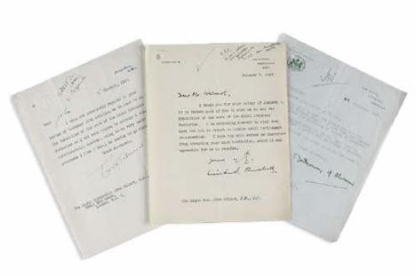
Churchill Montgomery and Ernest Bevin. Churchill Sir Winston. Typed letter signed to The Right Hon. John Wilmot: 'It is indeed good of you to wish me to see the Exhibition of the work of the Royal Ordnance Factories. I am proposing however to stay down here and not to return to London until Parliament re-assembles. I hope you will excuse me therefore from accepting your kind invitation which it was agreeable for me to receive'' Chartwell paper Jan 7 1947 with a secretary's ink initials and note at head; Montgomery Bernard Law 1st Viscount Montgomery of Alamein Typed letter signed accepting invitation to open the Exhibition at the Carlton Hotel War Office headed paper 22 Nov. 1946 staple holes at head; Bevin Ernest Minister of Foreign Affairs.Typed letter signed to John Wilmot apologising for not being able to visit the Exhibition Foreign Office headed paper 16 Jan. 1947 ink initials and note at head of page all three letters with punch hole top left (3)


Lot 1
Great Northern Railway Maps of near Ordnance Survey quality produced by The Dispatch Atlas, Fleet Street, London. There are 3 sheets and these are of some scarcity. Although undated, the Edenham & Little Bytham Railway branch is shown so it pre-dates 1873. Don't be mistaken, the quality of the mapping is incredible even though there is some tearing to the map folds. The whole route from Kings Cross to York is shown with other additional areas. These were drawn and engraved by Edward Weller.
Lot 1
Donkin (Lieutenant General Sir Rufane). A Dissertation on the Course and Probable Termination of the Niger, 1st ed., 1829, author's presentation copy, inscribed on title 'For General Lord Hill, from the Author', three folding eng. maps, some minor scattered spotting, near-contemp. half calf by J. MacKenzie, gilt dec. spine with red morocco label, a little rubbed and scuffed at extrems., slim 8vo Ex-libris General Lord Hill (second in command at Waterloo) with his engraved armorial bookplate. Sir Rufane Donkin (1773-1841) was Surveyor-General of the Ordnance and his theories on the source of the Niger were thought controversial at the time. He founded Port Elizabeth in 1821, naming the city in memory of his wife, who died of fever in Meerut, in 1818. Donkin committed suicide in 1841, having never properly come to terms with the loss of his wife. (1)


Lot 1
Ordnance Survey. Five folding engraved one inch to a mile maps, sheets 45, 47, 62, 63, 78, 1st editions, 1828-35, hachured contours and piano-key borders, each sectionalised onto linen, sheet 78 hand coloured in outline, a few brown spots, each sheet approx. 545 x 830 mm, all with pasted-on Letts label to lower boder, contained in contemp. half morocco map-box (rubbed) (1)
Lot 1
Yorkshire - Campsall Estate. 'Survey of the Revd. Edward Frank's Estates at Campsall Sutton &c. Yorkshire 1831' [as titled to upper cover] 10 ink and watercolour estate plans on scale of five chains to an inch, each with tenants names, field numbers and areas, each plan approx. 470 x 665 mm, some short marginal tears, contents loose in contemp. half morocco binding, rubbed, folio, together with two large original manuscript estate plans laid onto linen and entitled 'A Plan of Alterations Designed for Campsall the Seat of Bacon Frank Esqr by Thomas White 1771' and 'A Design for the Improvement of Campsal the Seat of Bacon Frank Esq. by T. White 1796', each with inset key to principal buildings, the latter with damp damage to right portion and some fraying to edges, measuring approx. 1120 x 1070 mm and 980 x 1270 mm respec., plus another late 18th century plan on a scale of 1/2 a chain to an inch, with some marginal tears, approx. 1170 x 1280 mm, and a collection of related manuscript maps and documents including three unbound 18th century ink manuscript reports relating to drainage in the area entitled 'The Report of John Smith Engineer for Draining and preserving certain Low Grounds upon the River Went from the Junction of the River Dun to the High Way Leading from Walden Stubbs to Norton in the Parish of Campsall' (7 ff.), 'The Report of John Smith Engineer for Draining and Preserving certain Low Grounds upon the River Went, from its Junction with the River Dun, to Smeeton Mill, in the West Riding of the County of York' (10 ff.), 'An Estimate of Expense of the Intended Drainage upon the River Went from its Junction with the River Dun to the High Way Leading from Walden Stubbs to Norton in the Parish of Campsall upon the Contracted Plan' (3 ff.), plus other related documents including a letter from the Ordnance Survey and manuscript area calculations Campsall Hall was the home of the Frank family for several generations. The hall and grounds were extensively enlarged during the time of Richard Frank (1698-1762) but unfortunately the fine Georgian house no longer stands. (-)
Lot 1
[Cromwell, Thomas Kitson]. Excursions in the County of Surrey: Comprsing Brief Historical and Topographical Delineations, 1821, additional engraved title, folding maps of Surrey and Guildford, 45 engraved views, orig. printed boards, later crude cloth reback, 8vo, together with Reduced Ordnance Survey Around Ipswich [as titled to upper cover], scale two miles to one inch, pub. G. Richmond, c.1860s, hand coloured folding engraved map, sectionalised onto linen, the whole approx. 1560 x 1540 mm, contemp. half calf boards, upper cover detached, and Favenc (Ernest), The History of Australian Exploration from 1788 to 1888, pub. 1888, folding map, numerous engraved plates and facsimiles, orig. cloth gilt, some fraying to extrems., 8vo, plus Suetonius. Le Vite de Dodici Cesari di Gajo Suetonio Tranquillo..., Vencie, 1738, additional woodcut title, title in red and black, some staining, contemp. wrappers, 4to, plus other sincluding a defective copy of Leigh's New Picture of London, 1819, with numerous engraved plates, a book of theatre postcards, a volume entitled 'The Shirt: Its History and How to Cut it by William J. Hurst, plus a collection of decorative prints and engravings (a carton)
Lot 1
Bacon (George W., pub.) New Large Scale Atlas of the British Isles from the Ordnance Survey, c.1900, numerous double-page maps, maps loose and not in order, contemp. gilt dec. morocco, together with Letts (Son & Co., pub.), Letts's Popular County Atlas. Being a Complete Series of Maps delineating the Whole Surface of England and Wales, 1884, 47 double-page colour printed maps, orig. cloth gilt, worn, plus a folding map entitled 'Bacon's New Survey Map of Somerset, Dorset and Parts of Wiltshire' Not subject to return. (3)
Lot 1
A Prussian Guard Hussars trials sword/Royal Engineers driver's sword, 88.5cm sharply curved fullered blade stamped FW50 on the back edge (for Fredrick William IV), the blade also carries double broad arrow Ordnance marks, regulation three-bar steel basket hilt, with cord bound wood grip, contained in its steel scabbard. Scabbard and hilt patinated, clean blade
Lot 1
A RARE BRITISH PATTERN 1855 SWORD BAYONET for the Royal Sappers and Miners Lancaster oval bore carbine, by R. & W. Aston of Birmingham, of post-1858 type with screw retained spring locking-catch, with 23 3/4in. pipe-back blade with Ordnance mark to the ricasso, the brass pommel with engraved unit marking 'V LD E1 410', in its original brass-mounted black leather scabbard with buff leather Slade-Wallace type bayonet frog.
Lot 1
A RARE .65 P.42 PERCUSSION CARBINE ISSUED TO THE LAND TRANSPORT CORPS DURING THE CRIMEAN WAR, the lock dated '1853', with 26 1/2in. barrel, dated lock marked 'TOWER' and with 'VR' cypher, walnut three-quarter stock stamped 'HOLLIS & SHEATH' on the toe of the butt, brass mounts including butt-plate marked 'LTC / I / 37' on the tang, Lovell bayonet catch, and iron sling mounts and ramrod, Ordnance inspection marks throughout. The Land Transport Corps were formed in January 1855 and sent directly out to the Crimea. The Corps were not issued with the same rifled arms as the front line troops, but rather whatever else happened to be in store. The Corps was disbanded in August 1856 once the war was over.
Lot 1
Johnston (Alexander Keith). The Royal Atlas of Modern Geography, 1906, 55 colour double page maps only (of 56), lacks map of New Zealand, contemp. half morocco gilt, spine defective and upper cover detached, together with Handy Royal Atlas of Modern Geography, 1881, 44 double page maps only (of 45), lacks map of New Zealand, contemp. half morocco, upper cover detached, and Bacon (G.W., pub.), New Large Scale Ordnance Atlas of the British Isles with Plans of Towns, 1884, 99 double page maps only (of 100), contemp. half morocco, worn, folio (3)
Lot 1
A Russian cavalry sword, shasqua, slightly curved, fullered blade, 34”, with numerous Ordnance stamps and date 1887 at forte, brass knucklebow hilt and ring quillon, diagonally ribbed wooden grips, in its brass mounted black painted scabbard with provision for bayonet. GC (some wear, sword laquered overall)
Lot 1
Fife and Kinross. Fraser James. Map of the counties of Fife and Kinross being a reconstruction of the map by Greenwood & Fowler. Edinburgh: W & A.K. Johnston 1841 one sheet approx 97cm high by 127cm wide hand coloured linen backed some tears to folds [no loss] some discolouration at folds half morocco gilt worn; Ordnance Survey Ordnance survey of the countys of Fife and Kinross. Southampton [c.1850] one sheet approx 86cm high by 120cm wide hand coloured some foxing original red cloth gilt worn; Black's Fife and Kinross. Edinburgh 1847 approx 21.5cm high by 27cm wide hand coloured linen backed original green cloth gilt; Perth Perth and Clackmannan shires. Edinburgh: Blackwood & Sons [1838] approx 20cm high by 25cm wide hand coloured in outline linen backed original green cloth paper label and another folding map (5).
Lot 1
Thomson John & Co. The atlas of Scotland containing maps of each country and places of importance laid down from actual survey. Large folio (54.5 x 41.5 cms.) index map as frontispiece (hand coloured in outline) 2 folding. hand coloured panoramas the one of the heights of the principal mountains the other the length of the rivers 29 maps hand coloured in outline and with engraved topographical vignettes town plans etc. on 58 sheets of which several are joined together contemporary half calf paper boards partial split of the lower joint occasional light offsetting lower margin of the map of Linlithgowshire slightly dusty and frayed some light stain marks in the outer margins of the map of Buteshire occasional slight cropping of the plate marks in a couple of instances touching the imprint otherwise a fine copy. Note: Chubb p. 388 no xxxii; Moir I p. 129 & II p. 154 no 11; Tooley p. 91. The publication of this atlas described by Tooley as "the finest county atlas of Scotland in the nineteenth century" was spread over the years 1820 to 1830 with the maps being sold in loose sheets when completed. Its cost lead to the publisher's bankruptcy. The scale of the maps of almost one and a half miles to an inch resulted in the most detailed map of Scotland prior to Ordnance Survey. An interesting feature is the provision on the maps of the names of the various surveyors and others involved in their compilation attesting to their accuracy. A corrected edition was brought out in 1869 by Lizars in 4to.
Lot 1
Bartholomew (John). The Imperial Map of England & Wales According to the Ordnance Survey, with the Latest Additions, shewing clearly every feature of the country, Railways and their Stations, Roads, Canals, Rivers, Gentlemen's Seats, &c. &c., on the Scale of 4 Miles to an Inch, Fullarton & Co., c.1870, title and seventeen folding maps, all sectionalized on linen, maps hand-col. in outline, approx. 540 x 740 mm., contained in pubs. orig. gilt dec. morocco map box, scuffed and worn, lid (with flap) detached (1)
Lot 1
Brookes (R.). A General Gazetteer; Or, Compendius Geographical Dictionary: Containing Descriptions of Every Country in the Known World, 5th ed., 1848, five (of six) folding eng. maps on thin paper (lacks double hemisphere map), contemp. cloth, some wear to spine, together with Bacon (G. W.), Commercial and Literary Atlas of the British Isles from the Ordnance Survey, 1896, sixty-five double-page coloured map sheets, orig. cloth, backstrip deficient and covers det., 4to, with other misc. books (a carton)
Lot 1
Groome, Francis H. Ordnance Gazetteer of Scotland. Edinburgh, 1884, 3 volumes, large 8vo, maps, some double-page and coloured, plates, contemporary green half calf, spines gilt; James VI of Scotland, King. Original Letters relating to the Ecclesiastical Affairs of Scotland, chiefly written by, or addressed to His Majesty King James the Sixth. Edinburgh: The Bannatyne Club, 1851, 2 volumes, 4to, bookplates of Sir George Henry Scott Douglas, Bt., green half morocco, spines gilt, joints lightly rubbed; Kirkton, James. The Secret and True History of the Church of Scotland. Edinburgh, 1817, first edition, edited by Charles K. Sharpe, 4to, 3 engraved plates, bookplate of the Abbey of St. Benedict, Fort Augustus, contemporary half calf; M’Dowall, William. Chronicles of Lincluden. Edinburgh, 1886, 4to, number 120 of 350 copies, lithographed plates on india paper, bookplate of the Abbey of St. Benedict, Fort Augustus, original brown half morocco, t.e.g., others uncut; Chambers, Robert and Thomas Thomson. A Biographical Dictionary of Eminent Scotsmen. London, 1870, 3 volumes, large 8vo, engraved titles and plates, contemporary half calf (10)
-
12130 item(s)/page