We found 12129 price guide item(s) matching your search
There are 12129 lots that match your search criteria. Subscribe now to get instant access to the full price guide service.
Click here to subscribe- List
- Grid
-
12129 item(s)/page


Lot 420
Railwayana - a collection of assorted Railway maps and posters comprising; Alan Young illustrated railway map of the South West, Great Orme Tramway & Tours poster, Devon & Cornwall photocopied map, GWR City & County Borough of Bristol 1903 dated map, 1953 dated Ordnance Survey map of Torquay and x7 Cheffins prints of bridges and viaducts.

Lot 108
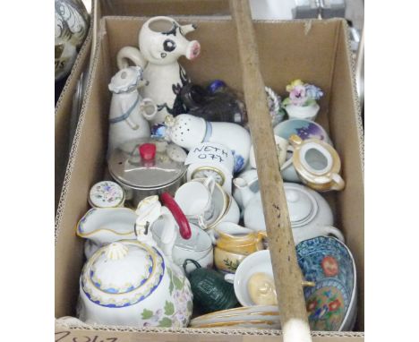
Food & Drink.- Farley (John) The London Art of Cookery, seventh edition, engraved portrait and 12 bills of fare (one with corner cut away not affecting image), 5pp. advertisements at end, a few stains, contemporary ink inscription "Susanna Bruce 1792" to front free endpaper, contemporary sheep, rebacked, worn, J.Scatherd & J.Whitaker, 1792 § Rumford (B.) Experimental Essays..., Essay X. Part II. On the Construction of Kitchen Fire-Places and Kitchen Utensils..., 6 plates, advertisement leaf at end, stitched in original printed blue wrappers with border decoration in imitation of binding, uncut, soiled and frayed at edges, T.Cadell & W.Davies, 1802 § Housewife's Guide (The) or, a Complete System of Modern Cookery...[with] The New Whole Art of Confectionary...by Edward Logan Mackenzie, 2 parts in 1, original printed viridian wrappers, rubbed, London & Otley, William Walker & Sons, [c.1840] § [Roberts (G.E.)] Cups and their Customs, second edition, chromolithographed frontispiece, original cloth, 1869; and a small bundle of food & drink ephemera including an engraved trade card for Angell & Son, Cooks to his Majesty and the Board of Ordnance (dated 1805 in ink on verso), a Vauxhall Gardens supper bill (stained) of 1823, a printed Cellar Book or Butler's Assistant completed in manuscript for 1853, various dinner menus etc., v.s. (a bundle)

Lot 149
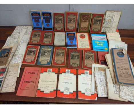
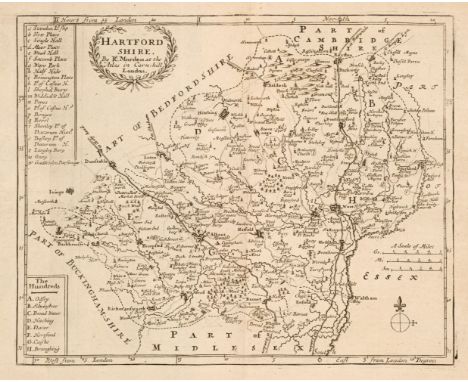
Cartography.- Cary (John) A New Map of England...1821, hand-coloured engraved map, dissected and mounted on linen, c.555 x 510mm., lightly soiled, folding into original paste-paper slip-case, names in ink to upper cover, a little worn, 1823 § Ministry of Finance, Egypt. Survey of Egypt. A List of Maps and Plans corrected to March 31, 1920, key plate and 2 folding colour maps, original cloth-backed printed green boards, Cairo, 1921 § Harley (J.B.) Ordnance Survey Maps; a Descriptive Manual, illustrations, original printed boards, Southampton, 1975; and c.30 others on cartography and some other folding maps including Walker's Suffolk and Warwickshire and some Blackwood's Scottish county maps, v.s. (c.40)
Lot 186
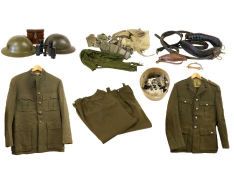
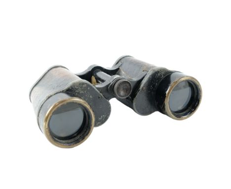
Two Post-Second World War Brodie Helmets, in olive green with leather liners; two Post-1953 Officer's No.2 Dress Uniforms, one to Royal Engineers and one to Royal Army Ordnance Corps, comprising jacket and trousers; also, webbing rucksack, webbing belt with ammunition pouch, four webbing canteen holders, a pair of x8 binoculars in leather case, a tub of mixed buttons (non-military)and a leather pony collar and straps


Lot 86
Bartholomew (John). The Imperial Map of England & Wales According to the Ordnance Survey, with the Latest Additions; Shewing clearly every Feature of the Country, Railways and their Stations, Roads, Canals, Rivers, Gentlemen's Seats &c. &c., On a Scale of 4 Miles to an Inch, A. Fullarton & Co., [1866], index and a double-page calligraphic title, sixteen double-page colour lithographic maps, sheet 16 divided into three separate maps, text block detached, contemporary half calf gilt, boards detached, lacking spine, slim folio.
Lot 163
Ordnance Survey Atlas of Scotland 1924 and England & Wales 1922. 2 volumes, printed at the Ordnance Survey office Southampton, both bound in orig cloth, oblong folios. With linen backed colour maps. Spine defective to the England and Wales volume. With one other “The Imperial Map of England & Wales according to the Ordnance Survey.. John Bartholomew. Large slim folio, orig binding, front board detached, colour maps. [3] C1841.

Lot 552
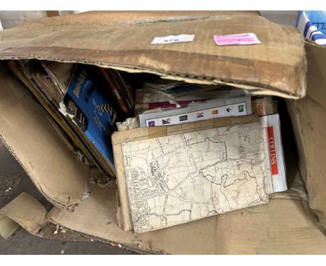
FOUR BOXES OF BOOKS, MAPS AND EPHEMERA, to include approximately ninety books in hardback and paperback format, subjects to include motoring, biography, history, the UK and wildlife, together with Ordnance Survey and similar maps, publications by Kings Bromley Historians relating to the history of the village, guide books and leaflets, etc (4 boxes) (sd)

Lot 564
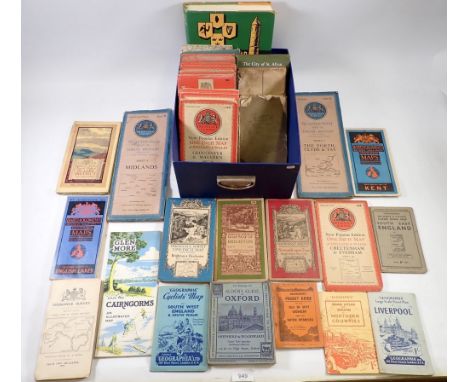
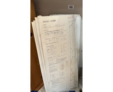
A BOXED LIMITED EDITION ORDNANCE SURVEY ONE-INCH SEVENTH SERIES MAP SET, produced to commemorate the bi-centenary of Ordnance Survey, with certificate, number thirty nine from a limited edition of sixty five, contains one hundred and eighty nine maps, box measures 99.5cm x 81.5cm x 6.5cm (1) (Condition Report: appears ok, a little scuffing to corners of box, certificate has small creases to corners, maps individually unchecked but appears complete and in good condition)

Lot 488
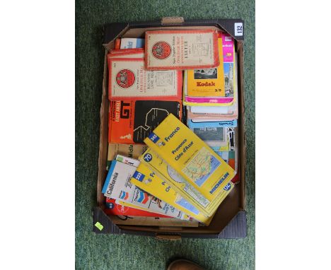
THREE BOXES AND LOOSE MISCELLANEOUS SUNDRIES, to include a 1928 linen Ordnance Survey map of Bromsgrove and Alvechurch, a collection of five tobacco pipes, maker's names include K&P Peterson, Bentmore Junior, Claude Romain Jura, Falcon, etc. jewellery boxes, wall clock, a small vintage chrome 'Jet Extinguisher' car fire extinguisher, a chrome automobile fitting with five enamel automobile badges fitted comprising RAC, Circuit Van Zandvoort, Wallasey Rally 1956, RAC Internationale Tulpenrallye and an AA badge No. 7051604, etc. (s.d) (3 boxes + loose)


Lot 252
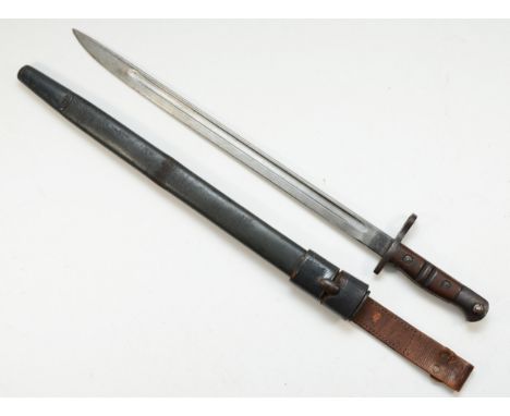
A 19th Century British Colonial 1853 pattern Enfield Musket socket bayonet. Zigzag slot and triangular section blade marked to the ricasso with Indian stamps and British Military ordnance mark. Measures approx 63cm. If this lot is required to be posted please see sale notes regarding age verification.
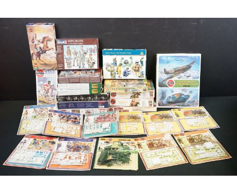
Lot 273
25 Boxed / carded plastic model kits featuring 11 x HO Airfix kits (Sherman Tank, 2 x English Musketeers 1642, 3 x English Pikeman 1642, French Legionnaire 1908, French Line Infantryman 1815, 42nd Highlander (Black Watch) 1815, British Grenadier 1776 and American Soldier 1776), 4 x 54mm Airfix kits (2nd Dragoon 181, French Cuirassier, Lifeguard 1815 & Polish Lancer), 1 x 1/32 US Marines 1941-45, 4 x Revell 1/72 kits (NATO Pilots, 2 x German Navy Figures WWII, Pilots & Ground Crew Royal Air Force WWII), 3 x Italeri kits (1/72 US Paratroopers 101st Airborne, 1/72 NATO Pilots and Ground Crews & 1/35 Soviet Cavalry WWII) and 2 x Meng kits 1/35 (French FT-17 Light Tank Crew & Orderly & U.S Explosive Ordnance Disposal Specialists & Robots), plus Airfix Hardback book, contents appearing complete, vg overall
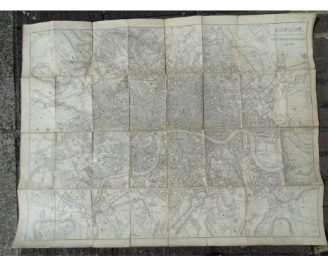
Lot 180
Davies (B R), London Post Office Directory 1870, printed by J M Johnson, (no slip case); Ordnance Survey Map of SE Environs of London, Sheet 271; The Illustrated Map of London Issued with Seven Days in London Apr 22nd 1900, a Reynolds' Large Coloured Map of London and Its Suburbs and a London Streets Directory, (5).

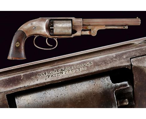
Lot 53
dating: about 1860 provenance: USA, Octagonal, rifled, 7-1/2', 44 cal barrel (clean bore, visible rifling) with brass front sight, marked 'WW' at the base. Six-shot cylinder with double-action operation (problems with the cylinder rotation). Frame with remains of a shield stamp in the lower part. Back with markings 'PETTENGILLS PATENT 1856' and 'RAYMOND & ROBINTAILLE PATENTED 1858'. Serial number '33xx' marching on the cylinder and handle. Walnut grips, the left one with remains of an inspection stamp (not clearly legible), both grips with serial number matching the revolver and mark 'H'. An interesting piece from the Civil War era with military adoption stamps. Originally, the Ordnance Department contracted 5000 units but then it commissioned only 2000 between 1862 and '63. These rifles were subsequently allocated to cavalry and militia units. Refer to Flayderman's Guide, 9th Edition, page 367, entry 7A-080 for further details. length 35 cm.
Lot 305
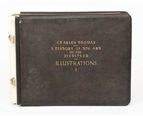
An archive of the artist Charles Thomas, comprising letters, photographs, glass slides and negatives of his travels, his World War I War medal and Victory medal, his Ordnance Corp cap badge, A History of the Art of Diecasting by Charles Thomas, a plaster plaque of a sailing vessel by a windmill, three silverpoint prints, and a woodblock for printing a star design, (a lot) ProvenanceThe collection of Phillip Allen (1938-2022).
Lot 280
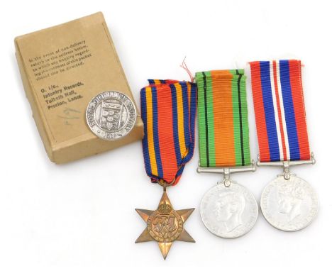
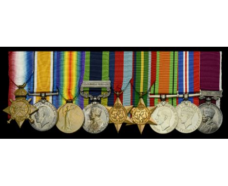
Nine: Lieutenant W. Ford, Royal Army Ordnance Corps, who was presumed killed in action at the Fall of Singapore on 15 February 1942 1914-15 Star (A.1317 Armr. S. Sjt. W. Ford. A.O.C.); British War and Victory Medals (A.1317 S. Sjt. W. Ford. A.O.C.); India General Service 1908-35, 1 clasp, Waziristan 1919-21 (A.3419 S-Sjt. W. Ford. R.A.O.C.); 1939-45 Star; Pacific Star; Defence and War Medals 1939-45; Army L.S. & G.C., G.V.R., 3rd issue, Regular Army (7578912 W.O. Cl. II. W. Ford. R.A.O.C.) mounted court-style for display, generally very fine and better (9) £600-£800 --- William Ford attested for the Army Ordnance Corps and served with them during the Great War as an Armourer Staff Sergeant on the Western Front from 31 December 1914. He suffered a shrapnel wound to the head in February 1916, and was admitted to 2 Canadian General Hospital, Le Treport, on 10 February 1916; discharged from hospital on 4 March 1916, he was subsequently admitted to the same hospital suffering from a double hernia on 5 September 1918. Remaining in the Army Ordnance Corps, Ford was advanced Armourer Quartermaster Sergeant, and was commissioned Lieutenant on 25 September 1941. He served with the Royal Army Ordnance Corps during the Second World War, and was presumed killed in action at the Fall of Singapore on 15 February 1942. A letter written to the recipient’s brother from the War Office, dated 29 January 1946, states: ‘Information regarding your brother Lieutenant W. Ford, R.A.O.C., has been received from your brother’s Commanding Officer that your brother embarked with him at Singapore on a Motor Launch on he night of 13-14 February 1942. On 15 February a Japanese Destroyer was encountered and the launch was sunk. The informant states that he believes he was the last to leave the vessel and after the commencement of the action he never saw your brother either on deck on in the water. In view of this information, and in the absence of any news of your brother since the cessation of hostilities and the consequent release of prisoners of war in the Far East ... it is officially recorded that Lieutenant W. Ford, R.A.O.C. is presumed to have been killed in action on or shortly after 15 February 1942.’ Ford has no known grave and is commemorated on the Singapore Memorial. Sold with a photograph of the recipient; photographs of the recipient’s name on the Singapore Memorial; three Army Ordnance Corps letters regarding the recipient’s hospitalisation during the Great War; and copy letter from the War Office to the recipient’s brother.
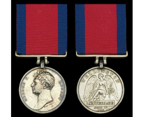
Lot 425
The Waterloo Medal awarded to Lieutenant John Sperling, Royal Engineers, one of eleven engineer officers present at the battle, he had previously distinguished himself in leading the ‘Forlorn Hope’ at Bergen-op-Zoom in 1814 Waterloo 1815 (Lieut. John Sperling, Engineer, R. Artillery.) fitted with original steel clip and silver bar suspension, minor edge bruising, otherwise good very fine and very rare £6,000-£8,000 --- The Royal Engineers were an all-officer corps and part of the Board of Ordnance together with the Royal Artillery. Most, but not all, of the Waterloo medals issued to these few engineers are named with the designation ‘Engineer, R. Artillery’. Of the known surviving medals, four are named in this manner whilst those to Lieutenants Head and Gilbert are known to be named ‘Royal Engineers’. John Sperling, was born at Tottenham on 4 November 1793, son of Henry Piper Sperling of Park Place, Henley-on-Thames, and afterwards of Norbury Park, Surrey. After passing through the Royal Military Academy at Woolwich, and spending some time in the ordnance survey of Great Britain, Sperling received a commission as second lieutenant in the royal engineers on 14 December 1811. He joined his corps at Chatham in March 1812, and was promoted to be first lieutenant on 1 July 1812. In December 1813, Sperling embarked at Ramsgate with the expedition under Sir Thomas Graham (afterwards Lord Lynedoch), to assist the Dutch against the French, whose garrisons had been recently much reduced in strength. He was one of nine officers of royal engineers under the commanding royal engineer Lieutenant-Colonel (afterwards Lieutenant-General Sir) James Carmichael Smyth. They landed at Williamstadt on 18 December. On 31 December, Sperling was at Staandaarhuyten making a bridge of boats, and in the early part of January 1814 he restored a tête-de-pont which protected the passage of the river. On 11 January 1814, Sperling, with his sappers, was attached to a column sent to assist the Prussians in dislodging the French from Hoogstraaten. Sperling went to Breda on 21 January to arrange for accommodating a store depôt for the bombardment of Antwerp. On 2 February he advanced his engineer stores to Merxem, and during the night commenced the construction of a mortar battery, which was armed and opened fire on Antwerp on the afternoon of the 3rd. He did duty in the trenches until the 6th, when the siege was raised. The British troops went into cantonments, and Sperling, after taking his engineer stores to Breda, was sent to Tholen, in the neighbourhood of Bergen-op-Zoom, to report on the fortifications there. On 8 March an attempt was made to storm Bergen-op-Zoom with four columns. Headed by Sperling, No. 1 storming column effected an entrance by surprise at the watergate and seized the guard, the French officer surrendering his sword to Sperling, who kept it as a trophy. The party then swept the ramparts for some way, but not being supported by the main body of their own, and encountering a large force of the enemy, it was obliged to fall back after the death of its two commanders, Carleton and Gore. In the course of this operation it came across the second column under Major-General Cooke, and together they made a stand for the night. When the day dawned it should have been possible to take Bergen-op-Zoom; but, instead of support, came an order to retire. The master-general of the board of ordnance conveyed to Sperling ‘a particular approbation of the gallantry and ability shown by him while attached to the advanced party which entered the fortress.’ On 23 March Sperling was appointed adjutant and quartermaster of the sappers and miners, and he accordingly joined headquarters at Calmthout. But on 11 April news arrived of the entrance of the allies into Paris, and of the change of government, upon which hostilities at once ceased. Sperling moved with army headquarters to St. Graven Wesel on 18 April, and during May was employed in preparations for taking possession of the fortresses assigned to British occupation by the convention. He also visited all the Scheldt defences. As soon as Antwerp was handed over, British headquarters were moved thither. On 7 June Sperling was sent to London to lay before the board of ordnance plans and reports of the fortresses. He returned to Antwerp on 8 July. In August he made a survey and plan of Liège citadel for Lord Lynedoch, who was vacating the command, the Prince of Orange succeeding him. On 10 September he removed with headquarters to Brussels, and in October reconnoitred ground which the Prince of Orange considered a good position for an army in advance of Brussels. When the news of Napoleon's escape from Elba arrived (9 March 1815), Sperling's work became very heavy. In April he visited Ghent in regard to the defence works for the permanent bridge over the Scheldt. On the 21 and 22 of this month he dined with Wellington, who, after a tour of inspection of the fortresses, expressed himself well satisfied with Sperling's preparations. On 1 May Sperling reported on the bridge of boats constructed at Boom, and then accompanied Colonel Carmichael Smyth on a tour of inspection of the works at Ghent, Oudenarde, Tournay, the pontoon bridge over the Scheldt at Escanaffles, with its tête-de-pont at Ath. A sketch which he made of the position at Hal for defence against an invading army was laid before Wellington on the 17th, who at once sent him to Antwerp to meet Sir David Dundas and conduct him over Bergen-op-Zoom. On 15 June the French crossed the frontier, and on the 16, all the troops in Brussels were in motion. Sperling joined Colonel Carmichael Smyth on the 17th, and found the British army falling back after the battle of Quatre Bras. Next day Sperling and Carmichael Smyth accompanied the Duke during the early part of the battle of Waterloo, and after, owing to the various evolutions, they separated from Wellington, they remained until the great engagement ended, for the most part on the hill near the artillery, occasionally taking refuge in the infantry squares. On 19 June Sperling returned with Smyth to Brussels, and arrived on 24 June at Le Cateau. He then moved with headquarters towards Paris. On 2 July he visited Argenteuil, Bezons, and Carrières, to report on their comparative eligibility for bridging the Seine. Argenteuil was selected, and the bridge was in progress the following day. On 7 July Sperling entered Paris with the headquarters staff. He remained in Paris until 27 January 1816, when he was moved to Cambrai. Sperling returned to England in November 1818, and retired on permanent half-pay on 24 January 1824. He resided first at Great Doods, near Reigate, Surrey, and afterwards in a house which he built for himself in Palace Gardens, Kensington, London. He died at Kensington on 13 February 1877. Sperling was the author of Letters of an Officer of the Corps of Royal Engineers, from the British Army in Holland, Belgium, and France, to his Father, from the latter end of 1813 to 1816, London, 1872 [now available in The Waterloo Archive, Volume VI: British sources, edited by Gareth Glover].
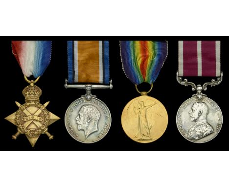
Lot 265
Four: Gunner P. E. Stilton, Royal Field Artillery 1914-15 Star (86874. Ftr. P. E. Stilton, R.F.A.); British War and Victory Medals (86874 Gnr. P. E. Stilton. R.A.); Army Meritorious Service Medal, G.V.R., 1st issue (86874 Gnr: P. E. Stilton. A.63/Bde: R.F.A.) polished, nearly very fine (4) £120-£160 --- M.S.M. London Gazette 1 January 1917. Philip Edward Stilton was born in Kentish Town, Middlesex, around 1885, and attested for the Royal Field Artillery at Woolwich on 25 August 1914. Sent to the workshops at Woolwich for a skills test, the resulting judgement of ‘indifferent’ by Major R. Edmonds, Army Ordnance Department, proved an early setback. Repeated absences from barracks further held Stilton back. Appointed Acting Fitter 23 May 1915, Stilton finally crossed the English Channel to France on 31 May 1915 and was later vindicated with the award of the M.S.M. in the New Year’s Honours list of 1917.
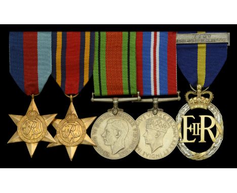
Lot 366
Five: Attributed to Major J. A. M. Meade, Royal Army Ordnance Corps 1939-45 Star; Burma Star; Defence and War Medals 1939-45; Army Emergency Reserve Decoration, E.II.R., reverse officially dated 1961, with integral top riband bar, mounted for wear; together with the related miniature awards, these mounted as worn, nearly extremely fine (5) £80-£100 --- Sold with named Record Office enclosure for the Emergency Reserved Decoration (London Gazette 17 March 1961), named to ‘Major J. A. M. Meade, ERD, 38 Salisbury Road, Carshalton, Surrey’, and dated 16 November 1961
Lot 43
Bacon (G. W.). Commercial and Library Atlas of the British Isles from the Ordnance Survey, 1895, additional half-title, 103 (complete as list) colour lithographic regional and county maps, letterpress and index bound at rear, all edges gilt, contemporary half morocco gilt, spine detached but retained, upper board detached, heavily worn and rubbed, folio, together with Blackie (W. G.). The Imperial Atlas of Modern Geography..., 1860, title, preface and index, 100 (complete as list) engraved maps by E. Weller, each with contemporary outline colouring, slight dust soiling and spotting, index bound at rear, contemporary half calf, boards detached and lacking spine, rubbed and worn, folio, with Migeon (J., publisher), Géographie Universelle Atlas Migeon...., published Paris, 1870, double page decorative title, 36 double-page engraved maps with contemporary wash colouring, folding maps of France and Paris bound at rear, slight spotting, marbled endpapers, contemporary cloth gilt, worn at extremities, folio, with two other atlases similar by Phillips and Bain, both folio, various conditionQTY: (5)

Lot 136
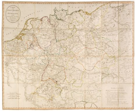
Pine (John). Two sea charts (on one sheet) originally published in 'The Tapestry Hangings of the House of Lords, Representing the Several Engagements between the English and Spanish Fleets, in the Ever Memorable Year MDLXXXVII ..., London: John Pine, 1739, two engraved sea charts (numbers VII & VIII) of the English Channel from the Isle of Wight to Dover, showing the progress of the Spanish Armada and the deployment of the English fleet, after H. Gravelot, each map displayed within highly decorative borders, the maps printed in blue, the borders in black, trimmed to the plate mark and laid on later paper, 380 x 60 mm, together with Weiland (C. F.). Ireland entworfen und geziechnet..., 1837, engraved map with contemporary outline colouring, slight staining, 615 x 495 mm, together with Von Reilly (Frans Johann Joseph). Das Konigreich Ireland Nro 89, Vienna, circa 1789, engraved map with contemporary wash colouring, orientated to the east, 225 x 295 mm, with Radefeld (H.). Neueste Karte von Ireland..., 1844, engraved map with contemporary outline colouring, very slight soiling, 380 x 310 mm, plus Ordnance Survey (publishers). Index to the Townland Survey of the County of Antrim and the County of the Town of Carrickfergus, 1833, engraved map with contemporary wash colouring, sectionalised and laid on linen, two inset tables, the map edged with red silk, 620 x 970 mm, with another three similar maps (including one duplicate) by or after Von Stülpnagel and Druck und Verlag, various sizes and condition, plus a plan of the siege of Kinsale, a map of Scotland by Stieler and a French lithograph of Edinburgh and Taylor (A. E.). Four 'Esso' Pictorial maps: Esso Pictorial Plan of the West Country, Esso Pictorial Plan of the Eastern Counties and the Midlands, Esso Pictorial Plan of the Roads of the South Coast [and] Esso Pictorial Plan of the Principal Islands of Northern Britain [on sheet with] Esso Pictorial Plan of the Principal Islands of Southern Britain, 1932, together four colour photolithographic pictorial maps, each sheet approximately 305 x 465 mm, together with Pratts High Test Plan of the Great North Road, Pratts High Test Plan of Scotland, Pratts High Test Plan of the West County [and] Pratts High Test Plan of the Bath Road, 1930 - 32, four uncoloured lithographic maps, old folds, various sizes, good condition, with three late 19th & early 20th-century geological charts, maps and booklets, plus Thomson (John). Northern part of Western Isles, part of Ross Shire [and] Middle part of Western Isles part of Inverness Sh: 1822, two engraved maps with contemporary outline colouring, some dust soiling and staining, each approximately 530 x 690 mm, and four duplicate mid to late 19th-century uncoloured engraved Ordnance Survey maps of Somerset, each approximately 650 x 800 mm, various condition, with a modern colour reproduction of the Mappa Mundi, sheet size 650 x 480 mm, plus approximately 55 engravings and colour lithographs of heraldry and flags, various sizes and condition, and a late 18th-century uncoloured engraving of Fountains Abbey, trimmed to the image, 175 x 345 mmQTY: (approx. 99)
Lot 102
Folding Maps. A collection of 30 folding maps, 18th & 19th century, twenty-eight engraved and lithographic county, regional and touring maps of the British Isles, including examples by or after J & C Walker, Cruchley, Gall & Inglis, Ordnance Survey, Collins, W. H. Smith, Bacon, Wyld, Iliffe & Son and Morden/Cox, mostly bound or contained in slipcases, with two additional late 19th century folding maps of the Dolomites and the Swiss Alps, various sizes and conditionQTY: (30)
Lot 103
Folding Maps. A collection of 30 maps, mostly 19th-century, engraved and lithographic British and foreign regional and country maps, including examples by or after G. & J. Cary, Ordnance Survey, W. Faden, Edward Stanford, J. Findley, S. Lewis, G. F. Cruchley, F. Harding, A. Peterman, J. Wyld, Letts Son & Co., F. M. Diez, W. & A. K. Johnston and James Gardner, mostly in contemporary slipcases or boards, various sizes and conditionQTY: (30)
Lot 75
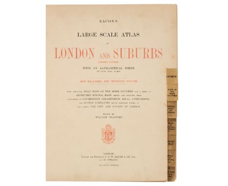
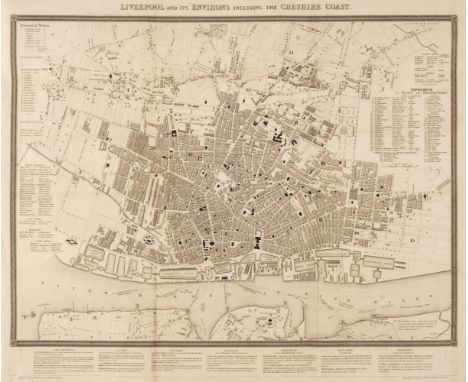
Bacon (G. W., publisher). Bacon's Large Scale Atlas of London and Suburbs (Revised Edition) with an Alphabetical Index, circa 1910, title page and contents list, 26 double-page and folding social, geographic and industrial maps and a 34-sheet map of Greater London, very slight spotting, endpapers and pastedowns with some water staining, publisher's half morocco gilt, a little stained and worn, folio, together with Wyld (James). Map of the County of Surrey from Trigonometrical Survey with the Roads, Parks and Railways, 2nd edition, circa 1860, engraved map with contemporary outline colouring, sectionalised and laid on linen, large uncoloured cartouche and table of explanation, some dust soiling and slight staining, marbled endpapers, 850 x 1130 mm, with Stark (J.). Stark's Geographical, Historical, Chronological, Biographical, Mineralogical and Railway Chart of the United Kingdom of Great Britain, published Glasgow, circa 1852, lithographic map with contemporary outline colouring, sectionalised and laid on linen, slight overall toning, frayed with slight loss to the printed image, edged in green silk, 1000 x 750 mm, contemporary blind-stamped morocco boards, lacking upper board, size when folded 265 x 175 mm, plus Ordnance Survey (publishers). Map of Putney, Wandsworth and Environs on a scale of 25 inches to the mile, circa 1870, large colour lithographic map, sectionalised and laid on linen, 1350 x 2040 mm, marbled endpapers, and Stanford (Edward, publishers). Stanford's Map of the River Thames from Richmond to Lechlade, circa 1950, folding colour lithographic map, slight spotting, publisher's paper wrappers, 210 x 3300 mm, with London Docks. Port of London Authority. Plan of the India & Millwall Docks [and] Port of London Authority. Plan of the Tilbury Docks, 1968 & 1969 respectively, the first map, colour printed, sectionalised and laid on linen, 655 x 620 mm, the second an uncoloured map, sectionalised and laid on linen, 890 x 725 mm, both with marbled endpapers and uniformly bound in envelope style blue boards with gilt title to the upper cover and secured with a steel 'popper' with one other map similarQTY: (8)
Lot 79
British County Maps. A collection of approximately 200 maps, mostly 18th & 19th-century, county, country and regional maps, city plans and road maps, including examples by or after Bowen (Emanuel), Ordnance Survey, Dawson, Paterson, Davies, Leigh, Phillips, Kitchin, Fullarton, Moule, Owen & Bowen, Seale, Seller/Grose, Cole & Roper, Archer, Hall, Wilkes, Hogg, Bacon and Lewis, some duplicates, various sizes and condition, together with approximately 150 prints and engravings, including British & foreign topographical views, portraits, sporting, classical and caricatures, various sizes and conditionQTY: (approx. 350)
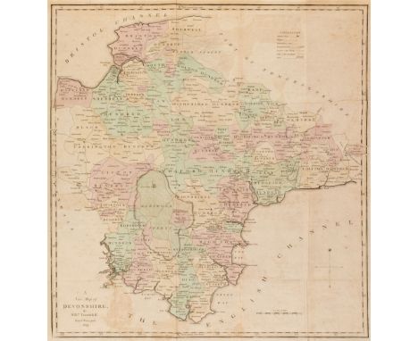
Lot 93
Devon. A collection of 25 county and road maps, mostly 18th & 19th-century, engraved and lithographic maps, including examples by or after Tunnicliff, Teesdale, Langley, Harrison, Owen & Bowen, Duncan, Ordnance Survey, Creighton/Lewis, Wallis, Laurie & Whittle, Hatchett, Kitchin, Van den Keere, Taylor/Blome, Paterson, Smith, Dawson, Archer, Weller and Pigot, various sizes and condition, together with a mileage triangle and descriptive text for Devonshire by Robert Morden, the descriptive text for Devon from 'The New and Complete British Traveller' and the county map, mileage table and descriptive text from James Pigot's 'Pocket Topography and GazetteerQTY: (28)
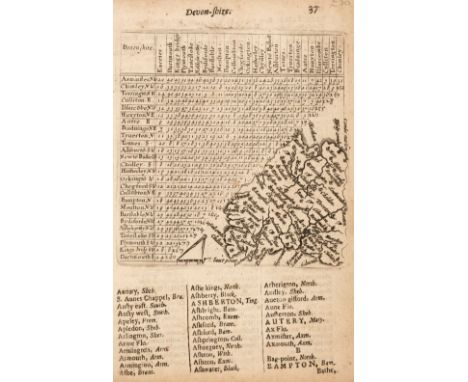
Lot 94
Devon. A collection of 47 maps, mostly 19th-century, engraved and lithographic county maps, town plans and road maps, including examples by or after Van Langeren, Ordnance Survey, Hames, Wallis, Gray, Cary, Phillips, Leigh/Hall, Fullarton, Wilkes, Archer, Lewis, J & C Walker, Weller, Owen & Bowen, Besley, Paterson, Carington Bowles, Gardner, Kitchin and Senex, occasional duplicates, various sizes and condition, together with three topographical views of Devonshire, with Gloucestershire. Six maps, 17th-19th century, engraved county maps and town plans, including examples by or after Saxton/Hole, Phillips, Cary, James and Griffiths/Radclyffe, plus two engraved topographical views of Cheltenham, with another 14 British & foreign maps, including examples by Rapkin, Kitchin, Cary, Gentlemen's Magazine, Faden and Morden, various sizes and condition QTY: (72)
Lot 99
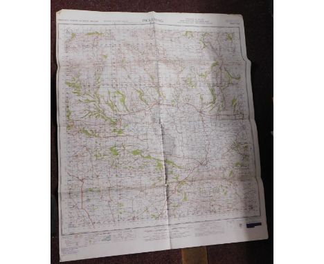
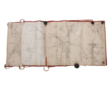
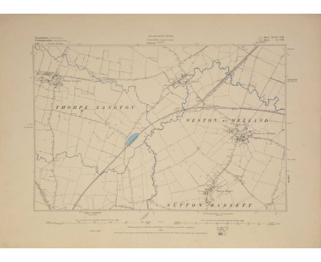
Doncaster. Ordnance Survey, 8 sheets on a scale of 1:500 (10.56 feet to the mile) 1901-02, lithographic map sections, each sheet split into 4 sections and re-mounted on to 8 sheets, sectionalised and laid on linen and if conjoined comprising the entirety of Doncaster, some red and blue ink annotations, some dust soiling and slight staining, if conjoined the overall size would be approximately 3880 x 3270 mm, contained in a contemporary cloth 'envelope style fold-over' case, some flaps detached, heavily worn and rubbed, size of folder 345 x 500 mmQTY: (1)NOTE:Formed from a complete set of 19 large-scale sheets. The sheet numbers are CCLXXVII 13.17, CCLXXVII 13.18, CCLXXVII 13. 19, CCLXXVII 13.21, CCLXXVII 13.22, CCLXXVII 13.23, CCLXXXV 1.6, CCLXXXV 1.7, CCLXXXV1.8, CCLXXXV1.9, CCLXXXV1.11, CCLXXXV1.12 [and] CCLXXXV 1.13

-
12129 item(s)/page