We found 12130 price guide item(s) matching your search
There are 12130 lots that match your search criteria. Subscribe now to get instant access to the full price guide service.
Click here to subscribe- List
- Grid
-
12130 item(s)/page


Lot 217
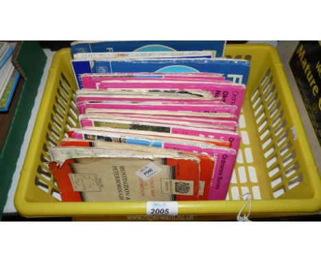
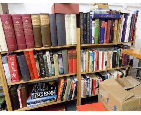
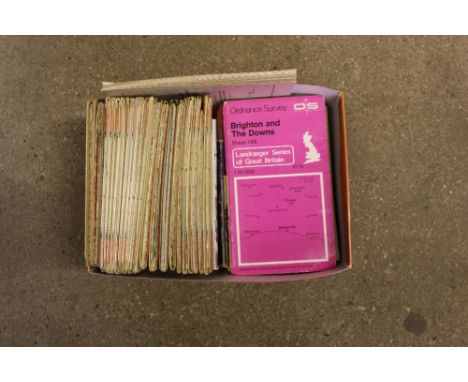
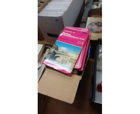
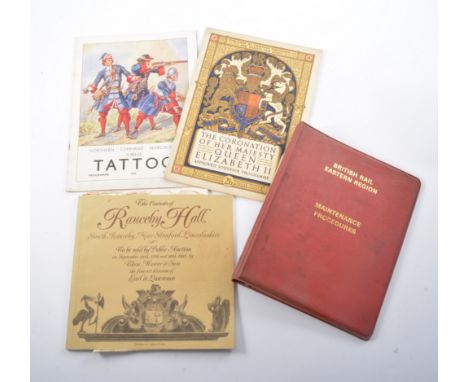
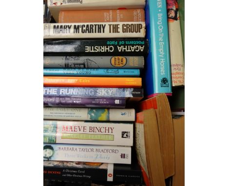
Fox-Davies (Arthur Charles). Armorial Families. A Directory of Gentlemen of Coat-Armour, 2 volumes, 7th edition, 1929, numerous armorial illustrations to text, top edge gilt, remainder untrimmed, original cloth, small folio, together with Burke's Peerage, Baronetage & Knightage, Clan Chiefs, Scottish Feudal Barons, 2 volumes, 107th edition, 2003, original maroon boards gilt, folio, with Domesday Book Studies, Oxfordshire, 3 volumes (including folding maps), Alecto Historical Editions, 1987-1990, original cloth-backed boards, folio, (limited edition 121/1000), and Crocker (Oliver), All Memoires Great & Small, 1st edition, 2017, colour and monotone plates, title signed by the author, original printed wrappers, 8vo, plus other miscellaneous books including dictionaries, reference, literature, biographies, history, Folio Society publications, plus a carton of 20th century Ordnance Survey and Bartholomew folding maps etc. (6 shelves + carton)
Lot 175
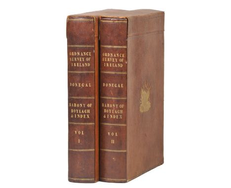
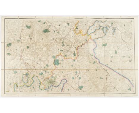
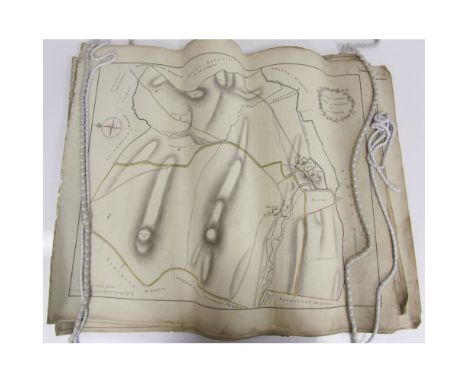
Ireland. Ordnance Survey of Ireland, Map of Donegal, Barony Of Boylagh, published Dublin 1835 - 36, twenty-one engraved maps with contemporary outline colouring, each map sectionalised and laid on linen, all maps initialled and dated by James Duncan, each sheet approximately 660 x 990 mm, contemporary canvas chemises and contained in two contemporary calf book boxes with 'envelope style' covers, decorated with gilt embossed arms of the Ordnance Survey to verso and recto of each box, contemporary book seller's label to inner cover, spines darkened, slightly rubbed at extremities, old chalk marks to boards, A fine, early and complete set of the enlarged six inches to the mile Ordnance Survey of Donegal. Sold Sotheby's, 10th October 2006. The Wardington Library sale of Important Atlases and Maps, part 2. Lot 332. (2)
Lot 200
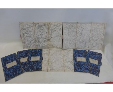
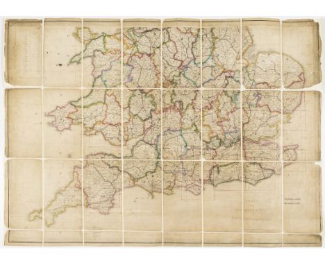
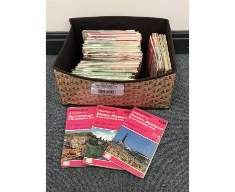
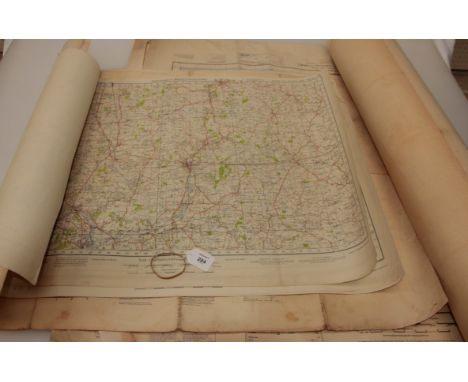
Ordnance Survey. A collection of seventy-nine maps (only), scale 1 inch / 1 mile, various dates but mostly early - mid 19th century, engraved maps, several with early outline colouring, sectionalised and laid on linen, together with two index maps (Northern and Southern England), each approximately 630 x 940 mm Sold as a collection of maps, not subject to return. (81)
Lot 206
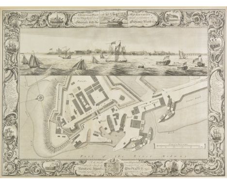
Sheerness. Milton (Thomas), A geometrical plan & west elevation of His Majesty's Dock-yard and Garrison at Sheerness with the Ordnance Wharfe &c., 1755, uncoloured engraved map with a panorama of the dockyard above the plan, engraved by J. Cleveley and P. C. Canot after T. Milton, decorative borders, 480 x 650 mm, mounted (1)
Lot 45
Groome (Francis H., ed.). Ordnance Gazetteer of Scotland: A Survey of Scottish Topography, Statistical, Biographical, and Historical, 3 volumes, 1st edition, Edinburgh, Thomas C. Jack, 1882-3, 42 engraved or lithographic maps, all coloured and folding and including a large elevation map of Scotland, 6 steel-engraved views, extra-illustrated with numerous tipped-in additional engraved views on different paper stock, the large map with some splitting along folds but contents otherwise clean, marbled edges, contemporary reddish-brown half morocco, extremities and sides slightly rubbed, large 8vo, together with Fullarton (A. and Co., publishers), A Gazetteer of the World, or Dictionary of Geographical Knowledge ... 7 volumes, Edinburgh, 1871, numerous steel-engraved plates, mainly maps and views, the maps with outline colour, wood-engravings to the text, occasional offsetting, marbled edges, contemporary half calf, slightly rubbed, large 8vo Groome's Gazetteer is complete in 3 volumes; it was also issued in 6 volumes between 1882 and 1885. (10)
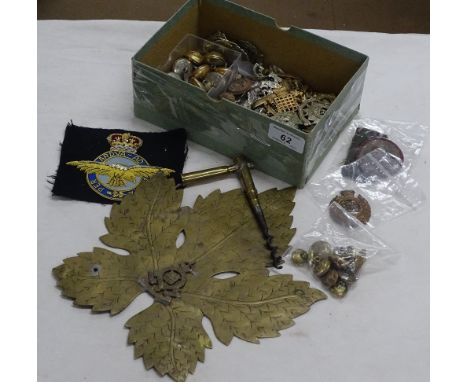
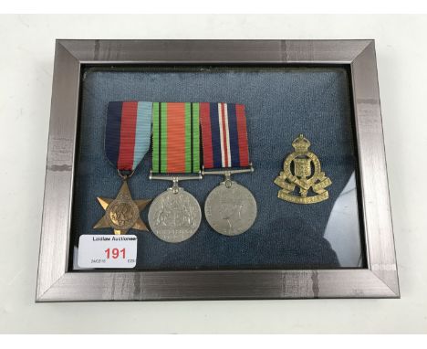
Lot 444
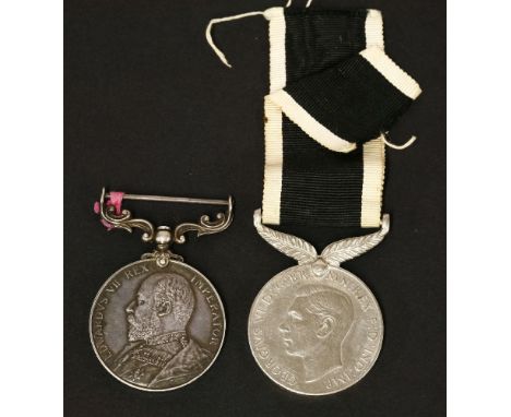
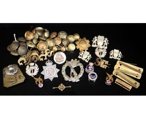
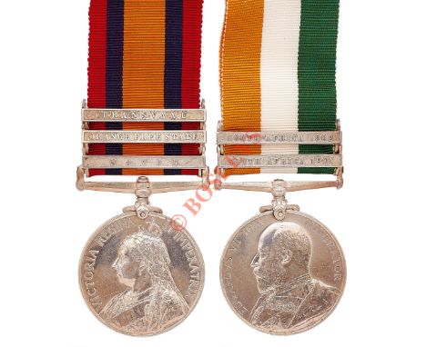
Boer War 1st Bn Border Regiment Officer’s Queen’s South Africa Pair of Medals. Awarded to “CAPT P.F.B. HAWES BORD REGT’. Comprising: Queen’s South Africa Medal “LIEUT 1/BORD REGT”, three clasps, “Natal”, “Orange Free State”, “Transvaal”, King’s South Africa Medal, “CAPT BORD REGT”, two clasps “South Africa 1901”, “South Africa 1902”. Correct engraved style naming. Medals loose. Captain Percy Frederick Brunel Hawes was born in October 1871. He was commissioned into the Border Regiment on the 21 January 1893 and promoted to the rank of Lieutenant in January 1896. He posted to South Africa with the 1st Battalion and took part in the operations in the Orange Free State, Transvaal and east of Pretoria. On 15 July 1902 he was promoted to Captain. Remaining with the Regiment after the war, he qualified on the Linguist Course and Ordnance Course and was attached to the Army Ordnance Department. He retired from the Army with the rank of Captain on 14 August 1914.
Lot 551
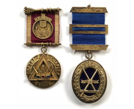
Masonic Army Ordnance Chapter Medal. This silver gilt example HM 1916, with an Ordnance shield device to the ribbon. The reverse is engraved “PRESENTED TO M.E. COMPANION J.A. LAWRIE FIRST PRINCIPLE 1918”. ... Accompanied by a Chapter Jewel for Bengal. Silver Hallmarks for London 1896. (2 items)

Lot 1078
A 19th century Flintlock Blunderbuss, possibly continental, the 23in (58.25cm) steel barrel with Greek Key Swastika decoration, lock plate stamped "London" and "G.R." and British Board of Ordnance Barrel, walnut stock and engraved brass mounts including trigger-guard indistinctly inscribed A. Barker, overall 38½in (97.75cm) long.
Lot 355
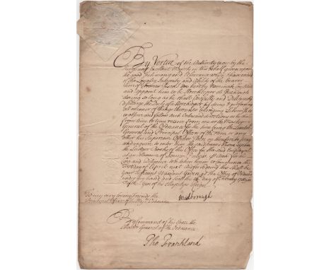
MARLBOROUGH DUKE OF: (1650-1722) John Churchill. English Soldier and Statesman. Commander-in-Chief of the Forces 1690-91, 1702-08. D.S., Marlborough, one page, folio, Office of Ordnance [London], 14th February 1718/19. The manuscript document is the appointment of Francis Biscoe to be Storekeeper at Greenwich. Countersigned at the foot by Thomas Frankland (1685-1747) Clerk of the Deliveries of the Ordnance. With blind embossed paper seal affixed. Some light overall discoloration and age wear, creasing and some small tears, only slightly affecting the text, but not the signature. G
Lot 24
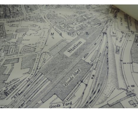
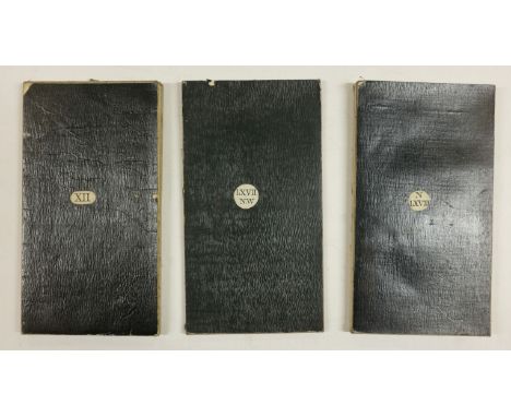
Birmingham.- Colby (Lt. Col. Thomas) Ordnance survey maps showing Birmingham and its environs, two sheets, numbers LXIII N.W. and LIII N.W., lithographs, with some hand-colouring, each sheet approx. 650 x 1130 mm. (25 1/2 x 44 1/2 in), both dissected and mounted on linen, folding with purple coloured endpapers and labelled 'North' and 'South' accordingly, presented in contemporary gilt-tooled slipcase, corners scuffed, worn, 8vo, 1831; Colby (Lt. Col. Thomas) Ordnance survey map centred on Birmingham, sheet no. LXII S.E., lithograph with hand-colouring, 650 x 810 mm. (25 1/2 x 31 7/8 in), dissected and mounted on linen, folding into mottled green envelope-style slipcase, rubbed, 8vo, 1831 § Richmond (George), publisher. Reduced Ordnance Survey around Bewdley, covering Worcestershire, Herefordshire, and parts of Radnorshire, Shropshire, Gloucestershire, and Warwickshire, lithographed map with some hand-colouring, 995 x 1305 mm. (39 1/4 x 51 1/4 in), dissected and mounted onto linen, some light surface dirt, folding with marbled endpaper into original cloth covered boards, gilt label on upper cover, worn, 4to, circa 1870s, (3).
Lot 31
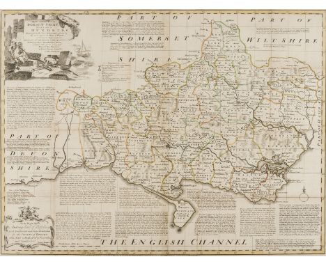
Bowen (Emanuel) An Accurate Map of Dorsetshire Divided into its Hundreds, title with vignette of fisherman upper left, engraving with outline hand-colouring, 545 x 710 mm. (21 1/2 x 28 in), central vertical folds, some surface dirt and light browning, Bowles & Sayer, [1756]; together with an Ordnance Survey Map by Mudge, showing part of Dorset and Somerset, numbered XVIII, engraved map, 645 x 800 mm. (25 3/8 x 31 1/2 in), central vertical fold, minor spotting and browning, unframed, 1811, (2).
Lot 35
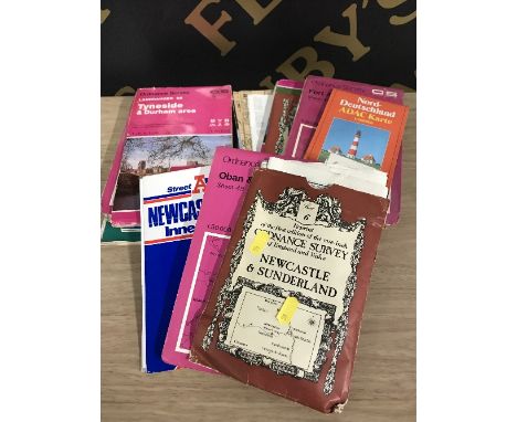
England and Wales.- Ordnance Survey.- Index to the Ordnance Survey of England and Wales, engraved map with outline hand-colouring, 645 x 970 mm. (25 3/8 x 38 1/4 in), dissected and mounted on linen, some areas of loss, surface dirt and browning, circa 1805-1842; together with five assorted Ordnance Survey maps, including an 1885 map showing the Isle of Wight, one of Berkshire and the other three of the Midlands, lithographs, various sizes, 1820s and later, (6).


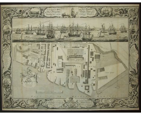
Lot 66
Milton, Thomas, A Geometrical plan and West Elevation of His Majesty's Dockyard near Plymouth, with the Ordnance Wharf, etc, Feb. 2nd 1756, elaborate pictorial borders with Reference vignettes to each side, panoramic view of Plymouth at the top, with shipping in the Sound, faint vertical fold lines, narrow margins, 65.3 x 49.6cm.

Lot 523
Mid 16th century AD. A very large silver-gilt octagonal-section ring with flared shoulders, hollow bezel with pellet border and waisted shield with crossed stave and scythe; below a later stamped 'broad arrow' and diagonal slash and three vertical lines above the shield, possibly an abraded 'VIII' (for King Henry VIII ?"). Cf. Oman, C.C. British Rings 800-1914, London, 1974, plate 52(E).28 grams, 33mm overall, 23.12mm internal diameter (approximate size British Z+3, USA 13 3/4, Europe 32.57, Japan 31) (1 1/4"). Property of a UK gentleman; acquired from a London gallery in the late 1980s; formerly from a private European collection, formed in the 1960s and 1970s. The shield with rounded base and waisted sides appears first in the Tudor period and is found, for example, on the arms of Anne Boleyn (1533-6"). This ring was made for a merchant and bears his arms, with the later addition of the 'King's Broad Arrow' stamp which may indicate that the merchant was associated with the Office of Ordnance, created by King Henry VIII in 1597, and tasked with organising the supply of guns, ammunition, stores and equipment to the King's Navy. The Office and Board used the 'broad arrow' to signify objects purchased from the monarch's purse; only later (from the 17th century) was its use extended to include government property. Very fine condition. A very large wearable glove ring. Rare.
Lot 92
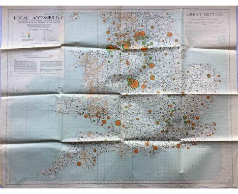
A fold-out MAP of England & Wales, c. early 1950s, entitled 'Local Accessibility - The hinterland of towns and other centres as determined by an analysis of bus services'. Produced by the Ministry of Housing & Local Government from information provided by bus operators etc and published by the Ordnance Survey. Undated but refers to bus services 1947/48 and population data 1951. Folds out to 42" x 33" (107cm x 84cm) and in very good condition. [1]
Lot 164
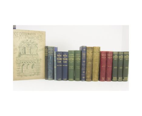
Scottish History and Topography, a quantity, including Walker, J.R.Pre-Reformation Churches in Fife and the Lothians. 1888. Folio, plates, quarter morocco, pictorial boards, worn, lacks spine; MacDonald, J. An Account of the Roman Stones in the Hunterian Museum. Glasgow, 1897. 4to, plates, original buckram; Colston, James The Edinburgh and District Water Supply. Edinburgh: Printed for Private Circulation, 1890. Large 8vo, etched plates, blue half morocco, t.e.g., rubbed; Skene, W.F. Celtic Scotland. 1876, 2 vol., original green cloth gilt; Tancred of Weens, G. The Annals of a Border Club. Jedburgh, 1899. 2 copies, Newbattle Abbey Library stamps, original cloth gilt; Laidlaw, Walter Poetry and Prose. Jedburgh, 1904. Second edition, presentation copy from the author, original cloth, frontispiece loose; Groome, F.H. Ordnance Gazetteer of Scotland. [c.1880]. 7 vol., 8vo, plates, maps, original blue cloth gilt; Colston, James Trinity College and Trinity Hospital. Edinburgh: printed for the Magistrates & Town Council, 1896. 2 vol., 4to., presentation copy from the author, plates, contemporary green half morocco, t.e.g., rubbed; Lindesay of Pitscottie, Robert The Historie and Cronicles of Scotland. Scottish Text Society, 1899. 2 vol., quarter purple morocco, rubbed; Seton, Sir Bruce G. The Prisoners of the '45. 1928, 3 vol., original green cloth gilt; Spalding, John The History of the Troubles and Memorable Transactions in Scotland. Aberdeen, 1792. 2 vol., 12mo, later half morocco, titles remounted with loss of a couple of letters, Paisley Free Library bookplate and stamps, some dust-soiling, rubbed; Highland and Agricultural Society of Scotland Catalogue of Stock, Edinburgh Show, 1899. 8vo, photograph frontispiece, later half calf gilt; Essays and Observations Physical and Literary. Edinbrugh, 1754. volume 1 only, 8vo, original boards, folding plates, worn, upper cover virtually deached; and a quantity of miscellaneous works on Scotland; sold not subject to returnProvenance: The property of the Newbattle Abbey College Trust
Lot 361
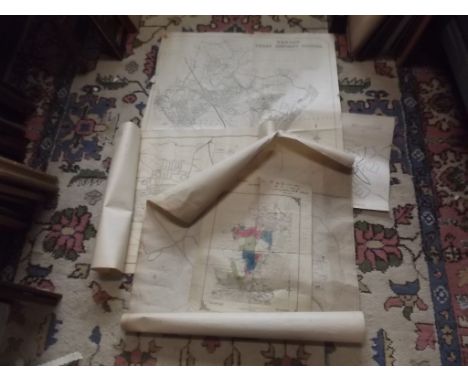
Fife: Kilmany, and the area; and Carntyne, GlasgowSeven manuscript plans, comprising: The East and West Farms of Kilmany and Cloughies; Cloughies; Muircraigs; Westerkilmany; Cloughies; East Farm of Kilmany; West Farm of Kilmany; each c. 44.5 x 57cm, hand-coloured, some creasing where the maps have been rolled, some soiling; a printed and rolled Ordnance Survey showing Kilmany; A Plan of Carntyne Estate for Registration of Ownership, hand-coloured printed map, some worming; Plan of the Estate of Carntyne, printed rolled map with manuscript additions (10)
-
12130 item(s)/page