We found 12130 price guide item(s) matching your search
There are 12130 lots that match your search criteria. Subscribe now to get instant access to the full price guide service.
Click here to subscribe- List
- Grid
-
12130 item(s)/page


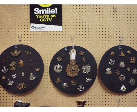
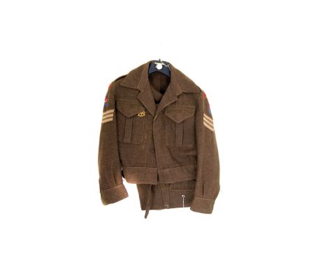
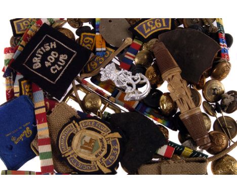
Lot 423
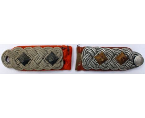
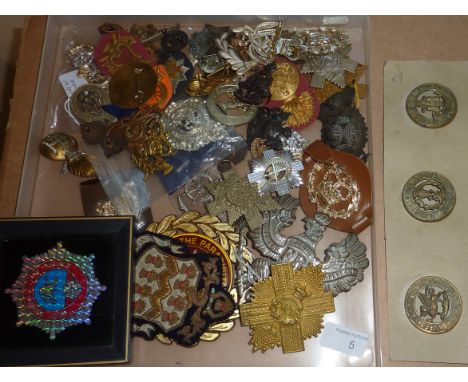
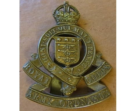
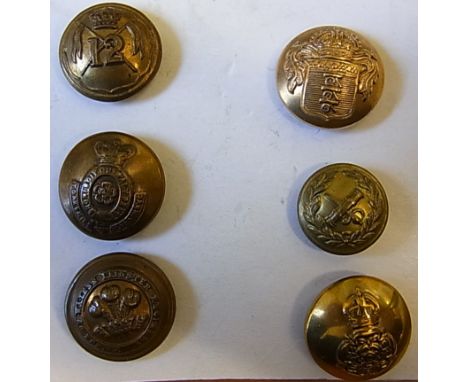
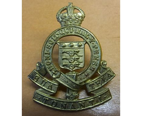
Lot of World War two badges and buttons to include: three whistles, one Indian Army marked, nine ARP buttons, thirty one officers rank pips, four officers Major's rank crowns, fourteen Canadian Army buttons, one Coventry Ordnance Works Ltd Special War Service badge, two East Lancashire Officers bronze cap badges, five East Lancashire Officers collar dogs

Lot 840B
A Brass Pocket Barometer By L Casella, Maker to the Admiralty & Ordnance London. *The Barometer was given to James Conroy by Waldyve Wellington St. George in the early 1900's while stationed in the Curragh. James Conroy served as a surveyor in New Westminster British Colombia Canada. It was left in James Nolans pub in 1914 and over the years, because it was so accurate, the local farmers would cut the hay by its reading. "It was nothing to do with it being in a pub".
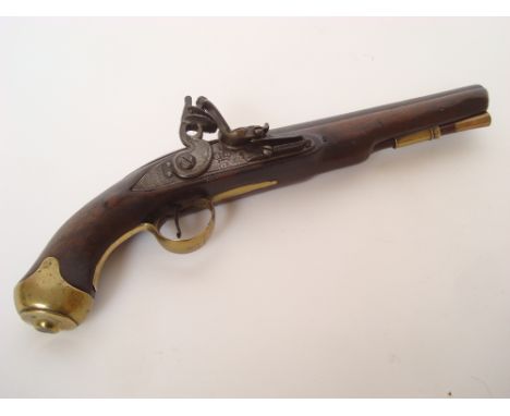
Lot 221
A late 18th Century 15-Bore Dublin Castle flintlock light Dragoon pistol. Stamped with ordnance marks with plain barrel and tang, the lock side plate with crowned G. R. cypher, Dublin Castle and engraved border, walnut stock with brass furniture including trigger guard engraved F G 14, fitted with a brass tipped ram rod. Barrel 23cm long, 40cm long overall.
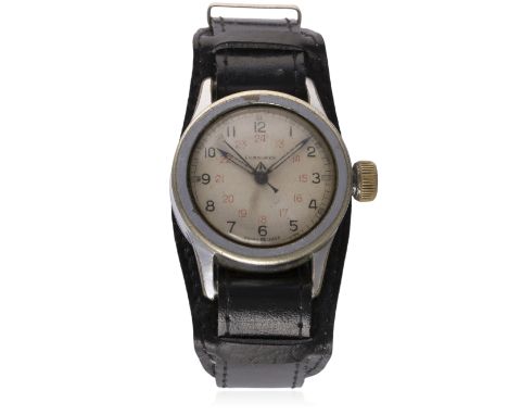
Lot 149
A RARE GENTLEMAN'S BRITISH MILITARY LONGINES PARATROOPERS WRIST WATCH CIRCA 1940s D: Silver dial with 12 & 24 hour Arabic numerals, luminous markers within outer tracking, military arrow. M: 16 jewel manual wind movement signed Longines & numbered, calibre 12.68N. C: Nickel plated military "tuna can" case with fixed bars, Company Ordnance Supply Depot issue markings C.O.S.D. 2340, military issue markings ^ 2072, original crown, case diameter measures approx. 36mm. S: Leather BUND strap. CONDITION REPORT D: Original dial in very good condition. M: Working at present. C: In good condition, showing some wear to the plating. S: In excellent condition. D: Dial / M: Movement / C: Case / S: Strap / B: Bracelet.
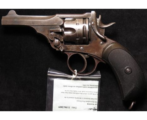
Lot 959
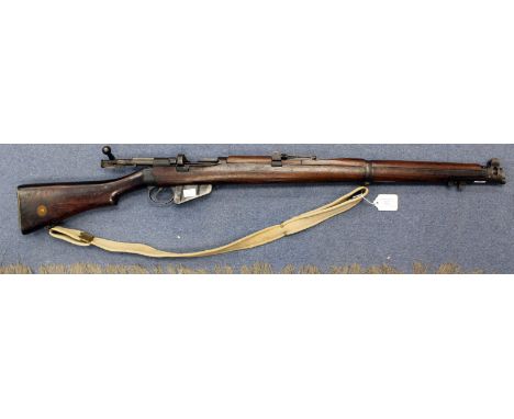
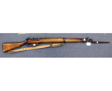
Revolver: A Boer War Webley MKIV service revolver. Calibre .455". Frame marked 'Webley Patents & MK IV' WD ordnance marks. Grip strap stamped 6/00 (June 1900 issue). All matching numbers SN: 82141. Good rubber grips with some handling wear. A good honest example of this popular revolver which continued in service throughout WW1. Probable issue to Artillery in The Boer War. With deactivation certificate.


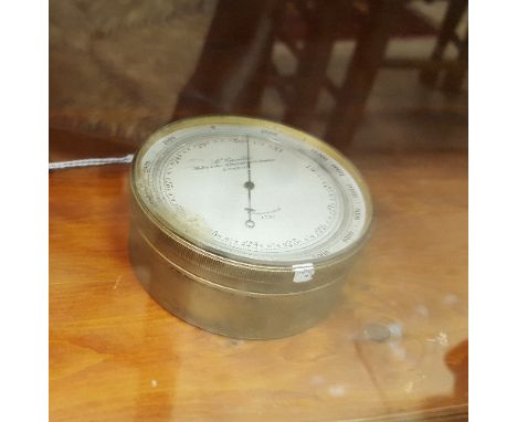
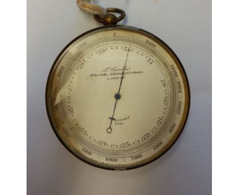
Lot 840B
A Brass Pocket Barometer By L Casella, Maker to the Admiralty & Ordnance London. *The Barometer was given to James Conroy by Waldyve Wellington St. George in the early 1900's while stationed in the Curragh. James Conroy served as a surveyor in New Westminster British Colombia Canada. It was left in James Nolans pub in 1914 and over the years, because it was so accurate, the local farmers would cut the hay by its reading. "It was nothing to do with it being in a pub".
Lot 257
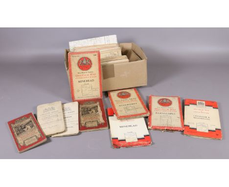
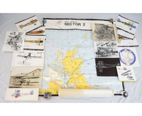
AERONAUTICAL INTEREST including photographic reproductions of biplanes, aerial photographs of Mount Everest, the insignia crest of the Royal Aeronautical Society, calendar prints of a 1918 Handley Page, two of a 1917 Sopwith Camel, 1917 S.E.5, 1917 SPAD S.13, 1917 Avro 504K and a 1919 Albatros D.V, a detailed map from the National Air Traffic Service of the West Scottish Sector 2 flying routes and four Ordnance Survey maps of Ayrshire
Lot 92
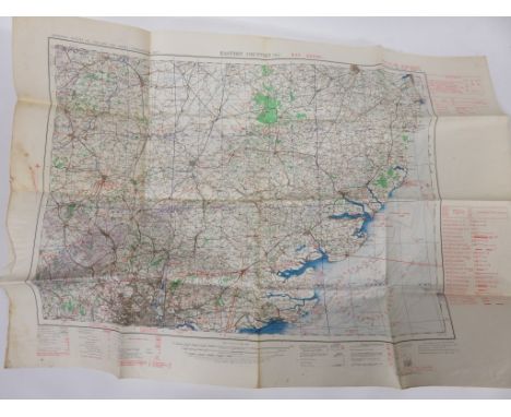
'MILITARY OPERATIONS - FRANCE AND BELGIUM 1914 MAPS' CIRCA 1920 ORDNANCE SURVEY SET OF FOLDED PRINTED PAPER MAPS RELATING TO GREAT WAR 1914, the 34 individual maps with numbered tabs and printed index and housed in a cloth backed book from folder, maps showing 'Le Cateau Battlefield (Layered)' disposition during 'Retreat from Mons, 23 - 29th Aug' 'Aisne Battlefield (layered)', etc published by Macmillan & Co., the hard back folder 9" (23cm) x 6 1/2" (16.5cm)
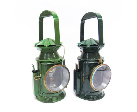
Lot 901
TWO SERVICE ISSUE HAND LAMPS both repainted green, each complete with clear, blue and red filters, reservoir, burner and reflector, one additionally wired for electricity, the bodies with a pleated caps, stamped 'C.E. & S. / [ordnance arrow mark] / 1955 / A 2348' and 'C.E. & S. / [ordnance arrow mark] / 1956 / A 2348' respectively, each 33cm high, (2).
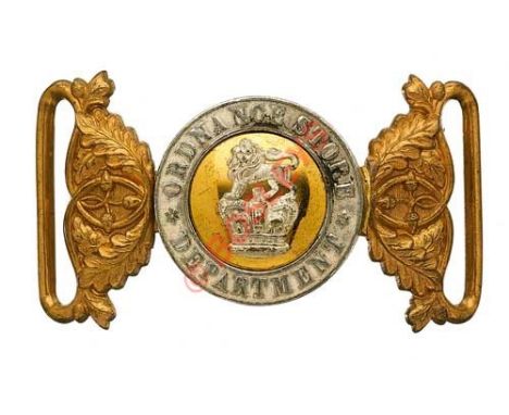
Lot 251
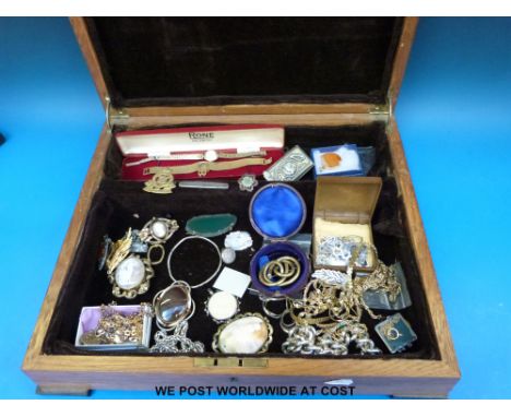
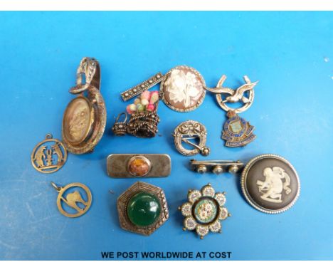
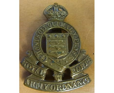
Badge. Ordnance Store Department Victorian Officer’s waist belt clasp circa 1875-96. An extremely fine and scarce silver and copper gilt example. Circlet inscribed “Ordnance Store Department”; gilt centre mounted with Royal Crest in silver. Oak leaf ends. VGC Officer only corps formed from Control Department 27th November 1875; redesignated Army Ordnance Department 26th June 1896. Provenance. Ex Hugh King Collection, Bosleys June 2006, Lot7
Lot 344
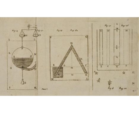
Sinclair (George). The Hydrostaticks; or, the Weight, Force, and Pressure of Fluid Bodies, made evident by physical, and Sensible Experiments. Together with some Miscellany Observations, the last whereof is a short History of Coal, and of all the Common, and Proper Accidents thereof; a Subject never treated of before, by G. S., 1st edition, Edinburgh: Printed by George Swintoun, James Glen, and Thomas Brown, 1672, seven engraved plates, (6 folding, lacking the additional engraved title and the folding engraved plate of arms), faint oval ink stamp to title (evidence of removal and consequent slight thinning to paper), plate II torn with very slight loss, plate IV with two old paper repairs to verso, plate V slightly loose with minor worming, marginal hole to P4, upper outer corner of Qq1 torn with loss of one word, occasional light fraying to few margins etc., occasional light spotting, manuscript ownership to front free endpaper of John Kirsop, 6 Queen Cresent, Glasgow, 1868, hinges repaired, contemporary calf, rebacked, covers & corners heavily rubbed, 4to ESTC R38925; Kress S.1382 (calling for 7 plates); Wing S3854 & Challinor 8. A scarce first edition. 'A gallimaufry of practical and theoretical physics, drawing on [Sinclair's] experiences with the diving bell and barometer' (ODNB). Sinclair had practical experience of the former while salvaging ordnance from an Armada wreck in Tobermory Bay, and was one of the earliest adopters of the latter to measure heights and depths in mines. Pp. 258-302 deal with mining in relation to the Midlothian coal field, Sinclair explaining the terms 'dipp', 'streek' [strike] and 'cropp' and describing folding and faulting. Without 2P4 (pp.303-4) as per Kress and ESTC. (1)
Lot 105
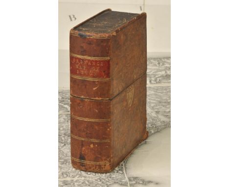
Devon. Untitled maps of Devon, published Ordnance Survey by Lt Col. Mudge, 1809, uncoloured engraved map on eight sheets, sectionalised and laid on linen, each sheet approximately 600 x 920 mm, contained in contemporary gilt calf book box with gilt crest of the Ordnance office to recto, worn and bumped at extremities and lacking base panel (1)
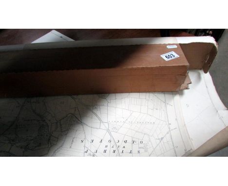
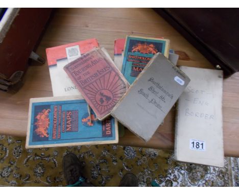
Lot 110
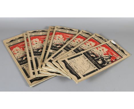
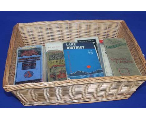
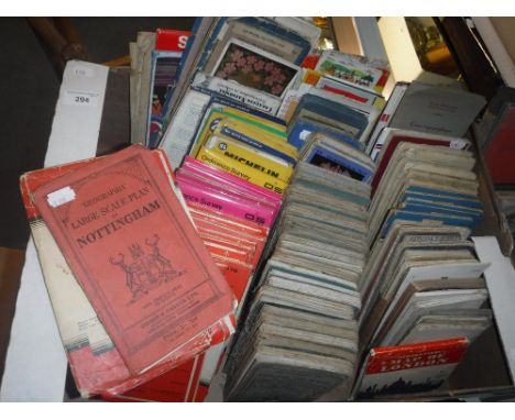
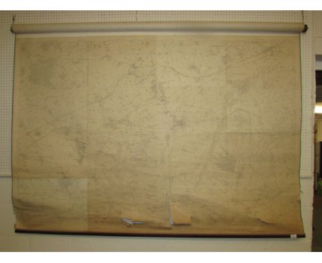
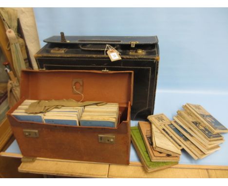
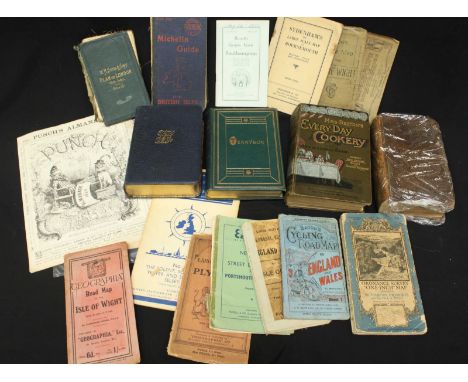
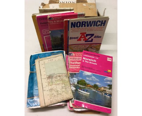
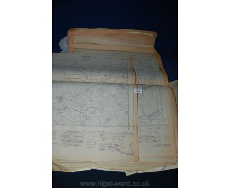
Folding maps. A mixed collection of approximately eighty-five folding maps, mostly 19th & 20th century, folding maps of countries, counties, town plans, cycling and rambling maps, railway and regional maps, including examples by Bartholomew, Wyld, Cruchley, Ordnance Survey, 'Geographia' Bacon and Blacks, various sizes and condition, together with seven early 20th century atlases, including examples by Woodward, Philips and Bartholomew, various sizes and condition (approx.92)
Lot 120
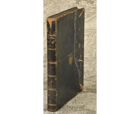
Hampshire. Untitled map of Hampshire, published by Ordnance Survey / Lt. Col. Mudge, 1810, three uncoloured engraved maps, sectionalised and laid on linen, each sheet approximately 635 x 945 mm, card chemise, contained in a contemporary gilt calf book box, worn and rubbed, together with another similar example of parts of Surrey and Sussex but appears to be lacking one sheet, contained in a matching book box, with another four sheets of Ordnance Survey maps of Hampshire, Surrey and Sussex, early 19th century, each sheet approximately 625 x 795 mm, some staining, contained in a morocco slip case, lacking lid, plus an Ordnance Survey map of central Wiltshire, dated 1817, toned overall, 635 x 775 mm, contained in contemporary morocco slip case with 'envelope style' lid, a little worn (4)
Lot 126
Kent. Faden (William, publisher), General Survey of England and Wales . An entirely new and accurate Survey of the County of Kent with part of the County of Essex, Done by the Surveying Draughtsmen of His Majesty's Board of Ordnance..., under the Direction of Capt. W. Mudge of the Royal Artillery F.R.S., 1801, large uncoloured map, engraved by Thomas Foot, sectionalised and laid on linen, 1185 x 1765 mm, publisher's label to rear of upper siding, contained in a contemporary morocco book box with the gilt arms of Ordnance Survey, scuffed and worn The first map published by Ordnance Survey. (1)
Lot 574
A Brass Pocket Barometer By L Casella, Maker to the Admiralty & Ordnance London. *The Barometer was given to James Conroy by Waldyve Wellington St. George in the early 1900's while stationed in the Curragh. James Conroy served as a surveyor in New Westminster British Colombia Canada. It was left in James Nolans pub in 1914 and over the years, because it was so accurate, the local farmers would cut the hay by its reading. "It was nothing to do with it being in a pub".

-
12130 item(s)/page