We found 12129 price guide item(s) matching your search
There are 12129 lots that match your search criteria. Subscribe now to get instant access to the full price guide service.
Click here to subscribe- List
- Grid
-
12129 item(s)/page


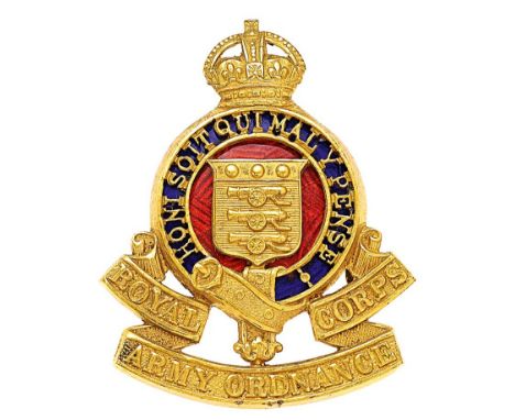
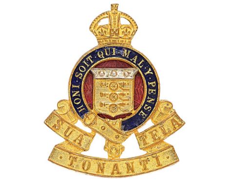
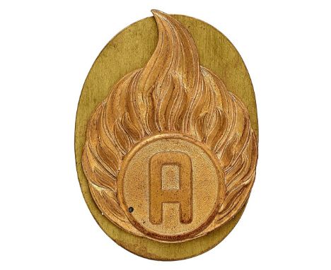
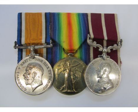
Lot 195
Royal Army Ordnance Corps Officer cap badge circa 1947-49. Fine die-stamped gilt crowned blue enamel backed pierced Garter resting on SUA TONANTI TELA scroll; silvered and gilt Board of Ordnance shield to red enamel centre. Reverse impressed P. J.R. Gaunt London . Loops . Minor service wear GC
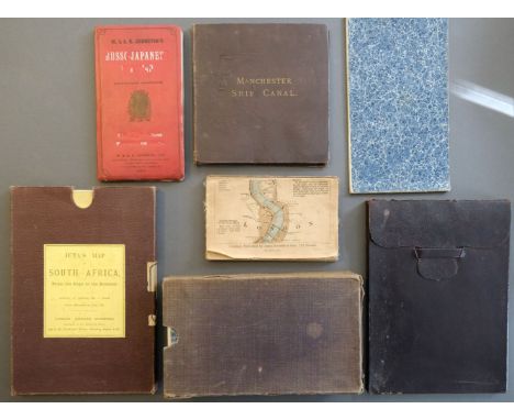
Lot 116
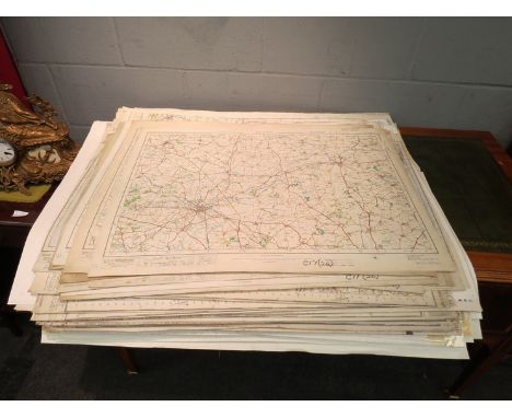
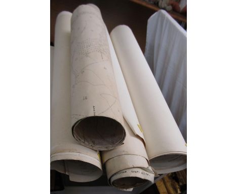
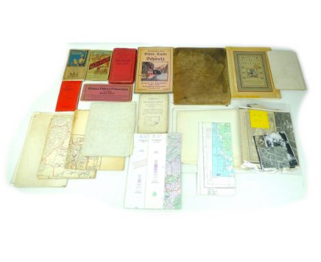
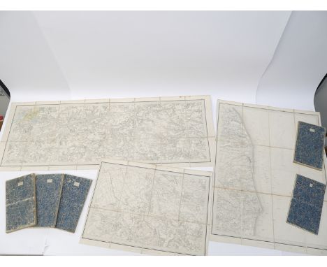
Folding Maps. Seven Folding Maps, late 19th & early 20th century, including, Juta (J. C.). Juta's Map of South Africa from the Cape to the Zambesi compiled from the best available Colonial and Imperial Information..., J. C. Juta & Co. Cape Town and Edward Stanford, London, 1903, large colour lithographic map, sectionalised and laid on linen, 900 x 1220 mm, contained in a contemporary cloth slipcase with printed title label to upper cover, together with Grosvenor (Gilbert, Editor). North America prepared especially for The National Geographic Magazine, Edward Stanford, circa 1930, colour photolithographic map, sectionalised and laid on linen, 970 x 690 mm, contained in contemporary diced calf slipcase with an 'envelope style' lid, with Canal Map. Manchester Ship Canal General Plan, Henry Blacklock & Co. Manchester, 1890, colour lithographic map, sectionalised and laid on linen, 455 x 910 mm, marbled endpapers, publisher's gilt cloth boards, plus Ordnance Survey. Four maps of parts of South -East England on a scale of 1 inch to the mile, circa 1825, four uncoloured engraved maps (part of Middlesex and Berkshire, part of Surrey, part of Sussex & part of Kent), numbered 7, 8, 9 & 6 respectively, each sectionalised and laid on linen, marbled endpapers, each approximately 635 x 950 mm, contained in a contemporary cloth slipcase, and Reynolds (James). The Oarsman's and Angler's Map of the River Thames from its Source to London Bridge, 1891, colour lithographic map, laid on linen and folded 'concertina' style', some staining, lacking rear board and spine, upper board stained, 2650 x145 mm, with 2 others similar and one early 20th-century map of China displayed on turned wooden battens, and another of a historical time chart of world history, the letter lacking its lower batten, both creased and stainedQty: (9)
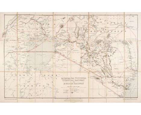
Lot 107
Africa. Stanford (Edward publisher). Mombasa-Victoria (Uganda) Railway and Busoga Railway, Printed by the Ordnance Survey office for the War Office, 1913, colour photolithographic map, sectionalised and laid on linen, 540 x 810 mm, bound in the publisher's cloth boards with printed label to upper cover, spine and boards fadedQty: (1)NOTESThe Uganda Railway was a metre-gauge railway system and former British state-owned railway company. The line linked the interiors of Uganda and Kenya with the Indian Ocean port of Mombasa in Kenya. The map is indicative of the period preceding WWI in the 'scramble for Africa' when various European powers struggled to grasp, maintain and exploit various parts of Africa.
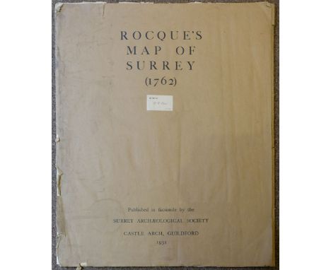
Lot 121
London. Cole (B.), A collection of 6 ward plans, circa 1760, engraved maps, 3 with later hand-colouring, 2 trimmed to plate mark and laid on later paper, various sizes and condition, together with Norden (John & Kip J.). Middlesex olima Trinobantibus habitat, circa 1610, hand-coloured engraved map, large strapwork cartouche and mileage scale, toned overall, some creasing, 280 x 340 mm, Ordnance Survey (Publishers). Three maps of parts of Middlesex, Wiltshire and Somerset on a 1 inch to the mile scale, 1809 - 22, three uncoloured engraved maps, slight marginal fraying, each approximately 630 x 930 mm, with facsimile maps of John Rocques Large Scale Map of Surrey (2 copies), Rocques Map of London and Westminster and Wenceslaus Hollar's Prospect of London and two others similar, various sizes, good condition, with Collins (Captain Greenville). Rye Harbour, circa 1790, uncoloured engraved sea chart, 445 x 290 mm, and Skelton (J. publisher). Skelton's Reduced Engraving of the Original Plan of Oxford, Taken by Ralph Agas in the Year 1578, Jany. 1st 1823, hand-coloured engraved city plan, old folds, slight mount staining, 335 x 485 mmQty: (16)
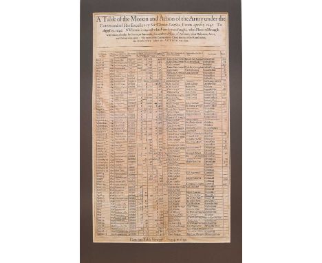
Lot 71
CIVIL WAR BROADSIDE. A Table of the Motion and Action of the Army Under the Command of his Excellency Sir Thomas Fairfax, from April 15 1645 to August 19 1646. Wherein is exprest what battels were fought, what places of strength were taken, whether by storm or surrender, the number of slain, of prisoners, what ordnance, arms and colours were taken: the name of the commander in chief, the day of the month when, the county where the action was done. 420mm x 265mm. Old repairs to verso. With a plate of the seals of England c1795 (2)
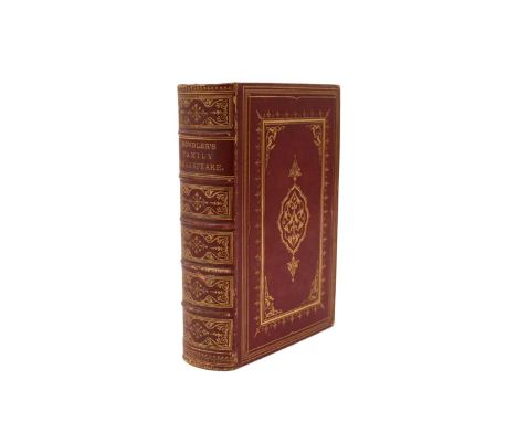
Lot 116
BOWDLER, Thomas. The Family Shakespeare, 1861. Full red morocco gilt, out of its covers. With RUSKIN, John, Roadside Songs of Tuscany, 4to, George Allen, Orpington, 1885. With 20 pasted-in plates. Black morocco gilt. With the Ordnance Survey map of Scotland, folio, 1924, on the scale of a quarter of an inch to the mile. With other books (box)
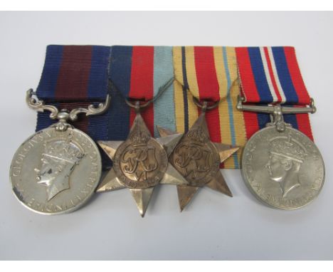
Lot 286
A Second World War I.D.S.M. group of four to Sepoy A.Rahim, Indian Army Ordnance Corps,Indian Distinguished Service Medal, G.VI.R., machine engraved (508170 Sepoy. Abdul Rahim. I.A.O.C.); 1939-1945 Star; Africa Star; War Medal. Lacquered good very fine. (4)Footnotes:I.D.S.M. London Gazette 19.6.1941.This Indian driver showed great personal courage on the 15th May 1941. During 'A' Company's attack north of the Customs House. Under heavy M.G., L.A. and Breda fire he drove his truck forward with Sgt. Rogerson to pick up two wounded men. The distance covered was about 800 yards and his truck was hit on several occasions. His action saved the lives of the two men who would have not have been evacuated any other way.4th Indian Div Ammunition Coy Attached to 1st Bn Durham Light Infantry.For further information on this lot please visit Bonhams.com
Lot 318
Three to Sergeant A.Crawford, Royal Army Ordnance Corps,British War and Victory Medal (016137 A.S.Sjt.A.Crawford A.O.C.); Army Meritorious Service Medal, G.V.R. (016137 Sjt:A.Crawford. R.A.O.C.). Lacquered, good very fine. (3)Footnotes:M.S.M. London Gazette 10.10.1919.Entitled to BWM and Victory Medal only.For further information on this lot please visit Bonhams.com
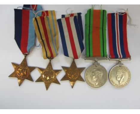
Lot 327
Five to Private P. D. Coppin, Royal Army Ordnance Corps,1939-1945 Star; Africa Star; France and Germany Star; Defence Medal; War Medal. Sold together with his Soldier's Release Book and Soldier's Service and Pay Book. With separate War Medal to his wife Private C.Coppin, Auxiliary Territorial Service, with her Soldier's Release Book and Soldier's Service and Pay Book. With further cloth insignia and a photograph album marked Souvenir of Egypt with photographs of his time in North Africa showing a number of images of trucks, transport etc. (Lot)Footnotes:Private P.D.Coppin enlisted into the Royal Army Pay Corps on the 1st November 1939 until 22nd December 1940. He then served in the Royal Army Ordnance Corps from 23rd December 1940 until 11th June 1946.For further information on this lot please visit Bonhams.com
Lot 658
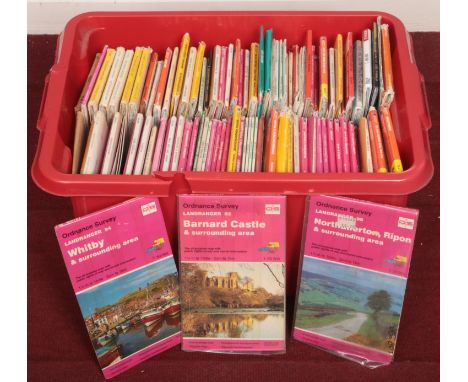
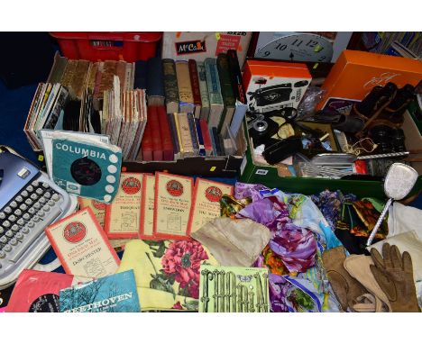
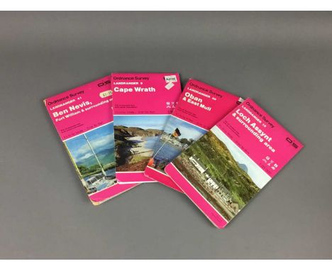
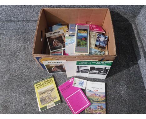
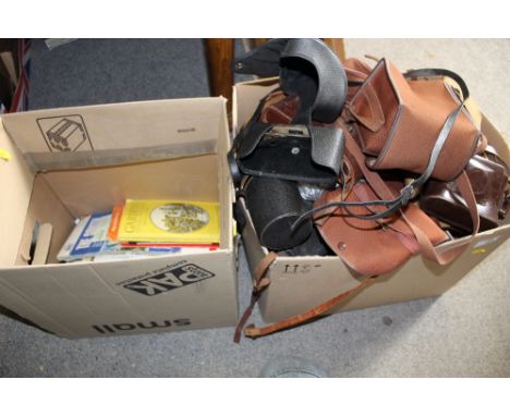
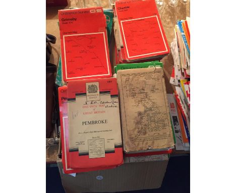
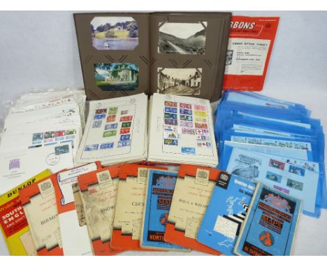
SUNDRY ITEMS, ETC, to include Canon 8x30 binoculars, Ensign Model 1 pocket camera, boxed AGFA 180 Rapid camera, box of knitting needles, vintage head scarves, quartz wall clock, amateur paintings, vintage books and Ordnance Survey maps, records to include 33rpm LPs mostly classical, 45rpm and 6inch children's records, Beaucourt typewriter, etc
Lot 673
Ordnance survey maps, Doncaster, Bolton, Liverpool, Northwich, Formby and Humber Estuary with Spurn point together with three unframed prints. W F Yeames, When did you last see your father? Pears print, Tempted but Shy and Wellingtons First Encounter with the French.Condition ReportYellowing paper, creases and tear to edges.
Lot 109
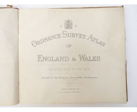
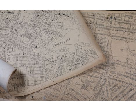
Ordnance Survey of Lancashire: a bound elephant folio of twenty 6 inch scale maps, Ordnance Office, Southampton, Lt. Col. Hall R.E., pub. 1848 and 1849, double pages backed on linen, page numbers 61, 69, 77, 78, 70, 62, 63, 71, 72, 64, 56, 73, 75, 57, 49, 48, 47, 55, 46, 54, the folio with leather spine and cloth boards, blank paper front and back (without index or other notation).
Lot 209
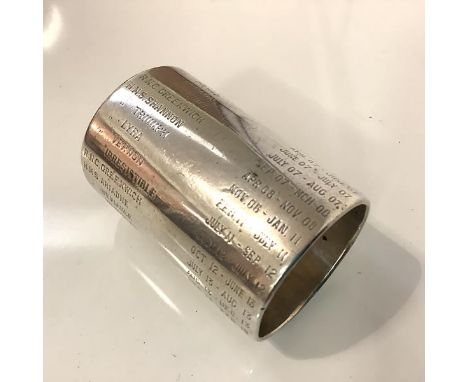
A large Royal Navy Service Record silver napkin ring, hallmarked for London 1900, with retailer's stamp, S. Lanyon, 4 Ordnance Row, Portsmouth, of double length, engraved with ships and dates of service commencing with H.M.S. Britannia 1902-3 and ending with H.M.S. Victory May-Oct. 1931, bearing date of 6th January 1933 at the end of the record. Length 6.25cm, 5 troy ounces
Lot 21
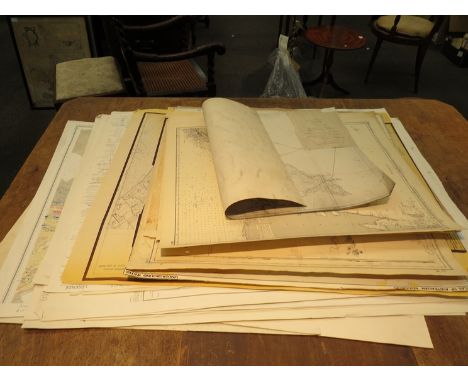
A collection of thirty five maps, including WWII Ordnance Survey military maps, 'Lighthouses, Fog Signals, Radio Beacons and Other Sea Marks 1965,' Bacon's map of the Isle of Wight for cyclists and tourists, in addition to maps of Colchester, Great Yarnmouth & Lowestoft, and London. (1 box)Provenance - From the Christopher Elliott collection
Lot 1479
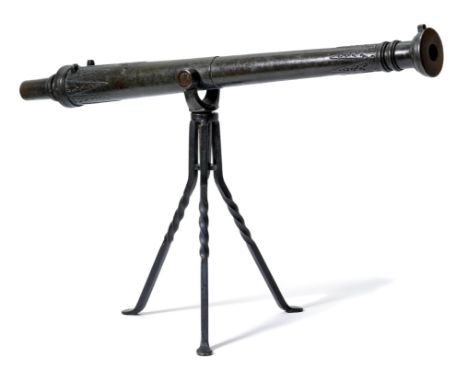
KANONENROHR "LANTAKA"Malaysisch, um 1800, Schiffs- und Festungsgeschütz.Bronzeguss, Mündungsbereich scheibenartig verbreitert mit Zierwulsten, Kaliber 30 mm, über der Mündung aufgesetztes Korn, doppeltes Halsband als Dekor, Schildzapfen mit fest montierter gegossener Tragvorrichtung und massivem Dorn. Beide Rohrenden mit identischem auf zugespitzten Dreiecken basierender Dekor. Zündloch, beidseitig Nocken für die fehlende Klappe, Stossbodenkante mit Zierringen, walzenförmige hohle Handhabe. Mit neuerem Eisenständer.L 97, 3 cm.In Anlehnung an spanische und portugiesische Schiffsgeschütze des 16. Jahrhunderts in Malaysia hergestelltes Geschützrohr in sehr gutem Zustand. Vgl. H.L. Blackmore: The Armouries of London. I Ordnance, London1976, S. 169-170, Nrn. 236, 237.
Lot 4301
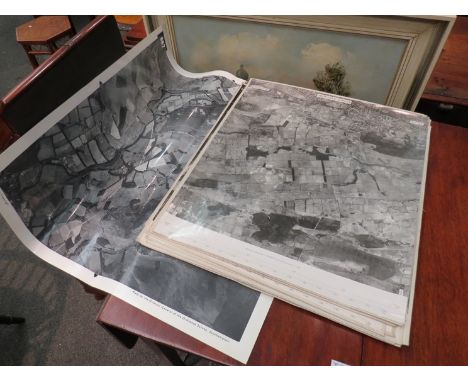
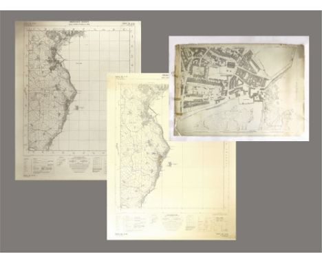
Ordnance Survey map of Norfolk, circa 1836-1838, eight separate engraved folding map sheets, each dissected and backed onto linen, each scale one inch to a mile, Ordnance Map Office, Colonel Colby, sheet numbers 50 (Diss, Eye & environs); 54 (Thetford, Bury St Edmunds, Ely & environs); 65 (Kings Lynn, Downham, Brandon, Wisbech, Littleport & environs); 66 (Norwich, Dereham, Watton, New Buckenham & environs); 67 (Yarmouth & environs); 68 (Wells, Fakenham, Cromer, Aylsham, Sea Palling & environs), 68 East Part (North Sea & Waxham); 69 (Burnhams, Hunstanton, The Wash, Lincolnshire & environs), all housed in battered original slipcase, Ordnance Survey printed title label
Lot 237
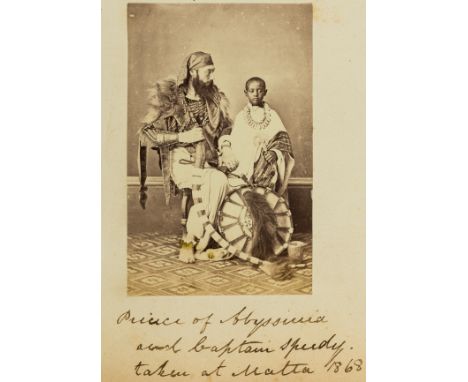
Malta & the exiled Prince of Abyssinia.- Alamayou (Prince of Abyssinia, son of King Tewodros, captive and exile after a British-Indian expedition to Abyssinia in 1868, 1861-79).- Raven (Newcome Richard, Commissary-General of Ordnance, 1830-1924) Album of photographs, albumen prints, including: Prince Almayou and Captain Speedy in Abyssinian dress, (portrait 93 x 60mm.), views of places and people in Malta, Pompeii, Gibraltar, Rome, Paris, Netley Abbey, Raven and his family, sculptures, portraits etc., c. 110 photographs, most laid down on 60pp., first f. loose, some album ff. with marginal tears, original blind-stamped cloth, gilt, rubbed and soiled, upper cover detached, joints and spines with tears, photographs v.s., v.d., 4to album, 1866-72.⁂ Photographs include: "Prince of Abyssinia and Captain Speedy taken at Malta 1868"; "Theatre Royal. Valletta Malta opened October 1866"; "La Porta Reale. Valletta. Malta"; "The Grand Harbour, Malta, & HMS Orlando"; "Porte des Bombes, Valletta, Malta"; "Strada Marsa-muscetto, Valletta": "Floriana Gardens Malta. Photographed by Lt. Maycock R.N."; "Royal Italian Opera. Valletta"; "The Roman Forum..."; "Corridor in Vatican"; "Ordnance Office Monkwood Hants"; "Le Tuileries, Paris, destroyed by the Communists in May 1871".Prince Alamayou was orphaned in 1868 after his father, Tewodros, Emperor of Abyssinia committed suicide after his defeat at Magdala by a British-Indian expedition commanded by General Sir Robert Napier. Captain Tristram Speedy (1836-1910), took the prince under his care and escorted him to Britain, stopping at Malta on the way. At Malta the captain had the prince photographed by Amadeo Preziosi, in European and native costume. After this, the boy was taken to England and was photographed by Julia Margaret Cameron. The boy was for some time in the care of Captain Speedy and his wife, but later was educated in England. He died of pleurisy in 1879. The Royal Collection has an 1883 copy of this photograph.
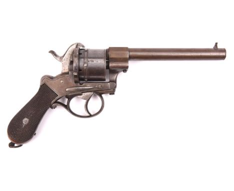
Lot 378
A Belgian 6 shot 12mm double action open frame military type pinfire revolver, round barrel 6”, B’ham proved, the cylinder stamped with Liege ordnance inspector’s mark for 1867 (crown over “EL” over “67”), with plain line engraved frame and cylinder, bag shaped butt with chequered walnut grips, and lanyard ring. GWO & C, the cylinder retaining some original blued finish (ejector rod missing) £250-300
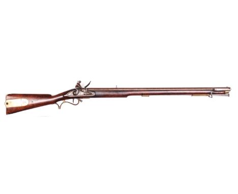
Lot 397
A very good .65” Enfield made late pattern Baker flintlock rifle, 45½” overall, twist barrel 30” with ordnance proofs, block rearsight, and bayonet bar at the muzzle; slightly rounded lock with swan neck cock, with double line border and marked with crown over “GR” and “Rl. My Enfield”; walnut fullstock with cheek piece and full length ramrod slot, the butt stamped with broad arrow over “BO” and number “204”; regulation brass mounts including rounded butt box plate; with original steel ramrod. Very Good Condition, the barrel retaining some original browned finish overall. £6000-8000.
Lot 593
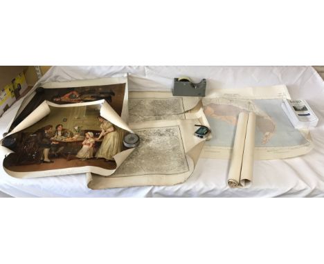
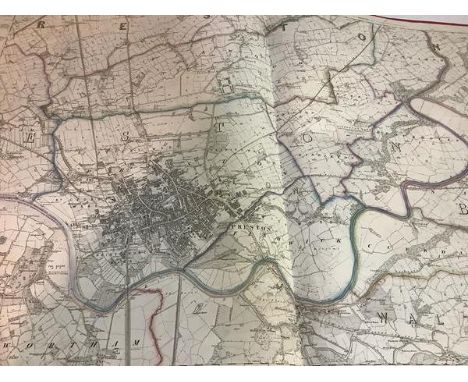
ORDNANCE SURVEY MAP. An Ordnance Survey Map of Trethosa Downs showing extensive mining activities. This map is the 1932 revision, printed at the Ordnance Survey Office, Southampton 1934. 101 x 68cm. Please note that all items in this auction are previously owned & are offered on behalf of private vendors. If detail on condition is required on any lot(s) PLEASE ASK FOR A CONDITION REPORT BEFORE BIDDING. The absence of a condition report does not imply the lot is perfect.WE CAN SHIP THIS LOT, but NOT if part of a large, multiple lots purchase
Lot 594
PENZANCE MAP ETC. An Ordnance Survey Map of Penzance Harbour & its surroundings, showing many buildings & numerous courts that have disappeared or been infilled. Surveyed in 1877. 107 x 71cm. Also, two copies of a 1931 map of Penzance Bay showing the coast from Marazion to Lamorna Cove. (one copy stained & torn) Please note that all items in this auction are previously owned & are offered on behalf of private vendors. If detail on condition is required on any lot(s) PLEASE ASK FOR A CONDITION REPORT BEFORE BIDDING. The absence of a condition report does not imply the lot is perfect.WE CAN SHIP THIS LOT, but NOT if part of a large, multiple lots purchase

Lot 595
ORDNANCE SURVEY MAPS. An Ordnance Survey map of the Truro area, Revision dated 1933. 57 x 42cm. Also, two other maps, one of Penzance dated 1982, the other of Truro & Falmouth dated 1984. Please note that all items in this auction are previously owned & are offered on behalf of private vendors. If detail on condition is required on any lot(s) PLEASE ASK FOR A CONDITION REPORT BEFORE BIDDING. The absence of a condition report does not imply the lot is perfect.WE CAN SHIP THIS LOT, but NOT if part of a large, multiple lots purchase

Lot 20
GEOLOGICAL & ORDNANCE SURVEY MAPS, including: Teall, JJH: Geological map of the British Isles 1912, 2nd. Edn. Folding linen backed coloured map (920 x 680 mm); Geological survey of England & Wales. Loughborough, 1932. Folding linen backed coloured map (1010 x 80 mm); PLUS 28 Others (QTY) Provenance: Leicester Museum Reference Library (Most of their books only have their bookplate and no stamps)
-
12129 item(s)/page