We found 12129 price guide item(s) matching your search
There are 12129 lots that match your search criteria. Subscribe now to get instant access to the full price guide service.
Click here to subscribe- List
- Grid
-
12129 item(s)/page

Lot 600
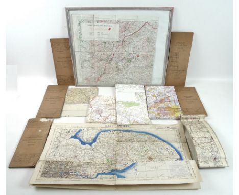
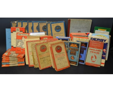
A group of vintage military maps including an Ordnance Survey map of Army Manoeuvres dated 1914 based around Ludlow, an Ordnance Survey map of East Anglia, Air Sheet 9, 2nd War Revision, three Royal Air Force Edition maps of Britain, comprising Sheet II, England, South, Sheet 4, The Border and Sheet 5, Scotland the Eastern Highlands, all marked in pencil to W. Osborne 236 Squadron and dated in pencil to 1940 and 1941, two further Royal Air Force Edition maps of Britain comprising Sheet 9, England Eastern Counties (S) and Sheet 7, Scotland North, a War Office Air Sheet 9 Map of East Anglia, a later Air Information map of the same, dated April 1952 and two post October 1987 United Kingdom Training Areas maps of Salisbury Plain. (12)Provenance: from the private collection of a local collector, who was collating items for a museum.
Lot 277
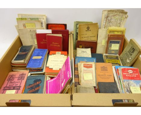
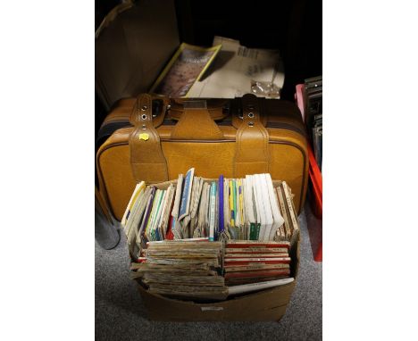
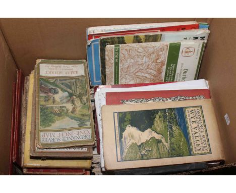
Baedecker's Switzerland, 1897, 17th edition and Sud-est De La France, 1901, 19th century and later folding maps, mainly Britain, some Ordnance Survey maps, The Motorist's Handbook and other ephemera in two boxes Condition Report Click here for further images, condition, auction times & delivery costs
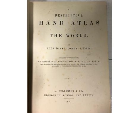
Lot 54
Atlases. EWING (T) General Atlas of Modern Geograpy 1868, 4to; LETTS'S Popular Atlas, c.1900, parts 1 to 9, folio, original wrappers; Century Atlas 1893; BARTHOLOMEW (J) Descriptive Hand Atlas, Fullarton 1871, folio; Survey Atlas, 1939; Ordnance Survey Atlas, 1922; Time Atlas 1896; also various colour reprint natural history illustrations; etc
Lot 368
A large collection of vintage folding maps to include Bartholomew's Map of England And Wales (31 sheets), Scotland (7 sheets), map of Central and East Africa, Tourist and Cyclists, HArrogate, Oban District, Orkney, Geological map of the British Islands, Wick, Ordnance Survey Thurso and Reay, London Transport Central Buses, Bacon's County map and guide Lincoln, Scarborough, Orkney Islands, Plymouth and Torquay etc., Rugby, Exmoor and many more. Also a larger folio of coloured paper maps.
Lot 5179
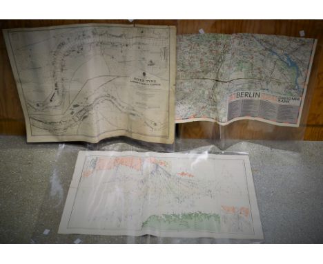
Cartography - Olympia 1936: Map of Berlin, a thirty-two fold chromolithographic map of the German capital, the front fold with the Olympic Rings and the Brandenburg Gate, the margins with guides and instructions for international visitors to the city and Olympiad, 82cm x 79cm overall; England _ East Coast: River Tyne, Jarrow Slake to Elswick, Soundings by Commander H.J. Gedge, R.N., Topography from the Ordnance Survey [...], large corrected edition, Published at the Admiralty, London 1948, 53.5cm x 70cm; others maps, British Grand Fleet in the Great War, Complete Chart of North Sea Movements 1914 - 1918 and Air Raid Map of the Metropolitan Are and Central London, [4]
![[MAPS]. ORDNANCE SURVEY Approximately ninety-eight Ordnance Survey 1:50,000 and Landranger folding maps, (some duplication;](https://cdn.globalauctionplatform.com/e8e2569d-0533-4b5a-b759-a9bb016ca457/97ba26f2-68bd-478a-b238-a9bd00f34c76/468x382.jpg)
![[MAPS]. ORDNANCE SURVEY Approximately ninety-two Ordnance Survey 1:50,000 and Landranger folding maps, (some duplication; tw](https://cdn.globalauctionplatform.com/e8e2569d-0533-4b5a-b759-a9bb016ca457/933a3b5d-1ff9-4d6b-a6d8-a9bd00f34ec9/468x382.jpg)
![[MAPS]. ORDNANCE SURVEY Approximately ninety-nine Ordnance Survey 1:50,000 and Landranger folding maps, (some duplication; t](https://cdn.globalauctionplatform.com/e8e2569d-0533-4b5a-b759-a9bb016ca457/df3fc022-74a1-4c64-bca6-a9bd00f34a2e/468x382.jpg)

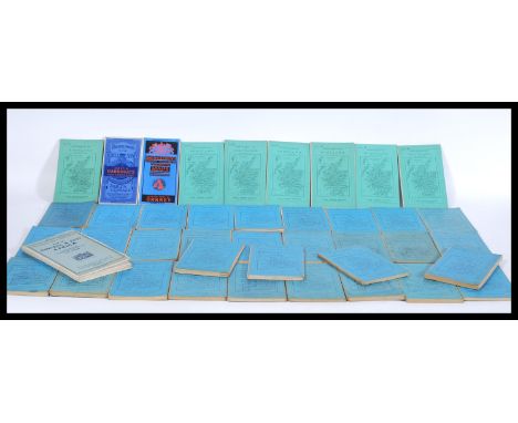
Lot 1120B
6 various engravings of maps of Lincolnshire from 18th/19th century - i) Robert Morden (coloured), ii) Reuben Ramble (coloured), iii) London to Boston road map by E.Bowen, iv) Road map featuring Kingston-upon-Hull, v) John Speed miniature map (coloured), vi) Thomas Molls - 17th century Lincs table of distances by Simons/Jenner and late 19th century ordnance survey map of Norwich and Wymondham.
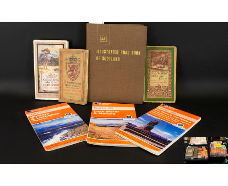
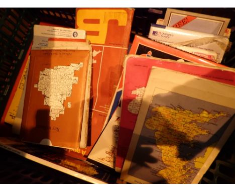
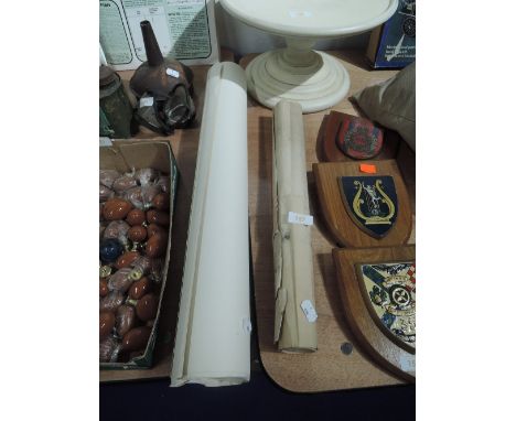
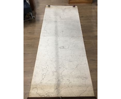
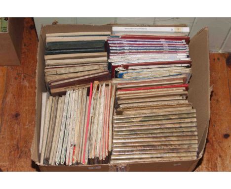
Lot 1434
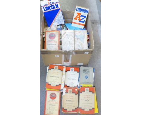
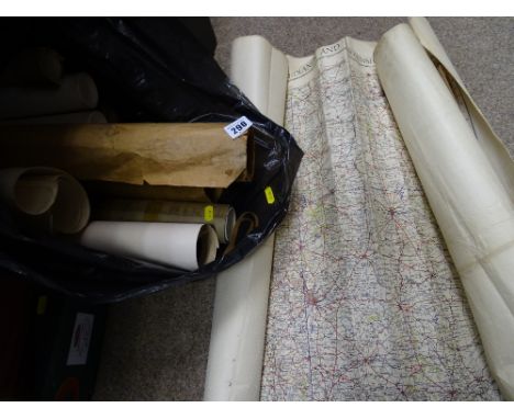
A Large Quantity Of Ordnance Survey Maps Three boxes, approx 277 in total, dating from the early 20th century, through to 1960's/70's. Various Scottish and Highland interest to include 1905 Oban And Killin with illustrated cover, 1927 Grampian Mountains And Blair Atholl with buff card cover and 1936 Cain Gorms with colour illustrated cover. Together with The AA Illustrated Road Book Of Scotland 1971, in good condition. Please see accompanying image

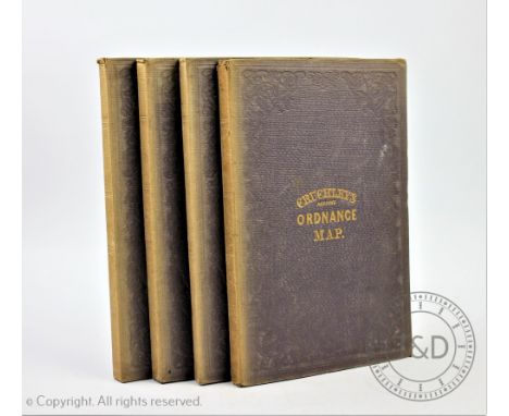
Lot 408
CRUCHLEYS REDUCED ORDNANCE MAP OF ENGLAND AND WALES, four large folding linen backed maps comprising Shropshire and surrounding counties(30, 31, 36, 37,), another centred around Huntingdonshire (32, 33, 38, 39), one entered round London (19, 20, 26, 27) and a map centred around Bristol (17, 18, 24, 25)
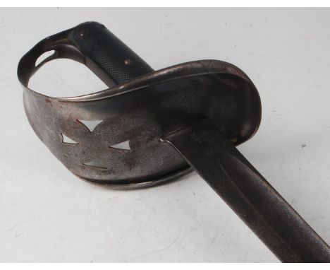
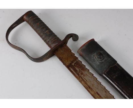
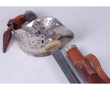
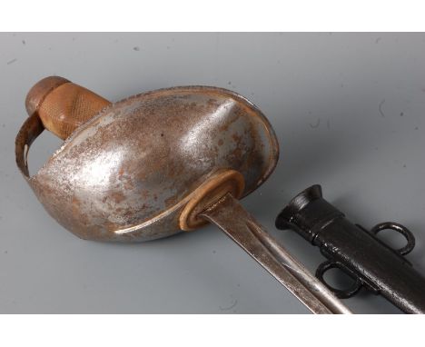
Lot 159
A British 1885 pattern Cavalry Trooper's sword, the 87.5cm slightly curved fullered blade stamped to the forte Weyersberg Kirschbaum & Co, Solingen (worn) with War Department and various ordnance marks to the opposing side, having a steel bowl hilt with pierced Maltese Cross and chequered two piece grip, 102cm.

Lot 253
A Geo. VI. 1897 pattern Royal Army Ordnance Corps Officer's sword, the 83cm single edged fullered blade etched with a crowned GR VI cypher and foliage, having a typical pierced steel hilt with further cypher, chequered backstrap and wire bound fishskin grip, housed in a leather covered steel scabbard with Sam Browne belt and leather outer cover, 102cm.
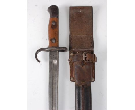
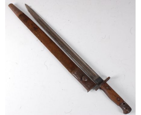
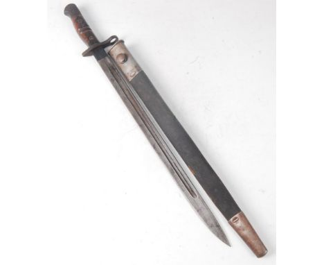
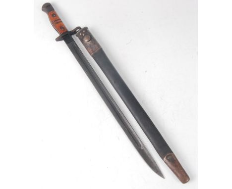
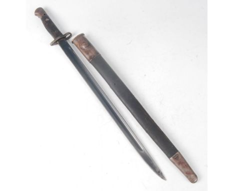
Lot 28
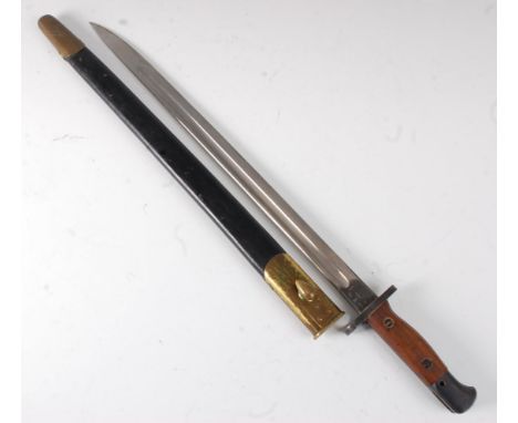
A British 1907 pattern bayonet, the 43cm single edged fullered blade stamped to the ricasso with a crowned ER cypher 1907 JAC with various ordnance marks to the opposing side, having a hooked quillon and two piece grip, stamped to the pommel 3 GOP 209, housed in a leather covered scabbard with an Australian brown leather frog, 56cm.
Lot 450
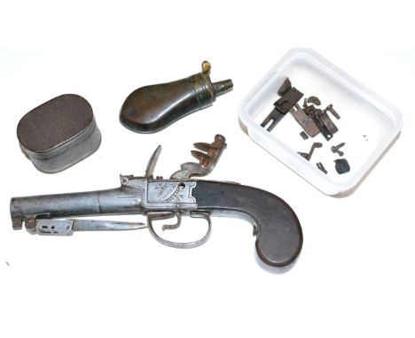
An 18th Century Flintlock Greatcoat Pistol by Jover, London, the 6cm round steel barrel with Board of Ordnance marks, the underside set with a sprung bayonet, signed foliate engraved box lock, the trigger guard sliding back to release the bayonet, with walnut slab butt, 20cm, 26.5cm including bayonet (af), together with some loose parts, a tin and a copper pistol flask (4). Action does not work. Spring for bayonet missing. Poor condition.
Lot 188
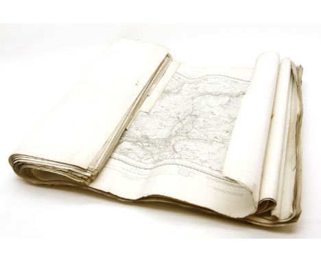
Folding maps. A collection of thirteen maps, 19th & early 20th century, including Betts (John), Betts's new Map of India, Birmah, The Punjab and parts of Afganistan, circa 1860, engraved map with contemporary outline colouring, sectionalised and laid on linen, 750 x 640 mm, cloth endpapers, contained in publisher's cloth slipcase with printed label to upper board, together with Hall (Sidney), Surrey [and] Sussex, published Chapman & Hall, circa 1850, two engraved maps with contemporary outline colouring, sectionalised and laid on linen, bound in publisher's cloth gilt boards, with Ordnance Survey,, Five maps, published Edward Stanford, [1830 or later], five engraved maps (of the environs of Bath, Basingstoke & Hungerford, Salisbury, Shaftesbury and Yeovil), each sectionalised and laid on paper, each with contemporary outline colouring, each approximately 625 x 720 mm, marbled endpapers and each contained in publisher's cloth slipcase with printed label to upper board with added manuscript title, plus four early 20th century Ordnance Survey maps of Gloucestershire and one other similar, various sizes and condition (13)
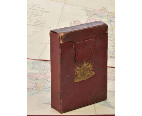
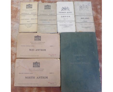
Lot 202
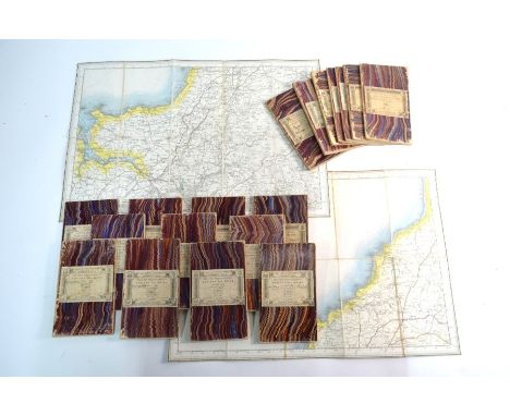
Ireland. Ordnance Survey (publishers), Index to the Townland Survey of the County of Louth and the County of the Town of Drogheda, Index to the Townland Survey of the County of Cavan, Index to the Townland Survey of the County of Donegal, Index to the Townland Survey of the county of Monaghan [and] Index to the Townland Survey of the County of Armagh, 1836, together five engraved maps with contemporary hand colouring, sectionalised and laid on linen, each map with a table of explanation and a table of areas, very slight dust soiling and spotting, each edged in red silk, each 620 x 970 mm, with canvas chemise, the whole contained in a contemporary red diced calf slipcase with 'envelope style' lid, gilt decorated spine and with the gilt crest of the Ordnance Survey to upper cover, spine faded, worn and frayed at extremities (5)
Lot 210
Maps. A mixed collection of approximately seventy-five maps and charts, 17th - 19th century engraved maps, charts and town plans, including examples by Morden, Lewis, Speed, Fullarton Ordnance Survey, Hermannides, Cary, Owen & Bowen, Pigot, Seller/Grose, Bowen and Blaeu, various sizes and condition (approx.75)
-
12129 item(s)/page