We found 12130 price guide item(s) matching your search
There are 12130 lots that match your search criteria. Subscribe now to get instant access to the full price guide service.
Click here to subscribe- List
- Grid
-
12130 item(s)/page

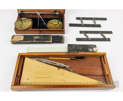
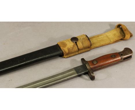
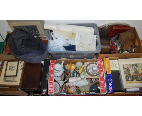
Lot 732
A WWI German ersatz bayonet, unfullered blade 12” with ordnance mark on back edge, the black painted all steel hilt with parallel sides and short crosspiece with part muzzle ring and vestigial quillon, in its silver painted steel scabbard with leather frog. GC (some wear). Almost identical to figure 337 in “The Bayonet Book” by Watts and White.

Lot 96
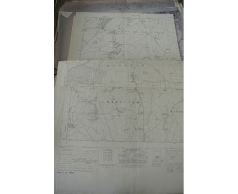
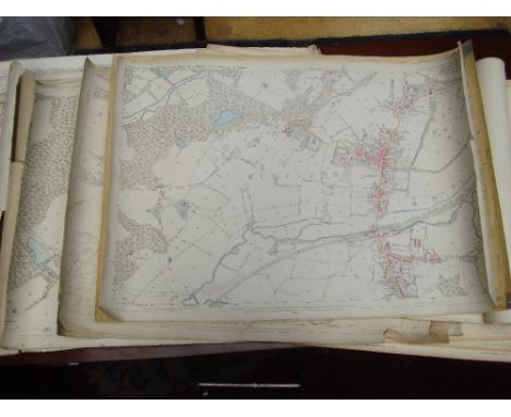
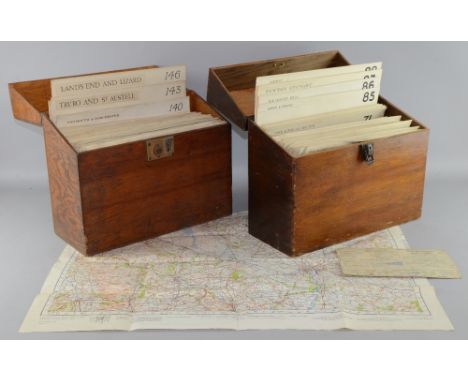
GNR tenancy agreement and maps for land at Hadley Wood station. 6 inch Ordnance map re GC and mid Joint Line Rotherham to Shereoaks railway, bound linen map 58 Survey of "Liverpool Street", Large linen bound map Post War Development Peterborough. Linen map diagram of MGN and GE Rly with New committees Lines Norfolk/Suffolk January 1904, etc
Lot 348A
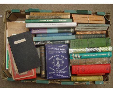
Topography, Kent and Sussex to include Pikes Blue Book for Tunbridge Wells, 1895- 6, New Naturalist Series, S. W. Wooldridge & Frederick Goldring, The Weald, 1972 d.w, sundry guide books etc together with a selection of linen backed maps and other Ordnance Survey maps relating to the South East etc.
Lot 220
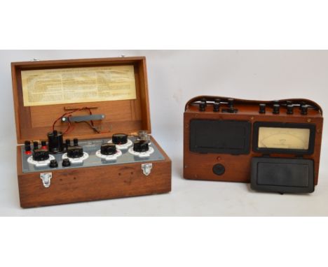
A combined volt meter and watt meter in a wooden case, the dial marked "Evershed & Vignoles Ltd No 385070" and with military ordnance mark, width 37cm, and a wooden cased "Cambridge Decade Bridge Type 43379" resistance measure, with built in galvanometer, stamped "Cambridge Instrument Co Ltd England No L-429945", width of case 39cm (2).
![[MAPS]. SOMERSET Approximately forty-one Ordnance Survey 1/2500 scale single-sheet maps, various editions, most circa 1903-31](https://cdn.globalauctionplatform.com/228f2232-b04e-400e-9d69-a4e200ceea53/c239e4cf-9f20-47cd-d46e-7779b2960d17/468x382.jpg)
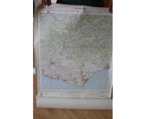
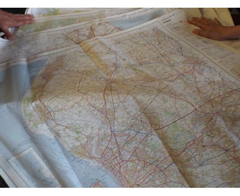
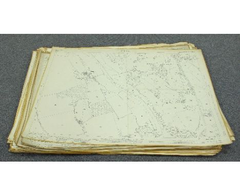
Lot 319
[MAPS]. SOMERSET Approximately forty-one Ordnance Survey 1/2500 scale single-sheet maps, various editions, most circa 1903-31, including those of Axbridge, Rowberrow, Blagdon, Shipham, Stowey, Clutton, Temple Cloud, Radstock and Foxcote interest, various sizes (some later copies; some with peripheral wear and / or annotations and amendments).
![[MAPS]. SOMERSET Approximately ninety-six Ordnance Survey 1/2500 scale single-sheet maps, various editions, most circa 1903-3](https://cdn.globalauctionplatform.com/228f2232-b04e-400e-9d69-a4e200ceea53/608a9818-3f17-49cd-8bd6-7cb3ec0cc717/468x382.jpg)
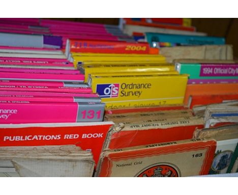
Lot 320
[MAPS]. SOMERSET Approximately ninety-six Ordnance Survey 1/2500 scale single-sheet maps, various editions, most circa 1903-36, including those of Beckington, Frome, Minehead, Watchet, West Quantoxhead, Dunster and Highbridge interest, various sizes (some later copies; some with peripheral wear and / or annotations and amendments).
![[MAPS]. SOMERSET Approximately ninety-five Ordnance Survey 1/2500 scale single-sheet maps, various editions, most circa 1903-](https://cdn.globalauctionplatform.com/228f2232-b04e-400e-9d69-a4e200ceea53/a162afdc-2576-4a74-904e-132c3e2139c1/468x382.jpg)
Lot 321
[MAPS]. SOMERSET Approximately ninety-five Ordnance Survey 1/2500 scale single-sheet maps, various editions, most circa 1903-30, including those of Ilchester, Podimore, West Camel, Queen Camel, Compton Pauncefoot, North Cheriton and Charlton Horethorne interest, various sizes (some later copies; some with peripheral wear and / or annotations and amendments).
![[MAPS]. SOMERSET Approximately ninety Ordnance Survey 1/2500 scale single-sheet maps, various editions, most circa 1903-04, i](https://cdn.globalauctionplatform.com/228f2232-b04e-400e-9d69-a4e200ceea53/02b06d5b-2aa8-4329-c425-35cccefa320f/468x382.jpg)
Lot 322
[MAPS]. SOMERSET Approximately ninety Ordnance Survey 1/2500 scale single-sheet maps, various editions, most circa 1903-04, including those of Mark, Wedmore, Panborough, Wookey, Wells, Shepton Mallet and Leigh upon Mendip interest, various sizes (some later copies; some with peripheral wear and / or annotations and amendments).
![[MAPS]. SOMERSET Approximately eighty-two Ordnance Survey 1/2500 scale single-sheet maps, various editions, most circa 1903-3](https://cdn.globalauctionplatform.com/228f2232-b04e-400e-9d69-a4e200ceea53/3696cd4c-8055-4783-9bcb-82879237d4bd/468x382.jpg)
Lot 323
[MAPS]. SOMERSET Approximately eighty-two Ordnance Survey 1/2500 scale single-sheet maps, various editions, most circa 1903-30, including those of Lympsham, Burnham-on-Sea, Brent Knoll, East Brent, Cheddar, Draycott and Chilcompton interest, various sizes (some later copies; some with peripheral wear and / or annotations and amendments).
![[MAPS]. SOMERSET Approximately 108 Ordnance Survey 1/2500 scale single-sheet maps, various editions, most circa 1903-04, incl](https://cdn.globalauctionplatform.com/228f2232-b04e-400e-9d69-a4e200ceea53/79cebe1d-7316-46a0-8cbe-4acf46b8dc8d/468x382.jpg)
Lot 324
[MAPS]. SOMERSET Approximately 108 Ordnance Survey 1/2500 scale single-sheet maps, various editions, most circa 1903-04, including those of Curry Mallet, Isle Abbots, Hambridge, Shepton Beauchamp, South Petherton, Tintinhull, Montacute and Broadway interest, various sizes (some later copies; some with peripheral wear and / or annotations and amendments).
![[MAPS]. SOMERSET Approximately ninety-two Ordnance Survey 1/2500 scale single-sheet maps, various editions, most circa 1903-3](https://cdn.globalauctionplatform.com/228f2232-b04e-400e-9d69-a4e200ceea53/fa1c1196-3c28-44c6-fa9f-6d427e562ad2/468x382.jpg)
Lot 325
[MAPS]. SOMERSET Approximately ninety-two Ordnance Survey 1/2500 scale single-sheet maps, various editions, most circa 1903-30, including those of East Anstey, Brushford, Chipstable, Wiveliscombe, Halse, Prston Bowyer, Langford Budville, Cheddon Fitzpaine, Norton Fitzwarren, Taunton, Bathpool and Langport interest, various sizes (some later copies; some with peripheral wear and / or annotations and amendments).
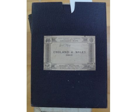
Lot 320
CANAL MAPS: SHAWE (W.): 'Philips' New Map of England & Wales. Compiled from the Ordnance Survey Showing Canals, Navigable Rivers, Principal Railway Lines..'; London & Liverpool, George Philip & Son, circa 1900, folding colour litho map, printed on paper and laid onto linen, dissected into forty sections and contained in orig. pub. purple cloth slip case, with printed label to one side; together with eighteen others, British and European folding canal maps, mostly later 19th/early 20th century. (19)
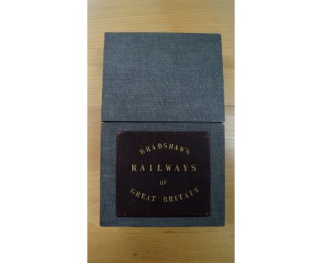
Lot 345
RAILWAY MAP: BRADSHAW (George): 'Bradshaw's Map of the Railways, Canals, Navigable Rivers & Mineral Districts of Great Britain, Reduced from the Ordnance Survey, Shewing All the Railway Junctions, Stations & c., also the Lines on which the Electric Telegraph is Laid Down..'; London, W. J. Adams, n.d. (circa 1860), folding engraved map hand-coloured in outline, printed onto paper and laid down on linen, two sheets dissected into forty two sections and measuring approx. 1660 x 980mm, contained in modern grey cloth-covered case preserving the original gilt titled burgundy morocco panel to one side, some light browning and offsetting to the map, otherwise good. (1) Condition Report: map very good, light toning and a few minor marks, a few smudges to reverse, case scuffed.
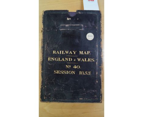
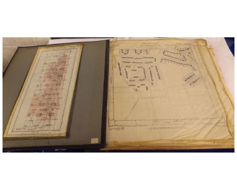
Lot 346
RAILWAY MAP: SIMMONS (J.L.A., Captain): 'Map of England and Wales, Shewing the Railways, Canals & Inland Navigation, Compiled from the Ordnance Surveys and Other Sources. For the Use of the Lords of the Committee of Privy Council for Trade & c...'; large folding engraved map in forty eight sections, hand-coloured in outline, printed on paper and laid onto linen, contained in original black morocco slip case, gilt lettered to spine and one face, the case rubbed and scuffed and lacking the lid, map in VG plus condition with a few minor spots and marks. (1)
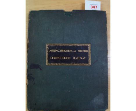
Lot 347
DORKING, BRIGHTON & ARUNDEL ATMOSPHERIC RAILWAY: A large folding twenty four sheet map from the Ordnance Survey printed by Ramshaw circa 1845-50, showing proposed route of the railway added by hand in red and blue ink. Large steel engraved map measuring approx. 1850 x 950mm, folding down into period green cloth slip case with burgundy morocco gilt label to one side titled 'Dorking, Brighton & Arundel Atmospheric Railway..', slip case scuffed and frayed with a few ink splats, some foxing and browning to map but condition otherwise generally sound. (1)
Lot 674
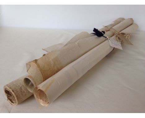
MAPS: Three large cartons of maps, largely later folding Ordnance Survey Maps but to include two sheets (of four) from a large format Stanford's Library Map of London & Suburbs; and some other earlier material; to also include a large framed sea chart of the approaches to the River Clyde. (Quantity: three cartons)
Lot 456
AT COVENTRY 1920/21 Rare large 4-page issue dated 14 May 1921 (no.51), Coventry Nursing Cup Final, Ordnance v Armstrong-Siddely. Most of the programme covers Coventry's season in Div II with results, tables etc. The previous season Coventry had entered the League, and in season 20/21 finished 2nd from bottom. Minor repairs to tears, ageing marks. Fair/Generally good
Lot 73
BROMLEY FC Collection of 36 home programmes, 1932-33 v Callender Athletic (FA Cup), 4 x 47/8, 3 x 48/9, 3 x 49/50, 5 x 50/51 (inc v St Austell) , 8 x 51/2 inc Possibles v Probables and Kent Cup v Gravesend, 3 x 52/3, 3 x 53/4 inc Kent Cup v Royal Ordnance Factories, 2 x 54/5 , 3 x 55/6 inc v Flushing (Holland) -punch-holes), 1 x 58/9 and 1 x 59/60. Also included is an away issue at Dulwich v Hayes (London Senior Cup Semi-Final, 9/4/49). Condition does vary, some have punch-holes, there is some creasing, wear, tears , occasional writing etc, some are "Fair", some "Fair-Generally good" and a few are "Generally good". Also included is a 1937-38 photo fixture card, one side having head and shoulders photographs of the Bromley team, the other side listing the fixtures for 1937-38 (postcard sized). As described

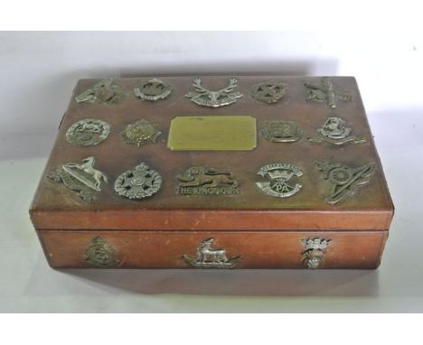
Lot 547
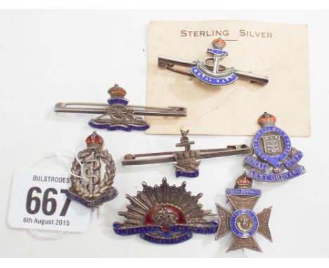
A tan leather clad chest of shallow rectangular form with central brass plaque to top reading - Fourth Division 1917, decorated with twenty applied military badges, examples to include The Kings Own, West Yorkshire Regiment, The Lancashire Fusiliers, East Lancashire, Army Ordnance Corps and The Royal Army Medical Corps, 8cm tall x 31 cm long approx.
-
12130 item(s)/page