We found 12129 price guide item(s) matching your search
There are 12129 lots that match your search criteria. Subscribe now to get instant access to the full price guide service.
Click here to subscribe- List
- Grid
-
12129 item(s)/page

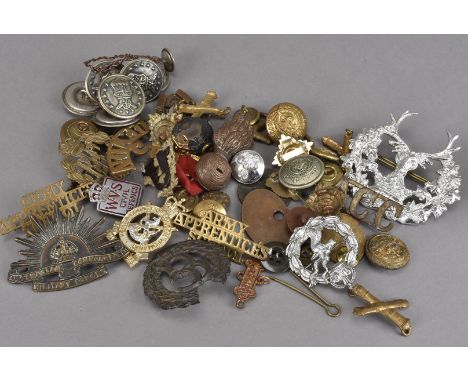
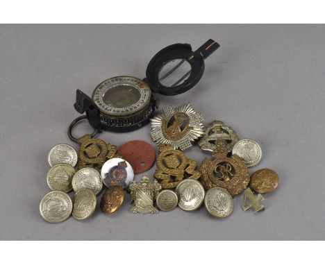
Lot 154
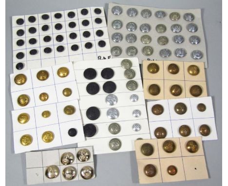
Various military and police buttons, to include silvered Staffordshire Constabulary repeat buttons, other similar, Lancashire, two sized Royal Army Ordnance buttons, St Johns buttons, RAF small black examples, other part sets, sets of six military buttons, etc, Royal Corps of signals, etc. (a quantity)
Lot 221
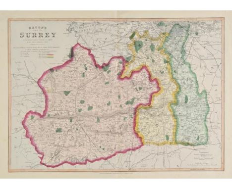
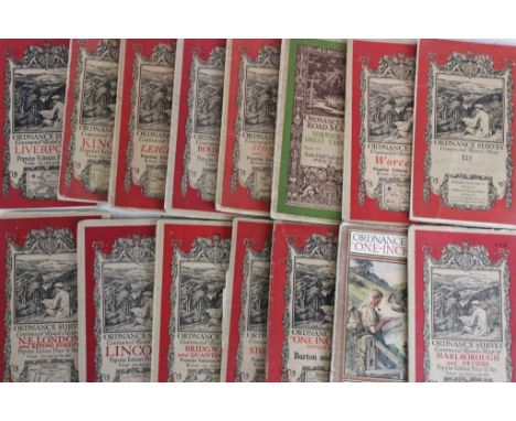
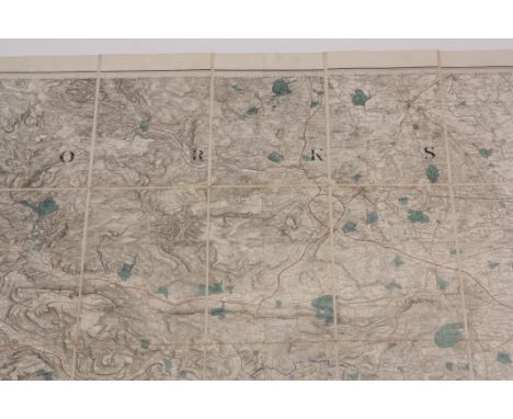
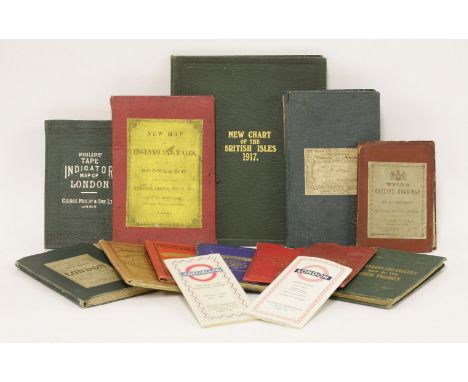
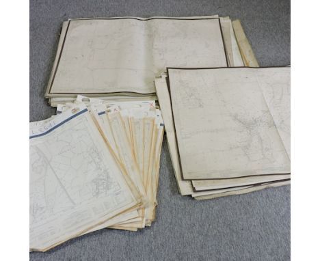
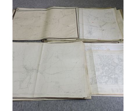
Surrey. A collection of thirty-nine maps, mostly 19th century, engraved and lithographic maps, including examples by Kelly, Harrison, Stockdale, Philip & Son, Murray, Davies, J & C Walker, Collins, Bacon, Van Voorst, Cruchley, Ordnance Survey, Cary and Smith, some duplicates, various sizes but mostly large format, various condition (39)
Lot 191
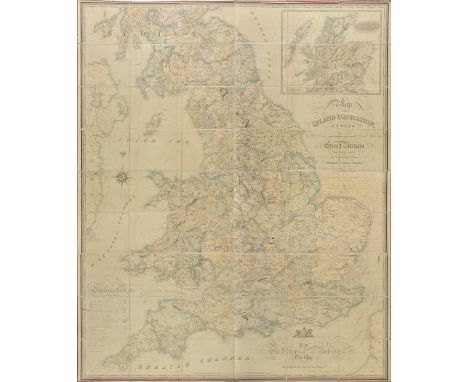
British Isles. Walker (John), Map of the Inland Navigation, Canals, and Rail Roads with the Situations of the various Mineral Productions throughout Great Britain, from actual surveys projected on the basis of the trigonometrical Survey made by order of The Honourable The Board of Ordnance..., published Richard Nichols, Wakefield, January 1st, 1830, very large engraved map with contemporary hand colouring, sectionalised and laid on linen, large calligraphic title and dedication, compass rose and table of explanation, inset map of Scotland, slight overall toning, marbled endpapers, 1920 x 1560 mm, contained in a contemporary calf book box, worn and rubbed Published and intended to accompany Joseph Priestleys "Historical Account of the Navigable Rivers, Canals, and Railways, of Great Britain", The map contains and wealth of detail bringing together many aspects of the Industrial revolution, namely the mining industry and the canal and railway networks. (1)
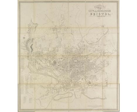
Lot 186
Bristol Ashmead (G.C.), Ashmead's Map of the City and Borough of Bristol, Reduced from the Original Survey and Corrected to 1855, published G. C. Ashmead, Bristol and E. Mardon, Clifton, 1855, uncoloured engraved map, sectionalised and laid on linen, 935 x 855 mm, contained in a contemporary cloth slipcase with manuscript label to upper board, faded along spines, together with Shiercliff (E.), The Bristol & Hotwell Guide..., fourth edition, published Bristol, circa 1810, frontispiece of a folding engraved plan of Bristol, three engraved plates, including one with contemporary hand colouring, later endpapers, uncut, re-backed but retaining original printed boards, worn and scuffed, 8vo, with Evans (Rev. John), The Picture of Bristol or a guide to objects of curiosity and interest in Bristol, Clifton, The Hotwells and their vicinity..., published Bristol, 1814, frontispiece of a folding engraved plan of Bristol, three folding engraved plates, bookplate of B. M. H. Rogers, contemporary half calf, worn at extremities, 8vo, plus three other similar bound guides to Bristol, together with Ordnance Survey, (publisher), Untitled map of Bristol, 1887, engraved plan of Bristol, sparse hand colouring, sectionalised and laid on linen, 675 x 960 mm, marbled endpapers, plus Herapath (W.), The Hand Book for Visitors to the Bristol & Clifton Hotwells (Illustrated by Plates) containing a chemical analysis of the Spa, published Bristol, Clifton and Weston-Super-Mare, circa 1860, frontispiece of a folding engraved geological cross-section with contemporary hand colouring, two engraved plates, advertisements bound at rear, publisher's blue cloth with gilt title to upper board, slight wear to extremities, slim 8vo, with four loose 19th maps of Bristol and its environs, various sizes and condition (12)
Lot 200
Folding maps. Smith (Charles), A New Map of the County of Berks divided into Hundreds, 1801, A New Map of the County of Cambridge divided into Hundreds, 1801 [and] A New Map of the County of Buckingham divided into Hundreds, 1804, together three county maps with contemporary hand colouring, each sectionalised and laid on linen and edged with blue silk, each approximately 515 x 455 mm, together with Cary (John), A New Map of Dorsetshire divided into its hundreds and liberties exhibiting its roads, rivers, parks &c., 1818, engraved map with contemporary hand colouring, sectionalised and laid on linen, slight spotting, marbled endpapers, 485 x 540 mm, with another fourteen late 19th and early 20th century folding Ordnance Survey maps of parts of London, Surrey, Sussex and South east England, various sizes and condition, plus Stanford (Edward, publisher), A New Map of Metropolitan Railways, Tramways & Miscellaneous Improvements, 1904, colour lithographic map, sectionalised and laid on linen, 680 x 1040 mm, contemporary cloth boards with publisher's printed label to upper siding, a little frayed on spine (18)
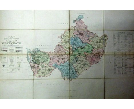
Lot 790
Ordnance Survey: County of Meath - Index Map to the Townland Survey, together with Sheets No's 14, 16, 22 & 23, together 5 lg. fold. linen backed maps, all hand coloured c. 1839, in orig. gilt decor. calf box; also Index Map to the Townland Survey of County Westmeath, c. 1838, lg. linen backed map, cont. hand colouring, slip case. As maps, w.a.f. (6)
Lot 789
Ordnance Survey of Ireland: Province of Connaught with Index Maps to the Townland Surveys of County Leitrim & Sligo, and also Index Map to Londonderry, 3 lg. folding linen backed maps, all hand coloured, London c. 1833 & 1838, in leather & cloth cases. As maps, w.a.f. Pierce Mahony's Copy. (3)

Lot 419
Box: Irish Literary interest: Heaney (S.) Death of a Naturalist, L. 1966 First; The Haw Lantern, L. 1987, First, and Hailstones, D. 1984, First, others by Brendan Kennelly, Paul Durcan etc; The Whoseday Book, 4to D. 1999. Lim. Edn.; Best (R.I.) Bibliography of Irish Philology, Printed & Manuscript Literature, 2 vols. roy 8vo D. 1913 & 1942, buckram; Healy (J.) Nineteen Acres, Galway 1978, First,; Macgill (P.) Children of The Dead End, n.d., cloth; O'Criomhthain (T.) An t Oileanach, D. 1929, illus.; Mac Liammhoir (M.) La agus Oidche, D. 1929, pict. d.w.; & many others, includ coll. of folding Ordnance Survey maps etc., over 50 items good lot. As a box, w.a.f. (1)

Lot 708
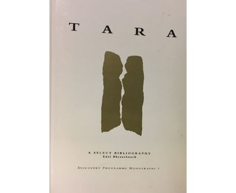
Co. Meath: Ordnance Survey Letters, 4to D. 2001, hf. mor.; Simington (R.C.) The Civil Survey - Co. Meath Vol. V., 4to D. 1940; MacAlister (R.A.S.) Tara A Pagan Sanctuary of Ancient Ireland, L. 1931; Bhreathnach (Edel)ed. The Kingship and Landscape of Tara, 4to D. 2005; Scott (B.) Religion and Reformation in the Tudor Diocese of Meath, D. 2006; Hickey (Eliz.) I Send My Love along the Boyne, 8vo Drogheda 2000, Reprint, Signed by Author, Good. (6) N.B. ONLY 6 ITEMS IN THIS LOT ( NOT 7 AS PER CATALOGUE )
Lot 689
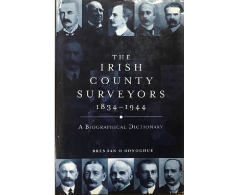
Surveying in Ireland: Andrews (J.H.) Plantation Acres, 1985, also Shapes in Ireland, D. 1997, First Edn.; O'Donoghue (B.) The Irish County Surveyors 1834 - 1944, A Biographical Dictionary, D. 2002; Duffy (P.J.) & Nolan (Wm.) At the Anvil - Essays in Honour of William J. Smyth, D. 2012; 2 others sim. on Ordnance Survey. (6)
Lot 788
Ordnance Survey of Ireland: Province of Leinster, with Index Maps to the townland surveys of County Westmeath, Meath, Longford and Louth, together 4 lg. fold. maps, linen backed, London c. 1838, with contemporary full hand colouring, in cont. leather container with gilt armorial's. As maps, w.a.f. Pierce Mahony's copy. (4)
Lot 719
Co. Meath: Moore (M.J.)ed. Archaeological Inventory of Co. Meath, folio D. 1987; Grogan (Eoin) The Rath of the Synods, Tara Co. Meath, Excavations by Sean P. O'Riordain, folio D. 2008; Connell (P.) The Land and People of Co. Meath 1750 - 1850, 2004; Connell (P.) The Diocese of Meath under Bishop John Cantwell 1840 - 1866, D. 2004; Fagan (P.) The Diocese of Meath in the 18th Century,I D. 2001; Ellison (C.) The Waters of the Boyne and Blackwater, D. 1983. First; Ordnance Survey Letters Meath, 4to D. 2001; & 2 others. (9)
Lot 711
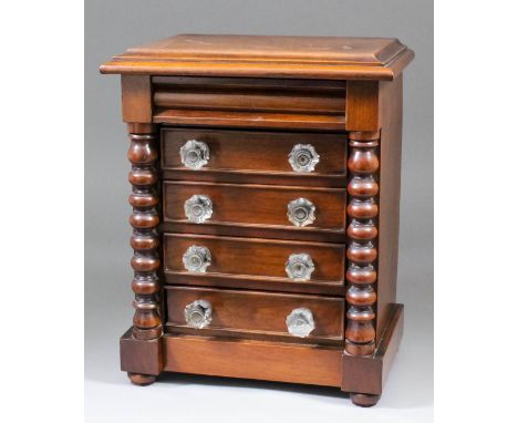
A late Victorian mahogany miniature chest of five drawers, the top drawer with shaped front, flanked by bobbin turned columns, on bun feet, 10.25ins x 7ins x 12.75ins high Note: A later handwritten note with this lot states - "This chest of drawers was made by a Headmaster of a Chatham school after he retired (aged 99 - possibly Pocknel). He was the father of Mrs Blanche Tasker, also a Headteacher of a Chatham school - Ordnance Street, Secondary Modern, who died in the early 1970s of a very great age, possibly in her 90s"
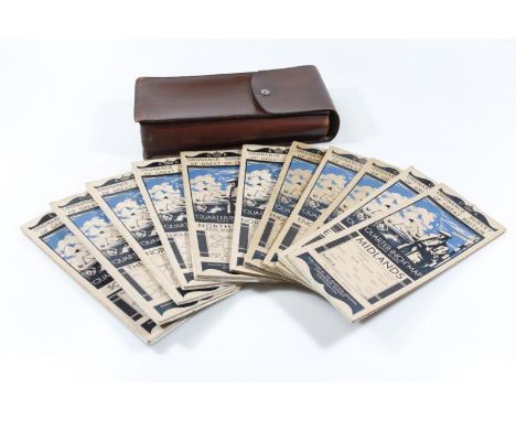
Lot 118
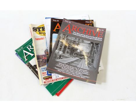
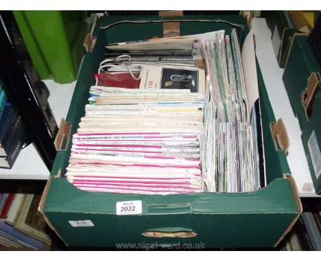
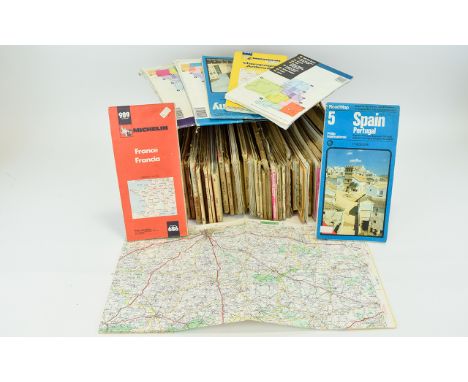
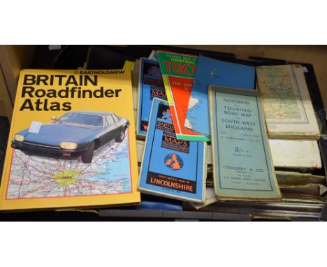
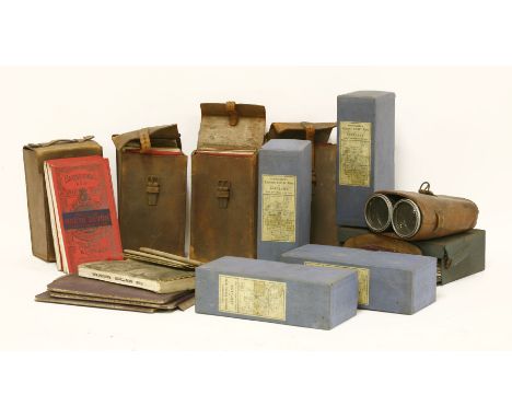
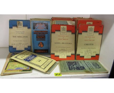
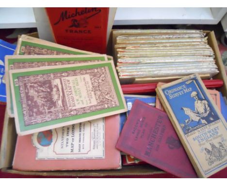
Quantity of railway interest reference books and magazines including 'Archive - The Quarterly Journal for British Industrial and Transport History', 'M&GN Circle Bulletin', two volumes of 'Midland Railway System Maps', timetables of the Midland Railway Summer 1903 and a large quantity of OS maps including reissued old Ordnance Survey maps (3 boxes)


Lot 882
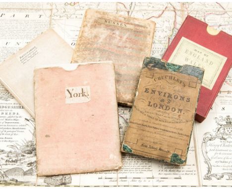
A collection of antique maps: four 18th-century hand-coloured copper engraved maps by Emanuel Bowen (York, Devonshire, Sussex, Cambridgeshire), all linen-backed, two complete with slipcases; Cruchley's Environs of London, 1827, complete in four parts within original slipcase, hand-coloured; Edward Stanford Railway & Road Map of England and Wales, 1877, hand-coloured and linen backed with original slipcase bearing label; and a quantity of Ordnance Survey maps, 1912 and later, including an interesting geological map of Cambridgeshire, plus a few similar folded maps.

Lot 17
1- Wyld’s new plan of London and its vicinity. 1874, colour linen backed 40 sections folding (116 x 81.5 cms); small tear to fold; 2- Philip's Tape Indicator map of London. N.d. c1920, colour linen backed folding (62 X 90cms.); lacking tape; 3- Ravenstein, E G: The Oarsman's and Angler's Map of the River Thames. James Reynolds, nd, c1880; colour linen backed folding into 25 sections (244 X 16 cms.); 4- A New Map of England and Wales with part of Scotland.. T. Doody, Newport, Shropshire, 1855. Colour linen backed folding into 20 sections (78 X 64 cms.), with a vignette and in original covers; G+; Plus 8 other ordnance survey maps and 2 London Underground maps, 1947 & 1959. (14)
Lot 13
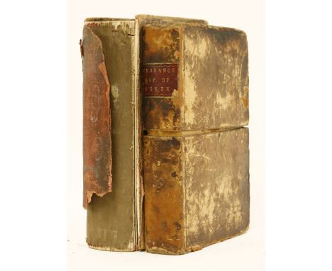
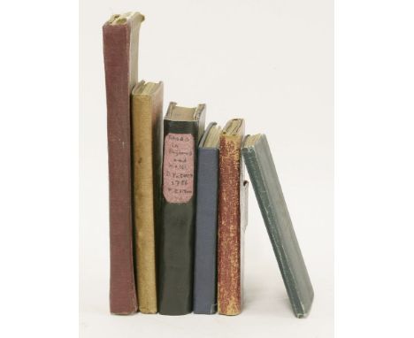
1- MUDGE, William: PART THE FIRST OF THE GENERAL SURVEY OF ENGLAND AND WALES CONTAINING THE WHOLE OF ESSEX AND A PORTION OF THE ADJOINING COUNTIES DONE BY THE SURVEYORS OF HIS MAJESTY'S ORDNANCE, UNDER THE DIRECTION OF Lt. Coll. MUDGE OF THE ROYAL ARTILLERY F.R.S. Four sections, linen backed and in the original leather box; n.d. C1805. Each section has its borders lined and sewn; 2- Kelly’s Directory of Essex, 1886. front cover and first few page detached; lacking the map? (2)
Lot 12
1- Cary's Traveller's Companion, or a Delineation of the Turnpike Roads of England and Wales. Printed for John Cary, 1791, first edition. With 42 of 43 coloured maps (lacking the folding map of Yorkshire). Contemporary full leather wallet binding; Hinges weak, o/w VG; 2- Paterson, Daniel: A new and accurate description of all the direct and principal cross roads in England and Wales. T. Carnan, 1786, 7th. edn. (price two shillings sewed); With a double-page map; PP: xxiv, 293, (i)ad. BOUND WITH: A travelling dictionary or, alphabetical tables of the distance of all the principal cities.. 1781, 4th. edn. PP: iv, 180. Home made crude leather binding; internally vg; 3- Kelly: Post Office Directory Map of London for 1913. Large coloured folding linen backed in original cloth covers and with the index. 36 sections, 4 inches to one mile; Light wear; 4- Post, Reise und Eisenbahnkarte von Deutschland, der Schweiz, den Niederlanden und Belgien. Glogau, Flemming, 1853, new revised edition. Large coloured folding linen backed in original buckram covers and with the index. 36 sections (87X106 cms.); Light wear; 5- Cruchley's Reduced Ordnance Map of England & Wales. Sheet 40. no date, c1880. Large coloured folding linen backed in original cloth covers; 2 miles to an inch; 36 sections; with tears to folds; covers worn; 6- W.H.Smith & Son’s MAP OF YORKSHIRE. 2/- Folding coloured linen backed in original cloth covers; Vg. (6)

Lot 686
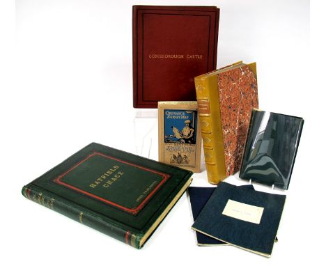
The History of Conisborough Castle, with Glimpses of Ivanhoe-Land, compiled by Henry Ecroyd Smith, printed for the subscriber, Robert White, Worksop, 1887, one of 150 copied printed, original red cloth; Tomlinson [John]: The Level of Hatfield Chace and Parts Adjacent, pub. John Tomlinson, Doncaster, original green cloth; Wainwright [John]: Yorkshire, an Historical and Topographical Introduction to a Knowledge of the Ancient State of the Wapentake, of Strafford and Tickhill, pub. John Blackwell, Sheffield, 1829, rebound half calf and marbled boards; The History & Antiquities of Thorne, with some account of the drainage of Hatfield Chace, pub. J. Mason, Thorne, 1874, green cloth; two Ordnance Survey fold-out linen maps of Snaith & Goole and Doncaster and one other. (7)
Lot 409
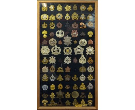
A collection of over seventy predominantly Canadian cap badges to include two Royal Winnipeg Rifles, 2nd/10th Dragoons, Royal Canadian Ordnance corps, etc., presented in framed and glazed mount. CONDITION REPORT: Badges have not been removed from mounts so cannot verify classification of material, condition of lugs/pins, etc.; some with visible surface wear, dirt, etc.; please refer to images for regiments/units included.

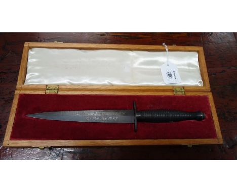
Lot 658
A pair of WWI engraved trench art shells, one dated 1917 and the other 1918, together with three later example, two having Royal Army Ordnance Corps badges, together with a grenade and a cloth badge (7)This is something we could possibly post for you. Only mainland UK approx £20-£25, postage costs will be worked out after the sale
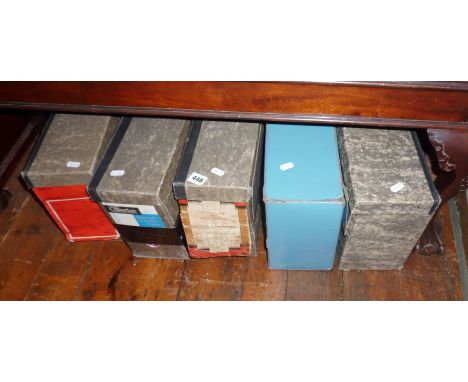
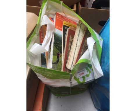
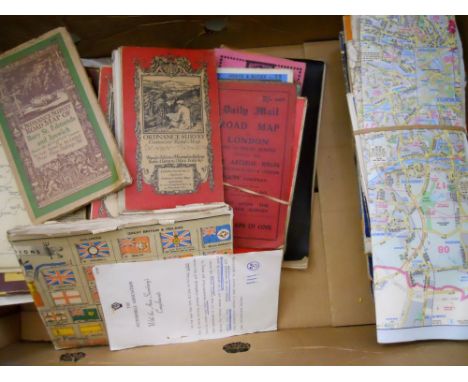
Lot 1348
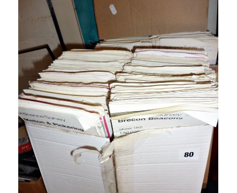
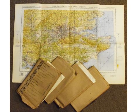
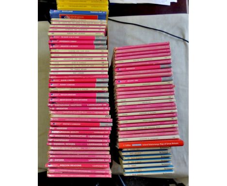
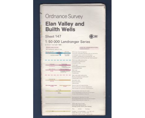
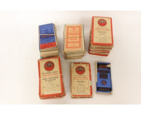
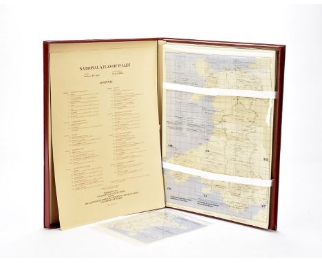
Motoring, a large collection of approx 150 Ordnance Survey Maps, including Landranger series, books, vintage maps, a vintage leather carry case with "Bacon's" large print road maps, Older Bartholomew's maps of various scales mostly England and Wales a boxed "National Atlas of Wales" in burgundy bound box with overlays loose leaf format and series maps including Physical Environment, Political Development, Culture, Economic History, Land use and Agriculture, Industry, Services and Communications, Population and Settlement, Regional Policy and Planning, published by the University of Wales. (3)


-
12129 item(s)/page