We found 12129 price guide item(s) matching your search
There are 12129 lots that match your search criteria. Subscribe now to get instant access to the full price guide service.
Click here to subscribe- List
- Grid
-
12129 item(s)/page

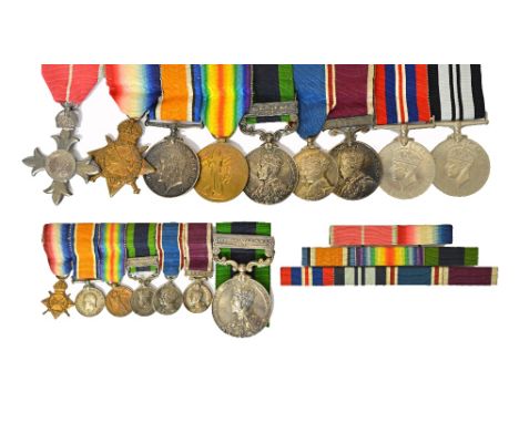
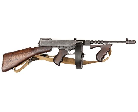
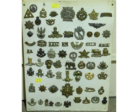
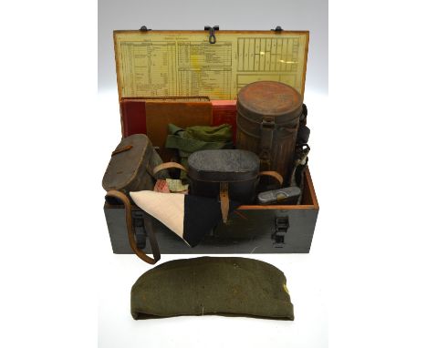
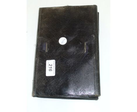
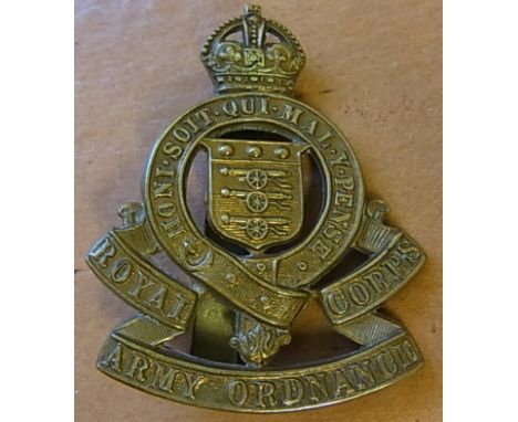
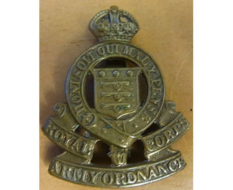
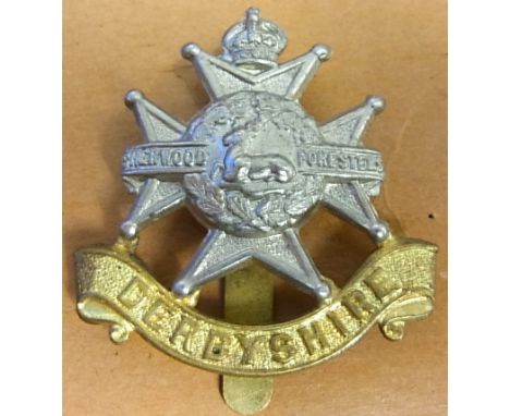
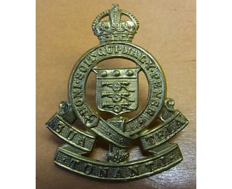
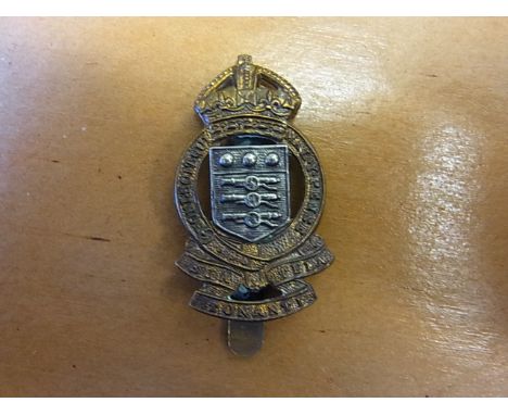
Lot 2150
The awards and medals as awarded to Lieut Colonel Ronald Bristow M.B.E, comprising; The M.B.E Military issue with box of issue and appointment certificate, accompanying letter and envelope, The 1914-15 Star to 1628 CPL.R.BRISTOW, E.KENT R. The 1914-18 British War Medal and The 1914-19 Victory medal to 1628 SJT.R.BRISTOW. E.KENT R., The India General Service Medal, George V issue, with bar Afghanistan N,W,F, 1919 to 114105 SJT.R.BRISTOW,ORDNANCE DEPTT, another similar medal to 114105 SJT.R.BRISTOW, M.G.C. (the initial R officially corrected), The 1937 Coronation Medal, The Army Long Service and Good Conduct Medal, George V issue, the suspension bar detailed INDIA, to S-CONDR.R.BRISTOW, I.A.O.C., The 1939-45 War Medal and The 1939-45 India War Medal, six mounted dress miniature medals, two further dress miniature medals (one lacking suspension, a quantity of medal ribbon bars, spare ribbons, cap badges, collar badges, shoulder titles, buttons and further items, also an oval two course meal ration tin, dated July 1908, together with a portrait photograph in uniform and commission documents and also relating to his son, The 1939-45 War Medal and The Air Council Forwarding Slip and box of postage addressed R.A.BRISTOW ESQ, an R.A.F side cap with a cap badge and also a keyring, detailed R.M.S Queen Mary. Illustrated

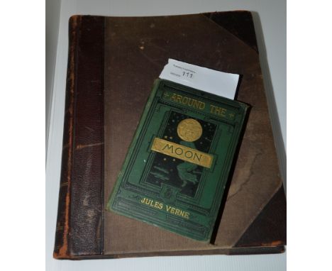
Lot 111
'Around the Moon' by Jules Verne dated 1876 authors edition with illustrations, published by Samson Low, Marsden, Searle and Ribbington - Crown Buildings 188 Fleet Street. 'New Large Scale Ordnance Map of the British Isles with plans of towns, copious letter press descriptions, alphabetical index's and census tables' edited and published by George W. Bacon
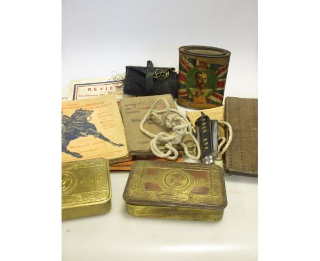
Lot 223
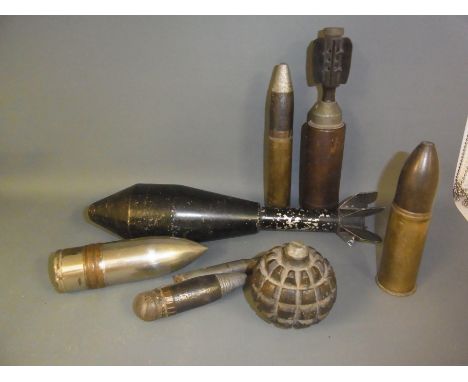
A BRITISH LEE ENFIELD NO.5 MK I KNIFE BAYONET by Wilkinson Sword, in its scabbard, the scabbard with brass throatpiece; together with a German K-98 bayonet, stamped at the ricasso '41asw' and numbered '3534', in its scabbard with non-matching number '6620'; a Japanese Arisaka Type 30 bayonet, with a hooked quillon and a wooden grip, in its metal scabbard, with leather frog; a Swiss M18 helmet; assorted items of inert ordnance, including a brass shell case mounted to a wood base and drilled to form a table lamp; and a quantity of books of military interest. PLEASE NOTE THE JAPANESE BAYONET MAYBE IN THE WHOLE POST WORLD WAR 2 IN MANUFACTURE.
Lot 775
A bayonet practice rifle, the spring cylinder stamped with broad arrow and ordnance inspector’s mark, the butt with broad arrow and “1915” (a little faint); and a French 1874 Gras bayonet, the blade marked “Paris Oudry 1879”, in its scabbard (rusted overall) with non matching numbers. Basically GC (2)
![*Charles II - Ordnance. Rules, Orders & Instructions for the Future Government of the Office of the Ordnance, [1681], off](https://cdn.globalauctionplatform.com/e6986aac-6ee6-4136-8dcf-a56700bd94e2/fb021f47-cb0b-494a-bcf0-a56e00ae28e0/468x382.jpg)
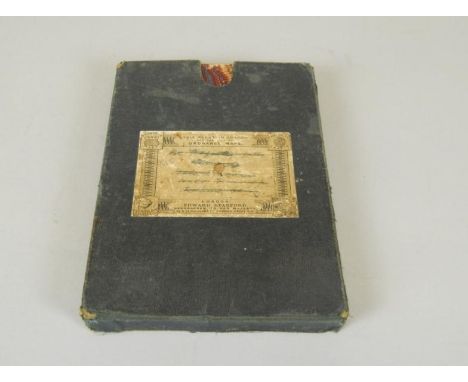
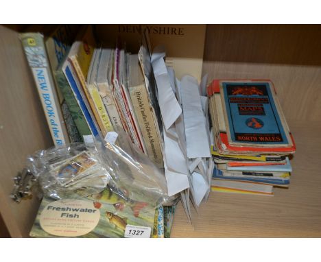
Lot 260
*Charles II - Ordnance. Rules, Orders & Instructions for the Future Government of the Office of the Ordnance, [1681], official manuscript copy issued on behalf of King Charles II to George Legge, Lord Dartmouth, 64 unnumbered leaves, a further 16 leaves in the same early 18th-century hand including 'An Establishment of the annual payments upon the Quarter Bookes' and 'Addicional Instructions', the last-reference date in the text being 30 June 1702, neatly written on rectos and versos throughout with calligraphic title and headings, United Services Club bookplate to front pastedown, modern cloth gilt, small 8vo, together with three further unrelated manuscripts, a late 18th-century 'Epitome of Smollet's History of England', 79 unnumbered leaves, written in a large clear hand, remaining leaves mostly blank but beginning with several leaves of arithmetic and the ownership name of Miss Harnick Junior dated 1756, contemporary vellum, stained green, marked, 4to, plus a manuscript(?) copy account of English Counties, circa 1800, 82 pp. in a neat italic hand with calligraphic flourishes, contemporary quarter calf over marbled boards, spine defective, folio, plus an 18th-century disbound commonplace book/receipts book fragment, 10 leaves, some rodent damage with loss of text affecting first 5 leaves, 12mo (6)
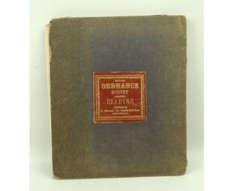
Lot 168
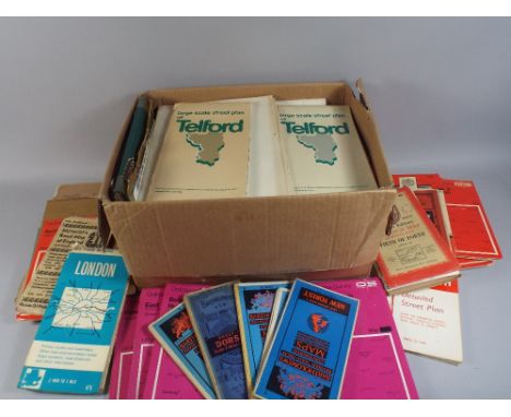
Geological Maps. A collection of approximately forty-eight maps and geological cross sections published in the 'Geological Survey of England and Wales', late 19th century, approximately forty-five coloured geological cross sections and three geological maps, each approximately 650 x 940 mm, together with a further ten geological and geographical folding maps, with examples by Bacon, Phillips, Cruchley and Ordnance Survey, plus two large folding lithographic maps of Welsh coal fields, various sizes and condition (approx.60)
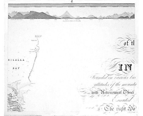
Lot 463A
William BaldMayo, Map of the maritime County Mayo in Ireland.Founded on various bases and trigonometrical operations, exhibiting barometrical altitudes of the mountains, the levels and depths of the bogs and lakes; with Astronomical Observations, Physical Sections and Profiles of the Country; Executed by order of the Grand Jury. The Right Honourable Denis Brown M.P. and Member of the Dublin Society, and Royal Irish Academy, foreman; Commenced in 1809, and terminated in 1817, by William Bald F.R.S.E. Member of the Royal Geographical Society Paris, Member of the Geological Society London, Member of the Royal Irish Academy, Honorary Member of the Wernerian Natural History Society Edinburgh. Engraved by Pierre Tardieu, 1830. overall dimensions when joined. 3.11m x 2.57m average sheet size 620 x 510By William Bald, a massively detailed map of Mayo in 25 sections, each varying slightly in size; a little detail here and there of adjacent counties. Large title cartouche. Extensive table of mountain heights. Lake levels; bog levels and depths. Coastal soundings. Plan of trigonometrical base lines. Scale 1 inches to 1 mile. Published by the Mayo Grand Jury. Some edges frayed and some light foxing otherwise in very good condition. William Bald was born in Burntisland in 1789. He was employed as an apprentice under the celebrated Scottish surveyor, engraver and mapmaker, John Ainslie. Bald made a survey of Harris in 1805 when he was only 16, and was later responsible for surveys of ~Benbecula, south Ulst, Eriskey and Argyll, possibly because the tugged nature of the terrain would have been difficult for Ainslie, then in his 60s. These and other of his surveys were later incorporated into Aaron Arrowsmith's map of Scotland. By the time Bald arrived in Mayo in 1809 as county surveyor, he had been described by his teacher and mentor John Ainslie as a very big man... In the words of John Andrews, no ordinary tribute for a twenty-year-old. Bald's first commitment in Mayo was a Grand Jury map of the county. At the same time, he managed to work for the Bogs Commission on their brief for a survey of the bogs of Ireland. Both surveys were to degree of sophistication and meticulousness which far outstripped anything known in Ireland up to that time. His map of Mayo was unique in its scale and scholarship. The base measurement and triangulation were impeccable. Bald spent 18 years on the Mayo survey and engaged Pierre Tardieu in Paris, the foremost engraver of his day, to bring the map to fruition. This was done very slowly and at great expense, finally reaching the light of day in 1830. Bald was a familiar figure in Castlebar, much admired by some, yet disliked by others who through envy of his great expertise, carped at his efforts; or who, unused to the sheer cost of mapping on such a scale, complained at his lavish use of public money. Bald went on to plan surveys of Clare and Down. He even envisaged a general triangulation of Ireland and a new geological map. He still found time to attend to roads and bridges in his adopted county. The coming of the Ordnance Survey spelled the end of the era of the great land surveyors, Bald among them. In later life, he concentrated on roads, bridges, canals and harbours, and eventually railways. He was a principal adviser in the early deliberations of the Ordnance Survey. William Bald loved Mayo, as can be seen from his Map. The profusion of place names, particularly coastal place names, attests to his love of the Mayo landscape, so like his native Scotland. He was one of the ablest, most hard-working and most creative map-makers ever to practise in Ireland. He died in 1857; he is buried in Highgate Cemetery, London. His wife, Anne, pre-deceased him; she is buried in Straide, Co. Mayo.

Lot 40
Irish Maps: Co. Kerry - Index to the Townland Survey of the County of Kerry, Dublin c. 1840, hd. coloured, folding linen backed map, approx. 65cms x 97cms (25 1/2" x 38 1/4"0, in cloth slip case; Co. Mayo - Index to the Townland Survey of the County of Mayo, hand coloured linen backed folding map, approx. 65cms x 97cms, D. c. 1840; 2 Ordnance Survey folding linen backed maps, one hand coloured of Dublin Co. & Bay, the other of Co. Kildare, c. 1838. As maps, w.a.f. Good. (4)
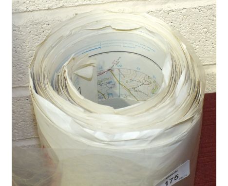
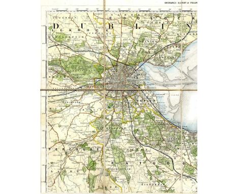
Lot 503
Rolled Maps: Taylors Map of The Environs of Dublin, c. 1840; Index to the Townland Survey of the County of Meath, D. 1889, cold.; Stanford's Ireland, c. 1880; and Ordnance Survey of Ireland - Dublin & Co. & Parts of Co. Meath, c. 1870, all linen backed, & on mahogany rollers. as maps, w.a.f. (4)
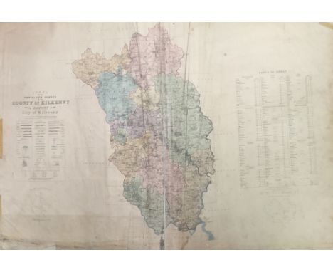
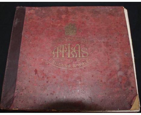
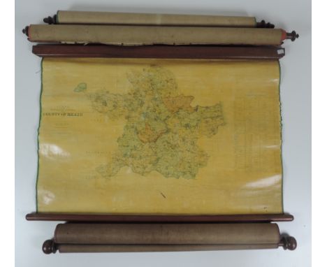
Lot 586
Kilkenny Ordnance Survey Atlas: Ordnance Survey of Ireland - Townland Survey of the County of Kilkenny and the County of the City of Kilkenny. Large Atlas folio D. 1842. With dbl. page hand coloured Index Map, & 47 lg. dbl. page maps, hd. cold. in outline, a.e.g., later hf. mor. As an Atlas, w.a.f. * M/ss note inside front cover by Mr. D. O'Neill Flanagan, dated 1980, states his father purchased this atlas at Duke of Ormonde's Sale at Kilkenny Castle, 1935. (1)
Lot 763
Northern Ireland: Day (Angelique) & McWilliams (P.)eds. Ordnance Survey, Memoirs of Ireland, Vol.s 1 - 40, complete with 'Index of People and Places,' together 41 vols. 4to Belfast (Queens) & Dublin (R.I.A.) 1990 - 1998 & 2002, Sole Edns., some illus., orig. d.w.'s & cloth. As a lot. A Complete Set. (41)
Lot 1104
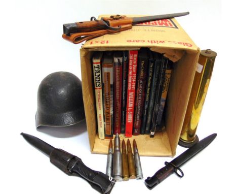
Assorted WWII German army items incl. a rifle cleaning kit, the case impressed G.Appel, an o/r side hat with yellow/blue enamelled roundel, the lining ink stamped with three crowns over '59', an M-38 gas mask canister, 3 x pair of field glasses etc all contained within a wooden ordnance box stencilled 'Ersatzeile I Ordnang fur AS10C Serie 1'


Lot 98
Record of sale by Francis Parke of Ipswich, - a mariner, of a share in a ship formerly named the Bridget a mariner, of a share in a ship formerly named the Bridget, to William Garnham, cordwainer of the same place, document in Early Modern English on parchment [England (Ipswich), dated 20 December 1647] Single-sheet document, 20 lines in a tall secretarial hand which leans to the right, opening words and crucial phrases in wide-nibbed larger script, seal tags cut from another contemporary document (seal wanting), line of stitch-holes down inner margin perhaps from once being attached to another document or ledger book, some small stains and folds, else good, 125+15 by 280mm. This is one of the earliest records of the ownership of shares in ships, which was only common from the early seventeenth century onwards owing to the increases in sizes and costs of maritime vessels. The earliest such document held by the National Maritime Museum at Greenwich is dated to the same year as the present example. Here Francis Parke sold One Twoe and Thirtieth part of the ship lately repayred & reedifyed by John Pole of Ipswich, which was formerly called the Bridgett but now the Providence , as well as a share in its mast[es] Sayles Sayleyard[es] anchors cables ropes cord[es] boat tackle stocke ordnance guns gunpowder shott amunic[i]on artillery furniture & apparel . The ship was a large one, with 200 tons of burden, and Parke s small share valued at the vast sum of £45, 12 shillings.
-
12129 item(s)/page