We found 12130 price guide item(s) matching your search
There are 12130 lots that match your search criteria. Subscribe now to get instant access to the full price guide service.
Click here to subscribe- List
- Grid
-
12130 item(s)/page
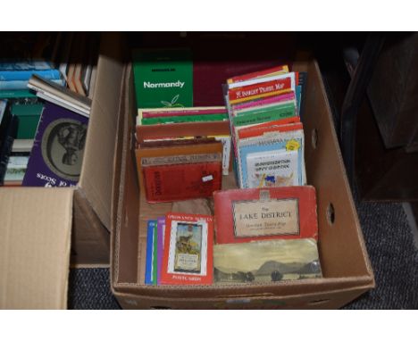
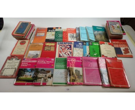
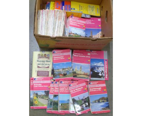
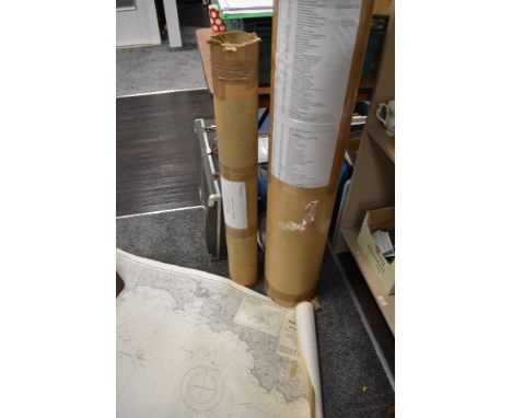
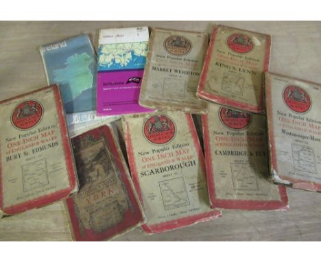
![[MAPS] Forty-nine assorted, mainly Ordnance Survey folding maps.](https://cdn.globalauctionplatform.com/d457bba3-72fc-4604-b57a-ac9900d9453d/5a65053c-78c8-4b2b-baa3-ace9009d1bd6/468x382.jpg)

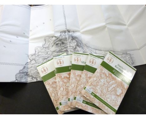
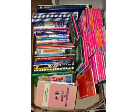
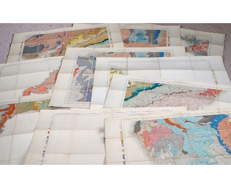
![[MAPS] Sixteen assorted folding maps, mainly Ordnance Survey, including also Bartholomew's New Map of Central & South Af](https://cdn.globalauctionplatform.com/d457bba3-72fc-4604-b57a-ac9900d9453d/2431ba60-174b-4316-93b7-ace900a023f5/468x382.jpg)
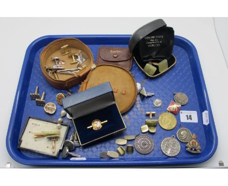

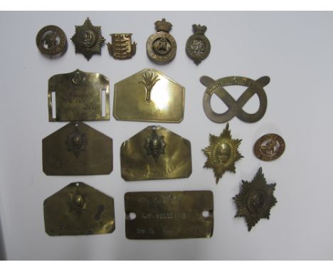
Lot 221
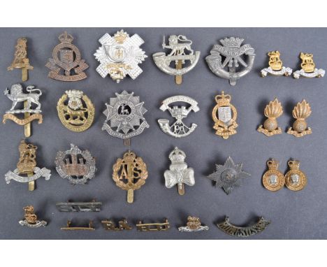
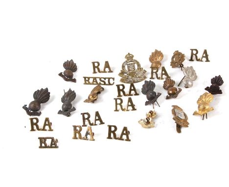
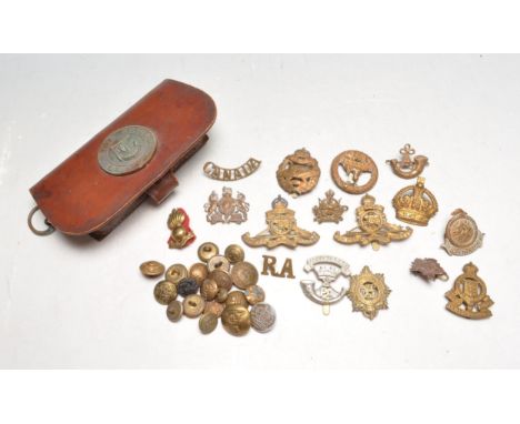
British Military Insignia,Good quality examples comprising seven brass bed plates, four to the Worcestershire Regiment all named, one KSLI named (Sergeant), a 'Knot' pattern to the South Staffordshire Regiment and a 'Duty' plate to the Welsh Guards; two valise badges to the Worcestershire Regiment (QVC & KC), glengarry badges to the 29th (KK471) & 53rd (KK512); a post 1881three part glengarry to the KSLI; two helmet plate centres KSLI & Worcestershire (last pattern); a glengarry to the Army Ordnance Corps. A crude and incorrect solder repair to the QVC valise badge fastener otherwise good overall condition. (15)For further information on this lot please visit Bonhams.com
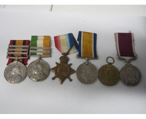
Lot 319
Six to Warrant Officer R.H.Erskine, Royal Army Ordnance Corps,Queen's South Africa 1899-1902, three bars, Cape Colony, Orange Free State, Transvaal (906 Armr: Sejt R.H.Erskine, A.O.C.); King's South Africa, two bars, S.A.01, S.A.02 (906 Armr:-Serjt: R.H.Erskine. A.O.C.); 1914-15 Star (A.906 Armr.S.Sjt.R.H.Erskine. A.O.C.); British War and Victory Medal (A-906 R.H.Erskine. A.O.C.); Army Long Service and Good Conduct, G.V.R. (A/906Ar;Q.M.Sjt R.H.Erskine. R.A.O.C.). Edge bruise to the first, otherwise very fine. (6)Footnotes:He served within the Armourers section of the Army Ordnance Corps during the Boer War and was attached to the 1st Yorkshire Regiment. He served in France from the 15th December 1914.Sold with copy Boer War and WW1 medal rolls/MIC.For further information on this lot please visit Bonhams.com
Lot 48
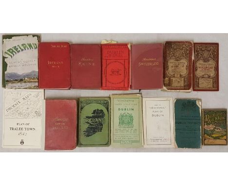
Maps and Guides: Ordnance Survey of Mullingar c.1904; Dublin District, c.1918; Dublin District, c.1918; Philips' Handy County Atlases of Ireland; Phoenix Maps Plan of Tralee 1842; Geographica Large Scale Plan of Dublin and Index; Murray's Handbook of Ireland; Your Holiday In Ireland by Cooper and Welsman, Ward Lock & Co. Dublin and Ireland Part 2, Baedeker's Guides of the Rhine and of Switzerland and Dublin and Wicklow Manure Company Ltd Catalogue for 1905 (14)

Lot 101
British Isles.- Collection of over 45 maps of counties and regions of England & Wales, including maps by Robert Morden of Cambridge, Oxford, and Hertfordshire, two maps showing distribution of the Volunteer Force in 1883, two maps by Col. Colby from the Ordnance Map Office showing the River Thames, 38 maps of counties by J. Archer, and others, engravings, lithographs, some with hand-colouring, various sizes, from approx. 225 x 270 mm (8 3/4 x 10 5/8 in) to 370 x 510 mm (14 1/2 x 20 in), some minor surface dirt and browning throughout, handling creases, minor nicks and tears, all unframed, 17th to 19th century (45)
Lot 119
Britain.- Bacon (George W.) New Large Scale Ordnance Atlas of the British Isles with Plans of Towns, title, Letterpress Descriptions, Alphabetical Indexes and census Tables of 1881, 104 colour lithographic maps and town plans, some handling creases, minor nicks with occasional surface dirt, a.e.g., contemporary morocco gilt, rubbed and worn, large 4to, [circa 1881-1885].
Lot 146
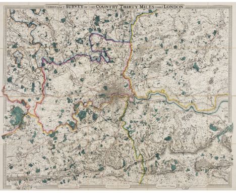
London.- Cruchley (George Frederick) From the Ordnance Survey of the Country Thirty Miles round London, map of the environs of London showing from Hertford to Godalming and Tunbridge, and from Maidenhead to Chatham, engraving with bold original hand-colouring, 1115 x 1380 mm (43 3/4 x 54 1/4 in), dissected and mounted on linen, folding without slipcase, 4to, [c.f. Howgego 333 for possible source], n.d., [circa 1850 or slightly later].
Lot 332
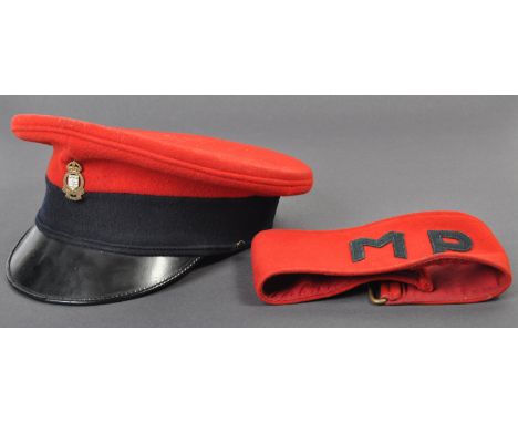
An original British post war 1962 dated Royal Army Ordnance Corps Officer's peaked dress uniform hat and a British Military Police arm band. The red felt hat with blue band, ROAC metal badge and black patent peak. Retaining an inner brown leather headband, dated 1962 with broad arrow marks. The Military Police armband also of red felt construction with buckle and Velcro fastening.
Lot 746
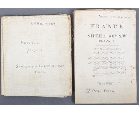
Two original WWI First World War period British Army issued maps of France, both named and owned by one Captain R. M. Huntrods of Durham Light Infantry. One 20,000 foot scale map and a second larger scale map: St. Pol area. France Sheet 36B SW, edition 6, published by the Ordnance Survey 1916. Coded in the bottom l/h corner GS GS 2742. On folding linen on a scale of 1:20,000. Size 90 by 68 cm. A key includes roads, railways, footpaths, churches, chimneys, windmills etc. The map does not show trenches but an area just to the west of Arras. An unusually clear and crisp map. Original owner’s name and rank to front of map. The owner served in the Durham Light Infantry and the Northumberland Fusiliers., and was wounded in France. The second map of part of France: Senleques-Lottinghem area. France Sheet 36D Western Half. Published by the Printing Section, Depot FSC., RE. GHQ (1701). No date. Information in the bottom l/h corner states: This map is an enlargement from the French 1:80,000 its accuracy cannot be guaranteed. Scale 1:40,000. Size 58 by 51 cm. On folding linen. Includes villages to the west of Arras including Bourthes and Zoteux. Original owner’s name in ink to front cover. The owner served in the Durham Light Infantry and the Northumberland Fusiliers and was wounded in France. Rare named maps.
Lot 852
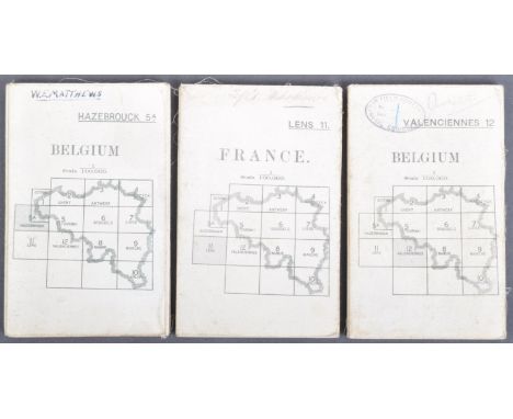
A collection of x3 original WWI First World War period British Army used maps of France and Belgium. Comprising:First World War British Officer’s map of part of France. France Sheet 11, Lens edition 2. Published by the Ordnance Survey in 1916. Coded in the bottom l/h corner GS GS 2364. On folding linen size 85 by 65 cm. Scale 1:100,000. A key includes details of roads, railways, mines, ruins, canals, churches, forts etc. In colour. Original owner’s name to the front cover. The owner served in the Durham Light Infantry and the Northumberland Fusiliers., and was wounded in France Area covered includes Arras and Bapaume.British Army map of Hazebrouck, published by the Ordnance Survey, Southampton for the Geographical Section General Staff 1915. Code 2364 to bottom left corner. On folding linen size 88 by 66 cm. Scale 1.100,000. Key gives information on many geographical features and has an explanation of French names for them. A very detailed map. VG condition.World War One Map British Army Map Belgium sheet 12: Valenciennes with Cambrai. Published for the British General Staff Geographical Section by the Ordnance Survey, Southampton May 1915. Scale 1:100,000. On folding linen. Name and stamp of the RE 73rd Field Company to the front of the map. Some annotations to the margins including details of the advance of the 21st Division from August to November 1918 and of the enemy captured. Good to VG condition.
Lot 1
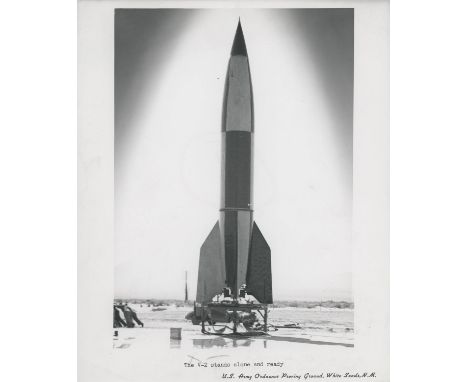
U.S. ArmyThe V2 rocket stands ready for its launch at White Sands Missile Range, New Mexico10 May 1946Vintage gelatin silver print on fibre-based paper, 21 x 25.3 cm (8¼ x 10 in). image 15.5 x 22.5 cm (6 x 8¾ in), with a caption in bottom margin 'The V-2 stands alone and ready' and 'US Army Ordnance Proving Ground, White Sands, N.M.', date stamp and pencil annotations on verso Condition Report: Minor handling dents in the left margin and two pencil parks in bottom margin (as seen on the web image), otherwise goodCondition Report Disclaimer
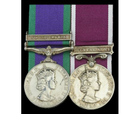
Lot 271
Pair: Sergeant V. H. Helm, Royal Army Ordnance Corps General Service 1962-2007, 1 clasp, South Arabia (23657053 Cpl V H Helm RAOC); Army L.S. & G.C., E.II.R., 2nd issue, Regular Army (23657053 Sgt V H Helm RAOC) mounted court-style as worn, the GSM a slightly later issue, nearly extremely fine (2) £80-£120 --- Volker “Buck” Hagen Helm, of 17 Woodside Road, Chilwell, was the son of Les Helm, who also served in the Ordnance Corps. He served in HQ Company, Ordnance Depot Cyprus from 1963, where he represented the Army against the Royal Air Force breaststroke. He saw further service overseas with 154th Forward Ammunition Depot in Germany; HQ BAOR Northag as a Sergeant;ANZUK (the tripartite force) in Singapore; and HQ British Forces Belize, where he served as Sergeant Supply Clerk of 3 Base Ammunition Depot. He was discharged in February 1983.

Lot 751
A good Omani Order of the Special Royal Emblem and Sultan’s Distinguished Service Medal for Gallantry group of ten awarded to Major W. G. Wood, Sultan of Oman’s Armed Forces, late Royal Army Ordnance Corps, who served as the Explosive Ordnance Disposal Officer in Northern Oman Oman, Sultanate, Order of the Special Royal Emblem, Expatriate Officer’s type, silver, with Omani crown emblem on riband, in fitted Asprey, London, case of issue; Sultan’s Distinguished Service Medal, for Gallantry, bronze, with Khunjar gallantry emblem on riband; Peace Medal, bronze, with Omani crown emblem on riband; Tenth Anniversary Medal, silvered; Glorious 15th National Day Medal, bronze; Great Britain, 1939-45 Star; Italy Star; Defence and War Medals 1939-45; Army L.S. & G.C., E.II.R., 2nd issue, Regular Army (22231899 W.O. Cl.2. W. G. Wood. RAOC.) mounted court-style as worn, edge bruising, generally very fine (10) £1,000-£1,400 --- William George Wood joined the Sultan of Oman’s Armed Forces on 7 August 1976, and was awarded the Sultan’s Distinguished Service Medal for Gallantry. The Recommendation states: ‘Ra’ees [Major] William George Wood is the Officer Commanding the Ammunition Sub Depot of the Base Ordnance Depot and the senior Ammunition Technical Officer in Northern Oman This entails being on continual stand-by to deal with Explosive Ordnance Disposal requests routed through the Royal Oman Police. He has been called to deal with a number of unexploded bombs and rockets dating from 1958 which he has made safe with deceptive ease. On at least two occasions he displayed gallantry of a particularly high order. In June 1978 he had to recover an unexploded aircraft rocket from a well at Izki and because of the risk of damage to life and property he subsequently drove with it cushioned on his lap to an area where it could be safely destroyed. This was a most hazardous operation carried through with courage and skill. On 19 July 1979 he was again tasked to deal with an unexploded bomb located 800 feet below Halhal in the Jebel Akdar. Access to the bomb could only be gained by Ra’ees Wood being winched down from a helicopter. He had not flown in a helicopter before and he was therefore briefed on winching techniques prior to being winched down with his detonating equipment onto a ledge by the bomb. The fuse was lit and Wood was winched back into the helicopter to await detonation at a safe distance. No detonation occurred and after the prescribed safety time allowance Wood was winched back down to the bomb. This experienced officer was immediately aware, having seen the state of the detonator, of the danger of an immediate explosion which would have put his life and that of the helicopter crew at risk. With complete disregard for his own safety he urgently waved the helicopter away instead of asking to be winched up. He then calmly removed the faulty detonator from the charge and prepared a second. The helicopter returned, the fuse was ignited, Wood was winched back up to the helicopter, and the detonation was ultimately successful. Wood’s entire service in Oman has been characterised by tireless effort and leadership of the highest possible order. He has removed the risk of loss of life and damage to civilians and their property, and put his own life at risk on their behalf. The incidents at Izki and Halhal are examples of this officer’s outstanding personal courage and devotion to duty.’ Sold with the Bestowal Document for the Omani Order of the Special Royal Emblem, named to Major William George Wood, and dated 18 November 1985; the original typed Recommendation for the Sultan’s Distinguished Service Medal for Gallantry, mounted on card with embroidered ribbon surround; the recipient’s riband bar; and related miniature awards for the 1939-45 Star; Italy Star; War Medal 1939-45; and Army L.S. & G.C., these mounted as worn.
Lot 1011
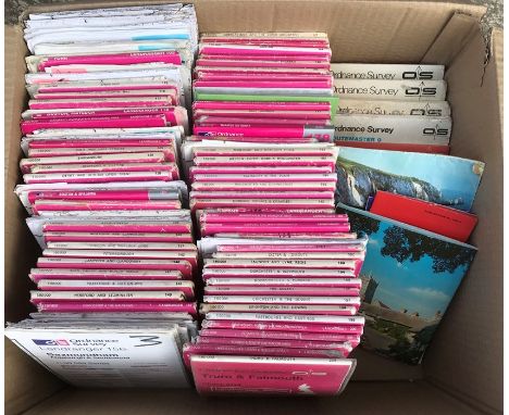
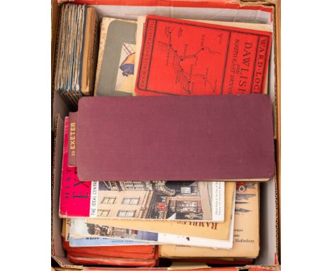
A large quantity of Ordnance Survey maps of England and Wales, including areas of Yorkshire, Norfolk, Sussex, Somerset, Devon, Cornwall, Dorset, Worcestershire, Shropshire, Derbyshire Buckinghamshire, Suffolk, and Wales, including Brecon Beacons, Llandovery, Elan Valley, Abergavenny and the Black Mountains and Hay-on-Wye 2 boxes (approx 80 maps). Estimate £30 - 50
Lot 319
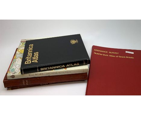
Bartholomew Times Survey Atlas of the World. 1922 with separate Gazetteer volume. Uniformly bound in half red morocco; Ordnance Survey Quarter-inch Atlas of Great Britain. 1969; Britannica Atlas; and New Worlds Maps from the Age of Discovery (5)Click here to view further images, condition reports, sale times & delivery costs for this lot.
Lot 527
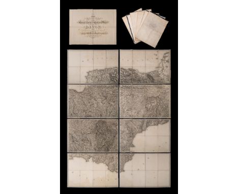
ORDNANCE SURVEY : The second part of the general survey of England and Wales. Containing the whole of DEVON and a proportion of the adjoining counties - large uncoloured map in eight parts folding in to 36 sections mounted on linen, slight water stain to lower part of the map, not offensive, no slipcase,1809. With the supplementary title sheet folding in 4 sections.
Lot 135
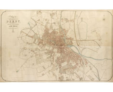
Derby. Standidge & Co., (lithographers), Map of the Borough of Derby, with portions of Darley, Litchurch and Little Chester, published for the Derby Board of Health by the Board of Ordnance, 1852, very large lithograph with contemporary outline colouring, on four conjoined sheets, laid on later canvas, slight staining and dust soiling, 1230 x 1910 mmQty: (1)NOTESA monumental plan of the city of Derby produced on the very large scale of 24 inches to the mile. A scarce plan of an expanding Victorian city shown in immense detail.
Lot 267
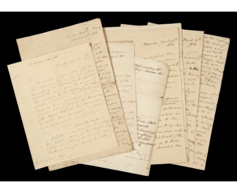
* Mulgrave (Henry Phipps, 1st Earl of, 1755-1831). Group of autograph letters signed relating to preparations for Napoleon's planned invasion of the United Kingdom, written at Beverley, Yorkshire, 1803-4, to: 1) Major-General John Hope (1765-1823), later 4th Earl of Hopetoun, 26 November, 1803, on the problems of manning coastal artillery batteries in Yorkshire and Lincolnshire, 4 pp., 4to, 2) Major-General Robert Brownrigg (1759-1833), quartermaster-general, 27 & 29 January & 20 February 1804, 3 letters, all on munitions for the Royal Artillery at Hull and the construction of beacons in the West Riding, 2, 2 and 4 pp., folio, 3) Frederick, Duke of York (1763-1827), commander-in-chief of the army, 30 March 1804, a detailed report on the readiness of coastal defences and volunteer forces in Yorkshire, and a request for permission for 'the general assembly of the volunteer force of the West Riding at Wakefield', 6 pp., folio, together with a letter signed by Mulgrave to Lieutenant-General Lord Charles Henry Somerset (1767-1831), Office of Ordnance, 30 April 1811, on 'the field exercise of the troop of horse artillery at Lewes', 2 pp., 4to, and two documents (chits) signed by Mulgrave, both 1803Qty: (9)NOTESNAPOLEONIC MANUSCRIPTS AND LETTERS INCLUDING SELECTIONS FROM THE CHARLES STUART PAPERS Mulgrave entered the army in 1775 and reached full general rank by 1809. He was governor of Scarborough castle from 1796, and at the time of writing these letters held the rank of lieutenant-general. He was foreign secretary during the second Pitt ministry (1804-6), first lord of the Admiralty from 1807 to 1809, and master-general of the ordnance from 1810 to 1818.
Lot 595
A collection of British military badges dating from the first world war WWI and the second world war WWII to include a Tank Corps badge, an Egypt SWB cap badge, two Royal Artillery cap badges, a Royal Army Ordnance Corps badge and a selection of naval / military buttons and various Canadian badges.
Lot 783
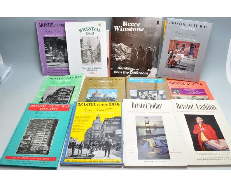
Of local interest - A collection of Reece Winstone Bristol As It Was to include Bristol In The 1940s, 1956-1959, 1914-1900, Bristol Blitzed, Bristol Tram and more. All signed by Reece Winstone. Together with a Graphic Bristol Story and a reprint of the first edition of the one inch Ordnance Survey of Bristol.
Lot 422
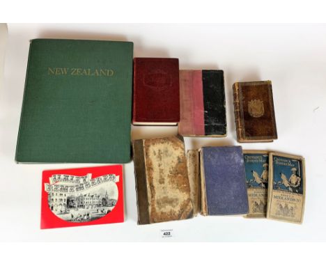
7 books: New Zealand by M.H. Holcroft, A Tale of Two Cities/A Christmas Carol by Charles Dickens, Langdale’s Yorkshire with maps, Holy Bible, Foxe’s Book of Martyrs, Des Vertus Theologales et Cardinales (part book cut out), Ilkley Remembered and 2 old Ordnance Survey Maps: Midlands N and Midlands S


Lot 193
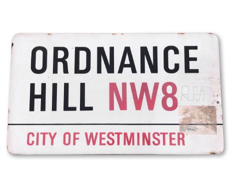
An enamelled iron street sign for Ordnance Hill NW8, City of Westminster, on wooden frame to back, with iconic black and red sans serif lettering first created by Sir Misha Black in 1967 which is unique to the Westminster signs and under copyright law, forbidden to be copied anywhere else in the world, sold together with a signed Certificate of Authenticity44.4 x 77.3 cmCondition: All signs have been hung outside and have been exposed to the elements and therefore have a general degree of wear. Sticker to right (can be removed) and graffiti with initials, also some rusting and losses.
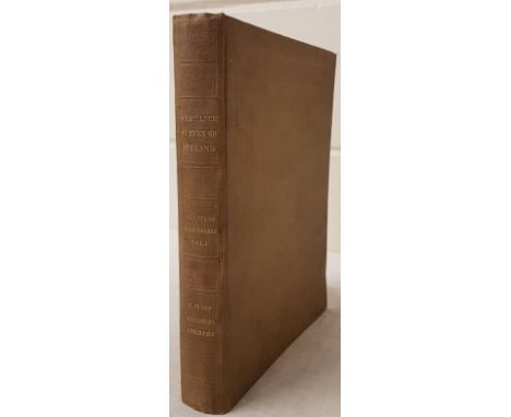
![Co. Derry: Colby (Col. Thos.) Ordnance Survey of the County of Londonderry, Part I [All Published] D. 1837, First E](https://cdn.globalauctionplatform.com/f4e1af99-2601-4c42-957a-acca00e9a9d6/4bee573e-5d56-4b93-bc14-accd00adf51d/468x382.jpg)
Lot 108
Co. Derry: Colby (Col. Thos.) Ordnance Survey of the County of Londonderry, Part I [All Published] D. 1837, First Edn., hd. cold. map & other fold. maps etc., also hd. cold. & other plts., text illus. etc. orig. cloth, v. good; [Phillips (Sir Thos.)] Londonderry and the London Companies 1609 - 1629, sm. folio Belfast (H.M.S.O.) 1928. First Edn., cold. & other maps, orig. cloth. V. good. (2)
-
12130 item(s)/page